

U.S. Route 441
Encyclopedia
U.S. Route 441 is a spur route
of U.S. Route 41
. It currently runs for 939 miles (1,511 km) from U.S. Route 41
in Miami, Florida
to U.S. Route 25W in Lake City, Tennessee
. Between its termini, US 441 passes through the states of Florida
, Georgia
, North Carolina
, and Tennessee
. The route acts as a connector between numerous major urban areas, including Miami
, Orlando
, Ocala
, Gainesville
, Athens
and Knoxville
. It also crosses the Great Smoky Mountains National Park
, where it meets the southwestern end of the Blue Ridge Parkway
, and where no truck
s or other commercial
traffic
are allowed.
(both are one way streets). The route parallels Interstate 95 north out of Miami to western Aventura
, where I-95 heads northeast to access Fort Lauderdale
and the remainder of the eastern Florida coast. However, the route is soon joined by the tolled Florida's Turnpike
, which follows US 441 north to West Palm Beach
. In between, the route interchanges with the Turnpike at exit 62 via State Road 870 (Commercial Blvd.) in Tamarac
. Additionally, US 441 meets Interstate 595
(Exits 8 and 8B) west of Fort Lauderdale and the tolled State Road 869 in Coconut Creek
.
At West Palm Beach, US 441 intersects U.S. Route 98 and overlaps the highway to central Palm Beach County
, where the two routes split. US 441 continues west to the eastern shore of Lake Okeechobee
, where it turns north to follow the shoreline to Pahokee
. Just north of Pahokee, US 98 rejoins US 441 and remains concurrent with US 441 along the eastern edge of the lake. North of Lake Okeechobee in Okeechobee
, US 98 and 441 split for the final time. US 441 continues north, meeting the Turnpike at Yeehaw Junction
(via State Road 60) prior to intersecting U.S. Route 192 at Holopaw
. US 441 turns west onto US 192, forming an overlap into Kissimmee
. At the concurrent routes of U.S. Route 17/92, US 441 separates from US 192 and follows US 17/US 92 north into downtown Orlando
. In downtown, US 17/92 turns east onto State Road 50 while US 441 continues north on the Orange Blossom Trail. North of downtown, US 441 meets the northern terminus of the tolled State Road 429 in Apopka before leaving the Orlando area.
In Leesburg
, midway between Orlando and Ocala
, US 441 intersects U.S. Route 27. Here, the routes come together, creating a concurrency north to the Ocala suburb of Belleview
, where US 27 and US 441 intersect U.S. Route 301. US 301 turns north onto US 27/441, overlapping the routes into Ocala. Immediately north of downtown, US 27 separates from US 441; US 301 then departs the route north of the city. US 441 continues to the northwest, passing across Paynes Prairie
Preserve State Park, through Gainesville
and interchanging with Interstate 75
(Exit 399) ahead of an intersection with US 41 in High Springs
. US 441 joins US 41 north to Lake City
, where the routes split south of the city. The routes remain parallel, however, past U.S. Route 90 to the northern extents of Lake City.
Past Lake City, US 441 interchanges with Interstate 10(Exit 303), then skirts the western edge of the Okefenokee Swamp
as it enters Georgia
.
The section from Miami to West Palm Beach is paired with unsigned State Road 7; many locals in this area generally call US 441 as "State Road 7" instead of US 441. The section from Holopaw to Ocala is paired with unsigned State Road 500
. From SR 121
in Gainesville to US 90 in Lake City, it is part of the DeSoto Trail.
, US 441 intersects U.S. Route 84
, then meets and merges with U.S. Route 221
south of Pearson
. The routes remain concurrent to Douglas
, where US 221 and US 441 split. Farther north, US 441 intersects U.S. Route 319
south of Jacksonville
. US 319 turns north onto US 441, creating an overlap north to McRae
. US 319 and US 441 intersect U.S. Route 280
, which joins the routes for a concurrent run through McRae. In the center of McRae, US 280, US 319 and US 441 meet the concurrent routes of U.S. Route 23 and U.S. Route 341
. North of the city, US 280 splits off while US 319 and US 441 then pass Little Ocmulgee State Park
before continuing concurrently to Dublin
. Just south of Dublin, US 319 and US 441 interchange with Interstate 16
. In Dublin, US 319 and US 441 split, then 2 blocks north of this, US 441 intersects with U.S. Route 80
.
North of Dublin, US 441 passes through Milledgeville
prior to meeting U.S. Route 129
near Eatonton
. US 129 and US 441 continue concurrently through Madison
(where US 129 and US 441 interchange with Interstate 20
) and U.S. Route 278
to Athens
, where US 129 and US 441 turn eastward onto a limited-access beltway encircling the city. On the beltway, US 129 and US 441 run concurrent with U.S. Route 29
and, for a stretch, U.S. Route 78
to an interchange northeast of the city. Here, US 29 exits the highway while US 441 remains on the beltway for two more exits before departing.
The route proceeds north to Commerce
, where it interchanges with Interstate 85
north of the city. Past Commerce, US 441 continues to Cornelia
, where it intersects U.S. Route 23. US 441 merges with US 23, remaining concurrent with the route through Clayton
(where US 23 and US 441 are concurrent with U.S. Route 76
for a short distance) into North Carolina
. The portion of US 23/US 441 from U.S. Route 123
west of Toccoa
to the North Carolina state line is located within the Chattahoochee National Forest.
. The concurrent routes head north through a pair of small communities before intersecting U.S. Route 64
in Franklin. US 23 and US 441 turn east, briefly overlapping US 64 around Franklin before separating from the route and continuing to the northeast through the forest. At Dillsboro
, US 23 and US 441 intersect U.S. Route 74
, here a limited-access highway. US 23 and US 441 both merge onto the freeway, becoming concurrent with US 74; however, US 23 follows US 74 east toward Asheville
while US 441 utilizes US 74 west. Near Qualla, the overlap with US 74 comes to an end as US 441 departs the freeway as well as the forest.
US 441 heads north to Cherokee
, a town located within the Eastern Cherokee Indian Reservation, where it briefly overlaps U.S. Route 19
through the town center. Past Cherokee, US 441 progresses north through the reservation to the southern extent of the Great Smoky Mountains National Park
, a dual-state park situated on the North Carolina-Tennessee border. From the park entrance to the Tennessee
state line, the route follows a northwesterly alignment as it traverses the Great Smoky Mountains
.
 US 441 enters Tennessee at Newfound Gap
. The route heads north through the Great Smoky Mountains National Park to Gatlinburg
, where the route meets U.S. Route 321
. US 321 joins US 441 northward through Pigeon Forge
before separating north of the city. US 441 continues north to Sevierville
, where it intersects with U.S. Route 411
. US 441 turns west onto US 411, following the route west to Seymour
. Here, US 411 heads to the southwest towards Georgia while US 441 continues northwest to Knoxville
.
Immediately south of the city, US 441 junctions with State Route 33. SR 33 merges with US 441, following the U.S. route as it enters downtown Knoxville. Within downtown, US 441 interchanges with Interstate 40
and Interstate 640 before exiting the city limits. North of the city at Halls Crossroads
, SR 33 breaks from US 441 and heads northeast toward New Tazewell
. US 441, meanwhile, continues northeast, paralleling Interstate 75
for a distance before crossing the top of Norris Dam
and finally interchanging with the freeway at exit 128 near Lake City
. The route then terminates at an intersection with U.S. Route 25W just west of I-75 in Lake City.
The route is paired with unsigned State Route 71
for most of its length in Tennessee.
.svg.png) In Florida
In Florida
, where signs for U.S. Highways formerly had different colors for each highway (until the state was forced by the federal government to conform to standards that required consistent black-and-white signs), the "shield" for US 441 was brown.
Although the southern terminus of US 441 is US 41 in Miami, the current, temporary terminus has been the Miami River
since early 2007, when the Florida Department of Transportation demolished the NW 7th Avenue Bridge over which the highway passed. The replacement bridge will not be finished until 2011.
," by Tom Petty
and the Heartbreakers. ("She could hear the cars roll by/Out on 441/Like waves crashin' on the beach") Petty is from Gainesville, Florida
and Route 441 runs through Gainesville and the University of Florida
campus. This prompted an urban legend that stated that song was based on a suicide committed on the university campus.
Route 441 is also mentioned in the song "Best of Me" by country singer Brantley Gilbert. He sings, "I remember it all too well/ Riding 441 down to Milledgeville"
Spur route
A spur route is a short road forming a branch from a longer, more important route . A bypass or beltway is never considered a true spur route as it typically reconnects with the major road...
of U.S. Route 41
U.S. Route 41
U.S. Route 41 is a north–south United States Highway that runs from Miami, Florida to the Upper Peninsula of Michigan. Until 1949, the part in southern Florida, from Naples to Miami, was U.S...
. It currently runs for 939 miles (1,511 km) from U.S. Route 41
U.S. Route 41
U.S. Route 41 is a north–south United States Highway that runs from Miami, Florida to the Upper Peninsula of Michigan. Until 1949, the part in southern Florida, from Naples to Miami, was U.S...
in Miami, Florida
Miami, Florida
Miami is a city located on the Atlantic coast in southeastern Florida and the county seat of Miami-Dade County, the most populous county in Florida and the eighth-most populous county in the United States with a population of 2,500,625...
to U.S. Route 25W in Lake City, Tennessee
Lake City, Tennessee
Lake City is a town in Anderson and Campbell counties in the eastern part of the U.S. state of Tennessee, northwest of Knoxville. The population was 1,888 at the 2000 census...
. Between its termini, US 441 passes through the states of Florida
Florida
Florida is a state in the southeastern United States, located on the nation's Atlantic and Gulf coasts. It is bordered to the west by the Gulf of Mexico, to the north by Alabama and Georgia and to the east by the Atlantic Ocean. With a population of 18,801,310 as measured by the 2010 census, it...
, Georgia
Georgia (U.S. state)
Georgia is a state located in the southeastern United States. It was established in 1732, the last of the original Thirteen Colonies. The state is named after King George II of Great Britain. Georgia was the fourth state to ratify the United States Constitution, on January 2, 1788...
, North Carolina
North Carolina
North Carolina is a state located in the southeastern United States. The state borders South Carolina and Georgia to the south, Tennessee to the west and Virginia to the north. North Carolina contains 100 counties. Its capital is Raleigh, and its largest city is Charlotte...
, and Tennessee
Tennessee
Tennessee is a U.S. state located in the Southeastern United States. It has a population of 6,346,105, making it the nation's 17th-largest state by population, and covers , making it the 36th-largest by total land area...
. The route acts as a connector between numerous major urban areas, including Miami
Miami, Florida
Miami is a city located on the Atlantic coast in southeastern Florida and the county seat of Miami-Dade County, the most populous county in Florida and the eighth-most populous county in the United States with a population of 2,500,625...
, Orlando
Orlando, Florida
Orlando is a city in the central region of the U.S. state of Florida. It is the county seat of Orange County, and the center of the Greater Orlando metropolitan area. According to the 2010 US Census, the city had a population of 238,300, making Orlando the 79th largest city in the United States...
, Ocala
Ocala, Florida
Ocala is a city in Marion County, Florida. As of 2007, the population recorded by the U.S. Census Bureau was 53,491. It is the county seat of Marion County, and the principal city of the Ocala, Florida Metropolitan Statistical Area, which had an estimated 2007 population of 324,857.-History:Ocala...
, Gainesville
Gainesville, Florida
Gainesville is the largest city in, and the county seat of, Alachua County, Florida, United States as well as the principal city of the Gainesville, Florida Metropolitan Statistical Area . The preliminary 2010 Census population count for Gainesville is 124,354. Gainesville is home to the sixth...
, Athens
Athens, Georgia
Athens-Clarke County is a consolidated city–county in U.S. state of Georgia, in the northeastern part of the state, comprising the former City of Athens proper and Clarke County. The University of Georgia is located in this college town and is responsible for the initial growth of the city...
and Knoxville
Knoxville, Tennessee
Founded in 1786, Knoxville is the third-largest city in the U.S. state of Tennessee, U.S.A., behind Memphis and Nashville, and is the county seat of Knox County. It is the largest city in East Tennessee, and the second-largest city in the Appalachia region...
. It also crosses the Great Smoky Mountains National Park
Great Smoky Mountains National Park
Great Smoky Mountains National Park is a United States National Park and UNESCO World Heritage Site that straddles the ridgeline of the Great Smoky Mountains, part of the Blue Ridge Mountains, which are a division of the larger Appalachian Mountain chain. The border between Tennessee and North...
, where it meets the southwestern end of the Blue Ridge Parkway
Blue Ridge Parkway
The Blue Ridge Parkway is a National Parkway and All-American Road in the United States, noted for its scenic beauty. It runs for 469 miles , mostly along the famous Blue Ridge, a major mountain chain that is part of the Appalachian Mountains...
, and where no truck
Truck
A truck or lorry is a motor vehicle designed to transport cargo. Trucks vary greatly in size, power, and configuration, with the smallest being mechanically similar to an automobile...
s or other commercial
Commerce
While business refers to the value-creating activities of an organization for profit, commerce means the whole system of an economy that constitutes an environment for business. The system includes legal, economic, political, social, cultural, and technological systems that are in operation in any...
traffic
Traffic
Traffic on roads may consist of pedestrians, ridden or herded animals, vehicles, streetcars and other conveyances, either singly or together, while using the public way for purposes of travel...
are allowed.
Route description
Florida
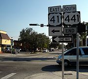
US 441 begins northbound at Southwest 7th Street, which is westbound U.S. Route 41, and ends southbound on Southwest 8th Street, which is eastbound U.S. Route 41 in downtown MiamiMiami, Florida
Miami is a city located on the Atlantic coast in southeastern Florida and the county seat of Miami-Dade County, the most populous county in Florida and the eighth-most populous county in the United States with a population of 2,500,625...
(both are one way streets). The route parallels Interstate 95 north out of Miami to western Aventura
Aventura, Florida
Aventura is a planned, suburban city located in northeastern Miami-Dade County, Florida. The city name is from the Spanish word for "adventure", and was named "Aventura" after one of the developers of the original group of condominiums in the area remarked to the others, "What an adventure this is...
, where I-95 heads northeast to access Fort Lauderdale
Fort Lauderdale, Florida
Fort Lauderdale is a city in the U.S. state of Florida, on the Atlantic coast. It is the county seat of Broward County. As of the 2010 census, the city had a population of 165,521. It is a principal city of the South Florida metropolitan area, which was home to 5,564,635 people at the 2010...
and the remainder of the eastern Florida coast. However, the route is soon joined by the tolled Florida's Turnpike
Florida's Turnpike
Florida's Turnpike , designated as the Ronald Reagan Turnpike, and originally known as the Sunshine State Parkway is a north–south toll road that runs through 11 counties in the Florida peninsula, from U.S...
, which follows US 441 north to West Palm Beach
West Palm Beach, Florida
West Palm Beach, is a city located on the Atlantic coast in southeastern Florida and is the most populous city in and county seat of Palm Beach County, the third most populous county in Florida with a 2010 population of 1,320,134. The city is also the oldest incorporated municipality in South Florida...
. In between, the route interchanges with the Turnpike at exit 62 via State Road 870 (Commercial Blvd.) in Tamarac
Tamarac, Florida
Tamarac is a city in Broward County, Florida, United States. As of the 2010 census, the city had a population of 60,427. It is part of the Miami–Fort Lauderdale–Pompano Beach Metropolitan Statistical Area, which was home to 5,564,635 people at the 2010 census....
. Additionally, US 441 meets Interstate 595
Interstate 595 (Florida)
Interstate 595 , also known as the Port Everglades Expressway and as the unsigned State Road 862, is a Interstate highway that connects Interstate 75 and Alligator Alley in the west with Florida's Turnpike, Interstate 95, Fort Lauderdale-Hollywood International Airport, US 1, and SR A1A before...
(Exits 8 and 8B) west of Fort Lauderdale and the tolled State Road 869 in Coconut Creek
Coconut Creek, Florida
Coconut Creek is a city in Broward County, Florida , nestled between Miami-Dade and Palm Beach counties. It had a population of 52,909 at the 2010 census...
.
At West Palm Beach, US 441 intersects U.S. Route 98 and overlaps the highway to central Palm Beach County
Palm Beach County, Florida
Palm Beach County is the largest county in the state of Florida in total area, and third in population. As of 2010, the county's estimated population was 1,320,134, making it the twenty-eighth most populous in the United States...
, where the two routes split. US 441 continues west to the eastern shore of Lake Okeechobee
Lake Okeechobee
Lake Okeechobee , locally referred to as The Lake or The Big O, is the largest freshwater lake in the state of Florida. It is the seventh largest freshwater lake in the United States and the second largest freshwater lake contained entirely within the lower 48 states...
, where it turns north to follow the shoreline to Pahokee
Pahokee, Florida
Pahokee is a city located on the shore of Lake Okeechobee in Palm Beach County, Florida, United States. The population was 5,985 at the 2000 census. As of 2007, the population recorded by the U.S. Census Bureau is 6,459. Culturally, Pahokee is associated with the Florida Heartland, although...
. Just north of Pahokee, US 98 rejoins US 441 and remains concurrent with US 441 along the eastern edge of the lake. North of Lake Okeechobee in Okeechobee
Okeechobee, Florida
Okeechobee is a city in Okeechobee County, Florida, United States. The population was 5,376 at the 2000 census. As of 2004, the population recorded by the U.S. Census Bureau is 5,784. It is the county seat of Okeechobee County. The Speckled Perch Festival is held annually in honor of the most...
, US 98 and 441 split for the final time. US 441 continues north, meeting the Turnpike at Yeehaw Junction
Yeehaw Junction, Florida
Yeehaw Junction is a census-designated place in Osceola County, Florida, United States. As of the 2010 census, it had a population of 240...
(via State Road 60) prior to intersecting U.S. Route 192 at Holopaw
Holopaw, Florida
Holopaw, Florida is a small unincorporated community in Osceola County, Florida, United States. It is located at the eastern end of the multiplex of highways US 192 and US 441. It has a population of fewer than 5,000 people and is part of the Orlando–Kissimmee Metropolitan Statistical...
. US 441 turns west onto US 192, forming an overlap into Kissimmee
Kissimmee, Florida
Kissimmee is a city in Osceola County, Florida, United States. As of the 2010 census, the population was 59,682. It is the county seat of Osceola County...
. At the concurrent routes of U.S. Route 17/92, US 441 separates from US 192 and follows US 17/US 92 north into downtown Orlando
Orlando, Florida
Orlando is a city in the central region of the U.S. state of Florida. It is the county seat of Orange County, and the center of the Greater Orlando metropolitan area. According to the 2010 US Census, the city had a population of 238,300, making Orlando the 79th largest city in the United States...
. In downtown, US 17/92 turns east onto State Road 50 while US 441 continues north on the Orange Blossom Trail. North of downtown, US 441 meets the northern terminus of the tolled State Road 429 in Apopka before leaving the Orlando area.
In Leesburg
Leesburg, Florida
Leesburg is a city in Lake County, Florida, United States. The population was 15,956 at the 2000 census. As of 2005, the population recorded by the U.S. Census Bureau is 19,086.. Leesburg is located in central Florida, between Lake Harris and Lake Griffin, at the head of the Oklawaha River system....
, midway between Orlando and Ocala
Ocala, Florida
Ocala is a city in Marion County, Florida. As of 2007, the population recorded by the U.S. Census Bureau was 53,491. It is the county seat of Marion County, and the principal city of the Ocala, Florida Metropolitan Statistical Area, which had an estimated 2007 population of 324,857.-History:Ocala...
, US 441 intersects U.S. Route 27. Here, the routes come together, creating a concurrency north to the Ocala suburb of Belleview
Belleview, Florida
Belleview is a city in Marion County, Florida. The population was 3,478 at the 2000 census. According to the U.S Census estimates of 2009, the city had a population of 4,483. It is part of the Ocala Metropolitan Statistical Area. The name, Belleview, which means beautiful view, came from one of...
, where US 27 and US 441 intersect U.S. Route 301. US 301 turns north onto US 27/441, overlapping the routes into Ocala. Immediately north of downtown, US 27 separates from US 441; US 301 then departs the route north of the city. US 441 continues to the northwest, passing across Paynes Prairie
Paynes Prairie
Paynes Prairie is a Florida State Park, encompassing a savanna south of Gainesville, Florida, in Micanopy. It is also a U.S. National Natural Landmark. It is crossed by both I-75 and U.S. 441 .- History :...
Preserve State Park, through Gainesville
Gainesville, Florida
Gainesville is the largest city in, and the county seat of, Alachua County, Florida, United States as well as the principal city of the Gainesville, Florida Metropolitan Statistical Area . The preliminary 2010 Census population count for Gainesville is 124,354. Gainesville is home to the sixth...
and interchanging with Interstate 75
Interstate 75 in Florida
Interstate 75 is a part of the Interstate Highway System and runs from Hialeah, Florida, a few miles northwest of Miami to Sault Ste. Marie in the Upper Peninsula of Michigan...
(Exit 399) ahead of an intersection with US 41 in High Springs
High Springs, Florida
High Springs is a city in Alachua County, Florida, United States. The population was 3,863 at the 2000 census. As of 2004, the population recorded by the U.S. Census Bureau is 4,139 .-Geography:High Springs is located at ....
. US 441 joins US 41 north to Lake City
Lake City, Florida
Lake City is the county seat of Columbia County, Florida, in the United States. In 2009, the U.S. Census Bureau estimated the city's population at 12,614. In addition, it is the Principal City of the Lake City Micropolitan Statistical Area, which is composed of Columbia County, and had an...
, where the routes split south of the city. The routes remain parallel, however, past U.S. Route 90 to the northern extents of Lake City.
Past Lake City, US 441 interchanges with Interstate 10(Exit 303), then skirts the western edge of the Okefenokee Swamp
Okefenokee Swamp
The Okefenokee Swamp is a shallow, 438,000 acre , peat-filled wetland straddling the Georgia–Florida border in the United States. A majority of the swamp is in Georgia and protected by the Okefenokee National Wildlife Refuge and the Okefenokee Wilderness. The Okefenokee Swamp is considered to be...
as it enters Georgia
Georgia (U.S. state)
Georgia is a state located in the southeastern United States. It was established in 1732, the last of the original Thirteen Colonies. The state is named after King George II of Great Britain. Georgia was the fourth state to ratify the United States Constitution, on January 2, 1788...
.
The section from Miami to West Palm Beach is paired with unsigned State Road 7; many locals in this area generally call US 441 as "State Road 7" instead of US 441. The section from Holopaw to Ocala is paired with unsigned State Road 500
Florida State Road 500
State Road 500 is a major state highway running through Florida as a mostly unsigned route under several US Highways. From Chiefland to Williston it is U.S. Highway 27 Alternate. From Williston to Ocala, it is U.S. Highway 27. From Ocala to Kissimmee, it is U.S. Highway 441. From Kissimmee to...
. From SR 121
Florida State Road 121
State Road 121 is a major state highway that runs north and south in northern Florida. The road is actually part of a long multi-state route that also goes through Georgia and South Carolina. Some see it as a de-facto auxiliary route from U.S. Route 21 in Rock Hill, South Carolina...
in Gainesville to US 90 in Lake City, it is part of the DeSoto Trail.
Georgia
In Georgia, US 441 continues to circumnavigate the Okefenokee Swamp to Edith, where it turns to the northwest toward the interior of the state. In HomervilleHomerville, Georgia
Homerville is a city in Clinch County, Georgia, United States. The population was 2,803 at the 2000 census. The city is the county seat of Clinch County. Homerville was incorporated February 15, 1869.-Geography:...
, US 441 intersects U.S. Route 84
U.S. Route 84
U.S. Route 84 is an east–west United States highway. It started as a short Georgia-Alabama route in the original 1926 scheme, but now extends all the way to Colorado. The highway's eastern terminus is a short distance east of Midway, Georgia, at an intersection with I-95. The road continues...
, then meets and merges with U.S. Route 221
U.S. Route 221
U.S. Route 221 is a spur of U.S. Route 21. It runs for 734 miles from Perry, Florida at US Routes 19/98/ALT 27 to Lynchburg, Virginia at U.S. Route 29 . It passes through the states of Florida, Georgia, South Carolina, North Carolina, and Virginia...
south of Pearson
Pearson, Georgia
Pearson is a city in Atkinson County, Georgia, United States. The population was 1,805 at the 2000 census. The city is the county seat of Atkinson County.-Geography:Pearson is located at ....
. The routes remain concurrent to Douglas
Douglas, Georgia
Douglas is a city in Coffee County, Georgia, United States. As of the 2010 census, the city had a population of 11,589. Douglas is the county seat of Coffee County and the core city of the Douglas, Georgia Micropolitan Statistical Area which has a population of 48,708 as of the 2008 census...
, where US 221 and US 441 split. Farther north, US 441 intersects U.S. Route 319
U.S. Route 319
U.S. Highway 319 is a spur of U.S. Route 19. It runs for 318 miles from US 1 /State Route 4 in Wadley, Georgia to the John Gorrie Bridge at Apalachicola, Florida. The sections of US 319 in Medart, Florida and from just east of Carrabelle, Florida to its terminus in Apalachicola are jointly...
south of Jacksonville
Jacksonville, Georgia
Jacksonville is a town in Telfair County, Georgia, United States. The population was 118 at the 2000 census.-Geography:Jacksonville is located at ....
. US 319 turns north onto US 441, creating an overlap north to McRae
McRae, Georgia
McRae is a town in Telfair County, Georgia, United States. Based on the 2000 census, the town has a total population of 2,682. Between 1990 and 2000, the town experienced a population decrease of 10.8%, compared to the state growth during this period of 26.4%. The town is the county seat of...
. US 319 and US 441 intersect U.S. Route 280
U.S. Route 280
U.S. Route 280 is a spur of U.S. Highway 80. It currently runs for 392 miles from Blichton, Georgia at U.S. Highway 80 to Birmingham, Alabama at I-20/I-59. For much of its route, U.S. 280 travels through rural areas and smaller cities in southern Georgia and east central Alabama. Once the...
, which joins the routes for a concurrent run through McRae. In the center of McRae, US 280, US 319 and US 441 meet the concurrent routes of U.S. Route 23 and U.S. Route 341
U.S. Route 341
U.S. Route 341 is a spur of U.S. Route 41. It currently runs southeasterly for 226 miles from Barnesville, Georgia at U.S. Route 41 to Brunswick, Georgia where it ends at its junction with U.S. Route 17 near the Sidney Lanier Bridge. Its run is entirely within the state of Georgia....
. North of the city, US 280 splits off while US 319 and US 441 then pass Little Ocmulgee State Park
Little Ocmulgee State Park
Little Ocmulgee State Park is a Georgia state park located north of McRae on the Little Ocmulgee River. Part of the park was initially built by the Civilian Conservation Corps during the Great Depression, around the natural diversion of the Little Ocmulgee into a lake...
before continuing concurrently to Dublin
Dublin, Georgia
Dublin is a city in Laurens County, Georgia, United States. As of the 2010 census, the city had a population of 16,201. The city is the county seat of Laurens County.-History:The original settlement was named after the city Dublin, Ireland....
. Just south of Dublin, US 319 and US 441 interchange with Interstate 16
Interstate 16
Interstate 16 , also known as Jim Gillis Historic Savannah Parkway or State Route 404 , is an intrastate Interstate Highway located entirely within the state of Georgia, United States...
. In Dublin, US 319 and US 441 split, then 2 blocks north of this, US 441 intersects with U.S. Route 80
U.S. Route 80
U.S. Route 80 is an east–west United States highway, much of which was once part of the early auto trail known as the Dixie Overland Highway. As the "0" in the route number indicates, it was originally a cross-country route, from the Atlantic to the Pacific...
.
North of Dublin, US 441 passes through Milledgeville
Milledgeville, Georgia
Milledgeville is a city in and the county seat of Baldwin County in the U.S. state of Georgia. It is northeast of Macon, located just before Eatonton on the way to Athens along U.S. Highway 441, and it is located on the Oconee River. The relatively rapid current of the Oconee here made this an...
prior to meeting U.S. Route 129
U.S. Route 129
U.S. Route 129 is an offshoot route of U.S. Route 29, which it intersects near Athens, Georgia. US 129 currently runs for 582 miles from Knoxville, Tennessee, to Chiefland, Florida, at U.S. Route 19 and U.S. Route 98. It passes through the states of Tennessee, North Carolina, Georgia and Florida...
near Eatonton
Eatonton, Georgia
Eatonton is a city in Putnam County, Georgia, United States. As of the 2010 census, the city had a population of 6,480. The city is the county seat of Putnam County. It was named after William Eaton, an officer and diplomat involved in the First Barbary War...
. US 129 and US 441 continue concurrently through Madison
Madison, Georgia
Madison is a city in Morgan County, Georgia, United States. The population was 3,636 at the 2000 census. The city is the county seat of Morgan County....
(where US 129 and US 441 interchange with Interstate 20
Interstate 20
Interstate 20 is a major east–west Interstate Highway in the Southern United States. I‑20 runs 1,535 miles from near Kent, Texas, at Interstate 10 to Florence, South Carolina, at Interstate 95...
) and U.S. Route 278
U.S. Route 278
U.S. Route 278 is a parallel route of U.S. Route 78. It currently runs for 1,074 miles from Hilton Head Island, South Carolina to Wickes, Arkansas at U.S. Highway 71/U.S. Highway 59. It might be notable that it is longer than its parent highway, US Hwy-78. US Hwy-278 passes through the states of...
to Athens
Athens, Georgia
Athens-Clarke County is a consolidated city–county in U.S. state of Georgia, in the northeastern part of the state, comprising the former City of Athens proper and Clarke County. The University of Georgia is located in this college town and is responsible for the initial growth of the city...
, where US 129 and US 441 turn eastward onto a limited-access beltway encircling the city. On the beltway, US 129 and US 441 run concurrent with U.S. Route 29
U.S. Route 29
U.S. Route 29 is a north–south United States highway that runs for from the western suburbs of Baltimore, Maryland, to Pensacola, Florida. This highway's northern terminus is at Maryland Route 99 in Ellicott City, Maryland...
and, for a stretch, U.S. Route 78
U.S. Route 78
U.S. Highway 78 is an east–west United States highway that runs for 715 miles from Memphis, Tennessee, to Charleston, South Carolina. Between Memphis and Birmingham, Alabama, it is being upgraded to become Interstate 22....
to an interchange northeast of the city. Here, US 29 exits the highway while US 441 remains on the beltway for two more exits before departing.
The route proceeds north to Commerce
Commerce, Georgia
Commerce is a city in Jackson County, Georgia, United States. As of the 2010 census, the city had a population of 6,544.-Geography:Commerce is located at ....
, where it interchanges with Interstate 85
Interstate 85
Interstate 85 is a major interstate highway in the Southeastern United States. Its current southern terminus is at an interchange with Interstate 65 in Montgomery, Alabama; its northern terminus interchanges with Interstate 95 in Petersburg, Virginia, near Richmond...
north of the city. Past Commerce, US 441 continues to Cornelia
Cornelia, Georgia
Cornelia is a city in Habersham County, Georgia, United States. The population was 3,834 at the 2010 census. It is home to one of the world's largest apple sculptures, which is displayed on top of an obelisk shaped monument...
, where it intersects U.S. Route 23. US 441 merges with US 23, remaining concurrent with the route through Clayton
Clayton, Georgia
Clayton is a city in Rabun County, Georgia, United States. The population was 2,019 at the 2000 census. The city is the county seat of Rabun County and is located in the Blue Ridge Mountains.-History:...
(where US 23 and US 441 are concurrent with U.S. Route 76
U.S. Route 76
U.S. Route 76 is an east–west United States highway that runs for from Chattanooga, Tennessee to Wrightsville Beach, North Carolina.-Tennessee:...
for a short distance) into North Carolina
North Carolina
North Carolina is a state located in the southeastern United States. The state borders South Carolina and Georgia to the south, Tennessee to the west and Virginia to the north. North Carolina contains 100 counties. Its capital is Raleigh, and its largest city is Charlotte...
. The portion of US 23/US 441 from U.S. Route 123
U.S. Route 123
U.S. Route 123 is a spur of U.S. Route 23. It currently runs for from Greenville, South Carolina to Dicks Hill, Georgia at U.S. Route 23. It passes through the states of South Carolina and Georgia and before the construction of I-85, it was the main route between Greenville, South Carolina and...
west of Toccoa
Toccoa, Georgia
Toccoa is a city in Stephens County, Georgia, United States located approximately from Athens and approximately northeast of Atlanta. The population was 9,323 at the 2000 census...
to the North Carolina state line is located within the Chattahoochee National Forest.
North Carolina
Upon crossing the state line, US 23 and US 441 enter the Nantahala National ForestNantahala National Forest
The Nantahala National Forest, established in 1920, is a national forest located in the American state of North Carolina. The word "Nantahala" is a Cherokee word meaning "Land of the Noonday Sun." The name is appropriate as, in some spots, the sun only reaches the floors of the deep gorges of the...
. The concurrent routes head north through a pair of small communities before intersecting U.S. Route 64
U.S. Route 64
U.S. Route 64 is an east–west United States highway that runs for 2,326 miles from eastern North Carolina to just southwest of the Four Corners in northeast Arizona. The western terminus is at U.S. Route 160 in Teec Nos Pos, Arizona. The highway's eastern terminus is at NC 12 and U.S. Route...
in Franklin. US 23 and US 441 turn east, briefly overlapping US 64 around Franklin before separating from the route and continuing to the northeast through the forest. At Dillsboro
Dillsboro, North Carolina
Dillsboro is a town in Jackson County, North Carolina, United States. The town is a popular tourist location, at which visitors tend to stop on their way into the Great Smoky Mountains. The town of Sylva is located just one mile east of Dillsboro and is the county seat...
, US 23 and US 441 intersect U.S. Route 74
U.S. Route 74
U.S. Route 74 is an east–west United States highway that runs for from Cleveland, Tennessee to Wrightsville Beach, North Carolina.-Tennessee:Established in 1987, US-74 western terminus is exit 20 on I-75 in Cleveland...
, here a limited-access highway. US 23 and US 441 both merge onto the freeway, becoming concurrent with US 74; however, US 23 follows US 74 east toward Asheville
Asheville, North Carolina
Asheville is a city in and the county seat of Buncombe County, North Carolina, United States. It is the largest city in Western North Carolina, and the 11th largest city in North Carolina. The City is home to the United States National Climatic Data Center , which is the world's largest active...
while US 441 utilizes US 74 west. Near Qualla, the overlap with US 74 comes to an end as US 441 departs the freeway as well as the forest.
US 441 heads north to Cherokee
Cherokee, North Carolina
Cherokee is a town in Swain County, North Carolina, USA, within the Qualla Boundary land trust. It is located in the Oconaluftee River Valley, near the intersection of U.S. Route 19 and U.S...
, a town located within the Eastern Cherokee Indian Reservation, where it briefly overlaps U.S. Route 19
U.S. Route 19
U.S. Route 19 is a north–south U.S. Highway. Despite encroaching Interstate Highways, the route has remained a long-haul route, connecting the Gulf of Mexico with Lake Erie....
through the town center. Past Cherokee, US 441 progresses north through the reservation to the southern extent of the Great Smoky Mountains National Park
Great Smoky Mountains National Park
Great Smoky Mountains National Park is a United States National Park and UNESCO World Heritage Site that straddles the ridgeline of the Great Smoky Mountains, part of the Blue Ridge Mountains, which are a division of the larger Appalachian Mountain chain. The border between Tennessee and North...
, a dual-state park situated on the North Carolina-Tennessee border. From the park entrance to the Tennessee
Tennessee
Tennessee is a U.S. state located in the Southeastern United States. It has a population of 6,346,105, making it the nation's 17th-largest state by population, and covers , making it the 36th-largest by total land area...
state line, the route follows a northwesterly alignment as it traverses the Great Smoky Mountains
Great Smoky Mountains
The Great Smoky Mountains are a mountain range rising along the Tennessee–North Carolina border in the southeastern United States. They are a subrange of the Appalachian Mountains, and form part of the Blue Ridge Physiographic Province. The range is sometimes called the Smoky Mountains or the...
.
Tennessee
Newfound Gap
Newfound Gap is a mountain pass located near the center of the Great Smoky Mountains National Park of the southern Appalachian Mountains in the United States of America. Situated along the border of Tennessee and North Carolina, the state line crosses the gap, as does U.S...
. The route heads north through the Great Smoky Mountains National Park to Gatlinburg
Gatlinburg, Tennessee
Gatlinburg is a mountain resort city in Sevier County, Tennessee, United States. As of the 2000 U.S. Census, Gatlinburg had a population of 3,828. The city is a popular vacation resort, as it rests on the border of the Great Smoky Mountains National Park along U.S...
, where the route meets U.S. Route 321
U.S. Route 321
U.S. Route 321 is a spur of U.S. Route 21. It runs for 526 miles from South Carolina to Tennessee. The northern terminus of U.S. 321 is between Lenoir City and Oak Ridge, Tennessee, at Interstate 40 exit 364, which is about 4 miles west of Interstate 40's junction with Interstate 75...
. US 321 joins US 441 northward through Pigeon Forge
Pigeon Forge, Tennessee
Pigeon Forge is a mountain resort city in Sevier County, Tennessee, located in the southeastern United States. As of the 2010 census, the city had a total population of 5,875....
before separating north of the city. US 441 continues north to Sevierville
Sevierville, Tennessee
Sevierville is a city in Sevier County, Tennessee, located in the Southeastern United States. Its population was 11,757 at the 2000 United States Census; in 2004 the estimated population was 14,101. Sevierville is the county seat of Sevier County, Tennessee....
, where it intersects with U.S. Route 411
U.S. Route 411
U.S. Highway 411 is an alternate parallel-highway associated with U.S. Highway 11. U.S. 411 extends for about 313 miles from U.S. Route 78 in Leeds, Jefferson County, Alabama, to U.S. Highway 25 in Newport, Cocke County, Tennessee. U.S. 411 passes through the northeastern State of Alabama, the...
. US 441 turns west onto US 411, following the route west to Seymour
Seymour, Tennessee
Seymour is an unincorporated community and a census-designated place in Blount and Sevier counties in the U.S. state of Tennessee, United States. The CDP population was 8,850 at the 2000 U.S. census...
. Here, US 411 heads to the southwest towards Georgia while US 441 continues northwest to Knoxville
Knoxville, Tennessee
Founded in 1786, Knoxville is the third-largest city in the U.S. state of Tennessee, U.S.A., behind Memphis and Nashville, and is the county seat of Knox County. It is the largest city in East Tennessee, and the second-largest city in the Appalachia region...
.
Immediately south of the city, US 441 junctions with State Route 33. SR 33 merges with US 441, following the U.S. route as it enters downtown Knoxville. Within downtown, US 441 interchanges with Interstate 40
Interstate 40
Interstate 40 is the third-longest major east–west Interstate Highway in the United States, after I-90 and I-80. Its western end is at Interstate 15 in Barstow, California; its eastern end is at a concurrency of U.S. Route 117 and North Carolina Highway 132 in Wilmington, North Carolina...
and Interstate 640 before exiting the city limits. North of the city at Halls Crossroads
Halls Crossroads, Tennessee
Halls Crossroads is an unincorporated community in northern Knox County, Tennessee. As a northern suburb of nearby Knoxville, Halls is included in the Knoxville, Tennessee Metropolitan Statistical Area...
, SR 33 breaks from US 441 and heads northeast toward New Tazewell
New Tazewell, Tennessee
New Tazewell is a town in Claiborne County, Tennessee, United States. The population was 3,037 at the 2010 census.-Geography:New Tazewell is located at...
. US 441, meanwhile, continues northeast, paralleling Interstate 75
Interstate 75
Interstate 75 is a major north–south Interstate Highway in the Great Lakes and Southeastern regions of the United States. It travels from State Road 826 and State Road 924 in Hialeah, Florida to Sault Ste. Marie, Michigan, at the Ontario, Canada, border...
for a distance before crossing the top of Norris Dam
Norris Dam
Norris Dam is a hydroelectric and flood control structure located on the Clinch River in Anderson County and Campbell County, Tennessee, USA. Its construction in the mid-1930s was the first major project for the Tennessee Valley Authority, which had been created in 1933 to bring economic...
and finally interchanging with the freeway at exit 128 near Lake City
Lake City, Tennessee
Lake City is a town in Anderson and Campbell counties in the eastern part of the U.S. state of Tennessee, northwest of Knoxville. The population was 1,888 at the 2000 census...
. The route then terminates at an intersection with U.S. Route 25W just west of I-75 in Lake City.
The route is paired with unsigned State Route 71
Tennessee State Route 71
State Route 71 is a north–south state highway in Tennessee. For most of the length it is a "hidden" route, as it coincides with U.S. Route 441 in all but a short section in Knoxville. The road begins at the North Carolina state line in Sevier County within the Great Smoky Mountains National...
for most of its length in Tennessee.
History
Florida
Florida is a state in the southeastern United States, located on the nation's Atlantic and Gulf coasts. It is bordered to the west by the Gulf of Mexico, to the north by Alabama and Georgia and to the east by the Atlantic Ocean. With a population of 18,801,310 as measured by the 2010 census, it...
, where signs for U.S. Highways formerly had different colors for each highway (until the state was forced by the federal government to conform to standards that required consistent black-and-white signs), the "shield" for US 441 was brown.
Although the southern terminus of US 441 is US 41 in Miami, the current, temporary terminus has been the Miami River
Miami River (Florida)
The Miami River is a river in the United States state of Florida that drains out of the Everglades and runs through the Downtown and the city of Miami. The long river flows from the terminus of the Miami Canal at Miami International Airport to Biscayne Bay...
since early 2007, when the Florida Department of Transportation demolished the NW 7th Avenue Bridge over which the highway passed. The replacement bridge will not be finished until 2011.
Popular Culture References
Route 441 is mentioned in the song "American GirlAmerican Girl (song)
"American Girl" is the second single from Tom Petty and the Heartbreakers' self-titled debut album. The single did not chart in the U.S., but in the UK it peaked at #40 the week ending August 27, 1977...
," by Tom Petty
Tom Petty
Thomas Earl "Tom" Petty is an American singer-songwriter and multi-instrumentalist. He is the frontman of Tom Petty and the Heartbreakers and was a founding member of the late 1980s supergroup Traveling Wilburys and Mudcrutch. He has also performed under the pseudonyms of Charlie T...
and the Heartbreakers. ("She could hear the cars roll by/Out on 441/Like waves crashin' on the beach") Petty is from Gainesville, Florida
Gainesville, Florida
Gainesville is the largest city in, and the county seat of, Alachua County, Florida, United States as well as the principal city of the Gainesville, Florida Metropolitan Statistical Area . The preliminary 2010 Census population count for Gainesville is 124,354. Gainesville is home to the sixth...
and Route 441 runs through Gainesville and the University of Florida
University of Florida
The University of Florida is an American public land-grant, sea-grant, and space-grant research university located on a campus in Gainesville, Florida. The university traces its historical origins to 1853, and has operated continuously on its present Gainesville campus since September 1906...
campus. This prompted an urban legend that stated that song was based on a suicide committed on the university campus.
Route 441 is also mentioned in the song "Best of Me" by country singer Brantley Gilbert. He sings, "I remember it all too well/ Riding 441 down to Milledgeville"
External links
- Endpoints of U.S. highways (Ends of 441)
- US 441 @ Florida in Kodachrome
- Tennessee section - I-40 (exit 407) to the Great Smoky Mountains
- North Carolina section - Newfound Gap (Tennessee and North Carolina State line) to Cherokee
- Georgia section - North Carolina/Georgia State Line to Florida/Georgia State Line
- Florida section - Florida/Georgia State Line to Miami
- Athens 441 - Radio show produced by WUGA-FM and distributed through Georgia Public BroadcastingGeorgia Public BroadcastingGeorgia Public Broadcasting is the public broadcasting radio and television state network in the U.S. state of Georgia. It is operated by the Georgia Public Telecommunications Commission....
- 441 Heritage Program at the University of Georgia School of Environmental Design