
River engineering
Encyclopedia
River engineering
is the process of planned human intervention in the course, characteristics or flow of a river
with the intention of producing some defined benefit. People have intervened in the natural course and behaviour of rivers since before recorded history - to manage the water resources
, to protect against flooding or to make passage along or across rivers easier. From Roman
times, rivers have been used as a source of hydropower
. From the late 20th century, river engineering has had environmental
concerns broader than immediate human benefit and some river engineering projects have been concerned exclusively with the restoration or protection of natural characteristics and habitats.
Hydromodification is a term which encompasses the systematic response to alterations to riverine and non-riverine water bodies such as coastal waters (estuaries and bays) and lakes. The U.S. Environmental Protection Agency
(EPA) has defined hydromodification as the "alteration of the hydrologic characteristics of coastal and non-coastal waters, which in turn could cause degradation of water resources." River engineering has often resulted in unintended systematic responses.
The river engineering discipline now strives to repair hydromodified degradations and account for potential systematic response to planned alterations by considering fluvial geomorphology
. Fluvial geomorphology is the study of how rivers change their form over time. Fluvial geomorphology is the cumulation of a number of sciences including open channel hydraulics
, sediment transport
, hydrology
, physical geology
, and riparian ecology
. River engineering attempts to understand fluvial geomorphology, implement a physical alteration, and maintain public safety.
limit and their average freshwater discharge
are proportionate to the extent of their basins and the amount of rain
which, after falling over these basins, reaches the river channels in the bottom of the valleys, by which it is conveyed to the sea.
The basin
of a river is the expanse of country bounded by a watershed
(called a "divide" in North America) over which rainfall flows down towards the river traversing the lowest part of the valley, whereas the rain falling on the far slope of the watershed flows away to another river draining an adjacent basin. River basins vary in extent according to the configuration of the country, ranging from the insignificant drainage areas of streams
rising on high ground very near the coast and flowing straight down into the sea, up to immense tracts of great continents, where rivers rising on the slopes of mountain
ranges far inland have to traverse vast stretches of valleys and plain
s before reaching the ocean. The size of the largest river basin of any country depends on the extent of the continent in which it is situated, its position in relation to the hilly regions in which rivers generally arise and the sea into which they flow, and the distance between the source
and the outlet into the sea of the river draining it.
The rate of flow of rivers depends mainly upon their fall, also known as the gradient or slope
. When two rivers of different sizes have the same fall, the larger river has the quicker flow, as its retardation by friction against its bed and banks is less in proportion to its volume than is the case with the smaller river. The fall available in a section of a river approximately corresponds to the slope of the country it traverses; as rivers rise close to the highest part of their basins, generally in hilly regions, their fall is rapid near their source and gradually diminishes, with occasional irregularities, until, in traversing plains along the latter part of their course, their fall usually becomes quite gentle. Accordingly, in large basins, rivers in most cases begin as torrents with a very variable flow, and end as gently flowing rivers with a comparatively regular discharge.
The irregular flow of rivers throughout their course forms one of the main difficulties in devising works for mitigating inundations or for increasing the navigable capabilities of rivers. In tropical countries subject to periodical rains, the rivers are in flood
during the rainy season and have hardly any flow during the rest of the year, while in temperate
regions, where the rainfall is more evenly distributed throughout the year, evaporation
causes the available rainfall to be much less in hot summer weather than in the winter months, so that the rivers fall to their low stage in the summer and are very liable to be in flood in the winter. In fact, with a temperate climate, the year may be divided into a warm and a cold season, extending from May to October and from November to April in the Northern hemisphere
respectively; the rivers are low and moderate floods are of rare occurrence during the warm period, and the rivers are high and subject to occasional heavy floods after a considerable rainfall during the cold period in most years. The only exceptions are rivers which have their sources amongst mountains clad with perpetual snow
and are fed by glaciers; their floods occur in the summer from the melting of snow and ice, as exemplified by the Rhône
above the Lake of Geneva, and the Arve
which joins it below. But even these rivers are liable to have their flow modified by the influx of tributaries subject to different conditions, so that the Rhone below Lyon
has a more uniform discharge than most rivers, as the summer floods of the Arve are counteracted to a great extent by the low stage of the Saône
flowing into the Rhone at Lyon, which has its floods in the winter when the Arve, on the contrary, is low.
Another serious obstacle encountered in river engineering consists in the large quantity of detritus
they bring down in flood-time, derived mainly from the disintegration of the surface layers of the hills and slopes in the upper parts of the valleys by glaciers, frost
and rain. The power of a current
to transport materials varies with its velocity
, so that torrents with a rapid fall near the sources of rivers can carry down rocks, boulders and large stones
, which are by degrees ground by attrition
in their onward course into shingle
, gravel
, sand
and silt
, simultaneously with the gradual reduction in fall, and, consequently, in the transporting force of the current. Accordingly, under ordinary conditions, most of the materials brought down from the high lands by torrential water courses are carried forward by the main river to the sea, or partially strewn over flat alluvial plains during floods; the size of the materials forming the bed
of the river or borne along by the stream is gradually reduced on proceeding seawards, so that in the Po River
in Italy
, for instance, pebbles and gravel are found for about 140 miles below Turin
, sand along the next 100 miles, and silt and mud in the last 110 miles.
purposes, although power generation is often an important factor. The former is known in the US as channelization and the latter is generally referred to as canalization.
channel. Even if the cut is preserved by protecting the banks, it is liable to produce changes shoals and raise the flood-level in the channel just below its termination. Nevertheless, where the available fall is exceptionally small, as in land originally reclaimed from the sea, such as the English Fenlands
, and where, in consequence, the drainage is in a great measure artificial, straight channels have been formed for the rivers. Because of the perceived value in protecting these fertile, low-lying lands from inundation, additional straight channels have also been provided for the discharge of rainfall, known as drains in the fens. Even extensive modification of the course of a river combined with an enlargement of its channel often produces only a limited reduction in flood damage. Consequently, such floodworks are only commensurate with the expenditure involved where significant assets (such as a town) are under threat. Additionally, even when successful, such floodworks may simply move the problem further downstream and threaten some other town. Recent floodworks in Europe have included restoration
of natural floodplains and winding courses, so that floodwater is held back and released more slowly.
The removal of obstructions, natural or artificial (e.g., trunks of trees, boulders and accumulations of gravel) from a river bed furnishes a simple and efficient means of increasing the discharging capacity of its channel. Such removals will consequently lower the height of floods upstream. Every impediment to the flow, in proportion to its extent, raises the level of the river above it so as to produce the additional artificial fall necessary to convey the flow through the restricted channel, thereby reducing the total available fall.
Human intervention sometimes inadvertently modifies the course or characteristics of a river, for example by introducing obstructions such as mining refuse, sluice gates for mills, fish-traps, unduly wide piers for bridges and solid weirs. By impeding flow these measures can raise the flood-level upstream. Regulations for the management of rivers may include stringent prohibitions with regard to pollution
, requirements for enlarging sluice-ways
and the compulsory raising of their gates for the passage of floods, the removal of fish trap
s, which are frequently blocked up by leaves and floating rubbish, reduction in the number and width of bridge piers when rebuilt, and the substitution of movable weirs for solid weirs.
By installing gauges
in a fairly large river and its tributaries at suitable points, and keeping continuous records for some time of the heights of the water at the various stations, the rise of the floods in the different tributaries, the periods they take in passing down to definite stations on the main river, and the influence they severally exercise on the height of the floods at these places, can be ascertained. With the help of these records, and by observing the times and heights of the maximum rise of a particular flood at the stations on the various tributaries, the time of arrival and height of the top of the flood at any station on the main river can be predicted with remarkable accuracy two or more days beforehand. By communicating these particulars about a high flood to places on the lower river, weir-keepers are enabled to fully open the movable weirs beforehand to permit the passage of the flood, and riparian inhabitants receive timely warning of the impending inundation.
Where portions of a riverside town are situated below the maximum flood-level, or when it is important to protect land adjoining a river from inundations, the overflow of the river must be diverted into a flood-dam or confined within continuous embankments
on both sides. By placing these embankments somewhat back from the margin of the river-bed, a wide flood-channel is provided for the discharge of the river as soon as it overflows its banks, while leaving the natural channel unaltered for the ordinary flow. Low embankments may be sufficient where only exceptional summer floods have to be excluded from meadows. Occasionally the embankments are raised high enough to retain the floods during most years, while provision is made for the escape of the rare, exceptionally high floods at special places in the embankments, where the scour of the issuing current is guarded against, and the inundation of the neighboring land is least injurious. In this manner, the increased cost of embankments raised above the highest flood-level of rare occurrence is avoided, as is the danger of breaches in the banks from an unusually high flood-rise and rapid flow, with their disastrous effects.
to below Caranella, despite the clearance of sediment effected by the rush through breaches. Therefore, the completion of the embankments, together with their raising, would only eventually aggravate the injuries of the inundations they have been designed to prevent, as the escape of floods from the raised river must occur sooner or later.
In the UK, problems of flooding of domestic properties around the turn of the 21st century have been blamed on inadequate planning controls which have permitted development on floodplains. This exposes the properties on the floodplain to flood, and the substitution of concrete for natural strata speeds the run-off of water, which increases the danger of flooding downstream. In the Midwestern United States and the Southern United States
the term for this measure is channelization. Much of it was done under the auspices or overall direction of the United States Army
Corps of Engineers
. One of the most heavily channelized areas in the United States
is West Tennessee
, where every major stream with one exception (the Hatchie River
) has been partially or completely channelized.
; as a natural waterway curves back and forth, it usually deposits sand
and gravel
on the inside of the corners where the water flows slowly, and cuts sand, gravel, subsoil
, and precious topsoil
from the outside corners where it flows rapidly due to a change in direction. Unlike sand and gravel, the topsoil that is eroded does not get deposited on the inside of the next corner of the river. It simply washes away.
's Kissimmee River
has been cited as a cause contributing to the loss of wetlands. This straightening causes the streams to flow more rapidly, which can, in some instances, vastly increase soil erosion. It can also increase flooding downstream from the channelized area, as larger volumes of water traveling more rapidly than normal can reach choke points over a shorter period of time than they otherwise would, with a net effect of flood control in one area coming at the expense of greatly aggravated flooding in another. In addition, studies have shown that stream channelization results in declines of river fish populations. A 1971 study of the Chariton River
in northern Missouri
, United States, found that the channelized section of the river contained only 13 species of fish, whereas the natural segment of the stream was home to 21 species of fish. The biomass of fish able to be caught in the dredged segments of the river was 80 percent less than in the natural parts of the same stream. This loss of fish diversity and abundance is thought to occur because of reduction in habitat, elimination of riffles and pools, greater fluctuation of stream levels and water temperature, and shifting substrates. The rate of recovery for a stream once it has been dredged is extremely slow, with many streams showing no significant recovery 30 to 40 years after the date of channelization.
The major agency involved in the enforcement of this policy is the same Army Corps of Engineers which for so long was the primary promoter of wide-scale channelization. Often, in the instances where channelization is permitted, boulders may be installed in the bed of the new channel so that water velocity is slowed, and channels may be deliberately curved as well. In 1990 the U.S. Congress
gave the Army Corps a specific mandate to include environmental protection in its mission, and in 1996 it authorized the Corps to undertake restoration projects. The U.S. Clean Water Act regulates certain aspects of channelization by requiring non-Federal entities (i.e. state
and local
governments, private parties) to obtain permits for dredging and filling operations. Permits are issued by the Army Corps with EPA participation.
This new policy also has its critics, however. Farmers who are losing land to soil erosion as channelized streams cease to be maintained feel particularly aggrieved. Not only are they losing their valuable property to erosion, the erosion ends up in the stream or river, and contributes to decreased water quality
. They also point out that if such policies had been in place in the U.S. at the time of white settlement, the country probably would never have become a leader in world agriculture and a net exporter of food. Channelization critics respond that this is immaterial, as we are no longer living in the era of initial settlement.

 Rivers whose discharge is liable to become quite small at their low stage, or which have a somewhat large fall, as is usual in the upper part of rivers, cannot be given an adequate depth for navigation purely by works which regulate the flow; their ordinary summer level has to be raised by impounding the flow with weir
s at intervals across the channel, while a lock has to be provided alongside the weir, or in a side channel, to provide for the passage of vessels. A river is thereby converted into a succession of fairly level reaches rising in steps up-stream, providing still-water navigation comparable to a canal; but it differs from a canal in the introduction of weirs for keeping up the water-level, in the provision for the regular discharge of the river at the weirs, and in the two sills of the locks being laid at the same level instead of the upper sill being raised above the lower one to the extent of the rise at the lock, as usual on canals.
Canalization secures a definite available depth for navigation; and the discharge of the river generally is amply sufficient for maintaining the impounded water level, as well as providing the necessary water for locking. Navigation, however, is liable to be stopped during the descent of high floods, which in many cases rise above the locks; and it is necessarily arrested in cold climates on all rivers by long, severe frosts, and especially by ice
. Many small rivers, like the Thames above its tidal limit, have been rendered navigable by canalization, and several fairly large rivers have thereby provided a good depth for vessels for considerable distances inland. Thus the canalized Seine
has secured a navigable depth of 10 feet from its tidal limit up to Paris
, a distance of 135 miles, and a depth of 6 feet up to Montereau, 62 miles higher up.
and the Mississippi
. River engineering works are only required to prevent changes in the course of the stream, to regulate its depth, and especially to fix the low-water channel and concentrate the flow in it, so as to increase as far as practicable the navigable depth at the lowest stage of the water level.
Engineering works to increase the navigability of rivers can only be advantageously undertaken in large rivers with a moderate fall and a fair discharge at their lowest stage, for with a large fall the current presents a great impediment to up-stream navigation, and there are generally great variations in water level, and when the discharge becomes very small in the dry season. it is impossible to maintain a sufficient depth of water in the low-water channel.
The possibility to secure uniformity of depth in a river by lowering the shoals obstructing the channel depends on the nature of the shoals. A soft shoal
in the bed of a river is due to deposit from a diminution in velocity of flow, produced by a reduction in fall and by a widening of the channel, or to a loss in concentration of the scour of the main current in passing over from one concave bank to the next on the opposite side. The lowering of such a shoal by dredging merely effects a temporary deepening, for it soon forms again from the causes which produced it. The removal, moreover, of the rocky obstructions at rapids, though increasing the depth and equalizing the flow at these places, produces a lowering of the river above the rapids by facilitating the efflux, which may result in the appearance of fresh shoals at the low stage of the river. Where, however, narrow rocky reefs or other hard shoals stretch across the bottom of a river and present obstacles to the erosion by the current of the soft materials forming the bed of the river above and below, their removal may result in permanent improvement by enabling the river to deepen its bed by natural scour.
The capability of a river to provide a waterway for navigation during the summer or throughout the dry season depends on the depth that can be secured in the channel at the lowest stage. The problem in the dry season is the small discharge and deficiency in scour during this period. A typical solution is to restrict the width of the low-water channel, concentrate all of the flow in it, and also to fix its position so that it is scoured out every year by the floods which follow the deepest part of the bed along the line of the strongest current. This can be effected by closing subsidiary low-water channels with dikes across them, and narrowing the channel at the low stage by low-dipping cross dikes extending from the river banks down the slope and pointing slightly up-stream so as to direct the water flowing over them into a central channel.
. The interaction of river flow and tide
needs to be modeled by computer or using scale models, moulded to the configuration of the estuary under consideration and reproducing in miniature the tidal ebb and flow and fresh-water discharge over a bed of very fine sand, in which various lines of training walls can be successively inserted. The models should be capable of furnishing valuable indications of the respective effects and comparative merits of the different schemes proposed for works.
Engineering
Engineering is the discipline, art, skill and profession of acquiring and applying scientific, mathematical, economic, social, and practical knowledge, in order to design and build structures, machines, devices, systems, materials and processes that safely realize improvements to the lives of...
is the process of planned human intervention in the course, characteristics or flow of a river
River
A river is a natural watercourse, usually freshwater, flowing towards an ocean, a lake, a sea, or another river. In a few cases, a river simply flows into the ground or dries up completely before reaching another body of water. Small rivers may also be called by several other names, including...
with the intention of producing some defined benefit. People have intervened in the natural course and behaviour of rivers since before recorded history - to manage the water resources
Water resources
Water resources are sources of water that are useful or potentially useful. Uses of water include agricultural, industrial, household, recreational and environmental activities. Virtually all of these human uses require fresh water....
, to protect against flooding or to make passage along or across rivers easier. From Roman
Ancient Rome
Ancient Rome was a thriving civilization that grew on the Italian Peninsula as early as the 8th century BC. Located along the Mediterranean Sea and centered on the city of Rome, it expanded to one of the largest empires in the ancient world....
times, rivers have been used as a source of hydropower
Hydropower
Hydropower, hydraulic power, hydrokinetic power or water power is power that is derived from the force or energy of falling water, which may be harnessed for useful purposes. Since ancient times, hydropower has been used for irrigation and the operation of various mechanical devices, such as...
. From the late 20th century, river engineering has had environmental
Sustainability
Sustainability is the capacity to endure. For humans, sustainability is the long-term maintenance of well being, which has environmental, economic, and social dimensions, and encompasses the concept of union, an interdependent relationship and mutual responsible position with all living and non...
concerns broader than immediate human benefit and some river engineering projects have been concerned exclusively with the restoration or protection of natural characteristics and habitats.
Hydromodification is a term which encompasses the systematic response to alterations to riverine and non-riverine water bodies such as coastal waters (estuaries and bays) and lakes. The U.S. Environmental Protection Agency
United States Environmental Protection Agency
The U.S. Environmental Protection Agency is an agency of the federal government of the United States charged with protecting human health and the environment, by writing and enforcing regulations based on laws passed by Congress...
(EPA) has defined hydromodification as the "alteration of the hydrologic characteristics of coastal and non-coastal waters, which in turn could cause degradation of water resources." River engineering has often resulted in unintended systematic responses.
The river engineering discipline now strives to repair hydromodified degradations and account for potential systematic response to planned alterations by considering fluvial geomorphology
Geomorphology
Geomorphology is the scientific study of landforms and the processes that shape them...
. Fluvial geomorphology is the study of how rivers change their form over time. Fluvial geomorphology is the cumulation of a number of sciences including open channel hydraulics
Hydraulics
Hydraulics is a topic in applied science and engineering dealing with the mechanical properties of liquids. Fluid mechanics provides the theoretical foundation for hydraulics, which focuses on the engineering uses of fluid properties. In fluid power, hydraulics is used for the generation, control,...
, sediment transport
Sediment transport
Sediment transport is the movement of solid particles , typically due to a combination of the force of gravity acting on the sediment, and/or the movement of the fluid in which the sediment is entrained...
, hydrology
Hydrology
Hydrology is the study of the movement, distribution, and quality of water on Earth and other planets, including the hydrologic cycle, water resources and environmental watershed sustainability...
, physical geology
Geology
Geology is the science comprising the study of solid Earth, the rocks of which it is composed, and the processes by which it evolves. Geology gives insight into the history of the Earth, as it provides the primary evidence for plate tectonics, the evolutionary history of life, and past climates...
, and riparian ecology
Ecology
Ecology is the scientific study of the relations that living organisms have with respect to each other and their natural environment. Variables of interest to ecologists include the composition, distribution, amount , number, and changing states of organisms within and among ecosystems...
. River engineering attempts to understand fluvial geomorphology, implement a physical alteration, and maintain public safety.
Characteristics of rivers
The size of rivers above any tidalTide
Tides are the rise and fall of sea levels caused by the combined effects of the gravitational forces exerted by the moon and the sun and the rotation of the Earth....
limit and their average freshwater discharge
Discharge (hydrology)
In hydrology, discharge is the volume rate of water flow, including any suspended solids , dissolved chemical species and/or biologic material , which is transported through a given cross-sectional area...
are proportionate to the extent of their basins and the amount of rain
Rain
Rain is liquid precipitation, as opposed to non-liquid kinds of precipitation such as snow, hail and sleet. Rain requires the presence of a thick layer of the atmosphere to have temperatures above the melting point of water near and above the Earth's surface...
which, after falling over these basins, reaches the river channels in the bottom of the valleys, by which it is conveyed to the sea.
The basin
Drainage basin
A drainage basin is an extent or an area of land where surface water from rain and melting snow or ice converges to a single point, usually the exit of the basin, where the waters join another waterbody, such as a river, lake, reservoir, estuary, wetland, sea, or ocean...
of a river is the expanse of country bounded by a watershed
Water divide
A drainage divide, water divide, divide or watershed is the line separating neighbouring drainage basins...
(called a "divide" in North America) over which rainfall flows down towards the river traversing the lowest part of the valley, whereas the rain falling on the far slope of the watershed flows away to another river draining an adjacent basin. River basins vary in extent according to the configuration of the country, ranging from the insignificant drainage areas of streams
STREAMS
In computer networking, STREAMS is the native framework in Unix System V for implementing character devices.STREAMS was designed as a modular architecture for implementing full-duplex I/O between kernel or user space processes and device drivers. Its most frequent uses have been in developing...
rising on high ground very near the coast and flowing straight down into the sea, up to immense tracts of great continents, where rivers rising on the slopes of mountain
Mountain
Image:Himalaya_annotated.jpg|thumb|right|The Himalayan mountain range with Mount Everestrect 58 14 160 49 Chomo Lonzorect 200 28 335 52 Makalurect 378 24 566 45 Mount Everestrect 188 581 920 656 Tibetan Plateaurect 250 406 340 427 Rong River...
ranges far inland have to traverse vast stretches of valleys and plain
Plain
In geography, a plain is land with relatively low relief, that is flat or gently rolling. Prairies and steppes are types of plains, and the archetype for a plain is often thought of as a grassland, but plains in their natural state may also be covered in shrublands, woodland and forest, or...
s before reaching the ocean. The size of the largest river basin of any country depends on the extent of the continent in which it is situated, its position in relation to the hilly regions in which rivers generally arise and the sea into which they flow, and the distance between the source
Source (river or stream)
The source or headwaters of a river or stream is the place from which the water in the river or stream originates.-Definition:There is no universally agreed upon definition for determining a stream's source...
and the outlet into the sea of the river draining it.
The rate of flow of rivers depends mainly upon their fall, also known as the gradient or slope
Slope
In mathematics, the slope or gradient of a line describes its steepness, incline, or grade. A higher slope value indicates a steeper incline....
. When two rivers of different sizes have the same fall, the larger river has the quicker flow, as its retardation by friction against its bed and banks is less in proportion to its volume than is the case with the smaller river. The fall available in a section of a river approximately corresponds to the slope of the country it traverses; as rivers rise close to the highest part of their basins, generally in hilly regions, their fall is rapid near their source and gradually diminishes, with occasional irregularities, until, in traversing plains along the latter part of their course, their fall usually becomes quite gentle. Accordingly, in large basins, rivers in most cases begin as torrents with a very variable flow, and end as gently flowing rivers with a comparatively regular discharge.
The irregular flow of rivers throughout their course forms one of the main difficulties in devising works for mitigating inundations or for increasing the navigable capabilities of rivers. In tropical countries subject to periodical rains, the rivers are in flood
Flood
A flood is an overflow of an expanse of water that submerges land. The EU Floods directive defines a flood as a temporary covering by water of land not normally covered by water...
during the rainy season and have hardly any flow during the rest of the year, while in temperate
Temperate
In geography, temperate or tepid latitudes of the globe lie between the tropics and the polar circles. The changes in these regions between summer and winter are generally relatively moderate, rather than extreme hot or cold...
regions, where the rainfall is more evenly distributed throughout the year, evaporation
Evaporation
Evaporation is a type of vaporization of a liquid that occurs only on the surface of a liquid. The other type of vaporization is boiling, which, instead, occurs on the entire mass of the liquid....
causes the available rainfall to be much less in hot summer weather than in the winter months, so that the rivers fall to their low stage in the summer and are very liable to be in flood in the winter. In fact, with a temperate climate, the year may be divided into a warm and a cold season, extending from May to October and from November to April in the Northern hemisphere
Northern Hemisphere
The Northern Hemisphere is the half of a planet that is north of its equator—the word hemisphere literally means “half sphere”. It is also that half of the celestial sphere north of the celestial equator...
respectively; the rivers are low and moderate floods are of rare occurrence during the warm period, and the rivers are high and subject to occasional heavy floods after a considerable rainfall during the cold period in most years. The only exceptions are rivers which have their sources amongst mountains clad with perpetual snow
Snow
Snow is a form of precipitation within the Earth's atmosphere in the form of crystalline water ice, consisting of a multitude of snowflakes that fall from clouds. Since snow is composed of small ice particles, it is a granular material. It has an open and therefore soft structure, unless packed by...
and are fed by glaciers; their floods occur in the summer from the melting of snow and ice, as exemplified by the Rhône
Rhône River
The Rhone is one of the major rivers of Europe, rising in Switzerland and running from there through southeastern France. At Arles, near its mouth on the Mediterranean Sea, the river divides into two branches, known as the Great Rhone and the Little Rhone...
above the Lake of Geneva, and the Arve
Arve
The Arve river flows for approximately 100 km through France, in the département of Haute-Savoie, and in Switzerland...
which joins it below. But even these rivers are liable to have their flow modified by the influx of tributaries subject to different conditions, so that the Rhone below Lyon
Lyon
Lyon , is a city in east-central France in the Rhône-Alpes region, situated between Paris and Marseille. Lyon is located at from Paris, from Marseille, from Geneva, from Turin, and from Barcelona. The residents of the city are called Lyonnais....
has a more uniform discharge than most rivers, as the summer floods of the Arve are counteracted to a great extent by the low stage of the Saône
Saône
The Saône is a river of eastern France. It is a right tributary of the River Rhône. Rising at Vioménil in the Vosges department, it joins the Rhône in Lyon....
flowing into the Rhone at Lyon, which has its floods in the winter when the Arve, on the contrary, is low.
Another serious obstacle encountered in river engineering consists in the large quantity of detritus
Detritus
Detritus is a biological term used to describe dead or waste organic material.Detritus may also refer to:* Detritus , a geological term used to describe the particles of rock produced by weathering...
they bring down in flood-time, derived mainly from the disintegration of the surface layers of the hills and slopes in the upper parts of the valleys by glaciers, frost
Frost
Frost is the solid deposition of water vapor from saturated air. It is formed when solid surfaces are cooled to below the dew point of the adjacent air as well as below the freezing point of water. Frost crystals' size differ depending on time and water vapour available. Frost is also usually...
and rain. The power of a current
Current (stream)
A current, in a river or stream, is the flow of water influenced by gravity as the water moves downhill to reduce its potential energy. The current varies spatially as well as temporally within the stream, dependent upon the flow volume of water, stream gradient, and channel geometrics...
to transport materials varies with its velocity
Velocity
In physics, velocity is speed in a given direction. Speed describes only how fast an object is moving, whereas velocity gives both the speed and direction of the object's motion. To have a constant velocity, an object must have a constant speed and motion in a constant direction. Constant ...
, so that torrents with a rapid fall near the sources of rivers can carry down rocks, boulders and large stones
Rock (geology)
In geology, rock or stone is a naturally occurring solid aggregate of minerals and/or mineraloids.The Earth's outer solid layer, the lithosphere, is made of rock. In general rocks are of three types, namely, igneous, sedimentary, and metamorphic...
, which are by degrees ground by attrition
Attrition (weathering)
Attrition is a form of coastal or river erosion, when the bed load is eroded by itself and the bed. As rocks are transported downstream along a riverbed, the regular impacts between the grains themselves and between the grains and the bed cause them to be broken up into smaller fragments. This...
in their onward course into shingle
Slate
Slate is a fine-grained, foliated, homogeneous metamorphic rock derived from an original shale-type sedimentary rock composed of clay or volcanic ash through low-grade regional metamorphism. The result is a foliated rock in which the foliation may not correspond to the original sedimentary layering...
, gravel
Gravel
Gravel is composed of unconsolidated rock fragments that have a general particle size range and include size classes from granule- to boulder-sized fragments. Gravel can be sub-categorized into granule and cobble...
, sand
Sand
Sand is a naturally occurring granular material composed of finely divided rock and mineral particles.The composition of sand is highly variable, depending on the local rock sources and conditions, but the most common constituent of sand in inland continental settings and non-tropical coastal...
and silt
Silt
Silt is granular material of a size somewhere between sand and clay whose mineral origin is quartz and feldspar. Silt may occur as a soil or as suspended sediment in a surface water body...
, simultaneously with the gradual reduction in fall, and, consequently, in the transporting force of the current. Accordingly, under ordinary conditions, most of the materials brought down from the high lands by torrential water courses are carried forward by the main river to the sea, or partially strewn over flat alluvial plains during floods; the size of the materials forming the bed
Bed
A bed is a large piece of furniture used as a place to sleep, relax, or engage in sexual relations.Most modern beds consist of a mattress on a bed frame, with the mattress resting either on a solid base, often wooden slats, or a sprung base...
of the river or borne along by the stream is gradually reduced on proceeding seawards, so that in the Po River
Po River
The Po |Ligurian]]: Bodincus or Bodencus) is a river that flows either or – considering the length of the Maira, a right bank tributary – eastward across northern Italy, from a spring seeping from a stony hillside at Pian del Re, a flat place at the head of the Val Po under the northwest face...
in Italy
Italy
Italy , officially the Italian Republic languages]] under the European Charter for Regional or Minority Languages. In each of these, Italy's official name is as follows:;;;;;;;;), is a unitary parliamentary republic in South-Central Europe. To the north it borders France, Switzerland, Austria and...
, for instance, pebbles and gravel are found for about 140 miles below Turin
Turin
Turin is a city and major business and cultural centre in northern Italy, capital of the Piedmont region, located mainly on the left bank of the Po River and surrounded by the Alpine arch. The population of the city proper is 909,193 while the population of the urban area is estimated by Eurostat...
, sand along the next 100 miles, and silt and mud in the last 110 miles.
Methods
Improvements can be divided into those that are aimed at improving the flow of the river, particularly in flood conditions, and those that aim to hold back the flow, primarily for navigationNavigation
Navigation is the process of monitoring and controlling the movement of a craft or vehicle from one place to another. It is also the term of art used for the specialized knowledge used by navigators to perform navigation tasks...
purposes, although power generation is often an important factor. The former is known in the US as channelization and the latter is generally referred to as canalization.
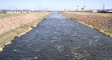
Channelization
Reducing the length of the channel by substituting straight cuts for a winding course is the only way in which the (effective) fall can be increased. This involves some loss of capacity in the channel as a whole, and in the case of a large river with a considerable flow it is very difficult to maintain a straight cut owing to the tendency of the current to erode the banks and form again a sinuousSinuous
Sinuous is a fictional snake from the third season of the animated children's television series The Animals of Farthing Wood based upon the books of the same name by author Colin Dann....
channel. Even if the cut is preserved by protecting the banks, it is liable to produce changes shoals and raise the flood-level in the channel just below its termination. Nevertheless, where the available fall is exceptionally small, as in land originally reclaimed from the sea, such as the English Fenlands
The Fens
The Fens, also known as the , are a naturally marshy region in eastern England. Most of the fens were drained several centuries ago, resulting in a flat, damp, low-lying agricultural region....
, and where, in consequence, the drainage is in a great measure artificial, straight channels have been formed for the rivers. Because of the perceived value in protecting these fertile, low-lying lands from inundation, additional straight channels have also been provided for the discharge of rainfall, known as drains in the fens. Even extensive modification of the course of a river combined with an enlargement of its channel often produces only a limited reduction in flood damage. Consequently, such floodworks are only commensurate with the expenditure involved where significant assets (such as a town) are under threat. Additionally, even when successful, such floodworks may simply move the problem further downstream and threaten some other town. Recent floodworks in Europe have included restoration
Stream restoration
Stream restoration or river restoration, sometimes called river reclamation in the UK, describes a set of activities that help improve the environmental health of a river or stream. Improved health may be indicated by expanded habitat for diverse species and reduced stream bank erosion...
of natural floodplains and winding courses, so that floodwater is held back and released more slowly.
The removal of obstructions, natural or artificial (e.g., trunks of trees, boulders and accumulations of gravel) from a river bed furnishes a simple and efficient means of increasing the discharging capacity of its channel. Such removals will consequently lower the height of floods upstream. Every impediment to the flow, in proportion to its extent, raises the level of the river above it so as to produce the additional artificial fall necessary to convey the flow through the restricted channel, thereby reducing the total available fall.
Human intervention sometimes inadvertently modifies the course or characteristics of a river, for example by introducing obstructions such as mining refuse, sluice gates for mills, fish-traps, unduly wide piers for bridges and solid weirs. By impeding flow these measures can raise the flood-level upstream. Regulations for the management of rivers may include stringent prohibitions with regard to pollution
Water pollution
Water pollution is the contamination of water bodies . Water pollution occurs when pollutants are discharged directly or indirectly into water bodies without adequate treatment to remove harmful compounds....
, requirements for enlarging sluice-ways
Spillway
A spillway is a structure used to provide the controlled release of flows from a dam or levee into a downstream area, typically being the river that was dammed. In the UK they may be known as overflow channels. Spillways release floods so that the water does not overtop and damage or even destroy...
and the compulsory raising of their gates for the passage of floods, the removal of fish trap
Fish trap
A fish trap is a trap used for fishing. Fish traps may have the form of a fishing weir or a lobster trap. A typical trap might consist of a frame of thick steel wire in the shape of a heart, with chicken wire stretched around it. The mesh wraps around the frame and then tapers into the inside of...
s, which are frequently blocked up by leaves and floating rubbish, reduction in the number and width of bridge piers when rebuilt, and the substitution of movable weirs for solid weirs.
By installing gauges
Stream gauge
A stream gauge, stream gage or gauging station is a location used by hydrologists or environmental scientists to monitor and test terrestrial bodies of water. Hydrometric measurements of water surface elevation and/or volumetric discharge are generally taken and observations of biota may also be...
in a fairly large river and its tributaries at suitable points, and keeping continuous records for some time of the heights of the water at the various stations, the rise of the floods in the different tributaries, the periods they take in passing down to definite stations on the main river, and the influence they severally exercise on the height of the floods at these places, can be ascertained. With the help of these records, and by observing the times and heights of the maximum rise of a particular flood at the stations on the various tributaries, the time of arrival and height of the top of the flood at any station on the main river can be predicted with remarkable accuracy two or more days beforehand. By communicating these particulars about a high flood to places on the lower river, weir-keepers are enabled to fully open the movable weirs beforehand to permit the passage of the flood, and riparian inhabitants receive timely warning of the impending inundation.
Where portions of a riverside town are situated below the maximum flood-level, or when it is important to protect land adjoining a river from inundations, the overflow of the river must be diverted into a flood-dam or confined within continuous embankments
Levee
A levee, levée, dike , embankment, floodbank or stopbank is an elongated naturally occurring ridge or artificially constructed fill or wall, which regulates water levels...
on both sides. By placing these embankments somewhat back from the margin of the river-bed, a wide flood-channel is provided for the discharge of the river as soon as it overflows its banks, while leaving the natural channel unaltered for the ordinary flow. Low embankments may be sufficient where only exceptional summer floods have to be excluded from meadows. Occasionally the embankments are raised high enough to retain the floods during most years, while provision is made for the escape of the rare, exceptionally high floods at special places in the embankments, where the scour of the issuing current is guarded against, and the inundation of the neighboring land is least injurious. In this manner, the increased cost of embankments raised above the highest flood-level of rare occurrence is avoided, as is the danger of breaches in the banks from an unusually high flood-rise and rapid flow, with their disastrous effects.
Effects
A most serious objection to the formation of continuous, high embankments along rivers bringing down considerable quantities of detritus, especially near a place where their fall has been abruptly reduced by descending from mountain slopes onto alluvial plains, is the danger of their bed being raised by deposit, producing a rise in the flood-level, and necessitating a raising of the embankments if inundations are to be prevented. Longitudinal sections of the Po River, taken in 1874 and 1901, show that its bed was materially raised during this period from the confluence of the TicinoTicino
Canton Ticino or Ticino is the southernmost canton of Switzerland. Named after the Ticino river, it is the only canton in which Italian is the sole official language...
to below Caranella, despite the clearance of sediment effected by the rush through breaches. Therefore, the completion of the embankments, together with their raising, would only eventually aggravate the injuries of the inundations they have been designed to prevent, as the escape of floods from the raised river must occur sooner or later.
In the UK, problems of flooding of domestic properties around the turn of the 21st century have been blamed on inadequate planning controls which have permitted development on floodplains. This exposes the properties on the floodplain to flood, and the substitution of concrete for natural strata speeds the run-off of water, which increases the danger of flooding downstream. In the Midwestern United States and the Southern United States
Southern United States
The Southern United States—commonly referred to as the American South, Dixie, or simply the South—constitutes a large distinctive area in the southeastern and south-central United States...
the term for this measure is channelization. Much of it was done under the auspices or overall direction of the United States Army
United States Army
The United States Army is the main branch of the United States Armed Forces responsible for land-based military operations. It is the largest and oldest established branch of the U.S. military, and is one of seven U.S. uniformed services...
Corps of Engineers
United States Army Corps of Engineers
The United States Army Corps of Engineers is a federal agency and a major Army command made up of some 38,000 civilian and military personnel, making it the world's largest public engineering, design and construction management agency...
. One of the most heavily channelized areas in the United States
United States
The United States of America is a federal constitutional republic comprising fifty states and a federal district...
is West Tennessee
West Tennessee
West Tennessee is one of the three Grand Divisions of the State of Tennessee. Of the three, it is the one that is most sharply defined geographically. Its boundaries are the Mississippi River on the west and the Tennessee River on the east...
, where every major stream with one exception (the Hatchie River
Hatchie River
The Hatchie River is a stream in northern Mississippi and southwestern Tennessee. It is of considerable geographic, cultural, and historic significance. In large measure this is because it is the only major stream of West Tennessee that has never been impounded, channelized, or otherwise...
) has been partially or completely channelized.
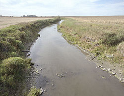
Advantages
Channelization of a stream may be undertaken for several reasons. One is to make a stream more suitable for navigation or for navigation by larger vessels with deep draughts. Another is to restrict water to a certain area of a stream's natural bottom lands so that the bulk of such lands can be made available for agriculture. A third reason is flood control, with the idea of giving a stream a sufficiently large and deep channel so that flooding beyond those limits will be minimal or nonexistent, at least on a routine basis. One major reason is to reduce natural erosionErosion
Erosion is when materials are removed from the surface and changed into something else. It only works by hydraulic actions and transport of solids in the natural environment, and leads to the deposition of these materials elsewhere...
; as a natural waterway curves back and forth, it usually deposits sand
Sand
Sand is a naturally occurring granular material composed of finely divided rock and mineral particles.The composition of sand is highly variable, depending on the local rock sources and conditions, but the most common constituent of sand in inland continental settings and non-tropical coastal...
and gravel
Gravel
Gravel is composed of unconsolidated rock fragments that have a general particle size range and include size classes from granule- to boulder-sized fragments. Gravel can be sub-categorized into granule and cobble...
on the inside of the corners where the water flows slowly, and cuts sand, gravel, subsoil
Subsoil
Subsoil, or substrata, is the layer of soil under the topsoil on the surface of the ground. The subsoil may include substances such as clay and/or sand that has only been partially broken down by air, sunlight, water, wind etc., to produce true soil...
, and precious topsoil
Topsoil
Topsoil is the upper, outermost layer of soil, usually the top to . It has the highest concentration of organic matter and microorganisms and is where most of the Earth's biological soil activity occurs.-Importance:...
from the outside corners where it flows rapidly due to a change in direction. Unlike sand and gravel, the topsoil that is eroded does not get deposited on the inside of the next corner of the river. It simply washes away.
Disadvantages
Channelization has several predictable and negative effects. One of them is loss of wetlands. Wetlands are an excellent habitat for many forms of wildlife, and additionally serve as a "filter" for much of the world's surface fresh water. Another is the fact that channelized streams are almost invariably straightened. For example, the channelization of FloridaFlorida
Florida is a state in the southeastern United States, located on the nation's Atlantic and Gulf coasts. It is bordered to the west by the Gulf of Mexico, to the north by Alabama and Georgia and to the east by the Atlantic Ocean. With a population of 18,801,310 as measured by the 2010 census, it...
's Kissimmee River
Kissimmee River
The Kissimmee River is a river in south-central Florida, United States.-Course:The Kissimmee River arises in Osceola County as the outflow from East Lake Tohopekaliga, passing through Lake Tohopekaliga, Lake Cypress, Lake Hatchineha and Lake Kissimmee...
has been cited as a cause contributing to the loss of wetlands. This straightening causes the streams to flow more rapidly, which can, in some instances, vastly increase soil erosion. It can also increase flooding downstream from the channelized area, as larger volumes of water traveling more rapidly than normal can reach choke points over a shorter period of time than they otherwise would, with a net effect of flood control in one area coming at the expense of greatly aggravated flooding in another. In addition, studies have shown that stream channelization results in declines of river fish populations. A 1971 study of the Chariton River
Chariton River
The Chariton River is a tributary to the Missouri River in southeast Iowa and northeast Missouri.It has been called Missouri's "Grand Divide" because streams west of the Chariton flow into the Missouri and streams east of it flow into the Mississippi River....
in northern Missouri
Missouri
Missouri is a US state located in the Midwestern United States, bordered by Iowa, Illinois, Kentucky, Tennessee, Arkansas, Oklahoma, Kansas and Nebraska. With a 2010 population of 5,988,927, Missouri is the 18th most populous state in the nation and the fifth most populous in the Midwest. It...
, United States, found that the channelized section of the river contained only 13 species of fish, whereas the natural segment of the stream was home to 21 species of fish. The biomass of fish able to be caught in the dredged segments of the river was 80 percent less than in the natural parts of the same stream. This loss of fish diversity and abundance is thought to occur because of reduction in habitat, elimination of riffles and pools, greater fluctuation of stream levels and water temperature, and shifting substrates. The rate of recovery for a stream once it has been dredged is extremely slow, with many streams showing no significant recovery 30 to 40 years after the date of channelization.
Modern policy
For the reasons cited above, in recent years stream channelization has been greatly curtailed in the U.S., and in some instances even partially reversed. The United States Government now has in place a "no net loss of wetlands" policy that means that stream channelization in one place has to be offset by the creation of new wetlands in another, a process known as "mitigation."The major agency involved in the enforcement of this policy is the same Army Corps of Engineers which for so long was the primary promoter of wide-scale channelization. Often, in the instances where channelization is permitted, boulders may be installed in the bed of the new channel so that water velocity is slowed, and channels may be deliberately curved as well. In 1990 the U.S. Congress
United States Congress
The United States Congress is the bicameral legislature of the federal government of the United States, consisting of the Senate and the House of Representatives. The Congress meets in the United States Capitol in Washington, D.C....
gave the Army Corps a specific mandate to include environmental protection in its mission, and in 1996 it authorized the Corps to undertake restoration projects. The U.S. Clean Water Act regulates certain aspects of channelization by requiring non-Federal entities (i.e. state
State governments of the United States
State governments in the United States are those republics formed by citizens in the jurisdiction thereof as provided by the United States Constitution; with the original 13 States forming the first Articles of Confederation, and later the aforementioned Constitution. Within the U.S...
and local
Local government in the United States
Local government in the United States is generally structured in accordance with the laws of the various individual states. Typically each state has at least two separate tiers: counties and municipalities. Some states have their counties divided into townships...
governments, private parties) to obtain permits for dredging and filling operations. Permits are issued by the Army Corps with EPA participation.
This new policy also has its critics, however. Farmers who are losing land to soil erosion as channelized streams cease to be maintained feel particularly aggrieved. Not only are they losing their valuable property to erosion, the erosion ends up in the stream or river, and contributes to decreased water quality
Water quality
Water quality is the physical, chemical and biological characteristics of water. It is a measure of the condition of water relative to the requirements of one or more biotic species and or to any human need or purpose. It is most frequently used by reference to a set of standards against which...
. They also point out that if such policies had been in place in the U.S. at the time of white settlement, the country probably would never have become a leader in world agriculture and a net exporter of food. Channelization critics respond that this is immaterial, as we are no longer living in the era of initial settlement.
Chanalization of rivers
Weir
A weir is a small overflow dam used to alter the flow characteristics of a river or stream. In most cases weirs take the form of a barrier across the river that causes water to pool behind the structure , but allows water to flow over the top...
s at intervals across the channel, while a lock has to be provided alongside the weir, or in a side channel, to provide for the passage of vessels. A river is thereby converted into a succession of fairly level reaches rising in steps up-stream, providing still-water navigation comparable to a canal; but it differs from a canal in the introduction of weirs for keeping up the water-level, in the provision for the regular discharge of the river at the weirs, and in the two sills of the locks being laid at the same level instead of the upper sill being raised above the lower one to the extent of the rise at the lock, as usual on canals.
Canalization secures a definite available depth for navigation; and the discharge of the river generally is amply sufficient for maintaining the impounded water level, as well as providing the necessary water for locking. Navigation, however, is liable to be stopped during the descent of high floods, which in many cases rise above the locks; and it is necessarily arrested in cold climates on all rivers by long, severe frosts, and especially by ice
Ice
Ice is water frozen into the solid state. Usually ice is the phase known as ice Ih, which is the most abundant of the varying solid phases on the Earth's surface. It can appear transparent or opaque bluish-white color, depending on the presence of impurities or air inclusions...
. Many small rivers, like the Thames above its tidal limit, have been rendered navigable by canalization, and several fairly large rivers have thereby provided a good depth for vessels for considerable distances inland. Thus the canalized Seine
Seine
The Seine is a -long river and an important commercial waterway within the Paris Basin in the north of France. It rises at Saint-Seine near Dijon in northeastern France in the Langres plateau, flowing through Paris and into the English Channel at Le Havre . It is navigable by ocean-going vessels...
has secured a navigable depth of 10 feet from its tidal limit up to Paris
Paris
Paris is the capital and largest city in France, situated on the river Seine, in northern France, at the heart of the Île-de-France region...
, a distance of 135 miles, and a depth of 6 feet up to Montereau, 62 miles higher up.
Regulation works (flow and depth control)
As rivers flow onward towards the sea, they experience a considerable diminution in their fall, and a progressive increase in the basin which they drain, owing to the successive influx of their various tributaries. Thus, their current gradually becomes more gentle and their discharge larger in volume and less subject to abrupt variations; and, consequently, they become more suitable for navigation. Eventually, large rivers, under favorable conditions, often furnish important natural highways for inland navigation in the lower portion of their course, as, for instance, the Rhine, the DanubeDanube
The Danube is a river in the Central Europe and the Europe's second longest river after the Volga. It is classified as an international waterway....
and the Mississippi
Mississippi
Mississippi is a U.S. state located in the Southern United States. Jackson is the state capital and largest city. The name of the state derives from the Mississippi River, which flows along its western boundary, whose name comes from the Ojibwe word misi-ziibi...
. River engineering works are only required to prevent changes in the course of the stream, to regulate its depth, and especially to fix the low-water channel and concentrate the flow in it, so as to increase as far as practicable the navigable depth at the lowest stage of the water level.
Engineering works to increase the navigability of rivers can only be advantageously undertaken in large rivers with a moderate fall and a fair discharge at their lowest stage, for with a large fall the current presents a great impediment to up-stream navigation, and there are generally great variations in water level, and when the discharge becomes very small in the dry season. it is impossible to maintain a sufficient depth of water in the low-water channel.
The possibility to secure uniformity of depth in a river by lowering the shoals obstructing the channel depends on the nature of the shoals. A soft shoal
Shoal
Shoal, shoals or shoaling may mean:* Shoal, a sandbank or reef creating shallow water, especially where it forms a hazard to shipping* Shoal draught , of a boat with shallow draught which can pass over some shoals: see Draft...
in the bed of a river is due to deposit from a diminution in velocity of flow, produced by a reduction in fall and by a widening of the channel, or to a loss in concentration of the scour of the main current in passing over from one concave bank to the next on the opposite side. The lowering of such a shoal by dredging merely effects a temporary deepening, for it soon forms again from the causes which produced it. The removal, moreover, of the rocky obstructions at rapids, though increasing the depth and equalizing the flow at these places, produces a lowering of the river above the rapids by facilitating the efflux, which may result in the appearance of fresh shoals at the low stage of the river. Where, however, narrow rocky reefs or other hard shoals stretch across the bottom of a river and present obstacles to the erosion by the current of the soft materials forming the bed of the river above and below, their removal may result in permanent improvement by enabling the river to deepen its bed by natural scour.
The capability of a river to provide a waterway for navigation during the summer or throughout the dry season depends on the depth that can be secured in the channel at the lowest stage. The problem in the dry season is the small discharge and deficiency in scour during this period. A typical solution is to restrict the width of the low-water channel, concentrate all of the flow in it, and also to fix its position so that it is scoured out every year by the floods which follow the deepest part of the bed along the line of the strongest current. This can be effected by closing subsidiary low-water channels with dikes across them, and narrowing the channel at the low stage by low-dipping cross dikes extending from the river banks down the slope and pointing slightly up-stream so as to direct the water flowing over them into a central channel.
Estuarine works
The needs of navigation may also require that a stable, continuous, navigable channel is prolonged from the navigable river to deep water at the mouth of the estuaryEstuary
An estuary is a partly enclosed coastal body of water with one or more rivers or streams flowing into it, and with a free connection to the open sea....
. The interaction of river flow and tide
Tide
Tides are the rise and fall of sea levels caused by the combined effects of the gravitational forces exerted by the moon and the sun and the rotation of the Earth....
needs to be modeled by computer or using scale models, moulded to the configuration of the estuary under consideration and reproducing in miniature the tidal ebb and flow and fresh-water discharge over a bed of very fine sand, in which various lines of training walls can be successively inserted. The models should be capable of furnishing valuable indications of the respective effects and comparative merits of the different schemes proposed for works.
Floods
- Integrated Flood Management
- BBC website explaining floods
- flood defence works in Wiltshire
- flood defence works in Carlisle
- flood management and restoration of habitats
- floods caused by spring thaws in Europe
Hydromodification - U.S.
- U.S. Army Corps of Engineers - Civil Works Program
- National Management Measures to Control Nonpoint Source Pollution from Hydromodification U.S. EPA
- "Controversial Army Corps Projects" Environmental Defense (A non-governmental organization)
- "Dave Rosgen - Wildland Hydrology - Natural River Design"