

Post-glacial rebound
Encyclopedia
Post-glacial rebound is the rise of land masses that were depressed
by the huge weight of ice sheet
s during the last glacial period, through a process known as isostasy
. It affects northern Europe (especially Scotland
, Fennoscandia
and northern Denmark
), Siberia
, Canada
, the Great Lakes
of Canada and the United States
, parts of Patagonia
, and Antarctica.
 During the last glacial period, much of northern Europe
, Asia
, North America
, Greenland
and Antarctica were covered by ice sheets. The ice was as thick as three kilometres during the last glacial maximum about 20,000 years ago. The enormous weight of this ice caused the surface of the Earth's crust
to deform and warp downward, forcing the fluid mantle
material to flow away from the loaded region. At the end of the ice age when the glaciers retreated, the removal of the weight from the depressed land led to slow (and still ongoing) uplift or rebound of the land and the return flow of mantle material back under the deglaciated area. Due to the extreme viscosity
of the mantle, it will take many thousands of years for the land to reach an equilibrium
level.
Studies have shown that the uplift has taken place in two distinct stages. The initial uplift following deglaciation was rapid (called "elastic"), and took place as the ice was being unloaded. After this "elastic" phase, uplift proceeded by "slow viscous flow" so the rate decreased exponentially after that. Today, typical uplift rates are of the order of 1 cm/year or less. In northern Europe, this is clearly shown by the GPS data obtained by the BIFROST GPS network. Studies suggest that rebound will continue for about at least another 10,000 years. The total uplift from the end of deglaciation depends on the local ice load and could be several hundred metres near the centre of rebound.
Recently, the term post-glacial rebound is gradually being replaced by the term glacial isostatic adjustment. This is in recognition that the response of the Earth to glacial loading and unloading is not limited to the upward rebound movement, but also involves downward land movement, horizontal crustal motion, changes in global sea levels, the Earth's gravity field, induced earthquakes and changes in the rotational motion.
The former is important to the study of mantle convection, plate tectonics
and the thermal evolution of the Earth. The latter is important to glaciology
, paleoclimate and changes in global sea level. Understanding postglacial rebound is also important to our ability to monitor recent global change.
 Erratic boulder
s, U-shaped valley
s, drumlin
s, esker
s, kettle lakes, bedrock
striation
s are among the common signatures of the Ice Age
. In addition, post-glacial rebound has caused numerous significant changes to coastlines and landscapes over the last several thousand years, and the effects continue to be significant.
In Sweden
, Lake Mälaren
was formerly an arm of the Baltic Sea
, but uplift eventually cut it off and led to its becoming a freshwater
lake
in about the 12th century, at the time when Stockholm
was founded at its outlet
. Marine seashells found in Lake Ontario
sediments imply a similar event in prehistoric times. Other pronounced effects can be seen on the island of Öland
, Sweden, which has little topographic relief due to the presence of the very level Stora Alvaret
. The rising land has caused the Iron Age
settlement area to recede from the Baltic Sea
, making the present day villages on the west coast set back unexpectedly far from the shore. These effects are quite dramatic at the village of Alby
, for example, where the Iron Age
inhabitants were known to subsist on substantial coastal fishing.
As a result of post-glacial rebound, the Gulf of Bothnia
is predicted to eventually close up at Kvarken
. The Kvarken
is a UNESCO
World Natural Heritage Site, selected as a "type area" illustrating the effects of post-glacial rebound and the holocene glacial retreat
.
In several other Nordic
ports, like Tornio
and Pori
(formerly at Ulvila
), the harbour has had to be relocated several times. Place names in the coastal regions also illustrate the rising land: there are inland places named 'island', 'skerry', 'rock', 'point' and 'sound'. For example, Oulunsalo
"island of Oulujoki
" is a peninsula, with inland names such as Koivukari "Birch Rock", Santaniemi "Sandy Cape", and Salmioja "the ditch of the Sound". (Compare http://kaino.kotus.fi/www/verkkojulkaisut/julk125/oulunsalo/oulunsalo_ennen.shtml and http://kaino.kotus.fi/www/verkkojulkaisut/julk125/oulunsalo/oulunsalo_nyt.shtml.)
In Great Britain
, glaciation affected Scotland
but not Southern England
, and the post-glacial rebound of northern Great Britain is causing a corresponding downward movement of the southern half of the island. This is leading to an increased risk of flood
s, particularly in the areas surrounding the lower River Thames
. Along with rising sea levels caused by global warming
, the post-glacial sinking of southern England
is likely to seriously compromise the effectiveness of the Thames Barrier
, London
's most important flood defence, after about 2030.
The combination of horizontal and vertical motion changes the tilt of the surface. That is, locations farther north rise faster. This effect is seen in lakes, where land rises at the northern end and sinks at the southern end. The Great Lakes
of North America
lie approximately on the 'pivot' line between rising and sinking land. Lake Superior
was formerly part of a much larger lake together with Lake Michigan
and Lake Huron
, but post-glacial rebound raised land dividing the three lakes about 2100 years ago. Today, southern shorelines of the lakes continue to experience rising water levels while northern shorelines see falling levels.
Since the glacial isostatic adjustment process causes the land to move relative to the sea, ancient shorelines are found to lie above present day sea level in areas that were once glaciated. On the other hand, places in the peripheral bulge area which was uplifted during glaciation now begins to subside. Therefore ancient beaches are found below present day sea level in the bulge area. The “relative sea level data”, which consists of height and age measurements of the ancient beaches around the world, tells us that glacial isostatic adjustment proceeded at a higher rate near the end of deglaciation than today.
The present-day uplift motion in northern Europe is also monitored by a GPS network called BIFROST. Results of GPS data shows a peak rate of about 11 mm/year in the north part of the Gulf of Bothnia, but this uplift rate decreases away and becomes negative outside the former ice margin.
In the near field outside the former ice margin, the land sinks relative to the sea. This is the case along the east coast of the United States, where ancient beaches are found submerged below present day sea level and Florida is expected to be submerged in the future. GPS data in North America also confirms that land uplift becomes subsidence outside the former ice margin.
The ice sheets at the last glacial maximum were so massive that global sea level fell by about 120 metres. Thus continental shelves were exposed and many islands became connected with the continents through dry land. This was the case between the British Isles and Europe, or between Taiwan, the Indonesian islands and Asia. Most important is the existence of a sub-continent between Siberia and Alaska that allowed the migration of people and animals during the last glacial maximum.
The fall in sea level also affects the circulation of ocean currents and thus has important impact on climate during the Ice Age.
During deglaciation, the melted ice water returns to the oceans, thus sea level in the ocean increases again. However, geological records of sea level changes show that the redistribution of the melted ice water is not the same everywhere in the oceans. In other words, depending upon the location, the rise in sea level at a certain site may be more than that at another site. This is due to the gravitational attraction between the mass of the melted water and the other masses, such as remaining ice sheets, glaciers, water masses and mantle rocks and the changes in centrifugal potential due to Earth's variable rotation.
The situation in North America is less certain; this is due to the sparse distribution of GPS stations in northern Canada, which is rather inaccessible.
, and as they move around, they exert a gravitational pull on other masses towards them. Thus, the gravity field, which is sensitive to all mass on the surface and within the Earth, is affected by the redistribution of ice/melted water on the surface of the Earth and the flow of mantle rocks within.
Today, more than 6000 years after the last deglaciation terminated, the flow of mantle
material back to the glaciated area causes the overall shape of the Earth to become less oblate. This change in the topography of Earth's surface affects the long-wavelength components of the gravity field.
The changing gravity field can be detected by repeated land measurements with absolute gravimeters and recently by the GRACE
satellite mission. The change in long-wavelength components of Earth's gravity field also perturbs the orbital motion of satellites and has been detected by LAGEOS
satellite motion.
To understand how glacial isostatic adjustment affects Earth's rotation rate, we note that the movement of mass on and beneath the Earth's surface affects the moment of inertia
of the Earth; by the conservation of angular momentum, the rotational motion must also change. This is illustrated by a rotating ice skater: as she extends her arms above her head, her moment of inertia decreases, and she spins faster. On the other hand, as she extends her arms horizontally, her moment of inertia increases and her spin slows.
During glaciation, water is taken from the oceans, whose average position is nearer the equator, and deposited as ice over the higher latitudes closer to the poles, which is closer to the rotational axis. This causes the moment of inertia of the Earth–ice–water system to decrease and just like the rotating figure skater bringing her arms closer to her body, the earth should spin faster. During deglaciation, the melted ice water returns to the oceans – farther from the rotational axis – causing the Earth’s spin to slow down. The mantle rocks flow in a direction opposite to that of the water, but the rate is much slower. After the end of deglaciation, the dominant mass movement is from the return flow of the mantle rocks back to the glaciated areas at high latitude, making the shape of the Earth less oblate. This process would, in isolation, lead to an increase in the rotation speed of the Earth and therefore to a decrease of the length of day. Lambeck estimated that the isolated effect of post-glacial rebound on the length of the day would be a decrease of about 0.7 milliseconds per century. This process of nontidal acceleration of the rotation of the earth is corroborated by observations of the satellite LAGEOS
and is generally attributed to glacial isostatic adjustment.
In addition to the changes in the Earth's rotation rate, the changes in the moment of inertia due to glacial isostatic adjustment also cause the rotational axis to move from the current position near the North Pole towards the center of the ice masses at glacial maximum (polar wander
); thus it is moving towards eastern Canada at a rate of about 1 degree per million years.
This drift of the Earth's rotational axis in turn affects the centrifugal potential on the surface of the earth, and thus also affects sea levels.
, plate-plate interaction results in earthquakes near plate boundaries. However, large earthquakes are found in intraplate environment like eastern Canada (up to M7) and northern Europe (up to M5) which are far away from present-day plate boundaries. An important intraplate earthquake was the magnitude 8 New Madrid earthquake that occurred in mid-continental USA in the year 1811.
Glacial loads have provided more than 30 MPa of vertical stress in northern Canada and more than 20 MPa in northern Europe during glacial maximum. This vertical stress is supported by the mantle and the flexure of the lithosphere
. Since the mantle and the lithosphere continuously respond to the changing ice and water loads, the state of stress at any location continuously changes in time. The changes in the orientation of the state of stress is recorded in the postglacial faults in southeastern Canada. When the postglacial faults formed at the end of deglaciation 9000 years ago, the horizontal principal stress orientation was almost perpendicular to the former ice margin, but today the orientation is in the northeast-southwest, along the direction of seafloor spreading
at the Mid-Atlantic Ridge
. This shows that the stress due to postglacial rebound had played an important role at deglacial time, but has gradually relaxed so that tectonic stress has become more dominant today.
According to the Mohr-Coulomb Theory
of rock failure, large glacial loads generally suppress earthquakes, but rapid deglaciation promotes earthquakes. According to Wu & Hasagawa, the rebound stress that is available to trigger earthquakes today is of the order of 1 MPa. This stress level is not large enough to rupture intact rocks but is large enough to reactivate pre-existing faults that are close to failure. Thus, both postglacial rebound and past tectonics play important roles in today's intraplate earthquakes in eastern Canada and southeast USA. Generally postglacial rebound stress could have triggered the intraplate earthquakes in eastern Canada and may have played some role in triggering earthquakes in eastern USA including the New Madrid earthquakes of 1811. The situation in northern Europe today is complicated by the current tectonic activities nearby and by coastal loading and weakening.
has caused mountain glaciers and the ice sheets in Greenland and Antarctica to melt and global sea level to rise. Therefore, monitoring sea level rise and the mass balance of ice sheets and glaciers allows us to understand more about global warming.
Recent rise in sea levels has been monitored by tide gauges and Satellite Altimetry (e.g. TOPEX/Poseidon
). In addition to the addition of melted ice water from glaciers and ice sheets, recent sea level changes are also affected by the thermal expansion of sea water due to global warming, sea level change due to deglaciation of the last Ice Age (postglacial sea level change), deformation of the land and ocean floor and other factors. Thus, to understand global warming from sea level change, one must be able to separate all these factors, especially postglacial rebound, since it is one of the leading factors.
Mass changes of ice sheets can be monitored by measuring changes in the ice surface height, the deformation of the ground below and the changes in the gravity field over the ice sheet. Thus ICESat
, GPS and GRACE
satellite mission are useful for such purpose. However, glacial isostatic adjustment of the ice sheets affect ground deformation and the gravity field today. Thus understanding glacial isostatic adjustment is important in monitoring recent global warming.
One of the possible impacts of global warming-triggered rebound may be more volcanic activity in previously ice-capped areas such as Iceland.
or rheology
(i.e., the flow) of the mantle, and the ice loading and unloading histories on the surface of Earth.
The viscosity of the mantle is important in understanding mantle convection, plate tectonics, dynamical processes in Earth, the thermal state and thermal evolution of Earth. However viscosity is difficult to observe because creep experiments of mantle rocks take thousands of years to observe and the ambient temperature and pressure conditions are not easy to attain for a long enough time. Thus, the observations of postglacial rebound provide a natural experiment to measure mantle rheology. Modelling of glacial isostatic adjustment addresses the question of how viscosity changes in the radial and lateral directions and whether the flow law is linear or nonlinear.
Ice thickness histories are useful in the study of paleoclimatology, glaciology and paleo-oceanography. Ice thickness histories are traditionally deduced from the three types of information: First, the sea level data at stable sites far away from the centers of deglaciation give an eastimate of how much water entered the oceans or equivalently how much ice was locked up at glacial maximum. Secondly, the location and dates of terminal moraines tell us the areal extent and retreat of past ice sheets. Physics of glaciers gives us the theoretical profile of ice sheets at equilibrium, it also says that the thickness and horizontal extent of equilibrium ice sheets are closely related to the basal condition of the ice sheets. Thus the volume of ice locked up is proportional to their instantaneous area. Finally, the heights of ancient beaches in the sea level data and observed land uplift rates (e.g. from GPS or VLBI) can be used to constrain local ice thickness. A popular ice model deduced this way is the ICE5G model. Because the response of the Earth to changes in ice height is slow, it cannot record rapid fluctuation or surges of ice sheets, thus the ice sheet profiles deduced this way only gives the "average height" over a thousand years or so.
Glacial isostatic adjustment also plays an important role in understanding recent global warming and climate change.
a number of marks were made in rock on different locations along the Swedish coast. In 1765 it was possible to conclude that it was not a lowering of sea levels but an uneven rise of land. In 1865 Thomas Jamieson
came up with a theory that the rise of land was connected with the ice age that had been first discovered in 1837. The theory was accepted after investigations by Gerard De Geer
of old shorelines in Scandinavia published in 1890.
of the landowners of the shores, a collective holding corporation.
Isostatic depression
Isostatic Depression is the term used by geologists for the sinking of large parts of the Earth's crust into the asthenosphere. The sinking is caused by a heavy weight placed on the Earth's surface...
by the huge weight of ice sheet
Ice sheet
An ice sheet is a mass of glacier ice that covers surrounding terrain and is greater than 50,000 km² , thus also known as continental glacier...
s during the last glacial period, through a process known as isostasy
Isostasy
Isostasy is a term used in geology to refer to the state of gravitational equilibrium between the earth's lithosphere and asthenosphere such that the tectonic plates "float" at an elevation which depends on their thickness and density. This concept is invoked to explain how different topographic...
. It affects northern Europe (especially Scotland
Scotland
Scotland is a country that is part of the United Kingdom. Occupying the northern third of the island of Great Britain, it shares a border with England to the south and is bounded by the North Sea to the east, the Atlantic Ocean to the north and west, and the North Channel and Irish Sea to the...
, Fennoscandia
Fennoscandia
Fennoscandia and Fenno-Scandinavia are geographic and geological terms used to describe the Scandinavian Peninsula, the Kola Peninsula, Karelia and Finland...
and northern Denmark
Denmark
Denmark is a Scandinavian country in Northern Europe. The countries of Denmark and Greenland, as well as the Faroe Islands, constitute the Kingdom of Denmark . It is the southernmost of the Nordic countries, southwest of Sweden and south of Norway, and bordered to the south by Germany. Denmark...
), Siberia
Siberia
Siberia is an extensive region constituting almost all of Northern Asia. Comprising the central and eastern portion of the Russian Federation, it was part of the Soviet Union from its beginning, as its predecessor states, the Tsardom of Russia and the Russian Empire, conquered it during the 16th...
, Canada
Canada
Canada is a North American country consisting of ten provinces and three territories. Located in the northern part of the continent, it extends from the Atlantic Ocean in the east to the Pacific Ocean in the west, and northward into the Arctic Ocean...
, the Great Lakes
Great Lakes
The Great Lakes are a collection of freshwater lakes located in northeastern North America, on the Canada – United States border. Consisting of Lakes Superior, Michigan, Huron, Erie, and Ontario, they form the largest group of freshwater lakes on Earth by total surface, coming in second by volume...
of Canada and the United States
United States
The United States of America is a federal constitutional republic comprising fifty states and a federal district...
, parts of Patagonia
Patagonia
Patagonia is a region located in Argentina and Chile, integrating the southernmost section of the Andes mountains to the southwest towards the Pacific ocean and from the east of the cordillera to the valleys it follows south through Colorado River towards Carmen de Patagones in the Atlantic Ocean...
, and Antarctica.
Overview
Europe
Europe is, by convention, one of the world's seven continents. Comprising the westernmost peninsula of Eurasia, Europe is generally 'divided' from Asia to its east by the watershed divides of the Ural and Caucasus Mountains, the Ural River, the Caspian and Black Seas, and the waterways connecting...
, Asia
Asia
Asia is the world's largest and most populous continent, located primarily in the eastern and northern hemispheres. It covers 8.7% of the Earth's total surface area and with approximately 3.879 billion people, it hosts 60% of the world's current human population...
, North America
North America
North America is a continent wholly within the Northern Hemisphere and almost wholly within the Western Hemisphere. It is also considered a northern subcontinent of the Americas...
, Greenland
Greenland
Greenland is an autonomous country within the Kingdom of Denmark, located between the Arctic and Atlantic Oceans, east of the Canadian Arctic Archipelago. Though physiographically a part of the continent of North America, Greenland has been politically and culturally associated with Europe for...
and Antarctica were covered by ice sheets. The ice was as thick as three kilometres during the last glacial maximum about 20,000 years ago. The enormous weight of this ice caused the surface of the Earth's crust
Crust (geology)
In geology, the crust is the outermost solid shell of a rocky planet or natural satellite, which is chemically distinct from the underlying mantle...
to deform and warp downward, forcing the fluid mantle
Mantle (geology)
The mantle is a part of a terrestrial planet or other rocky body large enough to have differentiation by density. The interior of the Earth, similar to the other terrestrial planets, is chemically divided into layers. The mantle is a highly viscous layer between the crust and the outer core....
material to flow away from the loaded region. At the end of the ice age when the glaciers retreated, the removal of the weight from the depressed land led to slow (and still ongoing) uplift or rebound of the land and the return flow of mantle material back under the deglaciated area. Due to the extreme viscosity
Viscosity
Viscosity is a measure of the resistance of a fluid which is being deformed by either shear or tensile stress. In everyday terms , viscosity is "thickness" or "internal friction". Thus, water is "thin", having a lower viscosity, while honey is "thick", having a higher viscosity...
of the mantle, it will take many thousands of years for the land to reach an equilibrium
Hydrostatic equilibrium
Hydrostatic equilibrium or hydrostatic balance is the condition in fluid mechanics where a volume of a fluid is at rest or at constant velocity. This occurs when compression due to gravity is balanced by a pressure gradient force...
level.
Studies have shown that the uplift has taken place in two distinct stages. The initial uplift following deglaciation was rapid (called "elastic"), and took place as the ice was being unloaded. After this "elastic" phase, uplift proceeded by "slow viscous flow" so the rate decreased exponentially after that. Today, typical uplift rates are of the order of 1 cm/year or less. In northern Europe, this is clearly shown by the GPS data obtained by the BIFROST GPS network. Studies suggest that rebound will continue for about at least another 10,000 years. The total uplift from the end of deglaciation depends on the local ice load and could be several hundred metres near the centre of rebound.
Recently, the term post-glacial rebound is gradually being replaced by the term glacial isostatic adjustment. This is in recognition that the response of the Earth to glacial loading and unloading is not limited to the upward rebound movement, but also involves downward land movement, horizontal crustal motion, changes in global sea levels, the Earth's gravity field, induced earthquakes and changes in the rotational motion.
Effects
Post-glacial rebound (or glacial isostatic adjustment) produces measurable effects on vertical crustal motion, global sea levels, horizontal crustal motion, gravity field, Earth's rotational motion and state of stress and earthquakes. Studies of glacial rebound give us information about the flow law of mantle rocks and also past ice sheet history.The former is important to the study of mantle convection, plate tectonics
Plate tectonics
Plate tectonics is a scientific theory that describes the large scale motions of Earth's lithosphere...
and the thermal evolution of the Earth. The latter is important to glaciology
Glaciology
Glaciology Glaciology Glaciology (from Middle French dialect (Franco-Provençal): glace, "ice"; or Latin: glacies, "frost, ice"; and Greek: λόγος, logos, "speech" lit...
, paleoclimate and changes in global sea level. Understanding postglacial rebound is also important to our ability to monitor recent global change.
Vertical crustal motion
Boulder
In geology, a boulder is a rock with grain size of usually no less than 256 mm diameter. While a boulder may be small enough to move or roll manually, others are extremely massive....
s, U-shaped valley
U-shaped valley
A U-shaped valley also known as a glacial trough is one formed by the process of glaciation. It has a characteristic U-shape, with steep, straight sides, and a flat bottom. Glaciated valleys are formed when a glacier travels across and down a slope, carving the valley by the action of scouring...
s, drumlin
Drumlin
A drumlin, from the Irish word droimnín , first recorded in 1833, is an elongated whale-shaped hill formed by glacial ice acting on underlying unconsolidated till or ground moraine.-Drumlin formation:...
s, esker
Esker
An esker is a long winding ridge of stratified sand and gravel, examples of which occur in glaciated and formerly glaciated regions of Europe and North America...
s, kettle lakes, bedrock
Bedrock
In stratigraphy, bedrock is the native consolidated rock underlying the surface of a terrestrial planet, usually the Earth. Above the bedrock is usually an area of broken and weathered unconsolidated rock in the basal subsoil...
striation
Striation
Striations means a series of ridges, furrows or linear marks, and are used in several ways* Glacial striation* Striation , a striation as a result of a geological fault* In medicine, striated muscle...
s are among the common signatures of the Ice Age
Ice age
An ice age or, more precisely, glacial age, is a generic geological period of long-term reduction in the temperature of the Earth's surface and atmosphere, resulting in the presence or expansion of continental ice sheets, polar ice sheets and alpine glaciers...
. In addition, post-glacial rebound has caused numerous significant changes to coastlines and landscapes over the last several thousand years, and the effects continue to be significant.
In Sweden
Sweden
Sweden , officially the Kingdom of Sweden , is a Nordic country on the Scandinavian Peninsula in Northern Europe. Sweden borders with Norway and Finland and is connected to Denmark by a bridge-tunnel across the Öresund....
, Lake Mälaren
Mälaren
Lake Mälaren is the third-largest lake in Sweden, after Lakes Vänern and Vättern. Its area is 1,140 km² and its greatest depth is 64 m. Mälaren spans 120 kilometers from east to west...
was formerly an arm of the Baltic Sea
Baltic Sea
The Baltic Sea is a brackish mediterranean sea located in Northern Europe, from 53°N to 66°N latitude and from 20°E to 26°E longitude. It is bounded by the Scandinavian Peninsula, the mainland of Europe, and the Danish islands. It drains into the Kattegat by way of the Øresund, the Great Belt and...
, but uplift eventually cut it off and led to its becoming a freshwater
Freshwater
Fresh water is naturally occurring water on the Earth's surface in ice sheets, ice caps, glaciers, bogs, ponds, lakes, rivers and streams, and underground as groundwater in aquifers and underground streams. Fresh water is generally characterized by having low concentrations of dissolved salts and...
lake
Lake
A lake is a body of relatively still fresh or salt water of considerable size, localized in a basin, that is surrounded by land. Lakes are inland and not part of the ocean and therefore are distinct from lagoons, and are larger and deeper than ponds. Lakes can be contrasted with rivers or streams,...
in about the 12th century, at the time when Stockholm
Stockholm
Stockholm is the capital and the largest city of Sweden and constitutes the most populated urban area in Scandinavia. Stockholm is the most populous city in Sweden, with a population of 851,155 in the municipality , 1.37 million in the urban area , and around 2.1 million in the metropolitan area...
was founded at its outlet
Slussen
Slussen is an area of central Stockholm, connecting Södermalm and Gamla stan. The area is named after the locks between Lake Mälaren and the Baltic Sea. The locks themselves allow passage between these two bodies of water...
. Marine seashells found in Lake Ontario
Lake Ontario
Lake Ontario is one of the five Great Lakes of North America. It is bounded on the north and southwest by the Canadian province of Ontario, and on the south by the American state of New York. Ontario, Canada's most populous province, was named for the lake. In the Wyandot language, ontarío means...
sediments imply a similar event in prehistoric times. Other pronounced effects can be seen on the island of Öland
Öland
' is the second largest Swedish island and the smallest of the traditional provinces of Sweden. Öland has an area of 1,342 km² and is located in the Baltic Sea just off the coast of Småland. The island has 25,000 inhabitants, but during Swedish Midsummer it is visited by up to 500,000 people...
, Sweden, which has little topographic relief due to the presence of the very level Stora Alvaret
Stora Alvaret
The Stora Alvaret is a limestone barren plain on the island of Öland, Sweden. Because of the thin soil mantle and high pH levels, a great assortment of vegetation is found including numerous rare species. Stora Alvaret has been designated as a World Heritage Site by UNESCO due to its...
. The rising land has caused the Iron Age
Iron Age
The Iron Age is the archaeological period generally occurring after the Bronze Age, marked by the prevalent use of iron. The early period of the age is characterized by the widespread use of iron or steel. The adoption of such material coincided with other changes in society, including differing...
settlement area to recede from the Baltic Sea
Baltic Sea
The Baltic Sea is a brackish mediterranean sea located in Northern Europe, from 53°N to 66°N latitude and from 20°E to 26°E longitude. It is bounded by the Scandinavian Peninsula, the mainland of Europe, and the Danish islands. It drains into the Kattegat by way of the Øresund, the Great Belt and...
, making the present day villages on the west coast set back unexpectedly far from the shore. These effects are quite dramatic at the village of Alby
Alby, Öland
Alby is a village on the Baltic Sea in the Hulterstad district at the western fringe of the Stora Alvaret. Archaeological evidence indicates this settlement to have been one of the oldest on the island of Öland, with excavations, dating to the paleolithic era, showing the presence of...
, for example, where the Iron Age
Iron Age
The Iron Age is the archaeological period generally occurring after the Bronze Age, marked by the prevalent use of iron. The early period of the age is characterized by the widespread use of iron or steel. The adoption of such material coincided with other changes in society, including differing...
inhabitants were known to subsist on substantial coastal fishing.
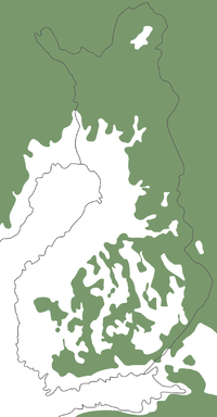
As a result of post-glacial rebound, the Gulf of Bothnia
Gulf of Bothnia
The Gulf of Bothnia is the northernmost arm of the Baltic Sea. It is situated between Finland's west coast and Sweden's east coast. In the south of the gulf lie the Åland Islands, between the Sea of Åland and the Archipelago Sea.-Name:...
is predicted to eventually close up at Kvarken
Kvarken
Kvarken is the narrow region in the Gulf of Bothnia separating the Bothnian Bay from the Bothnian Sea...
. The Kvarken
Kvarken
Kvarken is the narrow region in the Gulf of Bothnia separating the Bothnian Bay from the Bothnian Sea...
is a UNESCO
UNESCO
The United Nations Educational, Scientific and Cultural Organization is a specialized agency of the United Nations...
World Natural Heritage Site, selected as a "type area" illustrating the effects of post-glacial rebound and the holocene glacial retreat
Holocene glacial retreat
Holocene glacial retreat had a profound effect on landscapes in many areas that were covered by ice at the Last Glacial Maximum. The many valleys of the Cairngorms, a mountainous region in the Eastern Scottish Highlands are littered with deposits from this period.-Evidences of the retreat of the...
.
In several other Nordic
Nordic countries
The Nordic countries make up a region in Northern Europe and the North Atlantic which consists of Denmark, Finland, Iceland, Norway and Sweden and their associated territories, the Faroe Islands, Greenland and Åland...
ports, like Tornio
Tornio
Tornio is a town and municipality in Lapland, Finland. The municipality covers an area of of which is water. The population density is , with a total population of . It borders to the Swedish municipality of Haparanda...
and Pori
Pori
Pori is a city and municipality on the west coast of Finland. The city is located some from the Gulf of Bothnia, on the estuary of the Kokemäenjoki river, which is the largest in Finland. Pori is the most important town in the Satakunta region....
(formerly at Ulvila
Ulvila
Ulvila is a town and municipality of Finland. It is one of the six medieval cities of Finland. Its position as city was taken over by Pori in the 16th century....
), the harbour has had to be relocated several times. Place names in the coastal regions also illustrate the rising land: there are inland places named 'island', 'skerry', 'rock', 'point' and 'sound'. For example, Oulunsalo
Oulunsalo
Oulunsalo is a municipality in the region of Northern Ostrobothnia, in Finland. The municipality is located in Northern Finland just south-west of the city of Oulu. The municipality has a population of and covers an area of of which is water. The population density is...
"island of Oulujoki
Oulujoki
Oulujoki is a river in Oulu province, Finland.Its origin is Oulujärvi and, its watershed area covers a significant part of Kainuu region....
" is a peninsula, with inland names such as Koivukari "Birch Rock", Santaniemi "Sandy Cape", and Salmioja "the ditch of the Sound". (Compare http://kaino.kotus.fi/www/verkkojulkaisut/julk125/oulunsalo/oulunsalo_ennen.shtml and http://kaino.kotus.fi/www/verkkojulkaisut/julk125/oulunsalo/oulunsalo_nyt.shtml.)
In Great Britain
Great Britain
Great Britain or Britain is an island situated to the northwest of Continental Europe. It is the ninth largest island in the world, and the largest European island, as well as the largest of the British Isles...
, glaciation affected Scotland
Scotland
Scotland is a country that is part of the United Kingdom. Occupying the northern third of the island of Great Britain, it shares a border with England to the south and is bounded by the North Sea to the east, the Atlantic Ocean to the north and west, and the North Channel and Irish Sea to the...
but not Southern England
England
England is a country that is part of the United Kingdom. It shares land borders with Scotland to the north and Wales to the west; the Irish Sea is to the north west, the Celtic Sea to the south west, with the North Sea to the east and the English Channel to the south separating it from continental...
, and the post-glacial rebound of northern Great Britain is causing a corresponding downward movement of the southern half of the island. This is leading to an increased risk of flood
Flood
A flood is an overflow of an expanse of water that submerges land. The EU Floods directive defines a flood as a temporary covering by water of land not normally covered by water...
s, particularly in the areas surrounding the lower River Thames
River Thames
The River Thames flows through southern England. It is the longest river entirely in England and the second longest in the United Kingdom. While it is best known because its lower reaches flow through central London, the river flows alongside several other towns and cities, including Oxford,...
. Along with rising sea levels caused by global warming
Global warming
Global warming refers to the rising average temperature of Earth's atmosphere and oceans and its projected continuation. In the last 100 years, Earth's average surface temperature increased by about with about two thirds of the increase occurring over just the last three decades...
, the post-glacial sinking of southern England
England
England is a country that is part of the United Kingdom. It shares land borders with Scotland to the north and Wales to the west; the Irish Sea is to the north west, the Celtic Sea to the south west, with the North Sea to the east and the English Channel to the south separating it from continental...
is likely to seriously compromise the effectiveness of the Thames Barrier
Thames Barrier
The Thames Barrier is the world's second-largest movable flood barrier and is located downstream of central London. Its purpose is to prevent London from being flooded by exceptionally high tides and storm surges moving up from the sea...
, London
London
London is the capital city of :England and the :United Kingdom, the largest metropolitan area in the United Kingdom, and the largest urban zone in the European Union by most measures. Located on the River Thames, London has been a major settlement for two millennia, its history going back to its...
's most important flood defence, after about 2030.
The combination of horizontal and vertical motion changes the tilt of the surface. That is, locations farther north rise faster. This effect is seen in lakes, where land rises at the northern end and sinks at the southern end. The Great Lakes
Great Lakes
The Great Lakes are a collection of freshwater lakes located in northeastern North America, on the Canada – United States border. Consisting of Lakes Superior, Michigan, Huron, Erie, and Ontario, they form the largest group of freshwater lakes on Earth by total surface, coming in second by volume...
of North America
North America
North America is a continent wholly within the Northern Hemisphere and almost wholly within the Western Hemisphere. It is also considered a northern subcontinent of the Americas...
lie approximately on the 'pivot' line between rising and sinking land. Lake Superior
Lake Superior
Lake Superior is the largest of the five traditionally-demarcated Great Lakes of North America. It is bounded to the north by the Canadian province of Ontario and the U.S. state of Minnesota, and to the south by the U.S. states of Wisconsin and Michigan. It is the largest freshwater lake in the...
was formerly part of a much larger lake together with Lake Michigan
Lake Michigan
Lake Michigan is one of the five Great Lakes of North America and the only one located entirely within the United States. It is the second largest of the Great Lakes by volume and the third largest by surface area, after Lake Superior and Lake Huron...
and Lake Huron
Lake Huron
Lake Huron is one of the five Great Lakes of North America. Hydrologically, it comprises the larger portion of Lake Michigan-Huron. It is bounded on the east by the Canadian province of Ontario and on the west by the state of Michigan in the United States...
, but post-glacial rebound raised land dividing the three lakes about 2100 years ago. Today, southern shorelines of the lakes continue to experience rising water levels while northern shorelines see falling levels.
Since the glacial isostatic adjustment process causes the land to move relative to the sea, ancient shorelines are found to lie above present day sea level in areas that were once glaciated. On the other hand, places in the peripheral bulge area which was uplifted during glaciation now begins to subside. Therefore ancient beaches are found below present day sea level in the bulge area. The “relative sea level data”, which consists of height and age measurements of the ancient beaches around the world, tells us that glacial isostatic adjustment proceeded at a higher rate near the end of deglaciation than today.
The present-day uplift motion in northern Europe is also monitored by a GPS network called BIFROST. Results of GPS data shows a peak rate of about 11 mm/year in the north part of the Gulf of Bothnia, but this uplift rate decreases away and becomes negative outside the former ice margin.
In the near field outside the former ice margin, the land sinks relative to the sea. This is the case along the east coast of the United States, where ancient beaches are found submerged below present day sea level and Florida is expected to be submerged in the future. GPS data in North America also confirms that land uplift becomes subsidence outside the former ice margin.
Global sea levels
To form the ice sheets of the last Ice Age, water from the oceans evaporated, condensed as snow and was deposited as ice in high latitudes. Thus global sea level fell during glaciation.The ice sheets at the last glacial maximum were so massive that global sea level fell by about 120 metres. Thus continental shelves were exposed and many islands became connected with the continents through dry land. This was the case between the British Isles and Europe, or between Taiwan, the Indonesian islands and Asia. Most important is the existence of a sub-continent between Siberia and Alaska that allowed the migration of people and animals during the last glacial maximum.
The fall in sea level also affects the circulation of ocean currents and thus has important impact on climate during the Ice Age.
During deglaciation, the melted ice water returns to the oceans, thus sea level in the ocean increases again. However, geological records of sea level changes show that the redistribution of the melted ice water is not the same everywhere in the oceans. In other words, depending upon the location, the rise in sea level at a certain site may be more than that at another site. This is due to the gravitational attraction between the mass of the melted water and the other masses, such as remaining ice sheets, glaciers, water masses and mantle rocks and the changes in centrifugal potential due to Earth's variable rotation.
Horizontal crustal motion
Accompanying vertical motion is the horizontal motion of the crust. The BIFROST GPS network shows that the motion diverges from the centre of rebound. However, the largest horizontal velocity is found near the former ice margin.The situation in North America is less certain; this is due to the sparse distribution of GPS stations in northern Canada, which is rather inaccessible.
Tilt
In addition to changing the absolute vertical and horizontal position, the resulting change in tilt also has effects. The bottom of the lakes is gradually tilted up in the direction of the former ice maximum, such that lake shores on the side of the maximum recede and the opposite shores sink. This causes the formation of new rapids and rivers. The effects are similar to that concerning seashores, but occur above sea level.Gravity field
Ice, water and mantle rocks have massMass
Mass can be defined as a quantitive measure of the resistance an object has to change in its velocity.In physics, mass commonly refers to any of the following three properties of matter, which have been shown experimentally to be equivalent:...
, and as they move around, they exert a gravitational pull on other masses towards them. Thus, the gravity field, which is sensitive to all mass on the surface and within the Earth, is affected by the redistribution of ice/melted water on the surface of the Earth and the flow of mantle rocks within.
Today, more than 6000 years after the last deglaciation terminated, the flow of mantle
Mantle (geology)
The mantle is a part of a terrestrial planet or other rocky body large enough to have differentiation by density. The interior of the Earth, similar to the other terrestrial planets, is chemically divided into layers. The mantle is a highly viscous layer between the crust and the outer core....
material back to the glaciated area causes the overall shape of the Earth to become less oblate. This change in the topography of Earth's surface affects the long-wavelength components of the gravity field.
The changing gravity field can be detected by repeated land measurements with absolute gravimeters and recently by the GRACE
Gravity Recovery and Climate Experiment
The Gravity Recovery And Climate Experiment , a joint mission of NASA and the German Space Agency, has been making detailed measurements of Earth's gravity field since its launch in March 2002....
satellite mission. The change in long-wavelength components of Earth's gravity field also perturbs the orbital motion of satellites and has been detected by LAGEOS
LAGEOS
LAGEOS, or Laser Geodynamics Satellites, are a series of scientific research satellites designed to provide an orbiting laser ranging benchmark for geodynamical studies of the Earth...
satellite motion.
Vertical datum
The vertical datum is a theoretical reference surface for altitude measurement and plays vital roles in many human activities, including land surveying and construction of buildings and bridges. Since postglacial rebound continuously deforms the crustal surface and the gravitational field, the vertical datum needs to be redefined repeatedly through time.Earth's rotation
Examination of ancient Chinese and Babylonian eclipse records reveals that the Earth’s rotation rate is not constant. For example, if the rotation rate were constant, then the shadow path of an ancient Babylonian eclipse would lie somewhere across western Europe and the ancient eclipse could not have been observed at the recorded time in Babylon. It is well known that tidal interaction between Earth and the Moon (tidal friction or tidal dissipation) causes the Earth's rotation to slow. But taking into account the tidal interaction alone over-corrects the eclipse path which would lie east of Babylon. To have the shadow path pass through Babylon at the recorded time, we need to take into account the effect of glacial isostatic adjustment on Earth’s rotational motion.To understand how glacial isostatic adjustment affects Earth's rotation rate, we note that the movement of mass on and beneath the Earth's surface affects the moment of inertia
Moment of inertia
In classical mechanics, moment of inertia, also called mass moment of inertia, rotational inertia, polar moment of inertia of mass, or the angular mass, is a measure of an object's resistance to changes to its rotation. It is the inertia of a rotating body with respect to its rotation...
of the Earth; by the conservation of angular momentum, the rotational motion must also change. This is illustrated by a rotating ice skater: as she extends her arms above her head, her moment of inertia decreases, and she spins faster. On the other hand, as she extends her arms horizontally, her moment of inertia increases and her spin slows.
During glaciation, water is taken from the oceans, whose average position is nearer the equator, and deposited as ice over the higher latitudes closer to the poles, which is closer to the rotational axis. This causes the moment of inertia of the Earth–ice–water system to decrease and just like the rotating figure skater bringing her arms closer to her body, the earth should spin faster. During deglaciation, the melted ice water returns to the oceans – farther from the rotational axis – causing the Earth’s spin to slow down. The mantle rocks flow in a direction opposite to that of the water, but the rate is much slower. After the end of deglaciation, the dominant mass movement is from the return flow of the mantle rocks back to the glaciated areas at high latitude, making the shape of the Earth less oblate. This process would, in isolation, lead to an increase in the rotation speed of the Earth and therefore to a decrease of the length of day. Lambeck estimated that the isolated effect of post-glacial rebound on the length of the day would be a decrease of about 0.7 milliseconds per century. This process of nontidal acceleration of the rotation of the earth is corroborated by observations of the satellite LAGEOS
LAGEOS
LAGEOS, or Laser Geodynamics Satellites, are a series of scientific research satellites designed to provide an orbiting laser ranging benchmark for geodynamical studies of the Earth...
and is generally attributed to glacial isostatic adjustment.
In addition to the changes in the Earth's rotation rate, the changes in the moment of inertia due to glacial isostatic adjustment also cause the rotational axis to move from the current position near the North Pole towards the center of the ice masses at glacial maximum (polar wander
Polar wander
Polar wander is the movement of the North and South Poles of the Earth with respect to the continents. This motion can be divided into two components: that due to continental drift , and true polar wander, in which the mantle and the crust rotate together into new orientations....
); thus it is moving towards eastern Canada at a rate of about 1 degree per million years.
This drift of the Earth's rotational axis in turn affects the centrifugal potential on the surface of the earth, and thus also affects sea levels.
State of stress and intraplate earthquakes
According to the theory of plate tectonicsPlate tectonics
Plate tectonics is a scientific theory that describes the large scale motions of Earth's lithosphere...
, plate-plate interaction results in earthquakes near plate boundaries. However, large earthquakes are found in intraplate environment like eastern Canada (up to M7) and northern Europe (up to M5) which are far away from present-day plate boundaries. An important intraplate earthquake was the magnitude 8 New Madrid earthquake that occurred in mid-continental USA in the year 1811.
Glacial loads have provided more than 30 MPa of vertical stress in northern Canada and more than 20 MPa in northern Europe during glacial maximum. This vertical stress is supported by the mantle and the flexure of the lithosphere
Lithosphere
The lithosphere is the rigid outermost shell of a rocky planet. On Earth, it comprises the crust and the portion of the upper mantle that behaves elastically on time scales of thousands of years or greater.- Earth's lithosphere :...
. Since the mantle and the lithosphere continuously respond to the changing ice and water loads, the state of stress at any location continuously changes in time. The changes in the orientation of the state of stress is recorded in the postglacial faults in southeastern Canada. When the postglacial faults formed at the end of deglaciation 9000 years ago, the horizontal principal stress orientation was almost perpendicular to the former ice margin, but today the orientation is in the northeast-southwest, along the direction of seafloor spreading
Seafloor spreading
Seafloor spreading is a process that occurs at mid-ocean ridges, where new oceanic crust is formed through volcanic activity and then gradually moves away from the ridge. Seafloor spreading helps explain continental drift in the theory of plate tectonics....
at the Mid-Atlantic Ridge
Mid-Atlantic Ridge
The Mid-Atlantic Ridge is a mid-ocean ridge, a divergent tectonic plate boundary located along the floor of the Atlantic Ocean, and part of the longest mountain range in the world. It separates the Eurasian Plate and North American Plate in the North Atlantic, and the African Plate from the South...
. This shows that the stress due to postglacial rebound had played an important role at deglacial time, but has gradually relaxed so that tectonic stress has become more dominant today.
According to the Mohr-Coulomb Theory
Mohr-Coulomb theory
Mohr–Coulomb theory is a mathematical model describing the response of brittle materials such as concrete, or rubble piles, to shear stress as well as normal stress. Most of the classical engineering materials somehow follow this rule in at least a portion of their shear failure envelope...
of rock failure, large glacial loads generally suppress earthquakes, but rapid deglaciation promotes earthquakes. According to Wu & Hasagawa, the rebound stress that is available to trigger earthquakes today is of the order of 1 MPa. This stress level is not large enough to rupture intact rocks but is large enough to reactivate pre-existing faults that are close to failure. Thus, both postglacial rebound and past tectonics play important roles in today's intraplate earthquakes in eastern Canada and southeast USA. Generally postglacial rebound stress could have triggered the intraplate earthquakes in eastern Canada and may have played some role in triggering earthquakes in eastern USA including the New Madrid earthquakes of 1811. The situation in northern Europe today is complicated by the current tectonic activities nearby and by coastal loading and weakening.
Recent global warming
Recent global warmingGlobal warming
Global warming refers to the rising average temperature of Earth's atmosphere and oceans and its projected continuation. In the last 100 years, Earth's average surface temperature increased by about with about two thirds of the increase occurring over just the last three decades...
has caused mountain glaciers and the ice sheets in Greenland and Antarctica to melt and global sea level to rise. Therefore, monitoring sea level rise and the mass balance of ice sheets and glaciers allows us to understand more about global warming.
Recent rise in sea levels has been monitored by tide gauges and Satellite Altimetry (e.g. TOPEX/Poseidon
TOPEX/Poseidon
Launched in 1992, TOPEX/Poseidon was a joint satellite mission between NASA, the U.S. space agency, and CNES, the French space agency, to map ocean surface topography. The first major oceanographic research vessel to sail into space, TOPEX/Poseidon helped revolutionize oceanography by proving the...
). In addition to the addition of melted ice water from glaciers and ice sheets, recent sea level changes are also affected by the thermal expansion of sea water due to global warming, sea level change due to deglaciation of the last Ice Age (postglacial sea level change), deformation of the land and ocean floor and other factors. Thus, to understand global warming from sea level change, one must be able to separate all these factors, especially postglacial rebound, since it is one of the leading factors.
Mass changes of ice sheets can be monitored by measuring changes in the ice surface height, the deformation of the ground below and the changes in the gravity field over the ice sheet. Thus ICESat
ICESat
ICESat , part of NASA's Earth Observing System, was a satellite mission for measuring ice sheet mass balance, cloud and aerosol heights, as well as land topography and vegetation characteristics...
, GPS and GRACE
Grace
-Film:* Grace , a 2009 horror film* States of Grace, a 2005 drama film- Games :* The Game of graces, a 19th century game for young girls* Tales of Graces, a 2009 Tales of game by Namco Tales Studio- Literature :...
satellite mission are useful for such purpose. However, glacial isostatic adjustment of the ice sheets affect ground deformation and the gravity field today. Thus understanding glacial isostatic adjustment is important in monitoring recent global warming.
One of the possible impacts of global warming-triggered rebound may be more volcanic activity in previously ice-capped areas such as Iceland.
Applications
The speed and amount of postglacial rebound is determined by two factors: the viscosityViscosity
Viscosity is a measure of the resistance of a fluid which is being deformed by either shear or tensile stress. In everyday terms , viscosity is "thickness" or "internal friction". Thus, water is "thin", having a lower viscosity, while honey is "thick", having a higher viscosity...
or rheology
Rheology
Rheology is the study of the flow of matter, primarily in the liquid state, but also as 'soft solids' or solids under conditions in which they respond with plastic flow rather than deforming elastically in response to an applied force....
(i.e., the flow) of the mantle, and the ice loading and unloading histories on the surface of Earth.
The viscosity of the mantle is important in understanding mantle convection, plate tectonics, dynamical processes in Earth, the thermal state and thermal evolution of Earth. However viscosity is difficult to observe because creep experiments of mantle rocks take thousands of years to observe and the ambient temperature and pressure conditions are not easy to attain for a long enough time. Thus, the observations of postglacial rebound provide a natural experiment to measure mantle rheology. Modelling of glacial isostatic adjustment addresses the question of how viscosity changes in the radial and lateral directions and whether the flow law is linear or nonlinear.
Ice thickness histories are useful in the study of paleoclimatology, glaciology and paleo-oceanography. Ice thickness histories are traditionally deduced from the three types of information: First, the sea level data at stable sites far away from the centers of deglaciation give an eastimate of how much water entered the oceans or equivalently how much ice was locked up at glacial maximum. Secondly, the location and dates of terminal moraines tell us the areal extent and retreat of past ice sheets. Physics of glaciers gives us the theoretical profile of ice sheets at equilibrium, it also says that the thickness and horizontal extent of equilibrium ice sheets are closely related to the basal condition of the ice sheets. Thus the volume of ice locked up is proportional to their instantaneous area. Finally, the heights of ancient beaches in the sea level data and observed land uplift rates (e.g. from GPS or VLBI) can be used to constrain local ice thickness. A popular ice model deduced this way is the ICE5G model. Because the response of the Earth to changes in ice height is slow, it cannot record rapid fluctuation or surges of ice sheets, thus the ice sheet profiles deduced this way only gives the "average height" over a thousand years or so.
Glacial isostatic adjustment also plays an important role in understanding recent global warming and climate change.
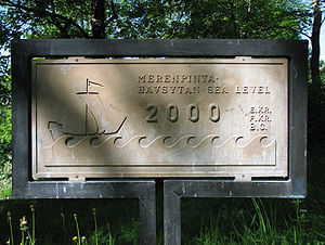
Discovery
Before the 18th century, it was thought in Sweden that sea levels were falling. On the initiative of Anders CelsiusAnders Celsius
Anders Celsius was a Swedish astronomer. He was professor of astronomy at Uppsala University from 1730 to 1744, but traveled from 1732 to 1735 visiting notable observatories in Germany, Italy and France. He founded the Uppsala Astronomical Observatory in 1741, and in 1742 he proposed the Celsius...
a number of marks were made in rock on different locations along the Swedish coast. In 1765 it was possible to conclude that it was not a lowering of sea levels but an uneven rise of land. In 1865 Thomas Jamieson
Thomas Jamieson
Thomas Francis Jamieson was a Scottish scientist most associated with his studies of sea level and glacial isostasy during the Quaternary....
came up with a theory that the rise of land was connected with the ice age that had been first discovered in 1837. The theory was accepted after investigations by Gerard De Geer
Gerard De Geer
Baron Gerard Jacob De Geer was a Swedish geologist who made significant contributions to Quaternary geology, particularly geomorphology and geochronology. De Geer is best known for his discovery of varves.- Early life and family :...
of old shorelines in Scandinavia published in 1890.
Legal status
In areas where the rising of land is seen, it is necessary to define the exact limits of property. In Finland, the "new land" is legally the property of the owner of the water area, not any land owners on the shore. Therefore, if the owner of the land wishes to build a pier over the "new land", he needs the permission of the owner of the (former) water area. The landowner of the shore may redeem the new land at market price. Usually the owner of the water area is the partition unitCommon land
Common land is land owned collectively or by one person, but over which other people have certain traditional rights, such as to allow their livestock to graze upon it, to collect firewood, or to cut turf for fuel...
of the landowners of the shores, a collective holding corporation.
See also
- Holocene glacial retreatHolocene glacial retreatHolocene glacial retreat had a profound effect on landscapes in many areas that were covered by ice at the Last Glacial Maximum. The many valleys of the Cairngorms, a mountainous region in the Eastern Scottish Highlands are littered with deposits from this period.-Evidences of the retreat of the...
- Deviatoric stress
- Marine terraceMarine terraceA marine terrace, coastal terrace, raised beach or perched coastline is a relatively flat, horizontal or gently inclined surface of marine origin, mostly an old abrasion platform which has been lifted out of the sphere of wave activity . Thus it lies above or under the current sea level, depending...
- Physical impacts of climate changePhysical impacts of climate changeThis article is about the physical impacts of climate change. For some of these physical impacts, their effect on social and economic systems are also described.-Definition of climate change:This article refers to reports produced by the IPCC...
External links
- http://www.gfz-potsdam.de/pb1/op/grace/index_GRACE.html GRACE Gravity Mission from GPZ, Potsdam
- http://cfa-www.harvard.edu/space_geodesy/BIFROST/radial_rates.html BIFROST GPS results from Harvard