
List of mountains in Australia
Encyclopedia
- See also: List of mountains: Australia.
This is a list of mountains in Australia
Australia
Australia , officially the Commonwealth of Australia, is a country in the Southern Hemisphere comprising the mainland of the Australian continent, the island of Tasmania, and numerous smaller islands in the Indian and Pacific Oceans. It is the world's sixth-largest country by total area...
.
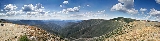
These are some of the highest mountains in Australia
Highest point in each State/Territory
| Flag | State/Territory name | Highest point | Altitude (metres) | Notes |
|---|---|---|---|---|
| | Ashmore and Cartier Islands Ashmore and Cartier Islands The Territory of the Ashmore and Cartier Islands is an external territory of Australia consisting of two groups of small low-lying uninhabited tropical islands in the Indian Ocean situated on the edge of the continental shelf north-west of Australia and south of the Indonesian island of... |
||||
 |
Australian Antarctic Territory Australian Antarctic Territory The Australian Antarctic Territory is a part of Antarctica. It was claimed by the United Kingdom and placed under the authority of the Commonwealth of Australia in 1933. It is the largest territory of Antarctica claimed by any nation... |
Mount McClintock Mount McClintock Mount McClintock is the highest mountain in the Britannia Range in Australian Antarctic Territory, surmounting the south end of Forbes Ridge, east of Mount Olympus. It was discovered by the Discovery expedition and named for Admiral Sir Leopold McClintock, Royal Navy, a member of the Ship... |
3,490 | |
 |
Australian Capital Territory Australian Capital Territory The Australian Capital Territory, often abbreviated ACT, is the capital territory of the Commonwealth of Australia and is the smallest self-governing internal territory... |
Bimberi Peak Bimberi Peak Bimberi Peak or Mount Bimberi is the highest mountain in the Australian Capital Territory at 1912 metres. It is located on the border between New South Wales and the ACT, the NSW portion in Kosciuszko National Park and the ACT portion in Namadgi National Park... |
1,912 | |
 |
Christmas Island Christmas Island The Territory of Christmas Island is a territory of Australia in the Indian Ocean. It is located northwest of the Western Australian city of Perth, south of the Indonesian capital, Jakarta, and ENE of the Cocos Islands.... |
Murray Hill Murray Hill, Christmas Island Murray Hill is the highest point of Christmas Island, an external territory of Australia, at 361 metres above sea level.-External links: , GeoNames.... |
361 | |
 |
Cocos (Keeling) Islands Cocos (Keeling) Islands The Territory of the Cocos Islands, also called Cocos Islands and Keeling Islands, is a territory of Australia, located in the Indian Ocean, southwest of Christmas Island and approximately midway between Australia and Sri Lanka.... |
|||
| |Coral Sea Islands Coral Sea Islands The Coral Sea Islands Territory includes a group of small and mostly uninhabited tropical islands and reefs in the Coral Sea, northeast of Queensland, Australia. The only inhabited island is Willis Island... |
Heralds-Beacon Islet, Mellish Reef | 1.5 | ||
| | Heard Island and McDonald Islands Heard Island and McDonald Islands The Heard Island and McDonald Islands are an Australian external territory and volcanic group of barren Antarctic islands, about two-thirds of the way from Madagascar to Antarctica. The group's overall size is in area and it has of coastline... |
Mawson Peak Mawson Peak Mawson Peak is a mountain on Heard Island, an external Australian territory in the Southern Ocean. With its summit at , it is the second highest peak in any state or territory of Australia, surpassed only by the Mount McClintock in the Britannia Range in Australian Antarctic Territory... |
2,745 | the summit of the Big Ben Big Ben (Heard Island) Big Ben is a volcanic massif that dominates the geography of Heard Island in the southern Indian Ocean. It is a composite cone with a diameter of approximately 25 kilometres. Its highest peak is Mawson Peak, which is 2,745 m above sea level. Much of it is covered by ice, including 14... massif |
|
| | Jervis Bay Territory Jervis Bay Territory The Jervis Bay Territory is a territory of the Commonwealth of Australia. It was surrendered by the state of New South Wales to the Commonwealth Government in 1915 so that the Federal capital at Canberra would have "access to the sea".... |
Cape St George, Booderee National Park Booderee National Park and Botanic Gardens Booderee National Park and Botanic Gardens are located in the Jervis Bay Territory of Australia. The reserve is composed of two sections:* the Bherwerre Peninsula, on the southern foreshore of Jervis Bay, Bowen Island and the waters of the south of the bay... |
|||
 |
New South Wales New South Wales New South Wales is a state of :Australia, located in the east of the country. It is bordered by Queensland, Victoria and South Australia to the north, south and west respectively. To the east, the state is bordered by the Tasman Sea, which forms part of the Pacific Ocean. New South Wales... |
Mount Kosciuszko Mount Kosciuszko Mount Kosciuszko is a mountain located in the Snowy Mountains in Kosciuszko National Park. With a height of 2,228 metres above sea level, it is the highest mountain in Australia... |
2,228 | |
 |
Norfolk Island Norfolk Island Norfolk Island is a small island in the Pacific Ocean located between Australia, New Zealand and New Caledonia. The island is part of the Commonwealth of Australia, but it enjoys a large degree of self-governance... |
Mount Bates Mount Bates Mount Bates is the highest point of Norfolk Island, an external territory of Australia, at 319 metres above sea level.... |
319 | |
 |
Northern Territory Northern Territory The Northern Territory is a federal territory of Australia, occupying much of the centre of the mainland continent, as well as the central northern regions... |
Mount Zeil Mount Zeil Mount Zeil is a mountain situated in the western MacDonnell Ranges in Australia's Northern Territory. It is the highest peak in the Northern Territory, and the highest peak in Australia west of the Great Dividing Range .It is believed that Mount Zeil was named during or following Ernest Giles'... |
1,531 | |
 |
Queensland Queensland Queensland is a state of Australia, occupying the north-eastern section of the mainland continent. It is bordered by the Northern Territory, South Australia and New South Wales to the west, south-west and south respectively. To the east, Queensland is bordered by the Coral Sea and Pacific Ocean... |
Mount Bartle Frere Mount Bartle Frere Mount Bartle Frere is the highest mountain in Queensland at an elevation of 1622 metres. The mountain was named after Sir Henry Bartle Frere, a British colonial administrator and then president of the Royal Geographical Society by George Elphinstone Dalrymple in 1873. Bartle Frere was British... |
1,622 | |
 |
South Australia South Australia South Australia is a state of Australia in the southern central part of the country. It covers some of the most arid parts of the continent; with a total land area of , it is the fourth largest of Australia's six states and two territories.South Australia shares borders with all of the mainland... |
Mount Woodroffe Mount Woodroffe Mount Woodroffe is South Australia's highest peak, at 1,435 metres.- Cultural Significance :The mountain is known to the Pitjantjatjara Indigenous Australians as Ngarutjaranya.... |
1,435 | |
 |
Tasmania Tasmania Tasmania is an Australian island and state. It is south of the continent, separated by Bass Strait. The state includes the island of Tasmania—the 26th largest island in the world—and the surrounding islands. The state has a population of 507,626 , of whom almost half reside in the greater Hobart... |
Mount Ossa | 1,614 | |
 |
Victoria Victoria (Australia) Victoria is the second most populous state in Australia. Geographically the smallest mainland state, Victoria is bordered by New South Wales, South Australia, and Tasmania on Boundary Islet to the north, west and south respectively.... |
Mount Bogong Mount Bogong Mount Bogong , located in the Alpine National Park, is the highest mountain in Victoria, Australia. The Big River separates the massif of the mountain from the Bogong High Plains to the south. "Bogong" in the local Aboriginal language means bigfella... |
1,986 | |
 |
Western Australia Western Australia Western Australia is a state of Australia, occupying the entire western third of the Australian continent. It is bounded by the Indian Ocean to the north and west, the Great Australian Bight and Indian Ocean to the south, the Northern Territory to the north-east and South Australia to the south-east... |
Mount Meharry Mount Meharry Mount Meharry is the highest mountain in Western Australia. It is located in the Hamersley Range within the southeastern part of Karijini National Park in the Pilbara region, approximately from Wittenoom, and from Tom Price.... |
1,253 |
Australian Capital Territory
- Bimberi PeakBimberi PeakBimberi Peak or Mount Bimberi is the highest mountain in the Australian Capital Territory at 1912 metres. It is located on the border between New South Wales and the ACT, the NSW portion in Kosciuszko National Park and the ACT portion in Namadgi National Park...
is the highest mountainMountainImage:Himalaya_annotated.jpg|thumb|right|The Himalayan mountain range with Mount Everestrect 58 14 160 49 Chomo Lonzorect 200 28 335 52 Makalurect 378 24 566 45 Mount Everestrect 188 581 920 656 Tibetan Plateaurect 250 406 340 427 Rong River...
in the Australian Capital TerritoryAustralian Capital TerritoryThe Australian Capital Territory, often abbreviated ACT, is the capital territory of the Commonwealth of Australia and is the smallest self-governing internal territory...
at 1,912 metres. - Mount GingeraMount GingeraMount Gingera is the second highest mountain in the Australian Capital Territory. The mountain is the most prominent snow covered peak to be seen from Canberra in winter. It is part of the Brindabella Ranges on the border of the ACT and New South Wales...
is the second highest mountain in the Territory at 1855m. It is the most prominent snow covered peak to be seen from Canberra in winter - Mount GininiMount GininiMount Ginini is a mountain on the border between the Australian Capital Territory and New South Wales. It is located in Bimberi Nature Reserve and Namadgi National Park. At 1762 m it is one of the highest mountains in the ACT. It is often climbed by bushwalkers from Corin Dam, as it is a few hours...
1762m. - Mount Franklin, Australian Capital Territory 1646m.
- Black MountainBlack Mountain (Australian Capital Territory)Black Mountain is situated close to the central business district of Australia's capital city Canberra. Like all major hills in Canberra it is protected from development by the Canberra Nature Park. It is covered in native bushland and is a haven to native wildlife.With its peak at 811.987m AHD,...
- Mount Ainslie (Australian Capital Territory)Mount Ainslie (Australian Capital Territory)Mount Ainslie or Mount Ainslie-Majura is a part of Canberra Nature Park. It borders on the inner suburbs of Campbell, Ainslie and Hackett...
- Mount StromloMount StromloMount Stromlo is situated a short drive west of the centre of Canberra, Australia, near the district of Weston Creek. Its peak is at approximately 770m AHD....
- Brindabella RangesBrindabella RangesThe Brindabella Range is a mountain range located on the border between New South Wales and the Australian Capital Territory, Australia. The ranges rise to the west of Canberra, the capital city of Australia, and include the Namadgi National Park in the A.C.T. and Bimberi Nature Reserve and...
New South Wales
- Snowy MountainsSnowy MountainsThe Snowy Mountains, known informally as "The Snowies", are the highest Australian mountain range and contain the Australian mainland's highest mountain, Mount Kosciuszko, which reaches 2,228 metres AHD, approximately 7310 feet....
- Mount KosciuszkoMount KosciuszkoMount Kosciuszko is a mountain located in the Snowy Mountains in Kosciuszko National Park. With a height of 2,228 metres above sea level, it is the highest mountain in Australia...
(2,228 m) (Highest mountain on the mainland) - Mount TownsendMount TownsendMount Townsend is the second highest peak of mainland Australia. Located in Kosciuszko National Park in the Snowy Mountains , Mount Townsend is north of Australia's highest mainland peak, Mount Kosciuszko....
(2,209 m) (Second highest mountain on the mainland) - Mount TwynamMount TwynamMount Twynam is the third-highest mountain on mainland Australia. It is located in the Snowy Mountains on the Main Range, north-west of Mount Kosciuszko. It is large but unimposing, and has good and far-reaching views over Blue Lake Cirque and the Western Falls...
(2,196 m) (Third highest) - Rams HeadRams HeadRams Head is a mountain in the Kosciuszko National Park in New South Wales, Australia. Its summit rises to an altitude of 2190 meters above sea level and is the fourth highest mountain in New South Wales and the fourth highest mountain in the country...
(2,190 m) (Fourth highest) - Unnamed peak on Etheridge Ridge (2,180 m) (Fifth highest)
- Rams Head North (2,177 m) (Sixth highest)
- Alice Rawson Peak (2,160 m) (Seventh highest)
- Byatts Camp (2,159 m) (Eighth highest)
- Abbott PeakAbbott PeakAbbott Peak , also known as Abbotts, Dimitri or Demetri's Peak, is a pyramidal peak on Ross Island, on the north side of Mount Erebus, between it and Mount Bird. Charted by the British Antarctic Expedition under Robert Falcon Scott, 1910–13, and named after Petty Officer George P. Abbott, a...
(2,145 m) (Equal ninth highest) - Carruthers PeakCarruthers PeakCarruthers Peak is a mountain in the Snowy Mountains between Mount Lee and Mount Twynam. It was named after NSW Premier Joseph Carruthers, who facilitated the building of the Summit Road to Mount Kosciuszko. It can be easily accessed, with the Main Range walk going straight up it.The area around it...
(2,145 m) (Equal ninth highest) - GungartanGungartanGungartan is a mountain in the Australian Alps in New South Wales. It is located close to Whites River Hut in Kosciuszko National Park. It is the highest mountain on mainland Australia not within the Main Range....
(2,068 m) (Equal eighteenth highest) - Mount TateMount Tate (New South Wales)Mount Tate is a prominent rocky mountain on the Main Range of the Snowy Mountains, New South Wales. northwest of Guthega. It has two ridges running north and south, perversely named Tate West Ridge and Tate East Ridge. This actually refers to which side of the Great Divide they lie. It has...
(2,068 m) (Equal eighteenth highest) - Mount JagungalMount JagungalMount Jagungal is a mountain within the Jagungal Wilderness Area of the Kosciuszko National Park in New South Wales, Australia. At 2061 metres AHD, Mount Jagungal surpasses any elevation except for peaks in the Main Range and Gungartan . Because it stands alone in an extensive plain Mount Jagungal...
(2,061 m) (Twentieth highest)
- Mount Kosciuszko
- Illawarra escarpmentIllawarra escarpmentThe Illawarra Escarpment is the fold created cliffs and plateau eroded outcrop mountain range west of the Illawarra coastal plain south of Sydney, Australia, enclosing the region known as the Illawarra which stretches from Stanwell Park in the north to Kiama, Gerringong and the Shoalhaven river in...
- Mount KeiraMount KeiraMount Keira is a 464 metre high mountain lying 4 kilometres northwest of the city of Wollongong, New South Wales, Australia. Its distinctive shape and proximity to Wollongong make it a major local landmark. It is noted for the views of the city from the popular summit lookout and its history of...
(464m) - Mount KemblaMount KemblaMount Kembla is a mountain in New South Wales, Australia, as well a semi-rural township of Wollongong, which gets its name from the mountain.Kembla is an Aboriginal word meaning "plenty of game"....
(534m) - Mount NeboMount Nebo (New South Wales)Mount Nebo is a tall hill, part of the Illawarra escarpment foothills on the edge of the suburban fringe of the city of Wollongong, New South Wales. Its summit , is reached by a steep road from the suburb of Figtree...
(252m) - Saddleback MountainSaddleback Mountain (New South Wales)Saddleback Mountain is a mountain in New South Wales, Australia which rises to about 600 metres above sea level and has spectacular views of Noorinan Mountain, 662 metres above sea level, and Barren Grounds Plateau to the west and south to Coolangatta Mountain and Pigeon House Mountain to...
(524m)
- Mount Keira
- Nandewar RangeNandewar RangeThe Nandewar Range is a mountain range east of Narrabri in New South Wales, Australia. John Oxley was the first European to see the range in 1818 as he explored the New South Wales Northern Tablelands....
- Bushy MountainBushy MountainBushy Mountain is a mountain east of Narrabri in northern New South Wales. It is part of the Nandewar Range and has been preserved within the Mount Kaputar National Park....
(1,250 m) - Castle Top Mountain (1,120 m)
- Gins Mountain (1,120 m)
- Grattai MountainGrattai MountainGrattai Mountain is a located in the Nandewar Range, in northern New South Wales, Australia. It was formed around 21 million years ago, by the Nandewar Volcano. The mountain is protected in the Mount Kaputar National Park. It is rarely climbed due to its isolation, lack of walking tracks and the...
(1,314 m) - Mount Dowe
- Mount KaputarMount KaputarMount Kaputar is a mountain near Narrabri in northern New South Wales. It is part of the Nandewar Range and has been preserved within the Mount Kaputar National Park. The mountain is a prominent landmark for travellers on the Newell Highway as it rises abruptly from the plains...
(1,508 m) - Mount Lindesay (1,373 m)
- Mount NingadhunMount NingadhunMount Ningadhun is a mountain east of Narrabri in northern New South Wales. It is part of the Nandewar Range and has been preserved within the Mount Kaputar National Park....
(1,008 m) - Mount Yulludunida (1,225 m)
- Round MountainRound Mountain (Snowy Mountains)Round Mountain is a mountain in the Snowy Mountains of southern New South Wales, Australia.Round Mountain is a high point on the dividing ridge between the Tumut River and Tooma River catchments. The summit is located quite close to the Khancoban-Cabramurra Road...
(1,250 m)
- Bushy Mountain
- Barrington Tops
- Brumlow Top (1586m)
- Mount Barrington
- Careys Peak
- New England Tableland
- Point Lookout, New South WalesPoint Lookout, New South WalesPoint Lookout is the name of a mountain in the New England National Park, near Ebor, Australia.It is the second highest peak in the Snowy Range, a spur of the Great Dividing Range which forms the highest part, and eastern edge of the Northern Tablelands...
(1564m) - Round Mountain (New England Tableland)Round Mountain (New England Tableland)Round Mountain is the highest peak on the Northern Tablelands of the New England region in New South Wales, Australia.Round Mountain is located in Cathedral Rock National Park about east of Armidale, New South Wales and 63 km west of Dorrigo, New South Wales...
(1585m)
- Point Lookout, New South Wales
- Other Mountains
- Mount Trickett
- Brown Mountain
- Mount CanobolasMount CanobolasMount Canobolas, at an altitude of above sea level, is the highest mountain in the central tablelands district of New South Wales, Australia.The mountain is of volcanic origin...
- Mount Banda Banda
- Mount BoyceMount BoyceMount Boyce is a mountain, located 2 kilometres north of Blackheath, New South Wales is one of the highest points in the Blue Mountains, standing approximately 1093 metres above sea level, the point where the Great Western Highway passes by is the location of a heavy vehicle checking...
- Mount Cenn Cruaich
- Mount DuvalMount Duval (New South Wales)Mount Duval is a large forested mountain 15 km north of Armidale, New South Wales. The mountain is one of the largest in the area, and is a dominating feature of the Armidale skyline. The mountain was named after John Duval, a convict and servant of a local pastoralist who worked in the area...
- Mount HopelessMount Hopeless (New South Wales)Mount Hopeless is a prominent mountain in New South Wales, Australia between the headwaters of Doris Creek about 2 km south by east of Mount Goondel in the Oberon local government area....
- Mount GibraltarMount GibraltarMount Gibraltar is a small mountain between Bowral and Mittagong in New South Wales, Australia-Facts and Figures:The mountain is locally known as 'The Gib', and is in the form of a ridge, rather than an obvious conical peak. The western extremity of the ridge is commonly pointed out as the mountain...
- Mount Gladstone
- Mount GulagaMount GulagaMount Gulaga is one of the highest mountains on the south coast of New South Wales, Australia. It rises above the village of Central Tilba and is within the Gulaga National Park...
- Mount Moombil
- Mount Nardi
- Mount Oxley
- Mount PiddingtonMount PiddingtonMount Piddington, or Wirindi, is a mountain in the Blue Mountains village of Mount Victoria in New South Wales. It has a lookout, restrooms and a picnic area at its summit, surrounded by a loop road, Mount Piddington Road, which runs from the summit to Mount Victoria village...
- Mount Sugarloaf
- Mount TilgaMount TilgaMount Tilga is a hill 329 metres high which rises sharply out of the plain eight kilometres north of Condobolin.Mount Tilga is said to be the exact centre of New South Wales., but establishing the centre of an irregular shape is not a straightforward matter...
- Mount TownsendMount TownsendMount Townsend is the second highest peak of mainland Australia. Located in Kosciuszko National Park in the Snowy Mountains , Mount Townsend is north of Australia's highest mainland peak, Mount Kosciuszko....
- Mount UlandraMount UlandraMount Ulandra is a 761-metre-high mountain approximately 25 kilometres south-west of the New South Wales town of Cootamundra, Australia, and 4 kilometres south-east of Bethungra. The mountain is within the Ulandra Nature Reserve. Atop the mountain are telecommunications towers, including television...
- Mount WarningMount WarningMount Warning is a mountain west-south-west of Murwillumbah, near the border with Queensland in the Northern Rivers region of New South Wales, Australia...
- Pigeon House MountainPigeon House MountainPigeon House Mountain is a mountain named by Captain James Cook during his voyage of discovery along Australia's eastern coast in 1770. The prominent remnant of a two tier sandstone structure, the summit rises to 720 m above sea level. Located on the South Coast region of New South Wales within the...
- Siding Spring Mountain
South East Queensland
- Camp MountainCamp Mountain, QueenslandCamp Mountain is a rural locality northwest of Brisbane, Queensland, Australia, near Samford. It is 20 km north-west of the Brisbane central business district...
- Mount CoolumMount Coolum, QueenslandMount Coolum is a suburb in the Sunshine Coast, Queensland, Australia.-External links:* *...
(208m) - Mount CottonMount Cotton, QueenslandMount Cotton is a suburb located south-east of Brisbane, Queensland, Australia in the Redland City local government area.Mount Cotton is named for the mountain that is in the area. It was named by Robert Dixon, a surveyor in the colony of Queensland. He named it after the commandant of the penal...
- Mount CrosbyMount Crosby, QueenslandMount Crosby is a mountain and outer suburb of Brisbane, Australia located south-west of the Brisbane CBD.-Geography:The Brisbane River, Mount Crosby and the adjoining State Forest are the dominant natural features of the area.-History:...
- Mount GravattMount Gravatt, QueenslandMount Gravatt is the name of both a major suburb of Brisbane, Queensland, Australia and a prominent hill in this suburb. The suburb is situated in the south-east of the city and was one of Brisbane's largest...
- Mount PetrieMount PetrieMount Petrie is a small mountain in the south east of the city of Brisbane. The 170 metre rise sometimes referred to as Petrie Hill, elevates semi-rural residential parts in the suburbs of Mackenzie and Burbank....
- Mount Stapylton
- Tamborine Mountain
- Teviot RangeTeviot RangeThe Teviot Range, also referred to as the Flinders Peak Group, is a mountain range located on the northern edge of the Scenic Rim region of South East Queensland, Australia....
- Flinders Peak
- D'Aguilar RangeD'Aguilar RangeThe D'Aguilar Range is a mountain range near Brisbane, Queensland, Australia. The town of Dayboro is situated on the lower foothills midway along the range and Woodford lies at the northern most point of the range. Many residential areas line its eastern slopes including the town of Samford and the...
- Mount NeboMount Nebo (Queensland)Mount Nebo is a mountain approximately 28 km north of the Brisbane suburb of The Gap in Queensland, Australia. It is part of the D'Aguilar Range which includes other mountains such as Mount Pleasant, Mount Glorious and Mount Mee. The town of Mount Nebo is named after the mountain on which it...
- Mount Glorious
- Mount PleasantMount Pleasant (Queensland)Mount Pleasant, is a mountain which is a part of the D'Aguilar Range.Other mountains in the D'Aguilar Range include Mount Nebo, Mount Glorious and Mount Mee.-External links:*...
- Mount MeeMount Mee, QueenslandMount Mee is a suburb and mountain in Queensland, Australia, located north of the town of Dayboro on the D'Aguilar Range.-History:The area around Mount Mee was known to the indigenous inhabitants of the area as Dahmongah, a word meaning "flying squirrel" or glider...
- Mount Nebo
- Taylor Range
- Mount Coot-tha
- Enoggera HillEnoggera HillEnoggera Hill is a small mountain of the Taylor Range in the Brisbane suburb of The Gap.Enoggera Hill is close to Mount Cootha and like this peak, it is mostly covered by bushland. The hill is located within the grounds of the Enoggera Barracks.-References:...
- Moogerah Peaks
- Mount French
- Mount EdwardsMount EdwardsMount Edwards is a mountain in South East Queensland, Australia. The mountain rises 634 m above sea level and is part of the Moogerah Peaks National Park. It lies approximately 100 km south west of Brisbane just outside the town of Boonah. The mountain is the closest of the Moogerah Peaks to...
(630 m) - Mount GrevilleMount GrevilleMount Greville is a cone-shaped and deeply fissured mountain in South East Queensland, Australia. The mountain rises 720 m above sea level and is part of the Moogerah Peaks National Park. It lies approximately 100 km south west of Brisbane just outside the town of Boonah...
- Mount MoonMount MoonMount Moon is a lightly timbered, dome-shaped mountain in South East Queensland, Australia. The mountain rises 786 m above sea level and is part of the Moogerah Peaks National Park. It lies approximately 100 km south west of Brisbane just outside the town of Boonah...
- McPherson RangeMcPherson RangeThe McPherson Range is an extensive mountain range, a spur of the Great Dividing Range, heading in an easterly direction from near Wallangarra to the Pacific Ocean coastline. It forms part of the Scenic Rim on the border between the states of New South Wales and Queensland. Further west of the...
- Mount BarneyMount BarneyMount Barney is a mountain located in south-east Queensland, Australia. It lies approximately 130 kilometres south-west of Brisbane, not far from the Queensland - New South Wales border, and forms part of the McPherson Range. It is a popular destination for bushwalkers and campers...
(1,356 m) - Mount Lindesay (1,175 m)
- Mount Ernest (960 m)
- Mount May
- Mount Ballow (1,280 m)
- Mount MaroonMount MaroonMount Maroon is a mountain in South East Queensland that is part of the McPherson Range. The mountain rises to above sea level about 12 km west of Rathdowney....
- Springbrook Mountain (900 m)
- Mount Barney
- Main RangeMain Range National ParkMain Range is a mountain range and a national park in Queensland , 85 km southwest of Brisbane. It is part of the World Heritage Site Gondwana Rainforests of Australia . It protects the western part of a semicircle of mountains in South East Queensland known as the Scenic Rim...
- Wilsons Peak
- Mount SuperbusMount SuperbusMount Superbus lies 150 km south-west of Brisbane and is South East Queensland's highest peak at 1375 metres . At this elevation it is the third highest peak in Queensland. Only Mount Bellenden Ker at 1593 m and Mount Bartle Frere at 1622 m in Far North Queensland are higher.It has an...
(1,375 m) - Mount Roberts (1,370 m)
- Lizard PointLizard Point, QueenslandLizard Point, Queensland is a rocky outcrop between Mount Steamer and Mount Roberts. It offers great panoramic views of the Main Range National Park, Boonah and other Scenic Rim areas....
(1,200 m) - Mount SteamerMount SteamerMount Steamer marks the intersection between the Main Range National Park and The Steamer Range in Australia. Walking to the summit is a tough undertaking from any of its spurs.-See also:*List of mountains in Australia...
(1,215 m) - The Steamer RangeThe Steamer RangeThe Steamer Range is a series of spectacular rock formations branching off the Main Range National Park in Queensland, Australia. They lie at the head of Emu Creek, west of Warwick, in the Main Range...
- Mount AspleniumMount AspleniumMount Asplenium is a mountain in the Main Range of south-east Queensland, Australia. It is protected within the Main Range National Park. The summit can be reached by hiking south from Mount Huntley, however there is no marked trail so only experienced navigators should attempt the ascent...
(1,294 m) - Mount HuntleyMount HuntleyMount Huntley is one of the mountains of the Main Range in south-east Queensland, Australia. It is within the Main Range National Park. There are no marked walking trails to the summit, and the ascent is long and very steep with some dangerous sections. There is a clearing at the summit for hikers...
(1,264 m) - Sentinel Point (1,175 m)
- Spicers PeakSpicers PeakSpicers Peak is a mountain in Australia. It lies roughly 120 km west of Brisbane in the middle of the Main Range National Park. It is just south of Cunninghams Gap and Mount Mitchell...
(1,220 m) - Mount MitchellMount Mitchell (Queensland)Mount Mitchell lies about 100 km west of Brisbane, Australia and immediately south of Cunninghams Gap. The peak to the south of the gap was named by Allan Cunningham in 1828 and today is part of the Main Range National Park. Cunningham named the mountain after the Surveyor-General, Thomas...
(1,160 m) - Mount CordeauxMount CordeauxMount Cordeaux is a mountain near Brisbane, Australia. It lies to the immediate north of Cunninghams Gap in the Main Range National Park. It is known to the Aboriginal People as Niamboyoo and rises 1,135 m....
(1,145 m) - Bare RockBare RockBare Rock is a rock which lies northeast of Berntsen Point in the entrance to Borge Bay, off the east side of Signy Island in the South Orkney Islands. It was charted and named descriptively by DI personnel on the RRS Discovery in 1927....
(1,170 m)
- Lamington Plateau
- Mount Bithongabel
- Mount Cominan
- Mount Hobwee (1,175m)
- Mount Merino
- Mount Wanungara
- Mount Roberts (Queensland)
- Throakoban
- Mount Toolona
- Mount Westray
- Lost World
| width="" align="" valign="" |
- Bunya MountainsBunya MountainsThe Bunya Mountains are a distinctive set of peaks forming an isolated section of the Great Dividing Range in southern Queensland. The mountain range forms the northern edge of the Darling Downs near Bell and Dalby. The mountains are south of Kingaroy and just to the south west of Nanango...
- Mount Kiangarow
- Mount Mowbullan
- Glass House Mountains
- Mount Beerburrum, 276 m
- Mount BeerwahMount BeerwahMount Beerwah is the highest of the ten volcanic plugs in the Glass House Mountains range, 22 km north of Caboolture in South East Queensland, Australia. It was formed 26 million years ago during the tertiary period....
, 555 m - Mount Coochin, 235 m
- Mount CoonowrinMount CoonowrinCoonowrin is one of the Glass House Mountains, located in Queensland, Australia, located 19 km north of Caboolture or about one hour's drive north of Brisbane. It is easily distinguished because of its rocky formation at the top.- Dreamtime mythology :...
or Crookneck, 377 m - Mount Elimbah, 129 m
- Mount Miketeebumulgrai, 199 m
- Mount Ngungun, 253 m
- Round Mountain
- Mount Tibberoowuccum, 220 m
- Mount TibrogarganMount TibrogarganMount Tibrogargan is one of the many mountains in the Glass House Mountains National Park, north-northwest of Brisbane, Australia. It is a volcanic plug of hard alkali rhyolite that squeezed up into the vents of an ancient volcano 27 million years ago....
, 364 m - Mount Tunbubudla or the Twins, 312 and 293 m
- Wild Horse Mountain, 123 m
- Northern Tablelands
- Mount Norman
- First Pyramid
- Second Pyramid
- Bald Rock
- South Bald Rock
- Blackall RangeBlackall RangeThe Blackall Range is a mountain range in South East Queensland, Australia. The first European explorer in the area was Ludwig Leichhardt. It was named after Samuel Blackall, the second Governor of Queensland....
- Carnarvon RangeCarnarvon RangeThe Carnarvon Range is a mountain range in Central Queensland, Australia. It is a plateau section of the Great Dividing Range. The Carnarvon Range is 160 km in length. It was first explored by Ludwig Leichhardt but named by Thomas Mitchell after the 4th Earl of Carnarvon.North eastern parts of...
- Conondale RangeConondale RangeThe Conondale Range is a mountain range in Queensland, located between Maleny, Kenilworth, Kilcoy and Jimna. The range is the most westerly part of the Sunshine Coast hinterland and part of the Great Dividing Range. The highest point on the range is Mount Langley reaching 868 m above sea level...
- Little Liverpool RangeLittle Liverpool RangeThe Little Liverpool Range is a mountain range of the Scenic Rim in South East Queensland, Australia. It runs from the Main Range to the west of Aratula northwards to the area between Marburg and Hatton Vale where it is crossed by the Warrego Highway...
Central and North Queensland
- Mount ArcherMount ArcherMount Archer is a mountain located in Central Queensland, Australia.The mountain is high, and forms part of the Berserker Range. The Mount Archer National Park surrounds the mountain. Mount Archer is located within the boundaries of the city of Rockhampton...
- Mount BlackwoodMount BlackwoodMount Blackwood is a mountain located within the boundaries of the Mackay Regional Council in Central Queensland, Australia and has an elevation of 639m...
- Mount BowenMount Bowen (Queensland)Mount Bowen is a mountain located on Hinchinbrook Island, off the north east coast of Queensland, Australia. It rises out of the Coral Sea.On this mountain in April 1997, hiker Warren MacDonald became trapped beneath a one-ton slab of stone in a freak rock fall. Two days later he was rescued, only...
- Mount Cook
- Mount Dalrymple (1,259m)
- Mount Eliott (1,234 m)
- Mount Emerald
- Mount Inkerman
- Mount Jim CrowMount Jim CrowJust thought that I might add a little to this story. It has been many years since I first climbed Mt Jim Crow with a group of Boy Scouts; the 10th. Rockhampton group. There was a trig point on the top and a heap of stones with a glass bottle and screw top lid fitted between the stones. Messages...
- Mount Mort
- Mount Mulligan (NgarrabullganNgarrabullganNgarrabullgan , officially named Mount Mulligan by the State, is a large tabletop mountain located 100 kilometers west of Cairns in the north of Queensland .The tabletop mountain is a monolith bounded by high cliffs that fall 200 to 400 m to the surrounding...
) - Mount Myrtle
- Mount Tempest
- Mount WheelerMount WheelerMount Wheeler lies between Rockhampton and Yeppoon, in Australia. It has some large cliffs on its western face. On the south-east face is a type of soft rock which has formed into many huge caverns and overhangs. Gold mining around its base has been going on since the 19th century. Mount Wheeler...
- Mount Warrumbullen
- Thornton PeakThornton PeakThornton Peak is a prominent mountain that rises above the Daintree Rainforest to a height of 1374 m. The mountain is located about 32 km northwest of Cairns within the catchment of the Daintree River....
(1,374m) - Walshs Pyramid
- Bellenden Ker RangeBellenden Ker RangeThe Belleden Ker Range, also known as the Wooroonooran Range is a coastal mountain range in Far North Queensland, Australia. Part of the Great Dividing Range it is located between Gordonvale and Babinda....
- Mount Bartle FrereMount Bartle FrereMount Bartle Frere is the highest mountain in Queensland at an elevation of 1622 metres. The mountain was named after Sir Henry Bartle Frere, a British colonial administrator and then president of the Royal Geographical Society by George Elphinstone Dalrymple in 1873. Bartle Frere was British...
(1,622 m)(Highest mountain in Queensland) - Mount Bellenden KerMount Bellenden KerMount Bellenden Ker is the second highest mountain in Queensland, Australia. It is named after the botanist John Bellenden Ker Gawler. Located 60 km south of Cairns near Babinda, it is adjacent to Mount Bartle Frere, the state's highest peak, part of the Bellenden Ker Range which is also...
(1593 m)
- Mount Bartle Frere
- Lamb Range
- Lambs Head (Kahlpahlim Rock)
- Basilisk Range
- Mount Tyson
- Mount Mackay
- Cardwell Range
|}
South Australia
- Mount Lofty RangesMount Lofty RangesThe Mount Lofty Ranges are the range of mountains just to the east of Adelaide in South Australia.-Location and description:The Mount Lofty Ranges stretch from the southernmost point of the Fleurieu Peninsula at Cape Jervis northwards for over before petering out north of Peterborough...
- Mount Bryan (936 m)
- Mount LoftyMount LoftyMount Lofty is the highest point in the Mount Lofty Ranges. It is located about 15km east of the centre of the city of Adelaide in South Australia and gives unrivalled panoramic views of the city and the Adelaide plains and foothills. It was first climbed by a European when explorer Collet Barker...
(720 m) - New Campbell Hill (710 m)
- Mount BonythonMount BonythonMount Bonython is one of two major peaks in the Adelaide hills visible from Adelaide. The other, about a kilometre to the south and some 20 m higher, is Mount Lofty...
(700 m) - Kaiserstuhl (600 m)
- Mount CrawfordMount Crawford (South Australia)Mount Crawford is a hill in South Australia approximately 15 km north of Birdwood, in the Mount Lofty Ranges. It also refers to the Mount Crawford Forest which is a grouping of several government forest lands in the area, the largest encompassing the area around Mount Crawford - others are to the...
(560 m) - Mount Misery (560m)
- Mount BarkerMount Barker (South Australia)Mount Barker is a mountain just outside of the town of Mount Barker in South Australia.The mountain is the home to a transmission tower that services SAGRN and mobile phone transmissions throughout the area.- History :...
(520 m)
- Gawler RangesGawler RangesThe Gawler Ranges are a range of stoney hills in South Australia to the north of Eyre Peninsula. The Eyre Highway skirts the south of the ranges. The Gawler Ranges National Park and Gawler Ranges Conservation Reserve are in the ranges north of Wudinna...
and Eyre PeninsulaEyre PeninsulaEyre Peninsula is a triangular peninsula in South Australia. It is bounded on the east by Spencer Gulf, the west by the Great Australian Bight, and the north by the Gawler Ranges. It is named after explorer Edward John Eyre who explored some of it in 1839-1841. The coastline was first explored by...
- Paney Bluff (436 m)
- Mount Wudinna (260 m)
- Flinders RangesFlinders RangesFlinders Ranges is the largest mountain range in South Australia, which starts approximately north west of Adelaide. The discontinuous ranges stretch for over from Port Pirie to Lake Callabonna...
- St Mary PeakSt Mary PeakSt Mary Peak , is situated on the northwestern side of Wilpena Pound, and is the highest peak in the Flinders Ranges, South Australia. It lies within the Flinders Ranges National Park. St Mary Peak is the eighth highest peak in South Australia...
(Ngarri Mudlanha) (1,189 m) - Pompeys Pillar (1,168 m)
- Point Bonney (1,158 m)
- Beatrice Hill (Wilkalanha) (1,148m)
- Mount Aleck (Urdlu-warlpunha) (1,095 m)
- Mount Hack (1,086 m)
- Mount TilleyMount TilleyMount Tilley is a flat-topped, ice-capped mountain, 1,900 m, 7 nautical miles south of Mount Tyrrell and 3 nautical miles inland from George VI Sound in the east part of Alexander Island. Despite its height, it is best described as a foothill of the Douglas Range, from which it is separated by...
(1,018 m) - Patawarta Hill (1,015 m)
- Mount Boorong
- Mount Karawarra
- Harold Hill
- Beacon Hill (1,003m)
- Rawnsley Bluff (950 m)
- Mount Brown (970 m)
- Mount Remarkable (960 m)
- Mount Caernarvon (921 m)
- Mount HaywardMount HaywardMount Hayward is a hill 2 nautical miles southwest of Mount Heine on White Island, in the Ross Archipelago. Named by the New Zealand Geological Survey Antarctic Expedition for V...
(865 m) - Dutchmans Stern (820 m)
- Moockra Tower (758 m)
- Devils Peak (675 m)
- Wonoka Hill (630 m)
- Mount Chambers (409 m)
- St Mary Peak
- Gammon Ranges and Arkaroola
- Benbonyathe Hill (1,064 m)
- Mount McKinlay (Wayanha) (1,050 m)
- Gammon Hill (1,012 m)
- Freeling Heights (944 m)
- Mount Serle (912 m)
- Mount Rowe (900 m)
- Mount John Roberts (880 m)
- Cleft Peak (850m)
- Mount Painter (765 m)
- The Armchair (700 m)
- Musgrave RangesMusgrave RangesMusgrave Ranges is a mountain range in Central Australia, straddling the boundary of South Australia and the Northern Territory , extending into Western Australia. It is between the Great Victoria Desert to the south and the Gibson Desert to the north...
- Mount WoodroffeMount WoodroffeMount Woodroffe is South Australia's highest peak, at 1,435 metres.- Cultural Significance :The mountain is known to the Pitjantjatjara Indigenous Australians as Ngarutjaranya....
(Ngarutjaranya) (1,435m) - Mount Charles (1,332m)
- Mount Morris (1,285m)
- Mount Whinham (1,228m)
- Mount Berry, South Australia (1,227m)
- Mount Woodward (1,224m)
- Mount Edwin (1,193m)
- Mount Spec (Kali-Kalinya) (1,186m)
- Mount Davenport (1,135m)
- Mount Everard (Uwalinyi) (1,083m)
- Mount Kintore (1,066m)
- McNamara Hill (Marnilytjanya) (1,064m)
- Mount HardyMount HardyMount Hardy is a mountain standing close east of Mount Oldfield in the northwest part of the Tula Mountains, in Enderby Land. It was plotted from air photos taken from ANARE aircraft in 1956 and was named by the Antarctic Names Committee of Australia for K. Hardy, a weather observer at Wilkes...
(1,061m) - Mount Davies (1,053m)
- Ayliffe Hill (Altjinytjanya) (1,041m)
- Mount Caroline (Ulkiyanya) (1,039m)
- Mount Cuthbert (Atarkanya) (1,030m)
- Mount Cooparinna (1,014m)
- Dulgunja Hill (1,009m)
- Gosse Pile (1,002m)
- Mount Woodroffe
Tasmania
- Mount Hamilton (Macquarie IslandMacquarie IslandMacquarie Island lies in the southwest corner of the Pacific Ocean, about half-way between New Zealand and Antarctica, at 54°30S, 158°57E. Politically, it has formed part of the Australian state of Tasmania since 1900 and became a Tasmanian State Reserve in 1978. In 1997 it became a world heritage...
) (433m) - Mount AchillesMount Achilles (Tasmania)Mount Achilles is a mountain in the Cradle Mountain-Lake St Clair National Park in Tasmania, Australia. It is the 20th highest mountain in Tasmania. Mount Achilles consists of two main summits, the highest is known as 'Achilles Heel', and the other is referred to as 'Perrins Bluff'.It is a major...
- The Acropolis
- Adamsons PeakAdamsons PeakAdamson's Peak is a mountain in the Hartz Mountains National Park in Tasmania, Australia. It is the 27th highest mountain in Tasmania. It is a prominent feature of the national park, and is a popular venue with bushwalkers....
- Mount AnneMount AnneMount Anne is a mountain in the Southwest National Park in Tasmania, Australia. It is within the UNESCO World Heritage listed Tasmanian Wilderness....
- Mount ArthurMount Arthur (Tasmania)Mount Arthur is a mountain in the north of Tasmania. It is north-east of Launceston, near the town of Lilydale. Due to its close proximity to Launceston its summit is home to a large number of radio towers. WayFM , Launceston, and Northern Tasmania's Christian community radio station, have their...
- Artillery KnobArtillery KnobArtillery Knob is a mountain in the Cradle Mountain-Lake St Clair National Park in Tasmania, Australia. It is the 29th highest mountain in Tasmania. It is a prominent feature of the national park, and is a popular venue with bushwalkers....
- Barn BluffBarn BluffBarn Bluff is a mountain located in the Cradle Mountain-Lake St Clair National Park in the Central Highlands of Tasmania at the junction of the eastern most points of the Murchison River and Mackintosh River river catchments...
- Mount BarrowMount BarrowMount Barrow is a mountain located 46 kilometres north east of Launceston, Tasmania. The three kilometre long plateau reaches a maximum altitude of 1413 metres above sea level and receives regular snowfalls in winter. Mount Barrow State Reserve occupies 459 hectares and is an important subalpine...
(1,413m) - Ben LomondBen Lomond (Tasmania)Ben Lomond, 1,570 m AHD , is a mountain in the north of Tasmania. It is east of Launceston in the Ben Lomond National Park...
- Mount Bischoff
- Castle CragCastle Crag (Tasmania)Castle Crag is a mountain in the Cradle Mountain-Lake St Clair National Park in Tasmania, Australia. It is the twelfth highest mountain in Tasmania. It is a major feature of the national park, and is a popular venue with bush walkers and mountain climbers....
- Cradle MountainCradle MountainCradle Mountain is a mountain in the Cradle Mountain-Lake St Clair National Park, Tasmania, Australia. Rising to 1,545 metres above sea level it is one of the principal tourist sites in Tasmania, owing to its natural beauty...
- Mount DarwinMount Darwin (Tasmania)Mount Darwin, Tasmania is a mountain in the West Coast Range, Tasmania, named after Charles Darwin.-Location:On the eastern side of the mountain sits Darwin, a long-abandoned town site. Mount Darwin is the southernmost mountain of the West Coast range...
- Mount DundasMount Dundas (Tasmania)Mount Dundas is a mountain in Tasmania, Australia, that is at the north west edge of what is known as the West Coast RangeAs colourful a history as that of Mount Lyell, Mount Dundas has had a range of mines and railways within its vicinity....
- Mount FieldMount Field (Tasmania)Mount Field is a mountain in the Wellington Ranges northwest of the city of Hobart, Tasmania, Australia. It is frequently snow covered, sometimes even in summer. It is a major feature of the Mount Field National Park, and is a popular destination for bushwalkers...
- Federation PeakFederation PeakFederation Peak is a prominent mountain located in the Southwest National Park of Tasmania, Australia. The peak, 90 km from Hobart, was named after the Federation of Australia and is often described as one of the hardest Bushwalking challenges in Australia.-History:The first westerner to...
- Frenchmans Cap
- Mount GeikieMount GeikieMount Geikie is a mountain in the West Coast Range, Western Tasmania.Mount Geikie sits just north of Lake Margaret The surrounding high ground to the north of Mount Geikie is often known as 'The Tyndalls'...
- Mount GeryonMount GeryonMount Geryon is a mountain in the Cradle Mountain-Lake St Clair National Park in Tasmania, Australia. It is the ninth highest mountain in Tasmania.It is a major feature of the national park, and is a popular venue with bushwalkers and mountain climbers...
- Mount GouldMount Gould (Tasmania)Mount Gould is a mountain in the Cradle Mountain-Lake St Clair National Park in Tasmania, Australia. It is the eleventh highest mountain in Tasmania. It is a major feature of the national park, and is a popular venue with bushwalkers and mountain climbers....
- Hartz MountainsHartz Mountains (Tasmania)The Hartz Mountains are twin mountains located in Tasmania. They are 55 kilometres south west of Hobart, and are part of the Hartz Mountains National Park. The Hartz Mountains area experiences typical south-west weather conditions...
- Mount HuxleyMount Huxley (Tasmania)Mount Huxley is a mountain in the West Coast Range, Tasmania, named by Charles Gould in 1863 after Professor Thomas Henry Huxley.A smaller of the west coast range mountains, with a large 200 metre outcrop/rock face on its southern side above the King River gorge just west of the Crotty Dam - parts...
- Ironstone MountainIronstone MountainIronstone Mountain is in the Central Highlands of Tasmania, not far from the escarpment of the Great Western Tiers, south of the small country village of Mole Creek....
- Mount JukesMount Jukes (Tasmania)Mount Jukes is a mountain in the West Coast Range on the West Coast of Tasmania, Australia. It was named by Charles Gould in 1862 after Professor Joseph Beete Jukes, English geologist, who was involved in issues relating to Charles Darwin...
- King Davids Peak
- Legges TorLegges TorLegges Tor is a mountain in the Ben Lomond National Park in Tasmania, Australia. It is the second highest mountain in Tasmania. It is a major feature of the national park, and is a popular venue with bushwalkers and mountain climbers....
- Mount LyellMount Lyell (Tasmania)Mount Lyell is a mountain in the West Coast Range, Tasmania, named by Charles Gould in 1863 Charles Lyell was named during the nineteenth century controversy about the theory of evolution put forward by Charles Darwin, Lyell was a supporter of Darwin's....
- Mount MassifMount MassifMount Massif is a mountain in the Cradle Mountain-Lake St Clair National Park in Tasmania, Australia. It is the seventh highest mountain in Tasmania, and second highest point of the Du Cane Range. It is a major feature of the national park, and is a popular venue with bushwalkers and mountain...
- Mount MawsonMount MawsonMount Mawson is situated in the Mount Field National Park in Tasmania, Australia. The mountain is located approximately 89 kilometres north west of Hobart and 232 kilometres from Launceston by road...
- Mother Cummings PeakMother Cummings PeakMother Cummings Peak is one of the prominent peaks on the Great Western Tiers. The summit can be reached in about 1 - 2 hours , and the track is rather steep. The summit boasts 360 degree views....
- Mount MunroMount MunroMount Munro is, at 715 metres, the highest point on Cape Barren Island in Bass Strait, Tasmania, Australia . It was probably named after James Munro , a former convict who had been a sealer and beachcomber in Bass Strait from the early 1820s and lived for more than twenty years on nearby...
- Mount Ossa (1,617m) (Highest mountain in Tasmania)
- Mount OwenMount Owen (Tasmania)Mount Owen is the mountain directly east of the town of Queenstown in Tasmania, Australia.Like most of the mountains in the West Coast Range - it was named by Charles Gould after Richard Owen as the taller mountains were named after opponents or critics of Charles Darwin, the smaller after his...
- Mount MurchisonMount Murchison (Tasmania)Mount Murchison is the tallest mountain in the West Coast Range Tasmania, Australia.Like most of the mountains in the West Coast Range - the taller were named after opponents or critics of Charles Darwin, the smaller after his supporters.-References:...
- Mount Pelion EastMount Pelion EastMount Pelion East is in the Cradle Mountain-Lake St Clair National Park in Tasmania, Australia. It is the sixteenth highest mountain in Tasmania at 1461 metres, slightly higher than the better known Frenchmans Cap at 1446 metres...
- Mount Pelion WestMount Pelion WestMount Pelion West is a mountain located in the Central Highlands of Tasmania and in the Cradle Mountain-Lake St Clair National Park It is located at the eastern most boundary of the Murchison River, Tasmania river catchment.-Height:...
- Quamby BluffQuamby BluffQuamby Bluff is a mountain situated in the Great Western Tiers, Northern Tasmania, Australia. It is located 23 km from Deloraine and is one of the easier peaks to ascend in the Great Western Tiers...
- Mount ReadMount Read (Tasmania)Mount Read is a mountain in Tasmania, Australia, that is at the north west edge of what is known as the West Coast RangeAs colourful a history as that of Mount Lyell, Mount Read has had mines, settlements and other activities on its slopes for over a hundred years.The main copper and gold ore...
- Mount Sedgwick
- Mount Sorell
- Stacks BluffStacks BluffStacks Bluff is a mountain in the Ben Lomond National Park in Tasmania, Australia. It is the sixth highest mountain in Tasmania. It is a major feature of the national park, and is a popular venue with bushwalkers and mountain climbers....
- Mount StrahanMount StrahanMount Strahan is a mountain directly east of Macquarie Harbour on the West Coast of Tasmania, Australia.It lies to the west of the main north-south line of the mountains of the West Coast Range and like Mount Sorell dominates the east side of the harbour near Sarah Island.It was named by Thomas...
- Mount ThetisMount ThetisMount Thetis is a mountain in the Cradle Mountain-Lake St Clair National Park in Tasmania, Australia. It is the thirteenth highest mountain in Tasmania. It is a major feature of the national park, and is a popular venue with bushwalkers and mountain climbers....
- Mount TyndallMount Tyndall (Tasmania)Mount Tyndall is a mountain and high ground in the West Coast Range, Western Tasmania. The mountain was named after Irish scientist and mountaineer, John Tyndall.The surrounding high ground is often known as The Tyndalls or The Tyndall Range....
- Mount VictoriaMount Victoria (Tasmania)Mount Victoria is a mountain in the Mount Victoria Forest Reserve in Tasmania, Australia, and also forms part of what is described as the 'bio-region' of Ben Lomond National Park. It is the 30th highest mountain in Tasmania. It is a prominent feature of the reserve, and is a popular venue with...
- Mount Wellington
- Mount Pleasant
- West Coast Range
- Mount Darwin
- Mount Huxley
- Mount Jukes
- Mount Lyell
- Mount Owen
- Mount Sedgwick
- Mount StrahanMount StrahanMount Strahan is a mountain directly east of Macquarie Harbour on the West Coast of Tasmania, Australia.It lies to the west of the main north-south line of the mountains of the West Coast Range and like Mount Sorell dominates the east side of the harbour near Sarah Island.It was named by Thomas...
Victoria
- GrampiansGrampians National ParkThe Grampians National Park is a national park in Victoria, Australia, 235 kilometres west of Melbourne. The Park was listed on the Australian National Heritage List on 15 December 2006 for its outstanding natural beauty and being one of the richest indigenous rock art sites in south-eastern...
- Mount Difficult
- Mount Wilson
- Mount WilliamMount William (Victoria)Mount William is located within the Grampians National Park, approximately 250 kilometres west-north-west of Melbourne. It is situated on the eastern edge of the national park, approximately 22 kilometres drive from Halls Gap....
(1,167m) - Mount Zero
- Victorian Alps
- Mount Baw BawMount Baw BawMount Baw Baw is a mountain in Victoria, Australia. Mount Baw Baw Alpine Resort is an Unincorporated area of Victoria surrounded by the Shire of Baw Baw.-Location:...
(1,567 m) - Mount BogongMount BogongMount Bogong , located in the Alpine National Park, is the highest mountain in Victoria, Australia. The Big River separates the massif of the mountain from the Bogong High Plains to the south. "Bogong" in the local Aboriginal language means bigfella...
(1,986 m) (Highest mountain in the state) - Mount BuggeryMount BuggeryMount Buggery is the name of two mountains in the Australian state of Victoria. The more well known peak lies on the end of a ridgeline known as the Crosscut Saw between Mount Speculation and Mount Howitt...
- Mount BullerMount Buller (Victoria)Mount Buller is a mountain in the Australian Alps.The summit of Buller can be reached by vehicle via the village coupled with a 500m short walk. It is also possible to climb the peak from Delatite river level you can follow the Klingsporn walking track. The Klingsporn track was the bridle trail in...
(1,805 m) - Mount BuffaloMount Buffalo National ParkMount Buffalo is a mountain plateau in Victoria , 200 km northeast of Melbourne. It is one of the oldest parks in the Australian Alps, being first established in 1898 when 1165 ha was reserved around Eurobin Falls...
(1,723 m) - Mount Dom DomMount Dom DomMount Dom Dom is a mountain in Victoria, Australia 65 km from Melbourne.Mount Dom Dom was the site of a plane crash involving a Cessna 210 aircraft on 18 June 1974 during stormy weather....
(740 m) - Mount Donna BuangMount Donna BuangLocated approximately 80 km from Melbourne, Mount Donna Buang in Victoria, Australia, at is the closest snowfield to Melbourne.In winter, it usually receives snow suitable for snowplay and tobogganing, and during the non winter months the area is well visited by bushwalkers...
(1,250 m) - Mount FeathertopMount FeathertopMount Feathertop is the second-highest mountain in the Australian state of Victoria and is a member of the Australian Alps located entirely within the Alpine National Park. It rises to and is usually covered in snow from June to September...
(1,922 m) (Second highest mountain in the state) - Mount HothamMount HothamMount Hotham is a mountain in Victoria, Australia. It is home to Hotham Alpine Resort. The mountain is located approximately north east of Melbourne, from Sydney, and from Adelaide by road. Mt Hotham's summit rises to an altitude of above sea level...
(1,861 m) - Mount HowittMount HowittMount Howitt is a mountain in Victoria, Australia, named for Alfred William Howitt. Located in the Wonangatta Moroka Unit of the Alpine National Park approximately 170 km Northeast of Melbourne....
(1,742 m) - Mount LochMount LochMount Loch is a mountain in the Victorian part of the great dividing range, its summit is at 1865 m above sea level and it is the sixth highest point in Victoria, Australia....
- Lake MountainLake MountainLake Mountain is a cross-country ski resort in Victoria 90 km from Melbourne. It is the most popular ski resort in Australia in visitor numbers due to its proximity to the populous city of Melbourne, mainly from casual visitors....
(1,482 m) - Mount McKayMount McKay (Australia)Mount McKay is a mountain the Australian Alps region of Australia's Great Dividing Range. Skiing is possible during the winter seasons. Nearby is the Falls Creek Alpine Village.-External links:*...
(1,849m) - Mount Saint GwinearMount Saint GwinearMount Saint Gwinear is a mountain in Victoria, Australia, located at the north-east end of the Baw Baw National Park in the Gippsland high country. It is popular with families looking for a cheap and accessible snow-play/tobogganing destination and cross-country skiers. The flat Baw Baw Plateau...
(~1,500 m) - Mount Selma (1,456m)
- Mount Speculation
- Mount StirlingMount StirlingMount Stirling is a cross-country and backcountry ski resort in the Australian state of Victoria approximately 230 km from Melbourne. Mount Stirling is a popular location for beginner backcountry skiers and snowboarders due to its distance from Melbourne and proximity to the Mount Buller...
(1,749 m) - Mount TorbreckMount TorbreckMount Torbreck is a mountain in Victoria, Australia 150 km from Melbourne. The mountain was listed as a place that could be declared as an alpine resort in The Alpine Resorts Act 1983, however no resort was ever developed on the site and it was recommended to be changed to a natural and...
(1,516 m) - The HornThe Horn (Mount Buffalo)The Horn is the most prominent peak on the Mount Buffalo plateau in Victoria, Australia. The Horn has an elevation of AHD.Found on the west side of the Victorian Alps , the top of the mountain has striking granite boulders and rock formations and from the north the mountain is quite remarkable.A...
at Mount BuffaloMount Buffalo National ParkMount Buffalo is a mountain plateau in Victoria , 200 km northeast of Melbourne. It is one of the oldest parks in the Australian Alps, being first established in 1898 when 1165 ha was reserved around Eurobin Falls...
(1,723m) - Mount Useful (1,435m)
- Mount Baw Baw
- Other
- Mount DandenongMount Dandenong, VictoriaMount Dandenong is both a mountain and small township/suburb of Greater Melbourne, Victoria, Australia, 35 km east from Melbourne's central business district. Its Local Government Area is the Shire of Yarra Ranges...
(633 m) - Mount Corhanwarrabul (628m)
- Mount AlexanderMount AlexanderMount Alexander is a mountain that is located approximately 125 km north-west of Melbourne, near the small town of Harcourt. It rises 350 metres above the surrounding area to a level of 744 metres above sea level...
(744m) - Mount Tarrengower (556m)
- Mount ArapilesMount ArapilesMount Arapiles is a rock formation that rises 369 metres above the Wimmera plains in western Victoria, Australia. It is approximately 10 km from Natimuk, Victoria and is part of the Mount Arapiles-Tooan State Park. Arapiles is a very popular destination for rock climbers due to the quantity...
(369m) - Mount BuninyongMount BuninyongMount Buninyong is a hill overlooking Ballarat in Victoria, Australia. Formed from an extinct volcano, it rises to above sea level. The mountain was originally named Mount Bonan Yowing which is said to derive from an Aboriginal word meaning a man lying on his back with his knee raised...
(719m) - Mount CooperMount CooperMount Cooper is located within Bundoora Park, a large public park, in the suburb of Bundoora, and peaks at 137 meters above sea level. Mount Cooper is accessible by car via Mount Cooper Scenic Drive....
(137m) - Mount DisappointmentMount Disappointment (Australia)Mount Disappointment is an mountain, located on the southern end of The Great Dividing Range, north of Melbourne, the state capital of Victoria , Australia...
(794m) - Hanging RockHanging Rock, VictoriaHanging Rock , in Central Victoria, Australia, is a distinctive geological formation, 718m above sea level on the plain between the two small townships of Newham and Hesket, approximately 70 km north-west of Melbourne and a few kilometres north of Mount Macedon, a former volcano...
/ Mount Diogenes (718m) - Mount Donna BuangMount Donna BuangLocated approximately 80 km from Melbourne, Mount Donna Buang in Victoria, Australia, at is the closest snowfield to Melbourne.In winter, it usually receives snow suitable for snowplay and tobogganing, and during the non winter months the area is well visited by bushwalkers...
(1,250m) - Mount EcclesMount EcclesMount Eccles is an inactive volcano in southwestern Victoria, Australia near Macarthur. It is composed of scoria hill from a series of volcanic vents. The Gunditjmara name for the mountain is Budj Bim meaning High Head...
- Mount Hopeless
- Mount Horsfall (1,130m)
- Mount Macedon (1,001m)
- Mount Matlock (1,377m)
- Mount NapierMount NapierMount Napier in Victoria, Australia, one of the youngest volcanoes in Australia, last erupted about 5,290 BCE. Mount Napier State Park is located 270 kilometres west of Melbourne and 17 km south of Hamilton. The Mount Napier Lava Flow reached nearby Mount Eccles which is 25 km...
(440m) - Mount NooratMount NooratMount Noorat is an extinct volcano, situated on Glenormiston Road north of the township of Noorat, and approximately six kilometres north of Terang, Victoria, Australia...
(310m) - Mount Riddell (781m)
- Mount RitchieMount RitchieMount Ritchie is a mountain rising over 1600 m in the southeast part of Warren Range. The feature is 3 nautical miles northeast of Wise Peak on the west side of Deception Glacier. Named by the Victoria University of Wellington Antarctic Expedition , 1970-71, after A...
(1,259m) - Mount Toorongo (1,247m)
- You YangsYou YangsThe You Yangs are a series of granite ridges that rise to 364m above the Werribee Plain approximately 55km south west of Melbourne and 22km north east of Geelong, in Victoria, Australia. The main ridge runs roughly N-S for about 9 km, with a lower extension running for about 15 km to the west...
(352 m) - Falls CreekFalls Creek, VictoriaFalls Creek is a ski-in, ski-out ski resort in north-eastern Victoria, Australia. It is located about 350 kilometres by road from Melbourne in the Alpine National Park, with the nearest town Mount Beauty, approximately 30 kilometres away. The resort lies between an altitude of 1,210 and 1,830...
- Mount Dandenong
Western Australia
- Mount AugustusMount Augustus National ParkMount Augustus National Park is located 852 km north of Perth, 490 km by road east of Carnarvon and 390 km northwest of Meekatharra, in the Gascoyne region of Western Australia...
- Darling RangeDarling ScarpThe Darling Scarp, also referred to as the Darling Range or Darling Ranges, is a low escarpment running north-south to the east of the Swan Coastal Plain and Perth, Western Australia...
- Mount Dale
- Mount CookeMount Cooke (Western Australia)Mount Cooke, near Jarrahdale, Western Australia is the highest point on the Darling Scarp at 582 metres. It was named after William Ernest Cooke, Western Australia's first Government Astronomer, from 1896-1911....
- Hamersley RangeHamersley RangeThe Hamersley Ranges is a mountainous region of the Pilbara, Western Australia. The range runs from the Fortescue River in the northeast, 460 km south. The range contains Western Australia's highest point, Mount Meharry, which reaches approximately AHD. There are many extensively-eroded...
- Mount MeharryMount MeharryMount Meharry is the highest mountain in Western Australia. It is located in the Hamersley Range within the southeastern part of Karijini National Park in the Pilbara region, approximately from Wittenoom, and from Tom Price....
(highest peak in WA at 1249 metres) - Mount Bruce
- Mount Nameless
- Mount Meharry
- King Leopold Range
- Mount LesueurMount LesueurMount Lesueur is a near-circular, flat-topped mesa located 21 kilometres from Jurien Bay in Western Australia. It rises above the surrounding lateritic plain of Lesueur National Park which has eroded away around it....
- Porongurup RangePorongurup National ParkPorongurup National Park is a national park in the Great Southern region of Western Australia , 360 km southeast of Perth and 40 km from Albany....
- Stirling RangeStirling RangeThe Stirling Range or Koikyennuruff is a range of mountains and hills in the Great Southern region of Western Australia, 337 km south-east of Perth. It is located at approximately and is over 60 km wide from west to east, stretching from the highway between Mount Barker and Cranbrook...
- Bluff KnollBluff KnollBluff Knoll is a peak in the Stirling Range in the south-west of Western Australia . It is above sea level, and is one of only a few places to experience regular snowfalls in Western Australia, with some snow reported in most years. The last heavy snowfall was on 6 October 1992 when...
- Pyungoorup
- ToolbrunupToolbrunupToolbrunup is the second highest peak in the Stirling Ranges of Australia. The walk to the summit of Toolbrunup is often regarded as the best in the Stirling Ranges. The views from the summit are excellent, the many dramatic rocky outcrops provide spectacular scenery.Toolbrunup is made from...
- Mount MagogMount MagogMount Magog is located on the border of Alberta and British Columbia on the Continental Divide. It was named in 1930 after references in the Bible.-See also:* List of peaks on the British Columbia-Alberta border* Mountains of Alberta...
- Mount Trio
- Mount Hassell
- Talyuberlup Peak
- Bluff Knoll
- Peak Charles National ParkPeak Charles National ParkPeak Charles National Park is a national park in Western Australia , east of Perth and north west of Esperance.The park is named for one of the main features, Peak Charles, which is an ancient granite peak with an elevation of...
- Peak Charles
- Peak Eleanora
- West Mount BarrenWest Mount BarrenWest Mount Barren is part of the Fitzgerald River National Park located between Bremer Bay and Hopetoun on the south coast of Western Australia the coordinates of the summit of West Mount Barren are ....
Northern Territory
- Central Mount StuartCentral Mount StuartCentral Mount Stuart is a mountain peak situated in the southern Northern Territory, Australia. It is a prominent landmark easily seen from the nearby Stuart Highway, which at closest approach lies about 6 km to the southeast...
- Chambers PillarChambers pillarChambers Pillar is a sandstone formation some 160 km south of Alice Springs in the Northern Territory of Australia...
- Mount Connor
- Mount Hermannsburg
- MacDonnell RangesMacDonnell RangesThe MacDonnell Ranges of the Northern Territory, are a long series of mountain ranges located in the centre of Australia , and consist of parallel ridges running to the east and west of Alice Springs...
- Mount LiebigMount LiebigMount Liebig is a mountain with an altitude of 1524 m in the southern part of the Northern Territory of Australia. It is one of the highest peaks of the MacDonnell Ranges and was named by the explorer Ernest Giles after the German chemist Justus von Liebig...
- Mount GilesMount GilesMount Giles is one of the highest mountains in the Northern Territory, Australia, at 1389 metres AHD. It lies along the MacDonnell Ranges, dominating Ormiston Pound, in the West MacDonnell National Park, approximately 80 kilometres west of Alice Springs...
- Mount Gillen
- Mount SonderMount SonderMount Sonder, or Rwetyepme, its Aboriginal name, is the fourth highest mountain in the Northern Territory, Australia at 1380 metres above sea level. Mount Zeil is the highest at 1531 metres, 27 kilometres to the west. It is west of Alice Springs along the MacDonnell Ranges in the West MacDonnell...
- Mount ZeilMount ZeilMount Zeil is a mountain situated in the western MacDonnell Ranges in Australia's Northern Territory. It is the highest peak in the Northern Territory, and the highest peak in Australia west of the Great Dividing Range .It is believed that Mount Zeil was named during or following Ernest Giles'...
(1,531m)
- Mount Liebig
- Uluru/Ayers RockUluruUluru , also known as Ayers Rock, is a large sandstone rock formation in the southern part of the Northern Territory, central Australia. It lies south west of the nearest large town, Alice Springs; by road. Kata Tjuta and Uluru are the two major features of the Uluṟu-Kata Tjuṯa National Park....
- Kata Tjuta/Mount OlgaKata TjutaKata Tjuta, sometimes written Tjuṯa , and also known as Mount Olga , are a group of large domed rock formations or bornhardts located about southwest of Alice Springs, in the southern part of the Northern Territory, central Australia...