
Kata Tjuta
Encyclopedia
Kata Tjuta, sometimes written Tjuṯa (Kata Joota), and also known as Mount Olga (or colloquially as The Olgas), are a group of large domed rock formations or bornhardt
s located about 365 km (226.8 mi) southwest of Alice Springs
, in the southern part of the Northern Territory
, central Australia
. Uluru
, 25 km (15.5 mi) to the east, and Kata Tjuta form the two major landmarks within the Uluru-Kata Tjuta National Park
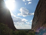
. The 36 domes, covering an area of 21.68 km² (8.4 sq mi), are composed of conglomerate
, a sedimentary rock
consisting of cobbles and boulders of varying rock types including granite
and basalt
, cemented by a matrix of sandstone
. The highest point, Mount Olga, is 1066 m (3,497.4 ft) above sea level, or approximately 546 m (1,791.3 ft) above the surrounding plain (198 m (649.6 ft) higher than Uluru). Kata Tjuta is located at the eastern end of the Docker River Road.
, Mt. Olga was named in 1872 by Ernest Giles
, in honour of Queen Olga of Württemberg. She and her husband King Karl had marked their 25th wedding anniversary the previous year by, amongst other things, naming Mueller a Freiherr (baron), making him Ferdinand von Mueller; this was his way of repaying the compliment.
On 15 December 1993, a dual naming
policy was adopted that allowed official names consisting of both the traditional Aboriginal name and the English name. As a result, Mount Olga was renamed Mount Olga / Kata Tjuta. On 6 November 2002, following a request from the regional Tourism Association, the order of the dual names was officially reversed to Kata Tjuta / Mount Olga.
, an intracratonic basin formed during the Adelaidian, roughly 850-800 mya. During the Petermann Orogeny
, approximately 550 mya, an event known as the Woodroff Thrust, thrust granulite facies rocks northward over low-grade metamorphic rock
s. The eventual erosion of the formation resulted in a molasse
facies, or deposition in front of rising mountains, in this case the Petermann Orogeny, to create the deposit known as the Mount Currie Conglomerate. The Mount Currie Conglomerate is made predominately of basalt
, porphyry
, granite
, gneiss
and volcanic rock
fragments with a matrix
composed of angular quartz
, microcline
and orthoclase
among other minerals.
Both Uluru and the Kata Tjuta are made of sediment originating in this Mount Currie Conglomerate and both have a chemical composition similar to granite. Scientists using Rb/Sr dating
techniques to accurately date the rock have given it an age of 600 mya, matching the date of the Woodroof Thrust event. The actual fresh rock that makes up the Olgas and Uluru is medium to dark gray with green or pink hues in some laminae. The bright orange-red hue, for which the structures are noted, is due to a patina
over finely divided feldspar coated in iron oxide.
legends associated with this place and indeed everything in the vicinity including, of course, Uluru. A number of legends surround the great snake king Wanambi who is said to live on the summit of Mount Olga and only comes down during the dry season. The majority of mythology surrounding the site is not disclosed to outsiders.
. It is then a 55 km drive south, then west. Visitors are required to pay a National Park http://www.deh.gov.au/parks/uluru/index.html entry fee, which is currently A$25 per person. Visitors can also drive along the Lasseter Highway
which joins the Stuart Hwy. 200 km south of Alice Springs at the township of Erldunda. The drive is 4½ hours from Alice Springs.
Bornhardt
A bornhardt is a dome-shaped, steep-sided, bald rock outcropping at least in height and several hundred meters in width. A type of inselberg, bornhardts are typically composed of granites or gneisses, though occasionally formed in other rock types such as dacite, norite, limestone, sandstone and...
s located about 365 km (226.8 mi) southwest of Alice Springs
Alice Springs, Northern Territory
Alice Springs is the second largest town in the Northern Territory of Australia. Popularly known as "the Alice" or simply "Alice", Alice Springs is situated in the geographic centre of Australia near the southern border of the Northern Territory...
, in the southern part of the Northern Territory
Northern Territory
The Northern Territory is a federal territory of Australia, occupying much of the centre of the mainland continent, as well as the central northern regions...
, central Australia
Australia
Australia , officially the Commonwealth of Australia, is a country in the Southern Hemisphere comprising the mainland of the Australian continent, the island of Tasmania, and numerous smaller islands in the Indian and Pacific Oceans. It is the world's sixth-largest country by total area...
. Uluru
Uluru
Uluru , also known as Ayers Rock, is a large sandstone rock formation in the southern part of the Northern Territory, central Australia. It lies south west of the nearest large town, Alice Springs; by road. Kata Tjuta and Uluru are the two major features of the Uluṟu-Kata Tjuṯa National Park....
, 25 km (15.5 mi) to the east, and Kata Tjuta form the two major landmarks within the Uluru-Kata Tjuta National Park
Uluru-Kata Tjuta National Park
Uluṟu-Kata Tjuṯa National Park is UNESCO World Heritage-listed in the Northern Territory of Australia. It is located 1431 kilometres south of Darwin by road and 440 kilometres south-west of Alice Springs along the Stuart and Lasseter Highways...
. The 36 domes, covering an area of 21.68 km² (8.4 sq mi), are composed of conglomerate
Conglomerate (geology)
A conglomerate is a rock consisting of individual clasts within a finer-grained matrix that have become cemented together. Conglomerates are sedimentary rocks consisting of rounded fragments and are thus differentiated from breccias, which consist of angular clasts...
, a sedimentary rock
Sedimentary rock
Sedimentary rock are types of rock that are formed by the deposition of material at the Earth's surface and within bodies of water. Sedimentation is the collective name for processes that cause mineral and/or organic particles to settle and accumulate or minerals to precipitate from a solution....
consisting of cobbles and boulders of varying rock types including granite
Granite
Granite is a common and widely occurring type of intrusive, felsic, igneous rock. Granite usually has a medium- to coarse-grained texture. Occasionally some individual crystals are larger than the groundmass, in which case the texture is known as porphyritic. A granitic rock with a porphyritic...
and basalt
Basalt
Basalt is a common extrusive volcanic rock. It is usually grey to black and fine-grained due to rapid cooling of lava at the surface of a planet. It may be porphyritic containing larger crystals in a fine matrix, or vesicular, or frothy scoria. Unweathered basalt is black or grey...
, cemented by a matrix of sandstone
Sandstone
Sandstone is a sedimentary rock composed mainly of sand-sized minerals or rock grains.Most sandstone is composed of quartz and/or feldspar because these are the most common minerals in the Earth's crust. Like sand, sandstone may be any colour, but the most common colours are tan, brown, yellow,...
. The highest point, Mount Olga, is 1066 m (3,497.4 ft) above sea level, or approximately 546 m (1,791.3 ft) above the surrounding plain (198 m (649.6 ft) higher than Uluru). Kata Tjuta is located at the eastern end of the Docker River Road.
Name
The alternative name, The Olgas, comes from the tallest peak, Mt. Olga. At the behest of Baron Ferdinand von MuellerFerdinand von Mueller
Baron Sir Ferdinand Jacob Heinrich von Mueller, KCMG was a German-Australian physician, geographer, and most notably, a botanist.-Early life:...
, Mt. Olga was named in 1872 by Ernest Giles
Ernest Giles
William Ernest Powell Giles , best known as Ernest Giles, was an Australian explorer who led three major expeditions in central Australia.- Early life :...
, in honour of Queen Olga of Württemberg. She and her husband King Karl had marked their 25th wedding anniversary the previous year by, amongst other things, naming Mueller a Freiherr (baron), making him Ferdinand von Mueller; this was his way of repaying the compliment.
On 15 December 1993, a dual naming
Dual naming
Dual naming is a policy for the naming of geographical landmarks, in which an official name is adopted that combines two previous names. Usually, the context is a conflict over which of the two previous names is most appropriate....
policy was adopted that allowed official names consisting of both the traditional Aboriginal name and the English name. As a result, Mount Olga was renamed Mount Olga / Kata Tjuta. On 6 November 2002, following a request from the regional Tourism Association, the order of the dual names was officially reversed to Kata Tjuta / Mount Olga.
Geologic origin
The region surrounding Kata Tjuta lies in the Amadeus BasinAmadeus Basin
The Amadeus Basin is a large intracratonic sedimentary basin in central Australia, lying mostly within the southern Northern Territory, but extending into the state of Western Australia. It is named after Lake Amadeus which lies within the basin...
, an intracratonic basin formed during the Adelaidian, roughly 850-800 mya. During the Petermann Orogeny
Petermann Orogeny
The Petermann Orogeny was an intracontinental event that affected basement rocks of the northern Musgrave Province and Proterozoic sediments of the southern Amadeus Basin between ~550-535 Ma....
, approximately 550 mya, an event known as the Woodroff Thrust, thrust granulite facies rocks northward over low-grade metamorphic rock
Metamorphic rock
Metamorphic rock is the transformation of an existing rock type, the protolith, in a process called metamorphism, which means "change in form". The protolith is subjected to heat and pressure causing profound physical and/or chemical change...
s. The eventual erosion of the formation resulted in a molasse
Molasse
The term "molasse" refers to the sandstones, shales and conglomerates formed as terrestrial or shallow marine deposits in front of rising mountain chains. The molasse is deposited in a foreland basin, especially on top of flysch, for example that left from the rising Alps, or erosion in the Himalaya...
facies, or deposition in front of rising mountains, in this case the Petermann Orogeny, to create the deposit known as the Mount Currie Conglomerate. The Mount Currie Conglomerate is made predominately of basalt
Basalt
Basalt is a common extrusive volcanic rock. It is usually grey to black and fine-grained due to rapid cooling of lava at the surface of a planet. It may be porphyritic containing larger crystals in a fine matrix, or vesicular, or frothy scoria. Unweathered basalt is black or grey...
, porphyry
Porphyry (geology)
Porphyry is a variety of igneous rock consisting of large-grained crystals, such as feldspar or quartz, dispersed in a fine-grained feldspathic matrix or groundmass. The larger crystals are called phenocrysts...
, granite
Granite
Granite is a common and widely occurring type of intrusive, felsic, igneous rock. Granite usually has a medium- to coarse-grained texture. Occasionally some individual crystals are larger than the groundmass, in which case the texture is known as porphyritic. A granitic rock with a porphyritic...
, gneiss
Gneiss
Gneiss is a common and widely distributed type of rock formed by high-grade regional metamorphic processes from pre-existing formations that were originally either igneous or sedimentary rocks.-Etymology:...
and volcanic rock
Volcanic rock
Volcanic rock is a rock formed from magma erupted from a volcano. In other words, it is an igneous rock of volcanic origin...
fragments with a matrix
Matrix (geology)
The matrix or groundmass of rock is the finer grained mass of material in which larger grains, crystals or clasts are embedded.The matrix of an igneous rock consists of finer grained, often microscopic, crystals in which larger crystals are embedded. This porphyritic texture is indicative of...
composed of angular quartz
Quartz
Quartz is the second-most-abundant mineral in the Earth's continental crust, after feldspar. It is made up of a continuous framework of SiO4 silicon–oxygen tetrahedra, with each oxygen being shared between two tetrahedra, giving an overall formula SiO2. There are many different varieties of quartz,...
, microcline
Microcline
Microcline is an important igneous rock-forming tectosilicate mineral. It is a potassium-rich alkali feldspar. Microcline typically contains minor amounts of sodium. It is common in granite and pegmatites. Microcline forms during slow cooling of orthoclase; it is more stable at lower temperatures...
and orthoclase
Orthoclase
Orthoclase is an important tectosilicate mineral which forms igneous rock. The name is from the Greek for "straight fracture," because its two cleavage planes are at right angles to each other. Alternate names are alkali feldspar and potassium feldspar...
among other minerals.
Both Uluru and the Kata Tjuta are made of sediment originating in this Mount Currie Conglomerate and both have a chemical composition similar to granite. Scientists using Rb/Sr dating
Rubidium-strontium dating
The rubidium-strontium dating method is a radiometric dating technique that geologists use to determine the age of rocks.Development of this process was aided by Fritz Strassmann, who later went on to discover nuclear fission with Otto Hahn and Lise Meitner....
techniques to accurately date the rock have given it an age of 600 mya, matching the date of the Woodroof Thrust event. The actual fresh rock that makes up the Olgas and Uluru is medium to dark gray with green or pink hues in some laminae. The bright orange-red hue, for which the structures are noted, is due to a patina
Patina
Patina is a tarnish that forms on the surface of bronze and similar metals ; a sheen on wooden furniture produced by age, wear, and polishing; or any such acquired change of a surface through age and exposure...
over finely divided feldspar coated in iron oxide.
Legends
There are many Pitjantjatjara DreamtimeDreamtime
In the animist framework of Australian Aboriginal mythology, The Dreaming is a sacred era in which ancestral Totemic Spirit Beings formed The Creation.-The Dreaming of the Aboriginal times:...
legends associated with this place and indeed everything in the vicinity including, of course, Uluru. A number of legends surround the great snake king Wanambi who is said to live on the summit of Mount Olga and only comes down during the dry season. The majority of mythology surrounding the site is not disclosed to outsiders.
Spiritual importance
Many ceremonies were, and are still carried out here, particularly at night. One of the former ceremonies was a type of public punishment that in extreme cases included death.Transportation
Kata Tjuta can be accessed via Ayers Rock AirportAyers Rock Airport
Ayers Rock Airport is situated near Yulara, around away from Alice Springs, Northern Territory, and 20 minutes drive from Uluru itself. An average of 400,000 passenger movements per year pass through this airport in the middle of Australia.-History:Connellan Airport was originally started by...
. It is then a 55 km drive south, then west. Visitors are required to pay a National Park http://www.deh.gov.au/parks/uluru/index.html entry fee, which is currently A$25 per person. Visitors can also drive along the Lasseter Highway
Lasseter Highway
Lasseter Highway is a fully sealed 244 kilometre highway in the Northern Territory of Australia. It connects Yulara, Kata Tjuta and Uluru east to the Stuart Highway...
which joins the Stuart Hwy. 200 km south of Alice Springs at the township of Erldunda. The drive is 4½ hours from Alice Springs.
Gallery
See also
- Ernest GilesErnest GilesWilliam Ernest Powell Giles , best known as Ernest Giles, was an Australian explorer who led three major expeditions in central Australia.- Early life :...
- Protected areas of the Northern TerritoryProtected areas of the Northern TerritoryThe Northern Territory contains 95 separate Protected Areas with a total area of 53,505 km² . Ten of these are National parks, totalling 19,622 km² . Four are Aboriginal National Parks, totalling 5,315 km²...
- Pitjantjatjara people#Recognition of sacred sites
- UluruUluruUluru , also known as Ayers Rock, is a large sandstone rock formation in the southern part of the Northern Territory, central Australia. It lies south west of the nearest large town, Alice Springs; by road. Kata Tjuta and Uluru are the two major features of the Uluṟu-Kata Tjuṯa National Park....
- Uluru-Kata Tjuta National ParkUluru-Kata Tjuta National ParkUluṟu-Kata Tjuṯa National Park is UNESCO World Heritage-listed in the Northern Territory of Australia. It is located 1431 kilometres south of Darwin by road and 440 kilometres south-west of Alice Springs along the Stuart and Lasseter Highways...
External links
- National Park - Australian Department of the Environment and Water Resources
- A Report on the Uluru-Kata Tjuta National Park