
Porongurup National Park
Encyclopedia
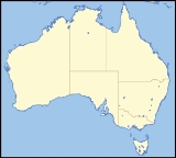
Porongurup National Park is a national park in the Great Southern region of Western Australia
(Australia
), 360 km southeast of Perth
and 40 km from Albany
.
It protects the Porongurup Range, an extremely ancient and largely levelled mountain range formed in the Precambrian
over 1200 million years ago. The present range is no more than fifteen km (10 miles) from east to west and consists of granite
peaks levelled into domes. The highest point in the Porongurup Range is Devils Slide at 670 metres (2,200 ft) whilst there are several other peaks above 600 metres (1,970 ft), which is about 400 metres above the surrounding plain. Indeed, for much of the Cretaceous
and Paleogene
the Porongurup Range was an island
surrounded by the sea, with the Stirling Range
forming the southern coastline.
It is believed that the Porongurup Range is a remnant of the Precambrian collision that joined Australia and Antarctica until they separated in the Paleocene
. There remain major granite intrusions in what is left of what must once have been a large mountain range.
The Porongurup Range was first sighted by Europeans passing near Albany
in 1802 but farming
in the surrounding districts did not start until around 1859 when vegetables were first grown on the southern slopes of the range. The giant karri
and jarrah
trees of the range were first harvested for timber
in the 1880s and timber leases did not begin to be withdrawn until 1925 and the National Park was not gazetted officially until 1971 with an area of 1,157 ha. This has now been increased to 2,511 ha.
In 1978, Cyclone Alby
felled many trees within the National Park (it was an unusual depression that produced very little rainfall after moving south of the Tropic of Capricorn
).
On February 11, 2007, a fire began on private property near the north-west corner of the park. It quickly spread into the native vegetation and raced up the steep slopes within hours. Volunteer fire crews
battled the fast-moving blaze and managed to contain it overnight after it had burnt around 50% of the park. The fire broke containment lines on Monday afternoon (12 February) and spread further through the park and into private property to the north-east. Fire crews, including aerial support from six water bomber planes
, continued the battle to contain the blaze and by Tuesday morning it was again under control though still burning freely within the containment zone. Water bombers paid special attention to tourist facilities and special habitats, including an area where endangered noisy scrub birds
had been released. By Wednesday morning (14 February) the fire had burnt through around 95% of the national park.
As many of the trees and vegetation are native to the region, it is expected that the park will, to a large extent, recover in the months after the fire. By early April, Kingia australis plants were re-shooting and flowering abundantly in heavily burnt areas but the legacy of the fire will be felt for some time to come. Local populations of kangaroos and other wildlife were injured and local residents assisted in their care and recovery where possible. There has not been such a devastating fire in the region since the 1960s.
Although no rain gauge has ever been placed on any Porongurup peak, by analogy with the Otway Ranges in Victoria
, it would be expected that the Porongurup summits would probably be the wettest place in Western Australia, with annual rainfalls conjectured to average around 1,600 mm (64 inches), with as much as 250 to 275 mm (10 to 11 inches) per month between May and August probable. Temperatures on the peaks are around 3 °C (5 °F) lower than on the plains, and snow
has occasionally fallen on the ranges (heavily in October 1992 and June 1956).
This high rainfall explains the survival of karri forests quite a distance from their main stronghold between Manjimup
and Walpole
. The karri forests are one of the major attractions of the Porongurups and occur chiefly on the upper slopes of the range on deep red soils known as "karri loam". On lateritic soils
downslope, the predominant type of vegetation is a maxied forst of jarrah and marri
, whilst on the highly exposed and frequently waterlogged summits, an open moss
y herbland prevails.
Though not nearly as rich biologically as the more northerly Stirling Range
, there exist ten endemic species of plant in the Porongurup Range, the best known being the mountain villarsia (Villarsia caltbifolia).
Western Australia
Western Australia is a state of Australia, occupying the entire western third of the Australian continent. It is bounded by the Indian Ocean to the north and west, the Great Australian Bight and Indian Ocean to the south, the Northern Territory to the north-east and South Australia to the south-east...
(Australia
Australia
Australia , officially the Commonwealth of Australia, is a country in the Southern Hemisphere comprising the mainland of the Australian continent, the island of Tasmania, and numerous smaller islands in the Indian and Pacific Oceans. It is the world's sixth-largest country by total area...
), 360 km southeast of Perth
Perth, Western Australia
Perth is the capital and largest city of the Australian state of Western Australia and the fourth most populous city in Australia. The Perth metropolitan area has an estimated population of almost 1,700,000....
and 40 km from Albany
Albany, Western Australia
Albany is a port city in the Great Southern region of Western Australia, some 418 km SE of Perth, the state capital. As of 2009, Albany's population was estimated at 33,600, making it the 6th-largest city in the state....
.
It protects the Porongurup Range, an extremely ancient and largely levelled mountain range formed in the Precambrian
Precambrian
The Precambrian is the name which describes the large span of time in Earth's history before the current Phanerozoic Eon, and is a Supereon divided into several eons of the geologic time scale...
over 1200 million years ago. The present range is no more than fifteen km (10 miles) from east to west and consists of granite
Granite
Granite is a common and widely occurring type of intrusive, felsic, igneous rock. Granite usually has a medium- to coarse-grained texture. Occasionally some individual crystals are larger than the groundmass, in which case the texture is known as porphyritic. A granitic rock with a porphyritic...
peaks levelled into domes. The highest point in the Porongurup Range is Devils Slide at 670 metres (2,200 ft) whilst there are several other peaks above 600 metres (1,970 ft), which is about 400 metres above the surrounding plain. Indeed, for much of the Cretaceous
Cretaceous
The Cretaceous , derived from the Latin "creta" , usually abbreviated K for its German translation Kreide , is a geologic period and system from circa to million years ago. In the geologic timescale, the Cretaceous follows the Jurassic period and is followed by the Paleogene period of the...
and Paleogene
Paleogene
The Paleogene is a geologic period and system that began 65.5 ± 0.3 and ended 23.03 ± 0.05 million years ago and comprises the first part of the Cenozoic Era...
the Porongurup Range was an island
Island
An island or isle is any piece of sub-continental land that is surrounded by water. Very small islands such as emergent land features on atolls can be called islets, cays or keys. An island in a river or lake may be called an eyot , or holm...
surrounded by the sea, with the Stirling Range
Stirling Range
The Stirling Range or Koikyennuruff is a range of mountains and hills in the Great Southern region of Western Australia, 337 km south-east of Perth. It is located at approximately and is over 60 km wide from west to east, stretching from the highway between Mount Barker and Cranbrook...
forming the southern coastline.
It is believed that the Porongurup Range is a remnant of the Precambrian collision that joined Australia and Antarctica until they separated in the Paleocene
Paleocene
The Paleocene or Palaeocene, the "early recent", is a geologic epoch that lasted from about . It is the first epoch of the Palaeogene Period in the modern Cenozoic Era...
. There remain major granite intrusions in what is left of what must once have been a large mountain range.
History
Although Aboriginal tribes had lived in the plains around the Porongurup Range for tens of thousands of years before European settlement, it is believed that they never or very rarely moved above the plains, largely because of the often inhospitable weather and the absence of useful resources in the forests of the region or on the often bare peaks.The Porongurup Range was first sighted by Europeans passing near Albany
Albany, Western Australia
Albany is a port city in the Great Southern region of Western Australia, some 418 km SE of Perth, the state capital. As of 2009, Albany's population was estimated at 33,600, making it the 6th-largest city in the state....
in 1802 but farming
Agriculture
Agriculture is the cultivation of animals, plants, fungi and other life forms for food, fiber, and other products used to sustain life. Agriculture was the key implement in the rise of sedentary human civilization, whereby farming of domesticated species created food surpluses that nurtured the...
in the surrounding districts did not start until around 1859 when vegetables were first grown on the southern slopes of the range. The giant karri
Karri
Eucalyptus diversicolor, commonly known as the Karri, is a eucalypt which is native to the wetter regions of south west of Western Australia.-Description:...
and jarrah
Jarrah
Eucalyptus marginata is one of the most common species of Eucalyptus tree in the southwest of Western Australia. The tree and the wood are usually referred to by the Aboriginal name Jarrah...
trees of the range were first harvested for timber
Timber
Timber may refer to:* Timber, a term common in the United Kingdom and Australia for wood materials * Timber, Oregon, an unincorporated community in the U.S...
in the 1880s and timber leases did not begin to be withdrawn until 1925 and the National Park was not gazetted officially until 1971 with an area of 1,157 ha. This has now been increased to 2,511 ha.
In 1978, Cyclone Alby
Cyclone Alby
Severe Tropical Cyclone Alby was regarded as the most devastating tropical cyclone to impact southwestern Western Australia on record. Forming out of an area of low pressure on 27 March, Alby steadily developed as it tracked southwestward, parallel to Western Australia...
felled many trees within the National Park (it was an unusual depression that produced very little rainfall after moving south of the Tropic of Capricorn
Tropic of Capricorn
The Tropic of Capricorn, or Southern tropic, marks the most southerly latitude on the Earth at which the Sun can be directly overhead. This event occurs at the December solstice, when the southern hemisphere is tilted towards the Sun to its maximum extent.Tropic of Capricorn is one of the five...
).
On February 11, 2007, a fire began on private property near the north-west corner of the park. It quickly spread into the native vegetation and raced up the steep slopes within hours. Volunteer fire crews
Fire and Emergency Services Authority of Western Australia
The Fire and Emergency Services Authority of Western Australia is a statutory government authority created in January 1999 to administer the following legislation within the state of Western Australia:...
battled the fast-moving blaze and managed to contain it overnight after it had burnt around 50% of the park. The fire broke containment lines on Monday afternoon (12 February) and spread further through the park and into private property to the north-east. Fire crews, including aerial support from six water bomber planes
Aerial firefighting
Aerial firefighting is the use of aircraft and other aerial resources to combat wildfires. The types of aircraft used include fixed-wing aircraft and helicopters. Smokejumpers and rappellers are also classified as aerial firefighters, delivered to the fire by parachute from a variety of fixed-wing...
, continued the battle to contain the blaze and by Tuesday morning it was again under control though still burning freely within the containment zone. Water bombers paid special attention to tourist facilities and special habitats, including an area where endangered noisy scrub birds
Scrub-bird
Scrub-birds are shy, secretive, ground-dwelling birds of the family Atrichornithidae. There are just two species. The Rufous scrub-bird is rare and very restricted in its range, and the Noisy scrub-bird is so rare that until 1961 it was thought to be extinct...
had been released. By Wednesday morning (14 February) the fire had burnt through around 95% of the national park.
As many of the trees and vegetation are native to the region, it is expected that the park will, to a large extent, recover in the months after the fire. By early April, Kingia australis plants were re-shooting and flowering abundantly in heavily burnt areas but the legacy of the fire will be felt for some time to come. Local populations of kangaroos and other wildlife were injured and local residents assisted in their care and recovery where possible. There has not been such a devastating fire in the region since the 1960s.
Climate and vegetation
The plains surrounding the Porongurup Range have an annual rainfall of around 800 mm (32 inches) per year to the south and around 600 mm (24 inches) on the northern side. Most of this rain falls between April and October: although light showers are common in the summer months, the average rainfall between November and March totals only around 110 mm (4.5 inches) in the southern plains and less than 75 mm (3 inches) to the north. Summer temperatures on the plains average a very warm 26 °C (79 °F) in the daytime and decline to around 18 °C (64 °F) at night. In winter, although it can be rainy, temperatures average a very pleasant 16 °C (60 °F) during the day and a cool 8 °C (46 °F) in the morning.Although no rain gauge has ever been placed on any Porongurup peak, by analogy with the Otway Ranges in Victoria
Victoria (Australia)
Victoria is the second most populous state in Australia. Geographically the smallest mainland state, Victoria is bordered by New South Wales, South Australia, and Tasmania on Boundary Islet to the north, west and south respectively....
, it would be expected that the Porongurup summits would probably be the wettest place in Western Australia, with annual rainfalls conjectured to average around 1,600 mm (64 inches), with as much as 250 to 275 mm (10 to 11 inches) per month between May and August probable. Temperatures on the peaks are around 3 °C (5 °F) lower than on the plains, and snow
Snow
Snow is a form of precipitation within the Earth's atmosphere in the form of crystalline water ice, consisting of a multitude of snowflakes that fall from clouds. Since snow is composed of small ice particles, it is a granular material. It has an open and therefore soft structure, unless packed by...
has occasionally fallen on the ranges (heavily in October 1992 and June 1956).
This high rainfall explains the survival of karri forests quite a distance from their main stronghold between Manjimup
Manjimup, Western Australia
Manjimup is a town in Western Australia, south of the state capital, Perth. The town of Manjimup is a regional centre for the largest shire in the South West of Western Australia. At the 2006 census, Manjimup had a population of 4,239.-History:...
and Walpole
Walpole, Western Australia
Walpole is a town in Western Australia, 432 km SSE of Perth and 66 km west of Denmark.Walpole lies very close to the northern point of the 100-hectare Walpole Inlet, from which it takes its name....
. The karri forests are one of the major attractions of the Porongurups and occur chiefly on the upper slopes of the range on deep red soils known as "karri loam". On lateritic soils
Laterite
Laterites are soil types rich in iron and aluminium, formed in hot and wet tropical areas. Nearly all laterites are rusty-red because of iron oxides. They develop by intensive and long-lasting weathering of the underlying parent rock...
downslope, the predominant type of vegetation is a maxied forst of jarrah and marri
Corymbia calophylla
Corymbia calophylla is a bloodwood native to Western Australia. Common names include Marri and Port Gregory Gum, and a long standing usage has been Red Gum due to the red gum effusions often found on trunks.It is distinctive among bloodwoods for its very large buds and fruit Corymbia calophylla...
, whilst on the highly exposed and frequently waterlogged summits, an open moss
Moss
Mosses are small, soft plants that are typically 1–10 cm tall, though some species are much larger. They commonly grow close together in clumps or mats in damp or shady locations. They do not have flowers or seeds, and their simple leaves cover the thin wiry stems...
y herbland prevails.
Though not nearly as rich biologically as the more northerly Stirling Range
Stirling Range
The Stirling Range or Koikyennuruff is a range of mountains and hills in the Great Southern region of Western Australia, 337 km south-east of Perth. It is located at approximately and is over 60 km wide from west to east, stretching from the highway between Mount Barker and Cranbrook...
, there exist ten endemic species of plant in the Porongurup Range, the best known being the mountain villarsia (Villarsia caltbifolia).
Features
The park includes a number of significant tourist features and walk trails.- Tree in the rock
- Castle Rock
- Balancing Rock
- Gibraltar Rock
- Devils Slide
- Wansborough Pass
- Millinup Pass
See also
- Protected areas of Western AustraliaProtected areas of Western AustraliaWestern Australia is the second largest subnational entity in the world. It contains no fewer than 1224 separate Protected Areas with a total area of 170,610 km²...
- Porongurup VillagePorongurup, Western AustraliaPorongurup is the name of a small mountain range in the Shire of Plantagenet in Western Australia and of a small village on the northern slopes of the range. At the 2006 census, Porongurup had a population of 370.The name is derived from the Aboriginal place-name, and consequently arrived with no...
- Porongurup.info