

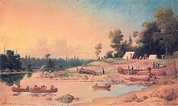
List of longest rivers of Canada
Encyclopedia
Among the longest rivers of Canada are 47 streams of at least 600 km (372.8 mi). In the case of some rivers such as the Columbia
, the length listed in the table below is solely that of the main stem
. In the case of others such as the Mackenzie
, it is the combined lengths of the main stem and one or more upstream tributaries, as noted. Excluded from the list are rivers such as the Dauphin
, a short connecting link between lakes Manitoba
and Winnipeg
, with main stems of 100 km (62.1 mi) or less. Also excluded are rivers such as the Mississippi
, the main stems of which do not enter Canada even though some of their tributaries do.
Nine rivers in this list cross international boundaries or form them. Four—the Yukon
, Columbia
, Porcupine
, and Kootenay
—begin in Canada and flow into the United States. Five—the Milk, Pend d'Oreille
, Saint Lawrence
, Red
, and Saint John—begin in the United States and flow into Canada. Of these, the Milk and the Kootenay cross the international border twice, the Milk leaving and then re-entering the United States, the Kootenay leaving and then re-entering Canada. The drainage basin
s of these nine rivers extend into both countries; in addition, the drainage basins of six others—the Fraser
, Assiniboine
, South Saskatchewan
, Saskatchewan
, Nelson
, and Winnipeg
—extend into the United States even though their main stems flow entirely within Canada.
Sources report hydrological quantities with varied precision. Biologist and author Ruth Patrick
, describing a table of high-discharge rivers, wrote that data on discharge, drainage area, and length varied widely among authors whose works she consulted. "It seems," she said, "that the wisest course is to regard data tables such as the present one as showing the general ranks of rivers, and not to place too much importance on minor (10–20%) differences in figures."
Columbia River
The Columbia River is the largest river in the Pacific Northwest region of North America. The river rises in the Rocky Mountains of British Columbia, Canada, flows northwest and then south into the U.S. state of Washington, then turns west to form most of the border between Washington and the state...
, the length listed in the table below is solely that of the main stem
Main Stem
"Main Stem" is 1942 instrumental by Duke Ellington and His Famous Orchestra. Although recorded in 1942, the single would not be released until 1944 where it was Duke Ellington's last of four number one's on the Harlem Hit Parade. "Main Stem" would also peak at number twenty on the pop chart"Main...
. In the case of others such as the Mackenzie
Mackenzie River
The Mackenzie River is the largest river system in Canada. It flows through a vast, isolated region of forest and tundra entirely within the country's Northwest Territories, although its many tributaries reach into four other Canadian provinces and territories...
, it is the combined lengths of the main stem and one or more upstream tributaries, as noted. Excluded from the list are rivers such as the Dauphin
Dauphin River
The Dauphin River is a river of Manitoba, Canada. The Dauphin is part of the connection from Lake Manitoba to Lake Winnipeg. The Fairford River flows from Portage Bay in Lake Manitoba through to Lake St. Martin then the Dauphin River continues northeastward from Lake St. Martin into Lake Winnipeg....
, a short connecting link between lakes Manitoba
Lake Manitoba
Lake Manitoba is Canada's thirteenth largest lake and the world's 33rd largest freshwater lake. It is in central North America, in the Canadian province of Manitoba, which is named after the lake...
and Winnipeg
Lake Winnipeg
Lake Winnipeg is a large, lake in central North America, in the province of Manitoba, Canada, with its southern tip about north of the city of Winnipeg...
, with main stems of 100 km (62.1 mi) or less. Also excluded are rivers such as the Mississippi
Mississippi River
The Mississippi River is the largest river system in North America. Flowing entirely in the United States, this river rises in western Minnesota and meanders slowly southwards for to the Mississippi River Delta at the Gulf of Mexico. With its many tributaries, the Mississippi's watershed drains...
, the main stems of which do not enter Canada even though some of their tributaries do.
Nine rivers in this list cross international boundaries or form them. Four—the Yukon
Yukon River
The Yukon River is a major watercourse of northwestern North America. The source of the river is located in British Columbia, Canada. The next portion lies in, and gives its name to Yukon Territory. The lower half of the river lies in the U.S. state of Alaska. The river is long and empties into...
, Columbia
Columbia River
The Columbia River is the largest river in the Pacific Northwest region of North America. The river rises in the Rocky Mountains of British Columbia, Canada, flows northwest and then south into the U.S. state of Washington, then turns west to form most of the border between Washington and the state...
, Porcupine
Porcupine River
The Porcupine River is a river that runs through Alaska and the Yukon. Having its source in the Ogilvie Mountains north of Dawson City, Yukon, it flows north, veers to the southwest, goes through the community of Old Crow, Yukon, flowing into the Yukon River at Fort Yukon, Alaska...
, and Kootenay
Kootenay River
The Kootenay is a major river in southeastern British Columbia, Canada and the northern part of the U.S. states of Montana and Idaho. It is one of the uppermost major tributaries of the Columbia River, which is the largest North American river that empties into the Pacific Ocean...
—begin in Canada and flow into the United States. Five—the Milk, Pend d'Oreille
Pend Oreille River
The Pend Oreille River is a tributary of the Columbia River, approximately long, in northern Idaho and northeastern Washington in the United States, as well as southeastern British Columbia in Canada. In its passage through British Columbia its name is spelled Pend-d'Oreille River...
, Saint Lawrence
Saint Lawrence River
The Saint Lawrence is a large river flowing approximately from southwest to northeast in the middle latitudes of North America, connecting the Great Lakes with the Atlantic Ocean. It is the primary drainage conveyor of the Great Lakes Basin...
, Red
Red River of the North
The Red River is a North American river. Originating at the confluence of the Bois de Sioux and Otter Tail rivers in the United States, it flows northward through the Red River Valley and forms the border between the U.S. states of Minnesota and North Dakota before continuing into Manitoba, Canada...
, and Saint John—begin in the United States and flow into Canada. Of these, the Milk and the Kootenay cross the international border twice, the Milk leaving and then re-entering the United States, the Kootenay leaving and then re-entering Canada. The drainage basin
Drainage basin
A drainage basin is an extent or an area of land where surface water from rain and melting snow or ice converges to a single point, usually the exit of the basin, where the waters join another waterbody, such as a river, lake, reservoir, estuary, wetland, sea, or ocean...
s of these nine rivers extend into both countries; in addition, the drainage basins of six others—the Fraser
Fraser River
The Fraser River is the longest river within British Columbia, Canada, rising at Fraser Pass near Mount Robson in the Rocky Mountains and flowing for , into the Strait of Georgia at the city of Vancouver. It is the tenth longest river in Canada...
, Assiniboine
Assiniboine River
The Assiniboine River is a river that runs through the prairies of Western Canada in Saskatchewan and Manitoba. It is a tributary of the Red River. The Assiniboine is a typical meandering river with a single main channel embanked within a flat, shallow valley in some places and a steep valley in...
, South Saskatchewan
South Saskatchewan River
The South Saskatchewan River is a major river in Canada that flows through the provinces of Alberta and Saskatchewan....
, Saskatchewan
Saskatchewan River
The Saskatchewan River is a major river in Canada, approximately long, flowing roughly eastward across Saskatchewan and Manitoba to empty into Lake Winnipeg...
, Nelson
Nelson River
The Nelson River is a river of north-central North America, in the Canadian province of Manitoba. Its full length is , it has mean discharge of , and has a drainage basin of , of which is in the United States...
, and Winnipeg
Winnipeg River
The Winnipeg River is a Canadian river which flows from Lake of the Woods in the province of Ontario to Lake Winnipeg in Manitoba. This river is long from the Norman Dam in Kenora to its mouth at Lake Winnipeg. Its watershed is in area, mainly in Canada. About of this area is in northern...
—extend into the United States even though their main stems flow entirely within Canada.
Sources report hydrological quantities with varied precision. Biologist and author Ruth Patrick
Ruth Patrick
Dr. Ruth Myrtle Patrick is a botanist and limnologist specializing in diatoms and freshwater ecology, who developed ways to measure the health of freshwater ecosystems and established a number of research facilities. She attended the Sunset Hill School in Kansas City, Missouri, graduating in 1925....
, describing a table of high-discharge rivers, wrote that data on discharge, drainage area, and length varied widely among authors whose works she consulted. "It seems," she said, "that the wisest course is to regard data tables such as the present one as showing the general ranks of rivers, and not to place too much importance on minor (10–20%) differences in figures."
Table
The primary source for data in the table below is The Atlas of Canada; other sources are as noted. Discharge refers to the flow at the mouth except as noted. U.S. states appear in italics. Abbreviations are as follows: "km" for "kilometre", "mi" for "mile", "s" for "second", "m" for "metre", and "ft" for "foot".| # | Name | Mouth | Length | Source | Watershed area |
Discharge | Provinces, states |
Image |
|---|---|---|---|---|---|---|---|---|
| 1 | Mackenzie River Mackenzie River The Mackenzie River is the largest river system in Canada. It flows through a vast, isolated region of forest and tundra entirely within the country's Northwest Territories, although its many tributaries reach into four other Canadian provinces and territories... |
Beaufort Sea Beaufort Sea The Beaufort Sea is a marginal sea of the Arctic Ocean, located north of the Northwest Territories, the Yukon, and Alaska, west of Canada's Arctic islands. The sea is named after hydrographer Sir Francis Beaufort... 69°21′59"N 133°54′10"W |
4,241 km 2,635 mi |
Thutade Lake Thutade Lake Thutade Lake is located in the Omineca Mountains of the Northern Interior of British Columbia, Canada. About 40 km in length, and no more than about 2 km wide, the lake is primarily significant as the ultimate source of the Mackenzie River. The lake is at the head of the Finlay River,... 56°44′00"N 127°31′00"W |
1,805,200 km2 697,000 mi2 |
9,700 m3/s 340,000 ft3/s |
Northwest Territories Northwest Territories The Northwest Territories is a federal territory of Canada.Located in northern Canada, the territory borders Canada's two other territories, Yukon to the west and Nunavut to the east, and three provinces: British Columbia to the southwest, and Alberta and Saskatchewan to the south... |
|
| 2 | Yukon River Yukon River The Yukon River is a major watercourse of northwestern North America. The source of the river is located in British Columbia, Canada. The next portion lies in, and gives its name to Yukon Territory. The lower half of the river lies in the U.S. state of Alaska. The river is long and empties into... |
Bering Sea Bering Sea The Bering Sea is a marginal sea of the Pacific Ocean. It comprises a deep water basin, which then rises through a narrow slope into the shallower water above the continental shelves.... 62°35′55"N 164°48′00"W |
3,185 km 1,979 mi |
Teslin Lake Teslin Lake Teslin Lake is a large lake spanning the border between British Columbia and Yukon in Canada. It is one of a group of large lakes in the region of far northwestern BC, east of the upper Alaska Panhandle, which are the southern extremity of the basin of the Yukon River, and which are known in the... 59°37′00"N 132°09′00"W |
839,200 km2 324,000 mi2 |
6,340 m3/s 224,000 ft3/s |
British Columbia British Columbia British Columbia is the westernmost of Canada's provinces and is known for its natural beauty, as reflected in its Latin motto, Splendor sine occasu . Its name was chosen by Queen Victoria in 1858... , Yukon Yukon Yukon is the westernmost and smallest of Canada's three federal territories. It was named after the Yukon River. The word Yukon means "Great River" in Gwich’in.... , Alaska Alaska Alaska is the largest state in the United States by area. It is situated in the northwest extremity of the North American continent, with Canada to the east, the Arctic Ocean to the north, and the Pacific Ocean to the west and south, with Russia further west across the Bering Strait... |
 |
| 3 | Saint Lawrence River Saint Lawrence River The Saint Lawrence is a large river flowing approximately from southwest to northeast in the middle latitudes of North America, connecting the Great Lakes with the Atlantic Ocean. It is the primary drainage conveyor of the Great Lakes Basin... |
Gulf of Saint Lawrence Gulf of Saint Lawrence The Gulf of Saint Lawrence , the world's largest estuary, is the outlet of North America's Great Lakes via the Saint Lawrence River into the Atlantic Ocean... 49°40′00"N 64°30′00"W |
3,058 km 1,900 mi |
|Seven Beaver Lake 47°30′04"N 91°49′51"W |
1,344,200 km2 519,000 mi2 |
9,850 m3/s 348,000 ft3/s |
Minnesota Minnesota Minnesota is a U.S. state located in the Midwestern United States. The twelfth largest state of the U.S., it is the twenty-first most populous, with 5.3 million residents. Minnesota was carved out of the eastern half of the Minnesota Territory and admitted to the Union as the thirty-second state... , Wisconsin Wisconsin Wisconsin is a U.S. state located in the north-central United States and is part of the Midwest. It is bordered by Minnesota to the west, Iowa to the southwest, Illinois to the south, Lake Michigan to the east, Michigan to the northeast, and Lake Superior to the north. Wisconsin's capital is... , Ontario Ontario Ontario is a province of Canada, located in east-central Canada. It is Canada's most populous province and second largest in total area. It is home to the nation's most populous city, Toronto, and the nation's capital, Ottawa.... , Michigan Michigan Michigan is a U.S. state located in the Great Lakes Region of the United States of America. The name Michigan is the French form of the Ojibwa word mishigamaa, meaning "large water" or "large lake".... , Ohio Ohio Ohio is a Midwestern state in the United States. The 34th largest state by area in the U.S.,it is the 7th‑most populous with over 11.5 million residents, containing several major American cities and seven metropolitan areas with populations of 500,000 or more.The state's capital is Columbus... , New York New York New York is a state in the Northeastern region of the United States. It is the nation's third most populous state. New York is bordered by New Jersey and Pennsylvania to the south, and by Connecticut, Massachusetts and Vermont to the east... , Quebec Quebec Quebec or is a province in east-central Canada. It is the only Canadian province with a predominantly French-speaking population and the only one whose sole official language is French at the provincial level.... |
|
| 4 | Nelson River Nelson River The Nelson River is a river of north-central North America, in the Canadian province of Manitoba. Its full length is , it has mean discharge of , and has a drainage basin of , of which is in the United States... |
Hudson Bay Hudson Bay Hudson Bay , sometimes called Hudson's Bay, is a large body of saltwater in northeastern Canada. It drains a very large area, about , that includes parts of Ontario, Quebec, Saskatchewan, Alberta, most of Manitoba, southeastern Nunavut, as well as parts of North Dakota, South Dakota, Minnesota,... 57°04′05"N 92°30′08"W |
2,575 km 1,600 mi |
Bow Glacier Bow Glacier Bow Glacier is located in Banff National Park, Alberta, Canada, approximately northwest of Lake Louise, and can be viewed from the Icefields Parkway. Bow Glacier is an outflow glacier from the Wapta Icefield, which rests along the Continental divide, and runoff from the glacier supplies water to... 51°40′00"N 116°27′00"W |
892,300 km2 344,500 mi2 |
2,370 m3/s 84,000 ft3/s |
Manitoba Manitoba Manitoba is a Canadian prairie province with an area of . The province has over 110,000 lakes and has a largely continental climate because of its flat topography. Agriculture, mostly concentrated in the fertile southern and western parts of the province, is vital to the province's economy; other... |
 |
| 5 | Slave River Slave River The Slave River is a Canadian river that flows from Lake Athabasca in northeastern Alberta and empties into Great Slave Lake in the Northwest Territories.... |
Great Slave Lake Great Slave Lake Great Slave Lake is the second-largest lake in the Northwest Territories of Canada , the deepest lake in North America at , and the ninth-largest lake in the world. It is long and wide. It covers an area of in the southern part of the territory. Its given volume ranges from to and up to ... 61°18′00"N 113°40′04"W |
2,338 km 1,453 mi |
Thutade Lake Thutade Lake Thutade Lake is located in the Omineca Mountains of the Northern Interior of British Columbia, Canada. About 40 km in length, and no more than about 2 km wide, the lake is primarily significant as the ultimate source of the Mackenzie River. The lake is at the head of the Finlay River,... 56°44′00"N 127°31′00"W |
616,400 km2 238,000 mi2 |
3,437 m3/s 121,400 ft3/s |
Alberta Alberta Alberta is a province of Canada. It had an estimated population of 3.7 million in 2010 making it the most populous of Canada's three prairie provinces... , Northwest Territories Northwest Territories The Northwest Territories is a federal territory of Canada.Located in northern Canada, the territory borders Canada's two other territories, Yukon to the west and Nunavut to the east, and three provinces: British Columbia to the southwest, and Alberta and Saskatchewan to the south... |
 |
| 6 | Columbia River Columbia River The Columbia River is the largest river in the Pacific Northwest region of North America. The river rises in the Rocky Mountains of British Columbia, Canada, flows northwest and then south into the U.S. state of Washington, then turns west to form most of the border between Washington and the state... |
Pacific Ocean Pacific Ocean The Pacific Ocean is the largest of the Earth's oceanic divisions. It extends from the Arctic in the north to the Southern Ocean in the south, bounded by Asia and Australia in the west, and the Americas in the east.At 165.2 million square kilometres in area, this largest division of the World... 46°14′39"N 124°03′29"W |
2,000 km 1,243 mi |
Columbia Lake Columbia Lake Columbia Lake is the primary lake at the headwaters of the Columbia River, in British Columbia, Canada. It is fed by several small tributaries. The village of Canal Flats is located at the south end of the lake.... 50°09′53"N 115°50′19"W |
671,300 km2 259,200 mi2 |
7,730 m3/s 273,000 ft3/s |
British Columbia British Columbia British Columbia is the westernmost of Canada's provinces and is known for its natural beauty, as reflected in its Latin motto, Splendor sine occasu . Its name was chosen by Queen Victoria in 1858... , Washington, Oregon Oregon Oregon is a state in the Pacific Northwest region of the United States. It is located on the Pacific coast, with Washington to the north, California to the south, Nevada on the southeast and Idaho to the east. The Columbia and Snake rivers delineate much of Oregon's northern and eastern... |
|
| 7 | Saskatchewan River Saskatchewan River The Saskatchewan River is a major river in Canada, approximately long, flowing roughly eastward across Saskatchewan and Manitoba to empty into Lake Winnipeg... |
Lake Winnipeg Lake Winnipeg Lake Winnipeg is a large, lake in central North America, in the province of Manitoba, Canada, with its southern tip about north of the city of Winnipeg... 53°11′20"N 99°15′18"W |
1,939 km 1,205 mi |
Bow Glacier Bow Glacier Bow Glacier is located in Banff National Park, Alberta, Canada, approximately northwest of Lake Louise, and can be viewed from the Icefields Parkway. Bow Glacier is an outflow glacier from the Wapta Icefield, which rests along the Continental divide, and runoff from the glacier supplies water to... 51°40′00"N 116°27′00"W |
335,900 km2 129,700 mi2 |
700 m3/s 25,000 ft3/s |
Saskatchewan Saskatchewan Saskatchewan is a prairie province in Canada, which has an area of . Saskatchewan is bordered on the west by Alberta, on the north by the Northwest Territories, on the east by Manitoba, and on the south by the U.S. states of Montana and North Dakota.... , Manitoba Manitoba Manitoba is a Canadian prairie province with an area of . The province has over 110,000 lakes and has a largely continental climate because of its flat topography. Agriculture, mostly concentrated in the fertile southern and western parts of the province, is vital to the province's economy; other... |
 |
| 8 | Peace River Peace River (Canada) The Peace River is a river in Canada that originates in the Rocky Mountains of northern British Columbia and flows to the northeast through northern Alberta. The Peace River flows into the Slave River, a tributary of the Mackenzie River. The Mackenzie is the 12th longest river in the world,... |
Slave River Slave River The Slave River is a Canadian river that flows from Lake Athabasca in northeastern Alberta and empties into Great Slave Lake in the Northwest Territories.... 59°00′01"N 111°24′47"W |
1,923 km 1,195 mi |
Thutade Lake Thutade Lake Thutade Lake is located in the Omineca Mountains of the Northern Interior of British Columbia, Canada. About 40 km in length, and no more than about 2 km wide, the lake is primarily significant as the ultimate source of the Mackenzie River. The lake is at the head of the Finlay River,... 56°44′00"N 127°31′00"W |
302,500 km2 116,800 mi2 |
2,118 m3/s 74,800 ft3/s |
British Columbia British Columbia British Columbia is the westernmost of Canada's provinces and is known for its natural beauty, as reflected in its Latin motto, Splendor sine occasu . Its name was chosen by Queen Victoria in 1858... , Alberta Alberta Alberta is a province of Canada. It had an estimated population of 3.7 million in 2010 making it the most populous of Canada's three prairie provinces... |
|
| 9 | Churchill River (Hudson Bay) Churchill River (Hudson Bay) The Churchill River is a major river in Alberta, Saskatchewan and Manitoba, Canada. From the head of the Churchill Lake it is 1,609 km long. It was named after John Churchill, 1st Duke of Marlborough and governor of the Hudson's Bay Company from 1685 to 1691... |
Hudson Bay Hudson Bay Hudson Bay , sometimes called Hudson's Bay, is a large body of saltwater in northeastern Canada. It drains a very large area, about , that includes parts of Ontario, Quebec, Saskatchewan, Alberta, most of Manitoba, southeastern Nunavut, as well as parts of North Dakota, South Dakota, Minnesota,... 58°47′45"N 94°12′15"W |
1,609 km 1,000 mi |
Churchill Lake Churchill Lake Churchill Lake is a glacial lake of Saskatchewan, Canada. It lies east of Peter Pond Lake, near the village of Buffalo Narrows in northwestern Saskatchewan... 55°49′02"N 108°22′52"W |
281,300 km2 108,600 mi2 |
1,200 m3/s 42,000 ft3/s |
Alberta Alberta Alberta is a province of Canada. It had an estimated population of 3.7 million in 2010 making it the most populous of Canada's three prairie provinces... , Saskatchewan Saskatchewan Saskatchewan is a prairie province in Canada, which has an area of . Saskatchewan is bordered on the west by Alberta, on the north by the Northwest Territories, on the east by Manitoba, and on the south by the U.S. states of Montana and North Dakota.... , Manitoba Manitoba Manitoba is a Canadian prairie province with an area of . The province has over 110,000 lakes and has a largely continental climate because of its flat topography. Agriculture, mostly concentrated in the fertile southern and western parts of the province, is vital to the province's economy; other... |
 |
| 10 | South Saskatchewan River South Saskatchewan River The South Saskatchewan River is a major river in Canada that flows through the provinces of Alberta and Saskatchewan.... |
Saskatchewan River Saskatchewan River The Saskatchewan River is a major river in Canada, approximately long, flowing roughly eastward across Saskatchewan and Manitoba to empty into Lake Winnipeg... 53°15′00"N 105°05′02"W |
1,392 km 865 mi |
Bow Glacier Bow Glacier Bow Glacier is located in Banff National Park, Alberta, Canada, approximately northwest of Lake Louise, and can be viewed from the Icefields Parkway. Bow Glacier is an outflow glacier from the Wapta Icefield, which rests along the Continental divide, and runoff from the glacier supplies water to... 51°40′00"N 116°27′00"W |
146,100 km2 56,400 mi2 |
280 m3/s 9,900 ft3/s |
Alberta Alberta Alberta is a province of Canada. It had an estimated population of 3.7 million in 2010 making it the most populous of Canada's three prairie provinces... , Saskatchewan Saskatchewan Saskatchewan is a prairie province in Canada, which has an area of . Saskatchewan is bordered on the west by Alberta, on the north by the Northwest Territories, on the east by Manitoba, and on the south by the U.S. states of Montana and North Dakota.... |
|
| 11 | Fraser River Fraser River The Fraser River is the longest river within British Columbia, Canada, rising at Fraser Pass near Mount Robson in the Rocky Mountains and flowing for , into the Strait of Georgia at the city of Vancouver. It is the tenth longest river in Canada... |
Strait of Georgia Strait of Georgia The Strait of Georgia or the Georgia Strait is a strait between Vancouver Island and the mainland coast of British Columbia, Canada. It is approximately long and varies in width from... 49°07′00"N 123°10′59"W |
1,370 km 850 mi |
Fraser Pass Fraser Pass Fraser Pass is a mountain pass in British Columbia's Rockies. Although immediately adjacent to the Continental Divide, the pass does not cross it; rather, it bridges the drainage basins of the Fraser River and Columbia River, both Pacific-draining rivers.... 52°32′01"N 118°19′39"W |
233,100 km2 90,000 mi2 |
3,540 m3/s 125,000 ft3/s |
British Columbia British Columbia British Columbia is the westernmost of Canada's provinces and is known for its natural beauty, as reflected in its Latin motto, Splendor sine occasu . Its name was chosen by Queen Victoria in 1858... |
|
| 12 | North Saskatchewan River North Saskatchewan River The North Saskatchewan River is a glacier-fed river that flows east from the Canadian Rockies to central Saskatchewan. It is one of two major rivers that join to make up the Saskatchewan River.... |
Saskatchewan River Saskatchewan River The Saskatchewan River is a major river in Canada, approximately long, flowing roughly eastward across Saskatchewan and Manitoba to empty into Lake Winnipeg... 53°15′00"N 105°05′02"W |
1,287 km 800 mi |
Saskatchewan Glacier Saskatchewan Glacier Saskatchewan Glacier is located in Banff National Park, Alberta, Canada, approximately northwest of the town of Banff, and can be accessed from the Icefields Parkway. Saskatchewan Glacier is the largest outflow glacier from the Columbia Icefield, which rests along the Continental divide. The... 52°14′33"N 117°09′05"W |
122,800 km2 47,400 mi2 |
245 m3/s 8,700 ft3/s |
Alberta Alberta Alberta is a province of Canada. It had an estimated population of 3.7 million in 2010 making it the most populous of Canada's three prairie provinces... , Saskatchewan Saskatchewan Saskatchewan is a prairie province in Canada, which has an area of . Saskatchewan is bordered on the west by Alberta, on the north by the Northwest Territories, on the east by Manitoba, and on the south by the U.S. states of Montana and North Dakota.... |
 |
| 13 | Ottawa River Ottawa River The Ottawa River is a river in the Canadian provinces of Ontario and Quebec. For most of its length, it now defines the border between these two provinces.-Geography:... |
Saint Lawrence River Saint Lawrence River The Saint Lawrence is a large river flowing approximately from southwest to northeast in the middle latitudes of North America, connecting the Great Lakes with the Atlantic Ocean. It is the primary drainage conveyor of the Great Lakes Basin... 45°33′59"N 74°23′11"W |
1,271 km 790 mi |
Laurentian Mountains Laurentian mountains The Laurentian Mountains are a mountain range in southern Quebec, Canada, north of the St. Lawrence River and Ottawa River, rising to a highest point of 1166 metres at Mont Raoul Blanchard, north east of Quebec City in the Reserve Faunique des Laurentides. The Gatineau, L'Assomption, Lièvre,... 47°36′00"N 75°43′40"W |
146,300 km2 56,500 mi2 |
1,950 m3/s 69,000 ft3/s |
Quebec Quebec Quebec or is a province in east-central Canada. It is the only Canadian province with a predominantly French-speaking population and the only one whose sole official language is French at the provincial level.... , Ontario Ontario Ontario is a province of Canada, located in east-central Canada. It is Canada's most populous province and second largest in total area. It is home to the nation's most populous city, Toronto, and the nation's capital, Ottawa.... |
|
| 14 | Athabasca River Athabasca River The Athabasca River originates from the Columbia Glacier of the Columbia Icefield in Jasper National Park in Alberta, Canada... |
Lake Athabasca Lake Athabasca Lake Athabasca is located in the northwest corner of Saskatchewan and the northeast corner of Alberta between 58° and 60° N.-History:The name in the Dene language originally referred only to the large delta formed by the confluence the Athabasca River at the southwest corner of the lake... 58°59′05"N 110°51′23"W |
1,231 km 765 mi |
Columbia Icefield Columbia Icefield The Columbia Icefield is an icefield located in the Canadian Rockies, astride the Continental Divide of North America. The icefield lies partly in the northwestern tip of Banff National Park and the southern end of Jasper National Park. It is about 325 km² in area, 100 to 365 metres in depth and... 52°11′14"N 117°28′27"W |
95,300 km2 36,800 mi2 |
783 m3/s 27,700 ft3/s |
Alberta Alberta Alberta is a province of Canada. It had an estimated population of 3.7 million in 2010 making it the most populous of Canada's three prairie provinces... |
 |
| 15 | Liard River Liard River The Liard River flows through Yukon, British Columbia and the Northwest Territories, Canada. Rising in the Saint Cyr Range of the Pelly Mountains in southeastern Yukon, it flows southeast through British Columbia, marking the northern end of the Rocky Mountains and then curving northeast back... |
MacKenzie River Mackenzie River The Mackenzie River is the largest river system in Canada. It flows through a vast, isolated region of forest and tundra entirely within the country's Northwest Territories, although its many tributaries reach into four other Canadian provinces and territories... 61°50′55"N 121°18′35"W |
1,115 km 693 mi |
Saint Cyr Range Saint Cyr Range The Saint Cyr Range is a remote mountain range in the Yukon, Canada. It has an area of 6224 km2 and is a subrange of the Pelly Mountains which in turn form part of the Yukon Ranges.... 61°11′08"N 131°45′36"W |
277,100 km2 107,000 mi2 |
2,446 m3/s 86,400 ft3/s |
Yukon Yukon Yukon is the westernmost and smallest of Canada's three federal territories. It was named after the Yukon River. The word Yukon means "Great River" in Gwich’in.... , British Columbia British Columbia British Columbia is the westernmost of Canada's provinces and is known for its natural beauty, as reflected in its Latin motto, Splendor sine occasu . Its name was chosen by Queen Victoria in 1858... , Northwest Territories Northwest Territories The Northwest Territories is a federal territory of Canada.Located in northern Canada, the territory borders Canada's two other territories, Yukon to the west and Nunavut to the east, and three provinces: British Columbia to the southwest, and Alberta and Saskatchewan to the south... |
|
| 16 | Assiniboine River Assiniboine River The Assiniboine River is a river that runs through the prairies of Western Canada in Saskatchewan and Manitoba. It is a tributary of the Red River. The Assiniboine is a typical meandering river with a single main channel embanked within a flat, shallow valley in some places and a steep valley in... |
Red River Red River of the North The Red River is a North American river. Originating at the confluence of the Bois de Sioux and Otter Tail rivers in the United States, it flows northward through the Red River Valley and forms the border between the U.S. states of Minnesota and North Dakota before continuing into Manitoba, Canada... 49°53′09"N 97°07′41"W |
1,070 km 660 mi |
near Hazel Dell Hazel Dell, Saskatchewan Hazel Dell is a hamlet in the Canadian province of Saskatchewan. Listed as a designated place by Statistics Canada, the hamlet had a population of 20 in the Canada 2006 Census.-References:... 52°15′53"N 103°08′48"W |
182,000 km2 70,000 mi2 |
45 m3/s 1,600 ft3/s |
Saskatchewan Saskatchewan Saskatchewan is a prairie province in Canada, which has an area of . Saskatchewan is bordered on the west by Alberta, on the north by the Northwest Territories, on the east by Manitoba, and on the south by the U.S. states of Montana and North Dakota.... , Manitoba Manitoba Manitoba is a Canadian prairie province with an area of . The province has over 110,000 lakes and has a largely continental climate because of its flat topography. Agriculture, mostly concentrated in the fertile southern and western parts of the province, is vital to the province's economy; other... |
 |
| 17 | Milk River | Missouri River Missouri River The Missouri River flows through the central United States, and is a tributary of the Mississippi River. It is the longest river in North America and drains the third largest area, though only the thirteenth largest by discharge. The Missouri's watershed encompasses most of the American Great... 48°03′26"N 106°19′07"W |
1,005 km 625 mi |
Blackfeet Indian Reservation Blackfeet Indian Reservation The Blackfeet Indian Reservation or Blackfeet Nation is an Indian reservation of the Blackfeet tribe in Montana in the United States. It is located east of Glacier National Park and borders Canada to the north. Cut Bank Creek and Birch Creek make up part of its eastern and southern borders... 48°51′20"N 113°01′10"W |
61,200 km2 23,600 mi2 |
m3/s 670 ft3/s |
Alberta Alberta Alberta is a province of Canada. It had an estimated population of 3.7 million in 2010 making it the most populous of Canada's three prairie provinces... , Montana Montana Montana is a state in the Western United States. The western third of Montana contains numerous mountain ranges. Smaller, "island ranges" are found in the central third of the state, for a total of 77 named ranges of the Rocky Mountains. This geographical fact is reflected in the state's name,... |
|
| 18 | Albany River Albany River The Albany River is a river in Northern Ontario, Canada, which flows northeast from Lake St. Joseph in Northwestern Ontario and empties into James Bay. It is long to the head of the Cat River, tying it with the Severn River for the title of longest river in Ontario... |
James Bay James Bay James Bay is a large body of water on the southern end of Hudson Bay in Canada. Both bodies of water extend from the Arctic Ocean. James Bay borders the provinces of Quebec and Ontario; islands within the bay are part of Nunavut... 52°17′00"N 81°30′59"W |
982 km 610 mi |
Cat Lake Cat Lake (Ontario) -References:*... 51°45′00"N 91°53′00"W |
135,200 km2 52,200 mi2 |
251 m3/s 8,900 ft3/s |
Ontario Ontario Ontario is a province of Canada, located in east-central Canada. It is Canada's most populous province and second largest in total area. It is home to the nation's most populous city, Toronto, and the nation's capital, Ottawa.... |
|
| 19 | Severn River Severn River (northern Ontario) The Severn River is a river in northern Ontario. The northern Ontario river has its headwaters near the western border of the province. From the head of the Black Birch River, the Severn River is long and its drainage basin is 102,800 km² , a small portion of which is in Manitoba... |
Hudson Bay Hudson Bay Hudson Bay , sometimes called Hudson's Bay, is a large body of saltwater in northeastern Canada. It drains a very large area, about , that includes parts of Ontario, Quebec, Saskatchewan, Alberta, most of Manitoba, southeastern Nunavut, as well as parts of North Dakota, South Dakota, Minnesota,... 56°03′22"N 87°34′36"W |
982 km 610 mi |
Deer Lake 52°37′00"N 94°40′00"W |
102,800 km2 39,700 mi2 |
645 m3/s 22,800 ft3/s |
Ontario Ontario Ontario is a province of Canada, located in east-central Canada. It is Canada's most populous province and second largest in total area. It is home to the nation's most populous city, Toronto, and the nation's capital, Ottawa.... |
|
| 20 | Back River Back River The Back River , is a river in the Northwest Territories and Nunavut in Canada... |
Chantrey Inlet Chantrey Inlet The Back River reaches the Arctic Ocean at Chantrey Inlet on the east side of Adelaide Peninsula, Nunavut, Canada. Montreal Island is contained within the Inlet, while King William Island shelters the Inlet. It is long and wide at its mouth... 67°16′00"N 95°15′00"W |
974 km 605 mi |
near Aylmer Lake Aylmer Lake Aylmer Lake is the seventh largest lake in the Northwest Territories, Canada.-See also:*List of lakes in the Northwest Territories... 64°25′00"N 108°27′00"W |
106,500 km2 41,120 mi2 |
612 m3/s 21,600 ft3/s |
Northwest Territories Northwest Territories The Northwest Territories is a federal territory of Canada.Located in northern Canada, the territory borders Canada's two other territories, Yukon to the west and Nunavut to the east, and three provinces: British Columbia to the southwest, and Alberta and Saskatchewan to the south... , Nunavut Nunavut Nunavut is the largest and newest federal territory of Canada; it was separated officially from the Northwest Territories on April 1, 1999, via the Nunavut Act and the Nunavut Land Claims Agreement Act, though the actual boundaries had been established in 1993... |
|
| 21 | Thelon River Thelon River The Thelon River stretches across northern Canada. Its source is Whitefish Lake in the Northwest Territories, and it flows east to Baker Lake in Nunavut. The Thelon ultimately drains into Hudson Bay at Chesterfield Inlet.-Geography:... |
Baker Lake 64°16′30"N 96°04′35"W |
904 km 562 mi |
Lynx Lake Lynx Lake (Northwest Territories) Lynx Lake is a lake in the Northwest Territories, Canada.-See also:*List of lakes in the Northwest Territories... 62°20′36"N 106°02′18"W |
142,400 km2 55,000 mi2 |
840 m3/s 30,000 ft3/s |
Northwest Territories Northwest Territories The Northwest Territories is a federal territory of Canada.Located in northern Canada, the territory borders Canada's two other territories, Yukon to the west and Nunavut to the east, and three provinces: British Columbia to the southwest, and Alberta and Saskatchewan to the south... , Nunavut Nunavut Nunavut is the largest and newest federal territory of Canada; it was separated officially from the Northwest Territories on April 1, 1999, via the Nunavut Act and the Nunavut Land Claims Agreement Act, though the actual boundaries had been established in 1993... |
 |
| 22 | La Grande River La Grande River La Grande River is a river in northwestern Quebec, Canada, which rises in the highlands of north central Quebec and flows roughly west to drain into James Bay. It is the second largest river in Quebec, surpassed only by the Saint Lawrence River.... |
James Bay James Bay James Bay is a large body of water on the southern end of Hudson Bay in Canada. Both bodies of water extend from the Arctic Ocean. James Bay borders the provinces of Quebec and Ontario; islands within the bay are part of Nunavut... 53°50′03"N 79°03′20"W |
893 km 555 mi |
Lac Nichicun 53°12′30"N 70°56′00"W |
97,600 km2 37,700 mi2 |
1,690 m3/s 60,000 ft3/s |
Quebec Quebec Quebec or is a province in east-central Canada. It is the only Canadian province with a predominantly French-speaking population and the only one whose sole official language is French at the provincial level.... |
|
| 23 | Red River Red River of the North The Red River is a North American river. Originating at the confluence of the Bois de Sioux and Otter Tail rivers in the United States, it flows northward through the Red River Valley and forms the border between the U.S. states of Minnesota and North Dakota before continuing into Manitoba, Canada... |
Lake Winnipeg Lake Winnipeg Lake Winnipeg is a large, lake in central North America, in the province of Manitoba, Canada, with its southern tip about north of the city of Winnipeg... 50°23′47"N 96°48′39"W |
890 km 545 mi |
Wahpeton Wahpeton, North Dakota The first European explorer in the area was Jonathan Carver in 1767. He explored and mapped the Northwest at the request of Major Robert Rogers, commander of Fort Michilimackinac, the British fort at Mackinaw City, Michigan, which protected the passage between Lake Michigan and Lake Huron... and Breckinridge Breckenridge, Minnesota As of the census of 2000, there were 3,559 people, 1,438 households, and 911 families residing in the city. The population density was 1,516.4 people per square mile . There were 1,582 housing units at an average density of 674.0 per square mile... 46°15′52"N 96°35′55"W |
287,500 km2 111,000 mi2 |
236 m3/s 8,300 ft3/s |
North Dakota North Dakota North Dakota is a state located in the Midwestern region of the United States of America, along the Canadian border. The state is bordered by Canada to the north, Minnesota to the east, South Dakota to the south and Montana to the west. North Dakota is the 19th-largest state by area in the U.S.... , Minnesota Minnesota Minnesota is a U.S. state located in the Midwestern United States. The twelfth largest state of the U.S., it is the twenty-first most populous, with 5.3 million residents. Minnesota was carved out of the eastern half of the Minnesota Territory and admitted to the Union as the thirty-second state... , Manitoba Manitoba Manitoba is a Canadian prairie province with an area of . The province has over 110,000 lakes and has a largely continental climate because of its flat topography. Agriculture, mostly concentrated in the fertile southern and western parts of the province, is vital to the province's economy; other... |
 |
| 24 | Koksoak River Koksoak River The Koksoak River is a river in northern Quebec, Canada, the largest river in the Nunavik region. The Inuit village and region's administrative center Kuujjuaq lies on the shores of the Koksoak, about south from its mouth.The name Koksoak is believed to originate from Moravian missionaries who... |
Ungava Bay Ungava Bay Ungava Bay is a large bay in northeastern Canada separating Nunavik from Baffin Island. The bay is shaped like a rounded square with a side length of about and has an area of approximately... 58°32′11"N 68°09′29"W |
874 km 543 mi |
Lake Sevestre 52°32′23"N 68°01′15"W |
133,400 km2 51,500 mi2 |
2,800 m3/s 99,000 ft3/s |
Quebec Quebec Quebec or is a province in east-central Canada. It is the only Canadian province with a predominantly French-speaking population and the only one whose sole official language is French at the provincial level.... |
|
| 25 | Churchill River (Atlantic) Churchill River (Atlantic) The Churchill River is a river in Newfoundland and Labrador which flows east from the Smallwood Reservoir in Labrador into the Atlantic Ocean via Lake Melville. The river is long and drains an area of ; it is the longest river in the province... |
Atlantic Ocean Atlantic Ocean The Atlantic Ocean is the second-largest of the world's oceanic divisions. With a total area of about , it covers approximately 20% of the Earth's surface and about 26% of its water surface area... 53°20′58"N 60°10′39"W |
856 km 532 mi |
Ashuanipi Lake 52°59′20"N 66°14′28"W |
79,800 km2 30,800 mi2 |
1,580 m3/s 56,000 ft3/s |
Labrador Labrador Labrador is the distinct, northerly region of the Canadian province of Newfoundland and Labrador. It comprises the mainland portion of the province, separated from the island of Newfoundland by the Strait of Belle Isle... |
|
| 26 | Coppermine River Coppermine River The Coppermine River is a river in the North Slave and Kitikmeot regions of the Northwest Territories and Nunavut in Canada. It is long. It rises in Lac de Gras, a small lake near Great Slave Lake and flows generally north to Coronation Gulf, an arm of the Arctic Ocean... |
|Coronation Gulf Coronation Gulf Coronation Gulf lies between Victoria Island and mainland Nunavut in Canada. To the northwest it connects with Dolphin and Union Strait and thence the Beaufort Sea and Arctic Ocean; to the northeast it connects with Dease Strait and thence Queen Maud Gulf. To the southeast lies Bathurst... 67°49′09"N 115°03′50"W |
845 km 525 mi |
Lac de Gras Lac de Gras Lac de Gras is a lake approximately 300 km north of Yellowknife, Northwest Territories, Canada. Lac de Gras was the centre of the Canadian diamond rush of the 1990s. There are two working diamond mines in the area, Ekati Diamond Mine, and Diavik Diamond Mine.It was called Ekati by aboriginal... 64°35′02"N 111°11′24"W |
50,800 km2 19,600 mi2 |
262 m3/s 9,300 ft3/s |
Northwest Territories Northwest Territories The Northwest Territories is a federal territory of Canada.Located in northern Canada, the territory borders Canada's two other territories, Yukon to the west and Nunavut to the east, and three provinces: British Columbia to the southwest, and Alberta and Saskatchewan to the south... , Nunavut Nunavut Nunavut is the largest and newest federal territory of Canada; it was separated officially from the Northwest Territories on April 1, 1999, via the Nunavut Act and the Nunavut Land Claims Agreement Act, though the actual boundaries had been established in 1993... |
 |
| 27 | Dubawnt River | Thelon River Thelon River The Thelon River stretches across northern Canada. Its source is Whitefish Lake in the Northwest Territories, and it flows east to Baker Lake in Nunavut. The Thelon ultimately drains into Hudson Bay at Chesterfield Inlet.-Geography:... 64°32′59"N 100°06′00"W |
842 km 523 mi |
Abitau Lake 60°21′00"N 107°09′00"W |
57,500 km2 22,200 mi2 |
366 m3/s 12,900 ft3/s |
Northwest Territories Northwest Territories The Northwest Territories is a federal territory of Canada.Located in northern Canada, the territory borders Canada's two other territories, Yukon to the west and Nunavut to the east, and three provinces: British Columbia to the southwest, and Alberta and Saskatchewan to the south... , Nunavut Nunavut Nunavut is the largest and newest federal territory of Canada; it was separated officially from the Northwest Territories on April 1, 1999, via the Nunavut Act and the Nunavut Land Claims Agreement Act, though the actual boundaries had been established in 1993... |
|
| 28 | Winnipeg River Winnipeg River The Winnipeg River is a Canadian river which flows from Lake of the Woods in the province of Ontario to Lake Winnipeg in Manitoba. This river is long from the Norman Dam in Kenora to its mouth at Lake Winnipeg. Its watershed is in area, mainly in Canada. About of this area is in northern... |
Lake Winnipeg Lake Winnipeg Lake Winnipeg is a large, lake in central North America, in the province of Manitoba, Canada, with its southern tip about north of the city of Winnipeg... 50°37′54"N 96°19′13"W |
813 km 505 mi |
Trap Lake 49°12′42"N 90°26′58"W |
135,800 km2 52,400 mi2 |
850 m3/s 30,000 ft3/s |
Ontario Ontario Ontario is a province of Canada, located in east-central Canada. It is Canada's most populous province and second largest in total area. It is home to the nation's most populous city, Toronto, and the nation's capital, Ottawa.... , Manitoba Manitoba Manitoba is a Canadian prairie province with an area of . The province has over 110,000 lakes and has a largely continental climate because of its flat topography. Agriculture, mostly concentrated in the fertile southern and western parts of the province, is vital to the province's economy; other... |
 |
| 29 | Kootenay River Kootenay River The Kootenay is a major river in southeastern British Columbia, Canada and the northern part of the U.S. states of Montana and Idaho. It is one of the uppermost major tributaries of the Columbia River, which is the largest North American river that empties into the Pacific Ocean... |
Columbia River Columbia River The Columbia River is the largest river in the Pacific Northwest region of North America. The river rises in the Rocky Mountains of British Columbia, Canada, flows northwest and then south into the U.S. state of Washington, then turns west to form most of the border between Washington and the state... 49°19′0"N 117°39′0"W |
780 km 485 mi |
Beaverfoot Range Beaverfoot Range The Beaverfoot Range is a mountain range of the Canadian Rockies, located in southeastern British Columbia. The range extends from Cedared Creek near Spillimacheen north to the Kicking Horse River.This range includes the following mountains and peaks:... 51°03′21"N 116°21′55"W |
50,300 km2 19,400 mi2 |
850 m3/s 30,000 ft3/s |
British Columbia British Columbia British Columbia is the westernmost of Canada's provinces and is known for its natural beauty, as reflected in its Latin motto, Splendor sine occasu . Its name was chosen by Queen Victoria in 1858... , Montana Montana Montana is a state in the Western United States. The western third of Montana contains numerous mountain ranges. Smaller, "island ranges" are found in the central third of the state, for a total of 77 named ranges of the Rocky Mountains. This geographical fact is reflected in the state's name,... , Idaho Idaho Idaho is a state in the Rocky Mountain area of the United States. The state's largest city and capital is Boise. Residents are called "Idahoans". Idaho was admitted to the Union on July 3, 1890, as the 43rd state.... |
|
| 30 | Nottaway River Nottaway River The Nottaway River is a river in Quebec, Canada. The river drains Lake Matagami and travels north-west before emptying into Rupert Bay at the south end of James Bay. Its drainage basin is and has a mean discharge of 1190 m³/s... |
James Bay James Bay James Bay is a large body of water on the southern end of Hudson Bay in Canada. Both bodies of water extend from the Arctic Ocean. James Bay borders the provinces of Quebec and Ontario; islands within the bay are part of Nunavut... 51°22′33"N 78°55′45"W |
776 km 482 mi |
Lake Gilles 48°07′00"N 75°38′00"W |
65,800 km2 25,400 mi2 |
1,190 m3/s 42000 ft3/s |
Quebec Quebec Quebec or is a province in east-central Canada. It is the only Canadian province with a predominantly French-speaking population and the only one whose sole official language is French at the provincial level.... |
|
| 31 | Rupert River Rupert River The Rupert River is one of the largest rivers in Quebec, Canada. From its headwaters in Lake Mistassini, the largest natural lake in Québec, it flows west into Rupert Bay on James Bay. The Rupert drains an area of . There is some extremely large whitewater on the river, but paddlers can avoid... |
James Bay James Bay James Bay is a large body of water on the southern end of Hudson Bay in Canada. Both bodies of water extend from the Arctic Ocean. James Bay borders the provinces of Quebec and Ontario; islands within the bay are part of Nunavut... 51°29′35"N 78°45′01"W |
763 km 474 mi |
north of Lake Mistassini Lake Mistassini Lake Mistassini is the largest natural lake by surface area in the province of Quebec, Canada, with a total surface area of approximately 2,335 km² and a net area of 2,164 km². It is located in the Jamésie region of the province, approximately east of James Bay... 52°13′11"N 71°32′19"W |
43,400 km2 16,800 mi2 |
900 m3/s 32,000 ft3/s |
Quebec Quebec Quebec or is a province in east-central Canada. It is the only Canadian province with a predominantly French-speaking population and the only one whose sole official language is French at the provincial level.... |
 |
| 32 | Eastmain River Eastmain River The Eastmain River is a river in northwestern Quebec which rises in north central Quebec and flows 800 km west to drain into James Bay. 'East Main' is an old name for the east side of James Bay. This river drains an area of 46,400 km²... |
James Bay James Bay James Bay is a large body of water on the southern end of Hudson Bay in Canada. Both bodies of water extend from the Arctic Ocean. James Bay borders the provinces of Quebec and Ontario; islands within the bay are part of Nunavut... 52°14′30"N 78°33′38"W |
756 km 470 mi |
Lac Bréhat 52°31′30"N 70°52′00"W |
46,400 km2 17,900 mi2 |
930 m3/s 33,000 ft3/s |
Quebec Quebec Quebec or is a province in east-central Canada. It is the only Canadian province with a predominantly French-speaking population and the only one whose sole official language is French at the provincial level.... |
|
| 33 | Attawapiskat River Attawapiskat River The Attawapiskat River is a river in Kenora District in northwestern Ontario, Canada that flows east from Attawapiskat Lake to James Bay.-Course:The Attawapiskat River travels a distance of , and has a drainage area of .... |
James Bay James Bay James Bay is a large body of water on the southern end of Hudson Bay in Canada. Both bodies of water extend from the Arctic Ocean. James Bay borders the provinces of Quebec and Ontario; islands within the bay are part of Nunavut... 52°57′12"N 82°17′43"W |
748 km 465 mi |
Attawapiskat Lake Attawapiskat Lake Attawapiskat Lake is a lake in Kenora District, Ontario, Canada. The primary inflows are the Otoskwin River, the Marten-Drinking River and the Pineimuta River... 52°10′00"N 87°37′00"W |
50,500 km2 19,500 mi2 |
263 m3/s 9,300 ft3/s |
Ontario Ontario Ontario is a province of Canada, located in east-central Canada. It is Canada's most populous province and second largest in total area. It is home to the nation's most populous city, Toronto, and the nation's capital, Ottawa.... |
|
| 34 | Kazan River | Thelon River Thelon River The Thelon River stretches across northern Canada. Its source is Whitefish Lake in the Northwest Territories, and it flows east to Baker Lake in Nunavut. The Thelon ultimately drains into Hudson Bay at Chesterfield Inlet.-Geography:... 64°02′30"N 95°29′04"W |
732 km 455 mi |
Ennadai Lake Ennadai Lake Ennadai Lake is a lake in Kivalliq Region, Nunavut, Canada. It is long, and wide. It is drained to the north by the Kazan River.-Geography:The lake is within the Hearne Domain.-Flora:... 60°55′00"N 101°20′00"W |
71,500 km2 27,600 mi2 |
540 m3/s 19,000 ft3/s |
Nunavut Nunavut Nunavut is the largest and newest federal territory of Canada; it was separated officially from the Northwest Territories on April 1, 1999, via the Nunavut Act and the Nunavut Land Claims Agreement Act, though the actual boundaries had been established in 1993... |
|
| 35 | Red Deer River Red Deer River The Red Deer River is a river in Alberta, Canada. It is a major tributary of the South Saskatchewan River.Red Deer River has a total length of and a drainage area of... |
South Saskatchewan River South Saskatchewan River The South Saskatchewan River is a major river in Canada that flows through the provinces of Alberta and Saskatchewan.... 50°58′05"N 110°00′00"W |
724 km 450 mi |
Sawback Range Sawback Range The Sawback Range is a mountain range of the Canadian Rockies that stretches from the Bow Valley in Alberta into southeastern Banff National Park.-Mountains:This range includes the following mountains and peaks:-References:... 51°32′19"N 116°02′46"W |
45,100 km2 17,400 mi2 |
70 m3/s 2,500 ft3/s |
Alberta Alberta Alberta is a province of Canada. It had an estimated population of 3.7 million in 2010 making it the most populous of Canada's three prairie provinces... |
 |
| 36 | Great Whale River Great Whale River The Great Whale River is a river in Nunavik, Quebec, Canada. It flows from Lac Saint-Luson through Lac Bienville west to Hudson Bay... |
Hudson Bay Hudson Bay Hudson Bay , sometimes called Hudson's Bay, is a large body of saltwater in northeastern Canada. It drains a very large area, about , that includes parts of Ontario, Quebec, Saskatchewan, Alberta, most of Manitoba, southeastern Nunavut, as well as parts of North Dakota, South Dakota, Minnesota,... 55°15′58"N 77°47′04"W |
724 km 450 mi |
Lake Saint-Lusson 54°49′30"N 70°32′17"W |
42,700 km2 16,500 mi2 |
680 m3/s 24,000 ft3/s |
Quebec Quebec Quebec or is a province in east-central Canada. It is the only Canadian province with a predominantly French-speaking population and the only one whose sole official language is French at the provincial level.... |
|
| 37 | Porcupine River Porcupine River The Porcupine River is a river that runs through Alaska and the Yukon. Having its source in the Ogilvie Mountains north of Dawson City, Yukon, it flows north, veers to the southwest, goes through the community of Old Crow, Yukon, flowing into the Yukon River at Fort Yukon, Alaska... |
Yukon River Yukon River The Yukon River is a major watercourse of northwestern North America. The source of the river is located in British Columbia, Canada. The next portion lies in, and gives its name to Yukon Territory. The lower half of the river lies in the U.S. state of Alaska. The river is long and empties into... 66°35′42"N 145°18′32"W |
721 km 448 mi |
Ogilvie Mountains Ogilvie Mountains The Ogilvie Mountains are a mountain range in the Yukon Territory that lie north of Dawson City and are crossed by the Dempster Highway. The best known mountains are part of the Tombstone Territorial Park .... 66°32′10"N 138°22′16"W |
117,900 km2 45,500 mi2 |
414 m3/s 14,600 ft3/s |
Yukon Yukon Yukon is the westernmost and smallest of Canada's three federal territories. It was named after the Yukon River. The word Yukon means "Great River" in Gwich’in.... , Alaska Alaska Alaska is the largest state in the United States by area. It is situated in the northwest extremity of the North American continent, with Canada to the east, the Arctic Ocean to the north, and the Pacific Ocean to the west and south, with Russia further west across the Bering Strait... |
|
| 38 | Pend d'Oreille River Pend Oreille River The Pend Oreille River is a tributary of the Columbia River, approximately long, in northern Idaho and northeastern Washington in the United States, as well as southeastern British Columbia in Canada. In its passage through British Columbia its name is spelled Pend-d'Oreille River... |
Columbia River Columbia River The Columbia River is the largest river in the Pacific Northwest region of North America. The river rises in the Rocky Mountains of British Columbia, Canada, flows northwest and then south into the U.S. state of Washington, then turns west to form most of the border between Washington and the state... 48°59′59"N 117°37′00"W |
703 km 437 mi |
near Butte Butte, Montana Butte is a city in Montana and the county seat of Silver Bow County, United States. In 1977, the city and county governments consolidated to form the sole entity of Butte-Silver Bow. As of the 2010 census, Butte's population was 34,200... 46°04′32"N 112°27′56"W |
tyle="background:#eeffee;"|66,900 km2 25,800 mi2 |
820 m3/s 29,000 ft3/s |
Idaho Idaho Idaho is a state in the Rocky Mountain area of the United States. The state's largest city and capital is Boise. Residents are called "Idahoans". Idaho was admitted to the Union on July 3, 1890, as the 43rd state.... , Washington, British Columbia British Columbia British Columbia is the westernmost of Canada's provinces and is known for its natural beauty, as reflected in its Latin motto, Splendor sine occasu . Its name was chosen by Queen Victoria in 1858... |
 |
| 39 | Hay River Hay River (Canada) Hay River is a large river in northern Alberta and southern Northwest Territories, Canada.It originates in the muskeg of north western Alberta, flows west to British Columbia, then returns to Alberta, where it follows a northern course towards the Northwest Territories, where it discharges in the... |
Great Slave Lake Great Slave Lake Great Slave Lake is the second-largest lake in the Northwest Territories of Canada , the deepest lake in North America at , and the ninth-largest lake in the world. It is long and wide. It covers an area of in the southern part of the territory. Its given volume ranges from to and up to ... 60°51′50"N 115°44′04"W |
702 km 436 mi |
near Zama Lake Zama Lake Zama Lake is a large lake in the Mackenzie County, in north-western Alberta, Canada.It is located approximately west of High Level, at the confluence of Zama River and Hay River. The lake covers and forms an intricate river, lakes and wetland system. The Hay-Zama Lakes complex is a Ramsar site... 58°14′14"N 118°51′34"W |
48,200 km2 18,600 mi2 |
113 m3/s 4,000 ft3/s |
Alberta Alberta Alberta is a province of Canada. It had an estimated population of 3.7 million in 2010 making it the most populous of Canada's three prairie provinces... , Northwest Territories Northwest Territories The Northwest Territories is a federal territory of Canada.Located in northern Canada, the territory borders Canada's two other territories, Yukon to the west and Nunavut to the east, and three provinces: British Columbia to the southwest, and Alberta and Saskatchewan to the south... |
|
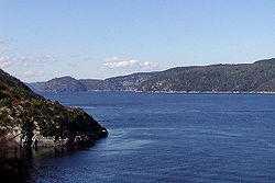
| 40 | Saguenay River Saguenay River The Saguenay River is a major river of Quebec, Canada.It drains Lac Saint-Jean in the Laurentian Highlands, leaving at Alma and running east, and passes the city of Saguenay. It drains into the Saint Lawrence River at Tadoussac.... |
Saint Lawrence River Saint Lawrence River The Saint Lawrence is a large river flowing approximately from southwest to northeast in the middle latitudes of North America, connecting the Great Lakes with the Atlantic Ocean. It is the primary drainage conveyor of the Great Lakes Basin... 48°07′59"N 69°43′59"W |
698 km 434 mi |
near Otish Mountains 52°16′17"N 70°48′38"W |
88,000 km2 34,000 mi2 |
1,750 m3/s 62,000 ft3/s |
Quebec Quebec Quebec or is a province in east-central Canada. It is the only Canadian province with a predominantly French-speaking population and the only one whose sole official language is French at the provincial level.... |
 |
| 41 | Anderson River Anderson River (Northwest Territories) The Anderson River is in the Northwest Territories in northern Canada. It originates in lakes north of Great Bear Lake; its headwaters are in the vicinity of the hamlet of Colville Lake . It flows north and west in the area between the Mackenzie and Coppermine Rivers... |
Beaufort Sea Beaufort Sea The Beaufort Sea is a marginal sea of the Arctic Ocean, located north of the Northwest Territories, the Yukon, and Alaska, west of Canada's Arctic islands. The sea is named after hydrographer Sir Francis Beaufort... 69°43′00"N 129°00′09"W |
692 km 430 mi |
northwest of Great Bear Lake Great Bear Lake Great Bear Lake is the largest lake entirely within Canada , the third or fourth largest in North America, and the seventh or eighth largest in the world... 66°57′00"N 124°36′00"W |
142 m3/s 5,000 ft3/s |
Northwest Territories Northwest Territories The Northwest Territories is a federal territory of Canada.Located in northern Canada, the territory borders Canada's two other territories, Yukon to the west and Nunavut to the east, and three provinces: British Columbia to the southwest, and Alberta and Saskatchewan to the south... |
||
| 42 | Peel River Peel River (Canada) The Peel River is a tributary of the Mackenzie River in the Yukon and Northwest Territories in Canada. Its source is in the Ogilvie Mountains in the central Yukon at the confluence of the Ogilvie River and Blackstone River... |
Mackenzie River Mackenzie River The Mackenzie River is the largest river system in Canada. It flows through a vast, isolated region of forest and tundra entirely within the country's Northwest Territories, although its many tributaries reach into four other Canadian provinces and territories... 67°41′49"N 134°31′58"W |
684 km 425 mi |
Gill Lake 65°19′00"N 139°49′00"W |
73,600 km2 28,400 mi2 |
103 m3/s 3,600 ft3/s |
Yukon Yukon Yukon is the westernmost and smallest of Canada's three federal territories. It was named after the Yukon River. The word Yukon means "Great River" in Gwich’in.... , Northwest Territories Northwest Territories The Northwest Territories is a federal territory of Canada.Located in northern Canada, the territory borders Canada's two other territories, Yukon to the west and Nunavut to the east, and three provinces: British Columbia to the southwest, and Alberta and Saskatchewan to the south... |
|
| 43 | Saint John River | Bay of Fundy Bay of Fundy The Bay of Fundy is a bay on the Atlantic coast of North America, on the northeast end of the Gulf of Maine between the Canadian provinces of New Brunswick and Nova Scotia, with a small portion touching the U.S. state of Maine... 45°16′00"N 66°04′00"W |
673 km 418 mi |
Somerset County Somerset County, Maine Somerset County is a county located in the U.S. state of Maine. As of 2010, the population was 52,228. Its county seat is Skowhegan.-History:... 46°33′47"N 69°53′05"W |
55,200 km2 21,300 mi2 |
1,130 m3/s 40,000 ft3/s |
Maine Maine Maine is a state in the New England region of the northeastern United States, bordered by the Atlantic Ocean to the east and south, New Hampshire to the west, and the Canadian provinces of Quebec to the northwest and New Brunswick to the northeast. Maine is both the northernmost and easternmost... , New Brunswick New Brunswick New Brunswick is one of Canada's three Maritime provinces and is the only province in the federation that is constitutionally bilingual . The provincial capital is Fredericton and Saint John is the most populous city. Greater Moncton is the largest Census Metropolitan Area... |
 |
| 44 | Stewart River Stewart River The Stewart River is a long river in the Yukon Territory of Canada. It originates in the Selwyn Mountains, which stand on the border between the Northwest Territories and the Yukon Territory. From there, the Stewart flows west, past the village of Mayo... |
Yukon River Yukon River The Yukon River is a major watercourse of northwestern North America. The source of the river is located in British Columbia, Canada. The next portion lies in, and gives its name to Yukon Territory. The lower half of the river lies in the U.S. state of Alaska. The river is long and empties into... 63°17′30"N 139°24′42"W |
644 km 400 mi |
Selwyn Mountains Selwyn Mountains The Selwyn Mountains are a mountain range in northern Canada, forming part of the border between the Yukon Territory and the Northwest Territories, and which are part of the Eastern System of the Canadian Cordillera . They are neighboured on the east by the Mackenzie Mountains and on their... 64°06′35"N 131°42′25"W |
51,000 km2 20,000 mi2 |
675 m3/s 23,800 ft3/s |
Yukon Yukon Yukon is the westernmost and smallest of Canada's three federal territories. It was named after the Yukon River. The word Yukon means "Great River" in Gwich’in.... |
|
| 45 | Horton River Horton River (Canada) The Horton River is a river in Inuvik and Sahtu Regions, Northwest Territories and Kitikmeot Region, Nunavut, Canada. It is a tributary of the Beaufort Sea and hence part of the Arctic Ocean drainage basin. Only the first few kilometres from its source are within Nunavut.-Course:The river begins at... |
Franklin Bay Franklin Bay Franklin Bay is a large inlet in the Northwest Territories, Canada. It is a southern arm of the Amundsen Gulf, southeastern Beaufort Sea. The bay measures long, and wide at its mouth. The Parry Peninsula is to the east, and its southern area is called Langton Bay.Franklin Bay receives the... 69°56′00"N 126°48′09"W |
618 km 384 mi |
Kitikmeot Region, Nunavut Kitikmeot Region, Nunavut Kitikmeot Region is an administrative region of Nunavut, Canada. It consists of the southern and eastern parts of Victoria Island with the adjacent part of the mainland as far as the Boothia Peninsula, together with King William Island and the southern portion of Prince of Wales Island... 67°51′00"N 120°33′00"W |
26,680 km2 10,300 mi2 |
Nunavut Nunavut Nunavut is the largest and newest federal territory of Canada; it was separated officially from the Northwest Territories on April 1, 1999, via the Nunavut Act and the Nunavut Land Claims Agreement Act, though the actual boundaries had been established in 1993... , Northwest Territories Northwest Territories The Northwest Territories is a federal territory of Canada.Located in northern Canada, the territory borders Canada's two other territories, Yukon to the west and Nunavut to the east, and three provinces: British Columbia to the southwest, and Alberta and Saskatchewan to the south... |
||
| 46 | English River English River (Ontario) The English River flows through Lac Seul to join the Winnipeg River. The river is 615 km in length. There are several hydroelectric plants on this river.Tributaries of this river include the Vermilion River and the Wabigoon River... |
Winnipeg River Winnipeg River The Winnipeg River is a Canadian river which flows from Lake of the Woods in the province of Ontario to Lake Winnipeg in Manitoba. This river is long from the Norman Dam in Kenora to its mouth at Lake Winnipeg. Its watershed is in area, mainly in Canada. About of this area is in northern... 50°12′04"N 95°00′12"W |
615 km 382 mi |
near Marmion Lake 49°06′00"N 91°16′00"W |
52,300 km2 20,200 mi2 |
Ontario Ontario Ontario is a province of Canada, located in east-central Canada. It is Canada's most populous province and second largest in total area. It is home to the nation's most populous city, Toronto, and the nation's capital, Ottawa.... |
||
| 47 | Pelly River Pelly River The Pelly River is a river in Canada, and is a headstream of the Yukon River. The river originates west of the Mackenzie Mountains and flows 530 km long through the south central Yukon. The Pelly has two main tributaries, the Ross and Macmillan rivers.The river was named by Robert Campbell in... |
Yukon River Yukon River The Yukon River is a major watercourse of northwestern North America. The source of the river is located in British Columbia, Canada. The next portion lies in, and gives its name to Yukon Territory. The lower half of the river lies in the U.S. state of Alaska. The river is long and empties into... 62°46′46"N 137°20′13"W |
608 km 378 mi |
Mackenzie Mountains Mackenzie Mountains The Mackenzie Mountains are a mountain range forming part of the Yukon-Northwest Territories boundary between the Liard and Peel rivers. The range is named in honour of Canada's second Prime Minister Alexander Mackenzie. Nahanni National Park Reserve is in the Mackenzie Mountains.The Mackenzie... 62°49′00"N 129°53′00"W |
51,000 km2 20,000 mi2 |
410 m3/s 14,000 ft3/s |
Yukon Yukon Yukon is the westernmost and smallest of Canada's three federal territories. It was named after the Yukon River. The word Yukon means "Great River" in Gwich’in.... |
 |
Map
Works cited
- Benke, Arthur C., ed., and Cushing, Colbert E., ed. Rivers of North America. Burlington, Massachusetts: Elsevier Academic Press. ISBN 0-12-088253-1.