
.gif)
Interstate 215 (Nevada)
Encyclopedia
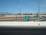
The Las Vegas Beltway is the name of the 53 miles (85.3 km) beltway route circling three-quarters of the Las Vegas Valley in southern Nevada
. The Las Vegas Beltway carries two numerical designations. Approximately 13 miles (20.9 km) of the beltway, from its southern terminus at Interstate 515/U.S. Route 93/U.S. Route 95 in Henderson
northwest to Interstate 15, is designated Interstate 215 (I-215). Clark County Route 215 (CC 215) composes the remaining 40 miles (64.4 km) of the highway
.
The Las Vegas Beltway currently consists of two different road types: freeway and a limited access expressway
. The beltway is currently a freeway from the I-515 interchange
in Henderson to just north of Cheyenne Avenue in western Las Vegas
. The remainder of the beltway is primarily expressway, with several expressway sections currently being upgraded to Interstate Highway standards
.
Construction of the Beltway was initially planned and constructed by Clark County
. This marked the first time in the United States
that a county has overseen the construction of an Interstate highway with little to no state or federal funding. Once completely upgraded to freeway, it is anticipated that the CC 215 portion of the beltway will be designated I-215 and the entire facility turned over to the Nevada Department of Transportation
for maintenance (currently, NDOT only maintains the beltway from I-515 to Stephanie Street and Warm Springs Road to I-15).
 The Las Vegas Beltway begins in Henderson, at the I-515/US 93/US 95 interchange, where traffic on westbound State Route 564
(Lake Mead Parkway) defaults onto I-215 west. From here, the beltway primarily follows the former Lake Mead Drive alignment west to the Pecos Road/Saint Rose Parkway (SR 146
) interchange. The highway then curves northwest towards McCarran International Airport
before intersecting Las Vegas Boulevard
and I-15.
As the beltway passes under I-15, it changes from Interstate to county highway
still maintaining freeway status as it heads due west. Passing Decatur Boulevard
, two one-way frontage road
s (which formerly carried the initial beltway facilities) appear on either side of the highway. At Durango Drive, the roadway curves northward. The frontage roads end at as the highway reaches Tropicana Avenue, but the freeway continues west and then north to intersect Charleston Boulevard (SR 159) near Red Rock Canyon
.
The beltway downgrades from freeway to an expressway (with some grade separations) as it passes the Cheyenne Avenue interchange. From here, the road continues north along the western foothills of Las Vegas to pass behind Lone Mountain. Soon afterward, the highway curves east and intersects US 95 before entering northern North Las Vegas
. Much of the final few miles of the route are in undeveloped land, with intersections existing primarily as turnarounds, until the beltway reaches its ending terminus at I-15 just south of the Las Vegas Motor Speedway
.
to US 95 (I-515) on April 17, 1993.
 Much of the beltway was built completely with local funds, and expressway upgrades have continued to be built without state or federal money (except for the I-515 interchange upgrade). A tax measure voted on by the County residents increased funding for the beltway. As a result, it is expected to be fully upgraded to a freeway by 2013, rather than the previous goal of 2025.
The first section of I-215 opened to traffic in 1996 from I-15 to Warm Springs Road, including the airport tunnel, linking McCarran International Airport to South Las Vegas without using Tropicana Avenue or Russell Road to access the airport. The south end of the beltway was completed ahead of schedule in 1999, while the north end was extended from Decatur Boulevard
in 1998 to Tropicana Avenue by 2000, with remaining sections of the beltway completed by 2002, either as a full freeway or frontage roads.
I-215 was built on the State Route 146 alignment between Exit 6 (Saint Rose Parkway/Pecos Road) and Mile 0 (the Interstate 515/U.S. Route 93/U.S. Route 95 interchange), formerly known as Lake Mead Drive. Since the Nevada Department of Transportation
(NDOT) does not co-sign state routes along Interstate highways, SR 146 was truncated to its current eastern terminus at I-215. SR 146 was co-signed with I-215 from Pecos Road to I-515/US 93/US 95, even though the state highway designation no longer existed in this section when the freeway was completed. Some SR 146 signs were still remaining on I-215 as of July 27, 2008.
In 2003, the entire 53 miles (85.3 km) long beltway was opened with the beltway consisting of three different road types: freeway, a limited access expressway
, and as a frontage road
with all three as sections of County highway
215. On August 9, 2006 a section of freeway was completed that allowed the connection of previously completed freeway sections that covered about half of the roads length from the SR 564
terminus to Charleston Boulevard.
Roads & Bridges magazine, a national publication that provides the latest technology news and information to the Transportation Construction industry, named the Las Vegas Beltway as one of the nation's Top Ten Road Projects in 2002.
At the Board of County Commission meeting on March 2, 2004, the road was renamed as the Bruce Woodbury Beltway. The Board approved a resolution recognizing Commissioner Woodbury
for his many years and efforts in the future of transportation in the valley.
Nevada
Nevada is a state in the western, mountain west, and southwestern regions of the United States. With an area of and a population of about 2.7 million, it is the 7th-largest and 35th-most populous state. Over two-thirds of Nevada's people live in the Las Vegas metropolitan area, which contains its...
. The Las Vegas Beltway carries two numerical designations. Approximately 13 miles (20.9 km) of the beltway, from its southern terminus at Interstate 515/U.S. Route 93/U.S. Route 95 in Henderson
Henderson, Nevada
-Demographics:According to the 2000 census, there were 175,381 people, 66,331 households, and 47,095 families residing in the city. The population density was 2,200.8 people per square mile . There were 71,149 housing units at an average density of 892.8 per square mile...
northwest to Interstate 15, is designated Interstate 215 (I-215). Clark County Route 215 (CC 215) composes the remaining 40 miles (64.4 km) of the highway
Highway
A highway is any public road. In American English, the term is common and almost always designates major roads. In British English, the term designates any road open to the public. Any interconnected set of highways can be variously referred to as a "highway system", a "highway network", or a...
.
The Las Vegas Beltway currently consists of two different road types: freeway and a limited access expressway
Limited-access road
A limited-access road known by various terms worldwide, including limited-access highway, dual-carriageway and expressway, is a highway or arterial road for high-speed traffic which has many or most characteristics of a controlled-access highway , including limited or no access to adjacent...
. The beltway is currently a freeway from the I-515 interchange
Interchange (road)
In the field of road transport, an interchange is a road junction that typically uses grade separation, and one or more ramps, to permit traffic on at least one highway to pass through the junction without directly crossing any other traffic stream. It differs from a standard intersection, at which...
in Henderson to just north of Cheyenne Avenue in western Las Vegas
Las Vegas, Nevada
Las Vegas is the most populous city in the U.S. state of Nevada and is also the county seat of Clark County, Nevada. Las Vegas is an internationally renowned major resort city for gambling, shopping, and fine dining. The city bills itself as The Entertainment Capital of the World, and is famous...
. The remainder of the beltway is primarily expressway, with several expressway sections currently being upgraded to Interstate Highway standards
Interstate Highway standards
Standards for Interstate Highways in the United States are defined by the American Association of State Highway and Transportation Officials in the publication A Policy on Design Standards - Interstate System...
.
Construction of the Beltway was initially planned and constructed by Clark County
Clark County, Nevada
-Demographics:As of the census of 2000, there were 1,375,765 people, 512,253 households, and 339,693 families residing within the MSA. The racial makeup of the MSA was 71.6% White , 9.1% Black, 5.7% Asian, 0.8% American Indian and 12.8% of other or mixed race. 22.0% were Hispanic of any race...
. This marked the first time in the United States
United States
The United States of America is a federal constitutional republic comprising fifty states and a federal district...
that a county has overseen the construction of an Interstate highway with little to no state or federal funding. Once completely upgraded to freeway, it is anticipated that the CC 215 portion of the beltway will be designated I-215 and the entire facility turned over to the Nevada Department of Transportation
Nevada Department of Transportation
The Nevada Department of Transportation is a government agency in the U.S. state of Nevada. NDOT is responsible for maintaining and improving Nevada's highway system, which includes U.S. highways and Interstate highways within the state's boundaries. The department is notable for its...
for maintenance (currently, NDOT only maintains the beltway from I-515 to Stephanie Street and Warm Springs Road to I-15).
Route description
Nevada State Route 564
State Route 564 is an east–west highway in Henderson, Nevada connecting the southern Las Vegas area to Lake Mead. The route is known as Lake Mead Parkway.-Route description:...
(Lake Mead Parkway) defaults onto I-215 west. From here, the beltway primarily follows the former Lake Mead Drive alignment west to the Pecos Road/Saint Rose Parkway (SR 146
Nevada State Route 146
State Route 146 is a major east–west route in Southern Nevada. It begins at the Exit 27 interchange on Interstate 15 south of the Las Vegas Strip and ends at the Pecos Road interchange on Interstate 215 in Henderson...
) interchange. The highway then curves northwest towards McCarran International Airport
McCarran International Airport
McCarran International Airport is the principal commercial airport serving Las Vegas and Clark County, Nevada, United States. The airport is located five miles south of the central business district of Las Vegas, in the unincorporated area of Paradise in Clark County. It covers an area of and...
before intersecting Las Vegas Boulevard
Las Vegas Boulevard
State Route 604 is the route number designation for parts of Las Vegas Boulevard, a major north–south road in the Las Vegas metropolitan area of Nevada in the United States best known for the Las Vegas Strip and its casinos. Formerly carrying U.S...
and I-15.
As the beltway passes under I-15, it changes from Interstate to county highway
County highway
A county highway is a road in the United States and in the Canadian province of Ontario that is designated and/or maintained by the county highway department...
still maintaining freeway status as it heads due west. Passing Decatur Boulevard
Decatur Boulevard
Decatur Boulevard is a major north-south section line arterial in the Las Vegas metropolitan area located on the west side of the city.-Route:...
, two one-way frontage road
Frontage road
A frontage road is a non-limited access road running parallel to a higher-speed road, usually a freeway, and feeding it at appropriate points of access...
s (which formerly carried the initial beltway facilities) appear on either side of the highway. At Durango Drive, the roadway curves northward. The frontage roads end at as the highway reaches Tropicana Avenue, but the freeway continues west and then north to intersect Charleston Boulevard (SR 159) near Red Rock Canyon
Red Rock Canyon National Conservation Area
Red Rock Canyon National Conservation Area in Nevada is an area managed by the Bureau of Land Management as part of its National Landscape Conservation System, and protected as a National Conservation Area. It is located about west of Las Vegas, and easily seen from the Las Vegas Strip...
.
The beltway downgrades from freeway to an expressway (with some grade separations) as it passes the Cheyenne Avenue interchange. From here, the road continues north along the western foothills of Las Vegas to pass behind Lone Mountain. Soon afterward, the highway curves east and intersects US 95 before entering northern North Las Vegas
North Las Vegas, Nevada
North Las Vegas is a city in Clark County, Nevada, United States, located in the Las Vegas metropolitan area. The city was incorporated on May 16, 1946.-Geography:...
. Much of the final few miles of the route are in undeveloped land, with intersections existing primarily as turnarounds, until the beltway reaches its ending terminus at I-15 just south of the Las Vegas Motor Speedway
Las Vegas Motor Speedway
Las Vegas Motor Speedway, located in Clark County, Nevada near Las Vegas, is a complex of multiple tracks for automobile racing. The complex is owned by Speedway Motorsports, Inc., which is headquartered in Charlotte, North Carolina.-History:...
.
History
AASHTO approved the I-215 designation for 18.9 miles (30.4 km) of (then unbuilt) highway, from Tropicana AvenueTropicana Avenue
Tropicana Avenue is a major east–west section line arterial in the Las Vegas area. The road is named after the Tropicana Resort & Casino which is located on the Las Vegas Boulevard where it intersects with Tropicana Avenue. Part of it is signed as Nevada State Route 593.-Route description:SR...
to US 95 (I-515) on April 17, 1993.
The first section of I-215 opened to traffic in 1996 from I-15 to Warm Springs Road, including the airport tunnel, linking McCarran International Airport to South Las Vegas without using Tropicana Avenue or Russell Road to access the airport. The south end of the beltway was completed ahead of schedule in 1999, while the north end was extended from Decatur Boulevard
Decatur Boulevard
Decatur Boulevard is a major north-south section line arterial in the Las Vegas metropolitan area located on the west side of the city.-Route:...
in 1998 to Tropicana Avenue by 2000, with remaining sections of the beltway completed by 2002, either as a full freeway or frontage roads.
I-215 was built on the State Route 146 alignment between Exit 6 (Saint Rose Parkway/Pecos Road) and Mile 0 (the Interstate 515/U.S. Route 93/U.S. Route 95 interchange), formerly known as Lake Mead Drive. Since the Nevada Department of Transportation
Nevada Department of Transportation
The Nevada Department of Transportation is a government agency in the U.S. state of Nevada. NDOT is responsible for maintaining and improving Nevada's highway system, which includes U.S. highways and Interstate highways within the state's boundaries. The department is notable for its...
(NDOT) does not co-sign state routes along Interstate highways, SR 146 was truncated to its current eastern terminus at I-215. SR 146 was co-signed with I-215 from Pecos Road to I-515/US 93/US 95, even though the state highway designation no longer existed in this section when the freeway was completed. Some SR 146 signs were still remaining on I-215 as of July 27, 2008.
In 2003, the entire 53 miles (85.3 km) long beltway was opened with the beltway consisting of three different road types: freeway, a limited access expressway
Limited-access road
A limited-access road known by various terms worldwide, including limited-access highway, dual-carriageway and expressway, is a highway or arterial road for high-speed traffic which has many or most characteristics of a controlled-access highway , including limited or no access to adjacent...
, and as a frontage road
Frontage road
A frontage road is a non-limited access road running parallel to a higher-speed road, usually a freeway, and feeding it at appropriate points of access...
with all three as sections of County highway
County highway
A county highway is a road in the United States and in the Canadian province of Ontario that is designated and/or maintained by the county highway department...
215. On August 9, 2006 a section of freeway was completed that allowed the connection of previously completed freeway sections that covered about half of the roads length from the SR 564
Nevada State Route 564
State Route 564 is an east–west highway in Henderson, Nevada connecting the southern Las Vegas area to Lake Mead. The route is known as Lake Mead Parkway.-Route description:...
terminus to Charleston Boulevard.
Roads & Bridges magazine, a national publication that provides the latest technology news and information to the Transportation Construction industry, named the Las Vegas Beltway as one of the nation's Top Ten Road Projects in 2002.
At the Board of County Commission meeting on March 2, 2004, the road was renamed as the Bruce Woodbury Beltway. The Board approved a resolution recognizing Commissioner Woodbury
Bruce L. Woodbury
Bruce L. Woodbury is a politician and lawyer in Nevada, currently residing in Boulder City.Bruce graduated from Las Vegas High School, the University of Utah and Stanford School of Law....
for his many years and efforts in the future of transportation in the valley.