
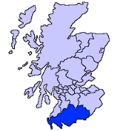
Dumfries and Galloway
Encyclopedia
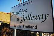
Dumfries and Galloway is one of 32 unitary council areas of Scotland
. It was one of the nine administrative 'regions' of mainland Scotland created in 1975 by the Local Government etc. (Scotland) Act 1973. It resulted from a union of the historic region of Galloway
- consisting of the counties of Wigtownshire
and Kirkcudbrightshire
- and the County of Dumfries (Dumfries-shire), hence "Dumfries and Galloway". The regions were abolished by the Local Government etc. (Scotland) Act 1994
and Dumfries and Galloway became one of the new council areas in 1996.
To the north, the council borders South Ayrshire
, East Ayrshire
and South Lanarkshire
; in the east the Borders
; and to the south the county of Cumbria
in England. It lies to the north of the Solway Firth
and to the east of the Irish Sea
. The region is well-known for its many artists and writers.
From west to east:
The term 'Dumfries and Galloway' has been used since at latest the 19th century - by 1911 the three counties had a united Sheriffdom
under that name. Dumfries and Galloway covers the majority of the Western area of the Southern Uplands
http://www.visitsouthernscotland.com/, it also hosts Scotland's most Southerly point, at the Mull of Galloway
in the west of the region.
The A701 branches off the M74 at Beattock
, goes through the town of Moffat
, climbs to Annanhead above the Devil's Beef Tub
(at the source of the River Annan) before passing the source of the River Tweed and carrying on to Edinburgh
. Until fairly recent times the ancient route to Edinburgh travelled right up Annandale to the Beef Tub before climbing steeply to Annanhead. The present road ascends northward on a ridge parallel to Annandale but to the west of it which makes for a much easier ascent.
From Moffat the A708 heads north east along the valley of Moffat Water (Moffatdale) on its way to Selkirk. Moffatdale separates the Moffat hills (to the north) from the Ettrick hills to the south.
s within this region.
, Kirkcudbrightshire
and Dumfriesshire
as a two-tier region with the districts of Wigtownshire, Stewartry, Nithsdale and Annandale and Eskdale within it. In 1996 the region became a unitary authority area and the districts were wound up. After 1996 the unitary authority became known as Dumfries and Galloway Council, instead of Dumfries and Galloway Regional Council.
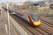 The region has 7 working railway stations. All are on the Glasgow South Western Line
, except Lockerbie
which is on the West Coast Main Line
.
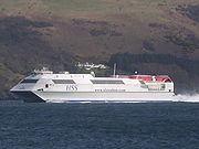 Dumfries and Galloway is home to two ports which have services to Northern Ireland, both are in the West of the region. Stena Line
have a port in the town of Stranraer
, and P&O Irish Sea
in the village of Cairnryan
.
The town of Lockerbie
was the scene of the Pan Am Flight 103
terrorist attack on December 21, 1988.
is the police force for the region, and is the smallest in the United Kingdom. Dumfries and Galloway Fire and Rescue Service
provide firefighting services across the region. The Coastguard, Lifeboats
, Moffat mountain rescue and Galloway Mountain Rescue also offer emergency services across Dumfries and Galloway.
NHS Dumfries and Galloway
provide healthcare services across the region. The two main hospitals are the Dumfries and Galloway Royal Infirmary
in Dumfries and Galloway Community Hospital
in Stranraer.
and the Great crested newt
. There are also RSPB Nature Reserves at the Mull of Galloway
, Wood of Cree (Galloway Forest Park
), Ken Dee Marshes (near Loch Ken
) and Mereshead (near Dalbeattie
on the Solway Firth
)
s elected for a four-year term from 13 wards. These wards were introduced for the 2007 election and each returns three or four members by the single transferable vote
system of election. This system was introduced by the Local Governance (Scotland) Act 2004
, as a means of ensuring a reasonably proportionately representative
outcome.
The council is currently controlled by a Conservative and Liberal Democrat minority coalition.
After the resignation of Bruce Hodgson (Conservative councillor for the Abbey ward) a by-election was held on 1 May 2008, with Michael Thomson (Conservative) being returned as the replacement councillor. On Tuesday 20 May 2008, Councillor Robert Higgins stood down as Scottish National Party
(SNP) Group Leader, after he received a triple driving ban for reckless driving. Similarly Councillor John Charteris Conservative was banned from driving for 12 months and fined £500 after he to admitted drink driving at Dumfries Sheriff Court on Friday, 29 August 2008 http://news.bbc.co.uk/1/hi/scotland/south_of_scotland/7588043.stm
Scotland
Scotland is a country that is part of the United Kingdom. Occupying the northern third of the island of Great Britain, it shares a border with England to the south and is bounded by the North Sea to the east, the Atlantic Ocean to the north and west, and the North Channel and Irish Sea to the...
. It was one of the nine administrative 'regions' of mainland Scotland created in 1975 by the Local Government etc. (Scotland) Act 1973. It resulted from a union of the historic region of Galloway
Galloway
Galloway is an area in southwestern Scotland. It usually refers to the former counties of Wigtownshire and Kirkcudbrightshire...
- consisting of the counties of Wigtownshire
Wigtownshire
Wigtownshire or the County of Wigtown is a registration county in the Southern Uplands of south west Scotland. Until 1975, the county was one of the administrative counties used for local government purposes, and is now administered as part of the council area of Dumfries and Galloway...
and Kirkcudbrightshire
Kirkcudbrightshire
The Stewartry of Kirkcudbright or Kirkcudbrightshire was a county of south-western Scotland. It was also known as East Galloway, forming the larger Galloway region with Wigtownshire....
- and the County of Dumfries (Dumfries-shire), hence "Dumfries and Galloway". The regions were abolished by the Local Government etc. (Scotland) Act 1994
Local Government etc. (Scotland) Act 1994
The Local Government etc. Act 1994 is an Act of the Parliament of the United Kingdom which created the current local government structure of 32 unitary authorities covering the whole of Scotland....
and Dumfries and Galloway became one of the new council areas in 1996.
To the north, the council borders South Ayrshire
South Ayrshire
South Ayrshire is one of 32 council areas of Scotland, covering the southern part of Ayrshire. It borders onto East Ayrshire, North Ayrshire and Dumfries and Galloway....
, East Ayrshire
East Ayrshire
East Ayrshire is one of 32 council areas of Scotland. It borders on to North Ayrshire, East Renfrewshire, South Lanarkshire, South Ayrshire and Dumfries and Galloway...
and South Lanarkshire
South Lanarkshire
South Lanarkshire is one of 32 unitary council areas of Scotland, covering the southern part of the former county of Lanarkshire. It borders the south-east of the city of Glasgow and contains many of Glasgow's suburbs, commuter towns and smaller villages....
; in the east the Borders
Scottish Borders
The Scottish Borders is one of 32 local government council areas of Scotland. It is bordered by Dumfries and Galloway in the west, South Lanarkshire and West Lothian in the north west, City of Edinburgh, East Lothian, Midlothian to the north; and the non-metropolitan counties of Northumberland...
; and to the south the county of Cumbria
Cumbria
Cumbria , is a non-metropolitan county in North West England. The county and Cumbria County Council, its local authority, came into existence in 1974 after the passage of the Local Government Act 1972. Cumbria's largest settlement and county town is Carlisle. It consists of six districts, and in...
in England. It lies to the north of the Solway Firth
Solway Firth
The Solway Firth is a firth that forms part of the border between England and Scotland, between Cumbria and Dumfries and Galloway. It stretches from St Bees Head, just south of Whitehaven in Cumbria, to the Mull of Galloway, on the western end of Dumfries and Galloway. The Isle of Man is also very...
and to the east of the Irish Sea
Irish Sea
The Irish Sea separates the islands of Ireland and Great Britain. It is connected to the Celtic Sea in the south by St George's Channel, and to the Atlantic Ocean in the north by the North Channel. Anglesey is the largest island within the Irish Sea, followed by the Isle of Man...
. The region is well-known for its many artists and writers.
Geography
The Dumfries and Galloway region is composed of several sub areas and former counties.From west to east:
- WigtownshireWigtownshireWigtownshire or the County of Wigtown is a registration county in the Southern Uplands of south west Scotland. Until 1975, the county was one of the administrative counties used for local government purposes, and is now administered as part of the council area of Dumfries and Galloway...
- Rhins of GallowayRhins of GallowayThe Rhins of Galloway is a hammer-head peninsula in Dumfries and Galloway, Scotland...
MacharsMacharsThe Machars is a peninsula in Galloway in the south-west of Scotland. The word is derived from the Gaelic word Machair meaning low lying or level land, known as "links" on the east coast of Scotland...
(archaically, Farines)
- Rhins of Galloway
- KirkcudbrightshireKirkcudbrightshireThe Stewartry of Kirkcudbright or Kirkcudbrightshire was a county of south-western Scotland. It was also known as East Galloway, forming the larger Galloway region with Wigtownshire....
- StewartryStewartryStewartry 1975-dateStewartry is a committee area in Dumfries and Galloway, Scotland.It was formerly one of four local government districts in the Dumfries and Galloway Region of Scotland....
(archaically, DesnesDesnesDesnes may refer to:*Desnes, a historical province in Scotland, roughly equivalent to southern Kirkcudbrightshire*Desnes, Jura, a commune in the French region of Franche-comtéSee also*Desne...
)
- Stewartry
- DumfriesshireDumfriesshireDumfriesshire or the County of Dumfries is a registration county of Scotland. The lieutenancy area of Dumfries has similar boundaries.Until 1975 it was a county. Its county town was Dumfries...
- NithsdaleNithsdaleNithsdale , also known by its anglicised gaelic name Strathnith or Stranit, is the valley of the River Nith in Scotland, and the name of the region...
Annandale EskdaleEskdale, Dumfries and GallowayEskdale is a glen in Dumfries and Galloway, Scotland. The River Esk flows through Eskdale to its estuary at the Solway Firth....
- Nithsdale
The term 'Dumfries and Galloway' has been used since at latest the 19th century - by 1911 the three counties had a united Sheriffdom
Sheriffdom
A sheriffdom is a judicial district in Scotland.Since 1 January 1975 there have been six sheriffdoms. Previously sheriffdoms were composed of groupings of counties...
under that name. Dumfries and Galloway covers the majority of the Western area of the Southern Uplands
Southern Uplands
The Southern Uplands are the southernmost and least populous of mainland Scotland's three major geographic areas . The term is used both to describe the geographical region and to collectively denote the various ranges of hills within this region...
http://www.visitsouthernscotland.com/, it also hosts Scotland's most Southerly point, at the Mull of Galloway
Mull of Galloway
The Mull of Galloway is the southernmost point of Scotland. It is situated in Wigtownshire, Dumfries and Galloway.A lighthouse is positioned at the point . Built in 1830 by engineer Robert Stevenson, the white-painted round tower is high...
in the west of the region.
Water systems and transport routes through the Southern Uplands
The region has a number of south running water systems which break through the Southern Uplands creating the main road, and rail, arteries north/south through the region and breaking the hills up into a number of ranges.- River CreeRiver CreeThe River Cree is a river in Dumfries and Galloway, Scotland which runs through Newton Stewart and into the Solway Firth. It forms part of the boundary between the counties of Wigtownshire and Kirkcudbrightshire....
valley carries the A714 north-westward from Newton StewartNewton StewartNewton Stewart is a burgh town in the south of Scotland in the west of the region of Dumfries and Galloway and in the county of Wigtownshire....
to GirvanGirvanGirvan is a burgh in Carrick, South Ayrshire, Scotland, with a population of about 8000 people. Originally a fishing port, it is now also a seaside resort with beaches and cliffs. Girvan dates back to 1668 when is became a municipal burgh incorporated by by charter...
and Water of Minnoch valley which lies just west of the Galloway HillsGalloway HillsThe Galloway hills are part of the Southern Uplands of Scotland, and form the northern boundary of western Galloway. They lie within the bounds of Galloway Forest Park, an area of some of largely uninhabited wild land, managed by the Forestry Commission...
carries a minor road northward through Glentrool village into South AyrshireAyrshireAyrshire is a registration county, and former administrative county in south-west Scotland, United Kingdom, located on the shores of the Firth of Clyde. Its principal towns include Ayr, Kilmarnock and Irvine. The town of Troon on the coast has hosted the British Open Golf Championship twice in the...
. This road leaves the A714 at BargrennanBargrennanBargrennan is a village in Dumfries and Galloway, in the south west of Scotland, by the River Cree, on the A714 to Girvan, nine miles from Newton Stewart....
. - Water of KenWater of KenThe Water of Ken is a river in Galloway, south-west Scotland. It rises on Blacklorg Hill, north-east of Cairnsmore of Carsphairn in the Carsphairn hills, and flows south-westward into the Glenkens valley, passing through Carsfad and Earlstoun lochs, both of which are dammed to supply the Galloway...
and River DeeRiver Dee, GallowayThe River Dee, in south-west Scotland, flows from its source in Loch Dee amongst the Galloway Hills, firstly to Clatteringshaws Loch, then in to Loch Ken, where it joins the Water of Ken. From there, the Dee flows southwards to Kirkcudbright, and into Kirkcudbright Bay to reach the Solway. The...
form a corridor through the hills called the Glenkens which carries the A713 road from Castle DouglasCastle DouglasCastle Douglas , a town in the south of Scotland in Dumfries and Galloway, lies in the eastern part of Galloway known as the Stewartry, between the towns of Dalbeattie and Gatehouse of Fleet.-History:...
to AyrAyrAyr is a town and port situated on the Firth of Clyde in south-west Scotland. With a population of around 46,000, Ayr is the largest settlement in Ayrshire, of which it is the county town, and has held royal burgh status since 1205...
. The Galloway Hills lie to the west of this route through the hills and the Carsphairn and Scaur HillsCarsphairn and Scaur HillsThe Carsphairn and Scaur hills are the western and eastern hills respectively of a hill range in the Southern Uplands of Scotland. Ordnance Survey maps don't have a general name for the hill area as a whole. Also, Ordnance Survey use "Scar" rather than the local spelling of "Scaur" - the word is...
lie to the east. - River NithRiver NithThe River Nith is a river in South West Scotland.-Source, flow and mouth:The Nith rises in the Carsphairn hills of East Ayrshire, more precisely between Prickeny Hill and Enoch Hill, 7 km East of Dalmellington...
rises between DalmellingtonDalmellingtonDalmellington is a market town in Ayrshire, Scotland. In 2001 it had a population of 1407. The town owes its origins to the fault line separating the Southern Uplands of Scotland from the Central Lowlands...
and New CumnockNew CumnockNew Cumnock is a place in East Ayrshire, Scotland. It expanded during the coal mining era but, like so many others, suffered after the deep shaft pits closed in the 1980's...
in Ayrshire and runs east then south down NithsdaleNithsdaleNithsdale , also known by its anglicised gaelic name Strathnith or Stranit, is the valley of the River Nith in Scotland, and the name of the region...
to Dumfries. Nithsdale carries both the A76 roadA76 roadThe A76 is a major trunk road in south west Scotland.Starting at Kilmarnock in East Ayrshire, the A76 goes through or immediately by-passes Hurlford, Mauchline, Cumnock, Pathhead and New Cumnock before entering Dumfries and Galloway and continuing through Sanquhar, Mennock, Enterkinfoot,...
and the rail line from Dumfries to KilmarnockKilmarnockKilmarnock is a large burgh in East Ayrshire, Scotland, with a population of 44,734. It is the second largest town in Ayrshire. The River Irvine runs through its eastern section, and the Kilmarnock Water passes through it, giving rise to the name 'Bank Street'...
. It separates the Carsphairn and Scaur HillsCarsphairn and Scaur HillsThe Carsphairn and Scaur hills are the western and eastern hills respectively of a hill range in the Southern Uplands of Scotland. Ordnance Survey maps don't have a general name for the hill area as a whole. Also, Ordnance Survey use "Scar" rather than the local spelling of "Scaur" - the word is...
from the Lowther HillsLowther HillsThe Lowther Hills, also sometimes known as the Lowthers, are an extensive area of hill country in the Southern Uplands of Scotland, though some sub ranges of hills in this area also go under their own local names - see "Hill Walking" below. They form a roughly rhomboidal or lozenge shape on the map...
which lie east of the Nith. - River AnnanRiver AnnanThe River Annan is a river in southwest Scotland. It rises at the foot of Hart Fell, five miles north of Moffat. A second fork rises on Annanhead Hill and flows through the Devil's Beef Tub before joining at the Hart Fell fork north of Moffat.From there it flows past the town of Lockerbie, and...
combines with Evan Water and the River ClydeRiver ClydeThe River Clyde is a major river in Scotland. It is the ninth longest river in the United Kingdom, and the third longest in Scotland. Flowing through the major city of Glasgow, it was an important river for shipbuilding and trade in the British Empire....
to form one of the principal routes into central Scotland from England - through Annandale and ClydesdaleClydesdaleClydesdale was formerly one of nineteen local government districts in the Strathclyde region of Scotland.The district was formed by the Local Government Act 1973 from part of the former county of Lanarkshire: namely the burghs of Biggar and Lanark and the First, Second and Third Districts...
- carrying the M74 and the west coast railway lineWest Coast Main LineThe West Coast Main Line is the busiest mixed-traffic railway route in Britain, being the country's most important rail backbone in terms of population served. Fast, long-distance inter-city passenger services are provided between London, the West Midlands, the North West, North Wales and the...
. This gap through the hills separates the Lowthers from the Moffat HillsMoffat HillsThe Moffat hills are a range of hills in the Southern Uplands of Scotland. They form a distinctly triangular shape with a west facing side, a north facing side, and a south-east facing side. It is 17 kilometres from east to west across this triangle and some 16 kilometres north to south...
. - River EskRiver Esk, Dumfries and GallowayThe River Esk is a river in Dumfries and Galloway, Scotland, that flows into the Solway Firth. It also flows for a small way through the English county of Cumbria before entering the Solway....
enters the Solway FirthSolway FirthThe Solway Firth is a firth that forms part of the border between England and Scotland, between Cumbria and Dumfries and Galloway. It stretches from St Bees Head, just south of Whitehaven in Cumbria, to the Mull of Galloway, on the western end of Dumfries and Galloway. The Isle of Man is also very...
just south of Gretna having travelled south from LangholmLangholmLangholm , also known colloquially as the "Muckle Toon", is a burgh in Dumfries and Galloway, Scotland, on the River Esk and the A7 road.- History:...
and EskdalemuirEskdalemuir-External links:*...
. The A7 travels up EskdaleEskdale, Dumfries and GallowayEskdale is a glen in Dumfries and Galloway, Scotland. The River Esk flows through Eskdale to its estuary at the Solway Firth....
as far as Langholm and from Langholm carries on up the valley of Ewes Water to TeviotheadTeviotheadTeviothead is a small village and civil parish in Teviotdale in the Scottish Borders, known locally as Teviotheed. It is located south of the River Teviot....
where it starts to follow the River TeviotRiver TeviotThe River Teviot, or Teviot Water, is a river of the Scottish Borders area of Scotland, and a tributary of the River Tweed.It rises in the western foothills of Comb Hill on the border of Dumfries and Galloway...
to HawickHawickHawick is a town in the Scottish Borders of south east Scotland. It is south-west of Jedburgh and south-southeast of Selkirk. It is one of the farthest towns from the sea in Scotland, in the heart of Teviotdale, and the biggest town in the former county of Roxburghshire. Hawick's architecture is...
. Eskdale itself heads north west from Langholm through Bentpath and Eskdalemuir to EttrickEttrick, ScotlandEttrick is a small village and civil parish in the Scottish Borders area of Scotland, located around south-west of the town of Selkirk.-Local area:...
and Selkirk.
The A701 branches off the M74 at Beattock
Beattock
The village of Beattock is located in the southern lowlands of Scotland, and lies within the administrative area of Dumfries and Galloway. It is surrounded by the parish of Kirkpatrick Juxta. It was an important stabling point for horses in the olden days with a coach house at one end of the village...
, goes through the town of Moffat
Moffat
Moffat is a former burgh and spa town in Dumfries and Galloway, Scotland, lying on the River Annan, with a population of around 2,500. The most notable building in the town is the Moffat House Hotel, designed by John Adam...
, climbs to Annanhead above the Devil's Beef Tub
Devil's Beef Tub
The Devil's Beef Tub is a deep, dramatic hollow in the hills north of the Scottish town of Moffat. The 500-foot deep hollow is formed by four hills, Great Hill , Peat Knowe, Annanhead Hill, and Ericstane Hill. It is one of the two main sources of the River Annan; the other is from the...
(at the source of the River Annan) before passing the source of the River Tweed and carrying on to Edinburgh
Edinburgh
Edinburgh is the capital city of Scotland, the second largest city in Scotland, and the eighth most populous in the United Kingdom. The City of Edinburgh Council governs one of Scotland's 32 local government council areas. The council area includes urban Edinburgh and a rural area...
. Until fairly recent times the ancient route to Edinburgh travelled right up Annandale to the Beef Tub before climbing steeply to Annanhead. The present road ascends northward on a ridge parallel to Annandale but to the west of it which makes for a much easier ascent.
From Moffat the A708 heads north east along the valley of Moffat Water (Moffatdale) on its way to Selkirk. Moffatdale separates the Moffat hills (to the north) from the Ettrick hills to the south.
National Scenic Areas
There are three National Scenic AreaNational Scenic Area
National Scenic Area is a designation for areas of natural beauty used by more than one nation.* National Scenic Area * National Scenic Area * National scenic areas in Taiwan* National Scenic Area...
s within this region.
- Nith Estuary - This area follows the River Nith southward from just south of Dumfries into the Solway Firth. Dumfries itself has a rich history going back over 800 years as a Royal Burgh (1186) and is particularly remembered as the place where Robert the BruceRobert I of ScotlandRobert I , popularly known as Robert the Bruce , was King of Scots from March 25, 1306, until his death in 1329.His paternal ancestors were of Scoto-Norman heritage , and...
murdered the Red ComynJohn III Comyn, Lord of BadenochJohn III Comyn, Lord of Badenoch and Lord of Lochaber or John "the Red", also known simply as the Red Comyn was a Scottish nobleman who was an important figure in the Wars of Scottish Independence, and was Guardian of Scotland during the Second Interregnum 1296-1306...
in 1306 before being crowned King of Scotland - and where Robert BurnsRobert BurnsRobert Burns was a Scottish poet and a lyricist. He is widely regarded as the national poet of Scotland, and is celebrated worldwide...
spent his last years. His mausoleum is in St Michael's graveyard. Going down the east bank there is the village of GlencapleGlencapleGlencaple is a small settlement in the Dumfries and Galloway area of Scotland. Situated on the banks of the River Nith, it once served as a port for nearby Dumfries. Dumfries F.C. play their home matches at Norfolk Park in Glencaple....
, Caerlaverock CastleCaerlaverock CastleCaerlaverock Castle is a moated triangular castle, built in the 13th century, in the Caerlaverock National Nature Reserve area at the Solway Firth, south of Dumfries in the southwest of Scotland. In the Middle Ages it was owned by the Maxwell family. Today, the castle is in the care of Historic...
, Caerlaverock Wild Fowl TrustWWT CaerlaverockWWT Caerlaverock is wetland nature reserve in southwest Scotland, one of nine reserves in Britain operated by the Wildfowl and Wetlands Trust founded by Sir Peter Scott....
, an ancient Roman fort on Ward Law Hill and neaby in RuthwellRuthwellRuthwell is a village and parish on the Solway Firth between Dumfries and Annan in Dumfries and Galloway, Scotland.Ruthwell's most famous inhabitant was the Rev. Dr. Henry Duncan. He was a minister, author, antiquarian, geologist, publisher, philanthropist, artist and businessman.In 1810, Dr...
is the Ruthwell CrossRuthwell CrossThe Ruthwell Cross is a stone Anglo-Saxon cross probably dating from the 8th century, when Ruthwell was part of the Anglo-Saxon kingdom of Northumbria; it is now in Scotland. Anglo-Saxon crosses are closely related to the contemporary Irish high crosses, and both are part of the Insular art tradition...
and the Brow Well where Robert Burns "took the waters" and bathed in the Solway just before his death. On the west bank, there are several walks and cycle routes in Mabie Forest, Kirkconnell Flow for the naturalist, the National Museum of Costume just outside New AbbeyNew AbbeyNew Abbey is a village in Dumfries and Galloway, south-west Scotland. It is around south-west of Dumfries. The summit of the prominent hill Criffel is to the south....
and Sweetheart AbbeySweetheart AbbeySweetheart Abbey , south of Dumfries, near to the Nith in south-west Scotland, was a Cistercian monastery, founded in 1275 by Dervorguilla of Galloway, daughter of Alan, Lord of Galloway, in memory of her husband John de Balliol...
within the village. CriffelCriffelCriffel is a hill in southern Galloway, Scotland. It is 570 metres high but appears higher because of its great isolation and high relative height — it is the eighth most prominent hill in Southern Scotland...
(569 metres) offers the hill walker a reasonably modest walk with excellent views across the Solway to the Lake DistrictLake DistrictThe Lake District, also commonly known as The Lakes or Lakeland, is a mountainous region in North West England. A popular holiday destination, it is famous not only for its lakes and its mountains but also for its associations with the early 19th century poetry and writings of William Wordsworth...
. The house of John Paul JonesJohn Paul JonesJohn Paul Jones was a Scottish sailor and the United States' first well-known naval fighter in the American Revolutionary War. Although he made enemies among America's political elites, his actions in British waters during the Revolution earned him an international reputation which persists to...
founder of the American Navy is also open to visitors near KirkbeanKirkbeanKirkbean is a small village and civil parish near the Solway Firth in Dumfries and Galloway, Scotland.Arbigland, an estate in Kirkbean parish, was the birthplace of American naval commander John Paul Jones....
. - East StewartryKirkcudbrightshireThe Stewartry of Kirkcudbright or Kirkcudbrightshire was a county of south-western Scotland. It was also known as East Galloway, forming the larger Galloway region with Wigtownshire....
- This takes in the coast line from Balcary Point eastward across Auchencairn Bay and the Rough FirthRough FirthRough Firth is an inlet on the northern coast of the Solway Firth in Dumfries and Galloway, Scotland.Rough Firth lies between Almorness Point and Castlehill Point. It contains Rough Island. The village of Kippford stands near the head of the firth where the Urr Water reaches the sea; the only other...
past SandyhillsSandyhillsSandyhills is a district in the Scottish city of Glasgow. It is situated north of the River Clyde.It is in close proximity to other districts of Glasgow namely Mount Vernon and Baillieston....
to Mersehead. There are several attractive coastal villages within this area - AuchencairnAuchencairnAuchencairn is a village in Dumfries and Galloway, Scotland. It is located on the coast of the Solway Firth at the head of Auchencairn Bay and lies on the A711 road between the town of Dalbeattie to the east and Kirkcudbright to the west.- Etymology :...
, KippfordKippfordKippford is a small village along the Solway coast, in Dumfries and Galloway, Scotland.-Geography:Kippford stretches along the banks of the Urr estuary and in places is only one house wide, being hemmed in between the forested Mark hill and the sea...
, Colvend, RockcliffeRockcliffe, Dumfries and GallowayRockcliffe is a small coastal tourist village in Dumfries and Galloway in Scotland, with a view of Rough Island, Hestan Island, the Solway Firth and sometimes the Lake District....
, and Portling. There is also a unigue round tower at OrchardtonOrchardton TowerOrchardton Tower, is a ruined tower house in Dumfries and Galloway, south west Scotland. It is located 4 miles south of Dalbeattie, and 1 mile south of Palnackie, in Buittle parish. It is remarkable as the only round tower house in Scotland...
and the islands of Hestan Isle and Rough IslandRough IslandRough Island may refer to:* Rough Island an island in Maryland, US* Rough Island, Scotland* Rough Island, County Down, a townland in County Down, Northern Ireland* Rough Island, County Fermanagh, a townland in County Fermanagh, Northern Ireland...
can be reached at low tide outside the breeding season for birds. Mersehead is an excellent wildfowl reserve. The area is well provided with coastal paths. - Fleet Valley - This area takes in Fleet Bay with its popular holiday destinations of Auchenlarie, Mossyard Bay, Cardoness, Sandgreen and Carrick Shore. The area also includes the town of Gatehouse of FleetGatehouse of FleetGatehouse of Fleet is a town in Dumfries and Galloway, Scotland, which has existed since the mid-18th century, although the area has been inhabited since much earlier...
and the historic villages of Anworth and Girthon - there is a castle at CardonessCardoness CastleCardoness Castle is a well-preserved 15th Century tower house just south west of Gatehouse of Fleet, south west Scotland. It was originally owned by the MacCulloch family of Galloway also known as the MacCullochs of Myreton. They abandoned the castle in the late 17th Century, following the...
in the care of Historic ScotlandHistoric ScotlandHistoric Scotland is an executive agency of the Scottish Government, responsible for historic monuments in Scotland.-Role:As its website states:...
. There are pleasant hills to walk in around Cairnharrow and Kenlum and Castramon Wood at the north end of the area is a joy particularly with the bluebells in spring.
Governance
The region was created in 1975, by merging the former counties of WigtownshireWigtownshire
Wigtownshire or the County of Wigtown is a registration county in the Southern Uplands of south west Scotland. Until 1975, the county was one of the administrative counties used for local government purposes, and is now administered as part of the council area of Dumfries and Galloway...
, Kirkcudbrightshire
Kirkcudbrightshire
The Stewartry of Kirkcudbright or Kirkcudbrightshire was a county of south-western Scotland. It was also known as East Galloway, forming the larger Galloway region with Wigtownshire....
and Dumfriesshire
Dumfriesshire
Dumfriesshire or the County of Dumfries is a registration county of Scotland. The lieutenancy area of Dumfries has similar boundaries.Until 1975 it was a county. Its county town was Dumfries...
as a two-tier region with the districts of Wigtownshire, Stewartry, Nithsdale and Annandale and Eskdale within it. In 1996 the region became a unitary authority area and the districts were wound up. After 1996 the unitary authority became known as Dumfries and Galloway Council, instead of Dumfries and Galloway Regional Council.
Transport
Transport in the region is operated by bus companies Huston's, McEwan's, Stagecoach Western and Mcall's coaches, and train operators Scot Rail First, Transpennine Express and Virgin Trains & PlanesRailway
Glasgow South Western Line
The Glasgow South Western Line is a mainline railway in Scotland that runs from Glasgow to Kilmarnock, and then either via Dumfries, or Stranraer via Ayr, with a branch to East Kilbride.- History :...
, except Lockerbie
Lockerbie
Lockerbie is a town in the Dumfries and Galloway region of south-western Scotland. It lies approximately from Glasgow, and from the English border. It had a population of 4,009 at the 2001 census...
which is on the West Coast Main Line
West Coast Main Line
The West Coast Main Line is the busiest mixed-traffic railway route in Britain, being the country's most important rail backbone in terms of population served. Fast, long-distance inter-city passenger services are provided between London, the West Midlands, the North West, North Wales and the...
.
- Stranraer railway station
- Kirkconnel railway stationKirkconnel railway stationKirkconnel railway station is a railway station in the town of Kirkconnel, Dumfries and Galloway, Scotland. The station is unstaffed, is managed by First ScotRail.- History :...
- Sanquhar railway stationSanquhar railway stationSanquhar railway station is a railway station in the village of Sanquhar, Dumfries and Galloway, Scotland. The station is managed by First ScotRail and is on the Glasgow South Western Line. The old station buildings are in use as a holiday home. the station was re-opened together with , , , and...
- Dumfries railway stationDumfries railway stationDumfries railway station serves the town of Dumfries in Dumfries and Galloway, Scotland. It is located on the Glasgow South Western Line and is managed by First ScotRail who provide all passenger train services...
- Annan railway stationAnnan railway stationAnnan railway station serves the town of Annan in Dumfries and Galloway, Scotland. It is located on the Glasgow South Western Line 28 km north west of Carlisle and is managed by First ScotRail who provide all passenger train services....
- Gretna Green railway stationGretna Green railway stationGretna Green railway station serves the village of Gretna Green and the town of Gretna in Dumfries and Galloway, Scotland. It is located on the Glasgow South Western Line and is managed by First ScotRail who provide all passenger train services.- History :...
- Lockerbie railway stationLockerbie railway stationLockerbie railway station lies on the West Coast Main Line between Carlisle and Carstairs in Lockerbie, Dumfries and Galloway, Scotland.- 1883 crash :...
Bus and coach
The area is served by buses which connect the main population centres. Express bus services link the main towns with Glasgow, Ayr, Edinburgh and Carlisle. Local bus services are also operated across the region.Sea
Stena Line
Stena Line is one of the world's largest ferry operators, with ferry services serving Scotland, Sweden, Northern Ireland, Denmark, Norway, England, Wales, Ireland, Germany, the Netherlands and Poland. Stena Line is a major unit of Stena AB, itself a part of the Stena Sphere, a grouping of Stena AB,...
have a port in the town of Stranraer
Stranraer
Stranraer is a town in the southwest of Scotland. It lies in the west of Dumfries and Galloway and in the county of Wigtownshire.Stranraer lies on the shores of Loch Ryan on the northern side of the isthmus joining the Rhins of Galloway to the mainland...
, and P&O Irish Sea
P&O Irish Sea
P&O Irish Sea was the trading name of P&O Ferries in the Irish Sea from 1998 - 2010. It has now merged back to being P&O Ferries.-History:P&O Irish Sea was formed in 1998, following the merger of the Cairnryan-based service of P&O European Ferries Ltd and Pandoro...
in the village of Cairnryan
Cairnryan
Cairnryan is a small Scottish village in Dumfries and Galloway on the eastern shore of Loch Ryan. The village has been of vital importance in maritime history.-Ferry Port:...
.
Air
The region also has no commercial airports; the nearest are Glasgow Prestwick Airport and Carlisle Lake District Airport. The region does host a number of private airfields.The town of Lockerbie
Lockerbie
Lockerbie is a town in the Dumfries and Galloway region of south-western Scotland. It lies approximately from Glasgow, and from the English border. It had a population of 4,009 at the 2001 census...
was the scene of the Pan Am Flight 103
Pan Am Flight 103
Pan Am Flight 103 was Pan American World Airways' third daily scheduled transatlantic flight from London Heathrow Airport to New York's John F. Kennedy International Airport...
terrorist attack on December 21, 1988.
Roads
The main roads to and from the region are:- A74(M)
- A75A75 roadThe A75 is a major road in Scotland, heading west along the south coast of Scotland from its junction with the A74 motorway at Gretna. It continues past Eastriggs, Annan, Dumfries, Castle Douglas, Gatehouse of Fleet, Newton Stewart and Glenluce before ending at Stranraer.The majority of the road...
- A76A76 roadThe A76 is a major trunk road in south west Scotland.Starting at Kilmarnock in East Ayrshire, the A76 goes through or immediately by-passes Hurlford, Mauchline, Cumnock, Pathhead and New Cumnock before entering Dumfries and Galloway and continuing through Sanquhar, Mennock, Enterkinfoot,...
- A77A77 roadThe A77 road is a major road in Scotland. It runs in a southwesternly direction from the city of Glasgow, past the towns of Giffnock, Newton Mearns, Kilmarnock, Prestwick, Ayr, Maybole, Girvan and Stranraer to the town of Portpatrick on the Irish Sea...
- A701A701 road-Route:The A701 leaves Dumfries and travels north to meet the A74 at Beattock. It thens joins the A74 for a short spell before branching off to the north-east towards Moffat and ultimately Edinburgh....
- A709
Emergency services
The Dumfries and Galloway ConstabularyDumfries and Galloway Constabulary
Dumfries and Galloway Constabulary is the territorial police force responsible for the council area of Dumfries and Galloway in Scotland.The police force was formed in 1948 as an amalgamation of the police forces of Dumfriesshire, Kirkcudbrightshire, and Wigtownshire, and preceded the creation of...
is the police force for the region, and is the smallest in the United Kingdom. Dumfries and Galloway Fire and Rescue Service
Dumfries and Galloway Fire and Rescue Service
Dumfries and Galloway Fire and Rescue Service is the statutory fire and rescue sercvice for the area of Dumfries and Galloway, Scotland.-Statistics:...
provide firefighting services across the region. The Coastguard, Lifeboats
Lifeboat (rescue)
A rescue lifeboat is a boat rescue craft which is used to attend a vessel in distress, or its survivors, to rescue crewmen and passengers. It can be hand pulled, sail powered or powered by an engine...
, Moffat mountain rescue and Galloway Mountain Rescue also offer emergency services across Dumfries and Galloway.
NHS Dumfries and Galloway
NHS Dumfries and Galloway
NHS Dumfries and Galloway is the health board serving the Dumfries and Galloway region. It is one of the fourteen regions of NHS Scotland...
provide healthcare services across the region. The two main hospitals are the Dumfries and Galloway Royal Infirmary
Dumfries and Galloway Royal Infirmary
Dumfries and Galloway Royal Infirmary is the main hospital in Dumfries. The hospital serves both the town of Dumfries and the entire catchment area of South West Scotland, with a population of at least 147,000...
in Dumfries and Galloway Community Hospital
Galloway Community Hospital
The Galloway Community Hospital is an NHS hospital in the town of Stranraer, Galloway, Scotland. Opened on a partial basis in September 2006 , being fully opened by October 2007....
in Stranraer.
Education
Dumfries & Galloway Council provides nursery, primary and secondary education across the region.Nurseries and primary schools
For a list of nurseries and primary schools see this page.Secondary schools
- Annan AcademyAnnan AcademyAnnan Academy is a secondary school in Annan, in Dumfries and Galloway, formerly Dumfriesshire, Scotland. The present school is the result of an amalgamation in 1921 of the original Annan Academy and Greenknowe Public School, although its history goes back to the 17th century.Behind the buildings...
- Castle Douglas High SchoolCastle Douglas High SchoolCastle Douglas High School is a coed comprehensive state school situated in south west Scotland, in the town of Castle Douglas. It has approximately 550 students and provides education from Secondary 1 to Secondary 6. The Times newspaper school league tables rates it as one of the top 20 secondary...
- Dalbeattie High SchoolDalbeattie High SchoolDalbeattie High School is a small rural school near the centre of Dalbeattie in the South of Scotland. The school has 380 pupils, with 40 staff....
- Douglas Ewart High School, Newton StewartNewton StewartNewton Stewart is a burgh town in the south of Scotland in the west of the region of Dumfries and Galloway and in the county of Wigtownshire....
- Dalry Secondary School
- Dumfries AcademyDumfries AcademyDumfries Academy is one of four secondary schools in the town of Dumfries in South West Scotland.-History:Dumfries Academy has existed in its present form, though not in the buildings it currently occupies, since 1804...
- Dumfries High SchoolDumfries High SchoolDumfries High School is a comprehensive school with a school roll of around 1000 pupils and students. It is situated in a residential area of Dumfries, adjacent to the David Keswick Athletic Centre, which provides excellent facilities both for the school and the local community...
- Kirkcudbright Academy
- Langholm AcademyLangholm AcademyLangholm Academy is a non-denominational, co-educational six-year comprehensive secondary school in Langholm, Scotland.The school was created in March 1876, with Mr John Howie as head. During the 1880s, the school had a record as one of the best academic schools in Scotland.Currently, the school...
- Lockerbie Academy
- Maxwelltown High SchoolMaxwelltown High SchoolMaxwelltown High School is one of four secondary schools in the town of Dumfries in South West Scotland.-Maxwelltown High School Today:Maxwelltown High is a seven year comprehensive school situated in the town of Dumfries adjoining open country containing a mix of pupils from private and council...
, DumfriesDumfriesDumfries is a market town and former royal burgh within the Dumfries and Galloway council area of Scotland. It is near the mouth of the River Nith into the Solway Firth. Dumfries was the county town of the former county of Dumfriesshire. Dumfries is nicknamed Queen of the South... - Moffat Academy
- Sanquhar Academy
- St Joseph's College
- Stranraer AcademyStranraer AcademyStranraer Academy is a secondary school in the town of Stranraer in South West Scotland, it serves the area of Stranraer, the Rhins, and parts of the Machars....
- Wallace Hall AcademyWallace Hall AcademyWallace Hall Academy is a secondary school located in Thornhill, Dumfries and Galloway in the southwest of Scotland, currently with a roll of over 600 pupils aged from 11 to 65. In 2005 it was awarded the Schools of Ambition award...
, ThornhillThornhill, Dumfries and GallowayThornhill is a town in the Mid Nithsdale area of Dumfries and Galloway, Scotland, south of Sanquhar and north of Dumfries.A monument to the explorer Joseph Thomson , who lived in neighbouring Penpont and Gatelawbridge, can be found close to the school...
Wildlife
The region is known as a stronghold for several rare and protected species of amphibian, such as the Natterjack toadNatterjack Toad
The Natterjack Toad is a toad native to sandy and heathland areas of Europe. Adults are 60–70 mm in length and are distinguished from Common Toads by a yellow line down the middle of the back...
and the Great crested newt
Great Crested Newt
The Great Crested Newt, also called Northern Crested Newt or Warty Newt is a newt in the family Salamandridae, found across Europe and parts of Asia.-Distribution:...
. There are also RSPB Nature Reserves at the Mull of Galloway
Mull of Galloway
The Mull of Galloway is the southernmost point of Scotland. It is situated in Wigtownshire, Dumfries and Galloway.A lighthouse is positioned at the point . Built in 1830 by engineer Robert Stevenson, the white-painted round tower is high...
, Wood of Cree (Galloway Forest Park
Galloway Forest Park
Galloway Forest Park is a woodland park in Scotland, principally covering woodland in Dumfries and Galloway. It is operated by Forestry Commission Scotland....
), Ken Dee Marshes (near Loch Ken
Loch Ken
Loch Ken is 9-mile long freshwater loch in Dumfries and Galloway, Scotland. It lies in the Glenkens, where it is fed from the north by the Water of Ken and from the west by the Dee. It continues as the Dee south from Glenlochar, where the water is held back by the Glenlochar Barrage...
) and Mereshead (near Dalbeattie
Dalbeattie
Dalbeattie is a town in Dumfries and Galloway , Scotland.Dalbeattie is situated in a wooded valley on the Urr Water east of Castle Douglas and south west of Dumfries...
on the Solway Firth
Solway Firth
The Solway Firth is a firth that forms part of the border between England and Scotland, between Cumbria and Dumfries and Galloway. It stretches from St Bees Head, just south of Whitehaven in Cumbria, to the Mull of Galloway, on the western end of Dumfries and Galloway. The Isle of Man is also very...
)
Towns and villages
Main settlements in bold text.- Ae, AirielandAirielandAirieland is a village in the Scottish council area of Dumfries and Galloway....
, Airds of KellsAirds of KellsAirds of Kells is a village in the Scottish council area of Dumfries and Galloway.Airds of Kells Wood is a biological Site of Special Scientific Interest, notified in 1983. It has the largest remaining block of oak woodland in the Ken/Dee valley....
, AnnanAnnan, Dumfries and GallowayThe royal burgh of Annan is a well-built town, red sandstone being the material mainly used. Each year in July, Annan celebrates the Royal Charter and the boundaries of the Royal Burgh are confirmed when a mounted cavalcade undertakes the Riding of the Marches. Entertainment includes a...
, AnwothAnwothAnwoth is a settlement near the Solway Firth in the Stewarty of Kirkcudbright, in South West Scotland, within a parish of the same name in the Vale of Fleet, Dumfries and Galloway. Anwoth lies a mile to the west of Gatehouse of Fleet....
, ArdwellArdwellArdwell is a village in the Scottish unitary council area of Dumfries and Galloway. It lies on the shores of Luce Bay in the southern part of the Rhins of Galloway. The A716 road to Drummore or the Mull of Galloway passes through the village... - BeattockBeattockThe village of Beattock is located in the southern lowlands of Scotland, and lies within the administrative area of Dumfries and Galloway. It is surrounded by the parish of Kirkpatrick Juxta. It was an important stabling point for horses in the olden days with a coach house at one end of the village...
, BeeswingBeeswing, DumfriesshireBeeswing is a small village in Dumfriesshire, Scotland. It was formerly known as Lochend in reference to its position near Loch Arthur, which lies to the east of the village and has been claimed as the setting for the Arthurian story of the Lady of the Lake. The village was renamed to honour the...
, BorgueBorgue, Stewartry of KirkcudbrightBorgue is a village in the Stewartry of Kirkcudbright in Dumfries and Galloway, south-west Scotland. It lies 5 miles south-west of Kirkcudbright and 6 miles south of Gatehouse of Fleet.-Notable people from Borgue:...
, BrydekirkBrydekirkBrydekirk is a village in Dumfries and Galloway, United Kingdom located approximately 2.5 miles north of Annan. The village sits adjacent to the River Annan, and was the concept of the Paisley Dirom family of Mount Annan and building started about 1822... - CaerlaverockCaerlaverockCaerlaverock is an area to the south of Dumfries and to the west of Annan in Dumfries and Galloway, Scotland.Caerlaverock NNR is a National Nature Reserve in the care of Scottish Natural Heritage....
, CairngaanCairngaanCairngaan, Dumfries and Galloway, is the southmost settlement in Scotland. The hamlet of Cairngaan lies just north of the Mull of Galloway on the B7041, after a turn-off from the B7065 road...
, CairnryanCairnryanCairnryan is a small Scottish village in Dumfries and Galloway on the eastern shore of Loch Ryan. The village has been of vital importance in maritime history.-Ferry Port:...
, CargenbridgeCargenbridgeCargenbridge is a hamlet located in Dumfries and Galloway, United Kingdom southwest of Dumfries....
, CarsphairnCarsphairnCarsphairn is a village in Dumfries and Galloway, Scotland. It is located about half way between Dalmellington and St. John's Town of Dalry, next to the A713 road. Carsphairn annual sheep show is held in the village. Cairnsmore of Carsphairn is to the north east of the village in the Carsphairn...
, Castle DouglasCastle DouglasCastle Douglas , a town in the south of Scotland in Dumfries and Galloway, lies in the eastern part of Galloway known as the Stewartry, between the towns of Dalbeattie and Gatehouse of Fleet.-History:...
, Castle KennedyCastle KennedyCastle Kennedy is a village three miles east of Stranraer in Dumfries and Galloway, Scotland.There is a castle there - indeed there are two. Castle Kennedy itself was burned down in the eighteenth century and remains a ruin to this day, the owner deciding to build Lochinch Castle as a replacement...
, ClarencefieldClarencefield-External links:***...
, CorsockCorsockCorsock is a village in Dumfries and Galloway, south-west Scotland. It is located north of Castle Douglas, and the same distance east of New Galloway, on the Urr Water....
, CreetownCreetownCreetown is a small seaport town in the Stewartry of Kirkcudbright, which forms part of the Galloway in the Dumfries and Galloway council area in south-west Scotland. Its population is about 750 people. It is situated near the head of Wigtown Bay, 18 mi. west of Castle Douglas... - DalbeattieDalbeattieDalbeattie is a town in Dumfries and Galloway , Scotland.Dalbeattie is situated in a wooded valley on the Urr Water east of Castle Douglas and south west of Dumfries...
, DaltonDalton, Dumfries and GallowayThe village of Dalton is a small settlement about 10 miles southeast of Dumfries and 4 miles south of Lockerbie.The village has an 18th-century church, one of its past ministers being The Rev. John W. Morris MA, who is buried near the southern boundary of the church...
, DornockDornockDornock is a small Scottish village in Dumfries and Galloway, situated about one mile west of Eastriggs and two miles east of Annan. Dornock is built on land which is 10 to 20 metres above sea level. Dornock Burn runs east of the village and the railway between Annan and Gretna is north of the...
, DrumlanrigDrumlanrigDrumlanrig is a settlement in Dumfries and Galloway, Scotland, which is best known for nearby Drumlanrig Castle.-External links:***...
, DrummoreDrummoreNot to be confused with Drummuir, north east ScotlandDrummore is a village at the southern end of the Rhins of Galloway in Scotland: it has two satellite clachans, called Kirkmaiden and Damnaglaur. The village lies where the Kildonan Burn runs out to the sea, a few miles north of the Mull of...
, DumfriesDumfriesDumfries is a market town and former royal burgh within the Dumfries and Galloway council area of Scotland. It is near the mouth of the River Nith into the Solway Firth. Dumfries was the county town of the former county of Dumfriesshire. Dumfries is nicknamed Queen of the South...
, DundrennanDundrennanDundrennan is a village in Dumfries and Galloway, Scotland, about five miles east of Kirkcudbright. Its population is around 230. It is most notable for the ruins of Dundrennan Abbey, a 12th century Cistercian monastery...
, DunscoreDunscoreDunscore is a small village which lies northwest of Dumfries, in Dumfries and Galloway, southwest Scotland. It has a population of about 150 people.... - EastriggsEastriggsEastriggs is a village in the south of Dumfries and Galloway. It has a small number of shops, a restaurant, post office, public house, working men's club and a church...
, EcclefechanEcclefechanEcclefechan is a small village in the south of Scotland in Dumfries and Galloway.Ecclefechan lay in the early middle ages within the British kingdom of Rheged, and the name is derived from the Brythonic for "small church"...
, EskdalemuirEskdalemuir-External links:*... - GarliestonGarliestonGarlieston is a small planned coastal village in south west Scotland founded circa 1790 by Lord Garlies.-Location & History:The village lies northwest of Whithorn and a few miles north of Cruggleton Castle which was abandoned in the 17th century...
, Gatehouse of FleetGatehouse of FleetGatehouse of Fleet is a town in Dumfries and Galloway, Scotland, which has existed since the mid-18th century, although the area has been inhabited since much earlier...
, GlenluceGlenluceGlenluce is a village in the Scottish area of Dumfries and Galloway.Located on the A75 road between Stranraer and Newton Stewart it is in the traditional county of Wigtownshire. Glenluce Abbey is nearby at ....
, Gretna GreenGretna GreenGretna Green is a village in the south of Scotland famous for runaway weddings. It is in Dumfries and Galloway, near the mouth of the River Esk and was historically the first village in Scotland, following the old coaching route from London to Edinburgh. Gretna Green has a railway station serving...
, GretnaGretna, Dumfries and GallowayGretna is a town in Dumfries and Galloway, Scotland. Because they are near the Anglo-Scottish border, nearby Gretna Green and to a lesser extent Gretna, are historically linked to weddings because of the more liberal marriage laws in Scotland... - Haugh of UrrHaugh of UrrHaugh of Urr, is a village in the Urr parish, Kirkcudbrightshire, in South West Scotland. It is approximately NNW of Dalbeattie, NE of Castle Douglas, 12½ miles west of Dumfries and 12½ miles east of Kirkcudbright. It is pronounced hoch of ur, with Haugh rhyming with the Scottish pronunciation of...
, HoddomHoddomHoddom is a small settlement in Dumfries and Galloway.-External links:**... - Isle of WhithornIsle of WhithornIsle of Whithorn is one of the most southerly villages and seaports in Scotland, lying on the coast, north east of Burrow Head, about three miles from Whithorn. Whithorn, , is a former royal burgh in Dumfries and Galloway, with which the Isle of Whithorn is frequently incorrectly amalgamated or...
- JohnsfieldJohnsfield-External link:...
, JohnstonebridgeJohnstonebridgeJohnstonebridge is a village in Dumfries and Galloway, Scotland.It is roughly halfway between Moffat and Lockerbie, and lies on the A74 motorway. The Annandale Water Services on the motorway are in Johnstonebridge; prior to the construction of the motorway there were services on the old A74 road... - Keir, KippfordKippfordKippford is a small village along the Solway coast, in Dumfries and Galloway, Scotland.-Geography:Kippford stretches along the banks of the Urr estuary and in places is only one house wide, being hemmed in between the forested Mark hill and the sea...
, Kirkcolm, KirkcudbrightKirkcudbrightKirkcudbright, is a town in Dumfries and Galloway, Scotland.The town lies south of Castle Douglas and Dalbeattie, in the part of Dumfries and Galloway known as the Stewartry, at the mouth of the River Dee, some six miles from the sea...
, Kirkpatrick DurhamKirkpatrick DurhamKirkpatrick Durham is a village and parish in Dumfries and Galloway, south-west Scotland. It is located north of Castle Douglas. The village was developed in the late 18th century as a handloom weaving centre, within the existing parish of the same name. The present church was built in 1850 by... - LangholmLangholmLangholm , also known colloquially as the "Muckle Toon", is a burgh in Dumfries and Galloway, Scotland, on the River Esk and the A7 road.- History:...
, LochmabenLochmabenLochmaben is a small town in Scotland, and site of a once-important castle. It lies four miles west of Lockerbie, in Dumfries and Galloway.-Notable people:*Angus Douglas - Scottish internationalist footballer...
, LockerbieLockerbieLockerbie is a town in the Dumfries and Galloway region of south-western Scotland. It lies approximately from Glasgow, and from the English border. It had a population of 4,009 at the 2001 census... - MiddleshawMiddleshawMiddleshaw is a hamlet on the B6254 road, near the village of Old Hutton in the South Lakeland district, in the county of Cumbria, England. Middleshaw contains a Grade II listed building....
, MillhousebridgeMillhousebridgeMillhousebridge is a village in Dumfries and Galloway, Scotland....
, MoffatMoffatMoffat is a former burgh and spa town in Dumfries and Galloway, Scotland, lying on the River Annan, with a population of around 2,500. The most notable building in the town is the Moffat House Hotel, designed by John Adam...
, MoniaiveMoniaiveMoniaive is a village in the south of Scotland in Dumfries and Galloway, near Thornhill, on the A702 road and B729 road. Population 520 . The name is from Gaelic monadh-abh and means "Hill of Streams". It is situated at the northern end of the very scenic and tranquil Cairn Valley...
, MuirheadMuirheadMuirhead is a small suburb about 7 miles North-East of Glasgow city centre. Nearby villages and towns include Chryston, Stepps, Lenzie, Garnkirk and Gartcosh....
Mull of GallowayMull of GallowayThe Mull of Galloway is the southernmost point of Scotland. It is situated in Wigtownshire, Dumfries and Galloway.A lighthouse is positioned at the point . Built in 1830 by engineer Robert Stevenson, the white-painted round tower is high... - New AbbeyNew AbbeyNew Abbey is a village in Dumfries and Galloway, south-west Scotland. It is around south-west of Dumfries. The summit of the prominent hill Criffel is to the south....
, New GallowayNew GallowayNew Galloway is a town in Dumfries and Galloway Region, southwest Scotland. It lies on the west side of the valley of the Water of Ken, a mile north of the end of Loch Ken...
, New LuceNew LuceNew Luce is a quiet picturesque village in the Scottish unitary council area of Dumfries and Galloway. It has a shop, pub and two bridges. In the summer it has a popular gala day. The coast to coast walk, the Southern Upland Way, passes close to the village. New Luce is surrounded by good walking...
, Newton StewartNewton StewartNewton Stewart is a burgh town in the south of Scotland in the west of the region of Dumfries and Galloway and in the county of Wigtownshire....
, Newton WamphrayNewton WamphrayNewton Wamphray is a village in Dumfries and Galloway. Wamphray is the name of the surrounding parish and of the Wamphray Water, which flows south-west through the Wamphray Glen to join the River Annan near the small village, or hamlet, of Newton.... - PalnackiePalnackiePalnackie is a village in the Parish of Buittle, in the Stewartry of Kirkcudbright in Scotland. Since 1995 it has been in Dumfries and Galloway Council Administrative Region.It has a population of around 150....
, Parton, PenpontPenpontPenpont is a small village in the region of Dumfries and Galloway, Scotland, two miles west of Thornhill.It is situated near the confluence of the Shinnel Water and Scaur Water rivers in the foothills of the Southern Uplands, and has a population of roughly 400 people...
, PortpatrickPortpatrickPortpatrick is a village hanging on to the extreme south-westerly tip of mainland Scotland, cut into a cleft in steep cliffs.Dating back historically some 500 years, and built adjacent to the ruins of nearby Dunskey Castle, its position on the Rhins of Galloway affords visitors views of the... - Parkgate
- Robgill TowerRobgill TowerRobgill Tower is a village near Ecclefechan. It is primarily farming-oriented and residential.-Etymology:The village's name is from the Old English personal name Hreodbeorht and Old Norse gil "ravine. The name was recorded as Redbeilgill in 1125.-References:...
, RingfordRingfordRingford is a village in the Dumfries and Galloway hills located at beside the Tarff Water. It is about north of the fishing town of Kirkcudbright. It has a war memorial and a village hall. The Kirkcudbright Railway used to run past the village, the nearest stop being Tarff.... - Rigg, RuthwellRuthwellRuthwell is a village and parish on the Solway Firth between Dumfries and Annan in Dumfries and Galloway, Scotland.Ruthwell's most famous inhabitant was the Rev. Dr. Henry Duncan. He was a minister, author, antiquarian, geologist, publisher, philanthropist, artist and businessman.In 1810, Dr...
, - SandheadSandheadSandhead is a small village in Dumfries and Galloway, south west Scotland. It overlooks Luce Bay, 7 miles south of Stranraer. The old main road, named "Main Street", runs through the village, but the A716 now bypasses it with a narrow and twisting carriageway...
, SanquharSanquharSanquhar is a town on the River Nith in Dumfries and Galloway, Scotland. It lies north of Thornhill and west of Moffat. It is a Royal Burgh.Sanquhar is notable for its tiny post office , claimed to be the oldest working post office in the world...
, St. John's Town of DalrySt. John's Town of DalrySt. John's Town of Dalry, usually referred to simply as Dalry, is a village in Dumfries and Galloway, formerly in Kirkcudbrightshire. It is located sixteen miles from Castle Douglas along the A713 road, and is at the southern terminus of the A702 road...
, StranraerStranraerStranraer is a town in the southwest of Scotland. It lies in the west of Dumfries and Galloway and in the county of Wigtownshire.Stranraer lies on the shores of Loch Ryan on the northern side of the isthmus joining the Rhins of Galloway to the mainland... - TerreglesTerreglesTerregles is a village and parish near Dumfries, in Dumfries and Galloway, Scotland. It lies in the former county of Kirkcudbrightshire.The name Terregles is said to be a corruption of Brythonic Tir-eglwys...
, ThornhillThornhill, Dumfries and GallowayThornhill is a town in the Mid Nithsdale area of Dumfries and Galloway, Scotland, south of Sanquhar and north of Dumfries.A monument to the explorer Joseph Thomson , who lived in neighbouring Penpont and Gatelawbridge, can be found close to the school...
, TwynholmTwynholmTwynholm is a small village in Kirkcudbrightshire, Dumfries and Galloway. It is located 3km north-north west of Kirkcudbright.Twynholm is the home town of Formula One racing driver David Coulthard. A museum to his career was established in the village and is a popular tourist attraction.The...
, TemplandTemplandTempland is a village in Dumfriesshire, Scotland, a few kilometers northwest of Lockerbie. Its name suggests it was at one point owned by the Templars. Templand was also owned by Clan Jardine and lies close to their clan seat, Spedlin's Tower, and what remains of Jardine Hall. Templand's biggest... - UnthankUnthank, Dumfries and GallowayUnthank is a village in Dumfries and Galloway, Scotland....
- WanlockheadWanlockheadWanlockhead is a village in Dumfries and Galloway, Scotland nestling in the Lowther Hills one mile south of Leadhills at the head of the Mennock Pass, which forms part of the Southern Uplands...
, WhithornWhithornWhithorn is a former royal burgh in Dumfries and Galloway, Scotland, about ten miles south of Wigtown. The town was the location of the first recorded Christian church in Scotland, Candida Casa : the 'White [or 'Shining'] House', built by Saint Ninian about 397.-Eighth and twelfth centuries:A...
, WigtownWigtownWigtown is a town and former royal burgh in the Machars of Galloway in the south west of Scotland. It lies south of Newton Stewart and east of Stranraer. It has a population of about 1,000...
Places of interest
- Caerlaverock CastleCaerlaverock CastleCaerlaverock Castle is a moated triangular castle, built in the 13th century, in the Caerlaverock National Nature Reserve area at the Solway Firth, south of Dumfries in the southwest of Scotland. In the Middle Ages it was owned by the Maxwell family. Today, the castle is in the care of Historic...
- Historic ScotlandHistoric ScotlandHistoric Scotland is an executive agency of the Scottish Government, responsible for historic monuments in Scotland.-Role:As its website states:... - Caerlaverock NNRCaerlaverock NNRCaerlaverock NNR is a National Nature Reserve covering part of the Solway Firth and the land south of Dumfries, in Dumfries and Galloway, Scotland...
- National Nature ReserveNational Nature ReserveFor details of National nature reserves in the United Kingdom see:*National Nature Reserves in England*National Nature Reserves in Northern Ireland*National Nature Reserves in Scotland*National Nature Reserves in Wales... - Cardoness CastleCardoness CastleCardoness Castle is a well-preserved 15th Century tower house just south west of Gatehouse of Fleet, south west Scotland. It was originally owned by the MacCulloch family of Galloway also known as the MacCullochs of Myreton. They abandoned the castle in the late 17th Century, following the...
- Cream o' Galloway
- Corsewall LighthouseCorsewall LighthouseCorsewall Lighthouse is a lighthouse at Corsewall Point, Kirkcolm near Stranraer in the region of Dumfries and Galloway in Scotland. First lit in 1817, it overlooks the North Channel of the Irish Sea. The definition of the name Corsewall is the place or well of the Cross.-History:In 1814, a Kirkman...
, privately owned - HM Factory, GretnaHM Factory, GretnaHis Majesty's Factory, Gretna, or H.M. Factory, Gretna as it was usually known, was a UK government World War I Cordite factory, adjacent to the Solway Firth, near Gretna, Dumfries and Galloway...
, EastriggsEastriggsEastriggs is a village in the south of Dumfries and Galloway. It has a small number of shops, a restaurant, post office, public house, working men's club and a church...
- site of a munitions factory http://www.devilsporridge.co.uk/ during the World War IWorld War IWorld War I , which was predominantly called the World War or the Great War from its occurrence until 1939, and the First World War or World War I thereafter, was a major war centred in Europe that began on 28 July 1914 and lasted until 11 November 1918... - Drumlanrig CastleDrumlanrig CastleDrumlanrig Castle sits on the Queensberry Estate in Scotland's Dumfries and Galloway.The Castle is the Dumfriesshire family home to the Duke and Duchess of Buccleuch and Queensberry...
- Galloway Forest ParkGalloway Forest ParkGalloway Forest Park is a woodland park in Scotland, principally covering woodland in Dumfries and Galloway. It is operated by Forestry Commission Scotland....
, Forestry CommissionForestry CommissionThe Forestry Commission is a non-ministerial government department responsible for forestry in Great Britain. Its mission is to protect and expand Britain's forests and woodlands and increase their value to society and the environment.... - Galloway Hydro Electric SchemeGalloway hydro-electric power schemeThe Galloway hydro-electric power scheme is a network of dams and hydro-electric power stations in Galloway, south west Scotland. It was built between 1930 and 1936....
, Scottish PowerScottish PowerScottishPower Ltd. is a vertically integrated energy company with its headquarters in Glasgow, Scotland. It was listed on the London Stock Exchange and was once a constituent of the FTSE 100 Index but in 2006 it became a subsidiary of the Spanish utility Iberdrola... - GlenlairGlenlairGlenlair House, near the village of Corsock in the Scottish Council area of Dumfries and Galloway, was the home of the physicist James Clerk Maxwell . The original structure was designed for Maxwell's father by Walter Newall; Maxwell himself oversaw the construction of an extension in the late...
- home of 19th century physicist James Clerk MaxwellJames Clerk MaxwellJames Clerk Maxwell of Glenlair was a Scottish physicist and mathematician. His most prominent achievement was formulating classical electromagnetic theory. This united all previously unrelated observations, experiments and equations of electricity, magnetism and optics into a consistent theory... - Glenluce AbbeyGlenluce AbbeyGlenluce Abbey, near to Glenluce, Scotland, was a Cistercian monastery called also Abbey of Luce or Vallis Lucis and founded around 1190 by Rolland or Lochlann, Lord of Galloway and Constable of Scotland...
- Isle of Whithorn CastleIsle of WhithornIsle of Whithorn is one of the most southerly villages and seaports in Scotland, lying on the coast, north east of Burrow Head, about three miles from Whithorn. Whithorn, , is a former royal burgh in Dumfries and Galloway, with which the Isle of Whithorn is frequently incorrectly amalgamated or...
- Kenmure Castle - a seat of the Clan GordonClan GordonClan Gordon, also known as the House of Gordon, is a Scottish clan. The chief of the clan was the powerful Earl of Huntly, now also Marquess of Huntly.-Origins:...
- Loch KenLoch KenLoch Ken is 9-mile long freshwater loch in Dumfries and Galloway, Scotland. It lies in the Glenkens, where it is fed from the north by the Water of Ken and from the west by the Dee. It continues as the Dee south from Glenlochar, where the water is held back by the Glenlochar Barrage...
- MacLellan's CastleMacLellan's CastleMacLellan's Castle, in Kirkcudbright, south west Scotland, was the noble residence of the MacLellan family. It was completed in 1582 by Thomas Maclellan of Bombie.File:MacLellan's Castle 20080422 - great hall.jpg|The great hall of MacLellan's Castle...
, Kirkcudbright - Mull of GallowayMull of GallowayThe Mull of Galloway is the southernmost point of Scotland. It is situated in Wigtownshire, Dumfries and Galloway.A lighthouse is positioned at the point . Built in 1830 by engineer Robert Stevenson, the white-painted round tower is high...
- RSPB/South Rhins Community Development Trust - Motte of Urr
- Ruthwell CrossRuthwell CrossThe Ruthwell Cross is a stone Anglo-Saxon cross probably dating from the 8th century, when Ruthwell was part of the Anglo-Saxon kingdom of Northumbria; it is now in Scotland. Anglo-Saxon crosses are closely related to the contemporary Irish high crosses, and both are part of the Insular art tradition...
- Samye Ling Tibetan Monastery
- Southern Upland WaySouthern Upland WayOpened in 1984, the Southern Upland Way is a coast to coast walk in Scotland between Portpatrick in the west and Cockburnspath in the east....
- long distance footpath - Sweetheart AbbeySweetheart AbbeySweetheart Abbey , south of Dumfries, near to the Nith in south-west Scotland, was a Cistercian monastery, founded in 1275 by Dervorguilla of Galloway, daughter of Alan, Lord of Galloway, in memory of her husband John de Balliol...
, New AbbeyNew AbbeyNew Abbey is a village in Dumfries and Galloway, south-west Scotland. It is around south-west of Dumfries. The summit of the prominent hill Criffel is to the south.... - Threave CastleThreave CastleThreave Castle is situated on an island in the River Dee, 2.5 km west of Castle Douglas, in Dumfries and Galloway, Scotland...
- WWT CaerlaverockWWT CaerlaverockWWT Caerlaverock is wetland nature reserve in southwest Scotland, one of nine reserves in Britain operated by the Wildfowl and Wetlands Trust founded by Sir Peter Scott....
- a reserve of the Wildfowl and Wetlands TrustWildfowl and Wetlands TrustThe Wildfowl & Wetlands Trust is a wildfowl and wetland conservation charity in the United Kingdom. Its patron is Queen Elizabeth II.It was founded in 1946 by the ornithologist and artist Sir Peter Scott, initially as the Severn Wildfowl Trust...
Council political composition
The council consists of 47 councillorCouncillor
A councillor or councilor is a member of a local government council, such as a city council.Often in the United States, the title is councilman or councilwoman.-United Kingdom:...
s elected for a four-year term from 13 wards. These wards were introduced for the 2007 election and each returns three or four members by the single transferable vote
Single transferable vote
The single transferable vote is a voting system designed to achieve proportional representation through preferential voting. Under STV, an elector's vote is initially allocated to his or her most preferred candidate, and then, after candidates have been either elected or eliminated, any surplus or...
system of election. This system was introduced by the Local Governance (Scotland) Act 2004
Local Governance (Scotland) Act 2004
The Local Governance Act 2004 is an Act of the Scottish Parliament which provided, inter alia, for the election of Councillors to the local authorities in Scotland by the Single Transferable Vote system....
, as a means of ensuring a reasonably proportionately representative
Proportional representation
Proportional representation is a concept in voting systems used to elect an assembly or council. PR means that the number of seats won by a party or group of candidates is proportionate to the number of votes received. For example, under a PR voting system if 30% of voters support a particular...
outcome.
2003–2007
The result of the 2003 election returned a council with no party having overall control. A 'silver' coalition was first formed involving all parties but Conservative and Labour, after this coalition resigned Labour took minority control of the council. The following number of councillors were elected for each party as follows:| Party | Councillors | |
| Labour | 14 | |
| Independent | 12 | |
| Conservative | 11 | |
| Scottish National Party | 5 | |
| Liberal Democrat | 5 |
2007–2011
The result of the 2007 election returned the following number of councillors for each party as follows:| Party | Councillors | |
| Conservative | 18 | |
| Labour | 14 | |
| Scottish National Party | 10 | |
| Liberal Democrat | 3 | |
| Independent | 2 |
The council is currently controlled by a Conservative and Liberal Democrat minority coalition.
After the resignation of Bruce Hodgson (Conservative councillor for the Abbey ward) a by-election was held on 1 May 2008, with Michael Thomson (Conservative) being returned as the replacement councillor. On Tuesday 20 May 2008, Councillor Robert Higgins stood down as Scottish National Party
Scottish National Party
The Scottish National Party is a social-democratic political party in Scotland which campaigns for Scottish independence from the United Kingdom....
(SNP) Group Leader, after he received a triple driving ban for reckless driving. Similarly Councillor John Charteris Conservative was banned from driving for 12 months and fined £500 after he to admitted drink driving at Dumfries Sheriff Court on Friday, 29 August 2008 http://news.bbc.co.uk/1/hi/scotland/south_of_scotland/7588043.stm
Conservative
- Graham Bell
- Ian Blake
- Ian Carruthers
- John Charteris
- John Dougan
- Peter DuncanPeter Duncan (politician)Peter John Duncan is a British politician. He was the Conservative Member of Parliament for Galloway and Upper Nithsdale from 2001 to 2005.-Early life:...
Business Leader - Gillian Dykes
- Patsy Gilroy (Convener)
- Allan Graham
- Roger Grant
- Jack Groom (Provost)
- Ivor Hyslop (Leader) Group Leader
- Ian Lindsay
- Gail MacGregor
- Denis R Male
- Graham Nicol
- Mike Thomson
- Roberta Tuckfield
Labour
- Ted Brown
- James H Dempster
- Archie Dryburgh
- Grahame Forster
- Dr. Jeff Leaver Secretary
- Sean W Marshall
- John Martin
- David J McKie
- Ronnie Nicholson Group Leader
- Ronald E Ogilvie
- Willie Scobie
- Colin Smyth
- David Stitt
- John Syme
Scottish National Party
- Brian Collins
- Rob Davidson Group Leader
- Iain Dick
- Alistair Geddes
- Robert J Higgins
- Thomas Jacques
- Lorna J McGowan Secretary
- Dr. Doug Snell
- Andrew S Wood
- Alastair Witts Deputy Group Leader
Liberal Democrat
- Richard Brodie
- Michael Dickie Secretary
- Sandra McDowall Group Leader