

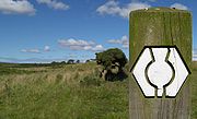
Southern Upland Way
Encyclopedia
Scotland
Scotland is a country that is part of the United Kingdom. Occupying the northern third of the island of Great Britain, it shares a border with England to the south and is bounded by the North Sea to the east, the Atlantic Ocean to the north and west, and the North Channel and Irish Sea to the...
between Portpatrick
Portpatrick
Portpatrick is a village hanging on to the extreme south-westerly tip of mainland Scotland, cut into a cleft in steep cliffs.Dating back historically some 500 years, and built adjacent to the ruins of nearby Dunskey Castle, its position on the Rhins of Galloway affords visitors views of the...
in the west and Cockburnspath
Cockburnspath
Cockburnspath is a village in the Scottish Borders area of Scotland. It lies near the North Sea coast between Berwick-upon-Tweed and Edinburgh. It is at the eastern extremity of the Southern Upland Way, a long-distance footpath from the west to east coast of Scotland, and it is also the terminus...
in the east.
The path visits Castle Kennedy
Castle Kennedy
Castle Kennedy is a village three miles east of Stranraer in Dumfries and Galloway, Scotland.There is a castle there - indeed there are two. Castle Kennedy itself was burned down in the eighteenth century and remains a ruin to this day, the owner deciding to build Lochinch Castle as a replacement...
, New Luce
New Luce
New Luce is a quiet picturesque village in the Scottish unitary council area of Dumfries and Galloway. It has a shop, pub and two bridges. In the summer it has a popular gala day. The coast to coast walk, the Southern Upland Way, passes close to the village. New Luce is surrounded by good walking...
, Bargrennan
Bargrennan
Bargrennan is a village in Dumfries and Galloway, in the south west of Scotland, by the River Cree, on the A714 to Girvan, nine miles from Newton Stewart....
, St John's Town of Dalry
St. John's Town of Dalry
St. John's Town of Dalry, usually referred to simply as Dalry, is a village in Dumfries and Galloway, formerly in Kirkcudbrightshire. It is located sixteen miles from Castle Douglas along the A713 road, and is at the southern terminus of the A702 road...
, Sanquhar
Sanquhar
Sanquhar is a town on the River Nith in Dumfries and Galloway, Scotland. It lies north of Thornhill and west of Moffat. It is a Royal Burgh.Sanquhar is notable for its tiny post office , claimed to be the oldest working post office in the world...
, Wanlockhead
Wanlockhead
Wanlockhead is a village in Dumfries and Galloway, Scotland nestling in the Lowther Hills one mile south of Leadhills at the head of the Mennock Pass, which forms part of the Southern Uplands...
, Beattock
Beattock
The village of Beattock is located in the southern lowlands of Scotland, and lies within the administrative area of Dumfries and Galloway. It is surrounded by the parish of Kirkpatrick Juxta. It was an important stabling point for horses in the olden days with a coach house at one end of the village...
, St Mary's Loch
St Mary's Loch
St Mary's Loch is the largest natural loch in the Scottish Borders, and is situated on the A708 road between Selkirk and Moffat, about south of Edinburgh. It is long and wide, and was created by glacial action during the last ice age...
, Traquair
Traquair
thumb|right|Cottages at TraquairTraquair is a small village and civil parish in the old county of Peeblesshire, but since 1975, a part of the Scottish Borders...
, Galashiels
Galashiels
Galashiels is a burgh in the Scottish Borders, on the Gala Water river. The name is often shortened to "Gala" .Galashiels is a major commercial centre for the Scottish Borders...
, Lauder
Lauder
The Royal Burgh of Lauder is a town in the Scottish Borders 27 miles south east of Edinburgh. It is also a royal burgh in the county of Berwickshire. It lies on the edge of the Lammermuir Hills, on the Southern Upland Way.-Medieval history:...
and Longformacus
Longformacus
Longformacus is a small village in Berwickshire in the Scottish Borders area of Scotland. It is around north-west of Duns, in the Lammermuir Hills. The Dye Water runs through the village, flowing east towards its confluence with the Whiteadder Water nearby...
en route. The Sir Walter Scott Way
Sir Walter Scott Way
The Sir Walter Scott Way is a long distance path in the Scottish Borders of Scotland, in memory of Sir Walter Scott, of one of Scotland's greatest writers.-The Way:...
shares the last five places with the Southern Upland Way.
John Dippie's Well
In the Lammermuir HillsLammermuir Hills
The Lammermuir Hills, usually simply called the Lammermuirs , in southern Scotland, form a natural boundary between Lothian and the Scottish Borders....
, near Longformacus
Longformacus
Longformacus is a small village in Berwickshire in the Scottish Borders area of Scotland. It is around north-west of Duns, in the Lammermuir Hills. The Dye Water runs through the village, flowing east towards its confluence with the Whiteadder Water nearby...
close to where the Way crosses the Watch Water
Watch Water
The Watch Water is a river in the Scottish Borders area of Scotland. It rises in the Lammermuir Hills, around west of Longformacus, and flows generally eastward to its confluence with the Dye Water, around west of Longformacus...
, is John Dippie's Well. The well is marked by a carved stone "headstone" which tells that there is no sweeter water in the Lammermuir Hills. John Dippie was a gamekeeper and the reason the water was so sweet was that he added some whisky to it before the thirsty shooting parties slaked their thirsts. The "headstone" marks their appreciation.
See also
- Borders Abbeys WayBorders Abbeys WayThe Borders Abbeys Way is a long-distance footpath in the Scottish Borders area of Scotland. It is a circular walkway and is 68 miles long....
- Central Scottish Way
- James Hutton Trail
- Pennine WayPennine WayThe Pennine Way is a National Trail in England. The trail runs from Edale, in the northern Derbyshire Peak District, north through the Yorkshire Dales and the Northumberland National Park and ends at Kirk Yetholm, just inside the Scottish border. The path runs along the Pennine hills, sometimes...
National Trail - Roman Heritage WayRoman Heritage WayThe Roman Heritage Way is a long-distance path in England and Scotland. It covers parts of Cumbria, Northumberland, the Scottish Borders, and Tyneside.The Way was developed from sections of the Hadrian's Wall Path, the Pennine Way, Dere Street, the St...
- St. Cuthbert's WaySt. Cuthbert's WaySt Cuthbert's Way is a long-distance trail between the Scottish Borders town of Melrose and Lindisfarne off the coast of Northumberland, England.It is part of the European walking route E2....
- Sir Walter Scott WaySir Walter Scott WayThe Sir Walter Scott Way is a long distance path in the Scottish Borders of Scotland, in memory of Sir Walter Scott, of one of Scotland's greatest writers.-The Way:...
- Long-distance footpaths in the United KingdomLong-distance footpaths in the United Kingdom-England and Wales: National Trails:National Trails are distinguished by being maintained by the National Trails organization . , there are fifteen such trails, one of which is not yet complete....
- List of places in the Scottish Borders
Bothies
- Beehive Bothy
- White Laggan Bothy
- Polskeoch Bothy
- Brattleburn Bothy
- Over Phawhope Bothy
- Minch Moor Bothy