

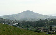
Breast shaped hill
Encyclopedia
A breast-shaped hill is a mountain in the shape of a human breast
. Such anthropomorphic geographic features are to be found in different places of the world and in some cultures they were revered as the attributes of the Mother Goddess
, like the Paps of Anu
, named after Anu
, an important goddess of pre-Christian Ireland
.
The name Mamucium that gave origin to the name of the city of Manchester
is thought to derive from the Celtic language meaning "breast shaped hill", referring to the sandstone bluff the fort stood on; this later evolved into the name Manchester.
Mostly breast shaped hills are connected with local ancestral veneration of the breast as a symbol of fertility and well-being. It is not uncommon for very old archaeological site
s to be located in or below such hills, like in Samson, Isles of Scilly
, where there are large ancient burial
grounds both on the North Hill and South Hill, or Burrén and Burrena
, Aragon
, Spain
, where two Iron Age
Urnfield culture
archaeological sites lie beneath the hills.
Also the myths surrounding these mountains are ancient and enduring and some have been recorded in the oral literature
or written texts; for example, in an unspecified location in Asia, there was a mountain known as "Breast Mountain" with a cave in which the Buddhist monk Bodhidharma
(Da Mo) spent a long time in meditation
.
Travelers and cartographers in colonial times often changed the ancestral names of such hills. The mountain known as Didhol or Dithol, Woman's Breast, by the Indigenous Australian people since time immemorial, was rechristened Pigeon House Mountain
by Captain James Cook
at the time of his exploration of Australia
's eastern coast in 1770
"Mamelon" (from French "nipple") is a French name for a breast shaped hillock. Fort Mamelon was a famous hillock fortified by the Russians and captured by the French as part of the Siege of Sevastopol during the Crimean War
of the 1850s. The word "mamelon
" is also used in volcanology
to describe a particular rock formation of volcanic origin. The term was coined by the French
explorer and naturalist Jean Baptiste Bory de Saint-Vincent
.
 East Africa
Mauritius
Seychelles
West Africa
Middle East
Philippines
Thailand
Greece
Spain
 Canada
El Salvador
Guadeloupe
Mexico
Puerto Rico
United States
 Australia
New Zealand
Bolivia
Chile
Colombia
Peru
Uruguay
Venezuela
Breast
The breast is the upper ventral region of the torso of a primate, in left and right sides, which in a female contains the mammary gland that secretes milk used to feed infants.Both men and women develop breasts from the same embryological tissues...
. Such anthropomorphic geographic features are to be found in different places of the world and in some cultures they were revered as the attributes of the Mother Goddess
Mother goddess
Mother goddess is a term used to refer to a goddess who represents motherhood, fertility, creation or embodies the bounty of the Earth. When equated with the Earth or the natural world such goddesses are sometimes referred to as Mother Earth or as the Earth Mother.Many different goddesses have...
, like the Paps of Anu
Paps of Anu
The Paps of Anu are twin hills located near Killarney, close to the border between County Cork and County Kerry.These breast-shaped hills are said to have been named after the ancient goddess Anann or Anu. On the top of each of these hills stands a tall cairn. With a height of , the cairn on the...
, named after Anu
Anann
In Irish mythology, Anann was a goddess. 'Anann' is identified as the personal name of the Morrígan in many MSS of Lebor Gabála Érenn. With Badb and Macha, she is sometimes part of a triple goddess or a triad of war goddesses. As such, she may be a Celtic personification of death, and is depicted...
, an important goddess of pre-Christian Ireland
Ireland
Ireland is an island to the northwest of continental Europe. It is the third-largest island in Europe and the twentieth-largest island on Earth...
.
The name Mamucium that gave origin to the name of the city of Manchester
Manchester
Manchester is a city and metropolitan borough in Greater Manchester, England. According to the Office for National Statistics, the 2010 mid-year population estimate for Manchester was 498,800. Manchester lies within one of the UK's largest metropolitan areas, the metropolitan county of Greater...
is thought to derive from the Celtic language meaning "breast shaped hill", referring to the sandstone bluff the fort stood on; this later evolved into the name Manchester.
Mostly breast shaped hills are connected with local ancestral veneration of the breast as a symbol of fertility and well-being. It is not uncommon for very old archaeological site
Archaeological site
An archaeological site is a place in which evidence of past activity is preserved , and which has been, or may be, investigated using the discipline of archaeology and represents a part of the archaeological record.Beyond this, the definition and geographical extent of a 'site' can vary widely,...
s to be located in or below such hills, like in Samson, Isles of Scilly
Samson, Isles of Scilly
Samson is the largest uninhabited island of the Isles of Scilly. It is in size. The island consists of two hills, North Hill and South Hill, which are connected by an isthmus on which the former inhabitants built many of their sturdy stone cottages...
, where there are large ancient burial
Burial
Burial is the act of placing a person or object into the ground. This is accomplished by excavating a pit or trench, placing an object in it, and covering it over.-History:...
grounds both on the North Hill and South Hill, or Burrén and Burrena
Burrén and Burrena
Burrén and Burrena, known popularly as Las Dos Teticas, are twin hills in Aragon, Spain. They are located in the Fréscano municipal limits, near the road between this town and Mallén....
, Aragon
Aragon
Aragon is a modern autonomous community in Spain, coextensive with the medieval Kingdom of Aragon. Located in northeastern Spain, the Aragonese autonomous community comprises three provinces : Huesca, Zaragoza, and Teruel. Its capital is Zaragoza...
, Spain
Spain
Spain , officially the Kingdom of Spain languages]] under the European Charter for Regional or Minority Languages. In each of these, Spain's official name is as follows:;;;;;;), is a country and member state of the European Union located in southwestern Europe on the Iberian Peninsula...
, where two Iron Age
Iron Age
The Iron Age is the archaeological period generally occurring after the Bronze Age, marked by the prevalent use of iron. The early period of the age is characterized by the widespread use of iron or steel. The adoption of such material coincided with other changes in society, including differing...
Urnfield culture
Urnfield culture
The Urnfield culture was a late Bronze Age culture of central Europe. The name comes from the custom of cremating the dead and placing their ashes in urns which were then buried in fields...
archaeological sites lie beneath the hills.
Also the myths surrounding these mountains are ancient and enduring and some have been recorded in the oral literature
Oral literature
Oral literature corresponds in the sphere of the spoken word to literature as literature operates in the domain of the written word. It thus forms a generally more fundamental component of culture, but operates in many ways as one might expect literature to do...
or written texts; for example, in an unspecified location in Asia, there was a mountain known as "Breast Mountain" with a cave in which the Buddhist monk Bodhidharma
Bodhidharma
Bodhidharma was a Buddhist monk who lived during the 5th/6th century AD. He is traditionally credited as the transmitter of Ch'an to China, and regarded as the first Chinese patriarch...
(Da Mo) spent a long time in meditation
Meditation
Meditation is any form of a family of practices in which practitioners train their minds or self-induce a mode of consciousness to realize some benefit....
.
Travelers and cartographers in colonial times often changed the ancestral names of such hills. The mountain known as Didhol or Dithol, Woman's Breast, by the Indigenous Australian people since time immemorial, was rechristened Pigeon House Mountain
Pigeon House Mountain
Pigeon House Mountain is a mountain named by Captain James Cook during his voyage of discovery along Australia's eastern coast in 1770. The prominent remnant of a two tier sandstone structure, the summit rises to 720 m above sea level. Located on the South Coast region of New South Wales within the...
by Captain James Cook
James Cook
Captain James Cook, FRS, RN was a British explorer, navigator and cartographer who ultimately rose to the rank of captain in the Royal Navy...
at the time of his exploration of Australia
Australia
Australia , officially the Commonwealth of Australia, is a country in the Southern Hemisphere comprising the mainland of the Australian continent, the island of Tasmania, and numerous smaller islands in the Indian and Pacific Oceans. It is the world's sixth-largest country by total area...
's eastern coast in 1770
"Mamelon" (from French "nipple") is a French name for a breast shaped hillock. Fort Mamelon was a famous hillock fortified by the Russians and captured by the French as part of the Siege of Sevastopol during the Crimean War
Crimean War
The Crimean War was a conflict fought between the Russian Empire and an alliance of the French Empire, the British Empire, the Ottoman Empire, and the Kingdom of Sardinia. The war was part of a long-running contest between the major European powers for influence over territories of the declining...
of the 1850s. The word "mamelon
Mamelon (volcanology)
A mamelon is a rock formation created by eruption of relatively thick or stiff lava through a narrow vent in the bedrock. Because the lava is not fluid, it does not flow away; instead it congeals around the vent, forming a small hill or mound on the surface...
" is also used in volcanology
Volcanology
Volcanology is the study of volcanoes, lava, magma, and related geological, geophysical and geochemical phenomena. The term volcanology is derived from the Latin word vulcan. Vulcan was the ancient Roman god of fire....
to describe a particular rock formation of volcanic origin. The term was coined by the French
France
The French Republic , The French Republic , The French Republic , (commonly known as France , is a unitary semi-presidential republic in Western Europe with several overseas territories and islands located on other continents and in the Indian, Pacific, and Atlantic oceans. Metropolitan France...
explorer and naturalist Jean Baptiste Bory de Saint-Vincent
Jean Baptiste Bory de Saint-Vincent
Jean Baptiste Bory de Saint-Vincent was a French naturalist. He was born at Agen...
.
Africa
- Naasa HabloodNaasa HabloodNaasa Hablood are twin hills situated on the outskirts of the city of Hargeisa in northeastern Somaliland. Since their discovery, the Naasa Hablood have become a key tourist attraction and a national landmark...
in SomaliaSomaliaSomalia , officially the Somali Republic and formerly known as the Somali Democratic Republic under Socialist rule, is a country located in the Horn of Africa. Since the outbreak of the Somali Civil War in 1991 there has been no central government control over most of the country's territory... - Mount ElgonMount ElgonMount Elgon is an extinct shield volcano on the border of Uganda and Kenya, north of Kisumu and west of Kitale.- Physical features :It is the oldest and largest solitary volcano in East Africa, covering an area of around 3500 km²....
on the UgandaUgandaUganda , officially the Republic of Uganda, is a landlocked country in East Africa. Uganda is also known as the "Pearl of Africa". It is bordered on the east by Kenya, on the north by South Sudan, on the west by the Democratic Republic of the Congo, on the southwest by Rwanda, and on the south by...
-KenyaKenyaKenya , officially known as the Republic of Kenya, is a country in East Africa that lies on the equator, with the Indian Ocean to its south-east...
border - Sweet Sixteen, Matthews RangeMatthews RangeThe Matthews Range, also known as the Lenkiyio Hills, is a range of mountains about 150 km long, oriented north-south, in the Laikipia district of the Rift Valley Province in northern Kenya...
(Ldoinyo Lenkiyio), Laikipia districtLaikipia District KenyaLaikipia District is one of the seventy-one districts of Kenya, located on the Equator in the Rift Valley Province of the country. The district has two major urban centres: Nanyuki to the southeast, and Nyahururu to the southwest...
, Rift Valley Province, northern KenyaKenyaKenya , officially known as the Republic of Kenya, is a country in East Africa that lies on the equator, with the Indian Ocean to its south-east...
.
Mauritius
- Trois Mamelles mountains in the west of MauritiusMauritiusMauritius , officially the Republic of Mauritius is an island nation off the southeast coast of the African continent in the southwest Indian Ocean, about east of Madagascar...
Seychelles
- Mamelles Island, SeychellesSeychellesSeychelles , officially the Republic of Seychelles , is an island country spanning an archipelago of 115 islands in the Indian Ocean, some east of mainland Africa, northeast of the island of Madagascar....
West Africa
- Deux MamellesDeux MamellesDeux Mamelles, Collines des Mamelles, or simply Mamelles are twin hills located in Ouakam, a suburbian commune of Dakar, in the Cap-Vert peninsula, Senegal....
, Pointe des AlmadiesPointe des AlmadiesPointe des Almadies is the westernmost point on the continent of Africa. Pointe des Almadies is located on the northwestern end of the Cap Vert peninsula in Senegal.- Environs :...
, Cap-VertCap-VertCap-Vert is a peninsula in Senegal, and the westernmost point of the continent of Africa and of the Old World mainland. Originally called Cabo Verde or "Cape Green" by Portuguese explorers, it is not to be confused with the Cape Verde islands, which are some further west...
, SenegalSenegalSenegal , officially the Republic of Senegal , is a country in western Africa. It owes its name to the Sénégal River that borders it to the east and north...
Antarctica
- Una's TitsUna's TitsUna's Tits are two towers of basalt, each topped by a cap of ice, guarding the entrance to the Lemaire Channel on the Antarctic Peninsula. With a highest summit is 747 m high, they are officially named "Una's Tits" and are identified as such on navigation charts...
at the entrance to the Lemaire ChannelLemaire ChannelLemaire Channel is a strait off Antarctica, located between Kiev Peninsula in the mainland's Graham Land and Booth Island. Nicknamed "Kodak Gap" by some, it is one of the top tourist destinations in Antarctica; steep cliffs hem in the iceberg-filled passage, which is 11 km long and just 1,600...
, Graham LandGraham LandGraham Land is that portion of the Antarctic Peninsula which lies north of a line joining Cape Jeremy and Cape Agassiz. This description of Graham Land is consistent with the 1964 agreement between the British Antarctic Place-names Committee and the US Advisory Committee on Antarctic Names, in... - Nipple PeakNipple PeakNipple Peak is a peak, 675 m, standing 1 nautical mile northeast of Channel Glacier in the north part of Wiencke Island, in the Palmer Archipelago. Discovered by the Belgian Antarctic Expedition, 1897–99, under Gerlache. The name, which suggests the shape of the feature, was given by the Falkland...
, Palmer ArchipelagoPalmer ArchipelagoPalmer Archipelago, also known as Antarctic Archipelago, Archipiélago Palmer, Antarktiske Arkipel or Palmer Inseln, is a group of islands off the northwestern coast of the Antarctic Peninsula....
, Graham Land - Hemus PeakHemus PeakHemus Peak is an ice-covered peak rising to 636 m off the northwest extremity of Bowles Ridge in eastern Livingston Island. The feature is breast-shaped, 850 m long in east-west direction and 550 m wide, and overlooks Kaliakra Glacier to the northeast and Perunika Glacier to the southwest...
, Livingston Island, South Shetland IslandsSouth Shetland IslandsThe South Shetland Islands are a group of Antarctic islands, lying about north of the Antarctic Peninsula, with a total area of . By the Antarctic Treaty of 1959, the Islands' sovereignty is neither recognized nor disputed by the signatories and they are free for use by any signatory for...
Asia
Cambodia- Sroh-Plom Mountain, "Virtuous Woman's Breast Mountain", located close to SenmonoromSenmonoromSenmonorom is the capital of Senmonorom District and Mondulkiri Province, Cambodia.Senmonorom is the only major town in the province of Mondulkiri...
, Senmonorom DistrictSenmonorom DistrictSenmonorom District is a district located in Mondulkiri Province, in Cambodia. Its capital is Senmonorom city. According to the 1998 census of Cambodia, it had a population of 7,032.-References:...
, Mondulkiri Province, CambodiaCambodiaCambodia , officially known as the Kingdom of Cambodia, is a country located in the southern portion of the Indochina Peninsula in Southeast Asia...
.
Middle East
- Tell Sader al-Arus (translation from Arabic: "Breast of the bride") is a mountain in the Golan Heights
Philippines
- Bundok ng Susong Dalaga, "Maiden's breast mountain", looking like a reclined woman, Western Mindoro, Philippines.
- Bundok ng Susong Dalaga, two huge conical hills resembling the female breast, which are the highest peaks of Talim IslandTalim IslandTalim Island is an island in the Philippines.-Features:Talim Island is located at the center of the Laguna de Bay lake under the municipality of Binangonan on the western side and the municipality of Cardona on the eastern side in the province of Rizal...
, Philippines. - Kagmasuso, among other breast shaped hills in San Andres, CatanduanesSan Andres, CatanduanesSan Andres is a 4th class municipality in the province of Catanduanes, Philippines. According to the 2007 census, it has a population of 33,781 people in 6,059 households.- The Town :...
- Chocolate HillsChocolate HillsThe Chocolate Hills is an unusual geological formation in Bohol province, Philippines. According to the latest accurate survey done, there are 1,776 hills spread over an area of more than . They are covered in green grass that turns brown during the dry season, hence the name.The Chocolate Hills...
, unusual geological formations in BoholBoholBohol is an island province of the Philippines located in the Central Visayas region, consisting of Bohol Island and 75 minor surrounding islands. Its capital is Tagbilaran City. With a land area of and a coastline long, Bohol is the tenth largest island of the Philippines... - Ilihan Hill, "Watery Breast", a religious pilgrimage site about four kilometers from Jagna
Thailand
- Khao Nom SaoKhao Nom SaoKhao Nom Sao , "female breast mountain", is a land feature located in Ranong Province, Thailand.-Description:Khao Nom Sao is the highest summit of a rugged mountain massif that stretches roughly from north to south in the Kra Isthmus....
(เขานมสาว), "female breast mountainBreastThe breast is the upper ventral region of the torso of a primate, in left and right sides, which in a female contains the mammary gland that secretes milk used to feed infants.Both men and women develop breasts from the same embryological tissues...
", a mountain located in Ranong ProvinceRanong ProvinceRanong is one of the southern provinces of Thailand, on the coast of the Andaman Sea. It is the province with the fewest citizens. Neighboring provinces are Chumphon, Surat Thani and Phang Nga...
, ThailandThailandThailand , officially the Kingdom of Thailand , formerly known as Siam , is a country located at the centre of the Indochina peninsula and Southeast Asia. It is bordered to the north by Burma and Laos, to the east by Laos and Cambodia, to the south by the Gulf of Thailand and Malaysia, and to the...
. - Khao Nom Sao, a round hill east of Phet Kasem road in Prachuap Khiri Khan ProvincePrachuap Khiri Khan ProvincePrachuap Khiri Khan is one of the central provinces of Thailand. Neighboring provinces are Phetchaburi in the north and Chumphon in the south. To the west it borders Tanintharyi Division of Myanmar....
. 10°59′00"N 99°22′00"E - Khao Nom Sao, a mountain in Chumphon ProvinceChumphon ProvinceChumphon ) is one of the southern provinces of Thailand, at the shore of the Gulf of Thailand. Neighboring provinces are Prachuap Khiri Khan, Surat Thani and Ranong...
. 09°46′00"N 98°43′01"E - Khao Nom Sao, a hill in Phang Nga ProvincePhang Nga ProvincePhang Nga is one of the southern provinces of Thailand, on the shore to the Andaman Sea. Neighboring provinces are Ranong, Surat Thani and Krabi. To the south is the Phuket province, but without land boundary to Phang Nga....
, part of a greater mountain system. 08°58′00"N 98°28′00"E - Khao Nom Nang, (เขานมนาง), an isolated large hill in khao Kala, Nakhon Sawan ProvinceNakhon Sawan ProvinceNakhon Sawan is one of the provinces of Thailand. Neighboring provinces are Kamphaeng Phet, Phichit, Phetchabun, Lop Buri, Sing Buri, Chai Nat, Uthai Thani and Tak.- Etymology :...
. 15°34′00"N 100°17′00"E - Khao Nom Nang, an isolated hill in Khok Samae San, LopburiLopburiLopburi ) is the capital city of Lopburi Province in Thailand. It is located about 150 km north-east of Bangkok. As of 2006 it has a population of 26,500...
. 15°19′00"N 100°51′00"E - Khao Nom Nang, the name of two hills west of Doeng Bang Nam Buat, Suphan Buri. 14°51′00"N 100°04′00"E
- Khao Nom Nang, a hill north of Pak Phraek, KanchanaburiKanchanaburiKanchanaburi ) is a town in the west of Thailand and the capital of Kanchanaburi province. In 2006 it had a population of 31,327...
. 14°05′00"N 99°34′00"E - Khao Nom Nang, a hill at Huai Krachao, KanchanaburiKanchanaburiKanchanaburi ) is a town in the west of Thailand and the capital of Kanchanaburi province. In 2006 it had a population of 31,327...
. 14°18′00"N 99°43′00"E - Khao Nom Nang, a hill between Nong Pet and Chong Sadao, KanchanaburiKanchanaburiKanchanaburi ) is a town in the west of Thailand and the capital of Kanchanaburi province. In 2006 it had a population of 31,327...
. 14°21′00"N 99°13′00"E - Khao Nom Wang (เขานมวังก), a small hill just east of the main road at Panomwang, also known as Khao Phanom Wang, Phatthalung ProvincePhatthalung ProvincePhatthalung is one of the southern provinces of Thailand. Neighboring provinces are Nakhon Si Thammarat, Songkhla, Satun and Trang.-Geography:...
. 07°40′58"N 100°01′01"E - Khao Nom (เขานม), was one of the former names of Khanom, a district of Nakhon Si Thammarat ProvinceNakhon Si Thammarat ProvinceNakhon Si Thammarat is one of the southern provinces of Thailand, at the eastern shore of the Gulf of Thailand...
, due to the surrounding mountains. - Ko Nom SaoKo Nom SaoKo Nom Sao are twin islands located in the Phang Nga Bay, and are part of the Ko Panyi subdistrict , Phang Nga Province, Thailand.-General:...
are twin islands located in the Phang Nga BayPhang Nga BayPhang Nga Bay is a 400 km² bay in the Andaman Sea between the island of Phuket and the mainland of the Malay peninsula of southern Thailand. Since 1981, an extensive section of the bay has been protected as the Ao Phang Nga National Park...
, Phang Nga ProvincePhang Nga ProvincePhang Nga is one of the southern provinces of Thailand, on the shore to the Andaman Sea. Neighboring provinces are Ranong, Surat Thani and Krabi. To the south is the Phuket province, but without land boundary to Phang Nga....
, ThailandThailandThailand , officially the Kingdom of Thailand , formerly known as Siam , is a country located at the centre of the Indochina peninsula and Southeast Asia. It is bordered to the north by Burma and Laos, to the east by Laos and Cambodia, to the south by the Gulf of Thailand and Malaysia, and to the...
. - Ko Nom Sao in Khao Sam Roi Yot National ParkKhao Sam Roi Yot National ParkKhao Sam Roi Yot is a marine national park in Sam Roi Yot district, Prachuap Khiri Khan Province, Thailand. It covers 98.08 km², of which 20.88 km² are marine areas. The park was established in 1966, and was the first coastal national park of Thailand....
, Prachuap Khiri Khan ProvincePrachuap Khiri Khan ProvincePrachuap Khiri Khan is one of the central provinces of Thailand. Neighboring provinces are Phetchaburi in the north and Chumphon in the south. To the west it borders Tanintharyi Division of Myanmar....
. 12°13′N 100°01′E
- Ko Nom Sao, an island off the shore in Chanthaburi ProvinceChanthaburi ProvinceChanthaburi is a province of Thailand. It is located in the east of Thailand, at the border to Battambang and Pailin of Cambodia and the shore to the Gulf of Thailand...
. 12°28′N 102°01′E
Europe
British Isles- Beinn ChìochanLochnagarLochnagar or Beinn Chìochan is a mountain in the Grampians of Scotland, located about five miles south of the River Dee near Balmoral.-Names:...
in the GrampiansGrampian Mountains (Scotland)The Grampian Mountains or Grampians are one of the three major mountain ranges in Scotland, occupying a considerable portion of the Scottish Highlands in northeast Scotland.-Extent:...
, Scotland - BennachieBennachieBennachie is a range of hills in Aberdeenshire, Scotland. It has several tops, the highest of which, Oxen Craig, has a height of 528 m...
in Aberdeenshire, Scotland - Mam Barisdale in Knoydart, Scotland
- Mynydd Llanwenarth near AbergavennyAbergavennyAbergavenny , meaning Mouth of the River Gavenny, is a market town in Monmouthshire, Wales. It is located 15 miles west of Monmouth on the A40 and A465 roads, 6 miles from the English border. Originally the site of a Roman fort, Gobannium, it became a medieval walled town within the Welsh Marches...
, WalesWalesWales is a country that is part of the United Kingdom and the island of Great Britain, bordered by England to its east and the Atlantic Ocean and Irish Sea to its west. It has a population of three million, and a total area of 20,779 km²... - Mount KeenMount KeenMount Keen is a 939 m high mountain in Scotland and the most easterly Munro. It can be accessed from several directions, South from Glen Mark, North from Glen Tanar, and East to Braid Cairn. It is a moderate walk which is most popularly started by mountain bike, riding through the native...
in AberdeenshireAberdeenshireAberdeenshire is one of the 32 unitary council areas in Scotland and a lieutenancy area.The present day Aberdeenshire council area does not include the City of Aberdeen, now a separate council area, from which its name derives. Together, the modern council area and the city formed historic...
/ AngusAngusAngus is one of the 32 local government council areas of Scotland, a registration county and a lieutenancy area. The council area borders Aberdeenshire, Perth and Kinross and Dundee City...
, Scotland - A' ChiochBen More (Mull)Ben More is the highest mountain and only Munro on the Isle of Mull, Scotland....
in Ben More, Isle of MullIsle of MullThe Isle of Mull or simply Mull is the second largest island of the Inner Hebrides, off the west coast of Scotland in the council area of Argyll and Bute....
, Scotland - Mam SodhailMam SodhailMam Sodhail, sometimes known by its anglicised name of "Mam Soul", is a Scottish Munro situated in the secluded country on the northern side of Glen Affric, some 30 kilometres east of Kyle of Lochalsh.- Overview :...
, on the northern side of Glen AffricGlen Affricright|300px|thumb|Glen AffricGlen Affric is a glen south-west of the village of Cannich in the Highland region of Scotland, some to the west of Loch Ness. The River Affric runs along its length, passing through Loch Affric and Loch Beinn a' Mheadhoin .It used to be part of the lands of the Clan...
, some 30 kilometres east of Kyle of LochalshKyle of LochalshKyle of Lochalsh is a village on the northwest coast of Scotland, 63 miles west of Inverness. It is located at the entrance to Loch Alsh, opposite the village of Kyleakin on the Isle of Skye... - Mam TorMam TorMam Tor is a hill near Castleton in the High Peak of Derbyshire, England. Its name literally translates as Heights of the Mother and it is also known as the Shivering Mountain on account of the instability of its lower shale layers...
, near Castleton in the High Peak of DerbyshireDerbyshireDerbyshire is a county in the East Midlands of England. A substantial portion of the Peak District National Park lies within Derbyshire. The northern part of Derbyshire overlaps with the Pennines, a famous chain of hills and mountains. The county contains within its boundary of approx...
, England. - Samson, Isles of ScillySamson, Isles of ScillySamson is the largest uninhabited island of the Isles of Scilly. It is in size. The island consists of two hills, North Hill and South Hill, which are connected by an isthmus on which the former inhabitants built many of their sturdy stone cottages...
- TwmbarlwmTwmbarlwmTwmbarlwm also known as Twm Barlwm, Twyn Barlwm, or locally known as "The tump" in relation to the mound that lies on its summit, is a mountain situated 2 km to the northeast of Risca in South Wales. It is high and is a well known sight throughout the region...
near RiscaRiscaRisca is a town of approximately 11,500 people in South Wales, within the Caerphilly County Borough and the historic boundaries of Monmouthshire. It is today part of the Newport conurbation , though it is not a Ward of Newport City Council...
, WalesWalesWales is a country that is part of the United Kingdom and the island of Great Britain, bordered by England to its east and the Atlantic Ocean and Irish Sea to its west. It has a population of three million, and a total area of 20,779 km²... - Paps are rounded, breastlike hills located mostly in ScotlandScotlandScotland is a country that is part of the United Kingdom. Occupying the northern third of the island of Great Britain, it shares a border with England to the south and is bounded by the North Sea to the east, the Atlantic Ocean to the north and west, and the North Channel and Irish Sea to the...
:- Paps of AnuPaps of AnuThe Paps of Anu are twin hills located near Killarney, close to the border between County Cork and County Kerry.These breast-shaped hills are said to have been named after the ancient goddess Anann or Anu. On the top of each of these hills stands a tall cairn. With a height of , the cairn on the...
, near KillarneyKillarneyKillarney is a town in County Kerry, southwestern Ireland. The town is located north of the MacGillicuddy Reeks, on the northeastern shore of the Lough Lein/Leane which are part of Killarney National Park. The town and its surrounding region are home to St...
, IrelandIrelandIreland is an island to the northwest of continental Europe. It is the third-largest island in Europe and the twentieth-largest island on Earth... - Paps of Fife in Scotland
- Paps of JuraPaps of JuraThe Paps of Jura are three mountains located on the western side of island of Jura, in the Inner Hebrides of Scotland. Their highest point is ....
, on the western side of island of JuraJura, ScotlandJura is an island in the Inner Hebrides of Scotland, situated adjacent and to the north-east of Islay. Part of the island is designated as a National Scenic Area. Until the twentieth century Jura was dominated - and most of it was eventually owned - by the Campbell clan of Inveraray Castle on Loch...
, in the Inner HebridesInner HebridesThe Inner Hebrides is an archipelago off the west coast of Scotland, to the south east of the Outer Hebrides. Together these two island chains form the Hebrides, which enjoy a mild oceanic climate. There are 36 inhabited islands and a further 43 uninhabited Inner Hebrides with an area greater than...
, Scotland - Paps of LothianPaps of LothianThe Paps of Lothian are two hills in Scotland:*Arthur's Seat, Edinburgh*North Berwick Law...
in Scotland - Maiden PapsMaiden Paps, CaithnessThe Maiden Paps are twin hills located in Caithness, Scotland that have the shape of human breasts.-External links:*...
, twin hills in CaithnessCaithnessCaithness is a registration county, lieutenancy area and historic local government area of Scotland. The name was used also for the earldom of Caithness and the Caithness constituency of the Parliament of the United Kingdom . Boundaries are not identical in all contexts, but the Caithness area is...
, Scotland - Maiden PapsKilpatrick HillsThe Kilpatrick Hills are a range of hills in central Scotland, stretching from Dumbarton in the west to Strathblane in the east. Strathblane divides the Kilpatricks from the Campsie Fells to the east, while to the north is part of the Loch Lomond and the Trossachs National Park...
, twin hills in the Kilpatrick HillsKilpatrick HillsThe Kilpatrick Hills are a range of hills in central Scotland, stretching from Dumbarton in the west to Strathblane in the east. Strathblane divides the Kilpatricks from the Campsie Fells to the east, while to the north is part of the Loch Lomond and the Trossachs National Park...
, Scotland - Maiden PapsMaiden Paps, HawickThe Maiden Paps are twin hills near Hawick, in the Scottish Borders of the south east of Scotland, that have the shape of human breasts. They are located 12 km south of Hawick; the higher pap is 510 m and the lower 500 m high....
, twin hills south of HawickHawickHawick is a town in the Scottish Borders of south east Scotland. It is south-west of Jedburgh and south-southeast of Selkirk. It is one of the farthest towns from the sea in Scotland, in the heart of Teviotdale, and the biggest town in the former county of Roxburghshire. Hawick's architecture is...
in the Scottish BordersScottish BordersThe Scottish Borders is one of 32 local government council areas of Scotland. It is bordered by Dumfries and Galloway in the west, South Lanarkshire and West Lothian in the north west, City of Edinburgh, East Lothian, Midlothian to the north; and the non-metropolitan counties of Northumberland...
, Scotland - Maiden PapsTunstall HillsTunstall Hills is an area of open space in Sunderland, Tyne and Wear, England. The area consists of Green Hill and Rocky Hill and surrounding land, and is the site of a local nature reserve....
, another name for the Tunstall Hills near SutherlandSutherlandSutherland is a registration county, lieutenancy area and historic administrative county of Scotland. It is now within the Highland local government area. In Gaelic the area is referred to according to its traditional areas: Dùthaich 'IcAoidh , Asainte , and Cataibh...
, Tyne and WearTyne and WearTyne and Wear is a metropolitan county in north east England around the mouths of the Rivers Tyne and Wear. It came into existence as a metropolitan county in 1974 after the passage of the Local Government Act 1972...
, England - Maiden PapsSchiehallionSchiehallion is a prominent mountain in Perth and Kinross, Scotland. Schiehallion has a rich botanical life, interesting archaeology, and a unique place in scientific history for an 18th-century experiment in 'weighing the world'...
, another name for the Schiehallion, Perth and KinrossPerth and KinrossPerth and Kinross is one of 32 council areas in Scotland, and a Lieutenancy Area. It borders onto the Aberdeenshire, Angus, Dundee City, Fife, Clackmannanshire, Stirling, Argyll and Bute and Highland council areas. Perth is the administrative centre...
, Scotland - Pap of GlencoePap of GlencoeThe Pap of Glencoe is a mountain on the northern side of Glen Coe, in the Highlands of Scotland. It lies at the western end of the Aonach Eagach ridge, directly above the point where the River Coe enters Loch Leven....
in the Scottish HighlandsScottish HighlandsThe Highlands is an historic region of Scotland. The area is sometimes referred to as the "Scottish Highlands". It was culturally distinguishable from the Lowlands from the later Middle Ages into the modern period, when Lowland Scots replaced Scottish Gaelic throughout most of the Lowlands...
- Paps of Anu
Greece
- Breasts of AphroditeAphroditeAphrodite is the Greek goddess of love, beauty, pleasure, and procreation.Her Roman equivalent is the goddess .Historically, her cult in Greece was imported from, or influenced by, the cult of Astarte in Phoenicia....
in MykonosMykonosMykonos is a Greek island, part of the Cyclades, lying between Tinos, Syros, Paros and Naxos. The island spans an area of and rises to an elevation of at its highest point. There are 9,320 inhabitants most of whom live in the largest town, Mykonos, which lies on the west coast. The town is also...
, GreeceGreeceGreece , officially the Hellenic Republic , and historically Hellas or the Republic of Greece in English, is a country in southeastern Europe....
Spain
- Tetica de Bacares or "La Tetica", a 2,086 m high mountain in the Sierra de Los FilabresSierra de Los FilabresSierra de Los Filabres is the largest mountain range in Almería Province, Andalusia, Spain. It is forms the southern limit of the Almanzora Valley...
, SpainSpainSpain , officially the Kingdom of Spain languages]] under the European Charter for Regional or Minority Languages. In each of these, Spain's official name is as follows:;;;;;;), is a country and member state of the European Union located in southwestern Europe on the Iberian Peninsula...
. - Tetas de Liérganes, CantabriaCantabriaCantabria is a Spanish historical region and autonomous community with Santander as its capital city. It is bordered on the east by the Basque Autonomous Community , on the south by Castile and León , on the west by the Principality of Asturias, and on the north by the Cantabrian Sea.Cantabria...
- Tetas de Viana, La Alcarria, Guadalajara Province
- Puig de Mamelles, FelanitxFelanitxFelanitx is a municipality in the Spanish autonomous community of the Balearic Islands, located in the southeast of Majorca, 48 kilometres from the capital Palma....
, MallorcaMallorcaMajorca or Mallorca is an island located in the Mediterranean Sea, one of the Balearic Islands.The capital of the island, Palma, is also the capital of the autonomous community of the Balearic Islands. The Cabrera Archipelago is administratively grouped with Majorca... - Ses Mamelles, another name for the 714 m high Puig des Castellot, EscorcaEscorcaEscorca is a municipality in northwest Majorca, one of the Balearic Islands, Spain.-Hills:* Puig Major * Puig de Massanella * Puig Tomir * Puig Roig...
, Mallorca - Turó de la MamellaTuró de la MamellaTuró de la Mamella is a mountain of Catalonia, Spain. Located in the Terrassa and Vacarisses municipal limits, it is one of the foothills of the Serra de l'Obac, Catalan Pre-Coastal Range, and has an altitude of 806.6 metres above sea level....
, a mountain near VacarissesVacarissesVacarisses is a village in the province of Barcelona and autonomous community of Catalonia, Spain....
, CataloniaCataloniaCatalonia is an autonomous community in northeastern Spain, with the official status of a "nationality" of Spain. Catalonia comprises four provinces: Barcelona, Girona, Lleida, and Tarragona. Its capital and largest city is Barcelona. Catalonia covers an area of 32,114 km² and has an... - Burrén and BurrenaBurrén and BurrenaBurrén and Burrena, known popularly as Las Dos Teticas, are twin hills in Aragon, Spain. They are located in the Fréscano municipal limits, near the road between this town and Mallén....
near FréscanoFréscanoFréscano is a municipality of province of Zaragoza, Aragon, Spain. It is located near the Huecha River, a tributary of the Ebro. According to the 2010 census the municipality has a population of 220 inhabitants...
, AragonAragonAragon is a modern autonomous community in Spain, coextensive with the medieval Kingdom of Aragon. Located in northeastern Spain, the Aragonese autonomous community comprises three provinces : Huesca, Zaragoza, and Teruel. Its capital is Zaragoza...
North and Central America
- Squaw's TitSquaw's TitSquaw's Tit is a mountain in the Canadian Rockies of Alberta. It is located at Lat/Lon: 51.13°N, 115.33°W and is one of themost prominent landmarks in the vicinity of Canmore, Alberta....
in the Canadian RockiesCanadian RockiesThe Canadian Rockies comprise the Canadian segment of the North American Rocky Mountains range. They are the eastern part of the Canadian Cordillera, extending from the Interior Plains of Alberta to the Rocky Mountain Trench of British Columbia. The southern end borders Idaho and Montana of the USA...
of AlbertaAlbertaAlberta is a province of Canada. It had an estimated population of 3.7 million in 2010 making it the most populous of Canada's three prairie provinces...
El Salvador
- San VicenteSan Vicente (volcano)San Vicente is a stratovolcano in central El Salvador. It is located next to the town of San Vicente and is the second highest volcano in El Salvador. In the indigenous language Nahuat, Chichontepec means the mountain of the two breasts, because its double summit resembles a woman's bosom...
, also known as Chichontepec, the mountain of the two breasts in Nahuat, a stratovolcano in El SalvadorEl SalvadorEl Salvador or simply Salvador is the smallest and the most densely populated country in Central America. The country's capital city and largest city is San Salvador; Santa Ana and San Miguel are also important cultural and commercial centers in the country and in all of Central America...
Guadeloupe
- Deux Mamelles, GuadeloupeGuadeloupeGuadeloupe is an archipelago located in the Leeward Islands, in the Lesser Antilles, with a land area of 1,628 square kilometres and a population of 400,000. It is the first overseas region of France, consisting of a single overseas department. As with the other overseas departments, Guadeloupe...
Mexico
- Tres Tetas Mountain or El Chichión in Costa Grande of GuerreroCosta Grande of GuerreroCosta Grande of Guerrero is a sociopolitical region located in the Mexican state of Guerrero, along the Pacific Coast. It makes up of Guerrero’s approximately coastline, extending from the Michoacán border to the Acapulco area, wedged between the Sierra Madre del Sur and the Pacific Ocean...
, MexicoMexicoThe United Mexican States , commonly known as Mexico , is a federal constitutional republic in North America. It is bordered on the north by the United States; on the south and west by the Pacific Ocean; on the southeast by Guatemala, Belize, and the Caribbean Sea; and on the east by the Gulf of...
Puerto Rico
- Cerro Las Tetas in Salinas, Puerto RicoSalinas, Puerto RicoSalinas is a small municipality in the southern part of Puerto Rico located in the southern coast of the island, south of Aibonito and Cayey; southeast of Coamo, east of Santa Isabel; and west of Guayama...
, Puerto RicoPuerto RicoPuerto Rico , officially the Commonwealth of Puerto Rico , is an unincorporated territory of the United States, located in the northeastern Caribbean, east of the Dominican Republic and west of both the United States Virgin Islands and the British Virgin Islands.Puerto Rico comprises an... - Tetas de Cerro Gordo in San Germán, Puerto RicoSan Germán, Puerto RicoSan Germán is a municipality located in the southwestern region of Puerto Rico, south of Mayagüez and Maricao; north of Lajas; east of Hormigueros and Cabo Rojo; and west of Sabana Grande. San Germán is spread over 18 wards and San Germán Pueblo...
United States
- Bubble Mountains, in Acadia National ParkAcadia National ParkAcadia National Park is a National Park located in the U.S. state of Maine. It reserves much of Mount Desert Island, and associated smaller islands, off the Atlantic coast...
of Maine. - NippletopNippletopNippletop is a mountain located in Essex County, New York.The mountain is part of the Colvin Range.Nippletop is flanked to the northeast by Dial Mountain....
, in the Adirondack High Peaks of New York. During the later 19th century, it was euphemistically renamed "Dial MountainDial MountainDial Mountain is a mountain located in Essex County, New York.The mountain is part of the Colvin Range.Dial Mountain is flanked to the southwest by Nippletop....
", a name now officially applied to another nearby peak. - Pinnacle Mountain, ArkansasArkansasArkansas is a state located in the southern region of the United States. Its name is an Algonquian name of the Quapaw Indians. Arkansas shares borders with six states , and its eastern border is largely defined by the Mississippi River...
. During the colonial and early American periods, the mountain was known as "Mamelle" mountain. "Mamelle" is a name commonly applied in the French-speaking parts of the world to a breast. - Teton RangeTeton RangeThe Teton Range is a mountain range of the Rocky Mountains in North America. A north-south range, it is on the Wyoming side of the state's border with Idaho, just south of Yellowstone National Park. Most of the range is in Grand Teton National Park....
. French-Canadian trappers named the Grand Teton Mountains around 1820. The distinctive peaks appeared as Les Trois Tetons (The Three Breasts) seen from the north- Grand TetonGrand TetonGrand Teton is the highest mountain in Wyoming's Grand Teton National Park, and a classic destination in American mountaineering.- Geography :...
- Middle TetonMiddle TetonMiddle Teton is the third highest peak in the Teton Range, Grand Teton National Park, Wyoming. The peak is immediately southwest of Grand Teton and the two are separated from one another by the lower saddle, a broad high ridge at . The Middle Teton Glacier is located on the eastern slopes of the...
- South TetonSouth TetonSouth Teton is the fifth highest peak in the Teton Range, Grand Teton National Park, Wyoming. The peak is south of Middle Teton and just west of Cloudveil Dome and is part of the Cathedral Group of high Teton peaks. The long Teton Range is the youngest mountain chain in the Rocky Mountains, and...
- Grand Teton
- Twin Peaks (San Francisco, California). When the SpanishSpanish peopleThe Spanish are citizens of the Kingdom of Spain. Within Spain, there are also a number of vigorous nationalisms and regionalisms, reflecting the country's complex history....
conquistadors and settlers arrived at the beginning of the 18th century, they called the area “Los Pechos de la Chola” or "Breasts of the Indian Maiden" and devoted the area to ranching. When San Francisco passed under American control during the 19th Century, it was renamed "Twin Peaks".
Oceania
- Pigeon House MountainPigeon House MountainPigeon House Mountain is a mountain named by Captain James Cook during his voyage of discovery along Australia's eastern coast in 1770. The prominent remnant of a two tier sandstone structure, the summit rises to 720 m above sea level. Located on the South Coast region of New South Wales within the...
, NSW, AustraliaAustraliaAustralia , officially the Commonwealth of Australia, is a country in the Southern Hemisphere comprising the mainland of the Australian continent, the island of Tasmania, and numerous smaller islands in the Indian and Pacific Oceans. It is the world's sixth-largest country by total area...
New Zealand
- Saddle HillSaddle Hill, New ZealandSaddle Hill is a prominent landmark overlooking the northeastern end of the Taieri Plains in Otago, New Zealand. Within the limits of Dunedin city, it is located 18 kilometres to the west of the city centre, between Mosgiel and Green Island, and is clearly visible from many of the city's southern...
, DunedinDunedinDunedin is the second-largest city in the South Island of New Zealand, and the principal city of the Otago Region. It is considered to be one of the four main urban centres of New Zealand for historic, cultural, and geographic reasons. Dunedin was the largest city by territorial land area until...
, New ZealandNew ZealandNew Zealand is an island country in the south-western Pacific Ocean comprising two main landmasses and numerous smaller islands. The country is situated some east of Australia across the Tasman Sea, and roughly south of the Pacific island nations of New Caledonia, Fiji, and Tonga...
South America
Argentina- Cerro Tres Tetas, ArgentinaArgentinaArgentina , officially the Argentine Republic , is the second largest country in South America by land area, after Brazil. It is constituted as a federation of 23 provinces and an autonomous city, Buenos Aires...
Bolivia
- Cerro Tres Tetas in PotosíPotosíPotosí is a city and the capital of the department of Potosí in Bolivia. It is one of the highest cities in the world by elevation at a nominal . and it was the location of the Spanish colonial mint, now the National Mint of Bolivia...
, BoliviaBoliviaBolivia officially known as Plurinational State of Bolivia , is a landlocked country in central South America. It is the poorest country in South America...
Chile
- Cerro de Las Tetas, ChileChileChile ,officially the Republic of Chile , is a country in South America occupying a long, narrow coastal strip between the Andes mountains to the east and the Pacific Ocean to the west. It borders Peru to the north, Bolivia to the northeast, Argentina to the east, and the Drake Passage in the far...
Colombia
- Cerro La Teta, La Guajira, ColombiaColombiaColombia, officially the Republic of Colombia , is a unitary constitutional republic comprising thirty-two departments. The country is located in northwestern South America, bordered to the east by Venezuela and Brazil; to the south by Ecuador and Peru; to the north by the Caribbean Sea; to the...
- Cerro de Las Tetas, Serranía del PerijáSerrania del PerijaThe Serranía del Perijá, Cordillera de Perijá or Sierra de Perijá is a mountain range, an extension of the eastern Andean branch , in northern South America, between Colombia and Venezuela, ending further north in the Guajira Desert, a total distance of about 310 km...
, La Guajira, Colombia
Peru
- Cerro Tetas, Chiclayo ProvinceChiclayo ProvinceThe Chiclayo Province is one of three provinces of the Lambayeque Region in Peru.-Boundaries:*North Lambayeque Province, Ferreñafe Province*East Cajamarca Region*South La Libertad Region*West Pacific Ocean-Political Division:...
, PeruPeruPeru , officially the Republic of Peru , is a country in western South America. It is bordered on the north by Ecuador and Colombia, on the east by Brazil, on the southeast by Bolivia, on the south by Chile, and on the west by the Pacific Ocean....
Uruguay
- Cerro BatovíCerro BatovíCerro Batoví is a hill in Uruguay, with an altitude of 224 metres . It is situated 25 km away from the city of Tacuarembó.-Location and features:...
in UruguayUruguayUruguay ,officially the Oriental Republic of Uruguay,sometimes the Eastern Republic of Uruguay; ) is a country in the southeastern part of South America. It is home to some 3.5 million people, of whom 1.8 million live in the capital Montevideo and its metropolitan area...
. Batoví means breastBreastThe breast is the upper ventral region of the torso of a primate, in left and right sides, which in a female contains the mammary gland that secretes milk used to feed infants.Both men and women develop breasts from the same embryological tissues...
of a virgin in the Guaraní languageGuaraní languageGuaraní, specifically the primary variety known as Paraguayan Guaraní , is an indigenous language of South America that belongs to the Tupí–Guaraní subfamily of the Tupian languages. It is one of the official languages of Paraguay , where it is spoken by the majority of the population, and half of...
.
Venezuela
- Tetas de María GuevaraTetas de Maria GuevaraTetas de Maria Guevara are twin hills located in central Isla Margarita, near La Restinga lagoon, Venezuela.These hills are used as a landmark by local fishermen. They were declared a Natural Monument in 1974. The western hill, the highest, is only 75 m high, but they stand out in the surrounding...
, Isla MargaritaIsla MargaritaMargarita Island is the largest island of the state of Nueva Esparta in Venezuela, situated in the Caribbean Sea, off the northeastern coast of the country. The state also contains two other smaller islands: Coche and Cubagua. The capital city of Nueva Esparta is La Asunción, located in a river...
, VenezuelaVenezuelaVenezuela , officially called the Bolivarian Republic of Venezuela , is a tropical country on the northern coast of South America. It borders Colombia to the west, Guyana to the east, and Brazil to the south... - Teta de Niquitao, Trujillo StateTrujillo (state)Trujillo State is one of the 23 states of Venezuela. Its capital is Trujillo. The state is divided into 20 municipalities and 93 parishes. Trujillo State covers a total surface area of 7,400 km² and, in 2007, had an estimated population of 711,400....
, Venezuela - Cerro de Las Tetas, TinaquilloTinaquilloTinaquillo is a city in Cojedes, 53km from San Carlos. It is the seat of the Falcón Municipality, Cojedes.It has a total population of some 63000 inhabitants.- References :...
, CojedesCojedes (state)Cojedes State is one of the 23 states of Venezuela. The state capital is San Carlos.Cojedes State covers a total surface area of 14,800 km² and, in 2007, had an estimated population of 300,300.- History :...
, Venezuela - Cerro las Tres Tetas, BarquisimetoBarquisimetoBarquisimeto is the capital city of the State of Lara located in west central Venezuela, halfway between Caracas and Maracaibo on the Turbio River.-Overview:...
, Venezuela
See also
- The Sleeping LadyThe Sleeping Lady-Mountains:The Sleeping Lady is a nickname for the following mountains:*Western United States :...
- Maiden Paps
- Mamucium
- MonadnockMonadnockA monadnock or inselberg is an isolated rock hill, knob, ridge, or small mountain that rises abruptly from a gently sloping or virtually level surrounding plain...
- St Melangell's Church, Pennant Melangell
- Mamelon (fort)
- Mamelon (volcanology)Mamelon (volcanology)A mamelon is a rock formation created by eruption of relatively thick or stiff lava through a narrow vent in the bedrock. Because the lava is not fluid, it does not flow away; instead it congeals around the vent, forming a small hill or mound on the surface...