

Wheatbelt region of Western Australia
Encyclopedia
Regions of Western Australia
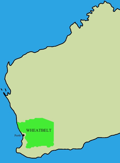
Regionalisations of Western Australia are systems by which Western Australia is divided into distinct geographic regions. The most commonly known regionalisation is the governmental division of the state into regions for economic development purposes, of which there are nine.Other regionalisations...
. It partially surrounds the Perth metropolitan area, extending north from Perth to the Mid West region, and east to the Goldfields-Esperance region. It is bordered to the south by the South West and Great Southern regions, and to the west by the Indian Ocean
Indian Ocean
The Indian Ocean is the third largest of the world's oceanic divisions, covering approximately 20% of the water on the Earth's surface. It is bounded on the north by the Indian Subcontinent and Arabian Peninsula ; on the west by eastern Africa; on the east by Indochina, the Sunda Islands, and...
, the Perth metropolitan area, and the Peel region. Altogether, it has an area of 154862 square kilometres (59,793 sq mi) (including islands), and a population of about 72,000 people. The population is widely distributed, with only about 16,000 people living in the main towns of Northam
Northam, Western Australia
Northam is a town in Western Australia, situated at the confluence of the Avon and Mortlock Rivers, about north-east of Perth in the Avon Valley. At the 2006 census, Northam had a population of 6,009. Northam is the largest town in the Avon region...
, Narrogin
Narrogin, Western Australia
Narrogin is a large town in the Wheatbelt region of Western Australia, southeast of Perth on the Great Southern Highway between Pingelly and Wagin...
, Merredin
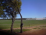
Merredin, Western Australia
-Economy:The agricultural land around Merredin produces 40% of Western Australia’s wheat quota. As a focal point for the region, Merredin’s local bulk handling co-operative receives and processes in excess of a million tonnes of grain every year...
and Moora
Moora, Western Australia
Moora is a townsite located 177 km north of Perth in the Wheatbelt region of Western Australia. Moora was one of the original stations on the Midland railway line to Walkaway, and the townsite was gazetted in 1895...
.
The Wheatbelt encompasses a range of ecosystems and as a result has a range industries operating in the region. In the Interim Biogeographic Regionalisation for Australia
Interim Biogeographic Regionalisation for Australia
The Interim Biogeographic Regionalisation for Australia is a biogeographic regionalisation of Australia developed by the Australian Government's Department of the Environment, Water, Heritage and the Arts...
- there are a number of subdivisions such as the 'Avon Wheatbelt' (AW) - and a further breakdown of Avon Wheatbelt P1 (AW1) and Avon Wheatbelt P2 (AW2), Jarrah Forest, Geraldton Sandplain and Mallee regions.
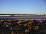
Near the coast, it receives relatively high rainfall and mild temperature, and its 150 kilometres (93 mi) of coastline is a significant tourist
Tourism
Tourism is travel for recreational, leisure or business purposes. The World Tourism Organization defines tourists as people "traveling to and staying in places outside their usual environment for not more than one consecutive year for leisure, business and other purposes".Tourism has become a...
area. In contrast, the eastern fringe is very arid, and is mainly used for mining
Mining
Mining is the extraction of valuable minerals or other geological materials from the earth, from an ore body, vein or seam. The term also includes the removal of soil. Materials recovered by mining include base metals, precious metals, iron, uranium, coal, diamonds, limestone, oil shale, rock...
of minerals including gold
Gold
Gold is a chemical element with the symbol Au and an atomic number of 79. Gold is a dense, soft, shiny, malleable and ductile metal. Pure gold has a bright yellow color and luster traditionally considered attractive, which it maintains without oxidizing in air or water. Chemically, gold is a...
, nickel
Nickel
Nickel is a chemical element with the chemical symbol Ni and atomic number 28. It is a silvery-white lustrous metal with a slight golden tinge. Nickel belongs to the transition metals and is hard and ductile...
and iron ore. The remainder of the region is highly suited to agriculture
Agriculture
Agriculture is the cultivation of animals, plants, fungi and other life forms for food, fiber, and other products used to sustain life. Agriculture was the key implement in the rise of sedentary human civilization, whereby farming of domesticated species created food surpluses that nurtured the...
, and is the source of nearly two thirds of the state's wheat
Wheat
Wheat is a cereal grain, originally from the Levant region of the Near East, but now cultivated worldwide. In 2007 world production of wheat was 607 million tons, making it the third most-produced cereal after maize and rice...
production, half of its wool
Wool
Wool is the textile fiber obtained from sheep and certain other animals, including cashmere from goats, mohair from goats, qiviut from muskoxen, vicuña, alpaca, camel from animals in the camel family, and angora from rabbits....
production, and the majority of its lamb and mutton, oranges
Orange (fruit)
An orange—specifically, the sweet orange—is the citrus Citrus × sinensis and its fruit. It is the most commonly grown tree fruit in the world....
, honey
Honey
Honey is a sweet food made by bees using nectar from flowers. The variety produced by honey bees is the one most commonly referred to and is the type of honey collected by beekeepers and consumed by humans...
, cut flowers and a range of other agricultural and pastoral products.
Local government areas
All but one of the Wheatbelt region’s local government areasLocal Government Areas of Western Australia
The Australian state of Western Australia is divided into 141 local government areas...
are shires:
- BeverleyShire of BeverleyThe Shire of Beverley is a Local Government Area located in the Wheatbelt region of Western Australia, and is about southeast of Perth, the state capital. The Shire covers an area of , starting outside Armadale in the Darling Scarp and extending eastwards beyond the scarp into agricultural lands...
- BrooktonShire of BrooktonThe Shire of Brookton is a Local Government Area located in the Wheatbelt region of Western Australia, about southeast of Perth, the state capital...
- Bruce RockShire of Bruce RockThe Shire of Bruce Rock is a Local Government Area in the Wheatbelt region of Western Australia, about south of Merredin and about east of the state capital, Perth. The Shire covers an area of , and its seat of government is the town of Bruce Rock.-History:...
- Chittering
- CorriginShire of CorriginThe Shire of Corrigin is a Local Government Area located in the Wheatbelt region of Western Australia, about east of the state capital, Perth. Its seat of government is the town of Corrigin...
- CuballingShire of CuballingThe Shire of Cuballing is a Local Government Area located in the Wheatbelt region of Western Australia, about north of the town of Narrogin and southeast of the capital, Perth. The Shire covers an area of and its seat of government is the small town of Cuballing.Over 10% of its area contains...
- CunderdinShire of CunderdinThe Shire of Cunderdin is a Local Government Area located in the Wheatbelt region of Western Australia, about west of Merredin and about east of Perth, the state capital. The Shire covers an area of and its seat of government is the town of Cunderdin....
- DandaraganShire of DandaraganThe Shire of Dandaragan is a Local Government Area located in the Wheatbelt region of Western Australia, about north of the state capital, Perth. The Shire covers an area of and its seat of government is the town of Jurien Bay.-History:...
- DalwallinuShire of DalwallinuThe Shire of Dalwallinu is a Local Government Area located in the Wheatbelt region of Western Australia, about NNE of Perth, the state capital. The Shire covers an area of and its seat of government is the town of Dalwallinu.-History:...
- DowerinShire of DowerinThe Shire of Dowerin is a Local Government Area in the Wheatbelt region of Western Australia, about northeast of Perth, the state capital. The Shire covers an area of and its seat of government is the town of Dowerin.-History:...
- DumbleyungShire of DumbleyungThe Shire of Dumbleyung is a Local Government Area located in the Wheatbelt region of Western Australia, about east of Wagin and about southeast of Perth, the state capital. The Shire covers an area of , and is involved in grain and livestock production and various biodiversity industries...
- GinginShire of GinginThe Shire of Gingin is a Local Government Area in the Wheatbelt region of Western Australia, just beyond the northern fringe of the Perth metropolitan area. The Shire covers an area of and its seat of government is the town of Gingin.-History:...
- GoomallingShire of GoomallingThe Shire of Goomalling is a Local Government Area in the Wheatbelt region of Western Australia, about northeast of Perth, the state capital. The Shire covers an area of and its seat of government is the town of Goomalling.-History:...
- KellerberrinShire of KellerberrinThe Shire of Kellerberrin is a Local Government Area in the Wheatbelt region of Western Australia, about west of Merredin and about east of Perth, the state capital...
- KondininShire of KondininThe Shire of Kondinin is a Local Government Area in the Eastern Wheatbelt region of Western Australia, about east of the state capital, Perth. The Shire's land area of forms a narrow east-west band, located between the Shire of Narembeen to the north and the Shire of Kulin to the south...
- KoordaShire of KoordaThe Shire of Koorda is a Local Government Area in the Wheatbelt region of Western Australia, about northeast of Perth, the state capital. The Shire covers an area of and its seat of government is the town of Koorda.-History:...
- KulinShire of KulinThe Shire of Kulin is a Local Government Area in the Eastern Wheatbelt region of Western Australia, about ESE of the state capital, Perth. The Shire's land area of forms a narrow east-west band, located between the Shire of Kondinin to the north and the Shire of Lake Grace to the south. Its seat...
- Lake GraceShire of Lake GraceThe Shire of Lake Grace is a Local Government Area in the Eastern Wheatbelt region of Western Australia, about ESE of the state capital, Perth. The Shire has a land area of and its seat of government is the town of Lake Grace.-History:...
- MerredinShire of MerredinThe Shire of Merredin is a Local Government Area in the Wheatbelt region of Western Australia, about east of Perth, the state capital. Its seat of government is the town of Merredin, where 2,804 of the Shire's 3,595 residents live. The Shire covers an area of .-History:On 30 June 1921, the...
- MooraShire of MooraThe Shire of Moora is a Local Government Area in the northern Wheatbelt region of Western Australia, and generally lies between the Brand Highway and Great Northern Highway about north of Perth, the state capital. The Shire covers an area of and its seat of government is the town of...
- Mount Marshall
- MukinbudinShire of MukinbudinThe Shire of Mukinbudin is a Local Government Area in the Wheatbelt region of Western Australia, about north of Merredin and about east of the state capital, Perth. The Shire covers an area of , and its seat of government is the town of Mukinbudin.-History:...
- NarembeenShire of NarembeenThe Shire of Narembeen is a Local Government Area in the Eastern Wheatbelt region of Western Australia, about east of the state capital, Perth, and between the shires of Merredin to the north, and Kondinin to the south...
- Narrogin (Shire)Shire of NarroginThe Shire of Narrogin is a Local Government Area in the Wheatbelt region of Western Australia, about south-east of the state capital, Perth. Curiously, the town of Narrogin serves as the Shire's seat of government, despite the fact that it is not part of the shire itself...
- Narrogin (Town)Town of NarroginThe Town of Narrogin is a Local Government Area of Western Australia for the town of Narrogin in the Wheatbelt region of Western Australia, south-east of the capital, Perth along Great Southern Highway. The Shire has a population of 4,238 ....
- NorthamShire of NorthamThe Shire of Northam is a Local Government Area in the Wheatbelt region of Western Australia, beyond the northeastern fringe of the Perth metropolitan area centred on the town of Northam itself. The Shire covers an area of...
- NungarinShire of NungarinThe Shire of Nungarin is a Local Government Area in the Wheatbelt region of Western Australia, and, with a population of 264 as at the 2001 census, is one of the nation's smallest. It is located about north of Merredin and about east of the state capital, Perth...
- PingellyShire of PingellyThe Shire of Pingelly is a Local Government Area in the Wheatbelt region of Western Australia, about southeast of the state capital, Perth, between the Shires of Brookton and Cuballing along the Great Southern Highway. The Shire covers an area of , and its seat of government is the town of...
- QuairadingShire of QuairadingThe Shire of Quairading is a Local Government Area in the Wheatbelt region of Western Australia, about east of the state capital, Perth. The Shire covers an area of , and its seat of government is the town of Quairading.-History:...
- TamminShire of TamminThe Shire of Tammin is a Local Government Area located in the Wheatbelt region of Western Australia. Its seat of government is the town of Tammin, about 80 kilometres west of Merredin and about 180 kilometres east of Perth, the state capital.-History:Originally the area was governed by...
- ToodyayShire of ToodyayThe Shire of Toodyay is a Local Government Area in the Wheatbelt region of Western Australia, beyond the north-eastern limits of the Perth metropolitan area. The Shire covers an area of , and its seat of government is the town of Toodyay.-History:...
- TrayningShire of TrayningThe Shire of Trayning is a Local Government Area in the Wheatbelt region of Western Australia, about northwest of Merredin and about east of the state capital, Perth. The Shire covers an area of , and its seat of government is the town of Trayning.-History:...
- Victoria Plains
- WaginShire of WaginThe Shire of Wagin is a Local Government Area in the Wheatbelt region of Western Australia, about southeast of the state capital, Perth. The Shire covers an area of about , and its seat of government is the town of Wagin.-History:...
- WanderingShire of WanderingThe Shire of Wandering is a Local Government Area in the Wheatbelt region of Western Australia, and, with a population of 318 as at the 2001 census, is one of the nation's smallest. It covers an area of generally to the east of Albany Highway about south-east of Perth, the state capital...
- West Arthur
- WestoniaShire of WestoniaThe Shire of Westonia is a Local Government Area in the Eastern Wheatbelt region of Western Australia, about east of Perth, the state capital. Its seat of government is the small town of Westonia....
- WickepinShire of WickepinThe Shire of Wickepin is a Local Government Area in the Wheatbelt region of Western Australia, east of Narrogin and about southeast of the state capital, Perth. The Shire covers an area of , and its seat of government is the town of Wickepin.-History:...
- WilliamsShire of WilliamsThe Shire of Williams is a Local Government Area in the Wheatbelt region of Western Australia, about southeast of the state capital, Perth. The Shire covers an area of , and its seat of government is the town of Williams.-History:...
- Wongan-Ballidu
- WyalkatchemShire of WyalkatchemThe Shire of Wyalkatchem is a Local Government Area located in the Wheatbelt region of Western Australia. Its seat of government is the town of Wyalkatchem, about northeast of Perth, the state capital.-History:...
- Yilgarn
- YorkShire of YorkThe Shire of York is a Local Government Area in the Wheatbelt region of Western Australia, covering an area of just beyond the eastern fringe of Perth's metropolitan area. The Shire's seat of government is the town of York.-History:...