
Transportation in the San Francisco Bay Area
Encyclopedia
Airports
The following airports are served by commercial airlines. In addition there are many general aviation airports in the region.- San Francisco International AirportSan Francisco International AirportSan Francisco International Airport is a major international airport located south of downtown San Francisco, California, United States, near the cities of Millbrae and San Bruno in unincorporated San Mateo County. It is often referred to as SFO...
(SFO)- The largest and oldest airport in the region, and a major international hub airport in California second only to LAX (Los AngelesLos ÁngelesLos Ángeles is the capital of the province of Biobío, in the commune of the same name, in Region VIII , in the center-south of Chile. It is located between the Laja and Biobío rivers. The population is 123,445 inhabitants...
).
- The largest and oldest airport in the region, and a major international hub airport in California second only to LAX (Los Angeles
- Oakland International AirportOakland International AirportOakland International Airport , also known as Metropolitan Oakland International Airport, is a public airport located south of the central business district of Oakland, a city in Alameda County, California, United States...
(OAK)- The second largest airport in the region and a hub for mostly low-cost domestic flights. Oakland International is the base airport for the rapidly growing Southwest AirlinesSouthwest AirlinesSouthwest Airlines Co. is an American low-cost airline based in Dallas, Texas. Southwest is the largest airline in the United States, based upon domestic passengers carried,...
.
- The second largest airport in the region and a hub for mostly low-cost domestic flights. Oakland International is the base airport for the rapidly growing Southwest Airlines
- Mineta San Jose International Airport (SJC)
- A minor hub for AmericanAmerican AirlinesAmerican Airlines, Inc. is the world's fourth-largest airline in passenger miles transported and operating revenues. American Airlines is a subsidiary of the AMR Corporation and is headquartered in Fort Worth, Texas adjacent to its largest hub at Dallas/Fort Worth International Airport...
and Southwest Airlines. Construction on a new concourse has just been completed.
- A minor hub for American
- Charles M. Schulz - Sonoma County AirportCharles M. Schulz - Sonoma County AirportCharles M. Schulz – Sonoma County Airport is a county-owned public-use airport located 6 nautical miles northwest of downtown Santa Rosa, a city in Sonoma County, California, United States. It serves the county and surrounding areas of Wine Country in California.The airport is named after Charles M...
(STS)- A minor airport in Santa Rosa, it is served by one commercial airline, Horizon AirHorizon AirHorizon Air Industries, Inc. is a regional low-cost airline based in SeaTac, Washington, United States. It is the eighth largest regional airline in the USA, serving 52 cities in the United States, Canada and Mexico....
.
- A minor airport in Santa Rosa, it is served by one commercial airline, Horizon Air
Public transportation
Mass transit
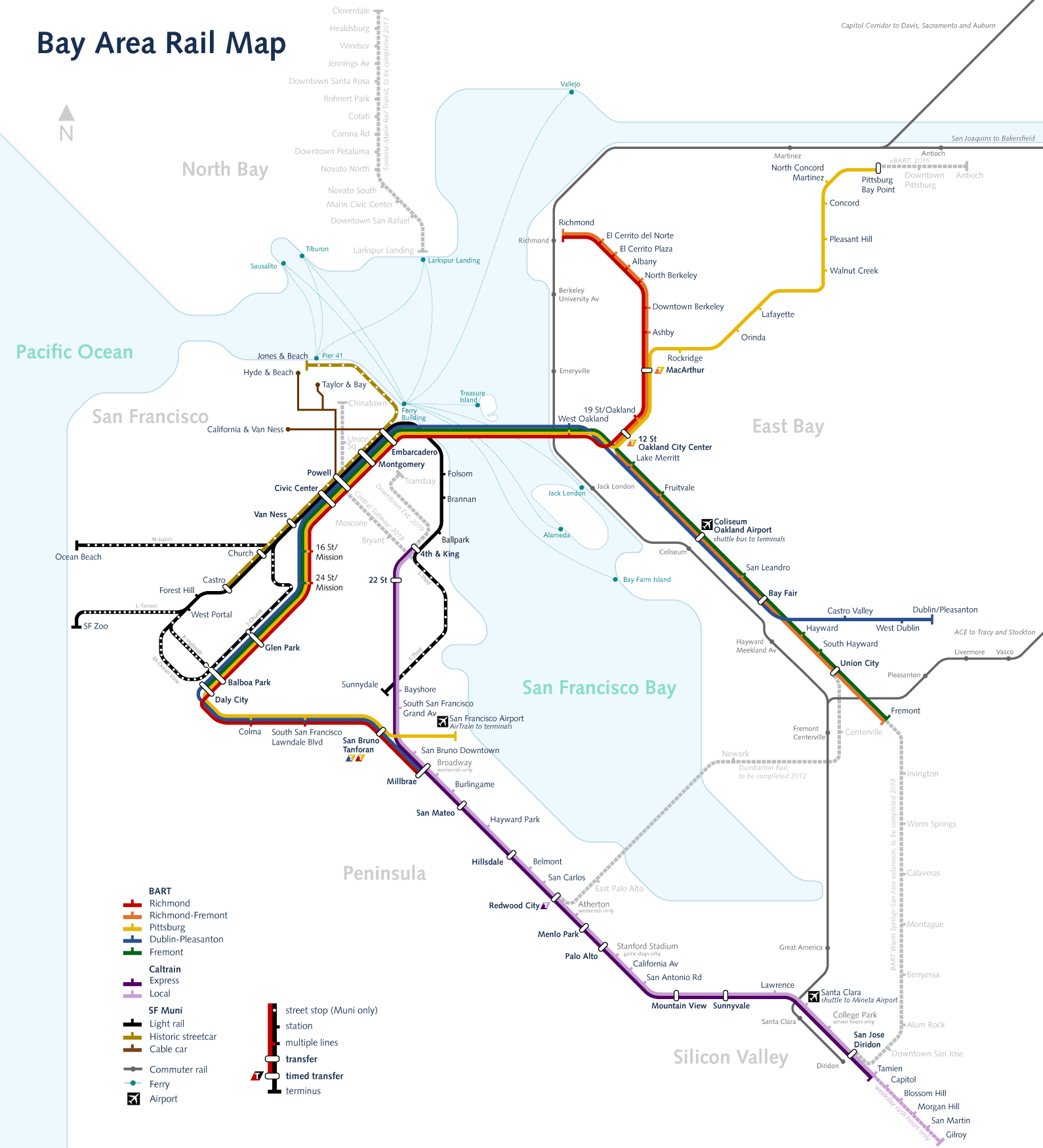
The Bay Area is served by a number of mass transit systems:- Bay Area Rapid TransitBay Area Rapid TransitBay Area Rapid Transit is a rapid transit system serving the San Francisco Bay Area. The heavy-rail public transit and subway system connects San Francisco with cities in the East Bay and suburbs in northern San Mateo County. BART operates five lines on of track with 44 stations in four counties...
(BART) - A subwayRapid transitA rapid transit, underground, subway, elevated railway, metro or metropolitan railway system is an electric passenger railway in an urban area with a high capacity and frequency, and grade separation from other traffic. Rapid transit systems are typically located either in underground tunnels or on...
/commuter rail service that serves parts of the Bay Area, including San Francisco, Oakland, Berkeley, Fremont, and Walnut Creek. It has a direct connection to San Francisco's airport while a direct connection to Oakland's airport is in the planning stages. - CaltrainCaltrainCaltrain is a California commuter rail line on the San Francisco Peninsula and in the Santa Clara Valley in the United States. The northern terminus of the rail line is in San Francisco, at 4th and King streets; its southern terminus is in Gilroy...
- A commuter rail service that connects San JoseSan Jose, CaliforniaSan Jose is the third-largest city in California, the tenth-largest in the U.S., and the county seat of Santa Clara County which is located at the southern end of San Francisco Bay...
and cities along the Peninsula with San Francisco, and with the BART system by way of the MillbraeMillbrae, CaliforniaMillbrae is a city in San Mateo County, California, United States, just west of San Francisco Bay, with San Bruno on the north and Burlingame on the south. The population was 21,532 at the 2010 census.-History:...
Station. - AmtrakAmtrakThe National Railroad Passenger Corporation, doing business as Amtrak , is a government-owned corporation that was organized on May 1, 1971, to provide intercity passenger train service in the United States. "Amtrak" is a portmanteau of the words "America" and "track". It is headquartered at Union...
- There are several Amtrak stations throughout the Bay Area. Major stations in MartinezMartinez, CaliforniaMartinez is a city and the county seat of Contra Costa County, California, United States. The population was 35,824 at the 2010 census. The downtown is notable for its large number of preserved old buildings...
and EmeryvilleEmeryville, CaliforniaEmeryville is a small city located in Alameda County, California, in the United States. It is located in a corridor between the cities of Berkeley and Oakland, extending to the shore of San Francisco Bay. Its proximity to San Francisco, the Bay Bridge, the University of California, Berkeley, and...
feature Coast StarlightCoast StarlightThe Coast Starlight is a passenger train operated by Amtrak on the West Coast of the United States. It runs from King Street Station in Seattle, Washington, to Union Station in Los Angeles, California. The train's name was formed as a merging of two of Southern Pacific's train names, the Coast...
and California ZephyrCalifornia ZephyrThe California Zephyr is a long passenger train route operated by Amtrak in the midwestern and western United States.It runs from Chicago, Illinois, in the east to Emeryville, California, in the west, passing through the states of Illinois, Iowa, Nebraska, Colorado, Utah, Nevada, and California...
service. The Starlight also serves Oakland and San Jose. The Capitol CorridorCapitol CorridorThe Capitol Corridor is a 168-mile passenger train route operated by Amtrak in California. Because it is fully supported by the state, the Capitol Corridor operates under Amtrak California. It runs from the San Francisco Bay Area to Sacramento, roughly parallel to Interstate 80...
connects Bay Area cities to SacramentoSacramento, CaliforniaSacramento is the capital city of the U.S. state of California and the county seat of Sacramento County. It is located at the confluence of the Sacramento River and the American River in the northern portion of California's expansive Central Valley. With a population of 466,488 at the 2010 census,...
and Auburn, CaliforniaAuburn, CaliforniaAuburn is the county seat of Placer County, California. Its population at the 2010 census was 13,330. Auburn is known for its California Gold Rush history.Auburn is part of the Greater Sacramento area.- History :...
, and features BART transfer stations at RichmondRichmond Station (California)Richmond Station is an at-grade Bay Area Rapid Transit and Amtrak station located in Richmond, California. Each system is served by an island platform. The Capitol Corridor, San Joaquins, California Zephyr, and Coast Starlight stop here and connect to BART. The station is currently being rebuilt...
and the Oakland ColiseumOakland Coliseum Amtrak/BART StationThe Oakland Coliseum Station is a complex of two stations of two public transit providers that are within of each other: Amtrak Capitol Corridors Oakland Coliseum station and Bay Area Rapid Transit 's Coliseum/Oakland Airport station...
. The San Joaquin serves Sacramento, CaliforniaSacramento, CaliforniaSacramento is the capital city of the U.S. state of California and the county seat of Sacramento County. It is located at the confluence of the Sacramento River and the American River in the northern portion of California's expansive Central Valley. With a population of 466,488 at the 2010 census,...
, and Oakland California with trains to Bakersfield, CaliforniaBakersfield, CaliforniaBakersfield is a city near the southern end of the San Joaquin Valley in Kern County, California. It is roughly equidistant between Fresno and Los Angeles, to the north and south respectively....
. - ACEAltamont Commuter ExpressThe Altamont Commuter Express is a regional rail service in California connecting Stockton with San Jose....
- Altamont Commuter Express; a rail service that mainly serves commuters to and from the Central Valley to the Silicon ValleySilicon ValleySilicon Valley is a term which refers to the southern part of the San Francisco Bay Area in Northern California in the United States. The region is home to many of the world's largest technology corporations...
. It travels from StocktonStockton, CaliforniaStockton, California, the seat of San Joaquin County, is the fourth-largest city in the Central Valley of the U.S. state of California. With a population of 291,707 at the 2010 census, Stockton ranks as this state's 13th largest city...
through PleasantonPleasanton, CaliforniaPleasanton is a city in Alameda County, California, incorporated in 1894. It is a suburb in the San Francisco Bay Area located about east of Oakland, and west of Livermore. The population was 70,285 at the 2010 census. In 2005 and 2007, Pleasanton was ranked the wealthiest middle-sized city in...
, FremontFremont, CaliforniaFremont is a city in Alameda County, California. It was incorporated on January 23, 1956, from the merger of five smaller communities: Centerville, Niles, Irvington, Mission San Jose, and Warm Springs...
, Santa ClaraSanta Clara, CaliforniaSanta Clara , founded in 1777 and incorporated in 1852, is a city in Santa Clara County, in the U.S. state of California. The city is the site of the eighth of 21 California missions, Mission Santa Clara de Asís, and was named after the mission. The Mission and Mission Gardens are located on the...
, and ends at San Jose. It operates only during commute hours on weekdays.
Light rail
- In San Francisco, Muni operates Muni MetroMuni MetroMuni Metro is a light rail system serving San Francisco, California, operated by the San Francisco Municipal Railway , a division of the San Francisco Municipal Transportation Agency...
, a light railLight railLight rail or light rail transit is a form of urban rail public transportation that generally has a lower capacity and lower speed than heavy rail and metro systems, but higher capacity and higher speed than traditional street-running tram systems...
system that runs mostly on converted streetcar lines. It also has a tunnel under Market Street that it shares with BART.
- In Santa Clara County, VTA operates its own light railSanta Clara VTA Light-railVTA Light Rail is a light rail system serving San Jose, California and its suburbs in Silicon Valley. It is operated by the Santa Clara Valley Transportation Authority, or VTA, and consists of of standard-gauge track on two main lines and a spur line...
network, serving southern, central and eastern San Jose, along with northern Santa Clara, northern Sunnyvale, Campbell and Mountain View.
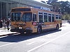
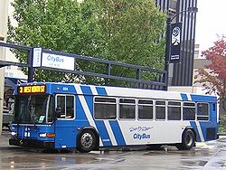
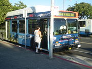
Bus
Numerous and often overlapping bus transit agencies service the area. The table below lists most of the Bay Area's bus agencies, along with their mass transit (train) connections.Legend for Mass Transit Connections:
| Color Code | Definition |
|---|---|
| Santa Rosa CityBus | Does not provide connections to any mass transit agency |
| Vallejo Transit | Serves one mass transit agency |
| Wheels | Serves two mass transit agencies |
| AC Transit | Serves three or more mass transit agencies |
Note: this list does not include school day-only routes or routes operated on special events.
| Agency Name | Bus Example | Coverage Area | Number of Routes | Mass Transit Connections | ||||
|---|---|---|---|---|---|---|---|---|
| Local/ Basic |
Rapid/ Limited |
Express/ Commuter |
Shuttle | All-Nighter | ||||
| AC Transit AC Transit AC Transit is an Oakland-based regional public transit agency serving the western half of Alameda County and parts of western Contra Costa County in the western, Bay-side area of the East Bay of the San Francisco Bay Area... * |
Inner East Bay (western Alameda County Alameda County, California Alameda County is a county in the U.S. state of California. It occupies most of the East Bay region of the San Francisco Bay Area. As of the 2010 census it had a population of 1,510,271, making it the 7th most populous county in the state... and western Contra Costa County Contra Costa County, California Contra Costa County is a primarily suburban county in the San Francisco Bay Area of the U.S. state of California. As of the 2010 census, it had a population of 1,049,025... ), with limited service to San Francisco (Transbay Terminal only), parts of San Mateo San Mateo County, California San Mateo County is a county located in the San Francisco Bay Area of the U.S. state of California. It covers most of the San Francisco Peninsula just south of San Francisco, and north of Santa Clara County. San Francisco International Airport is located at the northern end of the county, and... and Santa Clara Santa Clara County, California Santa Clara County is a county located at the southern end of the San Francisco Bay Area in the U.S. state of California. As of 2010 it had a population of 1,781,642. The county seat is San Jose. The highly urbanized Santa Clara Valley within Santa Clara County is also known as Silicon Valley... Counties |
68 | 4 | 29 | None | 6 | Connects to multiple Amtrak Amtrak The National Railroad Passenger Corporation, doing business as Amtrak , is a government-owned corporation that was organized on May 1, 1971, to provide intercity passenger train service in the United States. "Amtrak" is a portmanteau of the words "America" and "track". It is headquartered at Union... and BART Bay Area Rapid Transit Bay Area Rapid Transit is a rapid transit system serving the San Francisco Bay Area. The heavy-rail public transit and subway system connects San Francisco with cities in the East Bay and suburbs in northern San Mateo County. BART operates five lines on of track with 44 stations in four counties... stations, plus three Caltrain Caltrain Caltrain is a California commuter rail line on the San Francisco Peninsula and in the Santa Clara Valley in the United States. The northern terminus of the rail line is in San Francisco, at 4th and King streets; its southern terminus is in Gilroy... stations and one VTA Light Rail Santa Clara Valley Transportation Authority The Santa Clara Valley Transportation Authority is a special-purpose district responsible for public transit services, congestion management, specific highway improvement projects, and countywide transportation planning for Santa Clara County, California, United States... station |
|
| AirBART AirBART AirBART is a privately-run shuttle bus service that connects the Bay Area Rapid Transit's Coliseum/Oakland Airport station with Oakland International Airport . Buses stop at street level just outside the BART station and serve both airport terminals with one stop at the airport along the third curb... |
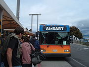 |
Oakland Oakland, California Oakland is a major West Coast port city on San Francisco Bay in the U.S. state of California. It is the eighth-largest city in the state with a 2010 population of 390,724... |
1 | None | None | None | None | Provides connections between Oakland Coliseum BART/Amtrak Station and Oakland International Airport Oakland International Airport Oakland International Airport , also known as Metropolitan Oakland International Airport, is a public airport located south of the central business district of Oakland, a city in Alameda County, California, United States... |
| Benicia Breeze | Benicia Benicia, California Benicia is a waterside city in Solano County, California, United States. It was the first city in California to be founded by Anglo-Americans, and served as the state capital for nearly thirteen months from 1853 to 1854. The population was 26,997 at the 2010 census. The city is located in the San... , Concord Concord, California Concord is the largest city in Contra Costa County, California, USA. At the 2010 census, the city had a population of 122,067. Originally founded in 1869 as the community of Todos Santos by Salvio Pacheco, the name was changed to Concord within months... |
5 | None | None | 2 | None | ||
| County Connection County Connection The County Connection is a Concord-based public transit agency operating fixed-route bus and ADA paratransit service in and around central Contra Costa County in the San Francisco Bay Area... |
 |
Central Contra Costa County Contra Costa County, California Contra Costa County is a primarily suburban county in the San Francisco Bay Area of the U.S. state of California. As of the 2010 census, it had a population of 1,049,025... (Concord Concord, California Concord is the largest city in Contra Costa County, California, USA. At the 2010 census, the city had a population of 122,067. Originally founded in 1869 as the community of Todos Santos by Salvio Pacheco, the name was changed to Concord within months... , Martinez Martinez, California Martinez is a city and the county seat of Contra Costa County, California, United States. The population was 35,824 at the 2010 census. The downtown is notable for its large number of preserved old buildings... , Orinda Orinda, California -2010:The 2010 United States Census reported that Orinda had a population of 17,643. The population density was 1,389.5 people per square mile . The racial makeup of Orinda was 14,533 White, 149 African American, 22 Native American, 2,016 Asian, 24 Pacific Islander, 122 from other races, and... , San Ramon San Ramon, California -2010 census:The 2010 United States Census reported that San Ramon had a population of 72,148. The population density was 3,991.1 people per square mile... , Walnut Creek Walnut Creek, California Walnut Creek is an incorporated city located east of the city of Oakland. It lies in the East Bay region of the San Francisco Bay Area. While not as large as neighboring Concord, Walnut Creek serves as the business and entertainment hub for the neighboring cities within central Contra Costa... ), southeastern Alameda County (Dublin/Pleasanton BART Dublin/Pleasanton (BART station) Dublin/Pleasanton is a Bay Area Rapid Transit station on the border of Dublin and Pleasanton. The station is fed by twenty local and regional bus lines from five different providers.... ) |
35 | None | 7 | 2 | None | Connects to four BART stations and the Martinez Amtrak Station Martinez (Amtrak station) Martinez Station is a union station in Martinez, California, the county seat of Contra Costa County. It is served by 44 Amtrak trains per day, including Capitol Corridor trains, San Joaquins, the California Zephyr and the Coast Starlight... |
| Dumbarton Express Dumbarton Express The Dumbarton Express is a California bus service operating between Union City BART station and Palo Alto Caltrain station via the Dumbarton Bridge. The service is operated by a group of operators including BART, VTA, Union City Transit, and AC Transit... * |
Southern Alameda County (Fremont Fremont, California Fremont is a city in Alameda County, California. It was incorporated on January 23, 1956, from the merger of five smaller communities: Centerville, Niles, Irvington, Mission San Jose, and Warm Springs... , Newark Newark, California Newark is a city in Alameda County, California, United States. It was incorporated as a city in September 1955. Newark is an enclave, completely surrounded by the city of Fremont. Its population was 42,573 at the 2010 census.-Geography:... , Union City BART Union City (BART station) Union City is a Bay Area Rapid Transit station located near the Decoto district of Union City. Service at this station began on September 11, 1972. The station sits near Decoto Road east of Alvarado-Niles Road, directly behind James Logan High School's campus... ), Santa Clara County Santa Clara County, California Santa Clara County is a county located at the southern end of the San Francisco Bay Area in the U.S. state of California. As of 2010 it had a population of 1,781,642. The county seat is San Jose. The highly urbanized Santa Clara Valley within Santa Clara County is also known as Silicon Valley... (Palo Alto Palo Alto, California Palo Alto is a California charter city located in the northwest corner of Santa Clara County, in the San Francisco Bay Area of California, United States. The city shares its borders with East Palo Alto, Mountain View, Los Altos, Los Altos Hills, Stanford, Portola Valley, and Menlo Park. It is... ) |
None | None | 3 | None | None | Connects to Union City BART Station and Palo Alto Caltrain Station Palo Alto (Caltrain station) Palo Alto Station is the main train station in Palo Alto, California. It is a regional transit center serving Santa Clara County and San Mateo County Santa Clara Valley Transportation Authority transit bus passengers as well as Caltrain commuters. Palo Alto is also one of the busiest stations in... |
|
| Emery Go Round Emery Go Round Emery Go-Round is a zero-fare bus service in Emeryville, California, near Oakland, California. It has three lines that run five days a week, with more limited service on weekends, and no or reduced service on holidays... |
Emeryville Emeryville, California Emeryville is a small city located in Alameda County, California, in the United States. It is located in a corridor between the cities of Berkeley and Oakland, extending to the shore of San Francisco Bay. Its proximity to San Francisco, the Bay Bridge, the University of California, Berkeley, and... , MacArthur BART MacArthur (BART station) MacArthur is a rapid transit station on three lines of the Bay Area Rapid Transit system in Oakland, California. It is the largest station in the BART system, being the only one with four platform tracks in regular use.-Location:... |
6 | None | None | None | None | Connects to MacArthur BART Station and Emeryville Amtrak Station Emeryville (Amtrak station) The Emeryville Amtrak station is an Amtrak station in Emeryville, California that replaced the older Amtrak 16th Street Station in Oakland. The original Beaux-Arts Oakland 16th Street Station was declared unsafe due to unreinforced masonry after sustaining damage in the Loma Prieta Earthquake of... |
|
| Fairfield and Suisun Transit | Parts of Contra Costa Contra Costa County, California Contra Costa County is a primarily suburban county in the San Francisco Bay Area of the U.S. state of California. As of the 2010 census, it had a population of 1,049,025... and Yolo Yolo County, California Yolo County is a county located in the northern part of the U.S. state of California, bordered by the other counties of Sacramento, Solano, Napa, Lake, Colusa, and Sutter. The city of Woodland is its county seat, though Davis is its largest city.... Counties, most of Solano County Solano County, California Solano County is a county located in Bay-Delta region of the U.S. state of California, about halfway between San Francisco and Sacramento and is one of the nine San Francisco Bay Area counties. The county's population was reported by the U.S. Census to be 413,344 in 2010... , Sacramento Sacramento, California Sacramento is the capital city of the U.S. state of California and the county seat of Sacramento County. It is located at the confluence of the Sacramento River and the American River in the northern portion of California's expansive Central Valley. With a population of 466,488 at the 2010 census,... |
10 | None | 4 | None | None | Connects to Suisun City/Fairfield Amtrak Station Suisun/Fairfield (Amtrak station) Suisun/Fairfield station is an Amtrak station in Suisun City, California, close to the city of Fairfield, served by the Amtrak Capitol Corridor commuter rail line between Auburn and San Jose through Oakland. Connecting bus service is provided by Fairfield and Suisun Transit... and two BART stations |
|
| Golden Gate Transit Golden Gate Transit Golden Gate Transit is a public transportation system serving the North Bay region of the San Francisco Bay Area in California, United States. It mainly serves Marin and Sonoma Counties, and also provides limited service to San Francisco and Contra Costa County.Golden Gate Transit is one of three... ** |
 |
Parts of Contra Costa County Contra Costa County, California Contra Costa County is a primarily suburban county in the San Francisco Bay Area of the U.S. state of California. As of the 2010 census, it had a population of 1,049,025... (El Cerrito El Cerrito, Contra Costa County, California -Transportation:The city's primary transportation infrastructure consists of the El Cerrito Plaza and El Cerrito del Norte BART stations along with several local bus lines, operated by AC Transit, providing access to the surrounding area and the nearby cities of Albany, Berkeley and Richmond... , Richmond Richmond, California Richmond is a city in western Contra Costa County, California, United States. The city was incorporated on August 7, 1905. It is located in the East Bay, part of the San Francisco Bay Area. It is a residential inner suburb of San Francisco, as well as the site of heavy industry, which has been... ), Marin County Marin County, California Marin County is a county located in the North San Francisco Bay Area of the U.S. state of California, across the Golden Gate Bridge from San Francisco. As of 2010, the population was 252,409. The county seat is San Rafael and the largest employer is the county government. Marin County is well... , San Francisco, Sonoma County Sonoma County, California Sonoma County, located on the northern coast of the U.S. state of California, is the largest and northernmost of the nine San Francisco Bay Area counties. Its population at the 2010 census was 483,878. Its largest city and county seat is Santa Rosa.... (up to Santa Rosa Santa Rosa, California Santa Rosa is the county seat of Sonoma County, California, United States. The 2010 census reported a population of 167,815. Santa Rosa is the largest city in California's Wine Country and fifth largest city in the San Francisco Bay Area, after San Jose, San Francisco, Oakland, and Fremont and 26th... ) |
20† | 1 | 20 | None | None | Connects to Del Norte BART El Cerrito del Norte (BART station) El Cerrito del Norte, frequenly shorterned to del Norte, is one of two BART stations in El Cerrito, California, just east of the Cutting Boulevard interchange of Interstate 80 parallel to San Pablo Avenue and the Ohlone Greenway straddling the Richmond border. Del Norte opened to revenue service on... , Richmond Amtrak/BART Richmond Station (California) Richmond Station is an at-grade Bay Area Rapid Transit and Amtrak station located in Richmond, California. Each system is served by an island platform. The Capitol Corridor, San Joaquins, California Zephyr, and Coast Starlight stop here and connect to BART. The station is currently being rebuilt... , and several BART Bay Area Rapid Transit Bay Area Rapid Transit is a rapid transit system serving the San Francisco Bay Area. The heavy-rail public transit and subway system connects San Francisco with cities in the East Bay and suburbs in northern San Mateo County. BART operates five lines on of track with 44 stations in four counties... and Muni Metro Muni Metro Muni Metro is a light rail system serving San Francisco, California, operated by the San Francisco Municipal Railway , a division of the San Francisco Municipal Transportation Agency... stations in San Francisco |
| Healdsburg Transit | Healdsburg Healdsburg, California Healdsburg is a city located in Sonoma County, California, in the United States. As of the 2010 United States Census, the city had a population of 11,254... |
1 | None | None | 1 | None | ||
| Marin Transit Marin Transit Marin Transit is a public bus agency in Marin County, California, in the United States. Originally formed in 1964 as Marin County Transit District , it was rebranded as Marin Transit on 30 July 2007... |
Marin County Marin County, California Marin County is a county located in the North San Francisco Bay Area of the U.S. state of California, across the Golden Gate Bridge from San Francisco. As of 2010, the population was 252,409. The county seat is San Rafael and the largest employer is the county government. Marin County is well... |
14† | None | None | 7 | None | ||
| Petaluma Transit Petaluma Transit Petaluma Transit is the public bus service in the city of Petaluma, Sonoma County, California. The system connects with several Sonoma County Transit routes for further travel within the county and Golden Gate Transit routes for travel between the city, Marin County, and San Francisco.Hours of... |
Petaluma Petaluma, California Petaluma is a city in Sonoma County, California, in the United States. In the 2010 Census the population was 57,941.Located in Petaluma is the Rancho Petaluma Adobe, a National Historic Landmark. It was built beginning in 1836 by General Mariano Guadalupe Vallejo, then Commandant of the San... |
5 | None | None | None | None | ||
| SamTrans SamTrans SamTrans is a public transport agency in and around San Mateo, California, in the San Francisco Bay Area. It provides bus service throughout San Mateo County and into portions of San Francisco and Palo Alto... * |
San Francisco, San Mateo County San Mateo County, California San Mateo County is a county located in the San Francisco Bay Area of the U.S. state of California. It covers most of the San Francisco Peninsula just south of San Francisco, and north of Santa Clara County. San Francisco International Airport is located at the northern end of the county, and... , part of Santa Clara County Santa Clara County, California Santa Clara County is a county located at the southern end of the San Francisco Bay Area in the U.S. state of California. As of 2010 it had a population of 1,781,642. The county seat is San Jose. The highly urbanized Santa Clara Valley within Santa Clara County is also known as Silicon Valley... (Palo Alto Palo Alto, California Palo Alto is a California charter city located in the northwest corner of Santa Clara County, in the San Francisco Bay Area of California, United States. The city shares its borders with East Palo Alto, Mountain View, Los Altos, Los Altos Hills, Stanford, Portola Valley, and Menlo Park. It is... ) |
30‡ | None | 1 | None | 2 | Provides connections to multiple BART and Caltrain stations; Muni Metro connections along Market Street are just one block from Mission Street | |
| San Benito County Transit San Benito County Transit San Benito County Transit is the public transportation agency of San Benito County, California, immediately south of the Silicon Valley .... |
San Benito County San Benito County, California San Benito County is a county located in the Coast Range Mountains of the U.S. state of California, south of San Jose. As of 2010 the population was 55,269. The county seat is Hollister, which includes nearly two-thirds of the county's population. El Camino Real passes through the county and... and parts of Gilroy Gilroy, California Gilroy is the southernmost city in Santa Clara County, California, United States. The population was 48,821 at the 2010 census. Gilroy is well-known for its garlic crop and for the annual Gilroy Garlic Festival, featuring various garlicky foods, including garlic ice cream. Gilroy also produces... (Santa Clara County Santa Clara County, California Santa Clara County is a county located at the southern end of the San Francisco Bay Area in the U.S. state of California. As of 2010 it had a population of 1,781,642. The county seat is San Jose. The highly urbanized Santa Clara Valley within Santa Clara County is also known as Silicon Valley... ) |
6*** | 2 | None | None | None | Connects to Gilroy Caltrain | |
| San Francisco MUNI San Francisco Municipal Railway The San Francisco Municipal Railway is the public transit system for the city and county of San Francisco, California. In 2006, it served with an operating budget of about $700 million... |
 |
San Francisco, parts of Marin County Marin County, California Marin County is a county located in the North San Francisco Bay Area of the U.S. state of California, across the Golden Gate Bridge from San Francisco. As of 2010, the population was 252,409. The county seat is San Rafael and the largest employer is the county government. Marin County is well... (Marin Headlands Marin Headlands The Marin Headlands is a hilly area at the southernmost end of Marin County, California, just north of the Golden Gate Bridge. The Headlands are located just north of San Francisco, immediately across the Golden Gate Bridge. The entire area is part of the Golden Gate National Recreation Area... ) and San Mateo County San Mateo County, California San Mateo County is a county located in the San Francisco Bay Area of the U.S. state of California. It covers most of the San Francisco Peninsula just south of San Francisco, and north of Santa Clara County. San Francisco International Airport is located at the northern end of the county, and... (Brisbane Brisbane, California Brisbane is a small city located in the northern part of San Mateo County, California on the lower slopes of San Bruno Mountain. It is on the northeastern edge of South San Francisco, next to the San Francisco Bay and near the San Francisco International Airport.The population was 4,282 as of... , Daly City Daly City, California Daly City is the largest city in San Mateo County, California, United States, with a 2010 population of 101,123. Located immediately south of San Francisco, it is named in honor of businessman and landowner John Daly.-History:... ) |
42 | 5 | 16# | None | 10 | Provides connections to multiple BART, Caltrain, and Muni Metro stations |
| Santa Cruz Metro | Santa Cruz County Santa Cruz County, California Santa Cruz County is a county located on the Pacific coast of the U.S. state of California, on the California Central Coast. The county forms the northern coast of the Monterey Bay. . As of the 2010 U.S. Census, its population was 262,382. The county seat is Santa Cruz... , part of San Jose San Jose, California San Jose is the third-largest city in California, the tenth-largest in the U.S., and the county seat of Santa Clara County which is located at the southern end of San Francisco Bay... (Santa Clara County Santa Clara County, California Santa Clara County is a county located at the southern end of the San Francisco Bay Area in the U.S. state of California. As of 2010 it had a population of 1,781,642. The county seat is San Jose. The highly urbanized Santa Clara Valley within Santa Clara County is also known as Silicon Valley... ) |
30 | 5 | 1 | None | None | Connects Santa Cruz County Santa Cruz County, California Santa Cruz County is a county located on the Pacific coast of the U.S. state of California, on the California Central Coast. The county forms the northern coast of the Monterey Bay. . As of the 2010 U.S. Census, its population was 262,382. The county seat is Santa Cruz... cities with San Jose San Jose, California San Jose is the third-largest city in California, the tenth-largest in the U.S., and the county seat of Santa Clara County which is located at the southern end of San Francisco Bay... via Highway 17 Express Highway 17 Express The Highway 17 Express is an Amtrak Thruway Motorcoach route provided by a consortium of entities that provides regional service between San Jose and Santa Cruz County in the South Bay of the San Francisco Bay Area... route to Amtrak/VTA light rail/Caltrain/ACE Diridon Station Diridon Station Diridon Station is the central passenger rail depot for San Jose, California. It also serves as a transit hub for Santa Clara County and the Silicon Valley... |
|
| Santa Rosa CityBus Santa Rosa CityBus Santa Rosa CityBus is a public transportation agency providing bus service in the northern California city of Santa Rosa. It provides service for over 2.8 million passenger trips annually. -Routes:... |
 |
Santa Rosa Santa Rosa, California Santa Rosa is the county seat of Sonoma County, California, United States. The 2010 census reported a population of 167,815. Santa Rosa is the largest city in California's Wine Country and fifth largest city in the San Francisco Bay Area, after San Jose, San Francisco, Oakland, and Fremont and 26th... |
18 | None | None | None | None | |
| Sonoma County Transit Sonoma County Transit Sonoma County Transit is a public transportation system based in Sonoma County, California.-Cities and communities served:As the primary bus system in the county, Sonoma County Transit operates to the following communities, listed by zones from south to north:Sonoma Coast and Russian River:*... |
|
Part of Marin County Marin County, California Marin County is a county located in the North San Francisco Bay Area of the U.S. state of California, across the Golden Gate Bridge from San Francisco. As of 2010, the population was 252,409. The county seat is San Rafael and the largest employer is the county government. Marin County is well... (San Rafael San Rafael, California San Rafael is a city and the county seat of Marin County, California, United States. The city is located in the North Bay region of the San Francisco Bay Area... ), Sonoma County Sonoma County, California Sonoma County, located on the northern coast of the U.S. state of California, is the largest and northernmost of the nine San Francisco Bay Area counties. Its population at the 2010 census was 483,878. Its largest city and county seat is Santa Rosa.... |
20†† | None | 6 | None | None | |
| Tri Delta Transit | Southeastern Alameda County (Dublin/Pleasanton BART Station Dublin/Pleasanton (BART station) Dublin/Pleasanton is a Bay Area Rapid Transit station on the border of Dublin and Pleasanton. The station is fed by twenty local and regional bus lines from five different providers.... ), central and eastern Contra Costa County (Antioch Antioch, California Antioch is a city in Contra Costa County, California. Located in the East Bay region of the San Francisco Bay Area along the San Joaquin-Sacramento River Delta, it is a suburb of San Francisco and Oakland. The city's population was 102,372 at the U.S... , Brentwood Brentwood, California Brentwood is a city in Contra Costa County, California, United States. It is located in the East Bay region of the San Francisco Bay Area. The population is 51,481 as of 2010.... , Concord Concord, California Concord is the largest city in Contra Costa County, California, USA. At the 2010 census, the city had a population of 122,067. Originally founded in 1869 as the community of Todos Santos by Salvio Pacheco, the name was changed to Concord within months... , Martinez Martinez, California Martinez is a city and the county seat of Contra Costa County, California, United States. The population was 35,824 at the 2010 census. The downtown is notable for its large number of preserved old buildings... , Pittsburg Pittsburg, California Pittsburg is a city located in eastern Contra Costa County, California, the outer portion of the East Bay region of the San Francisco Bay Area. The population was 63,264 at the 2010 census.... ), western San Joaquin County (Mountain House) |
13*** | None | 7 | 1 | None | Provides connections to several BART stations and Martinez Amtrak Station Martinez (Amtrak station) Martinez Station is a union station in Martinez, California, the county seat of Contra Costa County. It is served by 44 Amtrak trains per day, including Capitol Corridor trains, San Joaquins, the California Zephyr and the Coast Starlight... |
|
| Union City Transit Union City Transit Union City Transit is a public transit service in Union City, California, in the San Francisco Bay Area. It began operations in 1974 with the opening of the Union City BART station.The service was formerly known as "the Flea."... * |
Union City Union City, California Union City is a city in Alameda County, California, United States. It was incorporated in 1959, combining the communities of Alvarado and Decoto. Alvarado was the original county seat of Alameda County, and the site of the first county courthouse is a California Historical Landmark . The city... |
5 | None | None | None | None | Provides connections to Union City BART Union City (BART station) Union City is a Bay Area Rapid Transit station located near the Decoto district of Union City. Service at this station began on September 11, 1972. The station sits near Decoto Road east of Alvarado-Niles Road, directly behind James Logan High School's campus... |
|
| Vacaville City Coach Vacaville City Coach Vacaville City Coach runs local fixed route bus service in the city of Vacaville, California. And also provides commuter service to BART in Pleasant Hill and Walnut Creek in addition to job centers there in a consortium including Fairfield/Suisun Transit... |
Vacaville Vacaville, California Vacaville, California is a city located in the northeastern portion of the San Francisco Bay Area in Solano County. The city is nearly half way between Sacramento and San Francisco on I-80. It sits approximately from Sacramento, and from San Francisco... |
4 | None | None | None | None | ||
| Vallejo Transit | Parts of Contra Costa Contra Costa County, California Contra Costa County is a primarily suburban county in the San Francisco Bay Area of the U.S. state of California. As of the 2010 census, it had a population of 1,049,025... (El Cerrito) and Solano Solano County, California Solano County is a county located in Bay-Delta region of the U.S. state of California, about halfway between San Francisco and Sacramento and is one of the nine San Francisco Bay Area counties. The county's population was reported by the U.S. Census to be 413,344 in 2010... Counties (Fairfield Fairfield, California Fairfield is a city located in Solano County in Northern California, USA. It is generally considered the midpoint between the cities of San Francisco and Sacramento, approximately from the city center of both cities, approximately from the city center of Oakland, less than from Napa Valley, 18... , Vallejo Vallejo, California Vallejo is the largest city in Solano County, California, United States. The population was 115,942 at the 2010 census. It is located in the San Francisco Bay Area on the northeastern shore of San Pablo Bay... ) |
8 | None | 2 | None | None | Provides connections to several BART stations (Del Norte BART El Cerrito del Norte (BART station) El Cerrito del Norte, frequenly shorterned to del Norte, is one of two BART stations in El Cerrito, California, just east of the Cutting Boulevard interchange of Interstate 80 parallel to San Pablo Avenue and the Ohlone Greenway straddling the Richmond border. Del Norte opened to revenue service on... , Pleasant Hill BART Pleasant Hill (BART station) Pleasant Hill/Contra Costa Centre is a Bay Area Rapid Transit station serving the Contra Costa Centre Transit Village in Contra Costa Centre, California, just north of Walnut Creek and just east of Pleasant Hill.-Overview:... , Walnut Creek BART Walnut Creek (BART station) Walnut Creek is an elevated subway station in Walnut Creek, California, on the Pittsburg/Bay Point – SFO/Millbrae line of the Bay Area Rapid Transit system.-Location:... ) |
|
| VINE VINE (Napa County) VINE is a public transportation service in Napa County, California, USA and is under the Napa County Transportation and Planning Agency. The system offers extensive service throughout the County along with providing connections to other public transportation systems in adjacent counties.-Vehicles... |
 |
Napa County Napa County, California Napa County is a county located north of the San Francisco Bay Area in the U.S. state of California. It is coterminous with the Napa, California, Metropolitan Statistical Area. As of 2010 the population is 136,484. The county seat is Napa.... , parts of Solano County Solano County, California Solano County is a county located in Bay-Delta region of the U.S. state of California, about halfway between San Francisco and Sacramento and is one of the nine San Francisco Bay Area counties. The county's population was reported by the U.S. Census to be 413,344 in 2010... (Vallejo Vallejo, California Vallejo is the largest city in Solano County, California, United States. The population was 115,942 at the 2010 census. It is located in the San Francisco Bay Area on the northeastern shore of San Pablo Bay... ) and Sonoma County Sonoma County, California Sonoma County, located on the northern coast of the U.S. state of California, is the largest and northernmost of the nine San Francisco Bay Area counties. Its population at the 2010 census was 483,878. Its largest city and county seat is Santa Rosa.... (Santa Rosa Santa Rosa, California Santa Rosa is the county seat of Sonoma County, California, United States. The 2010 census reported a population of 167,815. Santa Rosa is the largest city in California's Wine Country and fifth largest city in the San Francisco Bay Area, after San Jose, San Francisco, Oakland, and Fremont and 26th... ) |
12## | None | 2 | 4 | None | Provides connections to the Vallejo Ferry Terminal and Del Norte BART El Cerrito del Norte (BART station) El Cerrito del Norte, frequenly shorterned to del Norte, is one of two BART stations in El Cerrito, California, just east of the Cutting Boulevard interchange of Interstate 80 parallel to San Pablo Avenue and the Ohlone Greenway straddling the Richmond border. Del Norte opened to revenue service on... |
| VTA Santa Clara Valley Transportation Authority The Santa Clara Valley Transportation Authority is a special-purpose district responsible for public transit services, congestion management, specific highway improvement projects, and countywide transportation planning for Santa Clara County, California, United States... * |
Santa Clara County Santa Clara County, California Santa Clara County is a county located at the southern end of the San Francisco Bay Area in the U.S. state of California. As of 2010 it had a population of 1,781,642. The county seat is San Jose. The highly urbanized Santa Clara Valley within Santa Clara County is also known as Silicon Valley... , parts of Alameda County Alameda County, California Alameda County is a county in the U.S. state of California. It occupies most of the East Bay region of the San Francisco Bay Area. As of the 2010 census it had a population of 1,510,271, making it the 7th most populous county in the state... (Fremont Fremont, California Fremont is a city in Alameda County, California. It was incorporated on January 23, 1956, from the merger of five smaller communities: Centerville, Niles, Irvington, Mission San Jose, and Warm Springs... ) and San Mateo County San Mateo County, California San Mateo County is a county located in the San Francisco Bay Area of the U.S. state of California. It covers most of the San Francisco Peninsula just south of San Francisco, and north of Santa Clara County. San Francisco International Airport is located at the northern end of the county, and... (Menlo Park Menlo Park, California Menlo Park, California is a city at the eastern edge of San Mateo County, in the San Francisco Bay Area of California, in the United States. It is bordered by San Francisco Bay on the north and east; East Palo Alto, Palo Alto, and Stanford to the south; Atherton, North Fair Oaks, and Redwood City... ) |
54# | 5 | 12 | 12 | 1 | Connects to multiple Caltrain and VTA light rail stations, plus one BART station (Fremont BART Fremont (BART station) Fremont is a Bay Area Rapid Transit station that serves Fremont, California. The elevated island platform serves as the southernmost terminal station of BART's Fremont line, which is served by trains on the Fremont - Daly City Line, which runs daytimes Monday-Saturday, and the Richmond - Fremont... ) |
|
| WestCAT WestCAT WestCAT is a public transportation service in western Contra Costa County . It is a service of the Western Contra Costa Transit Authority.... |
Western and Central Contra Costa County Contra Costa County, California Contra Costa County is a primarily suburban county in the San Francisco Bay Area of the U.S. state of California. As of the 2010 census, it had a population of 1,049,025... , San Francisco |
10 | None | 4 | None | None | Provides connections to Del Norte BART El Cerrito del Norte (BART station) El Cerrito del Norte, frequenly shorterned to del Norte, is one of two BART stations in El Cerrito, California, just east of the Cutting Boulevard interchange of Interstate 80 parallel to San Pablo Avenue and the Ohlone Greenway straddling the Richmond border. Del Norte opened to revenue service on... and Martinez Amtrak Martinez (Amtrak station) Martinez Station is a union station in Martinez, California, the county seat of Contra Costa County. It is served by 44 Amtrak trains per day, including Capitol Corridor trains, San Joaquins, the California Zephyr and the Coast Starlight... statons |
|
| WHEELS WHEELS (California) WHEELS is a bus service that provides public transportation in the Tri-Valley Region of the San Francisco Bay Area, in the United States... |
Central and southern Contra Costa County Contra Costa County, California Contra Costa County is a primarily suburban county in the San Francisco Bay Area of the U.S. state of California. As of the 2010 census, it had a population of 1,049,025... (San Ramon San Ramon, California -2010 census:The 2010 United States Census reported that San Ramon had a population of 72,148. The population density was 3,991.1 people per square mile... , Walnut Creek Walnut Creek, California Walnut Creek is an incorporated city located east of the city of Oakland. It lies in the East Bay region of the San Francisco Bay Area. While not as large as neighboring Concord, Walnut Creek serves as the business and entertainment hub for the neighboring cities within central Contra Costa... ), southeastern Alameda County Alameda County, California Alameda County is a county in the U.S. state of California. It occupies most of the East Bay region of the San Francisco Bay Area. As of the 2010 census it had a population of 1,510,271, making it the 7th most populous county in the state... (Dublin Dublin, California Dublin is a suburban city of the East Bay region of Alameda County, California, United States. Located along the north side of Interstate 580 at the intersection with Interstate 680, roughly east of Hayward, west of Livermore and north of San Jose, it was named after the city of Dublin in... , Livermore Livermore, California Livermore is a city in Alameda County. The population as of 2010 was 80,968. Livermore is located on the eastern edge of California's San Francisco Bay Area.... , Pleasanton Pleasanton, California Pleasanton is a city in Alameda County, California, incorporated in 1894. It is a suburb in the San Francisco Bay Area located about east of Oakland, and west of Livermore. The population was 70,285 at the 2010 census. In 2005 and 2007, Pleasanton was ranked the wealthiest middle-sized city in... ) |
20** | None | 3 | 4 | None | Provides connections to several BART and ACE Altamont Commuter Express The Altamont Commuter Express is a regional rail service in California connecting Stockton with San Jose.... |
|
| Note | Some routes that operate as one route type may also be listed as another type (e.g. select daytime Muni services also operate as All-Nighter routes) | |||||||
Symbols Legend:
- * - operates as a part of a consortium for Dumbarton Express
- ** - includes "variable" or "deviated" routes
- † - Golden Gate Transit's local routes are operated under contract with Marin Transit. Also, Golden Gate Transit's local routes include the Basic regional routes (Routes 10, 42, 70, 80, 101)
- †† - Sonoma County Transit's local routes include some commute-only services that also act as local trips.
Other Agencies:
- LINKSSan Leandro LINKSSan Leandro LINKS or West San Leandro Shuttle usually referred to simply as the Links Bus is a free public transit service in San Leandro, California.-Service:...
(connects parts of San LeandroSan Leandro, CaliforniaSan Leandro is a city in Alameda County, California, United States. It is considered a suburb of Oakland and San Francisco. The population was 84,950 as of 2010 census. The climate of the city is mild throughout the year.-Geography and water resources:...
to San Leandro BART stationSan Leandro (BART station)San Leandro is a Bay Area Rapid Transit station located near the downtown area of San Leandro, California. It is the busiest station in the city and is also one of the busiest in the East Bay....
) - Kaiser Permanente Bus Shuttles provide free service between many BART stations and medical centers throughout the Bay Area.
Ferries
Public ferry services cross the bay to serve both commuters and leisure travelers. Operators include Golden Gate TransitGolden Gate Transit
Golden Gate Transit is a public transportation system serving the North Bay region of the San Francisco Bay Area in California, United States. It mainly serves Marin and Sonoma Counties, and also provides limited service to San Francisco and Contra Costa County.Golden Gate Transit is one of three...
, Blue and Gold Fleet, and Red & White Fleet
Red & White Fleet
Red & White Fleet is the business name for a vessel tour company operating in the San Francisco Bay Area of California.Red and White Fleet is San Francisco’s original sightseeing provider and has been cruising the Bay since 1892...
. Hornblower Cruises
Hornblower Cruises
Hornblower Cruises & Events is a San Francisco-based charter yacht, dining cruise and ferry service company.-History:The company began in 1974 in Berkeley, CA. In 1980 the original owner, Ward Proescher, sold the business to Terry MacRae and P. Michael Watson...
provides service to Alcatraz Island
Alcatraz Island
Alcatraz Island is an island located in the San Francisco Bay, offshore from San Francisco, California, United States. Often referred to as "The Rock" or simply "Traz", the small island was developed with facilities for a lighthouse, a military fortification, a military prison, and a Federal...
.
Airport shuttle service
Airport shuttles (mostly buses and vans) provide services from the three major San Francisco Bay Area airports, namely San Francisco International AirportSan Francisco International Airport
San Francisco International Airport is a major international airport located south of downtown San Francisco, California, United States, near the cities of Millbrae and San Bruno in unincorporated San Mateo County. It is often referred to as SFO...
(SFO), Oakland International Airport
Oakland International Airport
Oakland International Airport , also known as Metropolitan Oakland International Airport, is a public airport located south of the central business district of Oakland, a city in Alameda County, California, United States...
(OAK), and San Jose International Airport
San Jose International Airport
Norman Y. Mineta San Jose International Airport is a city-owned public-use airport serving the city of San Jose in Santa Clara County, California, United States. It is named for San Jose native Norman Yoshio Mineta, who was Transportation Secretary in the Cabinet of George W...
(SJC).
- BayPorter Express Airport Shuttle - Airport Shuttle service serving Alameda, Contra Costa, and San Francisco Counties to and from SFO and OAK.
- Marin Airporter - Airport Shuttle service serving Marin County to and from SFO.
- Marin County Airport Shuttle - Airport Shuttle service serving Marin County to and from SFO, OAK, and SJC.
- Monterey Airport Shuttle - Airport Shuttle service serving Monterey County to and from SFO, OAK, and SJC.
- Non Stop Airport Shuttle - Private shuttle service to and from SFO, OAK, and SJC.
- Sonoma County Airport Express - Airport Shuttle service serving Sonoma County (Santa Rosa, Rohnert Park, Petaluma) and Marin County (San Rafael) to and from SFO and OAK.
- SuperShuttle - Airport door-to-door van service serving San Francisco, San Mateo, and Santa Clara Counties to and from SFO, OAK (reservations only), and SJC (reservations only).
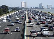
Freeways and highways
Trans-bay crossings
- Interstate 80 - The western terminus of I-80 is located in San Francisco as James Lick Skyway, just west of the San Francisco – Oakland Bay Bridge. The interstate continues to the east, connecting to Oakland and the north coast of the East Bay as the Eastshore Freeway, and then on to SacramentoSacramento, CaliforniaSacramento is the capital city of the U.S. state of California and the county seat of Sacramento County. It is located at the confluence of the Sacramento River and the American River in the northern portion of California's expansive Central Valley. With a population of 466,488 at the 2010 census,...
, RenoReno, NevadaReno is the county seat of Washoe County, Nevada, United States. The city has a population of about 220,500 and is the most populous Nevada city outside of the Las Vegas metropolitan area...
, and New JerseyNew JerseyNew Jersey is a state in the Northeastern and Middle Atlantic regions of the United States. , its population was 8,791,894. It is bordered on the north and east by the state of New York, on the southeast and south by the Atlantic Ocean, on the west by Pennsylvania and on the southwest by Delaware...
. - Interstate 580Interstate 580 (California)Interstate 580 is an 80-mile east–west Interstate Highway in Northern California. The heavily traveled spur route of Interstate 80 runs from San Rafael in the San Francisco Bay Area to Interstate 5 near Tracy in the Central Valley...
- This spur route's western terminus is in Marin CountyMarin County, CaliforniaMarin County is a county located in the North San Francisco Bay Area of the U.S. state of California, across the Golden Gate Bridge from San Francisco. As of 2010, the population was 252,409. The county seat is San Rafael and the largest employer is the county government. Marin County is well...
. The Interstate crosses the San Pablo Bay over the Richmond-San Rafael BridgeRichmond-San Rafael BridgeThe Richmond – San Rafael Bridge is the northernmost of the east–west crossings of the San Francisco Bay in California, USA, connecting Richmond on the east to San Rafael on the west end...
, goes through Richmond as the John T. Knox Freeway, passes through Oakland as the MacArthur Freeway, then continues to LivermoreLivermore, CaliforniaLivermore is a city in Alameda County. The population as of 2010 was 80,968. Livermore is located on the eastern edge of California's San Francisco Bay Area....
, through the Altamont PassAltamont PassAltamont Pass, formerly Livermore Pass, is a mountain pass in the Diablo Range between Livermore in the Livermore Valley and Tracy in the San Joaquin Valley in Northern California...
to TracyTracy, CaliforniaTracy is the second most populated city in San Joaquin County, California, United States and an exurb of the San Francisco Bay Area. The population was 82,922 at the 2010 census.-History:...
, where it intersects with Interstate 5, thus providing a link with Southern CaliforniaSouthern CaliforniaSouthern California is a megaregion, or megapolitan area, in the southern area of the U.S. state of California. Large urban areas include Greater Los Angeles and Greater San Diego. The urban area stretches along the coast from Ventura through the Southland and Inland Empire to San Diego...
. - State Route 92California State Route 92State Route 92 is an east-west highway in the San Francisco Bay area between Half Moon Bay near the coast in the west and downtown Hayward at its junction with State Route 238 and State Route 185. It is most notable for being the route that traverses the San Mateo Bridge. It has interchanges with...
- SR 92's western terminus is in Half Moon BayHalf Moon Bay, CaliforniaHalf Moon Bay is a coastal city in San Mateo County, California, USA. Its population was 11,324 as of the 2010 census. Immediately at the north of Half Moon Bay is the Pillar Point Harbor and the unincorporated community of Princeton-by-the-Sea....
. The two-lane highway crosses the Santa Cruz MountainsSanta Cruz MountainsThe Santa Cruz Mountains, part of the Pacific Coast Ranges, are a mountain range in central California, United States. They form a ridge along the San Francisco Peninsula, south of San Francisco, separating the Pacific Ocean from San Francisco Bay and the Santa Clara Valley, and continuing south,...
, connecting to Interstate 280 and U.S. Route 101 as the J. Arthur Younger Freeway, becoming a freeway as it passes through San MateoSan Mateo, CaliforniaSan Mateo is a city in San Mateo County, California, United States, in the San Francisco Bay Area. With a population of approximately 100,000 , it is one of the larger suburbs on the San Francisco Peninsula, located between Burlingame to the north, Foster City to the east, Belmont to the south,...
before crossing the San Mateo-Hayward Bridge to HaywardHayward, CaliforniaHayward is a city located in the East Bay in Alameda County, California. With a population of 144,186, Hayward is the sixth largest city in the San Francisco Bay Area and the third largest in Alameda County. Hayward was ranked as the 37th most populous municipality in California. It is included in...
as Jackson Street. - State Route 84California State Route 84State Route 84 is a split-section California State Highway consisting of two sections. The first section is an east–west arterial road running from San Gregorio to Menlo Park, across the Dumbarton Bridge through Fremont and Newark and ending at I-580 in Livermore. The route overlaps the...
- SR 84 begins at State Route 1California State Route 1State Route 1 , more often called Highway 1, is a state highway that runs along much of the Pacific coast of the U.S. state of California. It is famous for running along some of the most beautiful coastlines in the world, leading to its designation as an All-American Road.Highway 1 does not run...
(at the Pacific Coast) near San Gregorio State BeachSan Gregorio State BeachSan Gregorio State Beach is a beach near San Gregorio, California, USA, south of Half Moon Bay. Part of the California State Park System, the beach lies just west of the intersection of State Route 1 and State Route 84...
, and crosses the Santa Cruz MountainsSanta Cruz MountainsThe Santa Cruz Mountains, part of the Pacific Coast Ranges, are a mountain range in central California, United States. They form a ridge along the San Francisco Peninsula, south of San Francisco, separating the Pacific Ocean from San Francisco Bay and the Santa Clara Valley, and continuing south,...
on a scenic route between La Honda and WoodsideWoodside, CaliforniaWoodside is a small incorporated town in San Mateo County, California, United States, on the San Francisco Peninsula. It uses a council-manager system of government. The U.S. Census estimated the population of the town to be 5,287 in 2010....
as Woodside Road. It then crosses the Bay over the Dumbarton BridgeDumbarton Bridge (California)The Dumbarton Bridge is the southernmost of the highway bridges that span the San Francisco Bay in California. Carrying over 81,000 vehicles daily, it is also the shortest bridge across San Francisco Bay at 1.63 miles...
from Redwood CityRedwood City, CaliforniaRedwood City is a California charter city located on the San Francisco Peninsula in Northern California, approximately 27 miles south of San Francisco, and 24 miles north of San Jose. Redwood City's history spans from its earliest inhabitation by the Ohlone people, to its tradition as a port for...
to NewarkNewark, CaliforniaNewark is a city in Alameda County, California, United States. It was incorporated as a city in September 1955. Newark is an enclave, completely surrounded by the city of Fremont. Its population was 42,573 at the 2010 census.-Geography:...
. The route then passes through FremontFremont, CaliforniaFremont is a city in Alameda County, California. It was incorporated on January 23, 1956, from the merger of five smaller communities: Centerville, Niles, Irvington, Mission San Jose, and Warm Springs...
as Thornton Avenue and Peralta Boulevard, continuing as Niles CanyonNiles CanyonNiles Canyon is a canyon in the San Francisco Bay Area formed by Alameda Creek. The canyon is largely in an unincorporated area of Alameda County, while the western portion of the canyon lies within the city limits of Fremont and Union City...
Road to SunolSunol, CaliforniaSunol is an unincorporated census-designated place in Alameda County, California, United States. The population was 913 at the 2010 census....
and Livermore as Vallecitos Road and Isabel Avenue, terminating at Interstate 580Interstate 580 (California)Interstate 580 is an 80-mile east–west Interstate Highway in Northern California. The heavily traveled spur route of Interstate 80 runs from San Rafael in the San Francisco Bay Area to Interstate 5 near Tracy in the Central Valley...
as Airway Boulevard.
The Peninsula to the South Bay
- Interstate 280Interstate 280 (California)Interstate 280 is a 57-mile long north–south Interstate Highway in the San Francisco Bay Area of Northern California. It connects San Jose and San Francisco, running along just to the west of the cities of San Francisco Peninsula for most of its route.I-280 from its northern end at King...
and U.S. Route 101 - Eight-lane and, in some parts, 10-lane freeways connecting San Francisco to San Jose, passing through the Peninsula as Junipero Serra and Sinclair Freeways (I-280) and Bayshore Freeway (101). Highway 101 continues south to GilroyGilroy, CaliforniaGilroy is the southernmost city in Santa Clara County, California, United States. The population was 48,821 at the 2010 census. Gilroy is well-known for its garlic crop and for the annual Gilroy Garlic Festival, featuring various garlicky foods, including garlic ice cream. Gilroy also produces...
and Salinas, CaliforniaSalinas, CaliforniaSalinas is the county seat and the largest municipality of Monterey County, California. Salinas is located east-southeast of the mouth of the Salinas River, at an elevation of about 52 feet above sea level. The population was 150,441 at the 2010 census...
, before continuing to Los AngelesLos Angeles, CaliforniaLos Angeles , with a population at the 2010 United States Census of 3,792,621, is the most populous city in California, USA and the second most populous in the United States, after New York City. It has an area of , and is located in Southern California...
. For most of its route I-280 runs along the foothills of the Santa Cruz Mountains, and is very scenic, while 101 is highly urban and is locally known as "the world's longest parking lot." - California State Routes 1California State Route 1State Route 1 , more often called Highway 1, is a state highway that runs along much of the Pacific coast of the U.S. state of California. It is famous for running along some of the most beautiful coastlines in the world, leading to its designation as an All-American Road.Highway 1 does not run...
and 35California State Route 35State Route 35 in the U.S. state of California, generally known as Skyline Boulevard, is a two-lane road running along the western ridge of Silicon Valley in California. It runs from Highway 17 to San Francisco at State Route 1. It provides scenic views of both the Santa Cruz Mountains, the...
- Two-lane highways also traveling down the Peninsula, SR 1 along the Pacific coast, and SR 35 near the ridge of the Santa Cruz MountainsSanta Cruz MountainsThe Santa Cruz Mountains, part of the Pacific Coast Ranges, are a mountain range in central California, United States. They form a ridge along the San Francisco Peninsula, south of San Francisco, separating the Pacific Ocean from San Francisco Bay and the Santa Clara Valley, and continuing south,...
. SR 1 as Cabrillo Highway connects to Half Moon Bay, Santa CruzSanta Cruz, CaliforniaSanta Cruz is the county seat and largest city of Santa Cruz County, California in the US. As of the 2010 U.S. Census, Santa Cruz had a total population of 59,946...
, and MontereyMonterey, CaliforniaThe City of Monterey in Monterey County is located on Monterey Bay along the Pacific coast in Central California. Monterey lies at an elevation of 26 feet above sea level. As of the 2010 census, the city population was 27,810. Monterey is of historical importance because it was the capital of...
, before continuing to Los Angeles. - California State Routes 17 (Santa Cruz Freeway) and 9California State Route 9State Route 9 is mainly a rural and mountainous route in the U.S. state of California that travels 35 miles from SR 1 near Santa Cruz to SR 17 in Los Gatos, passing through the San Lorenzo Valley and the Saratoga Gap...
- Highways through the Santa Cruz Mountains, connecting the South Bay to Santa Cruz. Part of SR 17 in San Jose is an 8 lane freeway. - California Routes 237California State Route 237State Route 237 runs from El Camino Real in Mountain View to Interstate 680 in Milpitas. It runs south of the San Francisco Bay, connecting the East Bay to the Peninsula.This route is part of the California Freeway and Expressway System....
(South Bay Freeway) and 85California State Route 85State Route 85 is a freeway which connects Mountain View and southern San Jose. The entire freeway is named the West Valley Freeway. The majority of the route is also named the Norman Y. Mineta Highway, with the exception of the portion of Highway 85 passing through Saratoga which is named the CHP...
(West Valley Freeway) - Six-lane freeways connecting the west Santa Clara Valley to the east Santa Clara Valley, bypassing Downtown San JoseDowntown San JoseDowntown San Jose is the central business district of San Jose, California, United States. The area is generally located north of Interstate 280 and east of Guadalupe Parkway, which roughly parallels the Guadalupe River. The region is bound to the north by U.S...
. - State Route 87California State Route 87State Route 87 , locally called Highway 87 or the Guadalupe Freeway, is a north–south state highway entirely within San Jose, California, United States. Its name was changed from Guadalupe Parkway in 2004 after its entire constructed length was upgraded to a freeway...
(Guadalupe Parkway) - North-south six-lane freeway entirely in San Jose, connecting San Jose International AirportSan Jose International AirportNorman Y. Mineta San Jose International Airport is a city-owned public-use airport serving the city of San Jose in Santa Clara County, California, United States. It is named for San Jose native Norman Yoshio Mineta, who was Transportation Secretary in the Cabinet of George W...
, Downtown to the Almaden Valley. - State Route 152California State Route 152State Route 152 is a state highway that runs near the latitudinal middle of the U.S. state of California from Watsonville to Route 99 southeast of Merced...
- Two-lane highway from WatsonvilleWatsonville, CaliforniaWatsonville is a city in Santa Cruz County, California, United States. The population was 51,199 according to the 2010 census.Located on the central coast of California, the economy centers predominantly around the farming industry. It is known for growing strawberries, apples, lettuce and a host...
, crosses the Santa Cruz Mountains to Gilroy, then crosses the Diablo RangeDiablo RangeThe Diablo Range is a mountain range in the California Coast Ranges subdivision of the Pacific Coast Ranges. It is located in the eastern San Francisco Bay area south to the Salinas Valley area of northern California, the United States.-Geography:...
through Pacheco PassPacheco PassPacheco Pass, elevation , is a mountain pass located in the Diablo Range in southeastern Santa Clara County, California. It is the main road over the hills separating the Santa Clara Valley and the Central Valley....
to I-5 near Los BanosLos Banos, CaliforniaLos Banos is a city in Merced County, California, near the junction of State Route 152 and Interstate 5. Los Banos is located southwest of Merced, at an elevation of 118 feet . The population was 35,972 at the 2010 census, up from 25,869 at the 2000 census...
. - State Route 156California State Route 156State Route 156 is a state highway in California, USA, running from Castroville to State Route 152 near Hollister.This route is eligible for the State Scenic Highway System.-Route description:...
- Two-lane highway connecting the Monterey PeninsulaMonterey PeninsulaThe Monterey Peninsula is located on the central California coast and comprises the cities of Monterey, Carmel, and Pacific Grove, and unincorporated areas of Monterey County including the resort and community of Pebble Beach.-Monterey:...
from CastrovilleCastroville, CaliforniaCastroville is a census-designated place in Monterey County, California, United States. Castroville is located northwest of Salinas, at an elevation of 23 feet . The population was 6,481 at the 2010 census, down from 6,724 at the 2000 census. Castroville calls itself "Artichoke Center of the...
to northern San Benito CountySan Benito County, CaliforniaSan Benito County is a county located in the Coast Range Mountains of the U.S. state of California, south of San Jose. As of 2010 the population was 55,269. The county seat is Hollister, which includes nearly two-thirds of the county's population. El Camino Real passes through the county and...
and State Route 152California State Route 152State Route 152 is a state highway that runs near the latitudinal middle of the U.S. state of California from Watsonville to Route 99 southeast of Merced...
. - State Route 82California State Route 82State Route 82 is a state highway in the U.S. state of California that runs from U.S. Route 101 at Blossom Hill Road in San Jose to Interstate 280 in San Francisco following the San Francisco Peninsula...
- Highway running from San Jose to Interstate 280 in San Francisco. It is designated a State Route, although it is more similar to an inner-city boulevard, and contains either 2, 4, or 6 lanes. Through much of the San Mateo County, it is also known as El Camino RealEl Camino Real (California)El Camino Real and sometimes associated with Calle Real usually refers to the 600-mile California Mission Trail, connecting the former Alta California's 21 missions , 4 presidios, and several pueblos, stretching from Mission San Diego de Alcalá in San Diego...
. It runs from Daly City in the north through the Peninsula and beyond. - The freeway system in Santa Clara county is augmented by its expressway system.
North Bay
- US 101 (Redwood Highway) and SR 1 - Continue north of San Francisco, crossing the Golden Gate BridgeGolden Gate BridgeThe Golden Gate Bridge is a suspension bridge spanning the Golden Gate, the opening of the San Francisco Bay into the Pacific Ocean. As part of both U.S. Route 101 and California State Route 1, the structure links the city of San Francisco, on the northern tip of the San Francisco Peninsula, to...
and connecting San Francisco to Marin and Sonoma counties, and eventually to OregonOregonOregon is a state in the Pacific Northwest region of the United States. It is located on the Pacific coast, with Washington to the north, California to the south, Nevada on the southeast and Idaho to the east. The Columbia and Snake rivers delineate much of Oregon's northern and eastern...
. - State Route 29California State Route 29State Route 29 is a state highway in the U.S. state of California that travels in a north–south direction from State Route 20 in Upper Lake to Interstate 80 in Vallejo.-Route description:...
- Four-lane expressway connecting Interstate 80 in Vallejo in Solano County as Sonoma Boulevard to the towns of American Canyon and Napa. North of Napa, SR 29 is a two-lane rural highway through the towns of the Napa Valley, California's Wine Country, to Clear Lake. - State Route 37California State Route 37State Route 37 is a state highway in the northern part of the U.S. state of California that runs 21 miles along the northern shore of San Pablo Bay. It is built from U.S. Route 101 in Novato and runs through the southern tips of Sonoma and Napa Counties to Interstate 80 in Vallejo...
- Four- and two-lane expressway connecting US 101 in Novato with Interstate 80 in Vallejo, along the northern shore of San Pablo Bay. - State Route 12 - A highway connecting Santa Rosa with suburbs to the west and Interstate 80 through Sonoma and Napa to the east.
East Bay
- Interstates 880 (Nimitz Freeway and Cypress Freeway) and 680Interstate 680 (California)Interstate 680 is a north–south Interstate Highway in Northern California. It curves around the eastern cities of the San Francisco Bay Area from San Jose to Interstate 80 at Cordelia, bypassing cities along the eastern shore of San Francisco Bay such as Oakland and Richmond while serving...
travel up the East Bay from San Jose, 880 close to the bay to Oakland, and 680 inland from San Jose north through Fremont, PleasantonPleasanton, CaliforniaPleasanton is a city in Alameda County, California, incorporated in 1894. It is a suburb in the San Francisco Bay Area located about east of Oakland, and west of Livermore. The population was 70,285 at the 2010 census. In 2005 and 2007, Pleasanton was ranked the wealthiest middle-sized city in...
and ConcordConcord, CaliforniaConcord is the largest city in Contra Costa County, California, USA. At the 2010 census, the city had a population of 122,067. Originally founded in 1869 as the community of Todos Santos by Salvio Pacheco, the name was changed to Concord within months...
; then crosses the Benicia-Martinez bridge and ends at Interstate 80 in Fairfield. - Interstate 980 (Grove Shafter Freeway) is entirely in Downtown Oakland and begins at Interstate 880 and travels north to become State Route 24California State Route 24State Route 24 in the U.S. state of California is a heavily-traveled east–west freeway in the eastern side of the San Francisco Bay Area of northern California that runs from the Interstate 580/Interstate 980 interchange in Oakland to the Interstate 680 junction in Walnut Creek...
at Interstate 580Interstate 580 (California)Interstate 580 is an 80-mile east–west Interstate Highway in Northern California. The heavily traveled spur route of Interstate 80 runs from San Rafael in the San Francisco Bay Area to Interstate 5 near Tracy in the Central Valley...
. - State Route 13, or the Warren Freeway, is entirely in the Oakland Hills and travels north from Interstate 580Interstate 580 (California)Interstate 580 is an 80-mile east–west Interstate Highway in Northern California. The heavily traveled spur route of Interstate 80 runs from San Rafael in the San Francisco Bay Area to Interstate 5 near Tracy in the Central Valley...
to State Route 24California State Route 24State Route 24 in the U.S. state of California is a heavily-traveled east–west freeway in the eastern side of the San Francisco Bay Area of northern California that runs from the Interstate 580/Interstate 980 interchange in Oakland to the Interstate 680 junction in Walnut Creek...
, where the freeway portion ends. Beyond SR 24, SR 13 is Berkeley's Ashby Avenue. - State Route 24California State Route 24State Route 24 in the U.S. state of California is a heavily-traveled east–west freeway in the eastern side of the San Francisco Bay Area of northern California that runs from the Interstate 580/Interstate 980 interchange in Oakland to the Interstate 680 junction in Walnut Creek...
(Grove Shafter Freeway and Mt. Diablo Boulevard) begins at Interstate 580Interstate 580 (California)Interstate 580 is an 80-mile east–west Interstate Highway in Northern California. The heavily traveled spur route of Interstate 80 runs from San Rafael in the San Francisco Bay Area to Interstate 5 near Tracy in the Central Valley...
in Oakland and travels east through the Caldecott TunnelCaldecott TunnelThe Caldecott Tunnel is a three bore highway tunnel between Oakland, California and Contra Costa County, California. The east-west tunnel is signed as a part of State Route 24, which is also known as the William Byron Rumford...
to Interstate 680Interstate 680 (California)Interstate 680 is a north–south Interstate Highway in Northern California. It curves around the eastern cities of the San Francisco Bay Area from San Jose to Interstate 80 at Cordelia, bypassing cities along the eastern shore of San Francisco Bay such as Oakland and Richmond while serving...
in Walnut Creek. - State Route 238California State Route 238State Route 238 is a north–south highway in the U.S. state of California. The route is a divided multilane surface highway in the southeastern part of the San Francisco Bay Area. SR 238 connects Interstate 580 in Castro Valley and Interstate 680 in Fremont.-Route description:SR 238 goes...
/Interstate 238 (Mission Boulevard) is an arterial from Fremont to Hayward, along the base of the hills, then becomes a freeway near Oakland. - State Route 4 (John Muir Parkway) - Western terminus at Interstate 80 in Hercules, travels east through Martinez, Pittsburg, and Antioch, where the freeway portion ends. The highway continues to Brentwood and east to Stockton.
Named interchanges
The Alemany MazeAlemany Maze
Alemany Maze is the name given to the interchange between the James Lick Freeway and the John F. Foran Freeway in the city of San Francisco...
is the interchange
Interchange (road)
In the field of road transport, an interchange is a road junction that typically uses grade separation, and one or more ramps, to permit traffic on at least one highway to pass through the junction without directly crossing any other traffic stream. It differs from a standard intersection, at which...
between the James Lick Freeway (U.S. Route 101) and Interstate 280
Interstate 280 (California)
Interstate 280 is a 57-mile long north–south Interstate Highway in the San Francisco Bay Area of Northern California. It connects San Jose and San Francisco, running along just to the west of the cities of San Francisco Peninsula for most of its route.I-280 from its northern end at King...
.
The MacArthur Maze
MacArthur Maze
The MacArthur Maze refers to the large freeway interchange located near the eastern end of the San Francisco – Oakland Bay Bridge in Oakland, California and is the largest freeway interchange in the world...
is the interchange between the Eastshore Freeway, Nimitz Freeway, and MacArthur Freeway at the east end of the Bay Bridge.
Bridges
Due to the central location of the San Francisco Bay, eight toll bridgeToll bridge
A toll bridge is a bridge over which traffic may pass upon payment of a toll, or fee.- History :The practice of collecting tolls on bridges probably harks back to the days of ferry crossings where people paid a fee to be ferried across stretches of water. As boats became impractical to carry large...
s cross the Bay or Bay tributaries.
- The Golden Gate BridgeGolden Gate BridgeThe Golden Gate Bridge is a suspension bridge spanning the Golden Gate, the opening of the San Francisco Bay into the Pacific Ocean. As part of both U.S. Route 101 and California State Route 1, the structure links the city of San Francisco, on the northern tip of the San Francisco Peninsula, to...
, connecting San Francisco with Marin CountyMarin County, CaliforniaMarin County is a county located in the North San Francisco Bay Area of the U.S. state of California, across the Golden Gate Bridge from San Francisco. As of 2010, the population was 252,409. The county seat is San Rafael and the largest employer is the county government. Marin County is well... - The San Francisco – Oakland Bay Bridge
- The San Mateo-Hayward Bridge
- The Dumbarton BridgeDumbarton Bridge (California)The Dumbarton Bridge is the southernmost of the highway bridges that span the San Francisco Bay in California. Carrying over 81,000 vehicles daily, it is also the shortest bridge across San Francisco Bay at 1.63 miles...
, connecting Menlo ParkMenlo Park, CaliforniaMenlo Park, California is a city at the eastern edge of San Mateo County, in the San Francisco Bay Area of California, in the United States. It is bordered by San Francisco Bay on the north and east; East Palo Alto, Palo Alto, and Stanford to the south; Atherton, North Fair Oaks, and Redwood City...
in San Mateo CountySan Mateo County, CaliforniaSan Mateo County is a county located in the San Francisco Bay Area of the U.S. state of California. It covers most of the San Francisco Peninsula just south of San Francisco, and north of Santa Clara County. San Francisco International Airport is located at the northern end of the county, and...
with FremontFremont, CaliforniaFremont is a city in Alameda County, California. It was incorporated on January 23, 1956, from the merger of five smaller communities: Centerville, Niles, Irvington, Mission San Jose, and Warm Springs...
in Alameda CountyAlameda County, CaliforniaAlameda County is a county in the U.S. state of California. It occupies most of the East Bay region of the San Francisco Bay Area. As of the 2010 census it had a population of 1,510,271, making it the 7th most populous county in the state... - The Richmond-San Rafael BridgeRichmond-San Rafael BridgeThe Richmond – San Rafael Bridge is the northernmost of the east–west crossings of the San Francisco Bay in California, USA, connecting Richmond on the east to San Rafael on the west end...
- The Carquinez BridgeCarquinez BridgeThe Carquinez Bridge refers to parallel bridges spanning the Carquinez Strait, forming part of Interstate 80 between Crockett and Vallejo, California. The name originally referred to a single cantilever bridge built in 1927, helping to form a direct route between San Francisco and Sacramento. A...
, connecting VallejoVallejo, CaliforniaVallejo is the largest city in Solano County, California, United States. The population was 115,942 at the 2010 census. It is located in the San Francisco Bay Area on the northeastern shore of San Pablo Bay...
in Solano CountySolano County, CaliforniaSolano County is a county located in Bay-Delta region of the U.S. state of California, about halfway between San Francisco and Sacramento and is one of the nine San Francisco Bay Area counties. The county's population was reported by the U.S. Census to be 413,344 in 2010...
with CrockettCrockett, CaliforniaCrockett is a census-designated place in Contra Costa County, California, United States. The population was 3,094 at the 2010 census...
in Contra Costa CountyContra Costa County, CaliforniaContra Costa County is a primarily suburban county in the San Francisco Bay Area of the U.S. state of California. As of the 2010 census, it had a population of 1,049,025... - The Benicia-Martinez BridgeBenicia-Martinez BridgeThe Benicia–Martinez Bridge refers to three parallel bridges which cross the Carquinez Strait just west of Suisun Bay; the spans link Benicia, California to the north with Martinez, California to the south...
, connecting Solano and Contra Costa Counties - The Antioch BridgeAntioch BridgeThe Antioch Bridge crosses the San Joaquin River linking Antioch, California with Sacramento County, California. The bridge is signed as part of State Route 160. Unlike the other toll bridges in California, the Antioch bridge has only one lane going in each direction...
, connecting AntiochAntioch, CaliforniaAntioch is a city in Contra Costa County, California. Located in the East Bay region of the San Francisco Bay Area along the San Joaquin-Sacramento River Delta, it is a suburb of San Francisco and Oakland. The city's population was 102,372 at the U.S...
in Contra Costa County with Sacramento CountySacramento County, CaliforniaSacramento County is a county in the U.S. state of California. Its county seat is Sacramento, which is also the state capital. As of 2010 the county had a population of 1,418,788....