
The Broads
Encyclopedia
England
England is a country that is part of the United Kingdom. It shares land borders with Scotland to the north and Wales to the west; the Irish Sea is to the north west, the Celtic Sea to the south west, with the North Sea to the east and the English Channel to the south separating it from continental...
counties of Norfolk
Norfolk
Norfolk is a low-lying county in the East of England. It has borders with Lincolnshire to the west, Cambridgeshire to the west and southwest and Suffolk to the south. Its northern and eastern boundaries are the North Sea coast and to the north-west the county is bordered by The Wash. The county...
and Suffolk
Suffolk
Suffolk is a non-metropolitan county of historic origin in East Anglia, England. It has borders with Norfolk to the north, Cambridgeshire to the west and Essex to the south. The North Sea lies to the east...
. The Broads, and some surrounding land were constituted as a special area with a level of protection similar to a UK National Park
National parks of England and Wales
The national parks of England and Wales are areas of relatively undeveloped and scenic landscape that are designated under the National Parks and Access to the Countryside Act 1949...
by The Norfolk and Suffolk Broads Act of 1988. The Broads Authority
Broads Authority
The Broads Authority is the agency which has statutory responsibility for the Broads in England. Originally, the Nature Conservancy Council , pressed for a special authority to manage the Broads which had been neglected for a long time. In 1978, the forerunner to the present-day Broads Authority...
, a Special Statutory Authority responsible for managing the area, became operational in 1989.
The total area is 303 square kilometres (117 sq mi), most of which is in Norfolk, with over 200 kilometres (124.3 mi) of navigable waterways. There are seven rivers and 63 broads, mostly less than 4 metres (13.1 ft) deep. Thirteen broads are generally open to navigation, with a further three having navigable channels. Some broads have navigation restrictions imposed on them in autumn and winter.
Although the terms Norfolk Broads and Suffolk Broads are used to identify specific areas within the two counties respectively, the whole area is frequently referred to as the "Norfolk Broads". The Broads has the same status as the national parks in England and Wales; the Broads Authority has powers and duties almost identical to the national parks, but is also the third-largest inland navigation authority. Because of its navigation role the Broads Authority was established under its own legislation on 1 April 1989. More recently the Authority wanted to change the name of the area to The Broads National Park in recognition of the fact that the status of the area is equivalent to the rest of the national park family, but was unable to get agreement from all the different parties. The Broads Authority Act 2009, which was promoted through Parliament by the Authority, improves public safety on the water.
Management
The Broads are administered by the Broads AuthorityBroads Authority
The Broads Authority is the agency which has statutory responsibility for the Broads in England. Originally, the Nature Conservancy Council , pressed for a special authority to manage the Broads which had been neglected for a long time. In 1978, the forerunner to the present-day Broads Authority...
. Special legislation gives the navigation
Navigation
Navigation is the process of monitoring and controlling the movement of a craft or vehicle from one place to another. It is also the term of art used for the specialized knowledge used by navigators to perform navigation tasks...
of the waterways equal status with the conservation
Conservation ethic
Conservation is an ethic of resource use, allocation, and protection. Its primary focus is upon maintaining the health of the natural world: its, fisheries, habitats, and biological diversity. Secondary focus is on materials conservation and energy conservation, which are seen as important to...
and public enjoyment of the area.
Specific parts of 'the Broads' have been awarded a variety of conservation designation
Conservation designation
A conservation designation is a name and/or acronym which explains the status of an area of land in terms of conservation or protection.-United Kingdom:*Area of Outstanding Natural Beauty *Environmentally Sensitive Area*Local Nature Reserve...
s, for instance:
- Special Protection AreaSpecial Protection AreaA Special Protection Area or SPA is a designation under the European Union Directive on the Conservation of Wild Birds.Under the Directive, Member States of the European Union have a duty to safeguard the habitats of migratory birds and certain particularly threatened birds.Together with Special...
(SPA) status for an area named 'Broadland' composed of 28 SSSIs Site of Special Scientific InterestSite of Special Scientific InterestA Site of Special Scientific Interest is a conservation designation denoting a protected area in the United Kingdom. SSSIs are the basic building block of site-based nature conservation legislation and most other legal nature/geological conservation designations in Great Britain are based upon... - Environmentally Sensitive AreaEnvironmentally Sensitive AreaAn Environmentally Sensitive Area is a type of designation for an agricultural area which needs special protection because of its landscape, wildlife or historical value. The scheme was introduced in 1987...
(ESA) status for parts of the Halvergate MarshesHalvergate MarshesThe Halvergate Marshes are marshes situated south of the River Bure on the Norfolk Broads in Norfolk, England, United Kingdom.Halvergate Marshes were an estuary in Roman times. Around 400 years ago the land was drained and converted to grazing marsh... - National Nature ReserveNational Nature ReserveFor details of National nature reserves in the United Kingdom see:*National Nature Reserves in England*National Nature Reserves in Northern Ireland*National Nature Reserves in Scotland*National Nature Reserves in Wales...
(NNR) status for:- Bure Marshes NNRBure Marshes NNRBure Marshes National Nature Reserve is maintained by English Nature in Norfolk, England, within The Broads National Park.It is mostly fen land and includes four Broads which are disused peat workings dug between 900 and 1350:...
- Ant Broads & Marshes NNRAnt Broads & Marshes NNRAnt Broads & Marshes NNR is a National Nature Reserve in Norfolk, England established by English Nature. It is named after the River Ant.It is part of the "Ant Broads and Marshes" Site of Special Scientific Interest and is within The Broads National Park....
- Hickling Broad NNRHickling BroadHickling Broad lies within The Broads National Park in Norfolk, England,. 4 km south-east of Stalham.It is a National Nature Reserve established by English Nature and in the care of the Norfolk Wildlife Trust, who run boat trips around the reserve for visitors. It is also part of the Upper...
- Ludham - Potter Heigham NNRLudham - Potter Heigham NNRLudham–Potter Heigham Marshes NNR is a National Nature Reserve established and owned by English Nature in Norfolk, England. Located within The Broads National Park, it is an internationally important wetland site....
- Redgrave and Lopham Fen
- Martham Broad NNRMartham BroadMartham Broad is a broad and National Nature Reserve on the River Thurne in the English county of Norfolk. The broad is located within The Broads National Park about 2 km north of the village of Martham....
- Calthorpe Broad NNRCalthorpe BroadCalthorpe Broad is an isolated broad within The Broads National Park, three miles north east of Stalham, Norfolk, England.English Nature manages it as a National Nature Reserve, one of over 200 NNRs. It is only 44 hectares, but of interest because of its plant life. It is detached from the main...
- Mid-Yare NNRMid-Yare NNRMid-Yare NNR is a National Nature Reserve in Norfolk, east of Norwich, established by English Nature and managed by the Royal Society for the Protection of Birds . In RSPB publications, this reserve is known as Strumpshaw Fen....
- Bure Marshes NNR
A specific project being considered under the UK Biodiversity Action Plan
Biodiversity Action Plan
A Biodiversity Action Plan is an internationally recognized program addressing threatened species and habitats and is designed to protect and restore biological systems. The original impetus for these plans derives from the 1992 Convention on Biological Diversity...
is re-introduction of the Large Copper
Large Copper
The Large Copper is a butterfly of the family Lycaenidae.The insect has a wide range occurring throughout the Northern Palearctic ecozone north to the middle taiga zone .-Subspecies:...
butterfly, whose habitat has been reduced by reduction of fen
Fen
A fen is a type of wetland fed by mineral-rich surface water or groundwater. Fens are characterised by their water chemistry, which is neutral or alkaline, with relatively high dissolved mineral levels but few other plant nutrients...
s.
The Broads, although administered by the Broads Authority, give their name to the Broadland District Council area, while parts of the Broads also lie within other council areas: North Norfolk District Council, South Norfolk District Council, Norwich City Council, Great Yarmouth Borough Council (all in Norfolk) and Waveney District Council in Suffolk.
History
Joyce lambert
Joyce Lambert , was an English botanist and stratigrapher. She showed that the Norfolk Broads are artificial when it had been thought that they were natural.-Early life:...
proved that they were artificial features, the effect of flooding on Mediaeval peat
Peat
Peat is an accumulation of partially decayed vegetation matter or histosol. Peat forms in wetland bogs, moors, muskegs, pocosins, mires, and peat swamp forests. Peat is harvested as an important source of fuel in certain parts of the world...
excavations. The Romans first exploited the rich peat beds of the area for fuel, and in the Middle Ages
Middle Ages
The Middle Ages is a periodization of European history from the 5th century to the 15th century. The Middle Ages follows the fall of the Western Roman Empire in 476 and precedes the Early Modern Era. It is the middle period of a three-period division of Western history: Classic, Medieval and Modern...
the local monasteries began to excavate the peat lands as a turbary
Turbary
Turbary is the term used to describe the ancient right to cut turf, or peat, for fuel on a particular area of bog. The word may also be used to describe the associated piece of bog or peatland and, by extension, the material extracted from the turbary...
business, selling fuel to Norwich
Norwich
Norwich is a city in England. It is the regional administrative centre and county town of Norfolk. During the 11th century, Norwich was the largest city in England after London, and one of the most important places in the kingdom...
and Great Yarmouth
Great Yarmouth
Great Yarmouth, often known to locals as Yarmouth, is a coastal town in Norfolk, England. It is at the mouth of the River Yare, east of Norwich.It has been a seaside resort since 1760, and is the gateway from the Norfolk Broads to the sea...
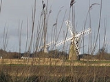
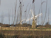
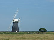
. The Cathedral took 320,000 tonnes of peat a year. Then the sea levels began to rise, and the pits began to flood. Despite the construction of windpump
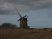
Windpump
A windpump is a windmill used for pumping water, either as a source of fresh water from wells, or for draining low-lying areas of land. Once a common fixture on farms in semi-arid areas, windpumps are still used today where electric power is not available or too expensive.-History:Windmills were...
s and dykes, the flooding continued and resulted in the typical Broads landscape of today, with its reed
Phragmites
Phragmites, the Common reed, is a large perennial grass found in wetlands throughout temperate and tropical regions of the world. Phragmites australis is sometimes regarded as the sole species of the genus Phragmites, though some botanists divide Phragmites australis into three or four species...
beds, grazing marshes and wet woodland.
Various attempts were made to extend the navigable rivers. The longest-lasting was on the River Waveney, where an Act of Parliament
Act of Parliament
An Act of Parliament is a statute enacted as primary legislation by a national or sub-national parliament. In the Republic of Ireland the term Act of the Oireachtas is used, and in the United States the term Act of Congress is used.In Commonwealth countries, the term is used both in a narrow...
passed on 17 March 1670 authorised improvements which included three locks, at Geldeston, Ellingham and Wainford. The head of navigation became a new staithe at Bungay. The new section was a private navigation which was not controlled by the Yarmouth Haven and Pier Commissioners, who had responsibility for the rest of the Broadland rivers. It remained in use until 1934 and, although the upper two locks have been replaced by sluices and Geldeston lock is derelict, the Environment Agency
Environment Agency
The Environment Agency is a British non-departmental public body of the Department for Environment, Food and Rural Affairs and an Assembly Government Sponsored Body of the Welsh Assembly Government that serves England and Wales.-Purpose:...
have negotiated with local landowners to allow use by canoes and unpowered vessels which can be portaged around the locks.
The next attempt was to extend navigation on the River Bure
River Bure
The River Bure is a river in the county of Norfolk, England, most of it in The Broads. The Bure rises near Melton Constable, upstream of Aylsham, which was the original head of navigation. Nowadays, the head of navigation is downstream at Coltishall Bridge...
from Coltishall
Coltishall
Coltishall is a village on the River Bure, west of Wroxham, in the English county of Norfolk, within the Norfolk Broads.Coltishall was a place of note even when the Domesday Book was compiled. For 250 years it was a centre of the malting industry...
to Aylsham
Aylsham
Aylsham is a historic market town and civil parish on the River Bure in north Norfolk, England, about north of Norwich. The river rises near Melton Constable, upstream from Aylsham and continues to Great Yarmouth and the North Sea, although it was only made navigable after 1779, allowing grain,...
, which was authorised by an Act of Parliament on 7 April 1773. Five locks were built, to bypass mills, at Coltishall, Oxnead Lamas, Oxnead, Burgh and Aylsham. There were financial difficulties during construction, but the works were eventually completed and opened in October 1779. At Aylsham, a 1 miles (1.6 km) cut was made from the river to a terminal basin, where several warehouses were constructed. Despite the arrival of the railways in 1879, goods continued to be carried to Aylsham by wherries until 1912, when major flooding badly damaged the locks. Unable to fund repairs, the Commissioners closed the 9 miles (14.5 km) section above Coltishall, although it was not formally abandoned until 1928. All of the locks are derelict, but the course can still be used by canoes and light craft, which can be portaged around the locks.
The third attempt was to make the River Ant navigable from Dilham to Antingham. An Act of Parliament was obtained on 5 May 1812, which authorised the North Walsham & Dilham Canal
North Walsham & Dilham Canal
The North Walsham and Dilham Canal is a waterway in the English county of Norfolk. It is accepted officially that this waterway is the only canal in Norfolk although it is the canalization of the upper reaches of the River Ant. This navigation was constructed with locks a little wider than most...
, but work on its construction did not start until April 1825. The canal was a true canal, as its route did not use the bed of the river, and its construction, including six locks, was completed in 1826. It was about 8.75 miles (14.1 km) long, and the locks raised the level by 58 feet (17.7 m). In 1886 the canal was sold to a miller called Edward Press for £600, but the principal clerk absconded with most of the money and it was never recovered. In 1893 the section from Swafield locks to Antingham was abandoned, and the lower section was damaged by flooding in 1912. Some attempts were made to improve it in the 1920s, but the last commercial traffic used it in 1934, and it gradually became derelict after that. There is still a public right of navigation to Swafield, and there is a campaign to reopen it.
In 1814 the merchants of Norwich first suggested a plan to improve the route between Norwich and the North Sea, as the shallowness of Breydon Water created difficulties for trading vessels, and there was organised theft of cargo during its trans-shipment at Great Yarmouth
Great Yarmouth
Great Yarmouth, often known to locals as Yarmouth, is a coastal town in Norfolk, England. It is at the mouth of the River Yare, east of Norwich.It has been a seaside resort since 1760, and is the gateway from the Norfolk Broads to the sea...
, for which 18 men were convicted of taking the goods and one of receiving it in 1820. The initial plan was to dredge a deeper channel along the southern edge of Breydon Water, but the scheme was opposed by the people of Yarmouth. A more expensive scheme, involving the construction of a new cut to link the River Yare to the River Waveney, together with a channel between Oulton Broad and Lake Lothing, where a sea lock was needed, was also opposed by Yarmouth, but formed the basis of a Bill to Parliament. An Act of Parliament
Act of Parliament
An Act of Parliament is a statute enacted as primary legislation by a national or sub-national parliament. In the Republic of Ireland the term Act of the Oireachtas is used, and in the United States the term Act of Congress is used.In Commonwealth countries, the term is used both in a narrow...
was passed on 28 May 1827, creating the Norwich and Lowestoft Navigation Company, and the work of construction and dredging of the River Yare and the Oulton Dyke was completed in 1833. The initial capital of £100,000 was inadequate and a further £50,000 was borrowed from the Exchequer Bill Loan Commissioners. The venture was not a commercial success, and, with expenditure exceeding income, the Company was unable to repay its loan. The Haddiscoe Cut
Haddiscoe Cut
The Haddiscoe Cut or New Cut is a canal in the English county of Norfolk and in The Broads National Park. The cut was conceived as a way to provide a more direct route from Lowestoft to Norwich, and was built as part of a larger scheme which included the linking of the River Waveney to Oulton Broad...
was taken over by the Commissioners in 1842 and sold to the railway developer Sir Samuel Morton Peto
Samuel Morton Peto
Sir Samuel Morton Peto, 1st Baronet was an English entrepreneur and civil engineer in the 19th century. A partner in Grissell and Peto, he managed construction firms that built many major buildings and monuments in London...
.
Recreation
The Broads have been a boating holiday destination since the late 19th century. In 1878 small yachts were available to hire from John Loynes, and with easy access to the area by rail from London, Harry Blake created an agency for yachting holidays in 1908. The first boats were owned by the boatbuilder Ernest Collins of WroxhamWroxham
Wroxham is a village and civil parish in the English county of Norfolk. The civil parish of Wroxham has an area of 6.21 square kilometres and in 2001 had a population of 1532 in 666 households. The village is situated within the Norfolk Broads on the south side of a loop in the middle reaches of...
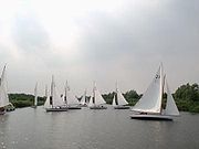
, but other boatyards were soon added to the business. The range of boats expanded to include powered cruisers in the 1930s, and the Hoseasons agency was founded soon after the Second World War. By the 1980s the number of cruisers available for hire was 2,400, but had decreased to around 1,700 by 2004. The Broads have also been an important centre for racing yachts since the late 19th century, and the design of the boats have included several innovative features, including short fin keels and a separate rudder. The design was eventually used on sea-going yachts from the 1960s.
The waterways are lock-free, although there are three bridges under which only small cruisers and smaller boats can pass. The area attracts all kinds of visitors, including ramblers, artists, anglers, and bird-watchers as well as people "messing about in boats". There are a number of companies hiring boats for leisure use, including both yachts and motor launches. The Norfolk Wherry
Norfolk wherry
The Norfolk wherry is a type of boat on The Broads in Norfolk, England. Three main types were developed over its life, all featuring the distinctive gaff rig with a single, high-peaked sail and the mast stepped well forward.-Development of the wherry:...
, the traditional cargo craft of the area, can still be seen on the Broads as some specimens have been preserved and restored.
The late Ted Ellis, a local naturalist, referred to the Broads as "the breathing space for the cure of souls".
A great variety of boats can be found on the Broads, from Edwardian trading wherries to state-of-the-art electric or solar-powered boats. The Broads Authority are promoting sustainable boating, and the use of electric boats is being encouraged by the provision of charging points at a number of the mooring sites provided by the Authority.
Geography

River Yare
The River Yare is a river in the English county of Norfolk. In its lower reaches the river connects with the navigable waterways of The Broads....
and its (direct and indirect) tributaries
Tributary
A tributary or affluent is a stream or river that flows into a main stem river or a lake. A tributary does not flow directly into a sea or ocean...
the Rivers Bure
River Bure
The River Bure is a river in the county of Norfolk, England, most of it in The Broads. The Bure rises near Melton Constable, upstream of Aylsham, which was the original head of navigation. Nowadays, the head of navigation is downstream at Coltishall Bridge...
, Thurne
River Thurne
The River Thurne is a river in Norfolk, England in The Broads. Just six miles long it rises two miles from the coast near Martham Broad and is navigable from West Somerton. It flows southwest and is linked by Candle Dyke and Heigham Sound to both Horsey Mere and Hickling Broad...
, Ant
River Ant
The River Ant is a tributary river of the River Bure in the county of Norfolk, England. It is 17 miles long , and has an overall drop of 25 metres from source to mouth...
, Waveney
River Waveney
The Waveney is a river which forms the border between Suffolk and Norfolk, England, for much of its length within The Broads.-Course:The source of the River Waveney is a ditch on the east side of the B1113 road between the villages of Redgrave, Suffolk and South Lopham, Norfolk...
, Chet
River Chet
The River Chet is a small river in South Norfolk, England, and a tributary of the River Yare. It rises in Poringland and then flows eastwards through Alpington, Bergh Apton, Thurton and Loddon. At Loddon it passes under the A146 and then through Loddon Mill and into Loddon Staithe. From this point...
and Wensum
River Wensum
The River Wensum is a chalk fed river in Norfolk, England and a tributary of the River Yare despite being the larger of the two rivers. The complete river is a designated Site of Special Scientific Interest and Special Area of Conservation ....
. There are no longer any operational locks
Lock (water transport)
A lock is a device for raising and lowering boats between stretches of water of different levels on river and canal waterways. The distinguishing feature of a lock is a fixed chamber in which the water level can be varied; whereas in a caisson lock, a boat lift, or on a canal inclined plane, it is...
on any of the rivers (except for Mutford Lock in Oulton Broad
Oulton Broad
Oulton Broad refers to both the lake and the suburb of Lowestoft in Suffolk, England located 2 miles west of the centre of the town.-Oulton Broad:...
that links to the saltwater Lake Lothing
Lake Lothing
Lake Lothing is a saltwater lake located in Lowestoft in the English county of Suffolk. The lake, which is believed to be the remnant of medieval peat cutting, flows into the North Sea and forms part of the Port of Lowestoft...
in Lowestoft
Lowestoft
Lowestoft is a town in the English county of Suffolk. The town is on the North Sea coast and is the most easterly point of the United Kingdom. It is north-east of London, north-east of Ipswich and south-east of Norwich...
, Suffolk
Suffolk
Suffolk is a non-metropolitan county of historic origin in East Anglia, England. It has borders with Norfolk to the north, Cambridgeshire to the west and Essex to the south. The North Sea lies to the east...
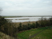
), but all of the waterways are subject to tidal influence. The tidal range decreases with distance from the sea, with highly tidal areas such as Breydon Water
Breydon Water
Breydon Water is a massive stretch of sheltered estuary at Great Yarmouth in Norfolk, England. It is at gateway to the Norfolk Broads. It is the UK's largest protected wetland. It is 5 km long and more than 1.5 km wide in places...
contrasted with effectively non-tidal reaches such as the River Ant upstream of Barton Broad
Barton Broad
Barton Broad lies within The Broads in Norfolk, the United Kingdom. The broad is situated to the south and east of the village of Barton Turf, and is within the parish of Barton Turf....
.
The broads themselves range in size from small pools to the large expanses of Hickling Broad
Hickling Broad
Hickling Broad lies within The Broads National Park in Norfolk, England,. 4 km south-east of Stalham.It is a National Nature Reserve established by English Nature and in the care of the Norfolk Wildlife Trust, who run boat trips around the reserve for visitors. It is also part of the Upper...
, Barton Broad and Breydon Water. The broads are unevenly distributed, with far more broads in the northern half of Broadland (the Rivers Bure, Thurne and Ant) than in the central and southern portions (the Rivers Yare, Waveney, Chet and Wensum). Individual broads may lie directly on the river, or are more often situated to one side and connected to the river by an artificial channel or dyke.
Besides the natural watercourses of the rivers, and the ancient but artificial broads, there is one more recent navigation canal, the lock-less Haddiscoe Cut
Haddiscoe Cut
The Haddiscoe Cut or New Cut is a canal in the English county of Norfolk and in The Broads National Park. The cut was conceived as a way to provide a more direct route from Lowestoft to Norwich, and was built as part of a larger scheme which included the linking of the River Waveney to Oulton Broad...
which connects the Rivers Yare and Waveney whilst permitting boats to by-pass Breydon Water.
There is also a second navigable link to the sea, via the River Waveney and its link to Oulton Broad
Oulton Broad
Oulton Broad refers to both the lake and the suburb of Lowestoft in Suffolk, England located 2 miles west of the centre of the town.-Oulton Broad:...
. Oulton Broad is part of the Broads tidal system, but is immediately adjacent to Lake Lothing
Lake Lothing
Lake Lothing is a saltwater lake located in Lowestoft in the English county of Suffolk. The lake, which is believed to be the remnant of medieval peat cutting, flows into the North Sea and forms part of the Port of Lowestoft...
which acts as a harbour for Lowestoft
Lowestoft
Lowestoft is a town in the English county of Suffolk. The town is on the North Sea coast and is the most easterly point of the United Kingdom. It is north-east of London, north-east of Ipswich and south-east of Norwich...
and connects to the North Sea. Oulton Broad and Lake Lothing
Lake Lothing
Lake Lothing is a saltwater lake located in Lowestoft in the English county of Suffolk. The lake, which is believed to be the remnant of medieval peat cutting, flows into the North Sea and forms part of the Port of Lowestoft...
are connected by Mutford Lock, the only lock on the broads and necessary because of the different tidal ranges and cycles in the two lakes.
In the lists below, names of broads are emboldened to help distinguish them from towns and villages.
River Bure
The River BureRiver Bure
The River Bure is a river in the county of Norfolk, England, most of it in The Broads. The Bure rises near Melton Constable, upstream of Aylsham, which was the original head of navigation. Nowadays, the head of navigation is downstream at Coltishall Bridge...
is a tributary of the River Yare
River Yare
The River Yare is a river in the English county of Norfolk. In its lower reaches the river connects with the navigable waterways of The Broads....
which rises near Aylsham
Aylsham
Aylsham is a historic market town and civil parish on the River Bure in north Norfolk, England, about north of Norwich. The river rises near Melton Constable, upstream from Aylsham and continues to Great Yarmouth and the North Sea, although it was only made navigable after 1779, allowing grain,...
in Norfolk and joins the Yare just downstream of Breydon Water
Breydon Water
Breydon Water is a massive stretch of sheltered estuary at Great Yarmouth in Norfolk, England. It is at gateway to the Norfolk Broads. It is the UK's largest protected wetland. It is 5 km long and more than 1.5 km wide in places...
. On its way it flows through or passes:
- ColtishallColtishallColtishall is a village on the River Bure, west of Wroxham, in the English county of Norfolk, within the Norfolk Broads.Coltishall was a place of note even when the Domesday Book was compiled. For 250 years it was a centre of the malting industry...
- BelaughBelaughBelaugh is a small village that occupies a bend in the River Bure in Norfolk, England - within The Broads National Park. It is accessible via the road between Hoveton and Coltishall or from the river. It contains no pubs, bars or shops...
- Belaugh Broad
- Bridge Broad
- WroxhamWroxhamWroxham is a village and civil parish in the English county of Norfolk. The civil parish of Wroxham has an area of 6.21 square kilometres and in 2001 had a population of 1532 in 666 households. The village is situated within the Norfolk Broads on the south side of a loop in the middle reaches of...
- HovetonHovetonHoveton is a village and civil parish in the English county of Norfolk. It is located within the Norfolk Broads, and immediately across the River Bure from the village of Wroxham...
- Wroxham BroadWroxham BroadWroxham Broad is on the River Bure near the village of Wroxham in Norfolk, England within The Broads National Park. The broad has an area of 34.4 hectares and a mean depth of 1.3 metres. It lies to the west of the Bure, with two navigable openings between river and broad...
- Hoveton Great BroadHoveton Great BroadHoveton Great Broad lies within The Broads in Norfolk, England, between Wroxham Broad and Salhouse Broad.The broad is connected to the River Bure, but not open to boat traffic. A nature trail was laid out in 1968 - the first in the region. It is accessible only by boat...
- Salhouse BroadSalhouse BroadSalhouse Broad, one of the Norfolk Broads, is situated on the River Bure in The Broads in Norfolk, England.The broad is situated just off the river and attracts little through traffic. It lies south of Hoveton Great Broad and about half a mile north of the village of Salhouse. The Broad is...
- Bure Marshes NNRBure Marshes NNRBure Marshes National Nature Reserve is maintained by English Nature in Norfolk, England, within The Broads National Park.It is mostly fen land and includes four Broads which are disused peat workings dug between 900 and 1350:...
(National Nature ReserveNational Nature ReserveFor details of National nature reserves in the United Kingdom see:*National Nature Reserves in England*National Nature Reserves in Northern Ireland*National Nature Reserves in Scotland*National Nature Reserves in Wales...
) - SalhouseSalhouseSalhouse is a village and civil parish within The Broads National Park in the English county of Norfolk. It lies south of the River Bure and Salhouse Broad, about north-east of Norwich....
- WoodbastwickWoodbastwickWoodbastwick is a village and civil parish in the English county of Norfolk. It is located on the River Bure between Cockshoot Broad and Salhouse Broad, within The Broads National Park and close to Bure Marshes NNR . The city of Norwich lies to the south-east.The village name relates to bast, a...
- Decoy Broad
- Hoveton Little BroadHoveton Little BroadHoveton Little Broad, also known as Black Horse Broad, is a secluded broad of fairly open aspect, in the middle reaches of the River Bure between Hoveton and Horning, Norfolk, in The Broads National Park...
(sometimes called 'Blackhorse Broad') - Burnt Fen Broad
- HorningHorningHorning is an ancient village and parish in the English county of Norfolk.It covers an area of 11 km2 and had a population of 1,033 in the 2001 census. Horning parish lies on the northern bank of the River Bure south of the River Thurne and is located in the The Broads National Park...
- Cockshoot BroadCockshoot BroadCockshoot Broad, one of the Norfolk Broads, lies on the River Bure within The Broads National Park in Norfolk, England. It is one of several Broads where boats are not allowed at any time of the year, although they can moor at its entrance. It is a nature reserve in the care of Norfolk Wildlife Trust...
- Ranworth BroadRanworth BroadRanworth Broad lies in The Broads. It is one of the nature reserves in the care of the Norfolk Wildlife Trust.Ranworth Broad has a floating visitor centre, a boardwalk and a bird observation hide....
- Malthouse BroadMalthouse BroadMalthouse Broad is a broad at Ranworth in the Norfolk Broads.The "Helen of Ranworth" is a traditional reed lighter, a boat that carried away the reed harvest. Now it ferries visitors from Malthouse Broad to Ranworth Broad....
- RanworthRanworthRanworth is a village in Norfolk, England in The Broads, adjacent to Malthouse Broad and Ranworth Broad.-Church of St Helen:The 14th century St. Helen's church has a fine 15th century painted rood screen and a rare Antiphoner. It is a Grade I listed building From the top of Ranworth church's 100...
- South WalshamSouth WalshamSouth Walsham is a village and civil parish in the English county of Norfolk. It is adjacent to South Walsham Broad.It covers an area of and had a population of 738 in 303 households as of the 2001 census....
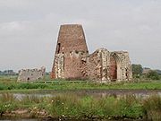
- St. Benet's AbbeySt. Benet's AbbeySt Benet's Abbey is a ruined abbey of the Order of Saint Benedict situated on the River Bure within The Broads in Norfolk England. It is also known as St Benet's at Holme or Hulme.-Background:...
- Upton
- Upton Broad
- Upton Broads and Marshes Site of Special Scientific InterestSite of Special Scientific InterestA Site of Special Scientific Interest is a conservation designation denoting a protected area in the United Kingdom. SSSIs are the basic building block of site-based nature conservation legislation and most other legal nature/geological conservation designations in Great Britain are based upon...
- Upton FenUpton FenUpton Fen lies within The Broads National Park in Norfolk, England.It is a nature reserve in the care of Norfolk Wildlife Trust. Notable species found on the reserve include:Bittern,Hobby,Norfolk Hawker,Swallowtail...
- AcleAcleAcle is a small market town on the River Bure on The Norfolk Broads in Norfolk, located halfway between Norwich and Great Yarmouth. It has the only bridge across the River Bure between Wroxham and Great Yarmouth. There is a high school Acle is a small market town on the River Bure on The Norfolk...
- ObyAshby with ObyAshby with Oby is a civil parish in the English county of Norfolk, which is located some north of Acle and north-west of Great Yarmouth. The parish largely comprises scattered farms, and is named for the tiny settlements of Ashby and Oby....
- StokesbyStokesby with HerringbyStokesby with Herringby is a civil parish in the English county of Norfolk. It comprises the village of Stokesby and the surrounding rural area. It is situated on the banks of the River Bure, some 10 km west of the town of Great Yarmouth and 25 km east of the city of Norwich.The civil parish has an...
- Mautby Decoy
- Great YarmouthGreat YarmouthGreat Yarmouth, often known to locals as Yarmouth, is a coastal town in Norfolk, England. It is at the mouth of the River Yare, east of Norwich.It has been a seaside resort since 1760, and is the gateway from the Norfolk Broads to the sea...
River Thurne
River Thurne
The River Thurne is a river in Norfolk, England in The Broads. Just six miles long it rises two miles from the coast near Martham Broad and is navigable from West Somerton. It flows southwest and is linked by Candle Dyke and Heigham Sound to both Horsey Mere and Hickling Broad...
is a tributary
Tributary
A tributary or affluent is a stream or river that flows into a main stem river or a lake. A tributary does not flow directly into a sea or ocean...
of the River Bure
River Bure
The River Bure is a river in the county of Norfolk, England, most of it in The Broads. The Bure rises near Melton Constable, upstream of Aylsham, which was the original head of navigation. Nowadays, the head of navigation is downstream at Coltishall Bridge...
. It rises near Martham Broad
Martham Broad
Martham Broad is a broad and National Nature Reserve on the River Thurne in the English county of Norfolk. The broad is located within The Broads National Park about 2 km north of the village of Martham....
and flows for about six miles (10 km) to Thurne Mouth where it joins the Bure. It is wide open and wind-swept, and on its way it flows through or passes:
- Upper Thurne Broads and Marshes Site of Special Scientific InterestSite of Special Scientific InterestA Site of Special Scientific Interest is a conservation designation denoting a protected area in the United Kingdom. SSSIs are the basic building block of site-based nature conservation legislation and most other legal nature/geological conservation designations in Great Britain are based upon...
- Hickling BroadHickling BroadHickling Broad lies within The Broads National Park in Norfolk, England,. 4 km south-east of Stalham.It is a National Nature Reserve established by English Nature and in the care of the Norfolk Wildlife Trust, who run boat trips around the reserve for visitors. It is also part of the Upper...
- HicklingHickling, NorfolkHickling is a village and a civil parish in the English county of Norfolk. The village is 22 miles south-east of Cromer, 20.3 miles north-east of Norwich and 137 miles north-east of London. The village lies 3 miles east of the Broadlands town of Stalham...
- HorseyHorsey, NorfolkHorsey is a village and civil parish in the English county of Norfolk within The Broads National Park.It covers an area of and had a population of 99 in 40 households as of the 2001 census....
- Horsey MereHorsey MereHorsey Mere is one of the Norfolk Broads in the east of England; it is one of the more northerly broads close to the North Sea coast.It is reached by Hickling Broad and the River Thurne. The nearest settlements are Horsey and West Somerton....
- Martham BroadMartham BroadMartham Broad is a broad and National Nature Reserve on the River Thurne in the English county of Norfolk. The broad is located within The Broads National Park about 2 km north of the village of Martham....
(NNR) (National Nature ReserveNational Nature ReserveFor details of National nature reserves in the United Kingdom see:*National Nature Reserves in England*National Nature Reserves in Northern Ireland*National Nature Reserves in Scotland*National Nature Reserves in Wales...
) - MarthamMarthamMartham is a village and civil parish in the English county of Norfolk and within the Broads National Park. It is situated some north-west of the town of Great Yarmouth and north-east of the city of Norwich....
- West SomertonSomerton, NorfolkSomerton is a civil parish in the English county of Norfolk. It comprises the twin villages of East Somerton and West Somerton and is situated some north of the town of Great Yarmouth, north-east of the city of Norwich, and from the sea....
- ThurneThurneThurne is a small village and civil parish in the English county of Norfolk. It is located on the River Thurne in The Broads, some west of the town of Great Yarmouth and east of the city of Norwich....
- Potter HeighamPotter HeighamPotter Heigham is a village and civil parish on the River Thurne in the English county of Norfolk. It is situated some north-east of the city of Norwich on the A149 road, and on The Broads....
- LudhamLudhamLudham is a village and civil parish in the English county of Norfolk, in The Broads, at the end of a dyke leading to Womack Water and flowing into the River Thurne...
- Ludham - Potter Heigham NNRLudham - Potter Heigham NNRLudham–Potter Heigham Marshes NNR is a National Nature Reserve established and owned by English Nature in Norfolk, England. Located within The Broads National Park, it is an internationally important wetland site....
(National Nature ReserveNational Nature ReserveFor details of National nature reserves in the United Kingdom see:*National Nature Reserves in England*National Nature Reserves in Northern Ireland*National Nature Reserves in Scotland*National Nature Reserves in Wales...
) - Womack Water
River Ant
River Ant
The River Ant is a tributary river of the River Bure in the county of Norfolk, England. It is 17 miles long , and has an overall drop of 25 metres from source to mouth...
is a tributary
Tributary
A tributary or affluent is a stream or river that flows into a main stem river or a lake. A tributary does not flow directly into a sea or ocean...
of the River Bure
River Bure
The River Bure is a river in the county of Norfolk, England, most of it in The Broads. The Bure rises near Melton Constable, upstream of Aylsham, which was the original head of navigation. Nowadays, the head of navigation is downstream at Coltishall Bridge...
. It rises at Antingham
Antingham
Antingham is a village and civil parish in the north of the English county of Norfolk. The village is located about south of Cromer and north of North Walsham...
and joins the Bure at St. Benet's Abbey
St. Benet's Abbey
St Benet's Abbey is a ruined abbey of the Order of Saint Benedict situated on the River Bure within The Broads in Norfolk England. It is also known as St Benet's at Holme or Hulme.-Background:...
. It is winding and narrow, and on its way it flows through or passes:
- HoningHoning, NorfolkHoning is a village and a civil parish in the English county of Norfolk. The village is north-northeast of Norwich, south east of Cromer and north-east of London. The village lies east of the town of North Walsham. The nearest railway station is at Worstead on the Bittern Line which runs...
- North Walsham & Dilham CanalNorth Walsham & Dilham CanalThe North Walsham and Dilham Canal is a waterway in the English county of Norfolk. It is accepted officially that this waterway is the only canal in Norfolk although it is the canalization of the upper reaches of the River Ant. This navigation was constructed with locks a little wider than most...
- DilhamDilhamDilham is a village and civil parish covering an area of with a population of 301 in 128 homes as of the 2001 census. It is on the River Ant just of the A149 road, near Stalham in Norfolk, England within The Broads...
- Dilham Broad
- Wayford BridgeWayford BridgeWayford Bridge is a village on the River Ant on the A149 road, near Stalham in Norfolk, England within The Broads National Park.Due to height restrictions under the road bridge it is the most northerly point of navigation on the Norfolk Broads for boats over Wayford Bridge is a village on the River...
- Barton BroadBarton BroadBarton Broad lies within The Broads in Norfolk, the United Kingdom. The broad is situated to the south and east of the village of Barton Turf, and is within the parish of Barton Turf....
- StalhamStalhamStalham is a market town on the River Ant in the English county of Norfolk, in East Anglia. It covers an area of and had a population of 2,951 in 1,333 households as of the 2001 census. It lies within the Norfolk Broads, about north-east of Norwich on the A149 road.For the purposes of local...
- SuttonSutton, NorfolkSutton is a village in the English county of Norfolk. It lies next to the Norfolk Broads , about 16 miles north-east of Norwich on the A149 road, adjacent to the slightly larger market town of Stalham.Sutton has a Post Office, public house and hotel, primary...
- Sutton Broad
- Ant Broads & Marshes NNRAnt Broads & Marshes NNRAnt Broads & Marshes NNR is a National Nature Reserve in Norfolk, England established by English Nature. It is named after the River Ant.It is part of the "Ant Broads and Marshes" Site of Special Scientific Interest and is within The Broads National Park....
(National Nature ReserveNational Nature ReserveFor details of National nature reserves in the United Kingdom see:*National Nature Reserves in England*National Nature Reserves in Northern Ireland*National Nature Reserves in Scotland*National Nature Reserves in Wales...
) - Turkey Broad
- Alderfen BroadAlderfen BroadAlderfen Broad lies within The Broads National Park in Norfolk, England.It is a nature reserve in the care of Norfolk Wildlife Trust....
- Catfield Broad
- Crome's BroadCrome's BroadCrome's Broad is situated to the east of the River Ant, north of How Hill, within The Broads National Park in Norfolk, England.It is named after John Crome, the founder of the Norwich school of painters....
- NeatisheadNeatisheadNeatishead is a village and civil parish in the English county of Norfolk. The village is situated some north-east of the city of Norwich, within The Norfolk Broads and to the west of Barton Broad...
- Barton TurfBarton TurfBarton Turf is a village and civil parish in the English county of Norfolk. The village is situated some 20 km north-east of the city of Norwich, on the northwestern edge of Barton Broad, the second largest broad of the Norfolk Broads within The Broads National Park...
- IrsteadIrsteadIrstead is a village in The Broads National Park in the English county of Norfolk, England. The village is situated at Irstead Shoals, on the River Ant just south of Barton Broad, the second largest of the Norfolk Broads...
- How HillHow HillHow Hill lies on the River Ant within The Broads National Park in Norfolk, England.The large Edwardian building houses the Norfolk Broads Study Centre, an independent charitable organisation which runs residential environmental courses for groups of schoolchildren.The How Hill Nature Reserve is...
- Ludham BridgeLudham BridgeLudham Bridge is a hamlet on the River Ant on the Norfolk Broads in Norfolk, England....
- Broad Fen
- Calthorpe BroadCalthorpe BroadCalthorpe Broad is an isolated broad within The Broads National Park, three miles north east of Stalham, Norfolk, England.English Nature manages it as a National Nature Reserve, one of over 200 NNRs. It is only 44 hectares, but of interest because of its plant life. It is detached from the main...
(NNR) (National Nature ReserveNational Nature ReserveFor details of National nature reserves in the United Kingdom see:*National Nature Reserves in England*National Nature Reserves in Northern Ireland*National Nature Reserves in Scotland*National Nature Reserves in Wales...
) - InghamIngham, NorfolkIngham is a small village and civil parish in the English county of Norfolk. It lies close to the village of Stalham, and is about 2 miles from Sea Palling on the North Sea coast....
, NorfolkNorfolkNorfolk is a low-lying county in the East of England. It has borders with Lincolnshire to the west, Cambridgeshire to the west and southwest and Suffolk to the south. Its northern and eastern boundaries are the North Sea coast and to the north-west the county is bordered by The Wash. The county...
River Yare
The River YareRiver Yare
The River Yare is a river in the English county of Norfolk. In its lower reaches the river connects with the navigable waterways of The Broads....
rises south of Dereham
Dereham
Dereham, also known as East Dereham, is a town and civil parish in the English county of Norfolk. It is situated on the A47 road, some 15 miles west of the city of Norwich and 25 miles east of King's Lynn. The civil parish has an area of and in the 2001 census had a population of...
and flows through the southern fringes of the city of Norwich, passes through Breydon Water
Breydon Water
Breydon Water is a massive stretch of sheltered estuary at Great Yarmouth in Norfolk, England. It is at gateway to the Norfolk Broads. It is the UK's largest protected wetland. It is 5 km long and more than 1.5 km wide in places...
and flows into the sea between Great Yarmouth
Great Yarmouth
Great Yarmouth, often known to locals as Yarmouth, is a coastal town in Norfolk, England. It is at the mouth of the River Yare, east of Norwich.It has been a seaside resort since 1760, and is the gateway from the Norfolk Broads to the sea...
and Gorleston
Gorleston
Gorleston-On-Sea, also known colloquially as Gorleston, is a settlement in Norfolk in the United Kingdom, forming part of the larger town of Great Yarmouth. Situated at the mouth of the River Yare it was a port town at the time of the Domesday Book. The port then became a centre of fishing for...
. On its way it passes through:
- RSPB Breydon WaterBreydon WaterBreydon Water is a massive stretch of sheltered estuary at Great Yarmouth in Norfolk, England. It is at gateway to the Norfolk Broads. It is the UK's largest protected wetland. It is 5 km long and more than 1.5 km wide in places...
- Halvergate MarshesHalvergate MarshesThe Halvergate Marshes are marshes situated south of the River Bure on the Norfolk Broads in Norfolk, England, United Kingdom.Halvergate Marshes were an estuary in Roman times. Around 400 years ago the land was drained and converted to grazing marsh...
, also RSPB reserve - HalvergateHalvergateHalvergate is a civil parish in the English county of Norfolk, north of Reedham., halfway between the Rivers Bure and Yare, within The Broads National Park.It covers an area of and had a population of 468 in 202 households as of the 2001 census....
- Berney ArmsBerney ArmsBerney Arms is a place on the north bank of the River Yare, close to Breydon Water in the English county of Norfolk. It is part of the civil parish of Reedham, is administered by the district of Broadland and lies within The Broads National Park...
- RSPB Berney MarshesRSPB Berney MarshesBerney Marshes RSPB reserve is a nature reserve in the care of the Royal Society for the Protection of Birds . It is situated south of the River Bure in Norfolk, England, within The Broads National Park.It is part of the Halvergate Marshes....
- ReedhamReedham, NorfolkReedham is a village and civil parish in the English county of Norfolk and within The Broads. It is situated on the north bank of the River Yare, some east of the city of Norwich, south-west of the town of Great Yarmouth and the same distance north-west of the Suffolk town of Lowestoft.The Romans...
- CantleyCantley, NorfolkCantley is a village and civil parish in the English county of Norfolk. Cantley is within the Broads Special Protection Area. The village lies on the north bank of the River Yare, some 17 km east of the city of Norwich, 15 km south-west of the town of Great Yarmouth and the same distance...
- Carleton Broad
- Rockland BroadRockland BroadRockland Broad lies just north of the village of Rockland St. Mary in South Norfolk, England.It comprises an area of approximately and is completely surrounded by marshland and tall reed beds. It is linked to the River Yare by two dykes: the Short Dyke and the Fleet Dyke.From the village of...
- Wheatfen Broad
- Strumpshaw FenStrumpshaw FenStrumpshaw Fen is a fen on the River Yare in Norfolk, England, between Brundall and Cantley.Much of the area is RSPB Strumpshaw Fen, a nature reserve in the care of the Royal Society for the Protection of Birds....
- RSPB Strumpshaw FenRSPB Strumpshaw Fenthumb|right|360px|A view from the brick hide over water showing mostly [[Greylag Goose]] coming into land for the evening. Strumpshaw Fen is a nature reserve managed by the Royal Society for the Protection of Birds . It is situated at Strumpshaw Fen, a fen on the River Yare in Norfolk, England...
(Royal Society for the Protection of BirdsRoyal Society for the Protection of BirdsBird Notes and News was first published in April 1903.The title changed to 'Bird Notes' in 1947. In the 1950s, there were four copies per year . Each volume covered two years, spread over three calendar years...
reserve) - Mid-Yare NNRMid-Yare NNRMid-Yare NNR is a National Nature Reserve in Norfolk, east of Norwich, established by English Nature and managed by the Royal Society for the Protection of Birds . In RSPB publications, this reserve is known as Strumpshaw Fen....
(National Nature ReserveNational Nature ReserveFor details of National nature reserves in the United Kingdom see:*National Nature Reserves in England*National Nature Reserves in Northern Ireland*National Nature Reserves in Scotland*National Nature Reserves in Wales...
) - SurlinghamSurlinghamSurlingham is a village and civil parish in South Norfolk situated on the Broads. It lies approximately 6½ miles south-east of Norwich on the south bank of the River Yare between Bramerton and Rockland St Mary. In the 2001 census it contained 266 households and a population of 637...
- Surlingham Broad
- Surlingham Church Marsh RSPB reserve.
- Brundall Broad
- HaddiscoeHaddiscoeHaddiscoe is a village and civil parish in the English county of Norfolk. It is situated some 30 km south-east of the city of Norwich, but only 10 km west of the Suffolk town of Lowestoft.The civil parish has an area of...
- Haddiscoe CutHaddiscoe CutThe Haddiscoe Cut or New Cut is a canal in the English county of Norfolk and in The Broads National Park. The cut was conceived as a way to provide a more direct route from Lowestoft to Norwich, and was built as part of a larger scheme which included the linking of the River Waveney to Oulton Broad...
also known as New CutHaddiscoe CutThe Haddiscoe Cut or New Cut is a canal in the English county of Norfolk and in The Broads National Park. The cut was conceived as a way to provide a more direct route from Lowestoft to Norwich, and was built as part of a larger scheme which included the linking of the River Waveney to Oulton Broad... - BrundallBrundallBrundall is a village and civil parish in the English county of Norfolk. It is located on the north bank of the River Yare opposite Surlingham Broad and about 7 miles east of the city of Norwich....
- Langley
- PostwickPostwick with WittonPostwick with Witton is a civil parish on the Broads in the English county of Norfolk, comprising the two nearby villages of Postwick and Witton. Postwick is some east of the city of Norwich, just south of the eastern end of the A47 Norwich southern bypass on the north bank of the River Yare...
- Thorpe St. Andrew
- Barnby Broad
River Chet
The River ChetRiver Chet
The River Chet is a small river in South Norfolk, England, and a tributary of the River Yare. It rises in Poringland and then flows eastwards through Alpington, Bergh Apton, Thurton and Loddon. At Loddon it passes under the A146 and then through Loddon Mill and into Loddon Staithe. From this point...
is a tributary
Tributary
A tributary or affluent is a stream or river that flows into a main stem river or a lake. A tributary does not flow directly into a sea or ocean...
of the River Yare
River Yare
The River Yare is a river in the English county of Norfolk. In its lower reaches the river connects with the navigable waterways of The Broads....
. It flows through, or passes by:
- LoddonLoddon, NorfolkLoddon is a small market town about southeast of Norwich on the River Chet, a tributary of the River Yare within The Broads in Norfolk, England. The name "Loddon" is thought to mean muddy river in Celtic in reference to the Chet.-Origins:...
- ChedgraveChedgraveChedgrave is a small village beside the River Chet, in Norfolk, England. It covers and had a population of 985 in 430 households as of the 2001 census.The Chet is known for its interesting ....
- Hardley FloodHardley FloodHardley Flood is a Site of Special Scientific Interest on the north bank of the River Chet northeast of Loddon in Norfolk, part-managed by the Norfolk Wildlife Trust. It is an area of shallow lagoons and reedbeds acting as a spillway for the River Chet...
River Waveney
River Waveney
The Waveney is a river which forms the border between Suffolk and Norfolk, England, for much of its length within The Broads.-Course:The source of the River Waveney is a ditch on the east side of the B1113 road between the villages of Redgrave, Suffolk and South Lopham, Norfolk...
is a tributary of the River Yare
River Yare
The River Yare is a river in the English county of Norfolk. In its lower reaches the river connects with the navigable waterways of The Broads....
, joining that river just upstream of Breydon Water
Breydon Water
Breydon Water is a massive stretch of sheltered estuary at Great Yarmouth in Norfolk, England. It is at gateway to the Norfolk Broads. It is the UK's largest protected wetland. It is 5 km long and more than 1.5 km wide in places...
. It flows through, or passes by:
- Burgh CastleBurgh CastleBurgh Castle is a village and civil parish in the English county of Norfolk. It is situated on the east bank of the River Waveney, near Great Yarmouth, some 6 km west of Great Yarmouth and within the Broads National Park.-Roman Fort:...
- BecclesBecclesBeccles is a market town and civil parish in the Waveney District of the English county of Suffolk. The town is shown on the milestone as from London via the A145 Blythburgh and A12 road, northeast of London as the crow flies, southeast of Norwich, and north northeast of the county town of...
- Diss, NorfolkNorfolkNorfolk is a low-lying county in the East of England. It has borders with Lincolnshire to the west, Cambridgeshire to the west and southwest and Suffolk to the south. Its northern and eastern boundaries are the North Sea coast and to the north-west the county is bordered by The Wash. The county...
- St. OlavesSt. OlavesSt Olaves is a village in the English county of Norfolk. The village is situated on the River Waveney in England, some south-west of the town of Great Yarmouth and the same distance north-west of the Suffolk town of Lowestoft...
- HerringfleetHerringfleetHerringfleet is a small village on the River Waveney, between Somerleyton and St. Olaves in Suffolk, England within The Broads National Park.Herringfleet was occupied by the Roman Empire, and archaeologists have made a number of finds, including a Roman bronze 'patera', a 'soup ladle' vessel with...
- SomerleytonSomerleytonSomerleyton is a village close to the River Waveney in the Waveney District of the English county of Suffolk. Somerleyton is located around north-west of Lowestoft and south-west of Great Yarmouth...
- FrittonFrittonFritton may refer to:* Fritton , a village in Norfolk, England* Fritton , a village in Norfolk, England* Fritton and St Olaves, a civil parish in Norfolk, England...
- Fritton Decoy
- GillinghamGillingham, NorfolkGillingham is a small village located just off the A146 in South Norfolk, about 1 mile north of the market town of Beccles. The full name of the parish is Gillingham All Saints and St Mary...
- GeldestonGeldestonGeldeston is a parish in Norfolk. It is about 1 mile west of Gillingham and 2 miles north west of Beccles. Other nearby villages include Ellingham and Broome to the west. It covers an area of and had a population of 398 in 161 households as of the 2001 census....
- Burgh St. PeterBurgh St. PeterBurgh St Peter is a village and civil parish in the South Norfolk district of Norfolk, England. It covers an area of . According to the 2001 census it had a population of 274. It is about north-east of Beccles in Suffolk....
- BungayBungay, SuffolkBungay is a market town in the English county of Suffolk. It lies in the Waveney valley, west of Beccles on the edge of The Broads, and at the neck of a meander of the River Waveney.-Early history:...
- DitchinghamDitchinghamDitchingham is a village and civil parish in the English county of Norfolk. It is located across the River Waveney from Bungay, Suffolk near to The Broads National Park.- Overview :...
- Oulton BroadOulton BroadOulton Broad refers to both the lake and the suburb of Lowestoft in Suffolk, England located 2 miles west of the centre of the town.-Oulton Broad:...
- LowestoftLowestoftLowestoft is a town in the English county of Suffolk. The town is on the North Sea coast and is the most easterly point of the United Kingdom. It is north-east of London, north-east of Ipswich and south-east of Norwich...
River Wensum
The River WensumRiver Wensum
The River Wensum is a chalk fed river in Norfolk, England and a tributary of the River Yare despite being the larger of the two rivers. The complete river is a designated Site of Special Scientific Interest and Special Area of Conservation ....
rises near Fakenham in north-west Norfolk and flows south-east and through the centre of the city of Norwich before joining the River Yare
River Yare
The River Yare is a river in the English county of Norfolk. In its lower reaches the river connects with the navigable waterways of The Broads....
just to the east of the city. Although the Wensum is the larger of the two rivers at their confluence, it is regarded as a tributary of the River Yare. The navigable section of the river is entirely urban and runs from the centre of Norwich, past Norwich Cathedral
Norwich Cathedral
Norwich Cathedral is a cathedral located in Norwich, Norfolk, dedicated to the Holy and Undivided Trinity. Formerly a Catholic church, it has belonged to the Church of England since the English Reformation....
to the confluence with the Yare.
Trinity Broads
The Trinity BroadsTrinity Broads
The Trinity Broads are part of the Broads National Park in Norfolk, England, comprising 5 broads in total. The three largest are Rollesby Broad, Ormesby Broad and Filby Broad, and there are two much smaller broads named Lily Broad and Ormesby Little Broad...
are an exception to the general rule, in that whilst they are connected to each other they have no navigable connection to the rest of the broads. The broads are:
- Rollesby Broad
- Ormesby Broad
- Filby BroadFilby BroadFilby Broad is one of five broads in the Trinity Broads in Norfolk, England. It lies within the Broads National Park, adjacent to the village of Filby...
- Lily Broad
- Ormesby Little Broad
Ecology
The Broads are Britain's largest protected wetlandWetland
A wetland is an area of land whose soil is saturated with water either permanently or seasonally. Wetlands are categorised by their characteristic vegetation, which is adapted to these unique soil conditions....
and are home to a wealth of wildlife
Wildlife
Wildlife includes all non-domesticated plants, animals and other organisms. Domesticating wild plant and animal species for human benefit has occurred many times all over the planet, and has a major impact on the environment, both positive and negative....
, especially birdlife. Amongst the waterfowl
Waterfowl
Waterfowl are certain wildfowl of the order Anseriformes, especially members of the family Anatidae, which includes ducks, geese, and swans....
: Mallard
Mallard
The Mallard , or Wild Duck , is a dabbling duck which breeds throughout the temperate and subtropical Americas, Europe, Asia, and North Africa, and has been introduced to New Zealand and Australia....
, Coot
Eurasian Coot
The Eurasian Coot, Fulica atra, also known as Coot, is a member of the rail and crake bird family, the Rallidae. The Australian subspecies is known as the Australian Coot.-Distribution:...
, Moorhen
Common Moorhen
The Common Moorhen is a bird in the Rallidae family with an almost worldwide distribution. The North and South American Committees of the AOU and the IOC have voted on or before July 2011 to split the American forms into a new species Common Gallinule, however, no other committee has voted to...
, Great Crested Grebe
Great Crested Grebe
The Great Crested Grebe is a member of the grebe family of water birds.- Description :The Great Crested Grebe is long with a wingspan. It is an excellent swimmer and diver, and pursues its fish prey underwater. The adults are unmistakable in summer with head and neck decorations...
, Greylag Goose
Greylag Goose
The Greylag Goose , Anser anser, is a bird with a wide range in the Old World. It is the type species of the genus Anser....
, Canada Goose
Canada Goose
The Canada Goose is a wild goose belonging to the genus Branta, which is native to arctic and temperate regions of North America, having a black head and neck, white patches on the face, and a brownish-gray body....
, Egyptian Goose
Egyptian Goose
The Egyptian Goose is a member of the duck, goose and swan family Anatidae. It is in the shelduck subfamily Tadorninae, and is the only extant member of the genus Alopochen...
. Larger birds include Grey Heron
Grey Heron
The Grey Heron , is a wading bird of the heron family Ardeidae, native throughout temperate Europe and Asia and also parts of Africa. It is resident in the milder south and west, but many birds retreat in winter from the ice in colder regions...
, Cormorant
Great Cormorant
The Great Cormorant , known as the Great Black Cormorant across the Northern Hemisphere, the Black Cormorant in Australia and the Black Shag further south in New Zealand, is a widespread member of the cormorant family of seabirds...
, Kestrel
Common Kestrel
The Common Kestrel is a bird of prey species belonging to the kestrel group of the falcon family Falconidae. It is also known as the European Kestrel, Eurasian Kestrel, or Old World Kestrel. In Britain, where no other brown falcon occurs, it is generally just called "the kestrel".This species...
, Sparrowhawk and Bittern
Great Bittern
The Eurasian Bittern or Great Bittern is a wading bird of the heron family Ardeidae. It is one of the species to which the Agreement on the Conservation of African-Eurasian Migratory Waterbirds applies.-Etymology:...
.
The scarce Cetti's Warbler
Cetti's Warbler
Cetti's Warbler , Cettia cetti, is an Old World warbler which breeds in Europe, northwest Africa and east southern temperate Asia as far as Afghanistan and NW Pakistan. It is the only bush warbler to occur outside Asia...
breeds in the Broads, and Britain's only breeding Common Crane
Common Crane
The Common Crane , also known as the Eurasian Crane, is a bird of the family Gruidae, the cranes.It is a large, stately bird and a medium-sized crane at 100–130 cm long, with a 180–240 cm wingspan and a weight of 4.5–6 kg...
s are found in the area.
Among the rare insects are the Norfolk hawker
Norfolk Hawker
Aeshna isoceles is a small hawker dragonfly that is found in Europe, mostly around the Mediterranean, and the lowlands of North Africa. Its common name in English is Green-eyed Hawker. In Britain it is a rare and local species and is known as the Norfolk Hawker...
, a dragonfly
Dragonfly
A dragonfly is a winged insect belonging to the order Odonata, the suborder Epiprocta or, in the strict sense, the infraorder Anisoptera . It is characterized by large multifaceted eyes, two pairs of strong transparent wings, and an elongated body...
and the Old World Swallowtail
Old World Swallowtail
The Old World Swallowtail is a butterfly of the family Papilionidae. The butterfly is also known as the Common Yellow Swallowtail or simply the Swallowtail...
butterfly (Papilio machaon subsp. brittanicus).
Some of the broads are surrounded by fen
Fen
A fen is a type of wetland fed by mineral-rich surface water or groundwater. Fens are characterised by their water chemistry, which is neutral or alkaline, with relatively high dissolved mineral levels but few other plant nutrients...
s, i.e. reed
Phragmites
Phragmites, the Common reed, is a large perennial grass found in wetlands throughout temperate and tropical regions of the world. Phragmites australis is sometimes regarded as the sole species of the genus Phragmites, though some botanists divide Phragmites australis into three or four species...
and sedge
Cyperaceae
Cyperaceae are a family of monocotyledonous graminoid flowering plants known as sedges, which superficially resemble grasses or rushes. The family is large, with some 5,500 species described in about 109 genera. These species are widely distributed, with the centers of diversity for the group...
beds. Norfolk reed from the broads has been a traditional material for thatching
Thatching
Thatching is the craft of building a roof with dry vegetation such as straw, water reed, sedge , rushes, or heather, layering the vegetation so as to shed water away from the inner roof. It is a very old roofing method and has been used in both tropical and temperate climates...
houses.
See also
- The children's novels Coot ClubCoot ClubCoot Club is the fifth book of Arthur Ransome's Swallows and Amazons series of children's books, published in 1934. The book sees Dick and Dorothea Callum visiting the Norfolk Broads during the Easter Holidays, eager to learn to sail and thus impress the Swallows and Amazons when they return to the...
and The Big SixThe Big SixThe Big Six is the ninth book of Arthur Ransome's Swallows and Amazons series of children's books, published in 1940. The book returns Dick and Dorothea Callum, known as the Ds, to the Norfolk Broads where they renew their friendship with the members of the Coot Club...
, both by Arthur RansomeArthur RansomeArthur Michell Ransome was an English author and journalist, best known for writing the Swallows and Amazons series of children's books. These tell of school-holiday adventures of children, mostly in the Lake District and the Norfolk Broads. Many of the books involve sailing; other common subjects...
, are set on the Broads. - Hunsett WindmillHunsett WindmillHunsett Mill is located on the east bank of the River Ant one mile north of Barton Broad in the English county of Norfolk. The Windmill is 1.2 miles south west of the town of Stalham. The mill structure is a grade II listed building.-Description:...
- Horsey WindpumpHorsey WindpumpHorsey Windpump is a windpump or drainage windmill in the care of the National Trust in the village of Horsey, near Great Yarmouth, Norfolk, England. The structure is a grade II* listed building.- History :...
External links
- Norfolk Broads, an introduction A promotional introduction from VisitNorwich
- Broads Authority
- VisitNorwich.co.uk Broads Guide within Official Norwich and Countryside Tourism website
- Broads Map - Project mapping the Broads
- Broadland Memories – An archive of old photos, personal memories and the history of boating for pleasure on the Norfolk Broads
- How Hill Trust - The Broads Study Centre
- Norfolk and Suffolk Broads Act 1988
- VisitNorfolk.co.uk - Broads guide on the official Norfolk Tourism website
- Shorebase - Norfolk Broads information, maps, photos, weather, tides, & local links