

Nepean Highway
Encyclopedia
Nepean Highway runs south from the centre of Melbourne in Victoria, Australia to Portsea
, along the eastern shore of Port Phillip
. It is the primary road route to central Melbourne from Melbourne's southern suburbs.
Between the 1950s and about 1980, the road was progressively upgraded to a divided highway between the City and Mordialloc
. From Mordialloc to Frankston
, the highway is an undivided four lane road. The widening of the Mordialloc Bridge, http://www.vicroads.vic.gov.au/Home/RoadsAndProjects/RoadProjects/SouthEasternSuburbs/NepeanHighwayMordiallocCreekBridgeMordialloc.htm, the last section section of less than four lanes, was completed in early 2009.
The Nepean Highway has kept the old signage throughout the suburbs but is designated
  at the town of Mornington.
at the corner of Flinders Street
, in the Melbourne CBD, and crosses the Princes Bridge
where its name changes to become St Kilda Road
, a leafy four lane boulevard shared with trams. It passes the Victorian Arts Centre (where the road number begins) and the Shrine of Remembrance
before reaching St Kilda Junction
. Shortly after, at the junction with Carlisle Street, there is another name change to Brighton Road. Then, at Glen Huntly Road
, Elsternwick, it becomes the Nepean Highway. The Route 67
Carnegie Tram runs down the middle of the highway until it turns into Glen Huntly Road.
 At Glen Huntly Road, the speed limit
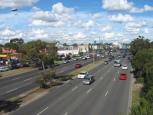
increases to 80 km/h and the road widens to become an eight-lane divided highway. It is reduced to six lanes at Moorabbin, passing through Cheltenham and Mentone
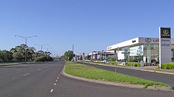
, and then to the 60 km/h or 70 km/h four-lane single carriageway after the roundabout
s at Mordialloc. The highway then travels virtually along the foreshore of Port Phillip Bay, to Frankston
, with several stretches of dual carriageway, and then up Olivers Hill
, from which there are good views across Frankston and the bay.
Just after passing through Mount Martha, the highway joins with the Mornington Peninsula Freeway
, before turning toward the town of Dromana. Here the highway changes name again, to become Point Nepean Road – which was the former name of the entire highway in the early years of settlement. From here, Arthurs Seat
is easily accessible, which gives spectacular views across the bay, and on a clear day, the skyscrapers of Melbourne are visible. Anthonys Nose is a point , or escarpment
located on the southern shore of Port Phillip Bay, between Dromana
and McCrae. The highway passes between "The Nose" and the shores of the bay. It was named by Charles La Trobe
in 1839. In the 1920s "The Nose" was modified in order to combat the daily tides that blocked the highway.
leaves the highway at Sorrento
to cross the bay to Queenscliff
, via the ferry
where it continues to Geelong, via Bellarine Highway
, but the highway continues as a two lane road down to the seaside resort of Portsea
. The end of the highway is the very nondescript painted turning circle, before the gates of the former Commonwealth quarantine and defence station of Point Nepean
, a humble ending to Melbourne's main southern highway.
 The highway is busy throughout the day, but the amount of traffic on the road does not merit the extension of the parallel Mornington Peninsula Freeway
, and cars can usually travel at the maximum speed limit.
, in their Response to the Eddington Report, July 2008http://210.15.220.118/ewlna_submissions/EastWestResponse_150708_Transurban.pdf, believe a north-south corridor from the Hume Freeway and Metropolitan Ring Road to the Nepean Highway south of Glen Huntly Road, Elsternwick
, generally via the Hoddle Highway
corridor, deserves attention.
This alignment would follow the original F2 Freeway corridor as proposed in the 1969 Melbourne Transportation Plan
.
Portsea, Victoria
Portsea is a resort town located across Port Phillip from Melbourne, Victoria, Australia. Its Local Government Area is the Shire of Mornington Peninsula....
, along the eastern shore of Port Phillip
Port Phillip
Port Phillip Port Phillip Port Phillip (also commonly referred to as Port Phillip Bay or (locally) just The Bay, is a large bay in southern Victoria, Australia; it is the location of Melbourne. Geographically, the bay covers and the shore stretches roughly . Although it is extremely shallow for...
. It is the primary road route to central Melbourne from Melbourne's southern suburbs.
History
Originally known as Arthurs Seat Road it was built in the 1850s to provide a road (originally a crude sandy track) from the farms (owned by Alexander Balcombe) south of Melbourne and link the city with its southern bay settlements and sea defences at Point Nepean. By the turn of the 20th century it had come to be known as Point Nepean Road and in 1948 was officially named Nepean Highway (indirectly after the British Politician and Colonial Administrator, Sir Evan Nepean, 1st Baronet PC (1751-1822)).Between the 1950s and about 1980, the road was progressively upgraded to a divided highway between the City and Mordialloc
Mordialloc, Victoria
Mordialloc is a suburb in Melbourne, Victoria, Australia, 24 km south-east from Melbourne's central business district. Its Local Government Area is the City of Kingston...
. From Mordialloc to Frankston
Frankston, Victoria
Frankston is a suburb within the Greater Melbourne metropolitan area in Victoria, Australia. It is located 40 km southeast of the state capital Melbourne at the southernmost edge of Greater Melbourne, near the beginnings of the Mornington Peninsula...
, the highway is an undivided four lane road. The widening of the Mordialloc Bridge, http://www.vicroads.vic.gov.au/Home/RoadsAndProjects/RoadProjects/SouthEasternSuburbs/NepeanHighwayMordiallocCreekBridgeMordialloc.htm, the last section section of less than four lanes, was completed in early 2009.
The Nepean Highway has kept the old
signage throughout the suburbs but is designated at the town of Mornington.Melbourne to Mornington
The road that is the Nepean Highway begins at the end of Swanston StreetSwanston Street, Melbourne
Swanston Street is a major thoroughfare in the centre of Melbourne, Australia. It is historically one of the main streets of central Melbourne, laid out in 1837 as part of the Hoddle Grid, the layout of major streets that makes up the central business district...
at the corner of Flinders Street
Flinders Street, Melbourne
Flinders Street is a notable street in Melbourne, Victoria, Australia. Running roughly parallel to the Yarra River, Flinders Street forms the southern edge of the Hoddle Grid. It is exactly one mile in length and one and half chains in width...
, in the Melbourne CBD, and crosses the Princes Bridge
Princes Bridge, Melbourne
Princes Bridge, originally Prince's Bridge, is an important bridge in central Melbourne, Australia that spans the Yarra River. It is built on the site of one of the oldest river crossings in Australia. The bridge connects Swanston Street on the north bank of the Yarra River to St Kilda Road on the...
where its name changes to become St Kilda Road
St Kilda Road, Melbourne
St Kilda Road is a street in Melbourne, Victoria, Australia. It is part of the locality of Melbourne which has the postcode of 3004 and along with Swanston Street forms a major spine of the city....
, a leafy four lane boulevard shared with trams. It passes the Victorian Arts Centre (where the
road number begins) and the Shrine of RemembranceShrine of Remembrance
The Shrine of Remembrance, located in Kings Domain on St Kilda Road, Melbourne, Australia was built as a memorial to the men and women of Victoria who served in World War I and is now a memorial to all Australians who have served in war...
before reaching St Kilda Junction
St Kilda Junction
St Kilda Junction is one of the most notorious intersections in Melbourne, Australia. It is located in the suburb of St Kilda, and bordering Windsor, Melbourne and St Kilda East, and is the meeting point of the major roads Punt Road, St Kilda Road, Dandenong Road/Queens Way/Princes Highway and...
. Shortly after, at the junction with Carlisle Street, there is another name change to Brighton Road. Then, at Glen Huntly Road
Glenhuntly Road, Melbourne
Glen Huntly Road is a historically known main road in Melbourne, Victoria. It starts at Beach Road, Elwood, runs east-west through Elsternwick, Caulfield, Glen Huntly and ends in Carnegie....
, Elsternwick, it becomes the Nepean Highway. The Route 67
Melbourne tram route 67
The Melbourne Tram Route 67 is an Australian tram route which runs back and forth from Carnegie to the University of Melbourne.The route starts at the Carnegie terminus, located in Trugininni Road at the corner of Koornang Road, and travels via Glen Huntly Road, Brighton Road, St Kilda Road and...
Carnegie Tram runs down the middle of the highway until it turns into Glen Huntly Road.
Speed limit
Road speed limits are used in most countries to regulate the speed of road vehicles. Speed limits may define maximum , minimum or no speed limit and are normally indicated using a traffic sign...
increases to 80 km/h and the road widens to become an eight-lane divided highway. It is reduced to six lanes at Moorabbin, passing through Cheltenham and Mentone
Mentone, Victoria
Mentone is a suburb in Melbourne, Victoria, Australia, 21 km south-east from Melbourne's central business district. Its Local Government Area is the City of Kingston...
, and then to the 60 km/h or 70 km/h four-lane single carriageway after the roundabout
Roundabout
A roundabout is the name for a road junction in which traffic moves in one direction around a central island. The word dates from the early 20th century. Roundabouts are common in many countries around the world...
s at Mordialloc. The highway then travels virtually along the foreshore of Port Phillip Bay, to Frankston
Frankston, Victoria
Frankston is a suburb within the Greater Melbourne metropolitan area in Victoria, Australia. It is located 40 km southeast of the state capital Melbourne at the southernmost edge of Greater Melbourne, near the beginnings of the Mornington Peninsula...
, with several stretches of dual carriageway, and then up Olivers Hill
Olivers Hill
Olivers Hill is a locality located in the City of Frankston, Victoria in Australia. It is the first major rise in terrain along the eastern coastline of Port Phillip, between Melbourne and the Mornington Peninsula...
, from which there are good views across Frankston and the bay.
Mornington Peninsula
Just after passing through Mount Martha, the highway joins with the Mornington Peninsula FreewayMornington Peninsula Freeway
Mornington Peninsula Freeway is an incomplete freeway in Melbourne, Victoria, Australia, that provides a link from outer suburban Melbourne to the Mornington Peninsula.- History :...
, before turning toward the town of Dromana. Here the highway changes name again, to become Point Nepean Road – which was the former name of the entire highway in the early years of settlement. From here, Arthurs Seat
Arthurs Seat, Victoria
Arthurs Seat is a hill and locality on the Mornington Peninsula, within the Shire of Mornington Peninsula, about 75 km south east of Melbourne, Australia....
is easily accessible, which gives spectacular views across the bay, and on a clear day, the skyscrapers of Melbourne are visible. Anthonys Nose is a point , or escarpment
Escarpment
An escarpment is a steep slope or long cliff that occurs from erosion or faulting and separates two relatively level areas of differing elevations.-Description and variants:...
located on the southern shore of Port Phillip Bay, between Dromana
Dromana, Victoria
Dromana is a suburb south of Melbourne, the capital city of Victoria, Australia, and is located on the Mornington Peninsula. Its Local Government Area is the Shire of Mornington Peninsula.-Geography:...
and McCrae. The highway passes between "The Nose" and the shores of the bay. It was named by Charles La Trobe
Charles La Trobe
Charles Joseph La Trobe was the first lieutenant-governor of the colony of Victoria .-Early life:La Trobe was born in London, the son of Christian Ignatius Latrobe, a family of Huguenot origin...
in 1839. In the 1920s "The Nose" was modified in order to combat the daily tides that blocked the highway.
leaves the highway at SorrentoSorrento, Victoria
Sorrento is a township in Victoria, Australia, located on the shores of Port Phillip on the Mornington Peninsula, about one and a half hours south of Melbourne...
to cross the bay to Queenscliff
Queenscliff, Victoria
Queenscliff is a small town on the Bellarine Peninsula in southern Victoria, Australia, south of Swan Bay at the entrance to Port Phillip. It is the administrative centre for the Borough of Queenscliffe...
, via the ferry
Searoad ferry
Searoad Ferries is an Australian company that operates a roll-on/roll-off vehicle and passenger ferry service between the heads of Port Phillip, near Melbourne, Victoria, Australia....
where it continues to Geelong, via Bellarine Highway
Bellarine Highway
The Bellarine Highway runs east from Geelong in Victoria along the Bellarine Peninsula to Queenscliff. Previously assigned State Route 91, it was later designated as B110...
, but the highway continues as a two lane road down to the seaside resort of Portsea
Portsea, Victoria
Portsea is a resort town located across Port Phillip from Melbourne, Victoria, Australia. Its Local Government Area is the Shire of Mornington Peninsula....
. The end of the highway is the very nondescript painted turning circle, before the gates of the former Commonwealth quarantine and defence station of Point Nepean
Point Nepean, Victoria
Point Nepean marks the southern point of The Rip and the most westerly point of the Mornington Peninsula, in Victoria, Australia. It was named after the British politician and colonial administrator, Sir Evan Nepean. It is within the suburb of Portsea...
, a humble ending to Melbourne's main southern highway.
Mornington Peninsula Freeway
Mornington Peninsula Freeway is an incomplete freeway in Melbourne, Victoria, Australia, that provides a link from outer suburban Melbourne to the Mornington Peninsula.- History :...
, and cars can usually travel at the maximum speed limit.
Possible future north-south connection
TransurbanTransurban
Transurban is an international toll road developer and manager with interests in Australia and North America. In Australia, Transurban has a stake in five out of Sydney’s nine motorways, and in Melbourne it is the full owner of CityLink, which connects three of the city’s major freeways...
, in their Response to the Eddington Report, July 2008http://210.15.220.118/ewlna_submissions/EastWestResponse_150708_Transurban.pdf, believe a north-south corridor from the Hume Freeway and Metropolitan Ring Road to the Nepean Highway south of Glen Huntly Road, Elsternwick
Elsternwick, Victoria
Elsternwick is a suburb in Melbourne, Victoria, Australia, 9 km south-east from Melbourne's central business district. Its Local Government Area is the City of Glen Eira...
, generally via the Hoddle Highway
Hoddle Highway
Hoddle Highway is an urban highway in Melbourne linking CityLink and the Eastern Freeway, allotted metropolitan route . The name "Hoddle Highway" is almost completely unknown to most drivers - who refer instead to its constituent parts: Hoddle Street and Punt Road.It starts at the Eastern Freeway...
corridor, deserves attention.
This alignment would follow the original F2 Freeway corridor as proposed in the 1969 Melbourne Transportation Plan
1969 Melbourne Transportation Plan
The 1969 Melbourne Transportation Plan was a road and rail transport plan for Melbourne, the state capital of Victoria, Australia instituted by Henry Bolte's state government...
.
Major intersections and towns
| Nepean Highway |
|||
| Northbound | Distance to Melbourne (km) |
Distance to Frankston (km) |
Southbound |
End Nepean Highway (St Kilda Road)  continues as St Kilda Road St Kilda Road, Melbourne St Kilda Road is a street in Melbourne, Victoria, Australia. It is part of the locality of Melbourne which has the postcode of 3004 and along with Swanston Street forms a major spine of the city.... to Melbourne Melbourne Melbourne is the capital and most populous city in the state of Victoria, and the second most populous city in Australia. The Melbourne City Centre is the hub of the greater metropolitan area and the Census statistical division—of which "Melbourne" is the common name. As of June 2009, the greater... |
4.6 | 35.4 | Start Nepean Highway (St Kilda Road) from St Kilda Road St Kilda Road, Melbourne St Kilda Road is a street in Melbourne, Victoria, Australia. It is part of the locality of Melbourne which has the postcode of 3004 and along with Swanston Street forms a major spine of the city.... and Punt RoadHoddle Highway Hoddle Highway is an urban highway in Melbourne linking CityLink and the Eastern Freeway, allotted metropolitan route . The name "Hoddle Highway" is almost completely unknown to most drivers - who refer instead to its constituent parts: Hoddle Street and Punt Road.It starts at the Eastern Freeway... |
Ballarat, Bendigo, Geelong via  Freeway FreewayWest Gate Freeway West Gate Freeway is a freeway in Melbourne, Australia, linking Geelong to Melbourne CBD and beyond. It is also a link between Melbourne and the west and linking industrial and residential areas west of the Yarra River with the city and port areas. The iconic West Gate Bridge is a part of the... Queens Road (Princes Highway) Princes Highway The Princes Highway extends from Sydney to Port Augusta via the coast through the states of New South Wales, Victoria and South Australia, a distance of 1941 km or 1898 km via the former alignments of the highway ....    |
St Kilda St Kilda, Victoria St Kilda is an inner city suburb of Melbourne, Victoria, Australia, 6 km south from Melbourne's central business district. Its Local Government Area is the City of Port Phillip... Fitzroy Street  |
||
| To Dandenong Dandenong, Victoria Dandenong is a suburb and major urban centre in metropolitan Melbourne, Victoria, Australia, 30 km south-east from Melbourne's central business district. Situated on Dandenong Creek and mostly flat land at the foothills of Mount Dandenong, it is the main administrative centre for the City of... ; South Yarra South Yarra, Victoria South Yarra is a suburb in Melbourne, Victoria, Australia, 4 km south-east from Melbourne's central business district. Its Local Government Area are the Cities of Stonnington and Melbourne... , Richmond Richmond, Victoria Richmond is a suburb in Melbourne, Victoria, Australia, 3 km south-east from Melbourne's central business district. Its Local Government Area is the City of Yarra... , Clifton Hill Clifton Hill, Victoria Clifton Hill is a suburb of Melbourne, Victoria, Australia, 4 km north-east from Melbourne's central business district. The border between Clifton Hill and Fitzroy North is Queens Parade and Smith Street. Merri Creek defines the eastern border of Clifton Hill. Its Local Government Area is... , Heidelberg Heidelberg, Victoria Heidelberg is a suburb in Melbourne, Victoria, Australia, 11 km north-east from Melbourne's central business district. Its Local Government Area is the City of Banyule.... Punt Road Hoddle Highway Hoddle Highway is an urban highway in Melbourne linking CityLink and the Eastern Freeway, allotted metropolitan route . The name "Hoddle Highway" is almost completely unknown to most drivers - who refer instead to its constituent parts: Hoddle Street and Punt Road.It starts at the Eastern Freeway... |
|||
| St. Kilda Fitzroy Street |
|||
| Elwood Elwood, Victoria Elwood is a suburb in Melbourne, Victoria, Australia, 8 km south from Melbourne's central business district. Its Local Government Area is the City of Port Phillip... Barkly Street |
4.8 | 35.2 | St Kilda St Kilda, Victoria St Kilda is an inner city suburb of Melbourne, Victoria, Australia, 6 km south from Melbourne's central business district. Its Local Government Area is the City of Port Phillip... , Elwood Elwood, Victoria Elwood is a suburb in Melbourne, Victoria, Australia, 8 km south from Melbourne's central business district. Its Local Government Area is the City of Port Phillip... Barkly Street |
| Glen Huntly Glen Huntly, Victoria Glen Huntly is a suburb in Melbourne, Victoria, Australia, 11 km south-east from Melbourne's central business district. Its Local Government Area is the City of Glen Eira. At the 2006 Census, Glen Huntly had a population of 4085.... Glen Eira Road  |
7 | 33 | Ripponlea Ripponlea, Victoria Ripponlea is a suburb of Melbourne, Victoria, Australia. It is centered on the intersection of Glen Eira Road and Hotham Street, in the municipality of City of Port Phillip. In terms of its cadastral division, Ripponlea is in the parish of Prahran within the County of Bourke. As of the 2006 Census,... , Glen Huntly Glen Huntly, Victoria Glen Huntly is a suburb in Melbourne, Victoria, Australia, 11 km south-east from Melbourne's central business district. Its Local Government Area is the City of Glen Eira. At the 2006 Census, Glen Huntly had a population of 4085.... Glen Eira Road |
| continues as |
7.9 | 32.1 | Toorak Toorak, Victoria Toorak is a suburb of Melbourne, Victoria, Australia, 5 km south-east from Melbourne's central business district located on a rise on the south side of a bend in the Yarra River. Its Local Government Area is the City of Stonnington... Hotham Street  |
| Toorak Toorak, Victoria Toorak is a suburb of Melbourne, Victoria, Australia, 5 km south-east from Melbourne's central business district located on a rise on the south side of a bend in the Yarra River. Its Local Government Area is the City of Stonnington... , Burnley Burnley, Victoria Burnley is a suburb in Melbourne, Victoria, Australia, 4 km east from Melbourne's central business district. Its Local Government Area is the City of Yarra. At the 2006 Census, Burnley had a population of 708.... Hotham Street |
duplexes with |
||
| Elsternwick Elsternwick, Victoria Elsternwick is a suburb in Melbourne, Victoria, Australia, 9 km south-east from Melbourne's central business district. Its Local Government Area is the City of Glen Eira... |
8 | 32 | Elsternwick Elsternwick, Victoria Elsternwick is a suburb in Melbourne, Victoria, Australia, 9 km south-east from Melbourne's central business district. Its Local Government Area is the City of Glen Eira... |
| duplexes with |
8.3 | 31.7 | Brighton Brighton, Victoria Brighton is a suburb of Melbourne, Victoria, Australia, 11 km south-east from Melbourne's central business district. Its Local Government Area is the City of Bayside. At the 2006 Census, Brighton had a population of 20,651... Rusden Street |
| Brighton Brighton, Victoria Brighton is a suburb of Melbourne, Victoria, Australia, 11 km south-east from Melbourne's central business district. Its Local Government Area is the City of Bayside. At the 2006 Census, Brighton had a population of 20,651... Rusden Street |
continues as |
||
| Elwood Elwood, Victoria Elwood is a suburb in Melbourne, Victoria, Australia, 8 km south from Melbourne's central business district. Its Local Government Area is the City of Port Phillip... , Ormond Ormond, Victoria Ormond is a suburb in Melbourne, Victoria, Australia, 12 km south-east from Melbourne's central business district. Its Local Government Area is the City of Glen Eira. At the 2006 Census, Ormond had a population of 7152.... North Road  |
9.9 | 30.1 | Ormond Ormond, Victoria Ormond is a suburb in Melbourne, Victoria, Australia, 12 km south-east from Melbourne's central business district. Its Local Government Area is the City of Glen Eira. At the 2006 Census, Ormond had a population of 7152.... , Oakleigh Oakleigh, Victoria Oakleigh is a suburb of Melbourne, Victoria, Australia and is located 14 km south-east from Melbourne's central business district. Its Local Government Area is the City of Monash. At the 2006 Census, Oakleigh had a population of 6,876.... , Elwood Elwood, Victoria Elwood is a suburb in Melbourne, Victoria, Australia, 8 km south from Melbourne's central business district. Its Local Government Area is the City of Port Phillip... North Road |
| continues as |
11.8 | 28.2 | Caulfield Caulfield, Victoria Caulfield is a suburb in Melbourne, Victoria, Australia, 12 km south-east from Melbourne's central business district. Its Local Government Area is the City of Glen Eira... Hawthorn Road  |
| Caulfield Caulfield, Victoria Caulfield is a suburb in Melbourne, Victoria, Australia, 12 km south-east from Melbourne's central business district. Its Local Government Area is the City of Glen Eira... , Malvern Malvern, Victoria Malvern is a suburb in Melbourne, Victoria, Australia, 8 km south-east from Melbourne's central business district. Its Local Government Area is the City of Stonnington. At the 2006 Census, Malvern had a population of 9,422.-History:... Hawthorn Road |
duplexes with |
||
| Brighton Brighton, Victoria Brighton is a suburb of Melbourne, Victoria, Australia, 11 km south-east from Melbourne's central business district. Its Local Government Area is the City of Bayside. At the 2006 Census, Brighton had a population of 20,651... , Bentleigh Bentleigh, Victoria Bentleigh is a suburb in Melbourne, Victoria, Australia, 13 km south-east from Melbourne's central business district. Its Local Government Area is the City of Glen Eira. At the 2006 Census, Bentleigh had a population of 14,271.-History:... Centre Road  |
12 | 28 | Bentleigh Bentleigh, Victoria Bentleigh is a suburb in Melbourne, Victoria, Australia, 13 km south-east from Melbourne's central business district. Its Local Government Area is the City of Glen Eira. At the 2006 Census, Bentleigh had a population of 14,271.-History:... , Clayton Clayton, Victoria Clayton is a suburb in Melbourne, Victoria, Australia, 19 km south-east from Melbourne's central business district. Its Local Government Area is the City of Monash. At the 2006 Census, Clayton had a population of 14,332.-Overview:... , Brighton Brighton, Victoria Brighton is a suburb of Melbourne, Victoria, Australia, 11 km south-east from Melbourne's central business district. Its Local Government Area is the City of Bayside. At the 2006 Census, Brighton had a population of 20,651... Centre Road |
| duplexes with |
13.3 | 26.7 | Sandringham Sandringham, Victoria Sandringham is a suburb in Melbourne, Victoria, Australia, 16 km south-east from Melbourne's central business district. Its Local Government Area is the City of Bayside. At the 2006 Census, Sandringham had a population of 8693.-History:... , Black Rock Black Rock, Victoria Black Rock is a suburb in Melbourne, Victoria, Australia, 18 km south-east from Melbourne's central business district. Its Local Government Area is the City of Bayside. At the 2006 Census, Black Rock had a population of 5796.-History:... Cummins Road |
| Black Rock Black Rock, Victoria Black Rock is a suburb in Melbourne, Victoria, Australia, 18 km south-east from Melbourne's central business district. Its Local Government Area is the City of Bayside. At the 2006 Census, Black Rock had a population of 5796.-History:... Cummins Road |
continues as |
||
To  Beach Road Beach RoadBeach Road, Melbourne Beach Road, is a bayside suburban coastal road in Melbourne, Australia. It runs along the south-eastern side of Melbourne's Port Phillip Bay, starting at its southern point in Mordialloc and ending at the intersection of New St and the Esplanade in Brighton. Metro-route 33 continues as Esplanade... South Road  |
14.4 | 25.6 | Noble Park Noble Park, Victoria Noble Park is a suburb in Melbourne, Victoria, Australia, 26 km south-east from Melbourne's central business district. Its Local Government Area is the City of Greater Dandenong... ; To  Frankston FrankstonFrankston, Victoria Frankston is a suburb within the Greater Melbourne metropolitan area in Victoria, Australia. It is located 40 km southeast of the state capital Melbourne at the southernmost edge of Greater Melbourne, near the beginnings of the Mornington Peninsula... , Portsea Portsea, Victoria Portsea is a resort town located across Port Phillip from Melbourne, Victoria, Australia. Its Local Government Area is the Shire of Mornington Peninsula.... via Freeway Mornington Peninsula Freeway Mornington Peninsula Freeway is an incomplete freeway in Melbourne, Victoria, Australia, that provides a link from outer suburban Melbourne to the Mornington Peninsula.- History :... South Road |
| Moorabbin Moorabbin, Victoria Moorabbin is a suburb in Melbourne, Victoria, Australia, 15 km south-east from Melbourne's central business district. Its Local Government Area is the City of Kingston. At the 2006 Census, Moorabbin had a population of 5,170.... |
14.8 | 25.2 | Moorabbin Moorabbin, Victoria Moorabbin is a suburb in Melbourne, Victoria, Australia, 15 km south-east from Melbourne's central business district. Its Local Government Area is the City of Kingston. At the 2006 Census, Moorabbin had a population of 5,170.... |
| FRANKSTON RAIL LINE | FRANKSTON RAIL LINE | ||
| Cheltenham Cheltenham, Victoria Cheltenham is a suburb in Melbourne, Victoria, Australia, located 19 km south-east of Melbourne's central business district. Its Local Government Area is the City of Kingston to the eastern side of the area's metropolitan railway line and Charman Road north, while the City of Bayside resides over... |
17.6 | 22.4 | Cheltenham Cheltenham, Victoria Cheltenham is a suburb in Melbourne, Victoria, Australia, located 19 km south-east of Melbourne's central business district. Its Local Government Area is the City of Kingston to the eastern side of the area's metropolitan railway line and Charman Road north, while the City of Bayside resides over... |
| continues as |
20.7 | 19.3 | Mentone Mentone, Victoria Mentone is a suburb in Melbourne, Victoria, Australia, 21 km south-east from Melbourne's central business district. Its Local Government Area is the City of Kingston... Balcombe Road  |
| Mentone Mentone, Victoria Mentone is a suburb in Melbourne, Victoria, Australia, 21 km south-east from Melbourne's central business district. Its Local Government Area is the City of Kingston... , Black Rock Black Rock, Victoria Black Rock is a suburb in Melbourne, Victoria, Australia, 18 km south-east from Melbourne's central business district. Its Local Government Area is the City of Bayside. At the 2006 Census, Black Rock had a population of 5796.-History:... Balcombe Road |
duplexes with |
||
| To Beach Road Beach Road, Melbourne Beach Road, is a bayside suburban coastal road in Melbourne, Australia. It runs along the south-eastern side of Melbourne's Port Phillip Bay, starting at its southern point in Mordialloc and ending at the intersection of New St and the Esplanade in Brighton. Metro-route 33 continues as Esplanade... ; Oakleigh Oakleigh, Victoria Oakleigh is a suburb of Melbourne, Victoria, Australia and is located 14 km south-east from Melbourne's central business district. Its Local Government Area is the City of Monash. At the 2006 Census, Oakleigh had a population of 6,876.... , Burwood Burwood, Victoria Burwood is a suburb in Melbourne, Victoria, Australia, 17 km east from Melbourne's central business district. Its Local Government Area is largely the City of Whitehorse but includes the City of Monash in its south west corner. At the 2006 Census, Burwood had a population of 11,886.-History:The... , Surrey Hills Surrey Hills, Victoria Surrey Hills is a suburb in Melbourne, Victoria, Australia, 12 km east from Melbourne's central business district. Its Local Government Area lies within the cities of Boroondara and Whitehorse... Warrigal Road Warrigal Road Warrigal Road is a major inner urban road in southeastern Melbourne, Australia. On weekdays, it is usually congested as it runs through many major suburbs along its route, traversing Melbourne's inner eastern and south-eastern suburbs. This includes suburbs such as Chadstone, Oakleigh, and...  |
20.8 | 19.2 | Oakleigh Oakleigh, Victoria Oakleigh is a suburb of Melbourne, Victoria, Australia and is located 14 km south-east from Melbourne's central business district. Its Local Government Area is the City of Monash. At the 2006 Census, Oakleigh had a population of 6,876.... , Parkdale Parkdale, Victoria Parkdale is a suburb in Melbourne, Victoria, Australia, 23 km south-east from Melbourne's central business district. Its Local Government Area is the City of Kingston... Warrigal Road Warrigal Road Warrigal Road is a major inner urban road in southeastern Melbourne, Australia. On weekdays, it is usually congested as it runs through many major suburbs along its route, traversing Melbourne's inner eastern and south-eastern suburbs. This includes suburbs such as Chadstone, Oakleigh, and... |
| duplexes with |
21 | 19 | Keysborough Keysborough, Victoria Keysborough is a suburb in Melbourne, Victoria, Australia, 27 km south-east from Melbourne's central business district. Its Local Government Area is the City of Greater Dandenong... , Dandenong Dandenong, Victoria Dandenong is a suburb and major urban centre in metropolitan Melbourne, Victoria, Australia, 30 km south-east from Melbourne's central business district. Situated on Dandenong Creek and mostly flat land at the foothills of Mount Dandenong, it is the main administrative centre for the City of... Lower Dandenong Road Route 10, Melbourne Route 10, also known as the Lower Dandenong State Highway is an 18 km stretch of continuous road in the southeastern suburbs of Melbourne, Australia.- Alternate names :... |
| Dandenong Dandenong, Victoria Dandenong is a suburb and major urban centre in metropolitan Melbourne, Victoria, Australia, 30 km south-east from Melbourne's central business district. Situated on Dandenong Creek and mostly flat land at the foothills of Mount Dandenong, it is the main administrative centre for the City of... Lower Dandenong Road Route 10, Melbourne Route 10, also known as the Lower Dandenong State Highway is an 18 km stretch of continuous road in the southeastern suburbs of Melbourne, Australia.- Alternate names :... |
continues as |
||
| FRANKSTON RAIL LINE | 23.3 | 16.7 | FRANKSTON RAIL LINE |
| Mordialloc Mordialloc, Victoria Mordialloc is a suburb in Melbourne, Victoria, Australia, 24 km south-east from Melbourne's central business district. Its Local Government Area is the City of Kingston... |
24 | 16 | Mordialloc Mordialloc, Victoria Mordialloc is a suburb in Melbourne, Victoria, Australia, 24 km south-east from Melbourne's central business district. Its Local Government Area is the City of Kingston... |
| Beach Road Beach Road, Melbourne Beach Road, is a bayside suburban coastal road in Melbourne, Australia. It runs along the south-eastern side of Melbourne's Port Phillip Bay, starting at its southern point in Mordialloc and ending at the intersection of New St and the Esplanade in Brighton. Metro-route 33 continues as Esplanade... .svg.png) |
24.2 | 15.8 | Beach Road Beach Road, Melbourne Beach Road, is a bayside suburban coastal road in Melbourne, Australia. It runs along the south-eastern side of Melbourne's Port Phillip Bay, starting at its southern point in Mordialloc and ending at the intersection of New St and the Esplanade in Brighton. Metro-route 33 continues as Esplanade... |
| Aspendale Aspendale, Victoria Aspendale is a suburb in Melbourne, Victoria, Australia, 27 km south-east from Melbourne's central business district. Its Local Government Area is the City of Kingston... |
26.7 | 13.3 | Aspendale Aspendale, Victoria Aspendale is a suburb in Melbourne, Victoria, Australia, 27 km south-east from Melbourne's central business district. Its Local Government Area is the City of Kingston... |
| Edithvale Edithvale, Victoria Edithvale is a suburb in Melbourne, Victoria, Australia, 28 km south-east from Melbourne's central business district. Its Local Government Area is the City of Kingston. At the 2006 Census, Edithvale had a population of 4991.-Public transport:... |
28.1 | 11.9 | Edithvale Edithvale, Victoria Edithvale is a suburb in Melbourne, Victoria, Australia, 28 km south-east from Melbourne's central business district. Its Local Government Area is the City of Kingston. At the 2006 Census, Edithvale had a population of 4991.-Public transport:... |
| Springvale Springvale, Victoria Springvale is a suburb in Melbourne, Victoria, Australia, approximately 20 km south-east from Melbourne's central business district. Its Local Government Area is the City of Greater Dandenong... , Glen Waverley Glen Waverley, Victoria Glen Waverley is a suburb in Melbourne, Victoria, Australia, 19 km south-east from Melbourne's central business district. Its Local Government Area is the City of Monash... Edithvale Road Route 40, Melbourne Route 40, or the Bell / Springvale State Highway is the longest urban highway in Melbourne linking Tullamarine Freeway and the Nepean Highway, allotted metropolitan route ....  |
Springvale Springvale, Victoria Springvale is a suburb in Melbourne, Victoria, Australia, approximately 20 km south-east from Melbourne's central business district. Its Local Government Area is the City of Greater Dandenong... Edithvale Road Route 40, Melbourne Route 40, or the Bell / Springvale State Highway is the longest urban highway in Melbourne linking Tullamarine Freeway and the Nepean Highway, allotted metropolitan route .... |
||
| Chelsea Chelsea, Victoria Chelsea is a suburb in Melbourne, Victoria, Australia, 30 km south-east from Melbourne's central business district. Its Local Government Area is the City of Kingston. At the 2006 Census, Chelsea had a population of 6694.... |
29.7 | 10.3 | Chelsea Chelsea, Victoria Chelsea is a suburb in Melbourne, Victoria, Australia, 30 km south-east from Melbourne's central business district. Its Local Government Area is the City of Kingston. At the 2006 Census, Chelsea had a population of 6694.... |
| Patterson Lakes Patterson Lakes, Victoria Patterson Lakes is a suburb in outer south-east Melbourne, Victoria, Australia, and is located 32 km south-east of Melbourne's central business district. Its Local Government Area is the City of Kingston. In the 2006 Census Patterson Lakes had a population of 7,235 people.Patterson Lakes consists... , Cranbourne Cranbourne, Victoria Cranbourne is a suburb in Melbourne, Victoria, Australia, 43 km south-east from Melbourne's central business district. Its Local Government Area is the City of Casey. At the 2006 Census, Cranbourne had a population of 14,750.... McLeod Road Thompsons Road, Melbourne Thompsons Road is a major urban arterial road in the south-eastern suburbs of Melbourne, Victoria, Australia.-Duplication Projects:Thompsons Road duplication, Carrum Downs... via Station Street  |
32.3 | 7.7 | Patterson Lakes Patterson Lakes, Victoria Patterson Lakes is a suburb in outer south-east Melbourne, Victoria, Australia, and is located 32 km south-east of Melbourne's central business district. Its Local Government Area is the City of Kingston. In the 2006 Census Patterson Lakes had a population of 7,235 people.Patterson Lakes consists... , Cranbourne Cranbourne, Victoria Cranbourne is a suburb in Melbourne, Victoria, Australia, 43 km south-east from Melbourne's central business district. Its Local Government Area is the City of Casey. At the 2006 Census, Cranbourne had a population of 14,750.... McLeod Road Thompsons Road, Melbourne Thompsons Road is a major urban arterial road in the south-eastern suburbs of Melbourne, Victoria, Australia.-Duplication Projects:Thompsons Road duplication, Carrum Downs... via Station Street |
| Carrum Carrum, Victoria Carrum is a suburb in Melbourne, Victoria, Australia, south-east from Melbourne's central business district. Its Local Government Area is the City of Kingston... |
Carrum Carrum, Victoria Carrum is a suburb in Melbourne, Victoria, Australia, south-east from Melbourne's central business district. Its Local Government Area is the City of Kingston... |
||
| Dandenong Dandenong, Victoria Dandenong is a suburb and major urban centre in metropolitan Melbourne, Victoria, Australia, 30 km south-east from Melbourne's central business district. Situated on Dandenong Creek and mostly flat land at the foothills of Mount Dandenong, it is the main administrative centre for the City of... Fletcher Road Dandenong Valley Highway The Dandenong Valley Highway stretches almost 30 kilometres from Wantirna South in Melbourne's eastern suburbs to Frankston in the south. For its entire length, its main name is not actually Dandenong Valley Highway, and very few locals use it...  |
39.6 | 0.4 | Cranbourne Cranbourne, Victoria Cranbourne is a suburb in Melbourne, Victoria, Australia, 43 km south-east from Melbourne's central business district. Its Local Government Area is the City of Casey. At the 2006 Census, Cranbourne had a population of 14,750.... , Flinders Flinders, Victoria Flinders is a historic town south of Melbourne, Victoria, Australia, located on the Mornington Peninsula at the point where Western Port meets Bass Strait. Its Local Government Area is the Shire of Mornington Peninsula... Fletcher Road Dandenong Valley Highway The Dandenong Valley Highway stretches almost 30 kilometres from Wantirna South in Melbourne's eastern suburbs to Frankston in the south. For its entire length, its main name is not actually Dandenong Valley Highway, and very few locals use it... |
| Frankston Frankston, Victoria Frankston is a suburb within the Greater Melbourne metropolitan area in Victoria, Australia. It is located 40 km southeast of the state capital Melbourne at the southernmost edge of Greater Melbourne, near the beginnings of the Mornington Peninsula... |
40 | 0 | Frankston Frankston, Victoria Frankston is a suburb within the Greater Melbourne metropolitan area in Victoria, Australia. It is located 40 km southeast of the state capital Melbourne at the southernmost edge of Greater Melbourne, near the beginnings of the Mornington Peninsula... |
| Northbound | Distance to Frankston (km) |
Distance to Mornington (km) |
Southbound |
| Cranbourne Cranbourne, Victoria Cranbourne is a suburb in Melbourne, Victoria, Australia, 43 km south-east from Melbourne's central business district. Its Local Government Area is the City of Casey. At the 2006 Census, Cranbourne had a population of 14,750.... , Berwick Berwick, Victoria Berwick is a suburb in Melbourne, Victoria, Australia, south-east from Melbourne's central business district. Its Local Government Area is the City of Casey. At the 2006 Census, Berwick had a population of 36,420.... ; To MelbourneMelbourne Melbourne is the capital and most populous city in the state of Victoria, and the second most populous city in Australia. The Melbourne City Centre is the hub of the greater metropolitan area and the Census statistical division—of which "Melbourne" is the common name. As of June 2009, the greater... via Freeway Frankston Freeway Frankston Freeway is a very short stretch of Melbourne freeway that was designed to upgrade Wells Road to freeway standard in the 1970s and provides a link from suburban Melbourne to Frankston... Davey Street   |
0.5 | 12 | Hastings Hastings, Victoria Hastings is a suburb on the Mornington Peninsula, Victoria, Australia, as a part of the urban enclave on Westernport comprising Hastings, Bittern, Crib Point, Tyabb, and Somerville. Its Local Government Area is the Shire of Mornington Peninsula... , Flinders Flinders, Victoria Flinders is a historic town south of Melbourne, Victoria, Australia, located on the Mornington Peninsula at the point where Western Port meets Bass Strait. Its Local Government Area is the Shire of Mornington Peninsula... Davey Street |
| Somerville Somerville, Victoria Somerville is a suburb in Victoria, Australia, 49 km southeast from Melbourne's central business district, as a part of the urban enclave on Westernport comprising Somerville, Hastings, Bittern, Crib Point, and Tyabb. Its Local Government Area is the Shire of Mornington Peninsula... , Tooradin Tooradin, Victoria Tooradin is a town in Victoria, Australia, 57 km south-east from Melbourne's central business district. Its Local Government Area is the City of Casey. At the 2006 Census, Tooradin had a population of 1183.-Today:... Bungower Road |
11 | 1.5 | Somerville Somerville, Victoria Somerville is a suburb in Victoria, Australia, 49 km southeast from Melbourne's central business district, as a part of the urban enclave on Westernport comprising Somerville, Hastings, Bittern, Crib Point, and Tyabb. Its Local Government Area is the Shire of Mornington Peninsula... Bungower Road |
| End Start |
12.5 | 0 | Mornington Mornington, Victoria Mornington is a sea side town on the Mornington Peninsula, Victoria, Australia, located 57 km south-east of Melbourne's central business district. It is in the Local Government Area of the Shire of Mornington Peninsula.... |
| To ; Moorooduc Moorooduc, Victoria Moorooduc is a suburb in Melbourne, Victoria, Australia. Its Local Government Area is the Shire of Mornington Peninsula.The Moorooduc Highway runs through the locality, being the main route between Melbourne and the Peninsula.... , Tyabb Tyabb, Victoria Tyabb is a suburb of Melbourne, Victoria, Australia, as a part of the urban enclave on Westernport comprising Tyabb, Hastings, Bittern, Crib Point, and Somerville. Its Local Government Area is the Shire of Mornington Peninsula... Mornington-Tyabb Road  |
To Mount Martha Mount Martha, Victoria Mount Martha is a suburb in Melbourne, Victoria, Australia, located 60 km south-east of Melbourne's central business district. Its Local Government Area is the Shire of Mornington Peninsula. It is located on the south-eastern shores of Port Phillip and offers a bathing beach... , Safety Beach Safety Beach, Victoria Safety Beach is a suburb in Melbourne, Victoria, Australia. Its Local Government Area is the Shire of Mornington Peninsula.Safety Beach occupies slightly less than half the area of land between the foothills of Mount Martha and Arthurs Seat and borders Port Philip Bay to its west.There is a large... ; Tyabb Tyabb, Victoria Tyabb is a suburb of Melbourne, Victoria, Australia, as a part of the urban enclave on Westernport comprising Tyabb, Hastings, Bittern, Crib Point, and Somerville. Its Local Government Area is the Shire of Mornington Peninsula... , Moorooduc Moorooduc, Victoria Moorooduc is a suburb in Melbourne, Victoria, Australia. Its Local Government Area is the Shire of Mornington Peninsula.The Moorooduc Highway runs through the locality, being the main route between Melbourne and the Peninsula.... Mornington-Tyabb Road |
||
| Mornington Mornington, Victoria Mornington is a sea side town on the Mornington Peninsula, Victoria, Australia, located 57 km south-east of Melbourne's central business district. It is in the Local Government Area of the Shire of Mornington Peninsula.... |
End Start |
||
| Northbound | Distance to Mornington (km) |
Distance to Flinders (km) |
Southbound |
| Frankston Frankston, Victoria Frankston is a suburb within the Greater Melbourne metropolitan area in Victoria, Australia. It is located 40 km southeast of the state capital Melbourne at the southernmost edge of Greater Melbourne, near the beginnings of the Mornington Peninsula... , Melbourne Melbourne Melbourne is the capital and most populous city in the state of Victoria, and the second most populous city in Australia. The Melbourne City Centre is the hub of the greater metropolitan area and the Census statistical division—of which "Melbourne" is the common name. As of June 2009, the greater... Mornington Peninsula Freeway Mornington Peninsula Freeway Mornington Peninsula Freeway is an incomplete freeway in Melbourne, Victoria, Australia, that provides a link from outer suburban Melbourne to the Mornington Peninsula.- History :... .svg.png) |
8.5 | 24.5 | Frankston Frankston, Victoria Frankston is a suburb within the Greater Melbourne metropolitan area in Victoria, Australia. It is located 40 km southeast of the state capital Melbourne at the southernmost edge of Greater Melbourne, near the beginnings of the Mornington Peninsula... , Melbourne Melbourne Melbourne is the capital and most populous city in the state of Victoria, and the second most populous city in Australia. The Melbourne City Centre is the hub of the greater metropolitan area and the Census statistical division—of which "Melbourne" is the common name. As of June 2009, the greater... Mornington Peninsula Freeway Mornington Peninsula Freeway Mornington Peninsula Freeway is an incomplete freeway in Melbourne, Victoria, Australia, that provides a link from outer suburban Melbourne to the Mornington Peninsula.- History :... |
End  continues as |
9 | 24 | Dromana Dromana, Victoria Dromana is a suburb south of Melbourne, the capital city of Victoria, Australia, and is located on the Mornington Peninsula. Its Local Government Area is the Shire of Mornington Peninsula.-Geography:... , Portsea Portsea, Victoria Portsea is a resort town located across Port Phillip from Melbourne, Victoria, Australia. Its Local Government Area is the Shire of Mornington Peninsula.... Mornington Peninsula Freeway Mornington Peninsula Freeway Mornington Peninsula Freeway is an incomplete freeway in Melbourne, Victoria, Australia, that provides a link from outer suburban Melbourne to the Mornington Peninsula.- History :... |
| Dromana Dromana, Victoria Dromana is a suburb south of Melbourne, the capital city of Victoria, Australia, and is located on the Mornington Peninsula. Its Local Government Area is the Shire of Mornington Peninsula.-Geography:... , Portsea Portsea, Victoria Portsea is a resort town located across Port Phillip from Melbourne, Victoria, Australia. Its Local Government Area is the Shire of Mornington Peninsula.... Mornington Peninsula Freeway Mornington Peninsula Freeway Mornington Peninsula Freeway is an incomplete freeway in Melbourne, Victoria, Australia, that provides a link from outer suburban Melbourne to the Mornington Peninsula.- History :... |
continues as |
||
| continues as |
13 | 20 | Red Hill Red Hill, Victoria Red Hill is a small rural community, located in the hinterland of the Mornington Peninsula, about an hour's drive south of Melbourne, in Victoria, Australia. The Local Government Area is the Shire of Mornington Peninsula... , Flinders Flinders, Victoria Flinders is a historic town south of Melbourne, Victoria, Australia, located on the Mornington Peninsula at the point where Western Port meets Bass Strait. Its Local Government Area is the Shire of Mornington Peninsula... ; To  White Hill Road |
| Red Hill Red Hill, Victoria Red Hill is a small rural community, located in the hinterland of the Mornington Peninsula, about an hour's drive south of Melbourne, in Victoria, Australia. The Local Government Area is the Shire of Mornington Peninsula... ; To HastingsHastings, Victoria Hastings is a suburb on the Mornington Peninsula, Victoria, Australia, as a part of the urban enclave on Westernport comprising Hastings, Bittern, Crib Point, Tyabb, and Somerville. Its Local Government Area is the Shire of Mornington Peninsula... White Hill Road |
continues as |
||
| Eastbound | Distance to Hastings (km) |
Distance to Dromana (km) |
Westbound |
| Portsea Portsea, Victoria Portsea is a resort town located across Port Phillip from Melbourne, Victoria, Australia. Its Local Government Area is the Shire of Mornington Peninsula.... Mornington Peninsula Freeway Mornington Peninsula Freeway Mornington Peninsula Freeway is an incomplete freeway in Melbourne, Victoria, Australia, that provides a link from outer suburban Melbourne to the Mornington Peninsula.- History :... |
22.5 | 2.5 | Portsea Portsea, Victoria Portsea is a resort town located across Port Phillip from Melbourne, Victoria, Australia. Its Local Government Area is the Shire of Mornington Peninsula.... Mornington Peninsula Freeway Mornington Peninsula Freeway Mornington Peninsula Freeway is an incomplete freeway in Melbourne, Victoria, Australia, that provides a link from outer suburban Melbourne to the Mornington Peninsula.- History :... |
| continues as |
23 | 2 | End continues as |
| Mornington Mornington, Victoria Mornington is a sea side town on the Mornington Peninsula, Victoria, Australia, located 57 km south-east of Melbourne's central business district. It is in the Local Government Area of the Shire of Mornington Peninsula.... , Frankston Frankston, Victoria Frankston is a suburb within the Greater Melbourne metropolitan area in Victoria, Australia. It is located 40 km southeast of the state capital Melbourne at the southernmost edge of Greater Melbourne, near the beginnings of the Mornington Peninsula... , Melbourne Melbourne Melbourne is the capital and most populous city in the state of Victoria, and the second most populous city in Australia. The Melbourne City Centre is the hub of the greater metropolitan area and the Census statistical division—of which "Melbourne" is the common name. As of June 2009, the greater... Mornington Peninsula Freeway Mornington Peninsula Freeway Mornington Peninsula Freeway is an incomplete freeway in Melbourne, Victoria, Australia, that provides a link from outer suburban Melbourne to the Mornington Peninsula.- History :... |
Frankston Frankston, Victoria Frankston is a suburb within the Greater Melbourne metropolitan area in Victoria, Australia. It is located 40 km southeast of the state capital Melbourne at the southernmost edge of Greater Melbourne, near the beginnings of the Mornington Peninsula... , Melbourne Melbourne Melbourne is the capital and most populous city in the state of Victoria, and the second most populous city in Australia. The Melbourne City Centre is the hub of the greater metropolitan area and the Census statistical division—of which "Melbourne" is the common name. As of June 2009, the greater... Mornington Peninsula Freeway Mornington Peninsula Freeway Mornington Peninsula Freeway is an incomplete freeway in Melbourne, Victoria, Australia, that provides a link from outer suburban Melbourne to the Mornington Peninsula.- History :... |
||
| continues as Nepean Highway |
24 | 1 | Mount Martha Mount Martha, Victoria Mount Martha is a suburb in Melbourne, Victoria, Australia, located 60 km south-east of Melbourne's central business district. Its Local Government Area is the Shire of Mornington Peninsula. It is located on the south-eastern shores of Port Phillip and offers a bathing beach... , Mornington Mornington, Victoria Mornington is a sea side town on the Mornington Peninsula, Victoria, Australia, located 57 km south-east of Melbourne's central business district. It is in the Local Government Area of the Shire of Mornington Peninsula.... Marine Parade |
| Mount Martha Mount Martha, Victoria Mount Martha is a suburb in Melbourne, Victoria, Australia, located 60 km south-east of Melbourne's central business district. Its Local Government Area is the Shire of Mornington Peninsula. It is located on the south-eastern shores of Port Phillip and offers a bathing beach... , Mornington Mornington, Victoria Mornington is a sea side town on the Mornington Peninsula, Victoria, Australia, located 57 km south-east of Melbourne's central business district. It is in the Local Government Area of the Shire of Mornington Peninsula.... Marine Parade |
continues as Point Nepean Road (Nepean Highway) |
||
| Dromana Dromana, Victoria Dromana is a suburb south of Melbourne, the capital city of Victoria, Australia, and is located on the Mornington Peninsula. Its Local Government Area is the Shire of Mornington Peninsula.-Geography:... |
25 | 0 | Dromana Dromana, Victoria Dromana is a suburb south of Melbourne, the capital city of Victoria, Australia, and is located on the Mornington Peninsula. Its Local Government Area is the Shire of Mornington Peninsula.-Geography:... |
| Northbound | Distance to Melbourne via Freeway(km) |
Distance to Portsea (km) |
Southbound |
| Melbourne Melbourne Melbourne is the capital and most populous city in the state of Victoria, and the second most populous city in Australia. The Melbourne City Centre is the hub of the greater metropolitan area and the Census statistical division—of which "Melbourne" is the common name. As of June 2009, the greater... via FreewayMornington Peninsula Freeway Mornington Peninsula Freeway is an incomplete freeway in Melbourne, Victoria, Australia, that provides a link from outer suburban Melbourne to the Mornington Peninsula.- History :... ; Arthurs Seat Arthurs Seat, Victoria Arthurs Seat is a hill and locality on the Mornington Peninsula, within the Shire of Mornington Peninsula, about 75 km south east of Melbourne, Australia.... , Red Hill Red Hill, Victoria Red Hill is a small rural community, located in the hinterland of the Mornington Peninsula, about an hour's drive south of Melbourne, in Victoria, Australia. The Local Government Area is the Shire of Mornington Peninsula... McCulloch Street  |
82 | 25 | Arthurs Seat Arthurs Seat, Victoria Arthurs Seat is a hill and locality on the Mornington Peninsula, within the Shire of Mornington Peninsula, about 75 km south east of Melbourne, Australia.... , Red Hill Red Hill, Victoria Red Hill is a small rural community, located in the hinterland of the Mornington Peninsula, about an hour's drive south of Melbourne, in Victoria, Australia. The Local Government Area is the Shire of Mornington Peninsula... McCulloch Street |
| Melbourne Melbourne Melbourne is the capital and most populous city in the state of Victoria, and the second most populous city in Australia. The Melbourne City Centre is the hub of the greater metropolitan area and the Census statistical division—of which "Melbourne" is the common name. As of June 2009, the greater... via FreewayMornington Peninsula Freeway Mornington Peninsula Freeway is an incomplete freeway in Melbourne, Victoria, Australia, that provides a link from outer suburban Melbourne to the Mornington Peninsula.- History :... ; McCrae McCrae, Victoria McCrae is a suburb in Melbourne, Victoria, Australia. Its Local Government Area is the Shire of Mornington Peninsula. McCrae is known for the McCrae Lighthouse... Lonsdale Street |
85 | 21 | McCrae McCrae, Victoria McCrae is a suburb in Melbourne, Victoria, Australia. Its Local Government Area is the Shire of Mornington Peninsula. McCrae is known for the McCrae Lighthouse... Lonsdale Street |
| Main Ridge Main Ridge, Victoria Main Ridge is a rural locality south of Melbourne, Victoria, Australia, located south of and inland from Rosebud on the Mornington Peninsula, and was originally known as Main Creek. Its Local Government Area is the Shire of Mornington Peninsula. At the 2006 census, Main Ridge had a population of... Jetty Road |
86 | 20 | Main Ridge Main Ridge, Victoria Main Ridge is a rural locality south of Melbourne, Victoria, Australia, located south of and inland from Rosebud on the Mornington Peninsula, and was originally known as Main Creek. Its Local Government Area is the Shire of Mornington Peninsula. At the 2006 census, Main Ridge had a population of... Jetty Road |
| Rosebud Rosebud, Victoria Rosebud is a sea side town on the Mornington Peninsula, Victoria, Australia located approximately 75 km southeast of the Melbourne City Centre. It is wedged between the lower slopes of Arthurs Seat, the shores of Port Phillip Bay and the plains of Boneo. Its Local Government Area is the... |
87 | 19 | Rosebud Rosebud, Victoria Rosebud is a sea side town on the Mornington Peninsula, Victoria, Australia located approximately 75 km southeast of the Melbourne City Centre. It is wedged between the lower slopes of Arthurs Seat, the shores of Port Phillip Bay and the plains of Boneo. Its Local Government Area is the... |
| Melbourne Melbourne Melbourne is the capital and most populous city in the state of Victoria, and the second most populous city in Australia. The Melbourne City Centre is the hub of the greater metropolitan area and the Census statistical division—of which "Melbourne" is the common name. As of June 2009, the greater... via FreewayMornington Peninsula Freeway Mornington Peninsula Freeway is an incomplete freeway in Melbourne, Victoria, Australia, that provides a link from outer suburban Melbourne to the Mornington Peninsula.- History :... ; Boneo Boneo, Victoria Boneo is a rural locality south of Melbourne, Victoria, Australia, located south of and inland from Rosebud on the Mornington Peninsula. Its Local Government Area is the Shire of Mornington Peninsula.-History:... , Flinders Flinders, Victoria Flinders is a historic town south of Melbourne, Victoria, Australia, located on the Mornington Peninsula at the point where Western Port meets Bass Strait. Its Local Government Area is the Shire of Mornington Peninsula... Boneo Road  |
90.5 | 18 | Melbourne Melbourne Melbourne is the capital and most populous city in the state of Victoria, and the second most populous city in Australia. The Melbourne City Centre is the hub of the greater metropolitan area and the Census statistical division—of which "Melbourne" is the common name. As of June 2009, the greater... via FreewayMornington Peninsula Freeway Mornington Peninsula Freeway is an incomplete freeway in Melbourne, Victoria, Australia, that provides a link from outer suburban Melbourne to the Mornington Peninsula.- History :... ; Boneo Boneo, Victoria Boneo is a rural locality south of Melbourne, Victoria, Australia, located south of and inland from Rosebud on the Mornington Peninsula. Its Local Government Area is the Shire of Mornington Peninsula.-History:... , Flinders Flinders, Victoria Flinders is a historic town south of Melbourne, Victoria, Australia, located on the Mornington Peninsula at the point where Western Port meets Bass Strait. Its Local Government Area is the Shire of Mornington Peninsula... Boneo Road |
| Melbourne Melbourne Melbourne is the capital and most populous city in the state of Victoria, and the second most populous city in Australia. The Melbourne City Centre is the hub of the greater metropolitan area and the Census statistical division—of which "Melbourne" is the common name. As of June 2009, the greater... via FreewayMornington Peninsula Freeway Mornington Peninsula Freeway is an incomplete freeway in Melbourne, Victoria, Australia, that provides a link from outer suburban Melbourne to the Mornington Peninsula.- History :... Eastbourne Road via Elizabeth Avenue |
91.5 | 16.5 | Eastbourne Road via Elizabeth Avenue |
| Rye Rye, Victoria Rye is a seaside resort town, approximately 83 km south of Melbourne, Victoria, Australia, on the Mornington Peninsula, Victoria, Australia. Its bay beach is popular with swimmers, fishermen, yachtsmen and kitesurfers. Its ocean beach is also popular with surfers... |
96 | 12 | Rye Rye, Victoria Rye is a seaside resort town, approximately 83 km south of Melbourne, Victoria, Australia, on the Mornington Peninsula, Victoria, Australia. Its bay beach is popular with swimmers, fishermen, yachtsmen and kitesurfers. Its ocean beach is also popular with surfers... |
| Blairgowrie Blairgowrie, Victoria Blairgowrie is a seaside village approximately 87 km from Melbourne, Victoria, Australia. Its Local Government Area is the Shire of Mornington Peninsula.-History:... |
100 | 8 | Blairgowrie Blairgowrie, Victoria Blairgowrie is a seaside village approximately 87 km from Melbourne, Victoria, Australia. Its Local Government Area is the Shire of Mornington Peninsula.-History:... |
| Peninsula Searoad Car/Passenger Ferry to Bellarine Highway The Bellarine Highway runs east from Geelong in Victoria along the Bellarine Peninsula to Queenscliff. Previously assigned State Route 91, it was later designated as B110... QueenscliffQueenscliff, Victoria Queenscliff is a small town on the Bellarine Peninsula in southern Victoria, Australia, south of Swan Bay at the entrance to Port Phillip. It is the administrative centre for the Borough of Queenscliffe... |
104 | 4 | Peninsula Searoad Car/Passenger Ferry to Bellarine Highway The Bellarine Highway runs east from Geelong in Victoria along the Bellarine Peninsula to Queenscliff. Previously assigned State Route 91, it was later designated as B110... QueenscliffQueenscliff, Victoria Queenscliff is a small town on the Bellarine Peninsula in southern Victoria, Australia, south of Swan Bay at the entrance to Port Phillip. It is the administrative centre for the Borough of Queenscliffe... |
| Sorrento Sorrento, Victoria Sorrento is a township in Victoria, Australia, located on the shores of Port Phillip on the Mornington Peninsula, about one and a half hours south of Melbourne... |
104.2 | 3.8 | Sorrento Sorrento, Victoria Sorrento is a township in Victoria, Australia, located on the shores of Port Phillip on the Mornington Peninsula, about one and a half hours south of Melbourne... |
| Portsea Portsea, Victoria Portsea is a resort town located across Port Phillip from Melbourne, Victoria, Australia. Its Local Government Area is the Shire of Mornington Peninsula.... |
109 | 0 | Portsea Portsea, Victoria Portsea is a resort town located across Port Phillip from Melbourne, Victoria, Australia. Its Local Government Area is the Shire of Mornington Peninsula.... |
| Start Point Nepean Road (Nepean Highway) from Point Nepean National Park |
110 | -- | End Point Nepean Road (Nepean Highway) entrance to Point Nepean National Park |
See also
- Highways in AustraliaHighways in AustraliaThis is a list of highways in Australia, listed alphabetically along with each highway's route number and location. Note that some highways service more than one state or territory.-Route numbering systems:...
- Highways in VictoriaHighways in VictoriaThe Highways in Victoria are the highest density in any state in Australia. Unlike Australia's other mainland states where vast areas are very sparsely inhabited "outback", there are population centres spread out over most of the state, with only the far north-west and the Victorian Alps lacking...