

List of North American deserts
Encyclopedia
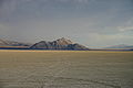
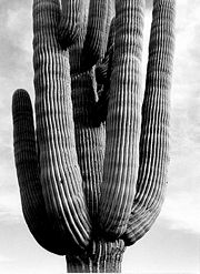
There are four major hot and dry desert
Desert
A desert is a landscape or region that receives an extremely low amount of precipitation, less than enough to support growth of most plants. Most deserts have an average annual precipitation of less than...
s in North America
North America
North America is a continent wholly within the Northern Hemisphere and almost wholly within the Western Hemisphere. It is also considered a northern subcontinent of the Americas...
, all located in the western United States
Western United States
.The Western United States, commonly referred to as the American West or simply "the West," traditionally refers to the region comprising the westernmost states of the United States. Because the U.S. expanded westward after its founding, the meaning of the West has evolved over time...
and northern Mexico. These are:
- The Chihuahuan DesertChihuahuan DesertThe Chihuahuan Desert is a desert, and an ecoregion designation, that straddles the U.S.-Mexico border in the central and northern portions of the Mexican Plateau, bordered on the west by the extensive Sierra Madre Occidental range, and overlaying northern portions of the east range, the Sierra...
– the largest desert in North America, located in the southwestern United States and northern Mexico - The Sonoran DesertSonoran DesertThe Sonoran Desert is a North American desert which straddles part of the United States-Mexico border and covers large parts of the U.S. states of Arizona and California and the northwest Mexican states of Sonora, Baja California, and Baja California Sur. It is one of the largest and hottest...
– a desert located in the southwestern United StatesSouthwestern United StatesThe Southwestern United States is a region defined in different ways by different sources. Broad definitions include nearly a quarter of the United States, including Arizona, California, Colorado, Nevada, New Mexico, Oklahoma, Texas and Utah...
and northwest MexicoNorthwest MexicoNorthwest Mexico is a region of the United Mexican States, formed by the states of Durango, Sinaloa, Chihuahua, Sonora, Baja California and Baja California Sur...
. It is the second largest desert in North America - The Great Basin DesertGreat Basin DesertThe Great Basin Desert is an area of nearctic high deserts across parts of Nevada, California, and Utah that extends into the Colorado River watershed , but which is mostly a portion of the central Nevada desert basins of the Great Basin.It along with the Escalante Desert, Mohave Desert, the...
– located within the Great BasinGreat BasinThe Great Basin is the largest area of contiguous endorheic watersheds in North America and is noted for its arid conditions and Basin and Range topography that varies from the North American low point at Badwater Basin to the highest point of the contiguous United States, less than away at the...
, it is commonly mistaken as the largest desert in North America due to confusion between the area of the Great BasinGreat BasinThe Great Basin is the largest area of contiguous endorheic watersheds in North America and is noted for its arid conditions and Basin and Range topography that varies from the North American low point at Badwater Basin to the highest point of the contiguous United States, less than away at the...
and the area of the Great Basin DesertGreat Basin DesertThe Great Basin Desert is an area of nearctic high deserts across parts of Nevada, California, and Utah that extends into the Colorado River watershed , but which is mostly a portion of the central Nevada desert basins of the Great Basin.It along with the Escalante Desert, Mohave Desert, the...
. - The Mojave DesertMojave DesertThe Mojave Desert occupies a significant portion of southeastern California and smaller parts of central California, southern Nevada, southwestern Utah and northwestern Arizona, in the United States...
– the hottest desert in North America, located primarily in southeastern CaliforniaCaliforniaCalifornia is a state located on the West Coast of the United States. It is by far the most populous U.S. state, and the third-largest by land area...
Additionally, there are smaller deserts within the Columbia Plateau
Columbia Plateau
The Columbia Plateau is a geologic and geographic region that lies across parts of the U.S. states of Washington, Oregon, and Idaho. It is a wide flood basalt plateau between the Cascade Range and the Rocky Mountains, cut through by the Columbia River...
/Columbia Basin
Columbia Basin
The Columbia Basin, the drainage basin of the Columbia River, occupies a large area–about —of the Pacific Northwest region of North America. In common usage, the term often refers to a smaller area, generally the portion of the drainage basin that lies within eastern Washington.Usage of the term...
, the Snake River Plain
Snake River Plain
The Snake River Plain is a geologic feature located primarily within the state of Idaho in the United States of America. It stretches about westward from northwest of the state of Wyoming to the Idaho-Oregon border. The plain is a wide flat bow-shaped depression, and covers about a quarter of Idaho...
, and the Colorado Plateau
Colorado Plateau
The Colorado Plateau, also called the Colorado Plateau Province, is a physiographic region of the Intermontane Plateaus, roughly centered on the Four Corners region of the southwestern United States. The province covers an area of 337,000 km2 within western Colorado, northwestern New Mexico,...
regions.
Canada
Canada
Canada is a North American country consisting of ten provinces and three territories. Located in the northern part of the continent, it extends from the Atlantic Ocean in the east to the Pacific Ocean in the west, and northward into the Arctic Ocean...
is home to a few small "deserts" such as the Nk'mip Desert
Nk'mip Desert
The Okanagan Desert is the common name for an arid area located in the South Okanagan region of British Columbia, Canada, primarily around Osoyoos Lake. The area, which is technically shrub steppe, has been defined as the Osoyoos Arid Biotic Zone...
, which is actually shrub steppe. Another "desert
Carcross Desert
Carcross Desert, located outside Carcross, Yukon, Canada , is often considered the smallest desert in the world. However, the Desert of Maine, another similar false "desert", has an area of . The Carcoss Desert measures approximately , or 640 acres....
" near Carcross, Yukon
Carcross, Yukon
Carcross, originally known as Caribou Crossing, is an unincorporated community in the Territory of Yukon, Canada on Bennett Lake and Nares Lake. It has a population of 431 and is home to the Carcross/Tagish First Nation....
is commonly called a desert, but it is not a true desert, rather an area of northern sand dunes.
Full listing
(Listed from north to south)- Western CanadaWestern CanadaWestern Canada, also referred to as the Western provinces and commonly as the West, is a region of Canada that includes the four provinces west of the province of Ontario.- Provinces :...
- Carcross DesertCarcross DesertCarcross Desert, located outside Carcross, Yukon, Canada , is often considered the smallest desert in the world. However, the Desert of Maine, another similar false "desert", has an area of . The Carcoss Desert measures approximately , or 640 acres....
, small "desert" in the Yukon, only 2.6 kilometers across. It has cold winters and very hot summers. Too humid to be a true desert. - Fraser CanyonFraser CanyonThe Fraser Canyon is an 84 km landform of the Fraser River where it descends rapidly through narrow rock gorges in the Coast Mountains en route from the Interior Plateau of British Columbia to the Fraser Valley...
- the landscape of the Fraser Canyon is severely arid from just south of Lytton upstream as far as the city of Williams LakeWilliams Lake, British ColumbiaWilliams Lake, is a city in the Central Interior of British Columbia, Canada. Located in the central part of a region known as the Cariboo, it is the largest urban centre between Kamloops and Prince George, with a population of 11,150 in city limits....
. - Thompson CountryThompson CountryThe Thompson Country, also referred to as The Thompson and in some ways as the Thompson Valley and historically known as the Couteau Country or Couteau District, is a historic geographic region of the Southern Interior of British Columbia, based around the basin of the Thompson River, a tributary...
- the southern Thompson Country, comprising the immediate banks of the Thompson RiverThompson RiverThe Thompson River is the largest tributary of the Fraser River, flowing through the south-central portion of British Columbia, Canada. The Thompson River has two main branches called the South Thompson and the North Thompson...
between the city of Kamloops and the village of LyttonLytton, British ColumbiaLytton in British Columbia, Canada, sits at the confluence of the Thompson River and Fraser River on the east side of the Fraser. The location has been inhabited by the Nlaka'pamux people for over 10,000 years, and is one of the earliest locations settled by non-natives in the Southern Interior of...
, has a range of desert-like terrain and climates. - Nk'mip DesertNk'mip DesertThe Okanagan Desert is the common name for an arid area located in the South Okanagan region of British Columbia, Canada, primarily around Osoyoos Lake. The area, which is technically shrub steppe, has been defined as the Osoyoos Arid Biotic Zone...
, small arid area in British Columbia, Canada. Claimed to be Canada's only "true" hot desert, but actually shrub steppe and, like other "deserts" in BC, is a northward extension of the Columbia Plateau (ecoregion)Columbia Plateau (ecoregion)The Columbia Plateau ecoregion is a Level III ecoregion designated by the United States Environmental Protection Agency in the U.S. states of Oregon and Washington, with small areas over the Washington state border in Idaho...
.
- Carcross Desert
- Washington - IdahoIdahoIdaho is a state in the Rocky Mountain area of the United States. The state's largest city and capital is Boise. Residents are called "Idahoans". Idaho was admitted to the Union on July 3, 1890, as the 43rd state....
- WyomingWyomingWyoming is a state in the mountain region of the Western United States. The western two thirds of the state is covered mostly with the mountain ranges and rangelands in the foothills of the Eastern Rocky Mountains, while the eastern third of the state is high elevation prairie known as the High...
- OregonOregonOregon is a state in the Pacific Northwest region of the United States. It is located on the Pacific coast, with Washington to the north, California to the south, Nevada on the southeast and Idaho to the east. The Columbia and Snake rivers delineate much of Oregon's northern and eastern...
- Much of the Columbia Plateau (ecoregion)Columbia Plateau (ecoregion)The Columbia Plateau ecoregion is a Level III ecoregion designated by the United States Environmental Protection Agency in the U.S. states of Oregon and Washington, with small areas over the Washington state border in Idaho...
is desert, such as the- Channeled ScablandsChanneled scablandsThe Channeled Scablands are a unique geological erosion feature in the U.S. state of Washington. They were created by the cataclysmic Missoula Floods that swept periodically across eastern Washington and down the Columbia River Plateau during the Pleistocene epoch. Geologist J Harlen Bretz coined...
, a desert in the Columbia BasinColumbia BasinThe Columbia Basin, the drainage basin of the Columbia River, occupies a large area–about —of the Pacific Northwest region of North America. In common usage, the term often refers to a smaller area, generally the portion of the drainage basin that lies within eastern Washington.Usage of the term...
of eastern Washington
- Channeled Scablands
- Most of the Snake River Plain (ecoregion)Snake River Plain (ecoregion)The Snake River Plain ecoregion is a Level III ecoregion designated by the United States Environmental Protection Agency in the U.S. states of Idaho and Oregon. It follows the Snake River across Idaho, stretching roughly from the Wyoming border to Eastern Oregon in the xeric intermontane west...
is sagebrush steppeSagebrush steppeThe sagebrush steppe is a type of shrub-steppe, which is a dry-xeric environment and plant community found in the Western United States and western Canada...
, but barren lava fields form small deserts, such as- Craters of the Moon National Monument in IdahoIdahoIdaho is a state in the Rocky Mountain area of the United States. The state's largest city and capital is Boise. Residents are called "Idahoans". Idaho was admitted to the Union on July 3, 1890, as the 43rd state....
- Craters of the Moon National Monument in Idaho
- The Wyoming Basin (ecoregion) is dominated by arid grasslands and shrub steppe, but also contains the
- Red Desert (Wyoming)Red Desert (Wyoming)The Red Desert is a high altitude desert and sagebrush steppe located in south central Wyoming, comprising approximately 9,320 square miles...
- Red Desert (Wyoming)
- Owyhee DesertOwyhee DesertThe Owyhee Desert ecoregion, within the Deserts and xeric shrublands Biome, is in the Northwestern United States. The Owyhee Uplands Bypass passes through the desert.-Geography:...
, in southwestern IdahoIdahoIdaho is a state in the Rocky Mountain area of the United States. The state's largest city and capital is Boise. Residents are called "Idahoans". Idaho was admitted to the Union on July 3, 1890, as the 43rd state....
, northern NevadaNevadaNevada is a state in the western, mountain west, and southwestern regions of the United States. With an area of and a population of about 2.7 million, it is the 7th-largest and 35th-most populous state. Over two-thirds of Nevada's people live in the Las Vegas metropolitan area, which contains its...
, and southeastern OregonOregonOregon is a state in the Pacific Northwest region of the United States. It is located on the Pacific coast, with Washington to the north, California to the south, Nevada on the southeast and Idaho to the east. The Columbia and Snake rivers delineate much of Oregon's northern and eastern...
.- Yp DesertYp DesertThe Yp Desert is a desert and ecoregion, within the Deserts and xeric shrublands Biome, in Owyhee County, Idaho, and Elko County, Nevada in the northwestern United States....
, a portion of the Owyhee Desert in Idaho
- Yp Desert
- Alvord DesertAlvord DesertThe Alvord Desert is a desert located in Harney County, in southeastern Oregon in the western United States. It is roughly southeast of Steens Mountain. The Alvord Desert is a dry lake bed and averages of rain a year. Two mountain ranges separate it from the Pacific Ocean—the Coast Range, and...
, a dry lakeDry lakeDry lakes are ephemeral lakebeds, or a remnant of an endorheic lake. Such flats consist of fine-grained sediments infused with alkali salts. Dry lakes are also referred to as alkali flats, sabkhas, playas or mud flats...
in eastern OregonOregonOregon is a state in the Pacific Northwest region of the United States. It is located on the Pacific coast, with Washington to the north, California to the south, Nevada on the southeast and Idaho to the east. The Columbia and Snake rivers delineate much of Oregon's northern and eastern... - Oregon High Desert, aka "Great Sandy Desert", eastern Oregon
- Much of the Columbia Plateau (ecoregion)
- NevadaNevadaNevada is a state in the western, mountain west, and southwestern regions of the United States. With an area of and a population of about 2.7 million, it is the 7th-largest and 35th-most populous state. Over two-thirds of Nevada's people live in the Las Vegas metropolitan area, which contains its...
- Black Rock DesertBlack Rock DesertThe Black Rock Desert is an arid region in the northern Nevada section of the Great Basin with a lakebed that is a dry remnant of Pleistocene Lake Lahontan...
, a dry lakeDry lakeDry lakes are ephemeral lakebeds, or a remnant of an endorheic lake. Such flats consist of fine-grained sediments infused with alkali salts. Dry lakes are also referred to as alkali flats, sabkhas, playas or mud flats...
bed in northwestern Nevada - Forty Mile Desert, Nevada
- Great Basin DesertGreat Basin DesertThe Great Basin Desert is an area of nearctic high deserts across parts of Nevada, California, and Utah that extends into the Colorado River watershed , but which is mostly a portion of the central Nevada desert basins of the Great Basin.It along with the Escalante Desert, Mohave Desert, the...
dominated by sagebrush steppeSagebrush steppeThe sagebrush steppe is a type of shrub-steppe, which is a dry-xeric environment and plant community found in the Western United States and western Canada... - Smoke Creek DesertSmoke Creek DesertThe Smoke Creek Desert is an arid region of northwestern Nevada, USA that lies to the north of Pyramid Lake, west of the Fox Range and east of the Smoke Creek Mountains. The southern end of the desert lies on the Pyramid Lake Indian Reservation, and a rail line lies at the eastern edge...
, Nevada (980 sq mi) - Amargosa DesertAmargosa DesertThe Amargosa Desert is located in Nye County in western Nevada, United States, along the California–Nevada border. It is largely coincident with the geographic Amargosa Valley....
, in lower southwestern NevadaNevadaNevada is a state in the western, mountain west, and southwestern regions of the United States. With an area of and a population of about 2.7 million, it is the 7th-largest and 35th-most populous state. Over two-thirds of Nevada's people live in the Las Vegas metropolitan area, which contains its...
- Black Rock Desert
- UtahUtahUtah is a state in the Western United States. It was the 45th state to join the Union, on January 4, 1896. Approximately 80% of Utah's 2,763,885 people live along the Wasatch Front, centering on Salt Lake City. This leaves vast expanses of the state nearly uninhabited, making the population the...
- Great Salt Lake DesertGreat Salt Lake DesertThe Great Salt Lake Desert is a large dry lake in northern Utah between the Great Salt Lake and the Nevada border which is noted for white sand from evaporite Lake Bonneville salt deposits...
, UtahUtahUtah is a state in the Western United States. It was the 45th state to join the Union, on January 4, 1896. Approximately 80% of Utah's 2,763,885 people live along the Wasatch Front, centering on Salt Lake City. This leaves vast expanses of the state nearly uninhabited, making the population the... - San Rafael Desert, the drier portions of the San Rafael SwellSan Rafael SwellThe San Rafael Swell is a large geologic feature located in south-central Utah, USA about 30 miles west of Green River, Utah. The San Rafael Swell, approximately by , consists of a giant dome-shaped anticline of sandstone, shale, and limestone that was pushed up during the Paleocene Laramide...
- Sevier Desert surrounds the intermittent, salty Sevier LakeSevier LakeSevier Lake is an intermittent and endorheic lake which lies in the lowest part of the Sevier Desert, Millard County, Utah. Like Great Salt Lake and Utah Lake, it is a remnant of Pleistocene Lake Bonneville. Sevier Lake is fed primarily by the Beaver and Sevier rivers, and the additional inflow...
- Great Salt Lake Desert
- The Colorado PlateauColorado PlateauThe Colorado Plateau, also called the Colorado Plateau Province, is a physiographic region of the Intermontane Plateaus, roughly centered on the Four Corners region of the southwestern United States. The province covers an area of 337,000 km2 within western Colorado, northwestern New Mexico,...
is dominated by pinyonPinyon pineThe pinyon pine group grows in the southwestern United States and in Mexico. The trees yield edible pinyon nuts, which were a staple of the Native Americans, and are still widely eaten...
-juniperJuniperJunipers are coniferous plants in the genus Juniperus of the cypress family Cupressaceae. Depending on taxonomic viewpoint, there are between 50-67 species of juniper, widely distributed throughout the northern hemisphere, from the Arctic, south to tropical Africa in the Old World, and to the...
woodlandWoodlandEcologically, a woodland is a low-density forest forming open habitats with plenty of sunlight and limited shade. Woodlands may support an understory of shrubs and herbaceous plants including grasses. Woodland may form a transition to shrubland under drier conditions or during early stages of...
s, but contains desert areas:- Escalante DesertEscalante DesertThe Escalante Desert is a geographic Great Basin region and arid desert ecoregion, in the Deserts and xeric shrublands Biome, located in southwestern Utah.-Geography:...
, Utah (3,270 sq mi) - Bisti Badlands DesertBisti/De-Na-Zin WildernessThe Bisti/De-Na-Zin Wilderness is a wilderness area located in San Juan County in the U.S. state of New Mexico. Established in 1984, the Wilderness is a desolate area of steeply eroded badlands managed by the Bureau of Land Management, with the exception of three parcels of private Navajo land...
, New MexicoNew MexicoNew Mexico is a state located in the southwest and western regions of the United States. New Mexico is also usually considered one of the Mountain States. With a population density of 16 per square mile, New Mexico is the sixth-most sparsely inhabited U.S... - Painted Desert, ArizonaPainted Desert, ArizonaThe Painted Desert is a area of badlands located in Northern Arizona in the United States. The Arizona desert stretches from the Grand Canyon National Park into the Petrified Forest National Park and runs roughly astride and just north of the Little Colorado and the Puerco Rivers...
- Escalante Desert
- Mojave DesertMojave DesertThe Mojave Desert occupies a significant portion of southeastern California and smaller parts of central California, southern Nevada, southwestern Utah and northwestern Arizona, in the United States...
- CaliforniaCaliforniaCalifornia is a state located on the West Coast of the United States. It is by far the most populous U.S. state, and the third-largest by land area...
(the High DesertHigh desertHigh desert refers to the inland and often high elevation deserts of the American West. Examples of high deserts in North America include the Great Basin Desert and the Mojave Desert.High desert can also mean:...
); and parts of western ArizonaArizonaArizona ; is a state located in the southwestern region of the United States. It is also part of the western United States and the mountain west. The capital and largest city is Phoenix...
and southern NevadaNevadaNevada is a state in the western, mountain west, and southwestern regions of the United States. With an area of and a population of about 2.7 million, it is the 7th-largest and 35th-most populous state. Over two-thirds of Nevada's people live in the Las Vegas metropolitan area, which contains its...
.- Death ValleyDeath ValleyDeath Valley is a desert valley located in Eastern California. Situated within the Mojave Desert, it features the lowest, driest, and hottest locations in North America. Badwater, a basin located in Death Valley, is the specific location of the lowest elevation in North America at 282 feet below...
, California
- Death Valley
- Sonoran DesertSonoran DesertThe Sonoran Desert is a North American desert which straddles part of the United States-Mexico border and covers large parts of the U.S. states of Arizona and California and the northwest Mexican states of Sonora, Baja California, and Baja California Sur. It is one of the largest and hottest...
- Colorado DesertColorado DesertCalifornia's Colorado Desert is a part of the larger Sonoran Desert, which extends across southwest North America. The Colorado Desert region encompasses approximately , reaching from the Mexican border in the south to the higher-elevation Mojave Desert in the north and from the Colorado River in...
, Southern CaliforniaSouthern CaliforniaSouthern California is a megaregion, or megapolitan area, in the southern area of the U.S. state of California. Large urban areas include Greater Los Angeles and Greater San Diego. The urban area stretches along the coast from Ventura through the Southland and Inland Empire to San Diego...
(the Low DesertLow DesertThe Low Desert is a common name for one the Deserts of California regional areas, that includes the Colorado Desert and Yuha Desert in the Southern California portion of the Sonoran Desert...
)- Yuha DesertYuha DesertThe Yuha Desert is a section of the Sonoran Desert located in the Imperial Valley of California; south of Interstate 8, west of El Centro, CA, and north of the international border....
, Imperial Valley, California
- Yuha Desert
- Yuma DesertYuma DesertThe Yuma Desert is a lower-elevation section of the Sonoran Desert in the southwestern United States and the northwest of Mexico. It is in the Salton basin. The desert contains areas of sparse vegetation and has notable areas of sand dunes. With an average rainfall less than 8 inches each...
, southwest Arizona - Lechuguilla DesertLechuguilla Desertthumb|250px|right|[[Agave lechuguilla]] the plant the desert is named afterThe Lechuguilla Desert is a small desert located in southwestern Arizona near the U.S.-Mexico border. It is considered to be part of the Lower Colorado Valley region of the Sonoran Desert...
, southwest Arizona - Tule Desert (Arizona)Tule Desert (Arizona)The Tule Desert is a small desert located in southwestern Arizona near the U.S.-Mexico border. It is considered to be part of the Lower Colorado Valley region of the Sonoran Desert. It lies in a north-south direction to the east of the Cabeza Prieta Mountains and almost entirely in the Barry M....
and SonoraSonoraSonora officially Estado Libre y Soberano de Sonora is one of the 31 states which, with the Federal District, comprise the 32 Federal Entities of Mexico. It is divided into 72 municipalities; the capital city is Hermosillo....
, MexicoMexicoThe United Mexican States , commonly known as Mexico , is a federal constitutional republic in North America. It is bordered on the north by the United States; on the south and west by the Pacific Ocean; on the southeast by Guatemala, Belize, and the Caribbean Sea; and on the east by the Gulf of... - Gran Desierto de AltarGran Desierto de AltarThe Gran Desierto de Altar is one of the major portions of the Sonoran Desert of Mexico, including the only active erg dune region in North America. It extends across much of the northern border of the Gulf of California, reaching more than 100 kilometers east to west, and over 50 km north to...
, Sonora, Mexico
- Colorado Desert
- Chihuahuan DesertChihuahuan DesertThe Chihuahuan Desert is a desert, and an ecoregion designation, that straddles the U.S.-Mexico border in the central and northern portions of the Mexican Plateau, bordered on the west by the extensive Sierra Madre Occidental range, and overlaying northern portions of the east range, the Sierra...
- Trans-Pecos Desert, west TexasTexasTexas is the second largest U.S. state by both area and population, and the largest state by area in the contiguous United States.The name, based on the Caddo word "Tejas" meaning "friends" or "allies", was applied by the Spanish to the Caddo themselves and to the region of their settlement in...
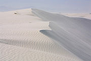
- White SandsWhite Sands National MonumentThe White Sands National Monument is a U.S. National Monument located about southwest of Alamogordo in western Otero County and northeastern Dona Ana County in the state of New Mexico, at an elevation of 4235 feet...
, unusual gypsumGypsumGypsum is a very soft sulfate mineral composed of calcium sulfate dihydrate, with the chemical formula CaSO4·2H2O. It is found in alabaster, a decorative stone used in Ancient Egypt. It is the second softest mineral on the Mohs Hardness Scale...
duneDuneIn physical geography, a dune is a hill of sand built by wind. Dunes occur in different forms and sizes, formed by interaction with the wind. Most kinds of dunes are longer on the windward side where the sand is pushed up the dune and have a shorter "slip face" in the lee of the wind...
field in New MexicoNew MexicoNew Mexico is a state located in the southwest and western regions of the United States. New Mexico is also usually considered one of the Mountain States. With a population density of 16 per square mile, New Mexico is the sixth-most sparsely inhabited U.S...
- Trans-Pecos Desert, west Texas
- Baja California peninsulaBaja California PeninsulaThe Baja California peninsula , is a peninsula in northwestern Mexico. Its land mass separates the Pacific Ocean from the Gulf of California. The Peninsula extends from Mexicali, Baja California in the north to Cabo San Lucas, Baja California Sur in the south.The total area of the Baja California...
- Baja California DesertBaja California DesertThe Baja California Desert is a Desert ecoregion of Mexico's Baja California Peninsula.-Geography and climate:The ecoregion covers 77,700 square kilometers and includes most of the Peninsula's western slope. It is bounded on the west by the Pacific Ocean and on the east by the Peninsular Ranges...
, State of Baja CaliforniaBaja CaliforniaBaja California officially Estado Libre y Soberano de Baja California is one of the 31 states which, with the Federal District, comprise the 32 Federal Entities of Mexico. It is both the northernmost and westernmost state of Mexico. Before becoming a state in 1953, the area was known as the North...
, Mexico - Vizcaíno Desert, central State of Baja California, Mexico
- Baja California Desert
See also
- North American Deserts in List of ecoregions in the United States (EPA)
- North American Deserts in List of ecoregions in North America (CEC)
- Deserts and xeric shrublandsDeserts and xeric shrublandsDeserts and xeric shrublands is a biome characterized by, relating to, or requiring only a small amount of moisture.-Definition and occurrence:...
- List of deserts
- Semi-arid climate
- Desert Region of CaliforniaDesert Region of CaliforniaThe Deserts of California have unique ecosystems and habitats, a sociocultural and historical "Old West" collection of legends, districts, and communities; and a popular tourism region of dramatic natural features and recreational development...
- Great American DesertGreat American DesertThe term Great American Desert was used in the 19th century to describe the western part of the Great Plains east of the Rocky Mountains in North America....
- Desert of MaineDesert of MaineThe Desert of Maine is a tract of exposed glacial silt in a pine forest in the town of Freeport, Maine, in the United States. The Desert of Maine is not a true desert, as it is carefully maintained against vegetation encroachment and receives an abundance of precipitation.It originated when the...