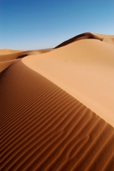
, a dune is a hill
of sand
built by wind. Dunes occur in different forms and sizes, formed by interaction with the wind. Most kinds of dunes are longer on the windward side where the sand is pushed up the dune and have a shorter "slip face" in the lee of the wind. The valley or trough between dunes is called a slack. A "dune field" is an area covered by extensive sand dunes. Large dune fields are known as erg
s.
Some coastal areas have one or more sets of dunes running parallel to the shoreline directly inland from the beach
.
I must not fear. Fear is the mind-killer. Fear is the little-death that brings total obliteration. I will face my fear. I will permit it to pass over me and through me. And when it has gone past I will turn the inner eye to see its path. Where the fear has gone there will be nothing. Only I will remain.
To attempt an understanding of Muad'Dib without understanding his mortal enemies, the House Harkonnen|Harkonnens, is to attempt seeing Truth without knowing Falsehood. It is the attempt to see the Light without knowing Darkness. It cannot be.
If wishes were fishes, we'd all cast nets.
The mystery of life isn't a problem to solve, but a reality to experience.
"You've heard of animals chewing off a leg to escape a trap? There's an animal kind of trick. A human would remain in the trap, endure the pain, feigning death that he might kill the trapper and remove a threat to his kind."
A process cannot be understood by stopping it. Understanding must move with the flow of the process, must join it and flow with it.
"Yueh! Yueh! Yueh!" goes the refrain. "A million deaths were not enough for Yueh!"
Muad'Dib learned rapidly because his first training was in how to learn. And the first lesson of all was the basic trust that he could learn. It's shocking to find how many people do not believe they can learn, and how many more believe learning to be difficult. Muad'Dib knew that every experience carries its lesson.


, a dune is a hill
of sand
built by wind. Dunes occur in different forms and sizes, formed by interaction with the wind. Most kinds of dunes are longer on the windward side where the sand is pushed up the dune and have a shorter "slip face" in the lee of the wind. The valley or trough between dunes is called a slack. A "dune field" is an area covered by extensive sand dunes. Large dune fields are known as erg
s.
Some coastal areas have one or more sets of dunes running parallel to the shoreline directly inland from the beach
. In most cases the dunes are important in protecting the land against potential ravages by storm waves from the sea
. Although the most widely distributed dunes are those associated with coastal regions, the largest complexes of dunes are found inland in dry regions and associated with ancient lake
or sea
beds.
Dunes also form under the action of water flow (alluvial processes), and on sand or gravel
beds of river
s, estuaries
and the sea-bed.
The modern word "dune" came into English from French circa 1790. In ancient times, words cognate to "dune" probably had the meaning of a built-up hill or citadel fortification.
Conservation
Dune habitats provide niches for highly specialised plants and animals, including numerous rare speciesand some endangered species
. Due to widespread human population expansion, dunes face destruction through land development and recreational usages, as well as alteration to prevent the encroachment of sand onto inhabited areas. Some countries, notably the United States
, Australia
, Canada
, New Zealand
, the United Kingdom
, and Netherlands
, have developed significant programs of dune protection through the use of sand dune stabilization
. In the U.K., a Biodiversity Action Plan
has been developed to assess dunes loss and to prevent future dunes destruction.
Crescentic
Crescent-shaped mounds are generally wider than they are long. The slipfaces are on the concave sides of the dunes. These dunes form under winds that blow consistently from one direction, and they also are known as barchans, or transverse dunes. Some types of crescentic dunes move more quickly over desert
surfaces than any other type of dune. A group of dunes moved more than 100 metres per year between 1954 and 1959 in the China
's Ningxia Province, and similar speeds have been recorded in the Western Desert of Egypt
. The largest crescentic dunes on Earth, with mean crest-to-crest widths of more than 3 kilometres, are in China's Taklamakan Desert.
Linear
Straight or slightly sinuous sand ridges typically much longer than they are wide are known as linear dunes. They may be more than 160 kilometres (99.4 mi) long. Some linear dunes merge to form Y-shaped compound dunes. Many form in bidirectional wind regimes. The long axes of these dunes extend in the resultant direction of sand movement.Linear loess
hills known as pahas
are superficially similar. These hills appear to have been formed during the last ice age
under permafrost
conditions dominated by sparse tundra
vegetation.
Star
Radially symmetrical, star dunes are pyramidal sand mounds with slipfaces on three or more arms that radiate from the high center of the mound. They tend to accumulate in areas with multidirectional wind regimes. Star dunes grow upward rather than laterally. They dominate the Grand Erg Orientalof the Sahara. In other deserts, they occur around the margins of the sand seas, particularly near topographic barriers. In the southeast Badain Jaran Desert
of China, the star dunes are up to 500 metres tall and may be the tallest dunes on Earth.
Dome
Oval or circular mounds that generally lack a slipface, dome dunes are rare, and these occur at the far upwind margins of sand seas.Parabolic
U-shaped mounds of sand with convex noses trailed by elongated arms are parabolic dunes. These dunes are formed from blowout dunes where the erosion of vegetated sand leads to a U-shaped depression. The elongated arms are held in place by vegetation; the largest arm known on Earth reaches 12 km. Sometimes these dunes are called U-shaped, blowout, or hairpin dunes, and they are well known in coastal deserts. Unlike crescent shaped dunes, their crests point upwind. The bulk of the sand in the dune migrates forward.
In plan view, these are U-shaped or V-shaped mounds of well-sorted, very fine to medium sand with elongated arms that extend upwind behind the central part of the dune. There are slip faces that often occur on the outer side of the nose and on the outer slopes of the arms.
These dunes often occur in semiarid areas where the precipitation is retained in the lower parts of the dune and underlying soils. Parabolic dunes are dependent on the vegetation that covers them—grasses,shrubs,and trees, which help anchor the trailing arms. In inland deserts, parabolic dunes commonly originate and extend downwind from blowouts in sand sheets only partly anchored by vegetation. They can also originate from beach sands and extend inland into vegetated areas in coastal zones and on shores of large lakes.
Most parabolic dunes do not reach heights higher than a few tens of metres except at their nose, where vegetation stops or slows the advance of accumulating sand.
Simple parabolic dunes have only one set of arms that trail upwind, behind the leading nose. Compound parabolic dunes are coalesced features with several sets of trailing arms. Complex parabolic dunes include subsidiary superposed or coalesced forms, usually of barchanoid or linear shapes.
Parabolic dunes, like crescent dunes, occur in areas where very strong winds are mostly unidirectional. Although these dunes are found in areas now characterized by variable wind speeds, the effective winds associated with the growth and migration of both the parabolic and crescent dunes probably are the most consistent in wind direction.
The grain size for these well-sorted, very fine to medium sands is about 0.06 to 0.5 mm. Parabolic dunes have loose sand and steep slopes only on their outer flanks. The inner slopes are mostly well packed and anchored by vegetation, as are the corridors between individual dunes. Because all dune arms are oriented in the same direction, and, the inter-dune corridors are generally swept clear of loose sand, the corridors can usually be traversed in between the trailing arms of the dune. However to cross straight over the dune by going over the trailing arms, can be very difficult. Also, traversing the nose is very difficult as well because the nose is usually made up of loose sand without much if any vegetation.
Longitudinal (Seif) dunes

_sand_dunes_imaged_by_terra_(eos_am-1).jpg)
Seif dunes are thought to develop from barchans if a change of the usual wind direction occurs. The new wind direction will lead to the development of a new wing and the over development of one of the original wings. If the prevailing wind then becomes dominant for a lengthy period of time the dune will revert to its barchan form, with one exaggerated wing. Should the strong wind then return the exaggerated wing will further extend so that eventually it will be supplied with sand when the prevailing wind returns. The wing will continue to grow under both wind conditions, thus producing a seif dune. On a seif dune the slip face develops on the side facing away from the strong wind, while the slip face of a barchan faces the direction of movement. In the sheltered troughs between highly developed seif dunes barchans may be formed because the wind is unidirectional.
A transverse dune is perpendicular to the prevailing wind, probably caused by a steady build-up of sand on an already existing minuscule mound.
Reversing dunes

All these dune shapes may occur in three forms: simple, compound, and complex. Simple dunes are basic forms with a minimum number of slipfaces that define the geometric type. Compound dunes are large dunes on which smaller dunes of similar type and slipface orientation are superimposed, and complex dunes are combinations of two or more dune types. A crescentic dune with a star dune superimposed on its crest is the most common complex dune. Simple dunes represent a wind regime that has not changed in intensity or direction since the formation of the dune, while compound and complex dunes suggest that the intensity and direction of the wind has changed.
Dune types

Sub-aqueous dunes
Sub-aqueous (underwater) dunes (also known in geology as megaripples) form on a bed of sand or gravel under the actions of water flow. They are ubiquitous in natural channels
such as rivers and estuaries, and also form in engineered canal
s and pipelines. Dunes move downstream as the upstream slope is eroded and the sediment deposited on the downstream or lee slope in typical bedform
construction.
These dunes most often form as a continuous 'train' of dunes, showing remarkable similarity in wavelength
and height.
Dunes on the bed of a channel significantly increase flow resistance, their presence and growth playing a major part in river flooding.
Lithified dunes
A lithified (consolidated) sand dune is a type of sandstonethat is formed when a marine or aeolian sand dune becomes compacted and hardened. Once in this form, water passing through the rock can carry and deposit minerals, which can alter the color of the rock. Cross-bedded layers of stacks of lithified dunes can produce the cross-hatching patterns, such as those seen in the Zion National Park
in the western United States
.
A slang term that is used in the Southwestern States (of the U.S.A.) for those consolidated and hardened sand dunes is "slickrock", a name that was introduced by pioneers of the Old West because their steel-rimmed wagon wheels could not gain traction on the rock.
Coastal dunes

Dunes provide privacy
and shelter from the wind
.
Ecological succession on coastal dunes

occurs. The conditions on an embryo dune are harsh, with salt spray from the sea carried on strong winds. The dune is well drained and often dry, and composed of calcium carbonate from seashells. Rotting seaweed
, brought in by storm waves adds nutrients to allow pioneer species
to colonize the dune. These pioneer species are marram grass, sea wort grass and other sea grasses in the United Kingdom
. These plants are well adapted to the harsh conditions of the fore-dune
typically having deep roots which reach the water table
, root nodules that produce nitrogen
compounds, and protected stoma
, reducing transpiration
. Also, the deep roots bind the sand together, and the dune grows into a fore dune as more sand is blown over the grasses. The grasses add nitrogen
to the soil, meaning other, less hardy plants can then colonize the dunes. Typically these are heather
, heath
s and gorse
s. These too are adapted to the low soil water content and have small, prickly leaves which reduce transpiration. Heather adds humus to the soil and is usually replaced by coniferous trees, which can tolerate low soil pH
, caused by the accumulation and decomposition of organic matter with nitrate leaching. Coniferous forests and heathland are common climax communities
for sand dune systems.
Young dunes are called yellow dune
s and dunes which have high humus content are called grey dune
s. Leaching occurs on the dunes, washing humus into the slacks, and the slacks may be much more developed than the exposed tops of the dunes. It is usually in the slacks that more rare species are developed and there is a tendency for the dune slacks soil to be waterlogged and where only marsh plants can survive. These plants would include: creeping willow, cotton grass, yellow ins, reeds, and rushes. As for the species, there is a tendency for natterjack toad
s to breed here.
Desertification

, where sand particles skip along the ground like a bouncing ball. When these skipping particles land, they may knock into other particles and cause them to move as well, in a process known as creep
. With slightly stronger winds, particles collide in mid-air, causing sheet flows. In a major dust storm
, dunes may move tens of metres through such sheet flows. Also as in the case of snow, sand avalanche
s, falling down the slipface of the dunes - that face away from the winds - also move the dunes forward.
Sand threatens buildings and crops in Africa, the Middle East, and China. Drenching sand dunes with oil stops their migration, but this approach is quite destructive to the dunes' animal habitats and uses a valuable resource. Sand fence
s might also slow their movement to a crawl, but geologists are still analyzing results for the optimum fence designs. Preventing sand dunes from overwhelming towns, villages, and agricultural areas has become a priority for the United Nations Environment Programme
. Planting dunes with vegetation also helps to stabilise them.
Examples

Africa
- Alexandria Coastal Dunefields, in the Eastern CapeEastern CapeThe Eastern Cape is a province of South Africa. Its capital is Bhisho, but its two largest cities are Port Elizabeth and East London. It was formed in 1994 out of the "independent" Xhosa homelands of Transkei and Ciskei, together with the eastern portion of the Cape Province...
, South AfricaSouth AfricaThe Republic of South Africa is a country in southern Africa. Located at the southern tip of Africa, it is divided into nine provinces, with of coastline on the Atlantic and Indian oceans... - Western SaharaWestern SaharaWestern Sahara is a disputed territory in North Africa, bordered by Morocco to the north, Algeria to the northeast, Mauritania to the east and south, and the Atlantic Ocean to the west. Its surface area amounts to . It is one of the most sparsely populated territories in the world, mainly...
Asia
- The dunes in the Thar desert in RajasthanRajasthanRājasthān the land of Rajasthanis, , is the largest state of the Republic of India by area. It is located in the northwest of India. It encompasses most of the area of the large, inhospitable Great Indian Desert , which has an edge paralleling the Sutlej-Indus river valley along its border with...
, IndiaIndiaIndia , officially the Republic of India , is a country in South Asia. It is the seventh-largest country by geographical area, the second-most populous country with over 1.2 billion people, and the most populous democracy in the world... - Tottori Sand DunesTottori Sand DunesThe are unique sand dunes located near Tottori City in Tottori Prefecture, Honshū, Japan. They are the only large dune system in Japan....
, Tottori PrefectureTottori Prefectureis a prefecture of Japan located in the Chūgoku region. The capital is the city of Tottori. It is the least populous prefecture in Japan.- History :Before the Meiji Restoration, Tottori encompassed the old provinces of Hōki and Inaba...
, JapanJapanJapan is an island nation in East Asia. Located in the Pacific Ocean, it lies to the east of the Sea of Japan, China, North Korea, South Korea and Russia, stretching from the Sea of Okhotsk in the north to the East China Sea and Taiwan in the south... - Rig-e JennRig-e JennThe Rig-e Jenn is a vast area of sand dunes in the middle of Dasht-e Kavir, Iran's central desert in the border region of the Semnan and Isfahan provinces. It was not travelled by the old caravan travellers, who believed it is a place where evil spirits live. Even today some in the neighbouring...
in the Central Desert of IranIranIran , officially the Islamic Republic of Iran , is a country in Southern and Western Asia. The name "Iran" has been in use natively since the Sassanian era and came into use internationally in 1935, before which the country was known to the Western world as Persia...
. - Rig-e Lut in the Southeast of IranIranIran , officially the Islamic Republic of Iran , is a country in Southern and Western Asia. The name "Iran" has been in use natively since the Sassanian era and came into use internationally in 1935, before which the country was known to the Western world as Persia...
. - The Ilocos NorteIlocos NorteIlocos Norte is a province of the Philippines located in the Ilocos Region in Luzon. Its capital is Laoag City and is located at the northwest corner of Luzon Island, bordering Cagayan and Apayao to the east, and Abra and Ilocos Sur to the south...
Sand Dunes in the PhilippinesPhilippinesThe Philippines , officially known as the Republic of the Philippines , is a country in Southeast Asia in the western Pacific Ocean. To its north across the Luzon Strait lies Taiwan. West across the South China Sea sits Vietnam...
, particularly Paoay Sand Dunes. - Mer'eb Dune (also written as Merheb) in United Arab EmiratesUnited Arab EmiratesThe United Arab Emirates, abbreviated as the UAE, or shortened to "the Emirates", is a state situated in the southeast of the Arabian Peninsula in Western Asia on the Persian Gulf, bordering Oman, and Saudi Arabia, and sharing sea borders with Iraq, Kuwait, Bahrain, Qatar, and Iran.The UAE is a...
, used as an arena for motor sports and skiing.
Europe
- The Dune of Pyla, not far from BordeauxBordeauxBordeaux is a port city on the Garonne River in the Gironde department in southwestern France.The Bordeaux-Arcachon-Libourne metropolitan area, has a population of 1,010,000 and constitutes the sixth-largest urban area in France. It is the capital of the Aquitaine region, as well as the prefecture...
, FranceFranceThe French Republic , The French Republic , The French Republic , (commonly known as France , is a unitary semi-presidential republic in Western Europe with several overseas territories and islands located on other continents and in the Indian, Pacific, and Atlantic oceans. Metropolitan France...
, is the largest known sand dune in Europe - Sands of ForvieSands of ForvieThe Sands of Forvie is a nature reserve north of Newburgh in Aberdeenshire in the northeast of Scotland. Forvie National Nature Reserve has the fifth largest sand dune system in Britain, and the least disturbed by human activity. The dune system is an integral part of the Ythan Estuary and...
within the Ythan EstuaryYthan EstuaryThe Ythan Estuary is the tidal component of the Ythan River, emptying into the North Sea approximately north of Aberdeen, Scotland. The estuary’s tidal action extends a full inland and has characteristic widths of between and . Besides the tidal channel there are several types of interfaces to...
complex, AberdeenshireAberdeenshireAberdeenshire is one of the 32 unitary council areas in Scotland and a lieutenancy area.The present day Aberdeenshire council area does not include the City of Aberdeen, now a separate council area, from which its name derives. Together, the modern council area and the city formed historic...
, ScotlandScotlandScotland is a country that is part of the United Kingdom. Occupying the northern third of the island of Great Britain, it shares a border with England to the south and is bounded by the North Sea to the east, the Atlantic Ocean to the north and west, and the North Channel and Irish Sea to the...
. - Oxwich DunesOxwich Baythumb|Oxwich Bay on the Gower Peninsula of South WalesOxwich Bay is a bay on the south of the Gower Peninsula, Wales.Its landscape features sand dunes, salt marshes and woodland. Oxwich Bay includes a 2.5-mile long sandy beach, accessible from the village of Oxwich. It is a popular spot for...
, near SwanseaSwanseaSwansea is a coastal city and county in Wales. Swansea is in the historic county boundaries of Glamorgan. Situated on the sandy South West Wales coast, the county area includes the Gower Peninsula and the Lliw uplands...
, is on the Gower PeninsulaGower PeninsulaGower or the Gower Peninsula is a peninsula in south Wales, jutting from the coast into the Bristol Channel, and administratively part of the City and County of Swansea. Locally it is known as "Gower"...
in WalesWalesWales is a country that is part of the United Kingdom and the island of Great Britain, bordered by England to its east and the Atlantic Ocean and Irish Sea to its west. It has a population of three million, and a total area of 20,779 km²...
. - Winterton DunesWinterton DunesWinterton Dunes is an extensive dune system on the east coast of Norfolk, England, which has been designated as a National Nature Reserve and is within the Norfolk Coast AONB....
– NorfolkNorfolkNorfolk is a low-lying county in the East of England. It has borders with Lincolnshire to the west, Cambridgeshire to the west and southwest and Suffolk to the south. Its northern and eastern boundaries are the North Sea coast and to the north-west the county is bordered by The Wash. The county...
, EnglandEnglandEngland is a country that is part of the United Kingdom. It shares land borders with Scotland to the north and Wales to the west; the Irish Sea is to the north west, the Celtic Sea to the south west, with the North Sea to the east and the English Channel to the south separating it from continental... - Słowiński National ParkSłowiński National ParkSłowiński National Park is a National Park in Pomeranian Voivodeship, northern Poland. It is situated on the Baltic coast, between Łeba and Rowy. The northern boundary of the Park consists of of coastline.-History:...
, PolandPolandPoland , officially the Republic of Poland , is a country in Central Europe bordered by Germany to the west; the Czech Republic and Slovakia to the south; Ukraine, Belarus and Lithuania to the east; and the Baltic Sea and Kaliningrad Oblast, a Russian exclave, to the north... - AkrotiriAkrotiri Peninsula (Cyprus)The Akrotiri Peninsula is a short peninsula which includes the southernmost point of the island of Cyprus. It is bounded by Episkopi Bay to the west and Akrotiri Bay to the east and has two capes to the south-west and south-east, known as Cape Zevgari and Cape Gata...
Sand Dune, LemesosLimassol DistrictLimassol District is one of the six districts of Cyprus. Its main town is Limassol. Part of the British overseas territory of Akrotiri and Dhekelia forms an enclave on the Akrotiri peninsula, under the sovereignty of the United Kingdom....
, CyprusCyprusCyprus , officially the Republic of Cyprus , is a Eurasian island country, member of the European Union, in the Eastern Mediterranean, east of Greece, south of Turkey, west of Syria and north of Egypt. It is the third largest island in the Mediterranean Sea.The earliest known human activity on the...
North America
- The Athabasca Sand Dunes, the northmost sand dunes in the world, located in the Athabasca Sand Dunes Provincial ParkAthabasca Sand Dunes Provincial ParkAthabasca Sand Dunes Provincial Park is a unique geophysical land feature in the boreal shield ecosystem of the province of Saskatchewan. It first came to attention that it should be a protected area in 1969, finally becoming the Athabasca Sand Dunes Provincial Wilderness Park on August 24, 1992. ...
, SaskatchewanSaskatchewanSaskatchewan is a prairie province in Canada, which has an area of . Saskatchewan is bordered on the west by Alberta, on the north by the Northwest Territories, on the east by Manitoba, and on the south by the U.S. states of Montana and North Dakota....
. - The Kelso DunesKelso DunesKelso Dunes, also known as the Kelso Dune Field, is the largest field of eolian sand deposits in the Mojave Desert. The region is protected by the Mojave National Preserve and is located near the town of Baker, San Bernardino County, California and the Preserve Visitor Center...
in the Mojave DesertMojave DesertThe Mojave Desert occupies a significant portion of southeastern California and smaller parts of central California, southern Nevada, southwestern Utah and northwestern Arizona, in the United States...
of CaliforniaCaliforniaCalifornia is a state located on the West Coast of the United States. It is by far the most populous U.S. state, and the third-largest by land area...
. - Great Sand Dunes National Park, ColoradoColoradoColorado is a U.S. state that encompasses much of the Rocky Mountains as well as the northeastern portion of the Colorado Plateau and the western edge of the Great Plains...
. - White Sands National MonumentWhite Sands National MonumentThe White Sands National Monument is a U.S. National Monument located about southwest of Alamogordo in western Otero County and northeastern Dona Ana County in the state of New Mexico, at an elevation of 4235 feet...
, New MexicoNew MexicoNew Mexico is a state located in the southwest and western regions of the United States. New Mexico is also usually considered one of the Mountain States. With a population density of 16 per square mile, New Mexico is the sixth-most sparsely inhabited U.S...
. - Little Sahara Recreation AreaLittle Sahara Recreation AreaThe Little Sahara Recreation Area in Utah is a large area of sand dunes, hills and sagebrush flats located in the west central part of the state approximately north of Delta, Utah. It is managed by the U.S. Department of the Interior Bureau of Land Management...
, UtahUtahUtah is a state in the Western United States. It was the 45th state to join the Union, on January 4, 1896. Approximately 80% of Utah's 2,763,885 people live along the Wasatch Front, centering on Salt Lake City. This leaves vast expanses of the state nearly uninhabited, making the population the...
. - Indiana Dunes National LakeshoreIndiana Dunes National LakeshoreIndiana Dunes National Lakeshore is a U.S. National Lakeshore located in northwest Indiana and managed by the National Park Service. It was authorized by Congress in 1966. The national lakeshore runs for nearly along the southern shore of Lake Michigan, from Gary, Indiana, on the west to Michigan...
, IndianaIndianaIndiana is a US state, admitted to the United States as the 19th on December 11, 1816. It is located in the Midwestern United States and Great Lakes Region. With 6,483,802 residents, the state is ranked 15th in population and 16th in population density. Indiana is ranked 38th in land area and is...
, on the south shore of Lake MichiganLake MichiganLake Michigan is one of the five Great Lakes of North America and the only one located entirely within the United States. It is the second largest of the Great Lakes by volume and the third largest by surface area, after Lake Superior and Lake Huron...
. - Warren Dunes State ParkWarren Dunes State ParkWarren Dunes State Park is a Michigan state park, located along the eastern shore of Lake Michigan in Berrien County. The park's large sand dunes and lakeshore beaches make it one of the most popular of Michigan’s state parks with an average of about one million visitors annually.Large sand dunes...
and Sleeping Bear Dunes National LakeshoreSleeping Bear Dunes National LakeshoreSleeping Bear Dunes National Lakeshore is a United States National Lakeshore located along the northwest coast of the Lower Peninsula of Michigan in Leelanau County and Benzie County....
, MichiganMichiganMichigan is a U.S. state located in the Great Lakes Region of the United States of America. The name Michigan is the French form of the Ojibwa word mishigamaa, meaning "large water" or "large lake"....
, on the east shore of Lake MichiganLake MichiganLake Michigan is one of the five Great Lakes of North America and the only one located entirely within the United States. It is the second largest of the Great Lakes by volume and the third largest by surface area, after Lake Superior and Lake Huron...
. - Grand Sable DunesGrand Sable DunesGrand Sable Dunes cover a 5-mile stretch along the southern shore of Lake Superior in the upper peninsula of Michigan in the eastern portion of the Pictured Rocks National Lakeshore....
, in the Pictured Rocks National LakeshorePictured Rocks National LakeshorePictured Rocks National Lakeshore is a U.S. National Lakeshore on the shore of Lake Superior in the Upper Peninsula of Michigan, United States. It extends for 42 miles along the shore and covers...
, MichiganMichiganMichigan is a U.S. state located in the Great Lakes Region of the United States of America. The name Michigan is the French form of the Ojibwa word mishigamaa, meaning "large water" or "large lake"....
. - Algodones DunesAlgodones DunesThe Algodones Dunes is a large erg located in the southeastern portion of the U.S. state of California, near the border with Arizona and the Mexican state of Baja California. The field is approximately 45 miles long by 6 miles wide and extends along a northwest-southeast line that correlates to...
near Brawley, CaliforniaBrawley, CaliforniaBrawley is a city in Imperial County, California, United States. Brawley is located north of El Centro. The population was 24,953 at the 2010 census, up from 22,052 at the 2000 census. The town has a significant cattle and feed industry, and hosts the annual Cattle Call Rodeo. Year-round...
. - Guadalupe-Nipomo DunesGuadalupe-Nipomo DunesGuadalupe-Nipomo Dunes is the largest remaining dune system south of San Francisco and the second largest in the U.S. state of California. It encompasses an stretch of coastline on the Central Coast of California and extends from southern San Luis Obispo County to northern Santa Barbara County.The...
, on the central coast of California. - Monahans Sandhills State ParkMonahans Sandhills State ParkThe Monahans Sandhills State Park is a state park located in Ward County and Winkler County, Texas. The closest major town is Monahans, Texas, and the closest limited-access highway ingress is Exit 86 on Interstate 20.-Features:...
near Odessa, TexasOdessa, TexasOdessa is a city in and the county seat of Ector County, Texas, United States. It is located primarily in Ector County, although a small portion of the city extends into Midland County. Odessa's population was 99,940 at the 2010 census. It is the principal city of the Odessa, Texas Metropolitan...
. - Beaver Dunes State ParkBeaver Dunes State ParkBeaver Dunes State Park is a Oklahoma state park located in Beaver County, Oklahoma. It is located near the city of Beaver, Oklahoma. The park, located in the panhandle region of Oklahoma, offers dune buggy riding on of sand hills, fishing, hiking trails, a playground and two campgrounds...
near Beaver, OklahomaBeaver, OklahomaBeaver is a town in and the county seat of Beaver County, Oklahoma, United States. As of the 2010 census, the city population was 1,515. The town is host to the annual World Cow Chip Throwing Championship.-History:...
. - The Killpecker sand dunes of the Red DesertRed Desert (Wyoming)The Red Desert is a high altitude desert and sagebrush steppe located in south central Wyoming, comprising approximately 9,320 square miles...
in southwestern WyomingWyomingWyoming is a state in the mountain region of the Western United States. The western two thirds of the state is covered mostly with the mountain ranges and rangelands in the foothills of the Eastern Rocky Mountains, while the eastern third of the state is high elevation prairie known as the High...
. - Jockey's Ridge State ParkJockey's Ridge State ParkJockey's Ridge State Park is a North Carolina state park in Dare County, North Carolina in the United States. Located in Nags Head, North Carolina, it covers 426 acres and includes the tallest active sand dune system in the eastern United States. It is the most visited park within the NC park...
– on the Outer Banks, North CarolinaNorth CarolinaNorth Carolina is a state located in the southeastern United States. The state borders South Carolina and Georgia to the south, Tennessee to the west and Virginia to the north. North Carolina contains 100 counties. Its capital is Raleigh, and its largest city is Charlotte...
. - Oregon Dunes National Recreation AreaOregon Dunes National Recreation AreaThe Oregon Dunes National Recreation Area is located on the Oregon Coast, stretching approximately 40 miles north from the Coos River in North Bend, to the Siuslaw River, in Florence. The NRA is part of Siuslaw National Forest and is administered by the United States Forest Service...
near Florence, OregonFlorence, OregonFlorence is a city in Lane County, Oregon, United States. As of the 2010 census, the city had a total population of 8,466.-History:The Florence area was originally inhabited by the Siuslaw tribe of Native Americans. Some state that the city was named for state senator A. B...
, on the Pacific Coast. - Bruneau Dunes State ParkBruneau Dunes State ParkBruneau Dunes State Park is a state park of Idaho, USA, featuring several large sand dunes and a small lake. The park is located south of Mountain Home, Idaho, outside of Bruneau. The park is the site of North America's highest single-structured sand dune which is approximately high...
- Owyhee Desert, Idaho
South America
- Lençóis Maranhenses National ParkLençóis Maranhenses National ParkThe Lençóis Maranhenses National Park is located in Maranhão state, in northeastern Brazil, just east of the Baía de São José, between 02º19’—02º45’ S and 42º44’—43º29’ W. It is an area of low, flat, occasionally flooded land, overlaid with large, discrete sand dunes...
in the state of MaranhãoMaranhãoMaranhão is a northeastern state of Brazil. To the north lies the Atlantic Ocean. Maranhão is neighbored by the states of Piauí, Tocantins and Pará. The people of Maranhão have a distinctive accent...
, BrazilBrazilBrazil , officially the Federative Republic of Brazil , is the largest country in South America. It is the world's fifth largest country, both by geographical area and by population with over 192 million people... - Jericoacoara National ParkJericoacoara National ParkJericoacoara National Park is a national park of Brazil, located in the municipality of Jijoca de Jericoacoara, state of Ceará. On its seashore is located the famous beach of Jericoacoara.- About Jericoacoara :...
, in the state of CearáCearáCeará is one of the 27 states of Brazil, located in the northeastern part of the country, on the Atlantic coast. It is currently the 8th largest Brazilian State by population and the 17th by area. It is also one of the main touristic destinations in Brazil. The state capital is the city of...
, Brazil - GenipabuGenipabuGenipabu is a beach with a complex of dunes, a lagoon and an environmental protection area located in Natal, one of the most famous post-cards of the Rio Grande do Norte Brazilian state....
in Natal, Brazil - Medanos de Coro National Park near the town of Coro, in Falcón State, VenezuelaVenezuelaVenezuela , officially called the Bolivarian Republic of Venezuela , is a tropical country on the northern coast of South America. It borders Colombia to the west, Guyana to the east, and Brazil to the south...
- Cerro Blanco in Ica ProvinceIca ProvinceThe Ica Province is the largest of five provinces of the Ica Region in Peru. The capital of the province is the city of Ica.Huacachina is a small town, oasis and resort in this region.-Political division:...
in PeruPeruPeru , officially the Republic of Peru , is a country in western South America. It is bordered on the north by Ecuador and Colombia, on the east by Brazil, on the southeast by Bolivia, on the south by Chile, and on the west by the Pacific Ocean.... - Cerro Medanoso in Atacama RegionAtacama RegionThe Atacama Region is one of Chile's 15 first order administrative divisions. It comprises three provinces, Chañaral, Copiapó and Huasco. It is bordered to the north by Antofagasta, to the south by Coquimbo, to east with Provinces of Catamarca, La Rioja and San Juan of Argentina, and to west with...
in ChileChileChile ,officially the Republic of Chile , is a country in South America occupying a long, narrow coastal strip between the Andes mountains to the east and the Pacific Ocean to the west. It borders Peru to the north, Bolivia to the northeast, Argentina to the east, and the Drake Passage in the far... - Valdivian Coastal ReserveValdivian Coastal ReserveValdivian Coastal Reserve is a natural reserve located in the Cordillera Pelada, in Los Ríos Region of Chile, near Corral. The reserve was formed in 2003 when the WWF, TNC and other local organizations acquired a large area of of which 83% is categorized as Valdivian temperate rainforest and 7.8%...
in ChileChileChile ,officially the Republic of Chile , is a country in South America occupying a long, narrow coastal strip between the Andes mountains to the east and the Pacific Ocean to the west. It borders Peru to the north, Bolivia to the northeast, Argentina to the east, and the Drake Passage in the far...
World's highest dunes
Dune | |Height from Sea Level feet/metres | |Notes | ||
---|---|---|---|---|
Cerro Blanco | ~3860/1176 | ~6791/2,080 | Sechura Desert Sechura Desert The Sechura Desert is located south of the Piura Region of Peru along the Pacific Ocean coast and inland to the foothills of the Andes Mountains... , Nazca, Peru 14.868°N 74.838°W |
Highest in the world |
Badain Jaran Dunes | ~1640/500 | ~6640/2,020 | Badain Jaran Desert Badain Jaran Desert The Badain Jaran Desert is a desert in China which spans the provinces of Gansu, Ningxia and Inner Mongolia. It covers an area of 49,000 sq. kilometers .... , Alashan Plain, Inner Mongolia, Gobi Desert Gobi Desert The Gobi is a large desert region in Asia. It covers parts of northern and northwestern China, and of southern Mongolia. The desert basins of the Gobi are bounded by the Altai Mountains and the grasslands and steppes of Mongolia on the north, by the Hexi Corridor and Tibetan Plateau to the... , China |
World's tallest stationary dunes and highest in Asia |
Rig-e Yalan Dune | ~1542/470 | ~3117/950 | Lut Desert, Kerman, Iran | Near World the hottest place (Gandom Beryan) |
Average Highest Area Dunes | 1,526/465? | ~6,500/~1,980? | Isaouane-n-Tifernine Sand Sea, Algerian Sahara | Highest in Africa |
Big Daddy/Dune 7 (Big Mama?) |
1,256/383 | ~1,870/570 | Sossusvlei Dunes, Namib Desert Namib Desert The Namib Desert is a desert in Namibia and southwest Angola that forms part of the Namib-Naukluft National Park, the largest game reserve in Africa. The name "Namib" is of Nama origin and means "vast place"... , Namibia / Near Walvis Bay Namib Desert Namib Desert The Namib Desert is a desert in Namibia and southwest Angola that forms part of the Namib-Naukluft National Park, the largest game reserve in Africa. The name "Namib" is of Nama origin and means "vast place"... , Namibia |
according to the Namibian Ministry of Environment & Tourism the highest dune in the world |
Mount Tempest | ~920/280 | ~920/280 | Moreton Island Moreton Island Moreton Island is a large sand island on the eastern side of Moreton Bay, on the coast of south-east Queensland, Australia. Moreton Island lies 58 kilometres northeast of the Queensland capital, Brisbane. The island is 95% National Park and a popular destination for four wheel driving, camping,... , Brisbane Brisbane Brisbane is the capital and most populous city in the Australian state of Queensland and the third most populous city in Australia. Brisbane's metropolitan area has a population of over 2 million, and the South East Queensland urban conurbation, centred around Brisbane, encompasses a population of... , Australia |
Highest in Australia |
Star Dune | >750/230 | ~8,950/2,730 | Great Sand Dunes National Park and Preserve Great Sand Dunes National Park and Preserve -Other features:The park also contains alpine lakes and tundra, six peaks over 13,000 feet in elevation, ancient spruce and pine forests, large stands of aspen and cottonwood, grasslands, and wetlands — all habitat for diverse wildlife and plant species.One of the most unusual features of... , Colorado, USA |
Highest in North America |
Dune of Pyla | ~345/105 | ~699/130 | Bay of Arcachon Arcachon Arcachon is a commune in the Gironde department in southwestern France.It is a popular bathing location on the Atlantic coast southwest of Bordeaux in the Landes forest... , Aquitaine, France |
Highest in Europe |
Ming-Sha Dunes | ? | 5,660/1,725 | Dunhuang Dunhuang Dunhuang is a city in northwestern Gansu province, Western China. It was a major stop on the ancient Silk Road. It was also known at times as Shāzhōu , or 'City of Sands', a name still used today... Oasis, Taklamakan Desert, Gansu, China |
|
Medanoso Dune | ~1805/550 | ~5446/1660 | Atacama Desert Atacama Desert The Atacama Desert is a plateau in South America, covering a strip of land on the Pacific coast, west of the Andes mountains. It is, according to NASA, National Geographic and many other publications, the driest desert in the world... , Chile |
Highest in Chile, second in Highest in the World |
Sand dune systems

- Ashdod Sand DuneAshdod Sand DuneAshdod Nitzanim Sand Dune Park is a psammosere ecosystem located close to the city of Ashdod on the Israeli Coastal Plain near the Mediterranean sea...
, IsraelIsraelThe State of Israel is a parliamentary republic located in the Middle East, along the eastern shore of the Mediterranean Sea... - Crymlyn BurrowsCrymlyn BurrowsCrymlyn Burrows is an area of land in Wales, UK to the east of Swansea city centre, and south of Crymlyn Bog. It is bounded by Jersey Marine Beach to the south and the River Neath to the east...
, WalesWalesWales is a country that is part of the United Kingdom and the island of Great Britain, bordered by England to its east and the Atlantic Ocean and Irish Sea to its west. It has a population of three million, and a total area of 20,779 km²... - Kenfig Burrows, WalesWalesWales is a country that is part of the United Kingdom and the island of Great Britain, bordered by England to its east and the Atlantic Ocean and Irish Sea to its west. It has a population of three million, and a total area of 20,779 km²...
- Margam burrows, WalesWalesWales is a country that is part of the United Kingdom and the island of Great Britain, bordered by England to its east and the Atlantic Ocean and Irish Sea to its west. It has a population of three million, and a total area of 20,779 km²...
- StudlandStudlandStudland is a small village on the Isle of Purbeck in the English county of Dorset. It is famous for its beaches and nature reserve. In 2001 Studland had a population of 480, the lowest in 50 years...
, Dorsetshire, EnglandEnglandEngland is a country that is part of the United Kingdom. It shares land borders with Scotland to the north and Wales to the west; the Irish Sea is to the north west, the Celtic Sea to the south west, with the North Sea to the east and the English Channel to the south separating it from continental... - Athabasca Sand Dunes Provincial ParkAthabasca Sand Dunes Provincial ParkAthabasca Sand Dunes Provincial Park is a unique geophysical land feature in the boreal shield ecosystem of the province of Saskatchewan. It first came to attention that it should be a protected area in 1969, finally becoming the Athabasca Sand Dunes Provincial Wilderness Park on August 24, 1992. ...
, AlbertaAlbertaAlberta is a province of Canada. It had an estimated population of 3.7 million in 2010 making it the most populous of Canada's three prairie provinces...
and SaskatchewanSaskatchewanSaskatchewan is a prairie province in Canada, which has an area of . Saskatchewan is bordered on the west by Alberta, on the north by the Northwest Territories, on the east by Manitoba, and on the south by the U.S. states of Montana and North Dakota.... - Murlough Sand Dunes, NewcastleNewcastle, County DownNewcastle is a small town in County Down, Northern Ireland. It had a population of 7,444 people recorded in the 2001 Census. The seaside resort lies on the Irish Sea coast at the base of Slieve Donard, one of the Mourne Mountains, and is known for its sandy beach and the Royal County Down Golf Club...
, Co DownCounty Down-Cities:*Belfast *Newry -Large towns:*Dundonald*Newtownards*Bangor-Medium towns:...
, Northern IrelandNorthern IrelandNorthern Ireland is one of the four countries of the United Kingdom. Situated in the north-east of the island of Ireland, it shares a border with the Republic of Ireland to the south and west... - Morfa Harlech sand dunesMorfa Harlech sand dunesMorfa Harlech is an extensive dune system stretching northwards from the town of Harlech in north Wales. The dunes cover some 6 km², of which an area of about 1.5 km² in the middle has been afforested with Corsican Pine....
, GwyneddGwyneddGwynedd is a county in north-west Wales, named after the old Kingdom of Gwynedd. Although the second biggest in terms of geographical area, it is also one of the most sparsely populated...
, WalesWalesWales is a country that is part of the United Kingdom and the island of Great Britain, bordered by England to its east and the Atlantic Ocean and Irish Sea to its west. It has a population of three million, and a total area of 20,779 km²... - Newborough WarrenNewborough WarrenNewborough Warren near the village of Newborough is part of a National Nature Reserve, in Anglesey, Wales. It includes Llanddwyn Bay and Malltraeth Bay, divided by Llanddwyn Island, and part of the Anglesey Coastal Path ....
, North WalesNorth WalesNorth Wales is the northernmost unofficial region of Wales. It is bordered to the south by the counties of Ceredigion and Powys in Mid Wales and to the east by the counties of Shropshire in the West Midlands and Cheshire in North West England... - Bamburgh DunesBamburgh DunesBamburgh Dunes are a region of coastal sand dunes with an area of over 40 hectares situated around the village of Bamburgh in Northumberland, England. The dunes, which stand in the shadow of the impressive Bamburgh Castle, have been a Site of Special Scientific Interest since 1995 and are part of...
, NorthumberlandNorthumberlandNorthumberland is the northernmost ceremonial county and a unitary district in North East England. For Eurostat purposes Northumberland is a NUTS 3 region and is one of three boroughs or unitary districts that comprise the "Northumberland and Tyne and Wear" NUTS 2 region...
, England - Oregon Dunes National Recreation AreaOregon Dunes National Recreation AreaThe Oregon Dunes National Recreation Area is located on the Oregon Coast, stretching approximately 40 miles north from the Coos River in North Bend, to the Siuslaw River, in Florence. The NRA is part of Siuslaw National Forest and is administered by the United States Forest Service...
, near North Bend, OregonNorth Bend, OregonNorth Bend is a city in Coos County, Oregon, in the United States with a population of 9,695 as of the 2010 census. North Bend is surrounded on three sides by Coos Bay, an S-shaped water inlet and estuary where the Coos River enters Coos Bay on the Pacific Ocean, and borders the city of Coos Bay,... - Circeo National Park, a Mediterranean dune area on the southwest coast of the Lazio region of ItalyItalyItaly , officially the Italian Republic languages]] under the European Charter for Regional or Minority Languages. In each of these, Italy's official name is as follows:;;;;;;;;), is a unitary parliamentary republic in South-Central Europe. To the north it borders France, Switzerland, Austria and...
- Winterton, NorfolkNorfolkNorfolk is a low-lying county in the East of England. It has borders with Lincolnshire to the west, Cambridgeshire to the west and southwest and Suffolk to the south. Its northern and eastern boundaries are the North Sea coast and to the north-west the county is bordered by The Wash. The county...
, England - Ynyslas Sand DunesYnyslas Sand DunesYnyslas Sand Dunes are sand dunes bordering Cardigan Bay and the Dyfi Estuary between Ynyslas and Aberdyfi in Ceredigion, Wales.-Wildlife:The Viviparous lizard, stoats, polecats, rabbits and voles can be found in the dunes. Skylark and Meadow Pipit can be seen and heard over the dunes together with...
, WalesWalesWales is a country that is part of the United Kingdom and the island of Great Britain, bordered by England to its east and the Atlantic Ocean and Irish Sea to its west. It has a population of three million, and a total area of 20,779 km²... - Sleeping Bear Dunes National LakeshoreSleeping Bear Dunes National LakeshoreSleeping Bear Dunes National Lakeshore is a United States National Lakeshore located along the northwest coast of the Lower Peninsula of Michigan in Leelanau County and Benzie County....
, MichiganMichiganMichigan is a U.S. state located in the Great Lakes Region of the United States of America. The name Michigan is the French form of the Ojibwa word mishigamaa, meaning "large water" or "large lake"....
Extraterrestrial dunes
Dunes can likely be found in any environment where there is a substantial atmosphere, winds, and dust to be blown. Dunes are common on Mars, and they have also been observed in the equatorial regions of Titan
using the radar system of the Cassini space probe.
Titan's dunes include large expanses with modal lengths of about 20–30 km. The regions are not topographically confined, resembling sand seas. These dunes are interpreted to be longitudinal dunes whose crests are oriented parallel to the dominant wind direction, which generally indicates west-to-east wind flow. The sand is likely composed of hydrocarbon particles, possibly with some water ice mixed in.
See also
- AntiduneAntiduneAn antidune is a bedform found in fluvial environments. It occurs where there is supercritical flow, meaning that the Froude number is greater than 1.0 or the flow velocity exceeds the wave velocity; this is also known as upper flow regime. In antidunes, sediment is deposited on the stoss side and...
- BarchanBarchanA barchan dune, also barkhan is an arc-shaped sand ridge, comprising well-sorted sand. This type of dune possesses two "horns" that face downwind, with the slip face at the angle of repose of sand, or approximately 35 degrees . The upwind side is packed by the wind, and stands at about 15 degrees...
- Earth scienceEarth scienceEarth science is an all-embracing term for the sciences related to the planet Earth. It is arguably a special case in planetary science, the Earth being the only known life-bearing planet. There are both reductionist and holistic approaches to Earth sciences...
- Erg (landform)Erg (landform)An erg is a broad, flat area of desert covered with wind-swept sand with little or no vegetative cover. The term takes its name from the Arabic word ʿarq , meaning "dune field"...
- Ice dune
- List of landforms
- MachairMachair (geography)The machair refers to a fertile low-lying grassy plain found on some of the north-west coastlines of Ireland and Scotland, in particular the Outer Hebrides...
- MasseiraMasseiraMasseira is a unique form of traditional farming technique practised in the parishes of Estela and Aguçadoura in the north of Póvoa de Varzim in Portugal, and in the neighbouring parish of Apúlia in Esposende...
- Médanos
- SandhillSandhillA sandhill is a type of ecological community or xeric wildfire-maintained ecosystem. It is not the same as a sand dune. It features very short fire return intervals, one to five years. Without fire, sandhills undergo ecological succession and become more oak dominated.Entisols are the typical...
- Singing sandSinging sandSinging sand, whistling sand or barking sand is sand that produces sound. The sound emission may be caused by wind passing over dunes or by walking on the sand.Certain conditions have to come together to create singing sand:...
- Strand plainStrand plainA strand plain or strandplain is a broad belt of sand along a shoreline with a surface exhibiting well-defined parallel or semi-parallel sand ridges separated by shallow swales. A strandplain differs from a barrier island in that it lacks either the lagoons or tidales marsh that separate a...
- Sand dune stabilizationSand dune stabilizationSand dunes are common features of shoreline and desert environments. Dunes provide habitat for highly specialized plants and animals, including rare and endangered species. They can protect beaches from erosion and recruit sand to eroded beaches. Dunes are threatened by human activity, both...
- Cliff-top duneCliff-top duneCliff-top dunes, also known as perched dunes, are dunes that occur on the tops of cliffs. They are uncommon in most parts of the world, because they only develop under unusual geomorphological conditions...
External links
- Coastal Sand Dunes
- Magilligan Dunes, Northern Ireland
- Dune pattern identification, U.S. Army
- Treading Lightly: Minimum Impact Dune Hiking
- Dune Racers of the Empty Quarter – video of sand dunes in the United Arab Emirates
- The Bibliography of Aeolian Research
- Sahara sand dunes forms – as investigated by native offroaders from Egypt
- Gold Coast Dune Management Policy
- USGS page on dune types
- Great Sand Dunes National Park