

List of islands of South America
Encyclopedia
The following are lists of the island
s of South America
by country.
Argentina
Bolivia
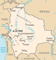 Bolivia
is a landlocked country with no ocean islands.
Brazil
Chile
Colombia

Ecuador
Falkland Islands
French Guiana
Guyana
Paraguay
 Paraguay
is a landlocked country with no ocean islands and only a few very small inland islands.
Peru
South Georgia and the South Sandwich Islands
Suriname
Uruguay
Venezuela
Island
An island or isle is any piece of sub-continental land that is surrounded by water. Very small islands such as emergent land features on atolls can be called islets, cays or keys. An island in a river or lake may be called an eyot , or holm...
s of South America
South America
South America is a continent situated in the Western Hemisphere, mostly in the Southern Hemisphere, with a relatively small portion in the Northern Hemisphere. The continent is also considered a subcontinent of the Americas. It is bordered on the west by the Pacific Ocean and on the north and east...
by country.
ArgentinaArgentinaArgentina , officially the Argentine Republic , is the second largest country in South America by land area, after Brazil. It is constituted as a federation of 23 provinces and an autonomous city, Buenos Aires...
Atlantic Ocean islands
- Isla ApipéIsla ApipéIsla Apipé or Isla Apipé Grande is an about 25 km long Argentine island in the Paraná River, on the border with Paraguay.Isla Apipé is part of Corrientes Province, but the island is separated from the rest of the province by a channel of the Paraná River, which belongs to Paraguay...
- Isla BermejoIsla BermejoIsla Bermejo is an island located east of Argentina near the city of Bahía Blanca.-References:...
- Isla de los EstadosIsla de los EstadosIsla de los Estados is an Argentine island that lies off the eastern extremity of the Argentine portion of Tierra del Fuego, from which it is separated by the Le Maire Strait...
- Isla de San MartínIsla de San Martín (Argentina)The Isla de San Martín is located in Argentina's Iguazu River, within the Iguazu Falls in Misiones Province. The island spans the 3 levels that form the falls, but only the lower and middle levels are open to visitors. The island can only be reached in small boats, unless the river is below the...
- Isla del CerritoIsla del CerritoIsla del Cerrito is a village and municipality in Chaco Province in northern Argentina.-References:...
- Isla Martín GarcíaIsla Martín GarcíaIsla Martín García is an Argentine island off the Río de la Plata coast of Uruguay. The enclave island is within the boundaries of Uruguayan waters; in 1973 both countries reached an agreement establishing Martín García as an Argentine territory and also as a nature reserve.The island of has a...
- Isla Trinidad (Buenos Aires)
- Patagonic Archipelago
- Archipiélago de Tierra del FuegoTierra del FuegoTierra del Fuego is an archipelago off the southernmost tip of the South American mainland, across the Strait of Magellan. The archipelago consists of a main island Isla Grande de Tierra del Fuego divided between Chile and Argentina with an area of , and a group of smaller islands including Cape...
- Isla Grande de Tierra del FuegoIsla Grande de Tierra del FuegoIsla Grande de Tierra del Fuego is an island near the southern tip of South America from which it is separated by the Strait of Magellan...
(divided with Chile)
- Isla Grande de Tierra del Fuego
- Archipiélago de Tierra del Fuego
River islands
- Islands of the Paraná River deltaParaná DeltaThe Paraná Delta is the delta of the Paraná River in Argentina. The Paraná flows north–south and becomes an alluvial basin between the Argentine provinces of Entre Ríos and Santa Fe, then emptying into the Río de la Plata....
- Islas del Ibicuy
BoliviaBoliviaBolivia officially known as Plurinational State of Bolivia , is a landlocked country in central South America. It is the poorest country in South America...
Bolivia
Bolivia officially known as Plurinational State of Bolivia , is a landlocked country in central South America. It is the poorest country in South America...
is a landlocked country with no ocean islands.
Lake islands
- Isla del PescadoIncahuasi IslandInkahuasi or Inkawasi is an island in the middle of Salar de Uyuni in the Potosí Department in Bolivia, situated in the Daniel Campos Province, Tahua Municipality, Yonza Canton....
(Incahuasi IslandIncahuasi IslandInkahuasi or Inkawasi is an island in the middle of Salar de Uyuni in the Potosí Department in Bolivia, situated in the Daniel Campos Province, Tahua Municipality, Yonza Canton....
) - Isla del SolIsla del SolIsla del Sol is an island in the southern part of Lake Titicaca. It is part of the modern Plurinational State of Bolivia. Geographically, the terrain is harsh; it is a rocky, hilly island. There are no motor vehicles or paved roads on the island...
- Isla de la LunaIsla de la LunaIsla de la Luna is an island in La Paz Department, Bolivia. It is situated in Lake Titicaca, east of Isla del Sol . Legends in Inca mythology refer to the island as the location where Viracocha commanded the rising of the moon. Archeological ruins of an Inca nunnery were found on the eastern shore....
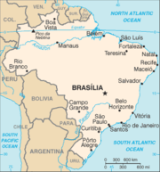
BrazilBrazilBrazil , officially the Federative Republic of Brazil , is the largest country in South America. It is the world's fifth largest country, both by geographical area and by population with over 192 million people...
Atlantic Ocean islands
- Arquipelago de Fernando de NoronhaFernando de NoronhaFernando de Noronha is an archipelago of 21 islands and islets in the Atlantic Ocean, offshore from the Brazilian coast. The main island has an area of and had a population of 3,012 in the year 2010...
- Arquipélago de São Pedro e São Paulo (Saint Peter and Paul RocksSaint Peter and Paul RocksThe Saint Peter and Saint Paul Archipelago is a group of 15 small islets and rocks in the central equatorial Atlantic Ocean. It lies in the Intertropical Convergence Zone, a region of severe storms...
) - Atol das Rocas (Rocas AtollRocas AtollThe Rocas Atoll is an atoll in the Atlantic Ocean, belonging to the Brazilian State of Rio Grande do Norte. It is located approximately northeast of Natal and west of the archipelago of Fernando de Noronha. The atoll is of volcanic origin and coralline formation.-Description:The oval atoll is ...
) - Ilha de Boipeba
- Ilha de Maraca
- Ilha de Santa Barbara
- Ilha de Santa Catarina
- Ilha de São LuísSão Luís IslandSão Luís Island is an island in Brazil with an area of 1,410 km² , located between the Baía de São Marcos and the Baía de São José in Maranhão state. There are 4 cities located in the island: São Luís, after which the island is named, São José de Ribamar, Paço do Lumiar, and Raposa. São Luís is the...
- Ilha GrandeIlha GrandeIlha Grande is an island located off the coast of Rio de Janeiro state, Brazil, and part of the municipality of Angra dos Reis. The island is largely undeveloped and noted for its scenic beauty, which includes tropical beaches, luxuriant vegetation and a rugged landscape. The land area is...
- Ilha Itaparica
- Ilha Tinhare
- Ilha Trindade
- Ilhabela archipelagoArchipelagoAn archipelago , sometimes called an island group, is a chain or cluster of islands. The word archipelago is derived from the Greek ἄρχι- – arkhi- and πέλαγος – pélagos through the Italian arcipelago...
- Ilha de São Sebastião
- Ilhas CagarrasIlhas CagarrasThe Cagarras Islands make up an uninhabited archipelago located off the southern coast of the city of Rio de Janeiro, Brazil, outside Guanabara Bay...
archipelagoArchipelagoAn archipelago , sometimes called an island group, is a chain or cluster of islands. The word archipelago is derived from the Greek ἄρχι- – arkhi- and πέλαγος – pélagos through the Italian arcipelago... - Ilhas Martim Vaz archipelagoArchipelagoAn archipelago , sometimes called an island group, is a chain or cluster of islands. The word archipelago is derived from the Greek ἄρχι- – arkhi- and πέλαγος – pélagos through the Italian arcipelago...
- Vitória archipelagoArchipelagoAn archipelago , sometimes called an island group, is a chain or cluster of islands. The word archipelago is derived from the Greek ἄρχι- – arkhi- and πέλαγος – pélagos through the Italian arcipelago...
- Ilha de Vitória
ChileChileChile ,officially the Republic of Chile , is a country in South America occupying a long, narrow coastal strip between the Andes mountains to the east and the Pacific Ocean to the west. It borders Peru to the north, Bolivia to the northeast, Argentina to the east, and the Drake Passage in the far...
Pacific Ocean islands
- Archipiélago de ChiloéChiloé ArchipelagoChiloé Archipelago consists of several islands lying off the coast of Chile. It is separated from mainland Chile by Chacao Channel in the north, the Sea of Chiloé in the east and Gulf of Corcovado to the southeast. All of the archipelago except Desertores Islands, which are part of Palena...
- Isla de ChiloéChiloé IslandChiloé Island , also known as Greater Island of Chiloé , is the largest island of the Chiloé Archipelago off the coast of Chile, in the Pacific Ocean...
- Isla Guafo
- Isla LemuyLemuy IslandLemuy Island is an island in Chiloé Archipelago, Chile, off the eastern coast of Chiloé Island. It has an area of 97 km2 and a population of 4,125 . It is coterminous with the commune of Puqueldón....
- Isla QuinchaoQuinchao IslandQuinchao Island is an island in Chiloé Province, Chile, off the east coast of Chiloé Island. It has an area of 135 km2 and a population of ca 12,000. It includes the communes of Quinchao and Curaco de Vélez. Main towns are Achao and Curaco de Vélez. Quinchao Island is separated from Chiloé...
- Isla de Chiloé
- Archipiélago de las GuaitecasGuaitecas ArchipelagoGuaitecas Archipelago is an archipelago in the municipality of Guaitecas in the Aisén province. The Ciprés de las Guaitecas tree is named after the archipelago. The only settlement in the archipelago is Melinka....
- Archipiélago GuayanecoGuayaneco ArchipelagoThe Guayaneco Archipelago is an archipelago in southern Chile . It was heavily glaciated during the most recent ice age. These glaciers dissected these mountain islands into a series of deep river valleys and glacial troughs. Today these glacial troughs are deep channels and fjords...
- Archipiélago Juan FernándezJuan Fernández IslandsThe Juan Fernández Islands are a sparsely inhabited island group reliant on tourism and fishing in the South Pacific Ocean, situated about off the coast of Chile, and is composed of three main volcanic islands; Robinson Crusoe Island, Alejandro Selkirk Island and Santa Clara Island, the first...
- Isla Alejandro SelkirkAlejandro Selkirk IslandAlejandro Selkirk Island, previously known as Isla Más Afuera and renamed after Alexander Selkirk, is the second largest and most westernly island of the Juan Fernández Islands archipelago of the Valparaíso Region of Chile...
- Isla Robinsón CrusoeRobinson Crusoe IslandRobinson Crusoe Island , formerly known as Más a Tierra , or Aguas Buenas, is the largest island of the Chilean Juan Fernández archipelago, situated 674 kilometres west of South America in the South Pacific Ocean...
- Isla Santa ClaraSanta Clara (Juan Fernández Islands)Santa Clara is an uninhabited tiny island in the Pacific Ocean, off the coast of Robinson Crusoe Island in a group of islands known as the Juan Fernández Islands. The island is of volcanic origin and is approximately 1 kilometre long and 600 metres wide...
- Islote JuanangaJuan Fernández IslandsThe Juan Fernández Islands are a sparsely inhabited island group reliant on tourism and fishing in the South Pacific Ocean, situated about off the coast of Chile, and is composed of three main volcanic islands; Robinson Crusoe Island, Alejandro Selkirk Island and Santa Clara Island, the first...
- Isla Alejandro Selkirk
- Isla ChañaralIsla ChañaralIsla Chañaral , Chile is located 6 km off-shore from the northern Central Chilean coast, some 100 km north of the city of La Serena. Together with Isla Choros and Isla Damas, the island forms the Humboldt Penguin National Reserve, which is administered by the Chilean Forestry Corporation...
- Isla de Pascua (Easter IslandEaster IslandEaster Island is a Polynesian island in the southeastern Pacific Ocean, at the southeasternmost point of the Polynesian triangle. A special territory of Chile that was annexed in 1888, Easter Island is famous for its 887 extant monumental statues, called moai, created by the early Rapanui people...
) - Isla del ReyDel Rey IslandIsla del Rey is the largest island in Los Ríos Region of Chile. It is located at the outflow of Valdivia River into Corral Bay. To the east the island is separated from the mainland by Futa River and by south by Tornagaleones River....
- Isla MagdalenaMagdalena Island, Aisén RegionMagdalena Island is an island in Aisén Region of southern Chile. It has an approximate area of 2,025 km2. The island is located between the Moraleda Channel and the Puyuhuapi Channel, and belongs partially to the Isla Magdalena National Park....
- Isla ManceraMancera IslandMancera Island is a minor island at the mouth of Valdivia River, in southern Chile. It was named after the Spanish viceroy of Peru Pedro de Toledo, 1st Marquis of Mancera, who fortified the island. The fort was a vital point in the Valdivian Fort System, preventing enemy ships from reaching...
- Isla Mocha
- Isla QuiriquinaQuiriquina IslandQuiriquina Island, Chile is located at the entrance to the Bay of Concepción, 11 km north of Talcahuano.In April, 1557, Don Garcia de Mendoza, Spanish viceroy of the Kingdom of Chile, arrived at the harbor of Concepción, with a large force of infantry and established himself upon the island of...
- Isla Salas y Gómez
- Islas DesventuradasDesventuradas Islandsthumb|Map of Desventuradas Islands The Desventuradas Islands, also known as Islas de los Desventurados, is a group of four small islands located off the coast of Chile, northwest of Santiago in the Pacific Ocean...
- Isla San AmbrosioDesventuradas Islandsthumb|Map of Desventuradas Islands The Desventuradas Islands, also known as Islas de los Desventurados, is a group of four small islands located off the coast of Chile, northwest of Santiago in the Pacific Ocean...
- Isla San FélixDesventuradas Islandsthumb|Map of Desventuradas Islands The Desventuradas Islands, also known as Islas de los Desventurados, is a group of four small islands located off the coast of Chile, northwest of Santiago in the Pacific Ocean...
- Islote GonzálezDesventuradas Islandsthumb|Map of Desventuradas Islands The Desventuradas Islands, also known as Islas de los Desventurados, is a group of four small islands located off the coast of Chile, northwest of Santiago in the Pacific Ocean...
- Roca CatedralDesventuradas Islandsthumb|Map of Desventuradas Islands The Desventuradas Islands, also known as Islas de los Desventurados, is a group of four small islands located off the coast of Chile, northwest of Santiago in the Pacific Ocean...
- Isla San Ambrosio
- Merino Jarpa IslandMerino Jarpa IslandMerino Jarpa Island is an island in the Baker Channel in Aisén region, Chile. It has an area of 430 km2....
- Patagonic Archipelago
- Archipelago de La Reina AdelaidaQueen Adelaide ArchipelagoQueen Adelaide Archipelago is an island group in Zona Austral, the extreme south of Chile. It belongs to the Magallanes y la Antártica Chilena Region....
(Queen Adelaide ArchipelagoQueen Adelaide ArchipelagoQueen Adelaide Archipelago is an island group in Zona Austral, the extreme south of Chile. It belongs to the Magallanes y la Antártica Chilena Region....
)- Isla CochraneQueen Adelaide ArchipelagoQueen Adelaide Archipelago is an island group in Zona Austral, the extreme south of Chile. It belongs to the Magallanes y la Antártica Chilena Region....
- Isla ContrerasContreras IslandContreras Island is an island in the Queen Adelaide Archipelago in Magallanes y la Antártica Chilena Region, Chile. Its area is 626 km²....
- Isla Juan GuillermoQueen Adelaide ArchipelagoQueen Adelaide Archipelago is an island group in Zona Austral, the extreme south of Chile. It belongs to the Magallanes y la Antártica Chilena Region....
- Isla PachecoPacheco IslandPacheco Island is an island in the Queen Adelaide Archipelago in Magallanes y la Antártica Chilena Region, Chile. Its area is 151 km²....
- Isla RamirezRamirez Island]Ramirez Island is an island in the Queen Adelaide Archipelago in Magallanes y la Antártica Chilena Region, Chile. Its area is 163 km². ....
- North Rennell IslandNorth Rennell IslandNorth Rennell Island is the smaller of the two Rennell Islands in the Queen Adelaide Archipelago in Magallanes y la Antártica Chilena Region, Chile. Its area is 303 km²....
- South Rennell IslandSouth Rennell Island]]South Rennell Island is the largest of the Rennell Islands in the Queen Adelaide Archipelago in Magallanes y la Antártica Chilena Region, Chile. Its area is 340 km²....
- Isla Cochrane
- Archipiélago de los ChonosChonos ArchipelagoChonos Archipelago is a series of low mountainous elongated islands with deep bays, traces of a submerged Chilean Coast Range. Most of the islands are forested with little or no human settlement...
- Isla BenjaminBenjamin IslandBenjamin Island is an island in the Chonos Archipelago of Chile. It has an area of 618 km²....
- Isla CuptanaCuptana IslandCuptana Island is an island in the Chonos Archipelago of Chile. It has an area of 320 km²....
- Isla GuamblinChonos ArchipelagoChonos Archipelago is a series of low mountainous elongated islands with deep bays, traces of a submerged Chilean Coast Range. Most of the islands are forested with little or no human settlement...
- Isla JamesJames Island (Chile)James Island is an island in the Chonos Archipelago of Chile. It has an area of 388 km²....
- Isla MelchorMelchor IslandMelchor Island is an island in the Chonos Archipelago of Chile. It has an area of 864 km²....
- Isla RiveroRivero IslandRivero Island is an island in the Chonos Archipelago of Chile. It has an area of 452 km²....
- Isla SimpsonChonos ArchipelagoChonos Archipelago is a series of low mountainous elongated islands with deep bays, traces of a submerged Chilean Coast Range. Most of the islands are forested with little or no human settlement...
- Isla TraiguenTraiguen IslandTraiguen Island is an island in the Chonos Archipelago of Chile. It has an area of 520 km²....
- Isla VictoriaVictoria Island (Chile)Victoria Island is an island in the Chonos Archipelago of Chile. It has an area of 354 km²....
- Isla Benjamin
- Archipiélago de Tierra del FuegoTierra del FuegoTierra del Fuego is an archipelago off the southernmost tip of the South American mainland, across the Strait of Magellan. The archipelago consists of a main island Isla Grande de Tierra del Fuego divided between Chile and Argentina with an area of , and a group of smaller islands including Cape...
- Isla DawsonDawson IslandDawson Island is an island in the Strait of Magellan that forms part of the Tierra del Fuego archipelago, 100 km south of the city of Punta Arenas in Chile, and part of the Municipality of Punta Arenas. It is located southeast of Brunswick Peninsula and is an approximately 1290 km² tract...
- Isla DesolaciónDesolación IslandDesolación Island is an island at the western end of the Strait of Magellan in the Magallanes y la Antártica Chilena Region, Chile. It belongs to the Tierra del Fuego archipelago...
- Isla GordonGordon IslandGordon Island is an island in the Tierra del Fuego archipelago. Politically, the island is located in the Commune of Cabo de Hornos, which belongs to the Magallanes y la Antártica Chilena Region, Chile. It has an area of 591 km²....
- Isla Grande de Tierra del FuegoIsla Grande de Tierra del FuegoIsla Grande de Tierra del Fuego is an island near the southern tip of South America from which it is separated by the Strait of Magellan...
(divided with Argentina) - Isla MagdalenaMagdalena Island, Magallanes RegionMagdalena Island is a small island in the Strait of Magellan, Chile. It is located in Magallanes Region about 32 km northeast of the regional capital Punta Arenas. In 1982 it, and nearby Marta Island, were declared a national monument- Monumento Natural Los Pingüinos. The island is the breeding...
- Islas HermiteHermite IslandsThe Hermite Islands are a group of Chilean islands in the archipelago of Tierra del Fuego. They form part of the Commune of Cabo de Hornos in Antártica Chilena Province of Magallanes y Antártica Chilena Region, at the southernmost end of South America...
- Isla HermiteHermite IslandsThe Hermite Islands are a group of Chilean islands in the archipelago of Tierra del Fuego. They form part of the Commune of Cabo de Hornos in Antártica Chilena Province of Magallanes y Antártica Chilena Region, at the southernmost end of South America...
- Isla HornosHornos IslandHornos Island is a Chilean island at the southern tip of South America. The island is mostly known for being the location of Cape Horn. It is generally considered South America's southernmost island, but the Diego Ramírez Islands are farther south...
– location of Cabo de Hornos (Cape HornCape HornCape Horn is the southernmost headland of the Tierra del Fuego archipelago of southern Chile, and is located on the small Hornos Island...
)
- Isla Hermite
- Isla Hoste
- Isla NavarinoIsla NavarinoIsla Navarino is a Chilean island located strategically between Isla Grande de Tierra del Fuego, to the north, and Cape Horn, to the south. The island forms part of the Commune of Cabo de Hornos, the southernmost commune in Chile and in the world, belonging to Antártica Chilena Province in the XII...
- Isla Santa Inés
- Islas Picton, Lennox y NuevaPicton, Lennox and NuevaPicton, Lennox and Nueva is a group of three islands on the extreme south of South America, in the Chilean commune of Cabo de Hornos in Antártica Chilena Province, Magallanes and Antártica Chilena Region...
- Islas WollastonWollaston IslandsWollaston Islands is a group of islands in the extreme south of Chile near Cape Horn. The islands are inside Cabo de Hornos National Park, belonging to the Commune of Cabo de Hornos in Antártica Chilena Province of Magallanes y Antártica Chilena Region....
- Londonderry IslandLondonderry IslandLondonderry is an island in Tierra del Fuego in Chile at the western end of the Beagle Channel and Darwin Sound; the captain of HMS Beagle, Robert FitzRoy, was a descendant of the Marquis of Londonderry. Politically, the island is located in the Commune of Cabo de Hornos, which belongs to the...
- Isla Dawson
- Isla AngamosAngamos IslandAngamos Island is an island in the Patagonian Archipelago in Magallanes y la Antártica Chilena Region, Chile. It has an area of 448 km²....
- Isla AracenaAracena IslandAracena Island is an island in the Patagonian Archipelago, Magallanes y la Antártica Chilena Region, Chile. It belongs to the Tierra del Fuego archipelago. It has an area of . The highest point of the island is Monte Vernal at...
- Isla CampanaCampana IslandCampana Island is an island in the Patagonic Archipelago, Chile. Its area is 1,188 km²....
- Isla ChathamChatham Island, ChileChatham Island is an island in the Patagonian Archipelago in Magallanes y la Antártica Chilena Region, Chile. It has an area of 696 km²....
- Isla ClarenceClarence Island, ChileClarence Island is an island in the Patagonian Archipelago, Magallanes y la Antártica Chilena Region, Chile. It belongs to the Tierra del Fuego archipelago and to the municipality of Punta Arenas. It is located just south of Brunswick Peninsula and has an area of...
- Isla Diego de AlmagroDiego de Almagro IslandDiego de Almagro Island is an island in the Patagonian Archipelago in Magallanes y la Antártica Chilena Region, Chile. It has an area of 376 km²....
- Isla Duque de YorkDuke of York Island (Chile)Duke of York Island is an island in the Patagonian Archipelago in Magallanes y la Antártica Chilena Region, Chile. It has an area of 522 km²....
- Isla EsmeraldaEsmeralda IslandEsmeralda Island is an island in the Patagonian Archipelago in Magallanes y la Antártica Chilena Region, Chile. It has an area of 515 km²....
- Isla FarrelFarrel IslandFarrel Island is an island in the Patagonian Archipelago in Magallanes y la Antártica Chilena Region, Chile. It has an area of 325 km²....
- Isla GuarelloGuarello IslandGuarello Island is an island in Madre de Dios Archipelago in Magallanes Region, Chile. Guarello Island is in a limestone area that also includes Madre de Dios Island. The island has the world's southernmost limestone mine...
- Isla HanoverHanover IslandHanover Island is an island in the Patagonian Archipelago in Magallanes y la Antártica Chilena Region, Chile. Its area is 812 km².In popular fiction the island is featured in Jules Verne's book 'Two Years' Vacation'...
- Isla Jorge MonttJorge Montt IslandJorge Montt Island is an island in the Patagonian Archipelago in Magallanes y la Antártica Chilena Region, Chile. It has an area of 537 km²....
- Isla Juan GuillermosJuan Guillermos IslandJuan Guillermos Island is a Chilean island in the Patagonian Archipelago in Magallanes and Antártica Chilena Region. It has an area of 393 km². It is named after Irish Captain John Williams Wilson....
- Isla Madre de DiosMadre de Dios IslandMadre de Dios Island is an island in the Patagonian Archipelago in Magallanes y la Antártica Chilena Region, Chile. Its area is 1,043 km². Madre de Dios Island is composed partly by limestone and has several natural caves...
- Isla Manuel RodriguezManuel Rodriguez IslandManuel Rodriguez Island is an island in the Patagonian Archipelago in Magallanes y la Antártica Chilena Region, Chile. It has an area of 466 km²....
- Isla MorningtonMornington Island (Chile)Mornington Island is an island in the Patagonian Archipelago in Magallanes y la Antártica Chilena Region, Chile. It has an area of 529 km²....
- Isla Patricio LynchPatricio Lynch IslandPatricio Lynch Island is an island in the Patagonian Archipelago, Chile. Its area is 561 km²....
- Isla Pratt
- Isla Riesco
- Isla SerranoSerrano IslandSerrano Island , also known as Little Wellington Island, is an island in the Patagonian Archipelago, Chile. Its area is 1,063 km². It should not be confused with Lavoisier Island in the Antarctica, which is also called Isla Serrano in Spanish.-References:http://islands.unep.ch/IXE.htm#329...
- Isla StoschStosch IslandStosch Island is an island in the Patagonian Archipelago in Magallanes y la Antártica Chilena Region, Chile. It has an area of 357 km²....
- Isla WellingtonWellington IslandWellington Island is an island west of Southern Patagonian Ice Field, Chile. It has an area of 5,556 km² and most of the island forms part of Bernardo O'Higgins National Park. It is home to the last Kawésqar people, living the village of Puerto Edén, the only inhabited place on the...
- Islas Diego RamírezDiego Ramírez IslandsThe Diego Ramírez Islands are a small group of lesser islands located in the southernmost extreme of Chile about south-west of Cape Horn and south-south-east of Ildefonso Islands, stretching north-south . Their land area is little more than...
- Islote ÁguilaÁguila IsletÁguila Islet is the southernmost point of the South American continent . It is part of the larger southern group of the Diego Ramírez Islands, about southwest of Cape Horn in the Drake Passage, which is the southernmost possession of Chile.The distance to the closest Antarctic lands is...
(Águila IsletÁguila IsletÁguila Islet is the southernmost point of the South American continent . It is part of the larger southern group of the Diego Ramírez Islands, about southwest of Cape Horn in the Drake Passage, which is the southernmost possession of Chile.The distance to the closest Antarctic lands is...
) – southernmost point of Chile
- Islote Águila
- Islas IldefonsoIldefonso IslandsIslas Ildefonso are a group of islands in Chile. The islands belong to the Commune of Cabo de Hornos in Antártica Chilena Province of Magallanes and Antártica Chilena Region...
- Archipelago de La Reina Adelaida
River islands
- Isla TejaIsla TejaTeja island is an island in the city of Valdivia, Chile surrounded by three rivers: Cau-Cau river to the north, Cruces river to the west and Valdivia river to the sout east...
- Isla del Rey
- Isla Mancera
- Isla Haverbeck
- Isla Orrego
ColombiaColombiaColombia, officially the Republic of Colombia , is a unitary constitutional republic comprising thirty-two departments. The country is located in northwestern South America, bordered to the east by Venezuela and Brazil; to the south by Ecuador and Peru; to the north by the Caribbean Sea; to the...
Caribbean Sea islands
- Archipiélago de San Andrés, Providencia y Santa Catalina
- Cayos de Albuquerque
- Cayos del Este Sudeste
- Isla de Providencia
- Isla San Andrés
- Isla Santa Catalina
- Minor islands:
- Alice ShoalAlice ShoalAlice Shoal is a wholly submerged reef, located in the western Caribbean Sea, about 260 kilometres southwest of Jamaica. The mainland of Colombia lies 740 km away to the southeast....
- Bajo Nuevo BankBajo Nuevo BankBajo Nuevo Bank, also known as the Petrel Islands , is a small, uninhabited reef with some small islets, covered with grass, located in the western Caribbean Sea at , with a lighthouse on Low Cay at . The closest neighbouring land feature is Serranilla Bank, located to the west.The reef was first...
(also claimed by the United StatesUnited StatesThe United States of America is a federal constitutional republic comprising fifty states and a federal district...
) - Quita Sueño BankQuita Sueño BankQuita Sueño Bank is a reef formation of Colombia which was once claimed by the United States, located 110 km North-northeast of Providencia Island.-History:...
- Roncador BankRoncador BankRoncador Bank is a mostly-submerged atoll with several sandy cays. It lies in the west Caribbean Sea off the coast of Central America. Originally claimed by the United States under the Guano Islands Act of 1856, the atoll was returned by the United States to Colombia on September 17, 1981, as the...
- Roncador CayRoncador CayRoncador Cay is a small island of the Roncador Bank, located in the west Caribbean Sea, off the coast of Central America, 150 km East-northwest of Providencia Island....
- Roncador Cay
- Serrana BankSerrana BankThe Serrana Bank is one of the few atolls in the Atlantic Ocean. Its mostly underwater reef of about 50 km long and 13 km wide has six cays or islets, the most prominent of which is Southwest Cay.The cays from south to north are:...
- Serranilla BankSerranilla BankSerranilla Bank is a partially submerged reef, with small uninhabited islets, in the western Caribbean Sea. It is situated about northeast of Punta Gorda, Nicaragua, and roughly southwest of Jamaica. The closest neighbouring land feature is Bajo Nuevo Bank, located 110 km to the east.Serranilla...
(also claimed by the United StatesUnited StatesThe United States of America is a federal constitutional republic comprising fifty states and a federal district...
)
- Alice Shoal
- Archipelago of San BernardoArchipelago of San BernardoThe Archipelago of San Bernardo is a set of 10 coastal islands belonging to Colombia, located in the Gulf of Morrosquillo in the Caribbean Sea, with an approximate area of 213.3 km² . Administratively, the archipelago belongs to the department of Sucre...
- Isla Barú
- Isla Fuerte
- Isla Tierra Bomba
- Isla Tortuguilla
- Islas del RosarioIslas del RosarioThe Islas del Rosario is one of the 46 Natural National Parks of Colombia, created in order to protect one of the most important coral reefs of the Colombian Caribbean coast.-Characteristics:...
Pacific Ocean islands
- Isla GorgonaGorgona, ColombiaGorgona is a Colombian island in the Pacific Ocean situated about 50 km off the Colombian Pacific coast and part of the municipality of Guapi in the Department of Cauca. The island is about 9 km long and 2.5 km wide, with a maximum height of 338 m ; with an area of 10 square miles...
- Isla de MalpeloMalpelo IslandMalpelo Island is an island located from Colombia's Pacific coast, and approximately from Panama's coast. It has a land area of . It is uninhabited except for a small military post manned by the Colombian Army, which was established in 1986. Visitors need a written permit from the Colombian...
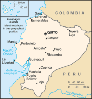
EcuadorEcuadorEcuador , officially the Republic of Ecuador is a representative democratic republic in South America, bordered by Colombia on the north, Peru on the east and south, and by the Pacific Ocean to the west. It is one of only two countries in South America, along with Chile, that do not have a border...
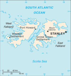
Falkland IslandsFalkland IslandsThe Falkland Islands are an archipelago in the South Atlantic Ocean, located about from the coast of mainland South America. The archipelago consists of East Falkland, West Falkland and 776 lesser islands. The capital, Stanley, is on East Falkland...
Atlantic Ocean islands
- Falkland IslandsFalkland IslandsThe Falkland Islands are an archipelago in the South Atlantic Ocean, located about from the coast of mainland South America. The archipelago consists of East Falkland, West Falkland and 776 lesser islands. The capital, Stanley, is on East Falkland...
(also claimed by Argentina)- West FalklandWest FalklandWest Falkland is the second largest of the Falkland Islands in the South Atlantic. It is a hilly island, separated from East Falkland by Falkland Sound. Its area is and its coastline is long. Including the adjacent small islands the land area is .-Population:The island has fewer than 200...
- East FalklandEast FalklandEast Falkland the largest of the Falkland Islands in the South Atlantic, has an area of and a coastline long. Most of the population of the Falklands live in East Falkland, almost all of them living in the northern half of the island...
- Jason IslandsJason IslandsThe Jason Islands are an archipelago in the Falkland Islands, lying to the far north-west of West Falkland. Three of the islands, Steeple Jason, Grand Jason and Clarke's Islet are private nature reserves owned by the Wildlife Conservation Society, New York...
- West Falkland
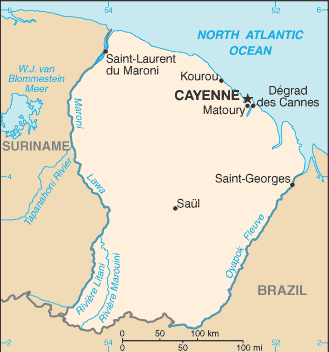
French GuianaFrench GuianaFrench Guiana is an overseas region of France, consisting of a single overseas department located on the northern Atlantic coast of South America. It has borders with two nations, Brazil to the east and south, and Suriname to the west...
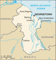
GuyanaGuyanaGuyana , officially the Co-operative Republic of Guyana, previously the colony of British Guiana, is a sovereign state on the northern coast of South America that is culturally part of the Anglophone Caribbean. Guyana was a former colony of the Dutch and of the British...
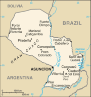
ParaguayParaguayParaguay , officially the Republic of Paraguay , is a landlocked country in South America. It is bordered by Argentina to the south and southwest, Brazil to the east and northeast, and Bolivia to the northwest. Paraguay lies on both banks of the Paraguay River, which runs through the center of the...
Paraguay
Paraguay , officially the Republic of Paraguay , is a landlocked country in South America. It is bordered by Argentina to the south and southwest, Brazil to the east and northeast, and Bolivia to the northwest. Paraguay lies on both banks of the Paraguay River, which runs through the center of the...
is a landlocked country with no ocean islands and only a few very small inland islands.
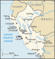
PeruPeruPeru , officially the Republic of Peru , is a country in western South America. It is bordered on the north by Ecuador and Colombia, on the east by Brazil, on the southeast by Bolivia, on the south by Chile, and on the west by the Pacific Ocean....
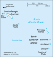
South Georgia and the South Sandwich IslandsSouth Georgia and the South Sandwich IslandsSouth Georgia and the South Sandwich Islands is a British overseas territory and overseas territory of the European Union in the southern Atlantic Ocean. It is a remote and inhospitable collection of islands, consisting of South Georgia and a chain of smaller islands, known as the South Sandwich...
Atlantic Ocean islands
- South Georgia (also claimed by Argentina)
- Bird Island, South Georgia
- South Sandwich Islands (also claimed by Argentina)
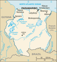
SurinameSurinameSuriname , officially the Republic of Suriname , is a country in northern South America. It borders French Guiana to the east, Guyana to the west, Brazil to the south, and on the north by the Atlantic Ocean. Suriname was a former colony of the British and of the Dutch, and was previously known as...
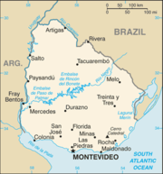
UruguayUruguayUruguay ,officially the Oriental Republic of Uruguay,sometimes the Eastern Republic of Uruguay; ) is a country in the southeastern part of South America. It is home to some 3.5 million people, of whom 1.8 million live in the capital Montevideo and its metropolitan area...
- Brazilian IslandBrazilian IslandBrazilian Island is a small fluvial island situated at the confluence of the Uruguay River and the Quarai River, between the borders of Brazil, Argentina and Uruguay....
- Juncal IslandJuncal IslandJuncal Island is an island belonging to Uruguay, located where the Uruguay River empties into the Rio de la Plata, a bit above the Uruguayan town of Carmelo...
- Isla de LobosIsla de LobosThe Isla de Lobos is a small island located about southeast of Punta del Este . An islet lies east of the island.- Geography :The island is an outcropping of rocks that is a continuation of the Cuchilla Grande, in an area of Atlantic Ocean immediately at the mouth of the estuary of Río de la Plata...
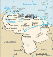
VenezuelaVenezuelaVenezuela , officially called the Bolivarian Republic of Venezuela , is a tropical country on the northern coast of South America. It borders Colombia to the west, Guyana to the east, and Brazil to the south...
Caribbean Sea islands
- Archipiélago Las AvesLas Aves ArchipelagoThe Las Aves Archipelagois a pristine archipelago in the Caribbean Sea, and is part of the Federal Dependencies of Venezuela. It is located north of the Venezuelan states of Aragua and Carabobo, between the Dutch island Bonaire in the west, and the Los Roques Archipelago in the east, at . The prime...
- Isla La Blanquilla
- Archipiélago Los MonjesLos Monjes ArchipelagoThe Los Monjes islands, a federal dependency of Venezuela, are located to the northwest of the Gulf of Venezuela, 34.8 km off the coast of Guajira Peninsula, at the border between Colombia and the Venezuelan state of Zulia....
- Archipiélago Los RoquesLos Roques ArchipelagoThe Los Roques islands are a federal dependency of Venezuela, consisting of about 350 islands, cays or islets. The archipelago is located 80 miles directly north of the port of La Guaira, and is a 40-minute flight, has a total area of 40.61 square kilometres.Being almost an untouched coral reef,...
- Isla de Aves
- Isla de Coche
- Isla de Cubagua
- Isla de Patos
- Isla de Toas
- Isla de Zapara
- Isla La OrchilaLa OrchilaLa Orchila is a military base off the coast of Venezuela, north of Caracas. It has numerous beaches, including one where the sand is markedly pink ....
- Isla La SolaLa Sola IslandLa Sola Island is a small island in the southeastern Caribbean Sea. The island is a part of the Dependencias Federales of Venezuela.-Geography:...
- Isla La Tortuga
- Isla MargaritaIsla MargaritaMargarita Island is the largest island of the state of Nueva Esparta in Venezuela, situated in the Caribbean Sea, off the northeastern coast of the country. The state also contains two other smaller islands: Coche and Cubagua. The capital city of Nueva Esparta is La Asunción, located in a river...
- Isla San Carlos
- Islas los FrailesIslas Los FrailesThe Islas Los Frailes are an archipelago of rock islets with sparse scrub vegetation belonging to the Federal dependencies of Venezuela, part of Venezuela.It is composed of ten islands:* Chepere* Guacaraida* Puerto Real* Nabobo* Cominoto* Macarare...
- Islas los HermanosLos Hermanos ArchipelagoThe Los Hermanos Archipelago is a chain of seven rocky barren islets that is part of the Federal Dependencies of Venezuela, at .The individual islands are:* Isla La Orquilla* Islote El Rajao* Isla Los Morochos* Islote Papelón* Isla Grueso...
- Islas los TestigosLos Testigos IslandsLos Testigos Islands are a group of islands in the southeastern Caribbean Sea. They are a part of the Dependencias Federales of Venezuela.-Geography:...
See also
- List of islands by area
- List of islands by highest point
- List of islands by population
- List of islands in lakes
- List of islands in the Atlantic Ocean
- List of islands in the Caribbean
- List of islands in the Pacific Ocean
- Topic outline of South America