

List of gaps in Interstate Highways
Encyclopedia
Interstate Highway System
The Dwight D. Eisenhower National System of Interstate and Defense Highways, , is a network of limited-access roads including freeways, highways, and expressways forming part of the National Highway System of the United States of America...
in the United States
United States
The United States of America is a federal constitutional republic comprising fifty states and a federal district...
is a connected system, with most roads completed; however, some Interstates still have gaps. This is a list of gaps in the Interstate Highway system where the roadway carrying an Interstate shield does not conform to the standards
Interstate Highway standards
Standards for Interstate Highways in the United States are defined by the American Association of State Highway and Transportation Officials in the publication A Policy on Design Standards - Interstate System...
set by the Federal Highway Administration
Federal Highway Administration
The Federal Highway Administration is a division of the United States Department of Transportation that specializes in highway transportation. The agency's major activities are grouped into two "programs," the Federal-aid Highway Program and the Federal Lands Highway Program...
(FHWA), the body that sets the regulations for the Interstate Highway System
Interstate Highway System
The Dwight D. Eisenhower National System of Interstate and Defense Highways, , is a network of limited-access roads including freeways, highways, and expressways forming part of the National Highway System of the United States of America...
. These gaps can be due to an unintended disconnection between two segments of the same route, failure of the roadway to be a full freeway, usage of traffic signals, or movable bridges (lift bridges and drawbridges
Bascule bridge
A bascule bridge is a moveable bridge with a counterweight that continuously balances the span, or "leaf," throughout the entire upward swing in providing clearance for boat traffic....
). This article deals with present day gaps, not the rampant examples of gaps when the Interstate Highway System was in its infancy since gaps were more expected back then. Temporary gaps, such as lane closures that reduce traffic to one lane in each direction with a reduced speed limit for a short distance from reconstruction, are also excluded.
True gaps
True gaps are where two sections of road are intended to be part of the same Interstate, but the two sections are not physically connected, are only connected by non-Interstates, or are connected but the connection is not signed as part of the highway.- Interstate 69Interstate 69Interstate 69 is an Interstate Highway in the United States. It exists in two parts: a completed highway from Indianapolis, Indiana, northeast to the Canadian border in Port Huron, Michigan, and a mostly proposed extension southwest to the Mexican border in Texas...
has three sections: the original alignment runs from Indianapolis, IndianaIndianapolis, IndianaIndianapolis is the capital of the U.S. state of Indiana, and the county seat of Marion County, Indiana. As of the 2010 United States Census, the city's population is 839,489. It is by far Indiana's largest city and, as of the 2010 U.S...
, to Port Huron, MichiganPort Huron, MichiganPort Huron is a city in the U.S. state of Michigan and the county seat of St. Clair County. The population was 30,184 at the 2010 census. The city is adjacent to Port Huron Township but is administratively autonomous. It is joined by the Blue Water Bridge over the St. Clair River to Sarnia,...
. On October 2, 2006, a segment of I-69 opened in TunicaTunica County, MississippiAs of the census of 2000, there were 9,227 people, 3,258 households, and 2,192 families residing in the county. The population density was 20 people per square mile . There were 3,705 housing units at an average density of 8 per square mile...
and DeSotoDeSoto County, Mississippi-Demographics:As of the census of 2005 estimate, there were 137,004 people, 38,792 households, and 30,102 families residing in the county. The population density was 224 people per square mile . There were 40,795 housing units at an average density of 85 per square mile...
counties in MississippiMississippiMississippi is a U.S. state located in the Southern United States. Jackson is the state capital and largest city. The name of the state derives from the Mississippi River, which flows along its western boundary, whose name comes from the Ojibwe word misi-ziibi...
. Another section exists near Evansville, IndianaEvansville, IndianaEvansville is the third-largest city in the U.S. state of Indiana and the largest city in Southern Indiana. As of the 2010 census, the city had a total population of 117,429. It is the county seat of Vanderburgh County and the regional hub for both Southwestern Indiana and the...
. This section, however, is expected to be connected to the original I-69 in Indianapolis in 2016. - Interstate 73Interstate 73Interstate 73 is a main route of the Interstate Highway System, currently located entirely within the U.S. state of North Carolina. It is part of a longer planned corridor, defined by various Federal laws to run from Myrtle Beach, South Carolina, to Grayling, Michigan, but only the part south of...
has two sections: a section of the Greensboro Urban LoopGreensboro Urban LoopThe Greensboro Urban Loop is a planned 41-mile beltway around Greensboro, North Carolina, United States. The loop carries Interstate 85 and U.S. Route 421 on its southern section, and Interstate 73 from U.S. 220 to Bryan Boulevard along the west side of Greensboro...
in Greensboro, North CarolinaGreensboro, North CarolinaGreensboro is a city in the U.S. state of North Carolina. It is the third-largest city by population in North Carolina and the largest city in Guilford County and the surrounding Piedmont Triad metropolitan region. According to the 2010 U.S...
, the only section of I-73 signed with normal Interstate shields, and one concurrent with the entire section of I-74Interstate 74Interstate 74 is an Interstate Highway in the Midwestern and Southeastern United States. Its western end is at an intersection with Interstate 80 in Davenport, Iowa; the eastern end of its Midwest segment is at an intersection with Interstate 75 in Cincinnati, Ohio...
from UlahUlah, North CarolinaUlah is an unincorporated community in Randolph County, south of the neighboring county seat of Asheboro, North Carolina.-References:...
to Ellerbe, North CarolinaEllerbe, North CarolinaEllerbe is a town in Richmond County, North Carolina, United States. The population was 1,021 at the 2000 census. It is perhaps best known as the one-time home of professional wrestler André the Giant, who operated a nearby ranch/farm in his spare time and retirement. His ashes were scattered on...
. Other sections up to freeway standards are signed with I-73 shields that have FUTURE instead of INTERSTATE. - Interstate 74Interstate 74Interstate 74 is an Interstate Highway in the Midwestern and Southeastern United States. Its western end is at an intersection with Interstate 80 in Davenport, Iowa; the eastern end of its Midwest segment is at an intersection with Interstate 75 in Cincinnati, Ohio...
currently has five sections, one heading west from Cincinnati, OhioCincinnati, OhioCincinnati is a city in the U.S. state of Ohio. Cincinnati is the county seat of Hamilton County. Settled in 1788, the city is located to north of the Ohio River at the Ohio-Kentucky border, near Indiana. The population within city limits is 296,943 according to the 2010 census, making it Ohio's...
, to Davenport, IowaDavenport, IowaDavenport is a city located along the Mississippi River in Scott County, Iowa, United States. Davenport is the county seat of and largest city in Scott County. Davenport was founded on May 14, 1836 by Antoine LeClaire and was named for his friend, George Davenport, a colonel during the Black Hawk...
; one from the VirginiaVirginiaThe Commonwealth of Virginia , is a U.S. state on the Atlantic Coast of the Southern United States. Virginia is nicknamed the "Old Dominion" and sometimes the "Mother of Presidents" after the eight U.S. presidents born there...
/North CarolinaNorth CarolinaNorth Carolina is a state located in the southeastern United States. The state borders South Carolina and Georgia to the south, Tennessee to the west and Virginia to the north. North Carolina contains 100 counties. Its capital is Raleigh, and its largest city is Charlotte...
line along Interstate 77Interstate 77Interstate 77 is an Interstate Highway in the eastern United States. It traverses diverse terrain, from the mountainous state of West Virginia to the rolling farmlands of North Carolina and Ohio. It largely supplants the old U.S...
south/east to a point southeast of Mount Airy, North CarolinaMount Airy, North CarolinaMount Airy is a city in Surry County, North Carolina, United States. As of the 2010 census, the city population was 10,388.-History:Mount Airy was settled in the 1750s as a stagecoach stop on the road between Winston-Salem and Galax, Virginia. It was named for a nearby plantation...
; one running concurrent with US 311 around High PointHigh Point, North CarolinaHigh Point is a city located in the Piedmont Triad region of North Carolina. As of 2010 the city had a total population of 104,371, according to the US Census Bureau. High Point is currently the eighth-largest municipality in North Carolina....
connecting with I-85Interstate 85Interstate 85 is a major interstate highway in the Southeastern United States. Its current southern terminus is at an interchange with Interstate 65 in Montgomery, Alabama; its northern terminus interchanges with Interstate 95 in Petersburg, Virginia, near Richmond...
; one concurrent with the entire section of I-73Interstate 73Interstate 73 is a main route of the Interstate Highway System, currently located entirely within the U.S. state of North Carolina. It is part of a longer planned corridor, defined by various Federal laws to run from Myrtle Beach, South Carolina, to Grayling, Michigan, but only the part south of...
from UlahUlah, North CarolinaUlah is an unincorporated community in Randolph County, south of the neighboring county seat of Asheboro, North Carolina.-References:...
to Ellerbe, North CarolinaEllerbe, North CarolinaEllerbe is a town in Richmond County, North Carolina, United States. The population was 1,021 at the 2000 census. It is perhaps best known as the one-time home of professional wrestler André the Giant, who operated a nearby ranch/farm in his spare time and retirement. His ashes were scattered on...
; and from west of LaurinburgLaurinburg, North CarolinaLaurinburg is a mid-sized city in Scotland County, North Carolina, United States. It is the county seat of Scotland County. Located in southern North Carolina near the South Carolina state border, Laurinburg is southwest of Fayetteville and is home to St. Andrews Presbyterian College...
to south of Lumberton, North CarolinaLumberton, North CarolinaLumberton is a city in Robeson County, North Carolina, United States. The population was 20,795 at the 2000 census. It is the county seat of Robeson County. Lumberton, located in southern North Carolina's Inner Banks region, is located on the Lumber River...
, at Interstate 95Interstate 95Interstate 95 is the main highway on the East Coast of the United States, running parallel to the Atlantic Ocean from Maine to Florida and serving some of the most populated urban areas in the country, including Boston, Providence, New Haven, New York City, Newark, Philadelphia, Baltimore,...
. Other sections up to freeway standards are signed with I-74 shields that have FUTURE instead of INTERSTATE. Future I-73 shields are also placed along some of these sections. North CarolinaNorth CarolinaNorth Carolina is a state located in the southeastern United States. The state borders South Carolina and Georgia to the south, Tennessee to the west and Virginia to the north. North Carolina contains 100 counties. Its capital is Raleigh, and its largest city is Charlotte...
is currently working on connecting all its sections of I-74, though the gap to Cincinnati will remain for the foreseen future. - The eastern Interstate 86Interstate 86 (east)Interstate 86 is an Interstate Highway that extends for through northwestern Pennsylvania and southern New York in the United States...
currently has three sections. One runs from I-90Interstate 90Interstate 90 is the longest Interstate Highway in the United States at . It is the northernmost coast-to-coast interstate, and parallels US 20 for the most part. Its western terminus is in Seattle, at Edgar Martinez Drive S. near Safeco Field and CenturyLink Field, and its eastern terminus is in...
in North East, Pennsylvania, to Exit 56 in Elmira, New YorkElmira, New YorkElmira is a city in Chemung County, New York, USA. It is the principal city of the 'Elmira, New York Metropolitan Statistical Area' which encompasses Chemung County, New York. The population was 29,200 at the 2010 census. It is the county seat of Chemung County.The City of Elmira is located in...
. The second section is a 9.9 miles (15.9 km) stretch outside of BinghamtonBinghamton, New YorkBinghamton is a city in the Southern Tier of New York in the United States. It is near the Pennsylvania border, in a bowl-shaped valley at the confluence of the Susquehanna and Chenango Rivers...
running from I-81Interstate 81Interstate 81 is an Interstate Highway in the eastern part of the United States. Its southern terminus is at Interstate 40 in Dandridge, Tennessee; its northern terminus is on Wellesley Island at the Canadian border, where the Thousand Islands Bridge connects it to Highway 401, the main freeway...
in KirkwoodKirkwood, New YorkKirkwood is a town in Broome County, New York, United States. The population was 5,651 at the 2000 census. The town is named after James P. Kirkwood, who was an engineer responsible for constructing the local railroad....
to exit 79 in WindsorWindsor, New YorkWindsor, New York may refer to:* Windsor , New York in Broome County* Windsor , New York, which lies within the Town of WindsorThere is also a town of New Windsor in Orange County, New York....
. In 2009, a third section opened near Middletown, New YorkMiddletown, Orange County, New YorkMiddletown is a city in Orange County, New York, United States. It lies in New York's Hudson Valley region, near the Wallkill River and the foothills of the Shawangunk Mountains. Middletown is situated between Port Jervis and Newburgh, New York. The city's population was 25,388 at the 2000 census...
. I-86 will eventually run from North East, Pennsylvania, to Harriman, New YorkHarriman, New YorkHarriman is a village in Orange County, New York, United States. The population was 2,252 at the 2000 census. It is part of the Poughkeepsie–Newburgh–Middletown, NY Metropolitan Statistical Area as well as the larger New York–Newark–Bridgeport, NY-NJ-CT-PA Combined...
, connecting to I-87Interstate 87Interstate 87 is a Interstate Highway located entirely within New York State in the United States of America. I-87 is the longest intrastate Interstate highway in the Interstate Highway System. Its southern end is at the Bronx approaches of the Robert F. Kennedy Bridge in New York City...
. All the designated sections and gaps are a part of the NY 17 expressway. - Interstate 95Interstate 95Interstate 95 is the main highway on the East Coast of the United States, running parallel to the Atlantic Ocean from Maine to Florida and serving some of the most populated urban areas in the country, including Boston, Providence, New Haven, New York City, Newark, Philadelphia, Baltimore,...
. Probably the best-known and most notoriously confusing of all the Interstate gaps, I-95Interstate 95Interstate 95 is the main highway on the East Coast of the United States, running parallel to the Atlantic Ocean from Maine to Florida and serving some of the most populated urban areas in the country, including Boston, Providence, New Haven, New York City, Newark, Philadelphia, Baltimore,...
is discontinuous in Lawrence Township, New JerseyLawrence Township, Mercer County, New JerseyArea residents often refer to all of Lawrence Township as Lawrenceville. Lawrenceville is a census-designated place and unincorporated area located within Lawrence Township...
(near TrentonTrenton, New JerseyTrenton is the capital of the U.S. state of New Jersey and the county seat of Mercer County. As of the 2010 United States Census, Trenton had a population of 84,913...
). Coming north from Philadelphia, PennsylvaniaPhiladelphia, PennsylvaniaPhiladelphia is the largest city in the Commonwealth of Pennsylvania and the county seat of Philadelphia County, with which it is coterminous. The city is located in the Northeastern United States along the Delaware and Schuylkill rivers. It is the fifth-most-populous city in the United States,...
, I-95 loops around the north side of Trenton and ends at U.S. Route 1U.S. Route 1U.S. Route 1 is a major north–south U.S. Highway that serves the East Coast of the United States. It runs 2,377 miles from Fort Kent, Maine at the Canadian border south to Key West, Florida. U.S. 1 generally parallels Interstate 95, though it is significantly farther west between...
, where it becomes I-295Interstate 295 (Delaware-New Jersey)Interstate 295 in New Jersey and Delaware is an auxiliary Interstate Highway, designated as a bypass around Philadelphia, Pennsylvania. The route begins at a junction with Interstate 95 south of Wilmington, Delaware, and runs to another junction with I-95 north of Trenton, New Jersey...
, which heads back south, heading to southern New JerseyNew JerseyNew Jersey is a state in the Northeastern and Middle Atlantic regions of the United States. , its population was 8,791,894. It is bordered on the north and east by the state of New York, on the southeast and south by the Atlantic Ocean, on the west by Pennsylvania and on the southwest by Delaware...
. The other section of I-95 begins on the Pennsylvania TurnpikePennsylvania TurnpikeThe Pennsylvania Turnpike is a toll highway system operated by the Pennsylvania Turnpike Commission in the Commonwealth of Pennsylvania, United States. The three sections of the turnpike system total . The main section extends from Ohio to New Jersey and is long...
at the PennsylvaniaPennsylvaniaThe Commonwealth of Pennsylvania is a U.S. state that is located in the Northeastern and Mid-Atlantic regions of the United States. The state borders Delaware and Maryland to the south, West Virginia to the southwest, Ohio to the west, New York and Ontario, Canada, to the north, and New Jersey to...
/New JerseyNew JerseyNew Jersey is a state in the Northeastern and Middle Atlantic regions of the United States. , its population was 8,791,894. It is bordered on the north and east by the state of New York, on the southeast and south by the Atlantic Ocean, on the west by Pennsylvania and on the southwest by Delaware...
state line, heads east into New Jersey along a spur of the New Jersey Turnpike, then heads north along the New Jersey TurnpikeNew Jersey TurnpikeThe New Jersey Turnpike is a toll road in New Jersey, maintained by the New Jersey Turnpike Authority. According to the International Bridge, Tunnel and Turnpike Association, the Turnpike is the nation's sixth-busiest toll road and is among one of the most heavily traveled highways in the United...
mainline. Originally I-95 was planned to have left the alignment north of Trenton and headed northeast to Interstate 287Interstate 287Interstate 287 is an auxiliary Interstate Highway in the U.S. states of New Jersey and New York. It is a partial beltway around New York City, serving the northern half of New Jersey and the counties of Rockland and Westchester in New York...
and run east along I-287 to Exit 10 on the Turnpike, but the Somerset Freeway was never built. Extensions over the years have taken I-95 several miles further north to the US-1 interchange northeast of Trenton, and along the New Jersey Turnpike to the Pennsylvania state line. An interchangePennsylvania Turnpike/Interstate 95 Interchange ProjectThe Pennsylvania Turnpike/Interstate 95 Interchange Project is a project to build an interchange where Interstate 95 crosses the Pennsylvania Turnpike in Bristol Township, Pennsylvania. This will fill the gap that exists on I-95 through New Jersey due to the cancellation of the Somerset Freeway....
is under construction, connecting the southern alignment with the Pennsylvania Turnpike, and I-95 will be rerouted via it, with the part north of that interchange becoming an extension of I-195Interstate 195 (New Jersey)Interstate 195 is an auxiliary route of the Interstate Highway System located in the U.S. state of New Jersey. Its western end is at I-295 and Route 29 just south of Trenton, New Jersey in Hamilton Township, Mercer County while its eastern end is at the Garden State Parkway, Route 34 and Route...
. (It was originally considered to be an extension of I-295.)
Disputed gaps
Gaps where different criteria constitute contradictory circumstances.- I-90Interstate 90Interstate 90 is the longest Interstate Highway in the United States at . It is the northernmost coast-to-coast interstate, and parallels US 20 for the most part. Its western terminus is in Seattle, at Edgar Martinez Drive S. near Safeco Field and CenturyLink Field, and its eastern terminus is in...
at the Chicago SkywayChicago SkywayThe Chicago Skyway, also known as Chicago Skyway Toll Bridge System, is a toll road in Chicago, Illinois, United States, carrying Interstate 90 from the Indiana Toll Road to the Dan Ryan Expressway on Chicago's South Side leading into the Chicago Loop....
— Historically, the Skyway was commonly considered to be, and was signed as, part of I-90 (originally I-94Interstate 94Interstate 94 is the northernmost east–west Interstate Highway, connecting the Great Lakes and Intermountain regions of the United States. I-94's western terminus is in Billings, Montana at a junction with Interstate 90; its eastern terminus is the U.S...
). However, around 1999, the City of Chicago, Illinois, determined it may never have applied for approval to sign it as an Interstate. (It also is not designed to Interstate standards.) The city re-signed the Skyway, and it is now mostly posted with "TO I-90" signs with a few older signs remaining. However, the Illinois Department of Transportation has always and continues to report the Skyway as part of the Interstate system, and the Federal Highway AdministrationFederal Highway AdministrationThe Federal Highway Administration is a division of the United States Department of Transportation that specializes in highway transportation. The agency's major activities are grouped into two "programs," the Federal-aid Highway Program and the Federal Lands Highway Program...
still considers it as such. A FHWA legal memo says "There is no doubt about it. The Chicago Skyway is officially part of I-90 that (has) always been included in the Dwight D. Eisenhower National System of Interstate and Defense Highways." - I-265Interstate 265Interstate 265 is an Interstate Highway ringing the Louisville, Kentucky metropolitan area, which includes southern Indiana, although the Indiana and Kentucky segments remain separate at the present time. In Kentucky it only runs through Jefferson County, from Interstate 71 in northeastern...
. The IndianaIndianaIndiana is a US state, admitted to the United States as the 19th on December 11, 1816. It is located in the Midwestern United States and Great Lakes Region. With 6,483,802 residents, the state is ranked 15th in population and 16th in population density. Indiana is ranked 38th in land area and is...
portion of I-265 does not yet connect with the KentuckyKentuckyThe Commonwealth of Kentucky is a state located in the East Central United States of America. As classified by the United States Census Bureau, Kentucky is a Southern state, more specifically in the East South Central region. Kentucky is one of four U.S. states constituted as a commonwealth...
portion of I-265. Each of the two segments, circling the outskirts and suburbs of LouisvilleLouisville, KentuckyLouisville is the largest city in the U.S. state of Kentucky, and the county seat of Jefferson County. Since 2003, the city's borders have been coterminous with those of the county because of a city-county merger. The city's population at the 2010 census was 741,096...
, ends before crossing the Ohio RiverOhio RiverThe Ohio River is the largest tributary, by volume, of the Mississippi River. At the confluence, the Ohio is even bigger than the Mississippi and, thus, is hydrologically the main stream of the whole river system, including the Allegheny River further upstream...
, making them completely in separate states. Plans for constructing a bridgeOhio River Bridges ProjectThe Ohio River Bridges Project is a controversial Louisville metropolitan area transportation project involving the reconstruction of the Kennedy Interchange , the completion of two new Ohio River bridges and the reconstruction of ramps on Interstate 65 between I-264 and downtown.One bridge will be...
to connect the two segments have been finalized, though the project is far from complete.
Freeway gaps
Freeway gaps occur where the Interstate is signed as a continuous route, but part or all of it is not up to freeway standards. This includes drawbridges where traffic on the Interstate can be stopped for vessels. This does not include facilities such as tollboothsToll road
A toll road is a privately or publicly built road for which a driver pays a toll for use. Structures for which tolls are charged include toll bridges and toll tunnels. Non-toll roads are financed using other sources of revenue, most typically fuel tax or general tax funds...
, toll plazas, agricultural inspection stations, or border stations
Border checkpoint
A border checkpoint is a place, generally between two countries, where travellers and/or goods are inspected. Authorization often is required to enter a country through its borders. Access-controlled borders often have a limited number of checkpoints where they can be crossed without legal...
.
At-grade intersections and traffic lights
Several Interstates in rural areas of the U.S. have at-grade intersectionAt-grade intersection
An at-grade intersection is a junction at which two or more transport axes cross at the same level .-Traffic management:With areas of high or fast traffic, an at-grade intersection normally requires a traffic control device such as a stop sign, traffic light or railway signal to manage conflicting...
s (including median breaks) with minor farm access roads. This is usually due to the lack of an old highway; the need to provide access to property that was accessed via the road prior to upgrade to Interstate; and the high cost to construct an interchange for the small amount of traffic that would use such a connection or to build a frontage road
Frontage road
A frontage road is a non-limited access road running parallel to a higher-speed road, usually a freeway, and feeding it at appropriate points of access...
parallel to the freeway to the nearest interchange.
- I-70 uses part of US 30 along a surface road in Breezewood, PennsylvaniaBreezewood, PennsylvaniaBreezewood is an unincorporated town in Bedford County in south-central Pennsylvania.Along a traditional pathway for Native Americans, European settlers, and British troops during colonial times, in the early 20th century, the small valley that became known as Breezewood was a popular stopping...
, to get between the freeway heading south to Hancock, MarylandHancock, MarylandHancock is a town in Washington County, Maryland, United States. The population was 1,725 at the 2000 census. The Western Maryland community is notable for being located at the narrowest part of the state...
, and the ramp to the Pennsylvania TurnpikePennsylvania TurnpikeThe Pennsylvania Turnpike is a toll highway system operated by the Pennsylvania Turnpike Commission in the Commonwealth of Pennsylvania, United States. The three sections of the turnpike system total . The main section extends from Ohio to New Jersey and is long...
. This is probably the best-known instance of traffic lightTraffic lightTraffic lights, which may also be known as stoplights, traffic lamps, traffic signals, signal lights, robots or semaphore, are signalling devices positioned at road intersections, pedestrian crossings and other locations to control competing flows of traffic...
s on an interstate. There used to be a sign of a policeman pointing at drivers leaving the Pennsylvania TurnpikePennsylvania TurnpikeThe Pennsylvania Turnpike is a toll highway system operated by the Pennsylvania Turnpike Commission in the Commonwealth of Pennsylvania, United States. The three sections of the turnpike system total . The main section extends from Ohio to New Jersey and is long...
to enter US 30, saying, "You! Slow Down!" Local businesses have lobbied to keep the gap to avoid loss of business (Map). - I-78Interstate 78Interstate 78 is an Interstate Highway in the Northeast United States, running 144 miles from Interstate 81 northeast of Harrisburg, Pennsylvania, through Allentown, Pennsylvania, and western and northern New Jersey to the Holland Tunnel and Lower Manhattan in New York City.I-78 is a major road...
travels along a one-way pairOne-way pairA one-way pair, one-way couple, or just couplet is a pair of parallel, usually one-way streets that carry opposite directions of a signed route or major traffic flow, or sometimes opposite directions of a bus or streetcar route....
of surface streets, 12th Street and 14th Street, in Jersey City, New JerseyJersey City, New JerseyJersey City is the seat of Hudson County, New Jersey, United States.Part of the New York metropolitan area, Jersey City lies between the Hudson River and Upper New York Bay across from Lower Manhattan and the Hackensack River and Newark Bay...
, between the end of the New Jersey TurnpikeNew Jersey TurnpikeThe New Jersey Turnpike is a toll road in New Jersey, maintained by the New Jersey Turnpike Authority. According to the International Bridge, Tunnel and Turnpike Association, the Turnpike is the nation's sixth-busiest toll road and is among one of the most heavily traveled highways in the United...
Newark Bay Extension and the Holland TunnelHolland TunnelThe Holland Tunnel is a highway tunnel under the Hudson River connecting the island of Manhattan in New York City with Jersey City, New Jersey at Interstate 78 on the mainland. Unusual for an American public works project, it is not named for a government official, politician, or local hero or...
, which leads into New York CityNew York CityNew York is the most populous city in the United States and the center of the New York Metropolitan Area, one of the most populous metropolitan areas in the world. New York exerts a significant impact upon global commerce, finance, media, art, fashion, research, technology, education, and...
. Between the two aforementioned points are four signalized intersections. - I-180Interstate 180 (Wyoming)Interstate 180 is a spur off Interstate 80 into downtown Cheyenne, Wyoming.-Route description:It is unusual for being the only Interstate Highway that is not up to Interstate Highway standards anywhere on its route...
in Cheyenne, WyomingCheyenne, WyomingCheyenne is the capital and most populous city of the U.S. state of Wyoming and the county seat of Laramie County. It is the principal city of the Cheyenne, Wyoming, Metropolitan Statistical Area which encompasses all of Laramie County. The population is 59,466 at the 2010 census. Cheyenne is the...
, has no parts built to Interstate standard; in fact the interchange with I-80Interstate 80Interstate 80 is the second-longest Interstate Highway in the United States, following Interstate 90. It is a transcontinental artery running from downtown San Francisco, California to Teaneck, New Jersey in the New York City Metropolitan Area...
is just a simple diamond interchangeDiamond interchangeA diamond interchange is a common type of road junction, used where a freeway crosses a minor road. The freeway itself is grade-separated from the minor road, one crossing the other over a bridge...
with two traffic lights on I-180, however it is expresswayLimited-access roadA limited-access road known by various terms worldwide, including limited-access highway, dual-carriageway and expressway, is a highway or arterial road for high-speed traffic which has many or most characteristics of a controlled-access highway , including limited or no access to adjacent...
-quality with a few grade-separations (Map). - I-585Interstate 585Interstate 585 stretches from Interstate 85 to Spartanburg, South Carolina. I-585 is co-signed the entire length with U.S. Highway 176 and it uses US 176's exit number system instead of its own. Between exits 23 and 25B the road is a freeway but has substandard or no shoulders. To the south of...
in Spartanburg, South CarolinaSpartanburg, South CarolinathgSpartanburg is the largest city in and the county seat of Spartanburg County, South Carolina, United States. It is the second-largest city of the three primary cities in the Upstate region of South Carolina, and is located northwest of Columbia, west of Charlotte, and about northeast of...
, is cosigned with US 176, in which I-585 shields are present in beyond the point where it ceases to be a freeway, having passed through traffic lights. There also exists a sign that marks the road there as "I-585 Business Spur" and hence it is unclear whether that surface section of US 176 also belongs to I-585. - I-676Interstate 676Interstate 676 is an Interstate Highway that serves as a major thoroughfare through Philadelphia, Pennsylvania, where it is known as the Vine Street Expressway, and Camden, New Jersey, where it is known as the northern segment of the North–South Freeway, as well as the Martin Luther King Jr....
has a surface street section at the west end of the Ben Franklin Bridge in Philadelphia, PennsylvaniaPhiladelphia, PennsylvaniaPhiladelphia is the largest city in the Commonwealth of Pennsylvania and the county seat of Philadelphia County, with which it is coterminous. The city is located in the Northeastern United States along the Delaware and Schuylkill rivers. It is the fifth-most-populous city in the United States,...
, because of historically significant areas. Signage and the Federal Highway AdministrationFederal Highway AdministrationThe Federal Highway Administration is a division of the United States Department of Transportation that specializes in highway transportation. The agency's major activities are grouped into two "programs," the Federal-aid Highway Program and the Federal Lands Highway Program...
consider I-676 to use the surface streets; the Pennsylvania Department of TransportationPennsylvania Department of TransportationThe Pennsylvania Department of Transportation oversees transportation issues in the Commonwealth of Pennsylvania. The administrator of PennDOT is the Pennsylvania Secretary of Transportation, currently Barry Schoch Presently, PennDOT supports over of state roads and highways, about 25,000...
and the New Jersey Department of TransportationNew Jersey Department of TransportationThe New Jersey Department of Transportation is the agency responsible for transportation issues and policy in New Jersey. It is headed by the Commissioner of Transportation...
consider I-676 to be continuous across the Ben Franklin Bridge, even though the bridge, built in 1926, is not up to Interstate standards (Aerial photo). - I-690 in Syracuse, New YorkSyracuse, New YorkSyracuse is a city in and the county seat of Onondaga County, New York, United States, the largest U.S. city with the name "Syracuse", and the fifth most populous city in the state. At the 2010 census, the city population was 145,170, and its metropolitan area had a population of 742,603...
, has a traffic light 12 days each year for buses to carry Great New York State FairGreat New York State FairThe Great New York State Fair is an annual farmers' exposition and a 12-day showcase of entertainment, education, industry, technology, and more, sponsored by the State of New York. Additionally there are midway rides, , and concerts. The first fair took place in Syracuse in 1841...
attendees from parking areas across the road to the fair. - Several at-grade access points exist for cattle ranches along I-35 in the Flint Hills in Kansas, and for cattle ranches along I-10 and I-40 in remote areas of West TexasTexasTexas is the second largest U.S. state by both area and population, and the largest state by area in the contiguous United States.The name, based on the Caddo word "Tejas" meaning "friends" or "allies", was applied by the Spanish to the Caddo themselves and to the region of their settlement in...
.
Undivided and narrow freeways
Two-lane freeway
A two-lane expressway is an expressway with only one lane in each direction, and usually no median barrier. It may be built that way because of constraints, or may be intended for expansion once traffic volumes rise. The term super two is often used by roadgeeks for this type of road, but traffic...
s and other narrow or undivided freeway sections of the Interstate, excepting instances of continuing routes using one-lane ramps and merge leads.
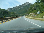
- Interstate 93Interstate 93Interstate 93 is an Interstate Highway in the New England section of the United States. Its southern terminus is in Canton, Massachusetts, in the Boston metropolitan area, at Interstate 95; its northern terminus is near St. Johnsbury, Vermont, at Interstate 91...
is a two-lane, divided parkway, or a super-two, through Franconia NotchFranconia NotchFranconia Notch is a major mountain pass through the White Mountains of New Hampshire. Dominated by Cannon Mountain, it lies principally within Franconia Notch State Park and is traversed by the Franconia Notch Parkway Franconia Notch (el. 1950 ft. / 590 m.) is a major mountain pass through...
in New HampshireNew HampshireNew Hampshire is a state in the New England region of the northeastern United States of America. The state was named after the southern English county of Hampshire. It is bordered by Massachusetts to the south, Vermont to the west, Maine and the Atlantic Ocean to the east, and the Canadian...
. A four-lane Interstate Highway was once proposed here, but the concept was abandoned because of environmental concerns, in part because of vibrations that could harm the Old Man of the MountainOld Man of the MountainThe Old Man of the Mountain, also known as the Great Stone Face or the Profile, was a series of five granite cliff ledges on Cannon Mountain in the White Mountains of New Hampshire, USA that, when viewed from the north, appeared to be the jagged profile of a face. The rock formation was above...
rock formation, prior to the formation's 2003 collapse. This section of highway was for many years marked as U.S. Route 3U.S. Route 3U.S. Route 3 is a north–south United States highway that runs from its southern terminus in Cambridge, Massachusetts through New Hampshire to its terminus near Third Connecticut Lake at the Canadian border, where the road continues north as Quebec Route 257.In New Hampshire parts of US 3 are...
and "To I-93", but these have now been replaced with regular Interstate 93 signs. The Federal Highway Act of 1973 exempts this stretch from the Interstate Highway standards that apply elsewhere, and this highway is considered to be I-93 for all practical purposes.
- The Thousand Islands BridgeThousand Islands BridgeThe Thousand Islands Bridge is an international bridge system over the Saint Lawrence River connecting northern New York in the United States with southeastern Ontario in Canada. Constructed in 1937, with additions in 1959, the bridges span the United States-Canada border in the middle of the...
, which carries Interstate 81Interstate 81Interstate 81 is an Interstate Highway in the eastern part of the United States. Its southern terminus is at Interstate 40 in Dandridge, Tennessee; its northern terminus is on Wellesley Island at the Canadian border, where the Thousand Islands Bridge connects it to Highway 401, the main freeway...
over part of the Saint Lawrence RiverSaint Lawrence RiverThe Saint Lawrence is a large river flowing approximately from southwest to northeast in the middle latitudes of North America, connecting the Great Lakes with the Atlantic Ocean. It is the primary drainage conveyor of the Great Lakes Basin...
, is an undivided road with one lane in each direction.
- The Murray Baker BridgeMurray Baker BridgeThe Murray Baker Bridge is a landmark cantilever bridge that carries Interstate 74 over the Illinois River from downtown Peoria to East Peoria in central Illinois...
, which carries Interstate 74Interstate 74Interstate 74 is an Interstate Highway in the Midwestern and Southeastern United States. Its western end is at an intersection with Interstate 80 in Davenport, Iowa; the eastern end of its Midwest segment is at an intersection with Interstate 75 in Cincinnati, Ohio...
over the Illinois RiverIllinois RiverThe Illinois River is a principal tributary of the Mississippi River, approximately long, in the State of Illinois. The river drains a large section of central Illinois, with a drainage basin of . This river was important among Native Americans and early French traders as the principal water route...
in Peoria, IllinoisIllinoisIllinois is the fifth-most populous state of the United States of America, and is often noted for being a microcosm of the entire country. With Chicago in the northeast, small industrial cities and great agricultural productivity in central and northern Illinois, and natural resources like coal,...
, has no shoulders, which makes it too narrow for Interstate standards. Trucks of all sizes, however, are permitted on this bridge.
- Interstate 35E in MinnesotaInterstate 35E (Minnesota)Interstate 35E is an Interstate Highway in the U.S. state of Minnesota, passing through downtown Saint Paul. It is one of two through routes for Interstate 35 through the Twin Cities of Minneapolis and Saint Paul, the other being Interstate 35W through Minneapolis. Thus, both ends of I-35E are...
travels along a narrow parkwayParkwayThe term parkway has several distinct principal meanings and numerous synonyms around the world, for either a type of landscaped area or a type of road.Type of landscaped area:...
for about 3.5 miles (5.6 km) from near downtown Saint Paul south to Minnesota State Highway 5Minnesota State Highway 5Minnesota State Highway 5 is a highway in Minnesota, which runs from its intersection with State Highways 19 and 22 in Gaylord and continues east and northeast to its eastern terminus at its interchange with State Highway 36 and Washington County Road 5 in Stillwater...
. Heavy trucks are forbidden from using this stretch, and the speed limitSpeed limitRoad speed limits are used in most countries to regulate the speed of road vehicles. Speed limits may define maximum , minimum or no speed limit and are normally indicated using a traffic sign...
is reduced to just 45 mph (20.1 m/s).
- Interstate 70Interstate 70Interstate 70 is an Interstate Highway in the United States that runs from Interstate 15 near Cove Fort, Utah, to a Park and Ride near Baltimore, Maryland. It was the first Interstate Highway project in the United States. I-70 approximately traces the path of U.S. Route 40 east of the Rocky...
is one-lane-only for through traffic for several thousand feet in Wheeling, West VirginiaWheeling, West VirginiaWheeling is a city in Ohio and Marshall counties in the U.S. state of West Virginia; it is the county seat of Ohio County. Wheeling is the principal city of the Wheeling Metropolitan Statistical Area...
, where the highway enters the Wheeling TunnelWheeling TunnelTwin tunnels form the Wheeling Tunnel in Wheeling, Ohio County, West Virginia. The tunnels are long, cutting though Wheeling Hill, and each carries two lanes of Interstate 70 and U.S. Route 250. The tunnels originally took three years to construct, costing $6.9 million...
and crosses the Ohio RiverOhio RiverThe Ohio River is the largest tributary, by volume, of the Mississippi River. At the confluence, the Ohio is even bigger than the Mississippi and, thus, is hydrologically the main stream of the whole river system, including the Allegheny River further upstream...
on the Fort Henry BridgeFort Henry BridgeThe Fort Henry Bridge is a crossing of the Ohio River main channel in Wheeling, West Virginia. The tied-arch bridge carries two lanes in each direction of Interstate 70 , U.S. Route 40 , and US 250. The bridge opened after four years of construction work on September 8, 1955, costing $6.8...
. Nearby I-470Interstate 470 (Ohio-West Virginia)Interstate 470 is a long loop of Interstate 70 bypassing the city of Wheeling, West Virginia. The western terminus of the freeway is at an interchange with I-70 near Blaine, Ohio. Traveling southeast through rural Belmont County, the highway approaches the Vietnam Veterans Memorial Bridge...
provides relief from this situation.
- Some stretches of Interstate highway use a barrier transfer machineBarrier transfer machineBarrier transfer machines, also known as zipper machines, are heavy vehicles used to transfer Jersey barriers or other concrete lane dividers used to relieve traffic congestion during rush hours....
on some bridges where it would be too costly to upgrade/rebuild to a higher-capacity bridge. In any case the traffic distribution is strongly asymmetric depending on the hour of the day. This kind of bridge typically contains undivided lanes without the flexible Jersey barrier that is manipulated by machines.
Movable bridges
By Interstate standard, all bridges on the Interstate system must be fixed as to not interrupt the flow of traffic. Several bridges on the system, however, are movable:- Interstate 5Interstate 5Interstate 5 is the main Interstate Highway on the West Coast of the United States, running largely parallel to the Pacific Ocean coastline from Canada to Mexico . It serves some of the largest cities on the U.S...
crosses the Columbia RiverColumbia RiverThe Columbia River is the largest river in the Pacific Northwest region of North America. The river rises in the Rocky Mountains of British Columbia, Canada, flows northwest and then south into the U.S. state of Washington, then turns west to form most of the border between Washington and the state...
from Portland, OregonPortland, OregonPortland is a city located in the Pacific Northwest, near the confluence of the Willamette and Columbia rivers in the U.S. state of Oregon. As of the 2010 Census, it had a population of 583,776, making it the 29th most populous city in the United States...
, to Vancouver, WashingtonVancouver, WashingtonVancouver is a city on the north bank of the Columbia River in the U.S. state of Washington. Incorporated in 1857, it is the fourth largest city in the state with a 2010 census population of 161,791 as of April 1, 2010...
, on the Interstate BridgeInterstate BridgeThe Interstate Bridge is a pair of nearly identical steel vertical-lift, through-truss bridges that carry Interstate 5 traffic over the Columbia River between Vancouver, Washington, and Portland, Oregon, in the United States...
, a vertical-lift bridge. There are plans in existence to replace this bridge with a high-level bridge over the river.
- Interstate 64Interstate 64Interstate 64 is an Interstate Highway in the Midwestern and Southeastern United States. Its western terminus is at I-70, U.S. 40, and U.S. 61 in Wentzville, Missouri. Its eastern terminus is at an interchange with I-264 and I-664 at Bowers Hill in Chesapeake, Virginia. As I-64 is concurrent with...
—the Hampton Roads BeltwayHampton Roads BeltwayThe Hampton Roads Beltway is a loop of Interstate 64 and Interstate 664, which links the communities of the Virginia Peninsula and South Hampton Roads which surround the body of water known as Hampton Roads and comprise much of the region of the same name in the southeastern portion of Virginia in...
—crosses the South Branch of the Elizabeth RiverElizabeth River (Virginia)The Elizabeth River is a tidal estuary forming an arm of Hampton Roads harbor at the southern end of Chesapeake Bay in southeast Virginia in the United States. It is located along the southern side of the mouth of the James River, between the cities of Portsmouth and Norfolk...
in Chesapeake, VirginiaChesapeake, VirginiaAs of the census of 2000, there were 199,184 people, 69,900 households, and 54,172 families residing in the city. The population density was 584.6 people per square mile . There were 72,672 housing units at an average density of 213.3 per square mile...
, on the High Rise BridgeHigh Rise BridgeHigh Rise Bridge is a bascule drawbridge which carries a portion of the Hampton Roads Beltway designated as Interstate 64 across the Southern Branch of the Elizabeth River in Chesapeake, Virginia....
, which is a drawbridge. This is a segment of I-64 that happens to not have any East and West signs posted on it, because of the highway's bending to a configuration that is opposite from its original compass direction.
- Interstate 95Interstate 95Interstate 95 is the main highway on the East Coast of the United States, running parallel to the Atlantic Ocean from Maine to Florida and serving some of the most populated urban areas in the country, including Boston, Providence, New Haven, New York City, Newark, Philadelphia, Baltimore,...
and Interstate 495Interstate 495 (Capital Beltway)Interstate 495 is a Interstate Highway that surrounds the United States' capital of Washington, D.C., and its inner suburbs in adjacent Maryland and Virginia. I-495 is widely known as the Capital Beltway or simply the Beltway, especially when the context of Washington, D.C., is clear...
pass together as the Capital Beltway over the Potomac RiverPotomac RiverThe Potomac River flows into the Chesapeake Bay, located along the mid-Atlantic coast of the United States. The river is approximately long, with a drainage area of about 14,700 square miles...
on the Woodrow Wilson BridgeWoodrow Wilson BridgeThe Woodrow Wilson Memorial Bridge is a bascule bridge that spans the Potomac River between the independent city of Alexandria, Virginia and Oxon Hill in Prince George's County, Maryland, United States. While over the water near the Virginia shore, it crosses the southern tip of the District of...
, a double-leaf bascule span. Even though the original bridge was replaced in the 2000s, the new bridge also has a draw span, albeit with more vertical clearance resulting in fewer openings than the old bridge — about 65 per annum, an average of about one every six days.
- Interstate 110Interstate 110 (Mississippi)Interstate 110 is a freeway spur route in Biloxi, running south from Interstate 10 to U.S. Route 90. It is one of very few places on the Interstate Highway System utilizing a drawbridge. The southbound control city is Biloxi, with a series of bridges out over the Gulf of Mexico at the southern...
has a drawbridge across the Back Bay of Biloxi in Biloxi, MississippiBiloxi, MississippiBiloxi is a city in Harrison County, Mississippi, in the United States. The 2010 census recorded the population as 44,054. Along with Gulfport, Biloxi is a county seat of Harrison County....
.
- Interstate 264Interstate 264 (Virginia)Interstate 264 is an Interstate Highway in the U.S. state of Virginia. It runs from a junction with Interstate 64 and Interstate 664 near Bowers Hill in Chesapeake east into Portsmouth and through the Downtown Tunnel under the South Branch of the Elizabeth River into Norfolk...
has a drawbridge, the Berkley BridgeBerkley Bridge (Virginia)The Berkley Bridge is a double-leaf bascule bridge across the Eastern Branch of the Elizabeth River in Norfolk, Virginia, United States. It carries Interstate 264, U.S. Route 460 Alternate, and State Route 337 across the river, connecting the Berkley neighborhood south of the river with downtown...
, crossing the Elizabeth RiverElizabeth River (Virginia)The Elizabeth River is a tidal estuary forming an arm of Hampton Roads harbor at the southern end of Chesapeake Bay in southeast Virginia in the United States. It is located along the southern side of the mouth of the James River, between the cities of Portsmouth and Norfolk...
in Norfolk, VirginiaNorfolk, VirginiaNorfolk is an independent city in the Commonwealth of Virginia in the United States. With a population of 242,803 as of the 2010 Census, it is Virginia's second-largest city behind neighboring Virginia Beach....
.
- Interstate 278Interstate 278Interstate 278 is an auxiliary Interstate Highway in New Jersey and New York, United States. The road runs from U.S. Route 1/9 in Linden, New Jersey to the Bruckner Interchange in the New York City borough of the Bronx...
has a drawbridge across the Bronx RiverBronx RiverThe Bronx River, approximately long, flows through southeast New York in the United States. It is named after colonial settler Jonas Bronck. The Bronx River is the only fresh water river in New York City....
in New York CityNew York CityNew York is the most populous city in the United States and the center of the New York Metropolitan Area, one of the most populous metropolitan areas in the world. New York exerts a significant impact upon global commerce, finance, media, art, fashion, research, technology, education, and...
.
- Interstate 280 (New Jersey)Interstate 280 (New Jersey)Interstate 280 is a Interstate Highway in the U.S. state of New Jersey. It provides a spur from I-80 in Parsippany-Troy Hills, Morris County to Newark, and I-95 Interstate 280 (abbreviated I-280) is a Interstate Highway in the U.S. state of New Jersey. It provides a spur from I-80 in...
has a drawbridge, the Stickel Memorial Bridge, crossing over the Passaic RiverPassaic RiverThe Passaic River is a mature surface river, approximately 80 mi long, in northern New Jersey in the United States. The river in its upper course flows in a highly circuitous route, meandering through the swamp lowlands between the ridge hills of rural and suburban northern New Jersey,...
between NewarkNewark, New JerseyNewark is the largest city in the American state of New Jersey, and the seat of Essex County. As of the 2010 United States Census, Newark had a population of 277,140, maintaining its status as the largest municipality in New Jersey. It is the 68th largest city in the U.S...
and Harrison, New JerseyHarrison, New JerseyHarrison is a town in Hudson County, New Jersey, United States. As of the 2010 United States Census, the town's population was 13,620. The town is a suburb of the nearby city of Newark, New Jersey.-Geography:Harrison is located at ....
.
- Interstate 695Interstate 695 (Maryland)Interstate 695 is a -long full beltway Interstate Highway extending around Baltimore, Maryland, USA. I-695 is officially designated the McKeldin Beltway, but is colloquially referred to as either the Baltimore Beltway or 695...
has a drawbridge over Curtis CreekCurtis CreekCurtis Creek is a tidal creek located in Baltimore City and Anne Arundel County, Maryland. It is a tributary of Curtis Bay. The creek begins at the confluence of Furnace Creek and Marley Creek and flows north about to Curtis Bay.-External links:**...
, south of BaltimoreBaltimoreBaltimore is the largest independent city in the United States and the largest city and cultural center of the US state of Maryland. The city is located in central Maryland along the tidal portion of the Patapsco River, an arm of the Chesapeake Bay. Baltimore is sometimes referred to as Baltimore...
and just west of the Francis Scott Key BridgeFrancis Scott Key Bridge (Baltimore)The Francis Scott Key Bridge, also known as the Outer Harbor Bridge or simply the Key Bridge, is a continuous truss bridge spanning the Patapsco River in Baltimore, Maryland, USA. The main span of is the third longest span of any continuous truss in the world.The bridge was opened in March 1977...
. However, this section of the Baltimore Beltway is not part of the Interstate Highway System, and is officially Maryland Route 695 despite the Interstate signage on the highway.
Other movable bridges on the Interstate System have been replaced after spending many years as part of the system. These include:
- Interstate 280 (Ohio)Interstate 280 (Ohio)Interstate 280 is a 12.41-mile-long highway that connects I-75 in northeast Toledo, Ohio with I-80/I-90 southeast of the city in northeastern Wood County, Ohio....
formerly had a drawbridge, the Craig Bridge, in Toledo, OhioToledo, OhioToledo is the fourth most populous city in the U.S. state of Ohio and is the county seat of Lucas County. Toledo is in northwest Ohio, on the western end of Lake Erie, and borders the State of Michigan...
. The fixed-span Veterans' Glass City Skyway replaced the drawbridge on the Interstate Highway in 2007.
- Interstate 75 (Michigan) had a bascule bridgeBascule bridgeA bascule bridge is a moveable bridge with a counterweight that continuously balances the span, or "leaf," throughout the entire upward swing in providing clearance for boat traffic....
from 1960 to 1988 at ZilwaukeeZilwaukee, MichiganZilwaukee is a city in Saginaw County in the U.S. state of Michigan. The population was 1,799 at the 2000 census. The 2009 Census Bureau estimate places the population at 1,640. The city is adjacent to and was created from Zilwaukee Township...
, just north of SaginawSaginaw, MichiganSaginaw is a city in the U.S. state of Michigan and the seat of Saginaw County. The city of Saginaw was once a thriving lumber town and manufacturing center. Saginaw and Saginaw County lie in the Flint/Tri-Cities region of Michigan...
; the high-level Zilwaukee BridgeZilwaukee BridgeThe Zilwaukee Bridge is a high-level, segmental concrete bridge spanning the Saginaw River in Zilwaukee, Michigan, approximately north of Saginaw, Michigan, United States. The current eight-lane structure, completed in 1988, is the second such bridge at this location, replacing a four-lane bascule...
replaced it on December 23, 1987, for northbound traffic, and on September 19, 1988, for southbound traffic. Interstate 675Interstate 675 (Michigan)Interstate 675 is an Interstate Highway in the US state of Michigan. I-675 is a loop route through downtown Saginaw as I-75 passes on the east side of the city....
was built as an in-town bypass of the bascule bridge prior to the construction of the tall Zilwaukee bridge. Since the completion of the tall Zilwaukee bridge in 1987, I-675 has had less traffic than its capacity; though it is a feasible detour for bridge, or other maintenance between both ends of the loop.
Connection gaps
Auxiliary Interstates (also known as 3-digit Interstates) are intended to connect to their parent either directly or via a same-parented Interstate (like I-280Interstate 280 (California)
Interstate 280 is a 57-mile long north–south Interstate Highway in the San Francisco Bay Area of Northern California. It connects San Jose and San Francisco, running along just to the west of the cities of San Francisco Peninsula for most of its route.I-280 from its northern end at King...
in California being connected to I-80
Interstate 80
Interstate 80 is the second-longest Interstate Highway in the United States, following Interstate 90. It is a transcontinental artery running from downtown San Francisco, California to Teaneck, New Jersey in the New York City Metropolitan Area...
via I-680
Interstate 680 (California)
Interstate 680 is a north–south Interstate Highway in Northern California. It curves around the eastern cities of the San Francisco Bay Area from San Jose to Interstate 80 at Cordelia, bypassing cities along the eastern shore of San Francisco Bay such as Oakland and Richmond while serving...
). Often, these connection gaps occur to eliminate concurrencies between other 3-digit routes.
- Interstate 210 in CaliforniaInterstate 210 and State Route 210 (California)Interstate 210 and State Route 210 together form a contiguous highway, called the Foothill Freeway, in the Greater Los Angeles area of the U.S. state of California. The western portion of the route is an auxiliary Interstate Highway, while the eastern portion is a state highway...
does not connect directly to Interstate 10Interstate 10Interstate 10 is the fourth-longest Interstate Highway in the United States, after I-90, I-80, and I-40. It is the southernmost east–west, coast-to-coast Interstate Highway, although I-4 and I-8 are further south. It stretches from the Pacific Ocean at State Route 1 in Santa Monica,...
, although I-210 is continuous with California State Route 210, which does connect to I-10, and California is petitioning to have that portion signed as Interstate 210 also. When that happens, this gap will disappear. I-210 does not connect to any of the spurs of I-10, with the exception of a short, unsigned, unfinished section of Interstate 710Interstate 710Interstate 710 is a major north–south interstate freeway running for 23 miles through Los Angeles County, California...
which connects to State Route 110 only via surface streets. - None of the spurs of I-78Interstate 78Interstate 78 is an Interstate Highway in the Northeast United States, running 144 miles from Interstate 81 northeast of Harrisburg, Pennsylvania, through Allentown, Pennsylvania, and western and northern New Jersey to the Holland Tunnel and Lower Manhattan in New York City.I-78 is a major road...
(I-278Interstate 278Interstate 278 is an auxiliary Interstate Highway in New Jersey and New York, United States. The road runs from U.S. Route 1/9 in Linden, New Jersey to the Bruckner Interchange in the New York City borough of the Bronx...
, I-478, I-678Interstate 678Interstate 678 is a north–south auxiliary Interstate Highway that extends for through two boroughs of New York City. The route begins at John F. Kennedy International Airport on Jamaica Bay and travels north through Queens and across the East River to the Bronx, where it ends at...
, I-878) connect to its parent. I-78 was planned to extend through New York CityNew York CityNew York is the most populous city in the United States and the center of the New York Metropolitan Area, one of the most populous metropolitan areas in the world. New York exerts a significant impact upon global commerce, finance, media, art, fashion, research, technology, education, and...
and end as two branches, where I-295Interstate 295 (New York)Interstate 295 is a connector route within New York City. Measuring 9.10 miles in length, I-295 travels from the Bruckner Interchange, a junction with I-95/I-278/I-678 in The Bronx, across the toll Throgs Neck Bridge to the Grand Central Parkway in Queens...
and I-695Interstate 695 (New York)Interstate 695 is an auxiliary Interstate Highway in the New York City borough of the Bronx. It serves as a connector between I-95 and I-295 near the Throgs Neck Bridge towards Queens and Long Island...
now end at I-95Interstate 95 in New YorkInterstate 95 is a part of the Interstate Highway System that runs from Miami, Florida, to the Canada – United States border near Houlton, Maine. In the U.S. state of New York, I-95 extends from the George Washington Bridge in New York City to the Connecticut state line at Port Chester...
. I-478 comes the closest, and would have intersected if the Westway project were not canceled; I-278, the only I-78 spur to leave New York CityNew York CityNew York is the most populous city in the United States and the center of the New York Metropolitan Area, one of the most populous metropolitan areas in the world. New York exerts a significant impact upon global commerce, finance, media, art, fashion, research, technology, education, and...
, was planned to extend northwest to I-78 at Route 24Route 24 (New Jersey)Route 24 is a state highway in New Jersey, United States, that extends from a junction with Interstate 287 in Hanover Township in Morris County, passing southeast through Essex County, and ends at a junction with Interstate 78 in Springfield Township in Union County. The route is a four- to...
. Since all the spurs are interconnected, only one of them needs to be eventually connected to its parent route for all of them to conform to standards. - Freeway gaps (signed or unsigned) that officially connect auxiliary routes to the parent are excluded.
- I-585Interstate 585Interstate 585 stretches from Interstate 85 to Spartanburg, South Carolina. I-585 is co-signed the entire length with U.S. Highway 176 and it uses US 176's exit number system instead of its own. Between exits 23 and 25B the road is a freeway but has substandard or no shoulders. To the south of...
used to connect with I-85Interstate 85Interstate 85 is a major interstate highway in the Southeastern United States. Its current southern terminus is at an interchange with Interstate 65 in Montgomery, Alabama; its northern terminus interchanges with Interstate 95 in Petersburg, Virginia, near Richmond...
in Spartanburg, South CarolinaSpartanburg, South CarolinathgSpartanburg is the largest city in and the county seat of Spartanburg County, South Carolina, United States. It is the second-largest city of the three primary cities in the Upstate region of South Carolina, and is located northwest of Columbia, west of Charlotte, and about northeast of...
, but I-85 was moved to a new bypassing route, and now I-585 ends at the I-85 Business loopInterstate 85 Business (Spartanburg, South Carolina)Interstate 85 Business is a Business Loop of the Interstate Highway System and a freeway, running along the old route of Interstate 85 through Spartanburg, South Carolina, United States...
. The signed connection to I-85 is via a surface section of US 176.
Instances of triple digit designations that cross state lines when they connect to the Interstate in the neighboring state but do not reconnect in that state are excluded from this list. But there are even instances of triple-digit interstates that cross state borders into states where their parent does not even exist. However, Interstate 238
Interstate 238
Interstate 238 is a short auxiliary route of the Interstate Highway System in the San Francisco Bay Area, California, United States. Part of State Route 238 until 1983, and still considered the same route by the California Department of Transportation , it connects Interstate 580 in Castro Valley...
in the San Francisco
San Francisco, California
San Francisco , officially the City and County of San Francisco, is the financial, cultural, and transportation center of the San Francisco Bay Area, a region of 7.15 million people which includes San Jose and Oakland...
area is an example of a triple-digit Interstate whose parent doesn't exist at all, on a side note: Every I-x80 designation in the San Francisco area was taken at the time I-238 was commissioned, in which an instance of a California state route with an x80 designation eliminated a candidate for a 3-digit Interstate designation as California law prohibits state highways from having common numbers with co-existing US and Interstate highways.
Examples of these connection gaps are subject to dispute with unofficial, unsigned concurrencies with other routes to the parent.
Other gaps
- In four cases — I-76, I-84, I-86 and I-88 — the same primary interstate route number is used on two separate, unconnected lengths of roadway, one in the eastern portion of the country and one in the western portion. These gaps are intentional — the two segments of roadway are not planned to be linked together.