

List of Northern Cordilleran volcanoes
Encyclopedia
Geography
Geography is the science that studies the lands, features, inhabitants, and phenomena of Earth. A literal translation would be "to describe or write about the Earth". The first person to use the word "geography" was Eratosthenes...
of northwestern British Columbia
British Columbia
British Columbia is the westernmost of Canada's provinces and is known for its natural beauty, as reflected in its Latin motto, Splendor sine occasu . Its name was chosen by Queen Victoria in 1858...
and Yukon
Yukon
Yukon is the westernmost and smallest of Canada's three federal territories. It was named after the Yukon River. The word Yukon means "Great River" in Gwich’in....
, Canada
Canada
Canada is a North American country consisting of ten provinces and three territories. Located in the northern part of the continent, it extends from the Atlantic Ocean in the east to the Pacific Ocean in the west, and northward into the Arctic Ocean...
is dominated by volcano
Volcano
2. Bedrock3. Conduit 4. Base5. Sill6. Dike7. Layers of ash emitted by the volcano8. Flank| 9. Layers of lava emitted by the volcano10. Throat11. Parasitic cone12. Lava flow13. Vent14. Crater15...
es of the Northern Cordilleran Volcanic Province
Northern Cordilleran volcanic province
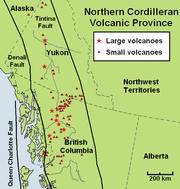
The Northern Cordilleran Volcanic Province , formerly known as the Stikine Volcanic Belt, is a geologic province defined by the occurrence of Miocene to Holocene volcanoes in the Pacific Northwest of North America...
formed due to continental rift
Rift
In geology, a rift or chasm is a place where the Earth's crust and lithosphere are being pulled apart and is an example of extensional tectonics....
ing of the North American Plate
North American Plate
The North American Plate is a tectonic plate covering most of North America, Greenland, Cuba, Bahamas, and parts of Siberia, Japan and Iceland. It extends eastward to the Mid-Atlantic Ridge and westward to the Chersky Range in eastern Siberia. The plate includes both continental and oceanic crust...
. It is the most active volcanic region in Canada. Some of the volcanoes are notable for their eruptions, for instance, Tseax Cone
Tseax Cone
The Tseax Cone , also called the Tseax River Cone or alternately the Aiyansh Volcano, is a young cinder cone and adjacent lava flows associated with the Nass Ranges and the Northern Cordilleran Volcanic Province...
for its catastrophic eruption estimated to have occurred in the 18th century which was responsible for the death of at least 2,000 Nisga'a
Nisga'a
The Nisga’a , often formerly spelled Nishga and spelled in the Nisga’a language as Nisga’a, are an Indigenous nation or First Nation in Canada. They live in the Nass River valley of northwestern British Columbia. Their name comes from a combination of two Nisga’a words: Nisk’-"top lip" and...
people from poisonous volcanic gas
Volcanic gas
|250px|thumb|right|Image of the [[rhyolitic]] [[lava dome]] of [[Chaitén Volcano]] during its 2008-2010 eruption.Volcanic gases include a variety of substances given off by active volcanoes...
es, the Mount Edziza volcanic complex
Mount Edziza volcanic complex
The Mount Edziza volcanic complex is a large and potentially active north-south trending complex volcano in Stikine Country, northwestern British Columbia, Canada, located southeast of the small community of Telegraph Creek...
for at least 20 eruptions throughout the past 10,000 years, and The Volcano
The Volcano (British Columbia)
The Volcano, also known as Lava Fork volcano, is a small cinder cone in the Boundary Ranges of the Coast Mountains in northwestern British Columbia, Canada. It is located approximately northwest of the small community of Stewart near the head of Lava Fork...
(also known as Lava Fork
Lava Fork
Lava Fork is a creek in northwestern British Columbia, Canada and of the Alaska Panhandle, United States. It lies west of the Unuk River and northwest of Stewart...
volcano) for the most recent eruption in Canada during 1904. The majority of volcanoes in the Northern Cordilleran Volcanic Province lie in Canada while a very small portion of the volcanic province lies in the U.S. state
U.S. state
A U.S. state is any one of the 50 federated states of the United States of America that share sovereignty with the federal government. Because of this shared sovereignty, an American is a citizen both of the federal entity and of his or her state of domicile. Four states use the official title of...
of Alaska
Alaska
Alaska is the largest state in the United States by area. It is situated in the northwest extremity of the North American continent, with Canada to the east, the Arctic Ocean to the north, and the Pacific Ocean to the west and south, with Russia further west across the Bering Strait...
.
Volcanoes of the Northern Cordilleran Volcanic Province are a part of the Pacific Ring of Fire
Pacific Ring of Fire
The Pacific Ring of Fire is an area where large numbers of earthquakes and volcanic eruptions occur in the basin of the Pacific Ocean. In a horseshoe shape, it is associated with a nearly continuous series of oceanic trenches, volcanic arcs, and volcanic belts and/or plate movements...
. The largest and most persistent volcanoes are the Mount Edziza volcanic complex and the Level Mountain Range
Level Mountain Range
The Level Mountain Range, also known as Level Mountain, is a mountain range in Cassiar Country, northwestern British Columbia, Canada, located just northeast of Callison Ranch, southwest of Dease Lake and about north of Mount Edziza. It consists of a massive shield volcano and lies on the Nahlin...
in northwestern British Columbia which have had volcanic activity for millions of years. In the past 7.5 million years, the Mount Edziza volcanic complex has had five phases of volcanic activity while the Level Mountain Range north of Edziza has had three phases of volcanic activity in the past 14.9 million years. The 1000 km² (386.1 sq mi) Mount Edziza volcanic complex has been made into a provincial park
Provincial park
A provincial park is a park under the management of a provincial or territorial government in Canada.While provincial parks are not the same as national parks, their workings are very similar...
since 1972 to protect its volcanic landscape. The 102 Northern Cordilleran volcanoes in the list below are grouped into their political regions in north-south order.
Scope
There is no single standard definition for a volcano. It can be defined from individual vents, volcanic edificies or volcanic fields. Interior of ancient volcanoes may have been eroded, creating a new subsurface magma chamberMagma chamber
A magma chamber is a large underground pool of molten rock found beneath the surface of the Earth. The molten rock in such a chamber is under great pressure, and given enough time, that pressure can gradually fracture the rock around it creating outlets for the magma...
as a separate volcano. Many contemporary volcanoes rise as young parasitic cones from flank vents or at a central crater
Volcanic crater
A volcanic crater is a circular depression in the ground caused by volcanic activity. It is typically a basin, circular in form within which occurs a vent from which magma erupts as gases, lava, and ejecta. A crater can be of large dimensions, and sometimes of great depth...
. Some volcanoes are grouped into one volcano name, for instance, the Mount Edziza volcanic complex, although individual vents are named by local people. The status of a volcano, either active, dormant or extinct, cannot be defined precisely. An indication of a volcano is determined by either its historical records, potassium-argon dating
Potassium-argon dating
Potassium–argon dating or K–Ar dating is a radiometric dating method used in geochronology and archeology. It is based on measurement of the product of the radioactive decay of an isotope of potassium into argon . Potassium is a common element found in many materials, such as micas, clay minerals,...
, radiocarbon dating
Radiocarbon dating
Radiocarbon dating is a radiometric dating method that uses the naturally occurring radioisotope carbon-14 to estimate the age of carbon-bearing materials up to about 58,000 to 62,000 years. Raw, i.e. uncalibrated, radiocarbon ages are usually reported in radiocarbon years "Before Present" ,...
, or geothermal activities.
The primary source of the list below is taken from the Geological Survey of Canada website, compiled by the Earth Sciences Sector of Natural Resources Canada
Natural Resources Canada
The Department of Natural Resources , operating under the FIP applied title Natural Resources Canada , is the ministry of the government of Canada responsible for natural resources, energy, minerals and metals, forests, earth sciences, mapping and remote sensing...
, in which Northern Cordilleran volcanoes in the past 66.4 million years are listed. The Geological Survey of Canada use a catalogue of volcanoes grouped by volcano fields, lava fields and mountain ranges. The Geological Survey of Canada list is the most complete list of volcanoes in the Northern Cordilleran Volcanic Province, but work of understanding the frequency and eruption characteristics at volcanoes in Canada is a slow process. This is because most of Canada's dormant and potentially active volcanoes are located in isolated jagged regions, very few scientists study Canadian volcanoes and the provision of money in the Canadian government is limited. Because of these issues, scientists that study Canada's volcanoes have a basic understanding of Canada's volcanic heritage and how it might impact people in the future. Therefore, instead of using the dates of recorded eruptions, the Geological Survey of Canada mostly uses geological epochs for estimating when a volcano last erupted. Geological epoches include the Cenozoic
Cenozoic
The Cenozoic era is the current and most recent of the three Phanerozoic geological eras and covers the period from 65.5 mya to the present. The era began in the wake of the Cretaceous–Tertiary extinction event at the end of the Cretaceous that saw the demise of the last non-avian dinosaurs and...
(66.4 million years ago to present) and its subdivisions Miocene
Miocene
The Miocene is a geological epoch of the Neogene Period and extends from about . The Miocene was named by Sir Charles Lyell. Its name comes from the Greek words and and means "less recent" because it has 18% fewer modern sea invertebrates than the Pliocene. The Miocene follows the Oligocene...
(23.7 to 5.3 million years ago), Pliocene
Pliocene
The Pliocene Epoch is the period in the geologic timescale that extends from 5.332 million to 2.588 million years before present. It is the second and youngest epoch of the Neogene Period in the Cenozoic Era. The Pliocene follows the Miocene Epoch and is followed by the Pleistocene Epoch...
(5.3 to 1.6 million years ago), Quaternary
Quaternary
The Quaternary Period is the most recent of the three periods of the Cenozoic Era in the geologic time scale of the ICS. It follows the Neogene Period, spanning 2.588 ± 0.005 million years ago to the present...
(1.6 million years ago to present), Pleistocene
Pleistocene
The Pleistocene is the epoch from 2,588,000 to 11,700 years BP that spans the world's recent period of repeated glaciations. The name pleistocene is derived from the Greek and ....
(1.6 to 0.01 million years ago) and Holocene
Holocene
The Holocene is a geological epoch which began at the end of the Pleistocene and continues to the present. The Holocene is part of the Quaternary period. Its name comes from the Greek words and , meaning "entirely recent"...
(0.01 million years ago to present).
Alaska
The northernmost portion of the Northern Cordilleran Volcanic Province extends just across the Alaska-Yukon border into the Southeast Fairbanks Census AreaSoutheast Fairbanks Census Area, Alaska
Southeast Fairbanks Census Area is a census area located in the state of Alaska, United States. As of the 2000 census, the population was 6,174. It is part of the unorganized borough and therefore has no borough seat...
of eastcentral Alaska. Here, a single cinder cone, dated at 177,000 years old occurs within the metamorphic
Metamorphic rock
Metamorphic rock is the transformation of an existing rock type, the protolith, in a process called metamorphism, which means "change in form". The protolith is subjected to heat and pressure causing profound physical and/or chemical change...
and granitic
Granite
Granite is a common and widely occurring type of intrusive, felsic, igneous rock. Granite usually has a medium- to coarse-grained texture. Occasionally some individual crystals are larger than the groundmass, in which case the texture is known as porphyritic. A granitic rock with a porphyritic...
composed upland of the Yukon-Tanana Terrane
Yukon-Tanana Terrane
The Yukon-Tanana Terrane is a tectonic terrane that extends from central Alaska through central Yukon and into northern British Columbia, Canada and Southeast Alaska, USA. Extending over 2000 km, the YTT is the largest tectonostratigraphic terrane in the northern North American Cordillera...
. Prindle Volcano is approximately 31 km (19 mi) west of the Alaska-Yukon border.
| Volcanoes | |||
| Name | Type | Last eruption | Location |
|---|---|---|---|
| Prindle Volcano | Cinder cone Cinder cone According to the , Cinder Cone is the proper name of 1 cinder cone in Canada and 7 cinder cones in the United States:In Canada: Cinder Cone In the United States:... |
Pleistocene Pleistocene The Pleistocene is the epoch from 2,588,000 to 11,700 years BP that spans the world's recent period of repeated glaciations. The name pleistocene is derived from the Greek and .... |
63.72°N 141.62°W |
Yukon
Yukon River
The Yukon River is a major watercourse of northwestern North America. The source of the river is located in British Columbia, Canada. The next portion lies in, and gives its name to Yukon Territory. The lower half of the river lies in the U.S. state of Alaska. The river is long and empties into...
and Pelly
Pelly River
The Pelly River is a river in Canada, and is a headstream of the Yukon River. The river originates west of the Mackenzie Mountains and flows 530 km long through the south central Yukon. The Pelly has two main tributaries, the Ross and Macmillan rivers.The river was named by Robert Campbell in...
rivers in central Yukon lies the Fort Selkirk Volcanic Field
Fort Selkirk Volcanic Field
The Fort Selkirk volcanic field is a monogenetic volcanic field in the Northern Cordilleran Volcanic Province, Yukon Territory, Canada. It is the northernmost Holocene age volcanic field in Canada, located close to the connection of the Yukon and Pelly rivers. The youngest eruptions within the...
. It is the northernmost Holocene age volcanic field in Canada, consisting of a sequence of valley-filling basalt
Basalt
Basalt is a common extrusive volcanic rock. It is usually grey to black and fine-grained due to rapid cooling of lava at the surface of a planet. It may be porphyritic containing larger crystals in a fine matrix, or vesicular, or frothy scoria. Unweathered basalt is black or grey...
and basanite
Basanite
Basanite is an igneous, volcanic rock with aphanitic to porphyritic texture.The mineral assembly is usually abundant feldspathoids , plagioclase, and augite, together with olivine and lesser iron-titanium oxides such as ilmenite and magnetite-ulvospinel; minor alkali feldspar may be present, as...
lava flows. Further south near the capital city of Whitehorse
Whitehorse, Yukon
Whitehorse is Yukon's capital and largest city . It was incorporated in 1950 and is located at kilometre 1476 on the Alaska Highway in southern Yukon. Whitehorse's downtown and Riverdale areas occupy both shores of the Yukon River, which originates in British Columbia and meets the Bering Sea in...
, a group of volcanoes and lava flows were constructed near Alligator Lake
Alligator Lake, Yukon
The Alligator Lake is an alpine lake near Whitehorse in southern Yukon. The Alligator Lake Volcanic Complex in its neighbourhood is named after it....
possibly in the past 10,000 years.
| Volcanoes | |||
| Name | Type | Last eruption | Location |
|---|---|---|---|
| Volcano Mountain Volcano Mountain Volcano Mountain is an active cinder cone in central Yukon Territory, Canada, located a short distance north of Fort Selkirk, near the confluence of the Pelly and Yukon Rivers... |
Cinder cone Cinder cone According to the , Cinder Cone is the proper name of 1 cinder cone in Canada and 7 cinder cones in the United States:In Canada: Cinder Cone In the United States:... |
Holocene Holocene The Holocene is a geological epoch which began at the end of the Pleistocene and continues to the present. The Holocene is part of the Quaternary period. Its name comes from the Greek words and , meaning "entirely recent"... |
62.93°N 137.37°W |
| Fort Selkirk Vent Fort Selkirk Vent Fort Selkirk Vent is a geological name for a cinder cone in central Yukon, Canada, located just east of Fort Selkirk along the Yukon River.Fort Selkirk Vent and the surrounding landscape lies in the Fort Selkirk Volcanic Field of the Northern Cordilleran Volcanic Province. During the Pleistocene... |
Cinder cone Cinder cone According to the , Cinder Cone is the proper name of 1 cinder cone in Canada and 7 cinder cones in the United States:In Canada: Cinder Cone In the United States:... |
Pleistocene Pleistocene The Pleistocene is the epoch from 2,588,000 to 11,700 years BP that spans the world's recent period of repeated glaciations. The name pleistocene is derived from the Greek and .... |
62.77°N 137.42°W |
| Ne Ch'e Ddhawa Ne Ch'e Ddhawa Ne Ch'e Ddhawa is a cinder cone, located 7 km upstream from Fort Selkirk in the Fort Selkirk Volcanic Field, Yukon, Canada. The volcano erupted subglacially during the late Pleistocene, erupting hyaloclastite tuffs, breccias, and pillow breccias.-See also:*Volcanism of Canada*List of Northern... |
Cinder cone Cinder cone According to the , Cinder Cone is the proper name of 1 cinder cone in Canada and 7 cinder cones in the United States:In Canada: Cinder Cone In the United States:... |
Pleistocene Pleistocene The Pleistocene is the epoch from 2,588,000 to 11,700 years BP that spans the world's recent period of repeated glaciations. The name pleistocene is derived from the Greek and .... |
62.47°N 137.24°W |
| Ibex Mountain Ibex Mountain Ibex Mountain is a young cinder cone in the Yukon Territory, Canada, located 33 km southwest of Whitehorse and 12 km southeast of Mount Arkell. It is in a group of basaltic cones and lava flows called Alligator Lake and is in the Northern Cordilleran Volcanic Province. It is believed Ibex... |
Cinder cone Cinder cone According to the , Cinder Cone is the proper name of 1 cinder cone in Canada and 7 cinder cones in the United States:In Canada: Cinder Cone In the United States:... |
Pleistocene Pleistocene The Pleistocene is the epoch from 2,588,000 to 11,700 years BP that spans the world's recent period of repeated glaciations. The name pleistocene is derived from the Greek and .... |
60.53°N 135.52°W |
| Watson Lake Cone Watson Lake Cone Watson Lake Cone is a cinder cone in southern Yukon, Canada, located near the British Columbia-Yukon border. It formed and last erupted during the Pleistocene period and is part of the Northern Cordilleran Volcanic Province.-See also:... |
Cinder cone Cinder cone According to the , Cinder Cone is the proper name of 1 cinder cone in Canada and 7 cinder cones in the United States:In Canada: Cinder Cone In the United States:... |
Pleistocene Pleistocene The Pleistocene is the epoch from 2,588,000 to 11,700 years BP that spans the world's recent period of repeated glaciations. The name pleistocene is derived from the Greek and .... |
60.00°N 129.00°W |
| Erupted products | |||
| Name | Type | Age | Location |
| Clinton Creek Clinton Creek, Yukon Clinton Creek was a company-owned and -operated asbestos mining town in the western Yukon near the confluence of the Yukon and Fortymile Rivers... |
Lava flow | Pliocene Pliocene The Pliocene Epoch is the period in the geologic timescale that extends from 5.332 million to 2.588 million years before present. It is the second and youngest epoch of the Neogene Period in the Cenozoic Era. The Pliocene follows the Miocene Epoch and is followed by the Pleistocene Epoch... |
64.40°N 140.63°W |
| Forty Mile | Unknown | Miocene Miocene The Miocene is a geological epoch of the Neogene Period and extends from about . The Miocene was named by Sir Charles Lyell. Its name comes from the Greek words and and means "less recent" because it has 18% fewer modern sea invertebrates than the Pliocene. The Miocene follows the Oligocene... |
64.38°N 140.5°W |
| Moose Creek Moose Creek (Yukon) Moose Creek is a creek in western Yukon, Canada.The landscape surrounding Moose Creek lies in the Northern Cordilleran Volcanic Province. During the Cenozoic era, volcanic activity engulfed the Moose Creek area... |
Unknown | Cenozoic Cenozoic The Cenozoic era is the current and most recent of the three Phanerozoic geological eras and covers the period from 65.5 mya to the present. The era began in the wake of the Cretaceous–Tertiary extinction event at the end of the Cretaceous that saw the demise of the last non-avian dinosaurs and... |
64.16°N 140.91°W |
| Sixty Mile Sixty Mile Sixty Mile is the name of a mining property in western Yukon, Canada.At Sixty Mile, Miocene age volcanics are present. However, the type of volcanic landform these volcanics represent is unknown.... |
Unknown | Miocene Miocene The Miocene is a geological epoch of the Neogene Period and extends from about . The Miocene was named by Sir Charles Lyell. Its name comes from the Greek words and and means "less recent" because it has 18% fewer modern sea invertebrates than the Pliocene. The Miocene follows the Oligocene... |
64.05°N 140.74°W |
| Rosebud Creek Rosebud Creek (Yukon) Rosebud Creek is a creek in eastcentral Yukon, Canada.The landscape surrounding Rosebud Creek lies in the Fort Selkirk Volcanic Field of the Northern Cordilleran Volcanic Province. During the Pliocene period, a basaltic lava flow from the Fort Selkirk field engulfed the Rosebud Creek area... |
Lava flow | Pliocene Pliocene The Pliocene Epoch is the period in the geologic timescale that extends from 5.332 million to 2.588 million years before present. It is the second and youngest epoch of the Neogene Period in the Cenozoic Era. The Pliocene follows the Miocene Epoch and is followed by the Pleistocene Epoch... |
63.25°N 138.24°W |
| Yukon River Yukon River The Yukon River is a major watercourse of northwestern North America. The source of the river is located in British Columbia, Canada. The next portion lies in, and gives its name to Yukon Territory. The lower half of the river lies in the U.S. state of Alaska. The river is long and empties into... |
Lava flow | Pleistocene Pleistocene The Pleistocene is the epoch from 2,588,000 to 11,700 years BP that spans the world's recent period of repeated glaciations. The name pleistocene is derived from the Greek and .... |
62.83°N 137.7°W |
| Holbrook Creek Holbrook Creek Holbrook Creek is a creek in eastcentral Yukon, Canada.The landscape surrounding Holbrook Creek lies in the Fort Selkirk Volcanic Field of the Northern Cordilleran Volcanic Province. During the Pleistocene period, a basaltic lava flow from the Fort Selkirk field engulfed the mouth of the Holbrook... |
Lava flow | Pleistocene Pleistocene The Pleistocene is the epoch from 2,588,000 to 11,700 years BP that spans the world's recent period of repeated glaciations. The name pleistocene is derived from the Greek and .... |
62.80°N 137.98°W |
| Mushroom | Lava flow | Pliocene Pliocene The Pliocene Epoch is the period in the geologic timescale that extends from 5.332 million to 2.588 million years before present. It is the second and youngest epoch of the Neogene Period in the Cenozoic Era. The Pliocene follows the Miocene Epoch and is followed by the Pleistocene Epoch... |
62.80°N 137.45°W |
| Pelly Formation Pelly Formation The Pelly Formation is a lava flow in the Yukon Territory, Canada. It was erupted during the Pleistocene and is in the Volcano Mountain area in the northern portion of the Northern Cordilleran Volcanic Province.-See also:*List of volcanoes in Canada... |
Lava flow | Pleistocene Pleistocene The Pleistocene is the epoch from 2,588,000 to 11,700 years BP that spans the world's recent period of repeated glaciations. The name pleistocene is derived from the Greek and .... |
62.80°N 137.5°W |
| Wolverine Formation Wolverine Formation The Wolverine Formation is a geological formation in central Yukon, Canada. It consists of a lava flow in the Fort Selkirk Volcanic Field of the Northern Cordilleran Volcanic Province that was erupted during the Pleistocene period.-See also:... |
Lava flow | Pleistocene Pleistocene The Pleistocene is the epoch from 2,588,000 to 11,700 years BP that spans the world's recent period of repeated glaciations. The name pleistocene is derived from the Greek and .... |
62.70°N 137.4°W |
| Minto Minto (lava flow) The Minto is the name of a lava flow located in Yukon that was erupted during the Holocene period in the Fort Selkirk Volcanic Field of the Northern Cordilleran Volcanic Province.-See also:*List of volcanoes in Canada*List of Northern Cordilleran volcanoes... |
Lava flow | Holocene Holocene The Holocene is a geological epoch which began at the end of the Pleistocene and continues to the present. The Holocene is part of the Quaternary period. Its name comes from the Greek words and , meaning "entirely recent"... |
62.60°N 137.2°W |
| Miles Canyon Basalts Miles Canyon Basalts The Miles Canyon Basalts is a cluster of basaltic lava flows and cones in south-central Yukon. The lava flows are in the Alligator Lake volcanic complex close to Whitehorse and were thought to be Pleistocene age.-See also:*Volcanism in Canada... |
Lava flow | Miocene Miocene The Miocene is a geological epoch of the Neogene Period and extends from about . The Miocene was named by Sir Charles Lyell. Its name comes from the Greek words and and means "less recent" because it has 18% fewer modern sea invertebrates than the Pliocene. The Miocene follows the Oligocene... |
60.40°N 135.00°W |
British Columbia
Over half of the Northern Cordilleran volcanoes are located in northwestern British Columbia. This portion is where the most recent eruptions in Canada and of the Northern Cordilleran Volcanic Province have occurred, including the catastrophic 18th century eruption of Tseax ConeTseax Cone
The Tseax Cone , also called the Tseax River Cone or alternately the Aiyansh Volcano, is a young cinder cone and adjacent lava flows associated with the Nass Ranges and the Northern Cordilleran Volcanic Province...
and the 1904 eruption of The Volcano
The Volcano (British Columbia)
The Volcano, also known as Lava Fork volcano, is a small cinder cone in the Boundary Ranges of the Coast Mountains in northwestern British Columbia, Canada. It is located approximately northwest of the small community of Stewart near the head of Lava Fork...
.
The Northern Cordilleran volcanoes of British Columbia comprises shield volcano
Shield volcano
A shield volcano is a type of volcano usually built almost entirely of fluid lava flows. They are named for their large size and low profile, resembling a warrior's shield. This is caused by the highly fluid lava they erupt, which travels farther than lava erupted from more explosive volcanoes...
es, stratovolcano
Stratovolcano
A stratovolcano, also known as a composite volcano, is a tall, conical volcano built up by many layers of hardened lava, tephra, pumice, and volcanic ash. Unlike shield volcanoes, stratovolcanoes are characterized by a steep profile and periodic, explosive eruptions...
es, subglacial volcano
Subglacial volcano
A subglacial volcano, also known as a glaciovolcano, is a volcanic form produced by subglacial eruptions or eruptions beneath the surface of a glacier or ice sheet which is then melted into a lake by the rising lava...
es, lava dome
Lava dome
|250px|thumb|right|Image of the [[rhyolitic]] lava dome of [[Chaitén Volcano]] during its 2008–2009 eruption.In volcanology, a lava dome is a roughly circular mound-shaped protrusion resulting from the slow extrusion of viscous lava from a volcano...
s and a large number of small cinder cone
Cinder cone
According to the , Cinder Cone is the proper name of 1 cinder cone in Canada and 7 cinder cones in the United States:In Canada: Cinder Cone In the United States:...
s and associated lava plains. The Northern Cordilleran volcanoes of northwestern British Columbia are disposed along short, northerly trending segments which are unmistakably involved with north-trending rift structures including synvolcanic graben
Graben
In geology, a graben is a depressed block of land bordered by parallel faults. Graben is German for ditch. Graben is used for both the singular and plural....
s and grabens with one major fault line along only one of the boundaries (half-grabens) similar to those associated with the East African Rift
East African Rift
The East African Rift is an active continental rift zone in eastern Africa that appears to be a developing divergent tectonic plate boundary. It is part of the larger Great Rift Valley. The rift is a narrow zone in which the African Plate is in the process of splitting into two new tectonic plates...
, which extends from the Afar Triple Junction
Afar Triple Junction
The Afar Triple Junction is a junction of three tectonic rifts centered in the Afar Depression, informally known as the Afar Triangle, of northeastern Africa. Here, the Red Sea Rift meets the Aden Ridge and the East African Rift...
southward across eastern Africa.
| Volcanoes | |||
| Name | Type | Last eruption | Location |
|---|---|---|---|
| Volcanic Creek Cone Volcanic Creek Cone Volcanic Creek Cone is a small cinder cone northeast of Atlin in northwestern British Columbia. There are two cinder cones and a lava flow at least 3 kilometers long which is present below parts of the tree covered area. The subdued form of Volcanic Creek cone is visible directly below the largest... |
Cinder cone Cinder cone According to the , Cinder Cone is the proper name of 1 cinder cone in Canada and 7 cinder cones in the United States:In Canada: Cinder Cone In the United States:... |
Holocene Holocene The Holocene is a geological epoch which began at the end of the Pleistocene and continues to the present. The Holocene is part of the Quaternary period. Its name comes from the Greek words and , meaning "entirely recent"... |
59.75°N 133.45°W |
| Cracker Creek Cone Cracker Creek Cone Cracker Creek Cone is a small cinder cone in northwestern British Columbia. A large lava flow that partly filled Ruby Creek may have originated from this cone. The lower west side of the cone appears to be partly covered by glacial till suggesting that the cone is older than the most recent glacial... |
Cinder cone Cinder cone According to the , Cinder Cone is the proper name of 1 cinder cone in Canada and 7 cinder cones in the United States:In Canada: Cinder Cone In the United States:... |
Quaternary Quaternary The Quaternary Period is the most recent of the three periods of the Cenozoic Era in the geologic time scale of the ICS. It follows the Neogene Period, spanning 2.588 ± 0.005 million years ago to the present... |
59.70°N 133.29°W |
| Ruby Mountain Ruby Mountain Ruby Mountain is a cinder cone in Stikine Region, British Columbia, Canada, located 23 km northeast of Atlin and south of Mount Barham. A recent collapse on the volcanoes eastern side created a large landslide which dissects this side of Ruby Mountain... |
Cinder cone Cinder cone According to the , Cinder Cone is the proper name of 1 cinder cone in Canada and 7 cinder cones in the United States:In Canada: Cinder Cone In the United States:... |
Historic | 59.68°N 123.33°W |
| Iverson Creek Volcano Iverson Creek Volcano Iverson Creek Volcano is an eroded volcanic outcrop in northwestern British Columbia, Canada. It is one of the volcanoes of the Northern Cordilleran Volcanic Province and last erupted in the Pleistocene period.-See also:*List of volcanoes in Canada... |
Outcrop Outcrop An outcrop is a visible exposure of bedrock or ancient superficial deposits on the surface of the Earth. -Features:Outcrops do not cover the majority of the Earth's land surface because in most places the bedrock or superficial deposits are covered by a mantle of soil and vegetation and cannot be... |
Pleistocene Pleistocene The Pleistocene is the epoch from 2,588,000 to 11,700 years BP that spans the world's recent period of repeated glaciations. The name pleistocene is derived from the Greek and .... |
59.50°N 130.28°W |
| Toozaza Peak Toozaza Peak Toozaza Peak is a tuya in the Stikine Ranges of the Cassiar Mountains in northern British Columbia, Canada, located in the Iverson Creek. Toozaza Peak is the summit of a north-south aligned ridge between the head of Toozaza Creek and the head of the Jennings River, just south of the Jennings'... |
Tuya Tuya A tuya is a type of distinctive, flat-topped, steep-sided volcano formed when lava erupts through a thick glacier or ice sheet. They are somewhat rare worldwide, being confined to regions which were covered by glaciers and also had active volcanism during the same time period.-Formation:Tuyas are... |
Pleistocene Pleistocene The Pleistocene is the epoch from 2,588,000 to 11,700 years BP that spans the world's recent period of repeated glaciations. The name pleistocene is derived from the Greek and .... |
59.50°N 130.3°W |
| Klinkit Lake Peak Klinkit Lake Peak Klinkit Lake Peak is a tuya in northwestern British Columbia, Canada, located near Klinkit Lake. It lies in the Northern Cordilleran Volcanic Province and last erupted during the Pleistocene epoch.-See also:*List of volcanoes in Canada... |
Tuya Tuya A tuya is a type of distinctive, flat-topped, steep-sided volcano formed when lava erupts through a thick glacier or ice sheet. They are somewhat rare worldwide, being confined to regions which were covered by glaciers and also had active volcanism during the same time period.-Formation:Tuyas are... |
Pleistocene Pleistocene The Pleistocene is the epoch from 2,588,000 to 11,700 years BP that spans the world's recent period of repeated glaciations. The name pleistocene is derived from the Greek and .... |
59.49°N 131.00°W |
| Klinkit Creek Peak Klinkit Creek Peak Klinkit Creek Peak is a tuya in northwestern British Columbia, Canada, located near Klinkit Lake. It lies in the Northern Cordilleran Volcanic Province and last erupted during the Pleistocene epoch.-See also:*List of volcanoes in Canada... |
Tuya Tuya A tuya is a type of distinctive, flat-topped, steep-sided volcano formed when lava erupts through a thick glacier or ice sheet. They are somewhat rare worldwide, being confined to regions which were covered by glaciers and also had active volcanism during the same time period.-Formation:Tuyas are... |
Pleistocene Pleistocene The Pleistocene is the epoch from 2,588,000 to 11,700 years BP that spans the world's recent period of repeated glaciations. The name pleistocene is derived from the Greek and .... |
59.47°N 131.28°W |
| Gabrielse Cone Gabrielse Cone Gabrielse Cone is a remarkably fresh, clearly postglacial monogenetic cinder cone, located in the Tuya Volcanic Field in British Columbia, Canada. It is about in diameter and has a central crater about deep. It is Holocene in age and to its northeast appears to be breached with the remnants of a... |
Cinder cone Cinder cone According to the , Cinder Cone is the proper name of 1 cinder cone in Canada and 7 cinder cones in the United States:In Canada: Cinder Cone In the United States:... |
Holocene Holocene The Holocene is a geological epoch which began at the end of the Pleistocene and continues to the present. The Holocene is part of the Quaternary period. Its name comes from the Greek words and , meaning "entirely recent"... |
59.44°N 130.46°W |
| Mount Sanford Mount Sanford (British Columbia) Mount Sanford is a mountain in northwestern British Columbia, Canada, located east of Atlin.Mount Sanford is a volcanic feature of the Northern Cordilleran Volcanic Province that formed in the past 66.4 million years of the Cenozoic epoch.-See also:... |
Outcrop Outcrop An outcrop is a visible exposure of bedrock or ancient superficial deposits on the surface of the Earth. -Features:Outcrops do not cover the majority of the Earth's land surface because in most places the bedrock or superficial deposits are covered by a mantle of soil and vegetation and cannot be... |
Cenozoic Cenozoic The Cenozoic era is the current and most recent of the three Phanerozoic geological eras and covers the period from 65.5 mya to the present. The era began in the wake of the Cretaceous–Tertiary extinction event at the end of the Cretaceous that saw the demise of the last non-avian dinosaurs and... |
59.42°N 132.75°W |
| Cottonwood Peak Cottonwood Peak Cottonwood Peak is a mountain in northwestern British Columbia, Canada, located in the Iverson Creek area. It is a volcanic feature of the Northern Cordilleran Volcanic Province that formed in the past 1.6 million years during the Pleistocene Epoch.-See also:... |
Outcrop Outcrop An outcrop is a visible exposure of bedrock or ancient superficial deposits on the surface of the Earth. -Features:Outcrops do not cover the majority of the Earth's land surface because in most places the bedrock or superficial deposits are covered by a mantle of soil and vegetation and cannot be... |
Pleistocene Pleistocene The Pleistocene is the epoch from 2,588,000 to 11,700 years BP that spans the world's recent period of repeated glaciations. The name pleistocene is derived from the Greek and .... |
59.40°N 130.25°W |
| Ash Mountain Ash Mountain (British Columbia) Ash Mountain is the highest summit in the Tuya Range of the Stikine Ranges in northcentral British Columbia, Canada, located immediately north of High Tuya Lake at the north end of Tuya Mountains Provincial Park. It is one of the six tuyas clustered close to Tuya Lake... |
Subglacial mound Subglacial mound A subglacial mound is a type of subglacial volcano. This type of volcano forms when lava erupts beneath a thick glacier or ice sheet. The magma forming these volcanoes was not hot enough to melt a vertical pipe right through the overlying glacial ice, instead forming hyaloclastite and pillow lava... |
Pleistocene Pleistocene The Pleistocene is the epoch from 2,588,000 to 11,700 years BP that spans the world's recent period of repeated glaciations. The name pleistocene is derived from the Greek and .... |
59.27°N 130.5°W |
| Chakatah Creek Peak Chakatah Creek Peak Chakatah Creek Peak is a subglacial mound in northwestern British Columbia, Canada. It is one of the volcanoes of the Northern Cordilleran Volcanic Province and last erupted in the Pleistocene period.-See also:*List of volcanoes in Canada... |
Subglacial mound Subglacial mound A subglacial mound is a type of subglacial volcano. This type of volcano forms when lava erupts beneath a thick glacier or ice sheet. The magma forming these volcanoes was not hot enough to melt a vertical pipe right through the overlying glacial ice, instead forming hyaloclastite and pillow lava... |
Pleistocene Pleistocene The Pleistocene is the epoch from 2,588,000 to 11,700 years BP that spans the world's recent period of repeated glaciations. The name pleistocene is derived from the Greek and .... |
59.25°N 131.03°W |
| Caribou Tuya Caribou Tuya Caribou Tuya is a basaltic subglacial mound in far northwestern British Columbia that began eruptive activity under glacial ice during the Fraser glaciation . Like Ash Mountain and South Tuya, sections of the subglacial mound reveal a consistent stratigraphic progression from pillow lavas to... |
Subglacial mound Subglacial mound A subglacial mound is a type of subglacial volcano. This type of volcano forms when lava erupts beneath a thick glacier or ice sheet. The magma forming these volcanoes was not hot enough to melt a vertical pipe right through the overlying glacial ice, instead forming hyaloclastite and pillow lava... |
Pleistocene Pleistocene The Pleistocene is the epoch from 2,588,000 to 11,700 years BP that spans the world's recent period of repeated glaciations. The name pleistocene is derived from the Greek and .... |
59.24°N 130.56°W |
| South Tuya South Tuya South Tuya, also called Southern Tuya, is a tuya clustered around Tuya Lake in the Northern Cordilleran Volcanic Province in British Columbia, Canada... |
Subglacial mound Subglacial mound A subglacial mound is a type of subglacial volcano. This type of volcano forms when lava erupts beneath a thick glacier or ice sheet. The magma forming these volcanoes was not hot enough to melt a vertical pipe right through the overlying glacial ice, instead forming hyaloclastite and pillow lava... |
Pleistocene Pleistocene The Pleistocene is the epoch from 2,588,000 to 11,700 years BP that spans the world's recent period of repeated glaciations. The name pleistocene is derived from the Greek and .... |
59.21°N 130.5°W |
| Mathews Tuya Mathews Tuya Mathews Tuya is a subglacial mound in northcentral British Columbia. It is one of the six tuyas close to Tuya Lake. It has been partly glaciated so it is probably older than 10,000 years. The other volcanoes in the area include Tuya Butte, South Tuya and Ash Mountain... |
Subglacial mound Subglacial mound A subglacial mound is a type of subglacial volcano. This type of volcano forms when lava erupts beneath a thick glacier or ice sheet. The magma forming these volcanoes was not hot enough to melt a vertical pipe right through the overlying glacial ice, instead forming hyaloclastite and pillow lava... |
Pleistocene Pleistocene The Pleistocene is the epoch from 2,588,000 to 11,700 years BP that spans the world's recent period of repeated glaciations. The name pleistocene is derived from the Greek and .... |
59.20°N 130.43°W |
| Tuya Butte Tuya Butte Tuya Butte is a tuya in the Tuya Range of north-central British Columbia, Canada. It is a bit less isolated from other ranges than neighbouring Mount Josephine... |
Tuya Tuya A tuya is a type of distinctive, flat-topped, steep-sided volcano formed when lava erupts through a thick glacier or ice sheet. They are somewhat rare worldwide, being confined to regions which were covered by glaciers and also had active volcanism during the same time period.-Formation:Tuyas are... |
Pleistocene Pleistocene The Pleistocene is the epoch from 2,588,000 to 11,700 years BP that spans the world's recent period of repeated glaciations. The name pleistocene is derived from the Greek and .... |
59.13°N 130.55°W |
| Isspah Butte Isspah Butte Isspah Butte is a tuya in the Atsutla Range of the Kawdy Plateau in northern British Columbia, Canada. It lies on the north side of the Nazcha Creek.-See also:* List of volcanoes in Canada* List of Northern Cordilleran volcanoes* Volcanism of Canada... |
Tuya Tuya A tuya is a type of distinctive, flat-topped, steep-sided volcano formed when lava erupts through a thick glacier or ice sheet. They are somewhat rare worldwide, being confined to regions which were covered by glaciers and also had active volcanism during the same time period.-Formation:Tuyas are... |
Pleistocene Pleistocene The Pleistocene is the epoch from 2,588,000 to 11,700 years BP that spans the world's recent period of repeated glaciations. The name pleistocene is derived from the Greek and .... |
59.07°N 131.32°W |
| Mount Josephine Mount Josephine (British Columbia) Mount Josephine is a subglacial mound in the Tuya Range in British Columbia, Canada. It is located near the northwestern shore of Tuya Lake.-See also:* Northern Cordilleran Volcanic Province* Tuya Range* List of Northern Cordilleran volcanoes... |
Subglacial mound Subglacial mound A subglacial mound is a type of subglacial volcano. This type of volcano forms when lava erupts beneath a thick glacier or ice sheet. The magma forming these volcanoes was not hot enough to melt a vertical pipe right through the overlying glacial ice, instead forming hyaloclastite and pillow lava... |
Pleistocene Pleistocene The Pleistocene is the epoch from 2,588,000 to 11,700 years BP that spans the world's recent period of repeated glaciations. The name pleistocene is derived from the Greek and .... |
59.6°N 130.7°W |
| Chikoida Mountain Chikoida Mountain Chikoida Mountain is a mountain on the Taku Plateau in northwestern British Columbia, Canada, located southeast of Atlin on the east side of the Silver Salmon River.... |
Outcrop Outcrop An outcrop is a visible exposure of bedrock or ancient superficial deposits on the surface of the Earth. -Features:Outcrops do not cover the majority of the Earth's land surface because in most places the bedrock or superficial deposits are covered by a mantle of soil and vegetation and cannot be... |
Cenozoic Cenozoic The Cenozoic era is the current and most recent of the three Phanerozoic geological eras and covers the period from 65.5 mya to the present. The era began in the wake of the Cretaceous–Tertiary extinction event at the end of the Cretaceous that saw the demise of the last non-avian dinosaurs and... |
59.2°N 133.4°W |
| Meehaz Mountain Meehaz Mountain Meehaz Mountain is a mountain in the Cassiar Country of the Northern Interior of British Columbia, Canada, located on the north side of the headwaters of Teslin River and to the south of the Atsutla Range... |
Subglacial mound Subglacial mound A subglacial mound is a type of subglacial volcano. This type of volcano forms when lava erupts beneath a thick glacier or ice sheet. The magma forming these volcanoes was not hot enough to melt a vertical pipe right through the overlying glacial ice, instead forming hyaloclastite and pillow lava... |
Pleistocene Pleistocene The Pleistocene is the epoch from 2,588,000 to 11,700 years BP that spans the world's recent period of repeated glaciations. The name pleistocene is derived from the Greek and .... |
59.00°N 131.44°W |
| Kawdy Mountain Kawdy Mountain Kawdy Mountain is a subglacial mound on the Kawdy Plateau, the northernmost sub-plateau of the Stikine Plateau in northwestern British Columbia, Canada. It consists of nearly horizontal beds of basaltic lava, capping outward dipping beds of fragmental volcanic rocks and last erupted in Pleistocene... |
Subglacial mound Subglacial mound A subglacial mound is a type of subglacial volcano. This type of volcano forms when lava erupts beneath a thick glacier or ice sheet. The magma forming these volcanoes was not hot enough to melt a vertical pipe right through the overlying glacial ice, instead forming hyaloclastite and pillow lava... |
Pleistocene Pleistocene The Pleistocene is the epoch from 2,588,000 to 11,700 years BP that spans the world's recent period of repeated glaciations. The name pleistocene is derived from the Greek and .... |
58.88°N 131.23°W |
| Nuthinaw Mountain Nuthinaw Mountain Nuthinaw Mountain is a mountain on the Stikine Plateau in northern British Columbia, Canada, located east of Tutsingale Mountain and northwest of Dease Lake on the north side of Tachilta Lakes... |
Subglacial mound Subglacial mound A subglacial mound is a type of subglacial volcano. This type of volcano forms when lava erupts beneath a thick glacier or ice sheet. The magma forming these volcanoes was not hot enough to melt a vertical pipe right through the overlying glacial ice, instead forming hyaloclastite and pillow lava... |
Pleistocene Pleistocene The Pleistocene is the epoch from 2,588,000 to 11,700 years BP that spans the world's recent period of repeated glaciations. The name pleistocene is derived from the Greek and .... |
58.79°N 131.06°W |
| Tutsingale Mountain Tutsingale Mountain Tutsingle Mountain is a mountain on the Stikine Plateau in northern British Columbia, Canada, located east of Nuthinaw Mountain and northwest of Dease Lake on the northeast side of the Tachilta Lakes... |
Subglacial mound Subglacial mound A subglacial mound is a type of subglacial volcano. This type of volcano forms when lava erupts beneath a thick glacier or ice sheet. The magma forming these volcanoes was not hot enough to melt a vertical pipe right through the overlying glacial ice, instead forming hyaloclastite and pillow lava... |
Pleistocene Pleistocene The Pleistocene is the epoch from 2,588,000 to 11,700 years BP that spans the world's recent period of repeated glaciations. The name pleistocene is derived from the Greek and .... |
58.78°N 130.87°W |
| Dark Mountain Dark Mountain Dark Mountain, formerly also known as Black Mountain, is a mountain in the Tanzilla Plateau of the Northern Interior of British Columbia, Canada, located northeast of the settlement of Dease Lake, near Cry Lake.-See also:... |
Subglacial mound Subglacial mound A subglacial mound is a type of subglacial volcano. This type of volcano forms when lava erupts beneath a thick glacier or ice sheet. The magma forming these volcanoes was not hot enough to melt a vertical pipe right through the overlying glacial ice, instead forming hyaloclastite and pillow lava... |
Pleistocene Pleistocene The Pleistocene is the epoch from 2,588,000 to 11,700 years BP that spans the world's recent period of repeated glaciations. The name pleistocene is derived from the Greek and .... |
58.64°N 129.35°W |
| Heart Peaks Heart Peaks Heart Peaks, originally known as the Heart Mountains, is a mountain massif in the Northern Interior of British Columbia, Canada. It is located northwest of the small community of Telegraph Creek and just southwest of Callison Ranch. With a maximum elevation of , it rises above the surrounding... |
Shield volcano Shield volcano A shield volcano is a type of volcano usually built almost entirely of fluid lava flows. They are named for their large size and low profile, resembling a warrior's shield. This is caused by the highly fluid lava they erupt, which travels farther than lava erupted from more explosive volcanoes... |
Pleistocene Pleistocene The Pleistocene is the epoch from 2,588,000 to 11,700 years BP that spans the world's recent period of repeated glaciations. The name pleistocene is derived from the Greek and .... |
58.60°N 131.97°W |
| Swinton Creek Volcano Swinton Creek Volcano The Swinton Creek Volcano is an eroded volcanic outcrop in northwestern British Columbia, Canada. It is one of the volcanoes of the Northern Cordilleran Volcanic Province and last erupted in the Pleistocene period.-See also:*List of volcanoes in Canada... |
Outcrop Outcrop An outcrop is a visible exposure of bedrock or ancient superficial deposits on the surface of the Earth. -Features:Outcrops do not cover the majority of the Earth's land surface because in most places the bedrock or superficial deposits are covered by a mantle of soil and vegetation and cannot be... |
Pleistocene Pleistocene The Pleistocene is the epoch from 2,588,000 to 11,700 years BP that spans the world's recent period of repeated glaciations. The name pleistocene is derived from the Greek and .... |
58.57°N 129.84°W |
| Little Eagle Cone Little Eagle Cone Little Eagle Cone is a subglacial mound in northwestern British Columbia, Canada, located in the Dark Mountain area. It last erupted during the Pleistocene epoch.-See also:*List of volcanoes in Canada*List of Northern Cordilleran volcanoes... |
Subglacial mound Subglacial mound A subglacial mound is a type of subglacial volcano. This type of volcano forms when lava erupts beneath a thick glacier or ice sheet. The magma forming these volcanoes was not hot enough to melt a vertical pipe right through the overlying glacial ice, instead forming hyaloclastite and pillow lava... |
Pleistocene Pleistocene The Pleistocene is the epoch from 2,588,000 to 11,700 years BP that spans the world's recent period of repeated glaciations. The name pleistocene is derived from the Greek and .... |
58.52°N 129.71°W |
| Meszah Peak Meszah Peak Meszah Peak is a volcanic cone located north of Telegraph Creek and southwest of Zus Mountain. It is the highest mountain of the Level Mountain Range, a massive shield volcano forming the most voluminous and most persistent eruptive centre in the Northern Cordilleran Volcanic Province.-See also:*... |
Outcrop Outcrop An outcrop is a visible exposure of bedrock or ancient superficial deposits on the surface of the Earth. -Features:Outcrops do not cover the majority of the Earth's land surface because in most places the bedrock or superficial deposits are covered by a mantle of soil and vegetation and cannot be... |
Pleistocene Pleistocene The Pleistocene is the epoch from 2,588,000 to 11,700 years BP that spans the world's recent period of repeated glaciations. The name pleistocene is derived from the Greek and .... |
58.48°N 131.43°W |
| Dome Mountain Dome Mountain Round Mountain is a mountain in northwestern British Columbia, Canada, located east of Dease Lake.Round Mountain is a volcanic feature of the Northern Cordilleran Volcanic Province that formed in the past 1.6 million years of the Pleistocene epoch.... |
Subglacial mound Subglacial mound A subglacial mound is a type of subglacial volcano. This type of volcano forms when lava erupts beneath a thick glacier or ice sheet. The magma forming these volcanoes was not hot enough to melt a vertical pipe right through the overlying glacial ice, instead forming hyaloclastite and pillow lava... |
Pleistocene Pleistocene The Pleistocene is the epoch from 2,588,000 to 11,700 years BP that spans the world's recent period of repeated glaciations. The name pleistocene is derived from the Greek and .... |
58.45°N 129.59°W |
| Level Mountain Range Level Mountain Range The Level Mountain Range, also known as Level Mountain, is a mountain range in Cassiar Country, northwestern British Columbia, Canada, located just northeast of Callison Ranch, southwest of Dease Lake and about north of Mount Edziza. It consists of a massive shield volcano and lies on the Nahlin... |
Shield volcano Shield volcano A shield volcano is a type of volcano usually built almost entirely of fluid lava flows. They are named for their large size and low profile, resembling a warrior's shield. This is caused by the highly fluid lava they erupt, which travels farther than lava erupted from more explosive volcanoes... |
Pleistocene Pleistocene The Pleistocene is the epoch from 2,588,000 to 11,700 years BP that spans the world's recent period of repeated glaciations. The name pleistocene is derived from the Greek and .... |
58.42°N 131.35°W |
| Enid Creek Cone Enid Creek Cone Enid Creek Cone is a subglacial mound in northwestern British Columbia, Canada, located in the Dark Mountain area. It last erupted during the Pleistocene epoch.-See also:*List of volcanoes in Canada*List of Northern Cordilleran volcanoes... |
Subglacial mound Subglacial mound A subglacial mound is a type of subglacial volcano. This type of volcano forms when lava erupts beneath a thick glacier or ice sheet. The magma forming these volcanoes was not hot enough to melt a vertical pipe right through the overlying glacial ice, instead forming hyaloclastite and pillow lava... |
Pleistocene Pleistocene The Pleistocene is the epoch from 2,588,000 to 11,700 years BP that spans the world's recent period of repeated glaciations. The name pleistocene is derived from the Greek and .... |
58.38°N 129.52°W |
| Kana Cone Kana Cone Kana Cone is a red nested cinder cone in northern British Columbia, Canada, located northeast of Eve Cone in Mount Edziza Provincial Park.-See also:*List of volcanoes in Canada*List of Northern Cordilleran volcanoes*Volcanism of Canada... |
Cinder cone Cinder cone According to the , Cinder Cone is the proper name of 1 cinder cone in Canada and 7 cinder cones in the United States:In Canada: Cinder Cone In the United States:... |
Holocene Holocene The Holocene is a geological epoch which began at the end of the Pleistocene and continues to the present. The Holocene is part of the Quaternary period. Its name comes from the Greek words and , meaning "entirely recent"... |
57.90°N 130.62°W |
| Sidas Cone Sidas Cone Sidas Cone is one of the cinder cones located north on the Mount Edziza plateau in British Columbia, Canada. Sidas Cone is visible from almost anywhere around the plateau.-See also:* Northern Cordilleran Volcanic Province* Volcanism of Canada... |
Cinder cone Cinder cone According to the , Cinder Cone is the proper name of 1 cinder cone in Canada and 7 cinder cones in the United States:In Canada: Cinder Cone In the United States:... |
Holocene Holocene The Holocene is a geological epoch which began at the end of the Pleistocene and continues to the present. The Holocene is part of the Quaternary period. Its name comes from the Greek words and , meaning "entirely recent"... |
57.87°N 130.63°W |
| Castle Rock Castle Rock (volcano) Castle Rock is a volcanic neck located west of Iskut and 8 km northwest of Tuktsayda Mountain in British Columbia, Canada. It is part of the Pacific Ring of Fire that includes over 160 active volcanoes and is in the Klastline Group, Northern Cordilleran Volcanic Province and last erupted in... |
Volcanic plug Volcanic plug A volcanic plug, also called a volcanic neck or lava neck, is a volcanic landform created when magma hardens within a vent on an active volcano. When forming, a plug can cause an extreme build-up of pressure if volatile-charged magma is trapped beneath it, and this can sometimes lead to an... |
Pleistocene Pleistocene The Pleistocene is the epoch from 2,588,000 to 11,700 years BP that spans the world's recent period of repeated glaciations. The name pleistocene is derived from the Greek and .... |
57.84°N 131.15°W |
| Eve Cone Eve Cone Eve Cone is a well-preserved black cinder cone on the Big Raven Plateau, British Columbia, Canada. It is one of the 30 cinder cones on the flanks of the massive shield volcano of Mount Edziza that formed in the year 700, making it one of the most recent eruptions on the Big Raven Plateau and in... |
Cinder cone Cinder cone According to the , Cinder Cone is the proper name of 1 cinder cone in Canada and 7 cinder cones in the United States:In Canada: Cinder Cone In the United States:... |
Holocene Holocene The Holocene is a geological epoch which began at the end of the Pleistocene and continues to the present. The Holocene is part of the Quaternary period. Its name comes from the Greek words and , meaning "entirely recent"... |
57.82°N 130.67°W |
| Triplex Cone Triplex Cone Triplex Cone is a cinder cone in northern British Columbia, Canada. It is thought to have last erupted in the Holocene period.-See also:*List of volcanoes in Canada*List of Northern Cordilleran volcanoes*Volcanism of Canada*Volcanism of Western Canada... |
Cinder cone Cinder cone According to the , Cinder Cone is the proper name of 1 cinder cone in Canada and 7 cinder cones in the United States:In Canada: Cinder Cone In the United States:... |
Holocene Holocene The Holocene is a geological epoch which began at the end of the Pleistocene and continues to the present. The Holocene is part of the Quaternary period. Its name comes from the Greek words and , meaning "entirely recent"... |
57.80°N 130.62°W |
| Twin Cone Twin Cone Twin Cone is a cinder cone in northern British Columbia, Canada. It is thought to have last erupted in the Holocene period.-See also:*List of volcanoes in Canada*List of Northern Cordilleran volcanoes*Volcanism of Canada*Volcanism of Western Canada... |
Cinder cone Cinder cone According to the , Cinder Cone is the proper name of 1 cinder cone in Canada and 7 cinder cones in the United States:In Canada: Cinder Cone In the United States:... |
Holocene Holocene The Holocene is a geological epoch which began at the end of the Pleistocene and continues to the present. The Holocene is part of the Quaternary period. Its name comes from the Greek words and , meaning "entirely recent"... |
57.80°N 130.53°W |
| Sleet Cone Sleet Cone Sleet Cone is a cinder cone in northern British Columbia, Canada. It lies in the Desolation Lava Field and is thought to have last erupted in the Holocene period and is part of the Mount Edziza volcanic complex.-See also:*List of volcanoes in Canada... |
Cinder cone Cinder cone According to the , Cinder Cone is the proper name of 1 cinder cone in Canada and 7 cinder cones in the United States:In Canada: Cinder Cone In the United States:... |
Holocene Holocene The Holocene is a geological epoch which began at the end of the Pleistocene and continues to the present. The Holocene is part of the Quaternary period. Its name comes from the Greek words and , meaning "entirely recent"... |
57.78°N 130.55°W |
| Williams Cone Williams Cone Williams Cone is a satellite cone of Mount Edziza, located 36 kilometers east of Telegraph Creek. It lies just off the northern edge of the Tencho Icefield and is one of the many postglacial cinder cones that lie on the Mount Edziza volcanic complex... |
Cinder cone Cinder cone According to the , Cinder Cone is the proper name of 1 cinder cone in Canada and 7 cinder cones in the United States:In Canada: Cinder Cone In the United States:... |
Holocene Holocene The Holocene is a geological epoch which began at the end of the Pleistocene and continues to the present. The Holocene is part of the Quaternary period. Its name comes from the Greek words and , meaning "entirely recent"... |
57.78°N 130.6°W |
| Klastline Cone Klastline Cone Klastline Cone is a cinder cone in northwestern British Columbia, Canada, located near Mount Edziza in Mount Edziza Provincial Park. It last erupted during the Pleistocene epoch.-See also:*List of volcanoes in Canada*List of Northern Cordilleran volcanoes... |
Cinder cone Cinder cone According to the , Cinder Cone is the proper name of 1 cinder cone in Canada and 7 cinder cones in the United States:In Canada: Cinder Cone In the United States:... |
Pleistocene Pleistocene The Pleistocene is the epoch from 2,588,000 to 11,700 years BP that spans the world's recent period of repeated glaciations. The name pleistocene is derived from the Greek and .... |
57.78°N 130.5°W |
| Tsekone Ridge Tsekone Ridge Tsekone Ridge, also known as Tsekone Peak and Black Knight Cone, is a subglacial mound that sits out by itself in the Desolation Lava Field in northwestern British Columbia, Canada.-See also:* List of volcanoes in Canada... |
Subglacial mound Subglacial mound A subglacial mound is a type of subglacial volcano. This type of volcano forms when lava erupts beneath a thick glacier or ice sheet. The magma forming these volcanoes was not hot enough to melt a vertical pipe right through the overlying glacial ice, instead forming hyaloclastite and pillow lava... |
Pleistocene Pleistocene The Pleistocene is the epoch from 2,588,000 to 11,700 years BP that spans the world's recent period of repeated glaciations. The name pleistocene is derived from the Greek and .... |
57.77°N 130.69°W |
| Storm Cone Storm Cone Storm Cone is a cinder cone in northern British Columbia, Canada. It is thought to have last erupted in the Holocene period and lies on the Desolation lava field which is part of the Mount Edziza volcanic complex.-See also:*List of volcanoes in Canada... |
Cinder cone Cinder cone According to the , Cinder Cone is the proper name of 1 cinder cone in Canada and 7 cinder cones in the United States:In Canada: Cinder Cone In the United States:... |
Holocene Holocene The Holocene is a geological epoch which began at the end of the Pleistocene and continues to the present. The Holocene is part of the Quaternary period. Its name comes from the Greek words and , meaning "entirely recent"... |
57.77°N 130.63°W |
| Moraine Cone Moraine Cone Moraine Cone is a cinder cone in northern British Columbia, Canada. It is thought to have last erupted in the Holocene period and is part of the Mount Edziza volcanic complex.-See also:*List of volcanoes in Canada*List of Northern Cordilleran volcanoes... |
Cinder cone Cinder cone According to the , Cinder Cone is the proper name of 1 cinder cone in Canada and 7 cinder cones in the United States:In Canada: Cinder Cone In the United States:... |
Holocene Holocene The Holocene is a geological epoch which began at the end of the Pleistocene and continues to the present. The Holocene is part of the Quaternary period. Its name comes from the Greek words and , meaning "entirely recent"... |
57.77°N 130.62°W |
| Glacier Dome Glacier Dome Glacier Dome is a lava dome in northwestern British Columbia, Canada, located near Mount Edziza in Mount Edziza Provincial Park. It last erupted during the Pleistocene epoch.-See also:*List of volcanoes in Canada*List of Northern Cordilleran volcanoes... |
Lava dome Lava dome |250px|thumb|right|Image of the [[rhyolitic]] lava dome of [[Chaitén Volcano]] during its 2008–2009 eruption.In volcanology, a lava dome is a roughly circular mound-shaped protrusion resulting from the slow extrusion of viscous lava from a volcano... |
Pleistocene Pleistocene The Pleistocene is the epoch from 2,588,000 to 11,700 years BP that spans the world's recent period of repeated glaciations. The name pleistocene is derived from the Greek and .... |
57.77°N 130.58°W |
| The Pyramid | Lava dome Lava dome |250px|thumb|right|Image of the [[rhyolitic]] lava dome of [[Chaitén Volcano]] during its 2008–2009 eruption.In volcanology, a lava dome is a roughly circular mound-shaped protrusion resulting from the slow extrusion of viscous lava from a volcano... |
Pleistocene Pleistocene The Pleistocene is the epoch from 2,588,000 to 11,700 years BP that spans the world's recent period of repeated glaciations. The name pleistocene is derived from the Greek and .... |
57.77°N 130.57°W |
| Pillow Ridge Pillow Ridge Pillow Ridge is a ridge of the Tahltan Highland in northern British Columbia, Canada, located southeast of Telegraph Creek. It extends northwest from Mount Edziza in Mount Edziza Provincial Park.-History:... |
Subglacial mound Subglacial mound A subglacial mound is a type of subglacial volcano. This type of volcano forms when lava erupts beneath a thick glacier or ice sheet. The magma forming these volcanoes was not hot enough to melt a vertical pipe right through the overlying glacial ice, instead forming hyaloclastite and pillow lava... |
Pleistocene Pleistocene The Pleistocene is the epoch from 2,588,000 to 11,700 years BP that spans the world's recent period of repeated glaciations. The name pleistocene is derived from the Greek and .... |
57.76°N 130.64°W |
| Sphinx Dome Sphinx Dome Sphinx Dome is a lava dome in northwestern British Columbia, Canada, located near Mount Edziza in Mount Edziza Provincial Park. It last erupted during the Pleistocene epoch.-See also:*List of volcanoes in Canada*List of Northern Cordilleran volcanoes... |
Lava dome Lava dome |250px|thumb|right|Image of the [[rhyolitic]] lava dome of [[Chaitén Volcano]] during its 2008–2009 eruption.In volcanology, a lava dome is a roughly circular mound-shaped protrusion resulting from the slow extrusion of viscous lava from a volcano... |
Pleistocene Pleistocene The Pleistocene is the epoch from 2,588,000 to 11,700 years BP that spans the world's recent period of repeated glaciations. The name pleistocene is derived from the Greek and .... |
57.75°N 130.58°W |
| Cinder Cliff Cinder Cliff Cinder Cliff is a cinder cone in northern British Columbia, Canada. It is thought to have last erupted during the Holocene period and is part of the Mount Edziza volcanic complex.-See also:*List of volcanoes in Canada*List of Northern Cordilleran volcanoes... |
Cinder cone Cinder cone According to the , Cinder Cone is the proper name of 1 cinder cone in Canada and 7 cinder cones in the United States:In Canada: Cinder Cone In the United States:... |
Holocene Holocene The Holocene is a geological epoch which began at the end of the Pleistocene and continues to the present. The Holocene is part of the Quaternary period. Its name comes from the Greek words and , meaning "entirely recent"... |
57.75°N 130.57°W |
| Triangle Dome Triangle Dome Triangle Dome is a trachytic lava dome in northern British Columbia, Canada. It is thought to have formed in the Pleistocene period.-See also:*List of volcanoes in Canada*List of Northern Cordilleran volcanoes*Volcanism of Canada... |
Lava dome Lava dome |250px|thumb|right|Image of the [[rhyolitic]] lava dome of [[Chaitén Volcano]] during its 2008–2009 eruption.In volcanology, a lava dome is a roughly circular mound-shaped protrusion resulting from the slow extrusion of viscous lava from a volcano... |
Pleistocene Pleistocene The Pleistocene is the epoch from 2,588,000 to 11,700 years BP that spans the world's recent period of repeated glaciations. The name pleistocene is derived from the Greek and .... |
57.72°N 130.65°W |
| Mount Edziza Mount Edziza Mount Edziza is a stratovolcano in the Stikine Country of northwestern British Columbia, Canada. The volcano and the surrounding area are protected within Mount Edziza Provincial Park. It consists of a complex of multiple peaks and ridges, with several glaciers flowing in all directions. The summit... |
Stratovolcano Stratovolcano A stratovolcano, also known as a composite volcano, is a tall, conical volcano built up by many layers of hardened lava, tephra, pumice, and volcanic ash. Unlike shield volcanoes, stratovolcanoes are characterized by a steep profile and periodic, explosive eruptions... |
Pleistocene Pleistocene The Pleistocene is the epoch from 2,588,000 to 11,700 years BP that spans the world's recent period of repeated glaciations. The name pleistocene is derived from the Greek and .... |
57.72°N 130.63°W |
| Nanook Dome Nanook Dome Nanook Dome is a lava dome in northwestern British Columbia, Canada, located just northeast of Mount Edziza in Mount Edziza Provincial Park. It last erupted during the Pleistocene epoch.-See also:*List of volcanoes in Canada... |
Lava dome Lava dome |250px|thumb|right|Image of the [[rhyolitic]] lava dome of [[Chaitén Volcano]] during its 2008–2009 eruption.In volcanology, a lava dome is a roughly circular mound-shaped protrusion resulting from the slow extrusion of viscous lava from a volcano... |
Pleistocene Pleistocene The Pleistocene is the epoch from 2,588,000 to 11,700 years BP that spans the world's recent period of repeated glaciations. The name pleistocene is derived from the Greek and .... |
57.72°N 130.6°W |
| Ice Peak Ice Peak Ice Peak is a stratovolcano, located west of Tatogga and south of Mount Edziza, British Columbia, Canada. It overlaps the 7.5 million year old Armadillo Peak. It lies on a large volcanic plateau, which is made of basaltic lava flows from the massive Mount Edziza volcanic complex... |
Stratovolcano Stratovolcano A stratovolcano, also known as a composite volcano, is a tall, conical volcano built up by many layers of hardened lava, tephra, pumice, and volcanic ash. Unlike shield volcanoes, stratovolcanoes are characterized by a steep profile and periodic, explosive eruptions... |
Holocene Holocene The Holocene is a geological epoch which began at the end of the Pleistocene and continues to the present. The Holocene is part of the Quaternary period. Its name comes from the Greek words and , meaning "entirely recent"... |
57.70°N 130.63°W |
| Icefall Cone Icefall Cone Icefall Cone is a cinder cone in northern British Columbia, Canada. It is thought to have last erupted during the Holocene period and forms part of the Mount Edziza volcanic complex.-See also:*List of volcanoes in Canada... |
Cinder cone Cinder cone According to the , Cinder Cone is the proper name of 1 cinder cone in Canada and 7 cinder cones in the United States:In Canada: Cinder Cone In the United States:... |
Holocene Holocene The Holocene is a geological epoch which began at the end of the Pleistocene and continues to the present. The Holocene is part of the Quaternary period. Its name comes from the Greek words and , meaning "entirely recent"... |
57.70°N 130.6°W |
| Tennena Cone Tennena Cone Tennena Cone is a subglacial mound in northern British Columbia, Canada, located just southwest of Mount Edziza in Mount Edziza Provincial Park.-See also:*List of volcanoes in Canada*List of Northern Cordilleran volcanoes*Volcanism of Canada... |
Subglacial mound Subglacial mound A subglacial mound is a type of subglacial volcano. This type of volcano forms when lava erupts beneath a thick glacier or ice sheet. The magma forming these volcanoes was not hot enough to melt a vertical pipe right through the overlying glacial ice, instead forming hyaloclastite and pillow lava... |
Holocene Holocene The Holocene is a geological epoch which began at the end of the Pleistocene and continues to the present. The Holocene is part of the Quaternary period. Its name comes from the Greek words and , meaning "entirely recent"... |
57.68°N 130.67°W |
| Ridge Cone Ridge Cone Ridge Cone is a cinder cone in northern British Columbia, Canada. It is thought to have last erupted in the Holocene period and is part of the Mount Edziza volcanic complex.-See also:*List of volcanoes in Canada*List of Northern Cordilleran volcanoes... |
Cinder cone Cinder cone According to the , Cinder Cone is the proper name of 1 cinder cone in Canada and 7 cinder cones in the United States:In Canada: Cinder Cone In the United States:... |
Pleistocene Pleistocene The Pleistocene is the epoch from 2,588,000 to 11,700 years BP that spans the world's recent period of repeated glaciations. The name pleistocene is derived from the Greek and .... |
57.68°N 130.62°W |
| The Neck The Neck (British Columbia) The Neck is a mountain in northwestern British Columbia, Canada, located in Mount Edziza Provincial Park. It is a volcanic feature of the Northern Cordilleran Volcanic Province that formed in the past 1.6 million years of the Pleistocene epoch.... |
Volcanic plug Volcanic plug A volcanic plug, also called a volcanic neck or lava neck, is a volcanic landform created when magma hardens within a vent on an active volcano. When forming, a plug can cause an extreme build-up of pressure if volatile-charged magma is trapped beneath it, and this can sometimes lead to an... |
Pleistocene Pleistocene The Pleistocene is the epoch from 2,588,000 to 11,700 years BP that spans the world's recent period of repeated glaciations. The name pleistocene is derived from the Greek and .... |
57.66°N 130.59°W |
| Cocoa Crater | Cinder cone Cinder cone According to the , Cinder Cone is the proper name of 1 cinder cone in Canada and 7 cinder cones in the United States:In Canada: Cinder Cone In the United States:... |
Holocene Holocene The Holocene is a geological epoch which began at the end of the Pleistocene and continues to the present. The Holocene is part of the Quaternary period. Its name comes from the Greek words and , meaning "entirely recent"... |
57.65°N 130.7°W |
| Pharaoh Dome Pharaoh Dome Pharaoh Dome is a lava dome in northwestern British Columbia, Canada, located near Mount Edziza in Mount Edziza Provincial Park. It last erupted during the Pleistocene epoch.-See also:*List of volcanoes in Canada*List of Northern Cordilleran volcanoes... |
Lava dome Lava dome |250px|thumb|right|Image of the [[rhyolitic]] lava dome of [[Chaitén Volcano]] during its 2008–2009 eruption.In volcanology, a lava dome is a roughly circular mound-shaped protrusion resulting from the slow extrusion of viscous lava from a volcano... |
Pleistocene Pleistocene The Pleistocene is the epoch from 2,588,000 to 11,700 years BP that spans the world's recent period of repeated glaciations. The name pleistocene is derived from the Greek and .... |
57.65°N 130.6°W |
| Coffee Crater Coffee Crater Coffee Crater is a well-preserved cinder cone south of Mount Edziza, British Columbia, Canada. It was formed during the Holocene period. It is within the Snowshoe lava field which in turn form part of the Mount Edziza volcanic complex.-See also:... |
Cinder cone Cinder cone According to the , Cinder Cone is the proper name of 1 cinder cone in Canada and 7 cinder cones in the United States:In Canada: Cinder Cone In the United States:... |
Holocene Holocene The Holocene is a geological epoch which began at the end of the Pleistocene and continues to the present. The Holocene is part of the Quaternary period. Its name comes from the Greek words and , meaning "entirely recent"... |
57.63°N 130.67°W |
| The Saucer The Saucer The Saucer is a cinder cone in northern British Columbia, Canada. It is thought to have last erupted in the Holocene epoch.-See also:*List of volcanoes in Canada*List of Northern Cordilleran volcanoes*Volcanism of Canada*Volcanism of Western Canada... |
Cinder cone Cinder cone According to the , Cinder Cone is the proper name of 1 cinder cone in Canada and 7 cinder cones in the United States:In Canada: Cinder Cone In the United States:... |
Holocene Holocene The Holocene is a geological epoch which began at the end of the Pleistocene and continues to the present. The Holocene is part of the Quaternary period. Its name comes from the Greek words and , meaning "entirely recent"... |
57.63°N 130.63°W |
| Kena Cone Kena Cone Kena Cone is a cinder cone in northwestern British Columbia, Canada, located in the Snowshoe Lava Field of Mount Edziza Provincial Park. It last erupted during the Holocene epoch.-See also:*List of volcanoes in Canada*List of Northern Cordilleran volcanoes... |
Cinder cone Cinder cone According to the , Cinder Cone is the proper name of 1 cinder cone in Canada and 7 cinder cones in the United States:In Canada: Cinder Cone In the United States:... |
Holocene Holocene The Holocene is a geological epoch which began at the end of the Pleistocene and continues to the present. The Holocene is part of the Quaternary period. Its name comes from the Greek words and , meaning "entirely recent"... |
57.60°N 130.68°W |
| Sezill Volcano Sezill Volcano Sezill Volcano is a lava dome in Mount Edziza Provincial Park of northern British Columbia, Canada. It is thought to have formed and last erupted during the Miocene period... |
Lava dome Lava dome |250px|thumb|right|Image of the [[rhyolitic]] lava dome of [[Chaitén Volcano]] during its 2008–2009 eruption.In volcanology, a lava dome is a roughly circular mound-shaped protrusion resulting from the slow extrusion of viscous lava from a volcano... |
Miocene Miocene The Miocene is a geological epoch of the Neogene Period and extends from about . The Miocene was named by Sir Charles Lyell. Its name comes from the Greek words and and means "less recent" because it has 18% fewer modern sea invertebrates than the Pliocene. The Miocene follows the Oligocene... |
57.59°N 130.62°W |
| Camp Hill Camp Hill (British Columbia) Camp Hill is a cinder cone in northern British Columbia, Canada. It is thought to have last erupted in the Holocene period.-See also:*List of volcanoes in Canada*List of Northern Cordilleran volcanoes*Volcanism of Canada*Volcanism of Western Canada... |
Cinder cone Cinder cone According to the , Cinder Cone is the proper name of 1 cinder cone in Canada and 7 cinder cones in the United States:In Canada: Cinder Cone In the United States:... |
Holocene Holocene The Holocene is a geological epoch which began at the end of the Pleistocene and continues to the present. The Holocene is part of the Quaternary period. Its name comes from the Greek words and , meaning "entirely recent"... |
57.58°N 130.78°W |
| Walkout Creek Cone Walkout Creek Cone Walkout Creek Cone is a cinder cone in northwestern British Columbia, Canada. It is one of the volcanoes that produced young basaltic lava flows in the central portion of the Mount Edziza volcanic complex in the past 10,000 years... |
Cinder cone Cinder cone According to the , Cinder Cone is the proper name of 1 cinder cone in Canada and 7 cinder cones in the United States:In Canada: Cinder Cone In the United States:... |
Holocene Holocene The Holocene is a geological epoch which began at the end of the Pleistocene and continues to the present. The Holocene is part of the Quaternary period. Its name comes from the Greek words and , meaning "entirely recent"... |
57.58°N 130.75°W |
| IGC Centre IGC Centre IGC Centre is a lava dome in Mount Edziza Provincial Park of northern British Columbia, Canada. It is thought to have formed and last erupted during the Miocene period.-See also:*List of volcanoes in Canada*List of Northern Cordilleran volcanoes... |
Lava dome Lava dome |250px|thumb|right|Image of the [[rhyolitic]] lava dome of [[Chaitén Volcano]] during its 2008–2009 eruption.In volcanology, a lava dome is a roughly circular mound-shaped protrusion resulting from the slow extrusion of viscous lava from a volcano... |
Miocene Miocene The Miocene is a geological epoch of the Neogene Period and extends from about . The Miocene was named by Sir Charles Lyell. Its name comes from the Greek words and and means "less recent" because it has 18% fewer modern sea invertebrates than the Pliocene. The Miocene follows the Oligocene... |
57.56°N 130.62°W |
| Cartoona Ridge Cartoona Peak Cartoona Peak, also unofficially called Cartoona Ridge, is a volcanic peak in northern British Columbia, Canada, located just southeast of Coffee Crater in Mount Edziza Provincial Park.-See also:*List of volcanoes in Canada... |
Lava dome Lava dome |250px|thumb|right|Image of the [[rhyolitic]] lava dome of [[Chaitén Volcano]] during its 2008–2009 eruption.In volcanology, a lava dome is a roughly circular mound-shaped protrusion resulting from the slow extrusion of viscous lava from a volcano... |
Miocene Miocene The Miocene is a geological epoch of the Neogene Period and extends from about . The Miocene was named by Sir Charles Lyell. Its name comes from the Greek words and and means "less recent" because it has 18% fewer modern sea invertebrates than the Pliocene. The Miocene follows the Oligocene... |
57.56°N 130.57°W |
| Tadeda Centre Tadeda Peak Tadeda Peak, also known unofficially as Tadeda Centre, is a volcanic peak in northern British Columbia, Canada, located just southeast of Coffee Crater in Mount Edziza Provincial Park.-See also:* List of volcanoes in Canada... |
Lava dome Lava dome |250px|thumb|right|Image of the [[rhyolitic]] lava dome of [[Chaitén Volcano]] during its 2008–2009 eruption.In volcanology, a lava dome is a roughly circular mound-shaped protrusion resulting from the slow extrusion of viscous lava from a volcano... |
Miocene Miocene The Miocene is a geological epoch of the Neogene Period and extends from about . The Miocene was named by Sir Charles Lyell. Its name comes from the Greek words and and means "less recent" because it has 18% fewer modern sea invertebrates than the Pliocene. The Miocene follows the Oligocene... |
57.54°N 130.61°W |
| Cache Hill Cache Hill Cache Hill is a cinder cone in northern British Columbia, Canada. It is thought to have last erupted in the Holocene period. Once used as an airdrop for food and supplies by the Geophysical Survey of Canada, hence its name, it is located north of Raspberry Pass in Mount Edziza Provincial Park.-See... |
Cinder cone Cinder cone According to the , Cinder Cone is the proper name of 1 cinder cone in Canada and 7 cinder cones in the United States:In Canada: Cinder Cone In the United States:... |
Holocene Holocene The Holocene is a geological epoch which began at the end of the Pleistocene and continues to the present. The Holocene is part of the Quaternary period. Its name comes from the Greek words and , meaning "entirely recent"... |
57.53°N 130.67°W |
| Armadillo Peak Armadillo Peak Armadillo Peak is a 7.5 million year old caldera, located about 3 km north of Bourgeaux Creek and northeast of Raspberry Pass, British Columbia, Canada. It is south of Mount Edziza and is overlapped by the Ice Peak central volcano, which was formed during the early Pleistocene. Its caldera is... |
Stratovolcano Stratovolcano A stratovolcano, also known as a composite volcano, is a tall, conical volcano built up by many layers of hardened lava, tephra, pumice, and volcanic ash. Unlike shield volcanoes, stratovolcanoes are characterized by a steep profile and periodic, explosive eruptions... |
Miocene Miocene The Miocene is a geological epoch of the Neogene Period and extends from about . The Miocene was named by Sir Charles Lyell. Its name comes from the Greek words and and means "less recent" because it has 18% fewer modern sea invertebrates than the Pliocene. The Miocene follows the Oligocene... |
57.53°N 130.55°W |
| Mess Lake Cone Mess Lake Cone Mess Lake Cone is a cinder cone in northwestern British Columbia, Canada. It is polygenetic in nature, having erupted more than once throughout its eruptive history. Mess Lake Cone is one of the volcanoes that produced young basaltic lava flows in the central portion of the Mount Edziza volcanic... |
Cinder cone Cinder cone According to the , Cinder Cone is the proper name of 1 cinder cone in Canada and 7 cinder cones in the United States:In Canada: Cinder Cone In the United States:... |
Holocene Holocene The Holocene is a geological epoch which began at the end of the Pleistocene and continues to the present. The Holocene is part of the Quaternary period. Its name comes from the Greek words and , meaning "entirely recent"... |
57.47°N 130.75°W |
| Little Iskut Little Iskut Little Iskut is an eroded volcanic outcrop in the Tahltan Highland of northwestern British Columbia, Canada. It is associated with the central portion of the Mount Edziza volcanic complex and last erupted during the Pliocene period.-See also:... |
Outcrop Outcrop An outcrop is a visible exposure of bedrock or ancient superficial deposits on the surface of the Earth. -Features:Outcrops do not cover the majority of the Earth's land surface because in most places the bedrock or superficial deposits are covered by a mantle of soil and vegetation and cannot be... |
Pliocene Pliocene The Pliocene Epoch is the period in the geologic timescale that extends from 5.332 million to 2.588 million years before present. It is the second and youngest epoch of the Neogene Period in the Cenozoic Era. The Pliocene follows the Miocene Epoch and is followed by the Pleistocene Epoch... |
57.47°N 130.55°W |
| The Ash Pit The Ash Pit The Ash Pit is a volcanic crater, located in the Spectrum Range in British Columbia, Canada. It is Holocene in age and is considered the youngest feature in the Spectrum Range volcanic complex... |
Volcanic crater Volcanic crater A volcanic crater is a circular depression in the ground caused by volcanic activity. It is typically a basin, circular in form within which occurs a vent from which magma erupts as gases, lava, and ejecta. A crater can be of large dimensions, and sometimes of great depth... |
Holocene Holocene The Holocene is a geological epoch which began at the end of the Pleistocene and continues to the present. The Holocene is part of the Quaternary period. Its name comes from the Greek words and , meaning "entirely recent"... |
57.45°N 130.78°W |
| Spectrum Range Spectrum Range The Spectrum Range, formerly called the Spectrum Mountains and the Rainbow Mountains, is a subrange of the Tahltan Highland in the Stikine Country of northwestern British Columbia, 20 km west of the Stewart-Cassiar Highway, south of Mount Edziza and north of the Arctic Lake Plateau. The... |
Shield volcano Shield volcano A shield volcano is a type of volcano usually built almost entirely of fluid lava flows. They are named for their large size and low profile, resembling a warrior's shield. This is caused by the highly fluid lava they erupt, which travels farther than lava erupted from more explosive volcanoes... |
Holocene Holocene The Holocene is a geological epoch which began at the end of the Pleistocene and continues to the present. The Holocene is part of the Quaternary period. Its name comes from the Greek words and , meaning "entirely recent"... |
57.43°N 130.68°W |
| Outcast Hill Outcast Hill Outcast Hill is an isolated hill in northern British Columbia, Canada, located southeast of Mess Lake. It lies at the southern end of Mount Edziza Provincial Park.-History:... |
Cinder cone Cinder cone According to the , Cinder Cone is the proper name of 1 cinder cone in Canada and 7 cinder cones in the United States:In Canada: Cinder Cone In the United States:... |
Pleistocene Pleistocene The Pleistocene is the epoch from 2,588,000 to 11,700 years BP that spans the world's recent period of repeated glaciations. The name pleistocene is derived from the Greek and .... |
57.40°N 130.77°W |
| Maitland Volcano Maitland Volcano Maitland Volcano was a Pliocene age shield volcano in the western Cassiar Mountains of northwestern British Columbia, Canada. In the course of one million years, Maitland Volcano was formed on a mature, eroded Tertiary surface by rifting of the North American continent as thin alkali olivine basalt... |
Shield volcano Shield volcano A shield volcano is a type of volcano usually built almost entirely of fluid lava flows. They are named for their large size and low profile, resembling a warrior's shield. This is caused by the highly fluid lava they erupt, which travels farther than lava erupted from more explosive volcanoes... |
Pliocene Pliocene The Pliocene Epoch is the period in the geologic timescale that extends from 5.332 million to 2.588 million years before present. It is the second and youngest epoch of the Neogene Period in the Cenozoic Era. The Pliocene follows the Miocene Epoch and is followed by the Pleistocene Epoch... |
57.40°N 129.7°W |
| Exile Hill Exile Hill Exile Hill is an isolated hill in the Spectrum Range of northern British Columbia, Canada, located southeast of Mess Lake. It lies at the southern end of Mount Edziza Provincial Park.-History:... |
Cinder cone Cinder cone According to the , Cinder Cone is the proper name of 1 cinder cone in Canada and 7 cinder cones in the United States:In Canada: Cinder Cone In the United States:... |
Pliocene Pliocene The Pliocene Epoch is the period in the geologic timescale that extends from 5.332 million to 2.588 million years before present. It is the second and youngest epoch of the Neogene Period in the Cenozoic Era. The Pliocene follows the Miocene Epoch and is followed by the Pleistocene Epoch... |
57.38°N 130.82°W |
| Spectrum Dome Spectrum Dome Spectrum Dome is a lava dome in the Spectrum Range of northwestern British Columbia, Canada. It last erupted during the Pliocene epoch.-See also:*List of volcanoes in Canada*List of Northern Cordilleran volcanoes*Volcanism of Canada... |
Lava dome Lava dome |250px|thumb|right|Image of the [[rhyolitic]] lava dome of [[Chaitén Volcano]] during its 2008–2009 eruption.In volcanology, a lava dome is a roughly circular mound-shaped protrusion resulting from the slow extrusion of viscous lava from a volcano... |
Pliocene Pliocene The Pliocene Epoch is the period in the geologic timescale that extends from 5.332 million to 2.588 million years before present. It is the second and youngest epoch of the Neogene Period in the Cenozoic Era. The Pliocene follows the Miocene Epoch and is followed by the Pleistocene Epoch... |
57.38°N 130.68°W |
| Yeda Peak Yeda Peak Yeda Peak is a volcano and the highest peak of the Spectrum Range in the Boundary Ranges of northwestern British Columbia, Canada, located southwest of Tatogga and south of Kitsu Peak... |
Lava dome Lava dome |250px|thumb|right|Image of the [[rhyolitic]] lava dome of [[Chaitén Volcano]] during its 2008–2009 eruption.In volcanology, a lava dome is a roughly circular mound-shaped protrusion resulting from the slow extrusion of viscous lava from a volcano... |
Pliocene Pliocene The Pliocene Epoch is the period in the geologic timescale that extends from 5.332 million to 2.588 million years before present. It is the second and youngest epoch of the Neogene Period in the Cenozoic Era. The Pliocene follows the Miocene Epoch and is followed by the Pleistocene Epoch... |
57.38°N 130.68°W |
| Tadekho Hill Tadekho Hill Tadekho Hill is an isolated hill in the Spectrum Range of northern British Columbia, Canada, located southwest of Tatogga and southwest of Kitsu Peak... |
Subglacial mound Subglacial mound A subglacial mound is a type of subglacial volcano. This type of volcano forms when lava erupts beneath a thick glacier or ice sheet. The magma forming these volcanoes was not hot enough to melt a vertical pipe right through the overlying glacial ice, instead forming hyaloclastite and pillow lava... |
Pleistocene Pleistocene The Pleistocene is the epoch from 2,588,000 to 11,700 years BP that spans the world's recent period of repeated glaciations. The name pleistocene is derived from the Greek and .... |
57.35°N 130.78°W |
| Nahta Cone Nahta Cone Nahta Cone is a cinder cone in northern British Columbia, Canada, located southwest of Tatogga, north of Wetalth Ridge and south of Telegraph Creek... |
Cinder cone Cinder cone According to the , Cinder Cone is the proper name of 1 cinder cone in Canada and 7 cinder cones in the United States:In Canada: Cinder Cone In the United States:... |
Holocene Holocene The Holocene is a geological epoch which began at the end of the Pleistocene and continues to the present. The Holocene is part of the Quaternary period. Its name comes from the Greek words and , meaning "entirely recent"... |
57.32°N 130.82°W |
| Wetalth Ridge Wetalth Ridge Wetalth Ridge is an isolated ridge in northern British Columbia, Canada, located southwest of Tatogga and south of Telegraph Creek. It lies on the southwest side of Little Arctic Lake at the southwest corner of Mount Edziza Provincial Park.-History:... |
Subglacial mound Subglacial mound A subglacial mound is a type of subglacial volcano. This type of volcano forms when lava erupts beneath a thick glacier or ice sheet. The magma forming these volcanoes was not hot enough to melt a vertical pipe right through the overlying glacial ice, instead forming hyaloclastite and pillow lava... |
Pleistocene Pleistocene The Pleistocene is the epoch from 2,588,000 to 11,700 years BP that spans the world's recent period of repeated glaciations. The name pleistocene is derived from the Greek and .... |
57.32°N 130.78°W |
| Source Hill Source Hill Source Hill is a cinder cone in northwestern British Columbia, Canada. It is polygenetic in nature, having erupted more than once throughout its eruptive history... |
Cinder cone Cinder cone According to the , Cinder Cone is the proper name of 1 cinder cone in Canada and 7 cinder cones in the United States:In Canada: Cinder Cone In the United States:... |
Pleistocene Pleistocene The Pleistocene is the epoch from 2,588,000 to 11,700 years BP that spans the world's recent period of repeated glaciations. The name pleistocene is derived from the Greek and .... |
57.28°N 130.82°W |
| Thaw Hill Thaw Hill Thaw Hill is a cinder cone in northwestern British Columbia, Canada. It is one of the volcanoes in the central portion of the Mount Edziza volcanic complex and last erupted during the Pleistocene period.-See also:*List of volcanoes in Canada... |
Cinder cone Cinder cone According to the , Cinder Cone is the proper name of 1 cinder cone in Canada and 7 cinder cones in the United States:In Canada: Cinder Cone In the United States:... |
Pleistocene Pleistocene The Pleistocene is the epoch from 2,588,000 to 11,700 years BP that spans the world's recent period of repeated glaciations. The name pleistocene is derived from the Greek and .... |
57.28°N 130.82°W |
| Little Bear Mountain Little Bear Mountain Little Bear Mountain is a basaltic Pleistocene age tuya in the Boundary Ranges of the Coast Mountains that adjoins Hoodoo Mountain to the north. Little Bear Mountain is part of the Northern Cordilleran Volcanic Province.-See also:* List of volcanoes in Canada... |
Tuya Tuya A tuya is a type of distinctive, flat-topped, steep-sided volcano formed when lava erupts through a thick glacier or ice sheet. They are somewhat rare worldwide, being confined to regions which were covered by glaciers and also had active volcanism during the same time period.-Formation:Tuyas are... |
Pleistocene Pleistocene The Pleistocene is the epoch from 2,588,000 to 11,700 years BP that spans the world's recent period of repeated glaciations. The name pleistocene is derived from the Greek and .... |
56.80°N 131.3°W |
| Hoodoo Mountain Hoodoo Mountain Hoodoo Mountain is a potentially active flat-topped stratovolcano in the Stikine Country of northwestern British Columbia, Canada, located northeast of Wrangell, Alaska on the north side of the lower Iskut River and east of its junction with the Stikine River... |
Stratovolcano Stratovolcano A stratovolcano, also known as a composite volcano, is a tall, conical volcano built up by many layers of hardened lava, tephra, pumice, and volcanic ash. Unlike shield volcanoes, stratovolcanoes are characterized by a steep profile and periodic, explosive eruptions... |
Holocene Holocene The Holocene is a geological epoch which began at the end of the Pleistocene and continues to the present. The Holocene is part of the Quaternary period. Its name comes from the Greek words and , meaning "entirely recent"... |
56.78°N 131.28°W |
| Tom MacKay Creek Cone Tom MacKay Creek Cone Tom MacKay Creek Cone is a subglacial mound in northwestern British Columbia, Canada. It is part of the Iskut-Unuk River Cones group and last erupted during the Pleistocene epoch.-See also:*List of volcanoes in Canada*List of Northern Cordilleran volcanoes... |
Subglacial mound Subglacial mound A subglacial mound is a type of subglacial volcano. This type of volcano forms when lava erupts beneath a thick glacier or ice sheet. The magma forming these volcanoes was not hot enough to melt a vertical pipe right through the overlying glacial ice, instead forming hyaloclastite and pillow lava... |
Pleistocene Pleistocene The Pleistocene is the epoch from 2,588,000 to 11,700 years BP that spans the world's recent period of repeated glaciations. The name pleistocene is derived from the Greek and .... |
56.71°N 130.56°W |
| Iskut Canyon Cone Iskut Canyon Cone Iskut Canyon Cone, also known as Iskut River Cone, is a cinder cone of the Iskut-Unuk River Cones group in northwestern British Columbia, Canada, located on the steep southern flank of the Iskut valley near its junction with Forrest Kerr Creek... |
Cinder cone Cinder cone According to the , Cinder Cone is the proper name of 1 cinder cone in Canada and 7 cinder cones in the United States:In Canada: Cinder Cone In the United States:... |
Holocene Holocene The Holocene is a geological epoch which began at the end of the Pleistocene and continues to the present. The Holocene is part of the Quaternary period. Its name comes from the Greek words and , meaning "entirely recent"... |
56.71°N 130.6°W |
| Snippaker Creek Cone Snippaker Creek Cone Snippaker Creek Cone is a cinder cone of the Iskut-Unuk River Cones group in northwestern British Columbia, Canada, located near the western flank of Cinder Mountain. It last erupted during the Holocene epoch.-See also:*List of volcanoes in Canada... |
Cinder cone Cinder cone According to the , Cinder Cone is the proper name of 1 cinder cone in Canada and 7 cinder cones in the United States:In Canada: Cinder Cone In the United States:... |
Holocene Holocene The Holocene is a geological epoch which began at the end of the Pleistocene and continues to the present. The Holocene is part of the Quaternary period. Its name comes from the Greek words and , meaning "entirely recent"... |
56.63°N 130.87°W |
| Cinder Mountain Cinder Mountain Cinder Mountain is a partly eroded cinder cone at the head of Snippaker Creek, British Columbia, Canada. It is one of the Iskut-Unuk River Cones and is the source of a basaltic lava flow that extends north into Copper King Creek. An isolated pile of subaerial basalt flows and associated pillow... |
Subglacial mound Subglacial mound A subglacial mound is a type of subglacial volcano. This type of volcano forms when lava erupts beneath a thick glacier or ice sheet. The magma forming these volcanoes was not hot enough to melt a vertical pipe right through the overlying glacial ice, instead forming hyaloclastite and pillow lava... |
Pleistocene Pleistocene The Pleistocene is the epoch from 2,588,000 to 11,700 years BP that spans the world's recent period of repeated glaciations. The name pleistocene is derived from the Greek and .... |
56.57°N 130.61°W |
| Cone Glacier Volcano Cone Glacier Volcano Cone Glacier Volcano is a cinder cone in the Boundary Ranges of the Coast Mountains in northwestern British Columbia, Canada. It is part of the Iskut-Unuk River Cones group and last erupted during the Holocene period... |
Cinder cone Cinder cone According to the , Cinder Cone is the proper name of 1 cinder cone in Canada and 7 cinder cones in the United States:In Canada: Cinder Cone In the United States:... |
Holocene Holocene The Holocene is a geological epoch which began at the end of the Pleistocene and continues to the present. The Holocene is part of the Quaternary period. Its name comes from the Greek words and , meaning "entirely recent"... |
56.56°N 130.66°W |
| King Creek Cone King Creek Cone King Creek Cone is a subglacial mound of the Iskut-Unuk River Cones group in northwestern British Columbia, Canada. It last erupted during the Pleistocene epoch.-See also:*List of volcanoes in Canada*List of Northern Cordilleran volcanoes... |
Subglacial mound Subglacial mound A subglacial mound is a type of subglacial volcano. This type of volcano forms when lava erupts beneath a thick glacier or ice sheet. The magma forming these volcanoes was not hot enough to melt a vertical pipe right through the overlying glacial ice, instead forming hyaloclastite and pillow lava... |
Pleistocene Pleistocene The Pleistocene is the epoch from 2,588,000 to 11,700 years BP that spans the world's recent period of repeated glaciations. The name pleistocene is derived from the Greek and .... |
56.49°N 130.66°W |
| The Volcano The Volcano (British Columbia) The Volcano, also known as Lava Fork volcano, is a small cinder cone in the Boundary Ranges of the Coast Mountains in northwestern British Columbia, Canada. It is located approximately northwest of the small community of Stewart near the head of Lava Fork... |
Cinder cone Cinder cone According to the , Cinder Cone is the proper name of 1 cinder cone in Canada and 7 cinder cones in the United States:In Canada: Cinder Cone In the United States:... |
Historic | 56.42°N 130.85°W |
| Seconed Canyon Cone Seconed Canyon Cone Seconed Canyon Cone, also called Canyon Creek Cone is a cinder cone in the Boundary Ranges of the Coast Mountains in northwestern British Columbia, Canada... |
Cinder cone Cinder cone According to the , Cinder Cone is the proper name of 1 cinder cone in Canada and 7 cinder cones in the United States:In Canada: Cinder Cone In the United States:... |
Holocene Holocene The Holocene is a geological epoch which began at the end of the Pleistocene and continues to the present. The Holocene is part of the Quaternary period. Its name comes from the Greek words and , meaning "entirely recent"... |
56.41°N 130.72°W |
| The Thumb The Thumb (Omineca) The Thumb is a mountain located south of Sitchiada Mountain on the east side of Bear Lake, on the divide between the upper Omineca River and the basin of the Bear River in the Omineca Country of the Central-North Interior of British Columbia, Canada... |
Volcanic plug Volcanic plug A volcanic plug, also called a volcanic neck or lava neck, is a volcanic landform created when magma hardens within a vent on an active volcano. When forming, a plug can cause an extreme build-up of pressure if volatile-charged magma is trapped beneath it, and this can sometimes lead to an... |
Pleistocene Pleistocene The Pleistocene is the epoch from 2,588,000 to 11,700 years BP that spans the world's recent period of repeated glaciations. The name pleistocene is derived from the Greek and .... |
56.16°N 126.7°W |
| Tseax Cone Tseax Cone The Tseax Cone , also called the Tseax River Cone or alternately the Aiyansh Volcano, is a young cinder cone and adjacent lava flows associated with the Nass Ranges and the Northern Cordilleran Volcanic Province... |
Cinder cone Cinder cone According to the , Cinder Cone is the proper name of 1 cinder cone in Canada and 7 cinder cones in the United States:In Canada: Cinder Cone In the United States:... |
Historic | 55.12°N 128.9°W |
| Crow Lagoon Crow Lagoon Crow Lagoon is a little-known volcanic center located north of Prince Rupert, British Columbia, Canada. There are beds of thick, basaltic tephra that are of Holocene age.... |
Cinder cone Cinder cone According to the , Cinder Cone is the proper name of 1 cinder cone in Canada and 7 cinder cones in the United States:In Canada: Cinder Cone In the United States:... |
Pleistocene Pleistocene The Pleistocene is the epoch from 2,588,000 to 11,700 years BP that spans the world's recent period of repeated glaciations. The name pleistocene is derived from the Greek and .... |
54.7°N 130.23°W |
| Erupted products | |||
| Name | Type | Age | Location |
| Anderson Bay Anderson Bay Anderson Bay is a bay of Atlin Lake in northwestern British Columbia, Canada, located southwest of Pike Bay.The landscape surrounding Anderson Bay lies in the Atlin Volcanic Field of the Northern Cordilleran Volcanic Province. During the Miocene period, a basaltic lava flow engulfed the southern... |
Lava flow | Miocene Miocene The Miocene is a geological epoch of the Neogene Period and extends from about . The Miocene was named by Sir Charles Lyell. Its name comes from the Greek words and and means "less recent" because it has 18% fewer modern sea invertebrates than the Pliocene. The Miocene follows the Oligocene... |
59.3°N 133.75°W |
| Desolation Lava Field Desolation Lava Field The Desolation Lava Field is a volcanic field associated with the Mount Edziza volcanic complex in British Columbia, Canada. It covers on the northern end of the Mount Edziza volcanic complex and is the largest area of the youngest lava flows. The longest lava flow from the field and the volcanic... |
Lava field | Holocene Holocene The Holocene is a geological epoch which began at the end of the Pleistocene and continues to the present. The Holocene is part of the Quaternary period. Its name comes from the Greek words and , meaning "entirely recent"... |
57.82°N 130.62°W |
| Snowshoe Lava Field Snowshoe lava field The Snowshoe Lava Field is a volcanic field associated with the Mount Edziza volcanic complex in northern British Columbia, Canada. It is on the southern end of the Big Raven Plateau and is an area of young lava flows.-Volcanoes:... |
Lava field | Holocene Holocene The Holocene is a geological epoch which began at the end of the Pleistocene and continues to the present. The Holocene is part of the Quaternary period. Its name comes from the Greek words and , meaning "entirely recent"... |
57.65°N 130.67°W |
| Sheep Track Pumice Sheep Track Pumice Sheep Track Pumice or Sheep Track Member by Canadian volcanologist Jack Souther, is the name for a pumice deposit in northern British Columbia, Canada. It lies in the Snowshoe Lava Field and is thought to have formed in the Holocene period.... |
Pumice deposit | Holocene Holocene The Holocene is a geological epoch which began at the end of the Pleistocene and continues to the present. The Holocene is part of the Quaternary period. Its name comes from the Greek words and , meaning "entirely recent"... |
57.64°N 130.67°W |
| Mess Lake Lava Field Mess Lake Lava Field The Mess Lake Lava Field is a volcanic field associated with the Mount Edziza volcanic complex of the Northern Cordilleran Volcanic Province in northwestern British Columbia, Canada. It lies northwest of the Spectrum Range on the Kitsu Plateau and consists of young basaltic lava flows and tephra... |
Lava field | Holocene Holocene The Holocene is a geological epoch which began at the end of the Pleistocene and continues to the present. The Holocene is part of the Quaternary period. Its name comes from the Greek words and , meaning "entirely recent"... |
57.47°N 130.75°W |

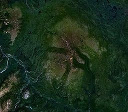
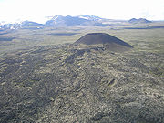
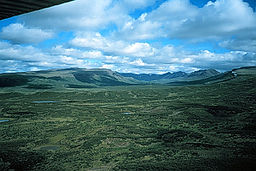

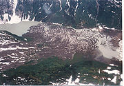
See also
- List of volcanoes in the United States
- List of volcanoes in Canada
- List of Cascade volcanoes
- Volcanism of Canada
- Volcanism of Northern CanadaVolcanism of Northern CanadaVolcanism of Northern Canada has led to the formation of hundreds of volcanic areas and extensive lava formations across Northern Canada, indicating volcanism played a major role in shaping its surface...
- Volcanism of Western CanadaVolcanism of Western CanadaVolcanism of Western Canada produces lava flows, lava plateaus, lava domes, cinder cones, stratovolcanoes, shield volcanoes, submarine volcanoes, calderas, diatremes and maars, along with examples of more less common volcanic forms such as tuyas and subglacial mounds.-Volcanic belts:*Anahim...