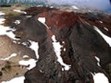
Nahta Cone
Encyclopedia
Nahta Cone is a cinder cone
in northern British Columbia
, Canada
, located 69 km (43 mi) southwest of Tatogga, 9 km (6 mi) north of Wetalth Ridge
and south of Telegraph Creek. It lies in the southwestern corner of Mount Edziza Provincial Park.
word meaning seven.
which in turn form part of the Mount Edziza
-Spectrum Range volcanic complex and the Northern Cordilleran Volcanic Province
. It formed in the Holocene
period.
Cinder cone
According to the , Cinder Cone is the proper name of 1 cinder cone in Canada and 7 cinder cones in the United States:In Canada: Cinder Cone In the United States:...
in northern British Columbia
British Columbia
British Columbia is the westernmost of Canada's provinces and is known for its natural beauty, as reflected in its Latin motto, Splendor sine occasu . Its name was chosen by Queen Victoria in 1858...
, Canada
Canada
Canada is a North American country consisting of ten provinces and three territories. Located in the northern part of the continent, it extends from the Atlantic Ocean in the east to the Pacific Ocean in the west, and northward into the Arctic Ocean...
, located 69 km (43 mi) southwest of Tatogga, 9 km (6 mi) north of Wetalth Ridge
Wetalth Ridge
Wetalth Ridge is an isolated ridge in northern British Columbia, Canada, located southwest of Tatogga and south of Telegraph Creek. It lies on the southwest side of Little Arctic Lake at the southwest corner of Mount Edziza Provincial Park.-History:...
and south of Telegraph Creek. It lies in the southwestern corner of Mount Edziza Provincial Park.
History
Nahta Cone was named on January 2, 1980 by the Geological Survey of Canada after the last seven survivors of the Wetalth people, a group outcast or exiled from the Tahltans in time past. Nahta is a TahltanTahltan
Tahltan refers to a Northern Athabaskan people who live in northern British Columbia around Telegraph Creek, Dease Lake, and Iskut.-Social Organization:...
word meaning seven.
Geology
Nahta Cone is one of the youngest volcanic features in the Spectrum RangeSpectrum Range
The Spectrum Range, formerly called the Spectrum Mountains and the Rainbow Mountains, is a subrange of the Tahltan Highland in the Stikine Country of northwestern British Columbia, 20 km west of the Stewart-Cassiar Highway, south of Mount Edziza and north of the Arctic Lake Plateau. The...
which in turn form part of the Mount Edziza
Mount Edziza
Mount Edziza is a stratovolcano in the Stikine Country of northwestern British Columbia, Canada. The volcano and the surrounding area are protected within Mount Edziza Provincial Park. It consists of a complex of multiple peaks and ridges, with several glaciers flowing in all directions. The summit...
-Spectrum Range volcanic complex and the Northern Cordilleran Volcanic Province
Northern Cordilleran volcanic province
The Northern Cordilleran Volcanic Province , formerly known as the Stikine Volcanic Belt, is a geologic province defined by the occurrence of Miocene to Holocene volcanoes in the Pacific Northwest of North America...
. It formed in the Holocene
Holocene
The Holocene is a geological epoch which began at the end of the Pleistocene and continues to the present. The Holocene is part of the Quaternary period. Its name comes from the Greek words and , meaning "entirely recent"...
period.
See also
- List of volcanoes in Canada
- List of Northern Cordilleran volcanoes
- Volcanism of Canada
- Volcanism of Western CanadaVolcanism of Western CanadaVolcanism of Western Canada produces lava flows, lava plateaus, lava domes, cinder cones, stratovolcanoes, shield volcanoes, submarine volcanoes, calderas, diatremes and maars, along with examples of more less common volcanic forms such as tuyas and subglacial mounds.-Volcanic belts:*Anahim...
External links
- Nahta Cone in the Canadian Mountain Encyclopedia

