
List of National Historic Landmarks in Alaska
Encyclopedia
The National Historic Landmarks in Alaska represent Alaska's history
from its Russian heritage
to its statehood. There are 48 National Historic Landmark
s (NHLs) in the state. The United States
National Historic Landmark
program is operated under the auspices of the National Park Service
, and recognizes structures, districts, objects, and similar resources according to a list of criteria of national significance. Major themes include Alaska's ancient cultures
, Russian heritage
, and role in World War II
, but other stories are represented as well. In addition, two sites in Alaska were designated National Historic Landmarks, and subsequently de-designated. These sites appear in italics in another table further below.
The National Historic Landmark Program is administered by the National Park Service
, a branch of the Department of the Interior
. The National Park Service determines which properties meet NHL criteria and makes nomination recommendations after an owner notification process. The Secretary of the Interior
reviews nominations and, based on a set of predetermined criteria, makes a decision on NHL designation or a determination of eligibility for designation. Both public and privately owned properties can be designated as NHLs. This designation provides indirect, partial protection of the historic integrity of the properties via tax incentives, grants, monitoring of threats, and other means. Owners may object to the nomination of the property as a NHL. When this is the case the Secretary of the Interior can only designate a site as eligible for designation.
Cape Krusenstern National Monument
is also an NHL and is listed above. The other two are:
History of Alaska
The history of Alaska dates back to the Upper Paleolithic period , when Asiatic groups crossed the Bering land bridge into what is now western Alaska. At the time of European contact by the Russian explorers, the area was populated by Alaska Native groups...
from its Russian heritage
Russian Alaska
Russian America was the name of Russian colonial possessions in the Americas from 1733 to 1867 that today is the U.S. state of Alaska and settlements farther south in California and Hawaii...
to its statehood. There are 48 National Historic Landmark
National Historic Landmark
A National Historic Landmark is a building, site, structure, object, or district, that is officially recognized by the United States government for its historical significance...
s (NHLs) in the state. The United States
United States
The United States of America is a federal constitutional republic comprising fifty states and a federal district...
National Historic Landmark
National Historic Landmark
A National Historic Landmark is a building, site, structure, object, or district, that is officially recognized by the United States government for its historical significance...
program is operated under the auspices of the National Park Service
National Park Service
The National Park Service is the U.S. federal agency that manages all national parks, many national monuments, and other conservation and historical properties with various title designations...
, and recognizes structures, districts, objects, and similar resources according to a list of criteria of national significance. Major themes include Alaska's ancient cultures
Archaeological culture
An archaeological culture is a recurring assemblage of artifacts from a specific time and place, which are thought to constitute the material culture remains of a particular past human society. The connection between the artifacts is based on archaeologists' understanding and interpretation and...
, Russian heritage
Russian Alaska
Russian America was the name of Russian colonial possessions in the Americas from 1733 to 1867 that today is the U.S. state of Alaska and settlements farther south in California and Hawaii...
, and role in World War II
World War II
World War II, or the Second World War , was a global conflict lasting from 1939 to 1945, involving most of the world's nations—including all of the great powers—eventually forming two opposing military alliances: the Allies and the Axis...
, but other stories are represented as well. In addition, two sites in Alaska were designated National Historic Landmarks, and subsequently de-designated. These sites appear in italics in another table further below.
The National Historic Landmark Program is administered by the National Park Service
National Park Service
The National Park Service is the U.S. federal agency that manages all national parks, many national monuments, and other conservation and historical properties with various title designations...
, a branch of the Department of the Interior
United States Department of the Interior
The United States Department of the Interior is the United States federal executive department of the U.S. government responsible for the management and conservation of most federal land and natural resources, and the administration of programs relating to Native Americans, Alaska Natives, Native...
. The National Park Service determines which properties meet NHL criteria and makes nomination recommendations after an owner notification process. The Secretary of the Interior
United States Secretary of the Interior
The United States Secretary of the Interior is the head of the United States Department of the Interior.The US Department of the Interior should not be confused with the concept of Ministries of the Interior as used in other countries...
reviews nominations and, based on a set of predetermined criteria, makes a decision on NHL designation or a determination of eligibility for designation. Both public and privately owned properties can be designated as NHLs. This designation provides indirect, partial protection of the historic integrity of the properties via tax incentives, grants, monitoring of threats, and other means. Owners may object to the nomination of the property as a NHL. When this is the case the Secretary of the Interior can only designate a site as eligible for designation.
NHLs in Alaska
The table below lists all 48 of the National Historic Landmark sites, along with added detail and description.| Landmark name | Image | Date desig. | Locality |
Borough or Census Area |
Description | |
|---|---|---|---|---|---|---|
| Adak Army Base and Adak Naval Operating Base Adak Army Base and Adak Naval Operating Base Adak Army Base and Adak Naval Operating Base is significant for having served as a staging area for the American assaults, during World War II, on Japanese-held Aleutian Islands of Kiska and Attu.... |
 |
Adak Station Adak, Alaska Adak , formerly Adak Station, is a city in the Aleutians West Census Area, Alaska, United States. At the 2010 census the population was 326. It is the westernmost municipality in the United States and the southernmost city in Alaska. The city is the former location of the Adak Army Base and Adak... 51.872°N 176.636°W |
Aleutians West Aleutians West Census Area, Alaska Aleutians West Census Area is a census area located in the U.S. state of Alaska. It contains most of the Aleutian Islands, from Attu Island in the west to Unalaska Island in the east, as well as the Pribilof Islands, which lie north of the Aleutians in the Bering Sea. As of 2010, the population is... |
Established in 1942 as part of World War II World War II World War II, or the Second World War , was a global conflict lasting from 1939 to 1945, involving most of the world's nations—including all of the great powers—eventually forming two opposing military alliances: the Allies and the Axis... , this military base Military base A military base is a facility directly owned and operated by or for the military or one of its branches that shelters military equipment and personnel, and facilitates training and operations. In general, a military base provides accommodations for one or more units, but it may also be used as a... was the launching pad for the American United States The United States of America is a federal constitutional republic comprising fifty states and a federal district... attack on the Japan Japan Japan is an island nation in East Asia. Located in the Pacific Ocean, it lies to the east of the Sea of Japan, China, North Korea, South Korea and Russia, stretching from the Sea of Okhotsk in the north to the East China Sea and Taiwan in the south... ese-held Aleutian Islands of Kiska Kiska Kiska is an island in the Rat Islands group of the Aleutian Islands of Alaska located at . It is about long and varies in width from - Discovery :... and Attu Attu Island Attu is the westernmost and largest island in the Near Islands group of the Aleutian Islands of Alaska, making it the westernmost point of land relative to Alaska and the United States. It was the site of the only World War II land battle fought on the incorporated territory of the United States ,... . |
||
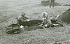
| 2 | Alaska Native Brotherhood Hall Alaska Native Brotherhood Hall Alaska Native Brotherhood Hall, or Sitka Camp No. 1, is significant for being the original chapter of the Alaska Native Brotherhood, an Alaska-wide native organization... |
.jpg) |
Sitka 57.0492013985°N 135.339440163°W |
Sitka | This 1914 meeting hall and headquarters Headquarters Headquarters denotes the location where most, if not all, of the important functions of an organization are coordinated. In the United States, the corporate headquarters represents the entity at the center or the top of a corporation taking full responsibility managing all business activities... building served the original chapter of Alaska Native Brotherhood, founded by Tlingits in the early 1900s to fight discrimination Discrimination Discrimination is the prejudicial treatment of an individual based on their membership in a certain group or category. It involves the actual behaviors towards groups such as excluding or restricting members of one group from opportunities that are available to another group. The term began to be... and represent interests of natives Indigenous peoples Indigenous peoples are ethnic groups that are defined as indigenous according to one of the various definitions of the term, there is no universally accepted definition but most of which carry connotations of being the "original inhabitants" of a territory.... . |
|
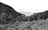
| Amalik Bay Archeological District Amalik Bay Archeological District Amalik Bay Archeological District is an archaeological site in Alaska. It was declared a National Historic Landmark in 2005.It is located in Katmai National Park and Preserve, in the mainland portion of Kodiak Island Borough, Alaska.... |
King Salmon King Salmon, Alaska King Salmon is a census-designated place in Bristol Bay Borough in the U.S. state of Alaska. As of the 2000 census the population was 442... 58°5′19"N 154°32′6"W |
Lake and Peninsula Lake and Peninsula Borough, Alaska -National protected areas:* Alagnak Wild River* Alaska Maritime National Wildlife Refuge ** Sutwik Island* Alaska Peninsula National Wildlife Refuge * Aniakchak National Monument and Preserve... |
An archeological site located in Lake and Peninsula Borough | |||
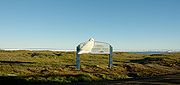
| 4 | American Flag Raising Site Castle Hill (Sitka, Alaska) Castle Hill or Noow Tlein, in Sitka, Alaska, is a National Historic Landmark and the historical site of Tlingit and Russian forts.Castle Hill is the area of land understood by the Tlingit people to be ceded to the Russian government following the battle of 1804... |
Sitka 57.0468450067°N 135.333765237°W |
Sitka | In 1867, site of Russian flag lowering and American flag raising marking the transfer of Alaska to the U.S. United States The United States of America is a federal constitutional republic comprising fifty states and a federal district... ; in 1959, after Alaska admitted as 49th state, site of first official raising of 49-star U.S. flag; also called Castle Hill. |
||
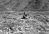
| 5 | Anangula Site Anangula Archeological District The Anangula Site or Anangula Archeological District is an archaeological site in Alaska. Located on a long island in the Aleutian Islands off the western coast of Umnak Island, it lies north-northwest of Nikolski Bay. The Anangula site was first recognized by a man with the last name of... |
 |
Nikolski Nikolski, Alaska Nikolski is a census-designated place on Umnak Island in Aleutians West Census Area, Alaska, United States. The population was 39 at the 2000 census.-Geography:Nikolski is located at .According to the U.S... |
Aleutians West Aleutians West Census Area, Alaska Aleutians West Census Area is a census area located in the U.S. state of Alaska. It contains most of the Aleutian Islands, from Attu Island in the west to Unalaska Island in the east, as well as the Pribilof Islands, which lie north of the Aleutians in the Bering Sea. As of 2010, the population is... |
Site of earliest signs of human occupation in the Aleutian Islands. | |
| 6 | Attu Battlefield and U.S. Army and Navy Airfields on Attu Attu Island Attu is the westernmost and largest island in the Near Islands group of the Aleutian Islands of Alaska, making it the westernmost point of land relative to Alaska and the United States. It was the site of the only World War II land battle fought on the incorporated territory of the United States ,... |
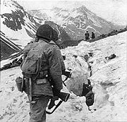 |
Attu Island Attu Island Attu is the westernmost and largest island in the Near Islands group of the Aleutian Islands of Alaska, making it the westernmost point of land relative to Alaska and the United States. It was the site of the only World War II land battle fought on the incorporated territory of the United States ,... 52.9005349534°N 172.909379543°W |
Aleutians West Aleutians West Census Area, Alaska Aleutians West Census Area is a census area located in the U.S. state of Alaska. It contains most of the Aleutian Islands, from Attu Island in the west to Unalaska Island in the east, as well as the Pribilof Islands, which lie north of the Aleutians in the Bering Sea. As of 2010, the population is... |
Site of bloody battle in which only 29 of 2,500 Japanese survived, only battle on U.S. soil during World War II World War II World War II, or the Second World War , was a global conflict lasting from 1939 to 1945, involving most of the world's nations—including all of the great powers—eventually forming two opposing military alliances: the Allies and the Axis... . |
|
| 7 | Bering Expedition Landing Site Kayak Island Kayak Island , which includes the Bering Expedition Landing Site, is located in the Gulf of Alaska, 100 km SE of Cordova, Alaska Malaspina Coastal Plain. It has a land area of 73.695 km² and no population.... |
 |
Kayak Island Kayak Island Kayak Island , which includes the Bering Expedition Landing Site, is located in the Gulf of Alaska, 100 km SE of Cordova, Alaska Malaspina Coastal Plain. It has a land area of 73.695 km² and no population.... 59.8925871018°N 144.485588497°W |
Valdez-Cordova Valdez-Cordova Census Area, Alaska Valdez-Cordova Census Area is a census area located in the state of Alaska, United States. As of the 2000 census, the population was 10,195. It is part of the unorganized borough and therefore has no borough seat... |
Site of first recorded contacts between natives and Europeans | |
| 8 | Birnirk Site Birnirk Site The Birnirk Site is an archaeological site near Barrow, Alaska. It includes sixteen prehistoric mounds which have yielded evidence of very early Birnirk and Thule culture... |
 |
Barrow Barrow, Alaska Barrow is the largest city of the North Slope Borough in the U.S. state of Alaska. It is one of the northernmost cities in the world and is the northernmost city in the United States of America, with nearby Point Barrow being the nation's northernmost point. Barrow's population was 4,212 at the... |
North Slope North Slope Borough, Alaska -National protected areas:* Alaska Maritime National Wildlife Refuge ** Cape Lisburne** Cape Thompson* Arctic National Wildlife Refuge ** Mollie Beattie Wilderness * Gates of the Arctic National Park and Preserve... |
Sixteen prehistoric mounds of the Birnirk and Thule cultures. | |
| Brooks River Archeological District Brooks River Archeological District Brooks River Archaeological District is an archaeological site located along a river bank and an ancient beach ridge in Katmai National Park and Preserve in the U.S. state of Alaska. It includes twenty separate settlement sites ranging from 2500BC to recent history... |
Katmai National Park and Preserve Katmai National Park and Preserve Katmai National Park and Preserve is a United States National Park in southern Alaska, notable for the Valley of Ten Thousand Smokes and for its brown bears. The park covers , being roughly the size of Wales. Most of this is a designated wilderness area, including of the park... 58°33′16"N 155°47′0"W |
Bristol Bay Bristol Bay Borough, Alaska As of the census of 2000, there were 1,258 people, 490 households, and 300 families residing in the borough. The population density was 2 people per square mile . There were 979 housing units at an average density of 2 per square mile... |
An archaeological site located along an ancient beach and modern river. There are twenty separate well preserved sites which have provided a large number of Arctic Small Tool Tradition Arctic small tool tradition The Arctic Small Tool tradition is a broad cultural entity that developed along the Alaska Peninsula, round Bristol Bay, and on the eastern shores of the Bering Strait around 2500 BC... artifacts. |
|||
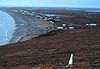
| Cape Krusenstern Archeological District | 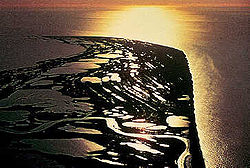 |
Kotzebue Kotzebue, Alaska As of the census of 2000, there were 3,082 people, 889 households, and 656 families residing in the city. The population density was 114.1 people per square mile . There were 1,007 housing units at an average density of 37.3 per square mile... 67°6′51"N 163°41′9"W |
Northwest Arctic Northwest Arctic Borough, Alaska -National protected areas:* Alaska Maritime National Wildlife Refuge ** Chamisso Wilderness* Bering Land Bridge National Preserve * Cape Krusenstern National Monument* Gates of the Arctic National Park and Preserve... |
The archeological district comprises 114 ancient beach ridges which formed nearly 60 years apart. They provide a rare sequential look at over 5000 years of inhabitation. | ||
| Cape Nome Mining District Discovery Sites Cape Nome Mining District Discovery Sites Cape Nome Mining District Discovery Sites is a National Historic Landmark located in Nome, Alaska. It was named a National Historic Landmark in 1978. It is significant for its role in the history of gold mining in Alaska.... |
 |
Nome Nome, Alaska Nome is a city in the Nome Census Area in the Unorganized Borough of the U.S. state of Alaska, located on the southern Seward Peninsula coast on Norton Sound of the Bering Sea. According to the 2010 Census, the city population was 3,598. Nome was incorporated on April 9, 1901, and was once the... |
Nome Nome Census Area, Alaska Nome Census Area is a census area located in the state of Alaska, United States. As of the 2000 census, the population was 9,196. It is part of the unorganized borough and therefore has no borough seat. Its largest community by far is the city of Nome.... |
Significant for role in the history of gold mining in Alaska | ||
| 12 | Chaluka Site Chaluka Site Chaluka Site is an archaeological site near Nikolski, Alaska. It includes a large mound yielding much information about the origins of the Aleut people. It was declared a National Historic Landmark in 1962.... |
 |
Nikolski Nikolski, Alaska Nikolski is a census-designated place on Umnak Island in Aleutians West Census Area, Alaska, United States. The population was 39 at the 2000 census.-Geography:Nikolski is located at .According to the U.S... |
Aleutians West Aleutians West Census Area, Alaska Aleutians West Census Area is a census area located in the U.S. state of Alaska. It contains most of the Aleutian Islands, from Attu Island in the west to Unalaska Island in the east, as well as the Pribilof Islands, which lie north of the Aleutians in the Bering Sea. As of 2010, the population is... |
Includes a large mound; yields information about origins of Aleuts | |
| Chilkoot Tail and Dyea Site | 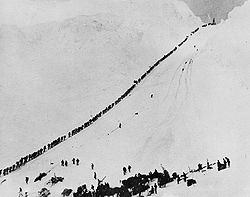 |
Skagway Skagway, Alaska Skagway is a first-class borough in Alaska, on the Alaska Panhandle. It was formerly a city first incorporated in 1900 that was re-incorporated as a borough on June 25, 2007. As of the 2000 census, the population of the city was 862... 59°38′N 135°17′W |
Skagway Skagway, Alaska Skagway is a first-class borough in Alaska, on the Alaska Panhandle. It was formerly a city first incorporated in 1900 that was re-incorporated as a borough on June 25, 2007. As of the 2000 census, the population of the city was 862... |
Major access route from the coast to Yukon goldfields in the late 1890s. | ||
| 14 | Church of the Holy Ascension Church of the Holy Ascension The Church of the Holy Ascension was built in 1826 by the Russian American Fur Company. It played a significant role in evangelizing the indigenous people in then-Russian Alaska. It was declared a National Historic Landmark in 1970.It was restored in 1998... |
 |
Unalaska Unalaska, Alaska Unalaska is a city in the Aleutians West Census Area of the Unorganized Borough of the U.S. state of Alaska. Unalaska is located on Unalaska Island and neighboring Amaknak Island in the Aleutian Islands off of mainland Alaska.... 53.8758259061°N 166.536306996°W |
Aleutians West Aleutians West Census Area, Alaska Aleutians West Census Area is a census area located in the U.S. state of Alaska. It contains most of the Aleutian Islands, from Attu Island in the west to Unalaska Island in the east, as well as the Pribilof Islands, which lie north of the Aleutians in the Bering Sea. As of 2010, the population is... |
Built in 1826 by the Russian American Fur Company to help acclimate indigenous population in Russian Alaska. | |
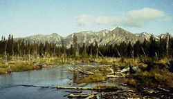
| 15 | Dry Creek Archeological Site Dry Creek Archeological Site Dry Creek Archeological Site is an archaeological site near Healy, Alaska. The site has provided evidence supporting the theory of a land bridge between Asia and Alaska.It was declared a National Historic Landmark in 1978.... |
Healy, Alaska Healy, Alaska Healy is a census-designated place in and the borough seat of Denali Borough in the U.S. state of Alaska. The population was 971 at the 2007 census.-Geography:Healy is located at .... |
Denali Denali Borough, Alaska -Demographics:As of the census of 2000, there were 1,893 people, 785 households, and 452 families residing in the borough. The population density was 0 people per square mile . There were 1,351 housing units at an average density of 0 per square mile... |
This archeological site has provided evidence which supports the Bering land bridge theory | ||
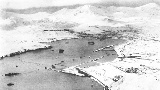
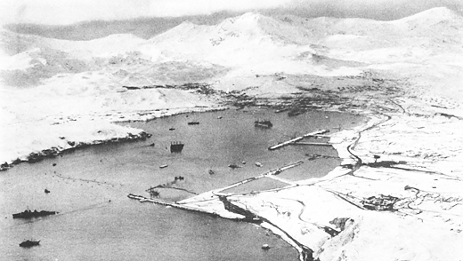
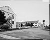
| Dutch Harbor Naval Operating Base and Fort Mears, U.S. Army Dutch Harbor Naval Operating Base and Fort Mears, U.S. Army Dutch Harbor Naval Operating Base and Fort Mears are the two military installations built next to each other in Dutch Harbor, Alaska, by the United States in response to the growing war threat with Japan. A 1938 Navy board recommended the construction which began in July 1940. The first army... |
 |
Unalaska Unalaska, Alaska Unalaska is a city in the Aleutians West Census Area of the Unorganized Borough of the U.S. state of Alaska. Unalaska is located on Unalaska Island and neighboring Amaknak Island in the Aleutian Islands off of mainland Alaska.... 53°53′16"N 166°32′23"W |
Aleutians West Aleutians West Census Area, Alaska Aleutians West Census Area is a census area located in the U.S. state of Alaska. It contains most of the Aleutian Islands, from Attu Island in the west to Unalaska Island in the east, as well as the Pribilof Islands, which lie north of the Aleutians in the Bering Sea. As of 2010, the population is... |
Only US fortifications in the Aleutian Islands prior to WWII, attacked by the Japanese Navy during the Battle of Dutch Harbor Battle of Dutch Harbor The Battle of Dutch Harbor took place on 3-4 June 1942, and was a minor air and naval battle of the Aleutian Islands Campaign of World War II between Imperial Japanese Navy and United States Army and Navy forces.-Overview:... in June 1943. |
||
| Eagle Historic District Eagle Historic District The Eagle Historic District in Eagle, Alaska is a well preserved example of the historic development in Northern Alaska. Fort Egbert was built in 1889 to serve a central governmental role for the area... |
 |
Eagle Eagle, Alaska Eagle is a city located along the United States-Canada border in the Southeast Fairbanks Census Area, Alaska, United States. It includes Eagle Historic District, a U.S. National Historic Landmark. The population was 129 at the 2000 census... 64°47′10"N 141°12′0"W |
Southeast Fairbanks Southeast Fairbanks Census Area, Alaska Southeast Fairbanks Census Area is a census area located in the state of Alaska, United States. As of the 2000 census, the population was 6,174. It is part of the unorganized borough and therefore has no borough seat... |
Historic district with over 100 well preserved buildings from the Gold Rush years on the Yukon river. Roald Amundsen Roald Amundsen Roald Engelbregt Gravning Amundsen was a Norwegian explorer of polar regions. He led the first Antarctic expedition to reach the South Pole between 1910 and 1912 and he was the first person to reach both the North and South Poles. He is also known as the first to traverse the Northwest Passage.... announced his successful traverse of the Northwest Passage Northwest Passage The Northwest Passage is a sea route through the Arctic Ocean, along the northern coast of North America via waterways amidst the Canadian Arctic Archipelago, connecting the Atlantic and Pacific Oceans... from here in 1905 |
||
| 18 | Fort Durham Site Fort Durham Fort Durham, also known as Fort Taku, Taku, Taco, and Tacouw and in legal terms as AHRS Site JUN 036 is an archaeological site near Taku Harbor, Alaska, within the limits of Juneau City and Borough... |
Taku Harbor Taku Harbor, Alaska Taku Harbor is a small harbor located about 21 miles southeast of central Juneau, Alaska, United States. It is accessible only by air or sea; there are no roads connecting it to the rest of Alaska. It is notable for Fort Durham, a National Historic Landmark Hudson's Bay Company trading... |
Juneau Juneau, Alaska The City and Borough of Juneau is a unified municipality located on the Gastineau Channel in the panhandle of the U.S. state of Alaska. It has been the capital of Alaska since 1906, when the government of the then-District of Alaska was moved from Sitka as dictated by the U.S. Congress in 1900... |
One of three Hudson's Bay Company posts set up in Alaska | ||
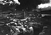
| Cape Field at Fort Glenn Cape Field at Fort Glenn Cape Field at Fort Glenn also known as Umnak Airport, is a site significant for its role in World War II fighting. It "provided aerial defensive cover for the U.S... |
image pending | Fort Glenn | Aleutians West Aleutians West Census Area, Alaska Aleutians West Census Area is a census area located in the U.S. state of Alaska. It contains most of the Aleutian Islands, from Attu Island in the west to Unalaska Island in the east, as well as the Pribilof Islands, which lie north of the Aleutians in the Bering Sea. As of 2010, the population is... |
Significant for its role in World War II fighting | ||
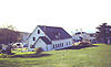
| Fort William H. Seward Fort William H. Seward Fort William H. Seward, also known as Chilkoot Barracks or as AHRS Site No. SKG-001 is a site at Port Chilkoot in Haines, Alaska. It was the last of a series of 11 military posts established in Alaska during the gold rush era.... |
image pending | Haines Haines, Alaska Haines is a census-designated place in Haines Borough, Alaska, United States. As of the 2000 census, the population of the area was 1,811. Haines was formerly a city but no longer has a municipal government... 59°13′36"N 135°26′40"W |
Haines Haines Borough, Alaska -Demographics:As of the census of 2000, there were 2,392 people, 991 households, and 654 families residing in the borough. The population density was 0,88 people per square mile . There were 1,419 housing units at an average density of 0,52 per square mile... |
Last of a series of 11 military posts established in Alaska during the gold rush era | ||
| 21 | Gallagher Flint Station Archeological Site Gallagher Flint Station Archeological Site Gallagher Flint Station Archeological Site is the earliest dated archaeological site in northern Alaska. It was discovered in 1970 during the construction of the Trans-Alaska Pipeline and dated to 10,540 B.P.... |
 |
Sagwon Sagwon, Alaska Sagwon is a small unincorporated community in North Slope Borough, Alaska, United States. It is above the Arctic Circle. It is known for the Gallagher Flint Station Archeological Site which was discovered during the construction of the Trans-Alaska Pipeline.... |
North Slope North Slope Borough, Alaska -National protected areas:* Alaska Maritime National Wildlife Refuge ** Cape Lisburne** Cape Thompson* Arctic National Wildlife Refuge ** Mollie Beattie Wilderness * Gates of the Arctic National Park and Preserve... |
Discovered in 1970 during the construction of the Trans-Alaska Pipeline, it is the earliest dated archaeological site Archaeological site An archaeological site is a place in which evidence of past activity is preserved , and which has been, or may be, investigated using the discipline of archaeology and represents a part of the archaeological record.Beyond this, the definition and geographical extent of a 'site' can vary widely,... in northern Alaska. |
|
| 22 | Holy Assumption Orthodox Church Holy Assumption of the Virgin Mary Church Holy Assumption Orthodox Church, also known as Church of the Assumption of the Virgin Mary, is a Russian Orthodox church in Kenai, Kenai Peninsula Borough, Alaska, USA... |
 |
Kenai Kenai, Alaska Kenai is a city in Kenai Peninsula Borough in the U.S. state of Alaska. According to 2005 Census Bureau estimates, the population of the city is 7,464... 60.552413°N 151.266262°W |
Kenai Peninsula Kenai Peninsula Borough, Alaska -National protected areas:* Alaska Maritime National Wildlife Refuge ** Chiswell Islands** Tuxedni Wilderness* Chugach National Forest * Katmai National Park and Preserve ** Katmai Wilderness... |
Russian Orthodox church in Kenai, Alaska. | |
| 23 | Ipiutak Site Ipiutak Site The Ipiutak Site is a large archaeological site at Point Hope in northwest Alaska.It is the type site for the Ipiutak culture, which arose possibly as early as 100–200 BCE and collapsed around 800 CE... |
 |
Point Hope Peninsula Point Hope, Alaska Point Hope is a city in North Slope Borough, Alaska, United States. At the 2000 census the population was 757.-Geography:... 68°20′49"N 166°45′47"W |
North Slope North Slope Borough, Alaska -National protected areas:* Alaska Maritime National Wildlife Refuge ** Cape Lisburne** Cape Thompson* Arctic National Wildlife Refuge ** Mollie Beattie Wilderness * Gates of the Arctic National Park and Preserve... |
The type site Type site In archaeology a type site is a site that is considered the model of a particular archaeological culture... for the Ipiutak culture |
|
| 24 | Iyatayet Site Iyatayet Site Iyatayet Site is an archaeological site located on the northwest shore of Cape Denbigh on Norton Bay in Nome Census Area, Alaska. It shows evidence of several separate cultures, dating back as far as 6000 B.C. It was excavated starting in 1948 by J L Giddings.... |
 |
Cape Denbigh Peninsula | Nome Nome Census Area, Alaska Nome Census Area is a census area located in the state of Alaska, United States. As of the 2000 census, the population was 9,196. It is part of the unorganized borough and therefore has no borough seat. Its largest community by far is the city of Nome.... |
Shows evidence of several separate cultures, dating back as far as 6000 B.C. | |
| 25 | Sheldon Jackson School Sheldon Jackson College Sheldon Jackson College was a small private college located on Baranof Island in Sitka, Alaska, United States. Founded in 1878, it was the oldest institution of higher learning in Alaska and maintained a historic relationship with the Presbyterian Church. The college was named in honor of Rev... |
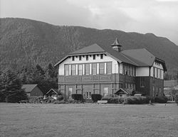 |
Sitka | Sitka | Oldest institution of higher learning in Alaska | |
| 26 | Kake Cannery Kake Cannery Kake Cannery is a historic site near Kake, Alaska. Alternate names for the site are: Sanborn Cutting Company, Sunny Point Packing Company, Alaska Pacific Salmon Corporation, P.E. Harris & Company, Keku Cannery. It was built from 1912 through 1940... |
.jpg) |
Kake Kake, Alaska Kake is a town in Petersburg Census Area, Alaska, United States. The population was 710 at the 2000 census. The name comes from the Tlingit word or , which is derived from “dawn, daylight” and “mouth”, i.e. “mouth of dawn” or “opening of daylight”.-Geography:Kake is located at... |
Petersburg | Built 1912-1940; significant for role in history of salmon canning in Alaska | |
| 27 | Kennecott Mines | 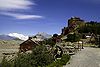 |
Kennecott 61°29′6.8"N 142°53′18.4"W |
Valdez-Cordova Valdez-Cordova Census Area, Alaska Valdez-Cordova Census Area is a census area located in the state of Alaska, United States. As of the 2000 census, the population was 10,195. It is part of the unorganized borough and therefore has no borough seat... |
Site of discovery of copper in 1900 and subsequent mining activities | |
| Kijik Archeological District Kijik Archeological District Kijik Archeological District, also known as Qizhjeh or XLC-001, is an archaeological site in Alaska. The site is related to the history of the Dena'ina Athabaskan Indians. It is located on the shores of Lake Clark, within Lake Clark National Preserve and Lake and Peninsula Borough.It was declared... |
 |
Lake Clark National Park and Preserve Lake Clark National Park and Preserve Established in 1980 by the Alaska National Interest Lands Conservation Act, Lake Clark National Park and Preserve is a United States National Park in southwestern Alaska. The park includes many streams and lakes vital to the Bristol Bay salmon fishery... 60°17′33"N 154°15′1"W |
Bristol Bay Bristol Bay Borough, Alaska As of the census of 2000, there were 1,258 people, 490 households, and 300 families residing in the borough. The population density was 2 people per square mile . There were 979 housing units at an average density of 2 per square mile... |
Related to the history of the Dena'ina Athabaskan Indians | ||
| 29 | Japanese Occupation Site, Kiska Island Japanese Occupation Site, Kiska Island The Japanese Occupation Site on Kiska island in the Rat Islands group of the Aleutian Islands of Alaska is where the Japanese Navy attacked and occupied United States territory during World War II. The Japanese invaded in June 1942 after the Battle of Dutch Harbor, capturing 10 Navy weathermen... |
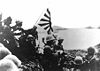 |
Kiska Island Kiska Kiska is an island in the Rat Islands group of the Aleutian Islands of Alaska located at . It is about long and varies in width from - Discovery :... 51°58′2.0"N 177°29′31.0"E |
Aleutians West Aleutians West Census Area, Alaska Aleutians West Census Area is a census area located in the U.S. state of Alaska. It contains most of the Aleutian Islands, from Attu Island in the west to Unalaska Island in the east, as well as the Pribilof Islands, which lie north of the Aleutians in the Bering Sea. As of 2010, the population is... |
Site of the Japanese occupation of Kiska Japanese occupation of Kiska The Japanese occupation of Kiska took place between 6 June 1942 and 28 July 1943 during the Aleutian Islands Campaign of the Pacific War. The Japanese occupied Kiska and nearby Attu Island in order to protect the northern flank of the Japanese Empire.... which along with nearby Attu Attu Island Attu is the westernmost and largest island in the Near Islands group of the Aleutian Islands of Alaska, making it the westernmost point of land relative to Alaska and the United States. It was the site of the only World War II land battle fought on the incorporated territory of the United States ,... were the only US land occupied by the Japanese during World War II World War II World War II, or the Second World War , was a global conflict lasting from 1939 to 1945, involving most of the world's nations—including all of the great powers—eventually forming two opposing military alliances: the Allies and the Axis... |
|
| 30 | Kodiak Naval Operating Base and Forts Greely and Abercrombie Integrated Support Command Kodiak Base Support Unit Kodiak is the host command for a large shore installation of the United States Coast Guard, located in Kodiak, Alaska. The largest tenant unit on the base is Air Station Kodiak. It is also the home port for several cutters... |
 |
Kodiak Kodiak, Alaska Kodiak is one of 7 communities and the main city on Kodiak Island, Kodiak Island Borough, in the U.S. state of Alaska. All commercial transportation between the entire island and the outside world goes through this city either via ferryboat or airline... |
Kodiak Island Kodiak Island Borough, Alaska -National protected areas:* Alaska Maritime National Wildlife Refuge ** Barren Islands** Semidi Wilderness*** Semidi Islands** Trinity Islands*** Sitkinak Island*** Tugidak Island... |
World War II-related facilities | |
| 31 | Ladd Field | 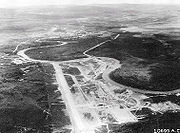 |
Fairbanks Fairbanks, Alaska Fairbanks is a home rule city in and the borough seat of the Fairbanks North Star Borough in the U.S. state of Alaska.Fairbanks is the largest city in the Interior region of Alaska, and second largest in the state behind Anchorage... 64°50′15"N 147°36′52"W |
Fairbanks North Star Fairbanks North Star Borough, Alaska -Demographics:As of the 2000 census, 82,840 people, 29,777 households, and 20,516 families were residing in the borough. The population density was 11 people per square mile . There were 33,291 housing units at an average density of 4 per square mile... |
Primary role during WWII was major stopping point for the Lend-Lease program. | |
| 32 | Leffingwell Camp Site Leffingwell Camp Site The Leffingwell Camp Site, located on a barrier island of the Arctic coast of Alaska, was used by polar explorer and geologist Ernest de Koven Leffingwell in the Anglo-American Polar Expedition of 1906–1908, which aimed to explore the Beaufort Sea... |
 |
Flaxman Island 70°11′6.5"N 146°0′14"W |
North Slope North Slope Borough, Alaska -National protected areas:* Alaska Maritime National Wildlife Refuge ** Cape Lisburne** Cape Thompson* Arctic National Wildlife Refuge ** Mollie Beattie Wilderness * Gates of the Arctic National Park and Preserve... |
Campsite of geologist and polar explorer Ernest de Koven Leffingwell Ernest de Koven Leffingwell Ernest de Koven Leffingwell was an arctic explorer, geologist and Spanish-American War veteran.During the period from 1906 to 1914, Leffingwell spent 9 summers and 6 winters on the Arctic coast of Alaska, making 31 trips by dog sled and/or small boats. He created the first accurate map of a large... on Arctic coast of Alaska, not far from Prudhoe Bay Prudhoe Bay, Alaska Prudhoe Bay or Sagavanirktok is a census-designated place located in North Slope Borough in the U.S. state of Alaska. As of the 2010 census, the population of the CDP was 2,174 people; however, at any given time several thousand transient workers support the Prudhoe Bay oil field... . |
|
| 33 | Nenana (river steamboat) Nenana (steamer) The SS Nenana is a river sternwheel paddleship currently preserved and displayed at Pioneer Park in Fairbanks, Alaska. It is the only surviving wooden one of this type. It was declared a National Historic Landmark in 1989... |
Fairbanks Fairbanks, Alaska Fairbanks is a home rule city in and the borough seat of the Fairbanks North Star Borough in the U.S. state of Alaska.Fairbanks is the largest city in the Interior region of Alaska, and second largest in the state behind Anchorage... 64.8377001558°N 147.768332861°W |
Fairbanks North Star Fairbanks North Star Borough, Alaska -Demographics:As of the 2000 census, 82,840 people, 29,777 households, and 20,516 families were residing in the borough. The population density was 11 people per square mile . There were 33,291 housing units at an average density of 4 per square mile... |
River steamboat; only surviving wooden one of this type. | ||
| 34 | New Russia Site New Russia (trading post) New Russia , near Yakutat, Alaska was a maritime fur trading post and penal colony established by Russians in 1795. It was presumably named after Joseph Billings ship Slava Rossia, or "Glory of Russia". The post was attacked and destroyed by Tlingits in 1805... |
image pending | Yakutat | Yakutat Yakutat City and Borough, Alaska Yakutat City and Borough is a unified city-borough in the U.S. state of Alaska. As of the 2010 census, the population was 4035. The name is Tlingit, Yaakwdáat, meaning "the place where canoes rest", but it originally derives from an Eyak name diyaʼqudaʼt and was influenced by the Tlingit word... |
Site of Russian trading post attacked and destroyed by Tlingit natives. | |
| Onion Portage Archeological District Onion Portage Archeological District Onion Portage Archeological District, located at a caribou migration river crossing point, is one of the most significant archaeological sites in Alaska because it has been used by many cultures over millennia. Archaeologists have located nine complexes from this site ranging from approximately... |
Kiana Kiana, Alaska Kiana is a city in Northwest Arctic Borough, Alaska, United States. At the 2000 census the population was 388.-Geography:Kiana is located at .... 67°5′49"N 158°17′51"W |
Northwest Arctic Northwest Arctic Borough, Alaska -National protected areas:* Alaska Maritime National Wildlife Refuge ** Chamisso Wilderness* Bering Land Bridge National Preserve * Cape Krusenstern National Monument* Gates of the Arctic National Park and Preserve... |
Perhaps most important archaeological site Archaeological site An archaeological site is a place in which evidence of past activity is preserved , and which has been, or may be, investigated using the discipline of archaeology and represents a part of the archaeological record.Beyond this, the definition and geographical extent of a 'site' can vary widely,... in Alaska; caribou river crossing; human presence for millennia. |
|||
| 36 | Palugvik Site Palugvik Site Palugvik Site, also known as Palugvik Archeological District, is an archaeological site on Hawkins Island in Prince William Sound, near Cordova, Alaska.It was declared a National Historic Landmark in 1962.... |
Hawkins Island Hawkins Island (Alaska) Hawkins Island is an island in the northern part of the Gulf of Alaska in the state of Alaska, USA. It lies just west of the city of Cordova, between that city and the further offshore Hinchinbrook Island. Prince William Sound lies to the north side of the island, while Orca Inlet and the main body... |
Valdez-Cordova Valdez-Cordova Census Area, Alaska Valdez-Cordova Census Area is a census area located in the state of Alaska, United States. As of the 2000 census, the population was 10,195. It is part of the unorganized borough and therefore has no borough seat... |
Includes a large midden yielding information about Eskimo culture in the area. | ||
| 37 | Russian-American Building #29 Russian-American Building No. 29 Russian-American Building #29, also known as Tilson Building or Building No. 29, Sitka, is a building in Sitka, Alaska. It is a siding covered log building dating back to the years after the 1867 purchase of Alaska by the United States.... |
 |
Sitka 57.047280°N 135.331157°W |
Sitka | Siding covered log building; dates back to the years after the 1867 purchase of Alaska. | |
| 38 | Russian-American Magazin Russian-American Magazin Russian-American Magazin, also known as Erskine House, is a storehouse building in Kodiak, Alaska. It is the only property known to have been associated with the Russian and then the American trading companies active in Alaska.... |
 |
Kodiak Kodiak, Alaska Kodiak is one of 7 communities and the main city on Kodiak Island, Kodiak Island Borough, in the U.S. state of Alaska. All commercial transportation between the entire island and the outside world goes through this city either via ferryboat or airline... |
Kodiak Island Kodiak Island Borough, Alaska -National protected areas:* Alaska Maritime National Wildlife Refuge ** Barren Islands** Semidi Wilderness*** Semidi Islands** Trinity Islands*** Sitkinak Island*** Tugidak Island... |
Storehouse building associated with the Russian and then the American trading companies active in Alaska. | |
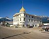
| 39 | Russian Bishop's House |  |
Sitka 57.048488°N 135.327267°W |
Sitka | One of four surviving examples of Russian Colonial Style architecture in the Western Hemisphere. | |
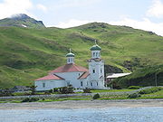
| 40 | St. Michael's Cathedral St. Michael's Cathedral (Sitka, Alaska) St. Michael's Cathedral , also known as Cathedral of St. Michael the Archangel , is a cathedral of the Orthodox Church in America Diocese of Alaska at Lincoln and Matsoutoff Streets in Sitka, Alaska... |
 |
Sitka 57°2′59"N 135°20′5"W |
Sitka | Primary evidence of Russian influence in North America. | |
| Seal Island Historic District Seal Island Historic District The Seal Island Historic District is a National Historic Landmark District located on the islands of St. George and St. Paul in the Pribilof Islands in the Bering Sea of Alaska. These islands are home to Northern Fur Seal herds which were actively hunted by indigenous populations and later by many... |
 |
Pribilof Islands Pribilof Islands The Pribilof Islands are a group of four volcanic islands off the coast of mainland Alaska, in the Bering Sea, about north of Unalaska and 200 miles southwest of Cape Newenham. The Siberia coast is roughly northwest... 57°N 170°W |
Aleutians West Aleutians West Census Area, Alaska Aleutians West Census Area is a census area located in the U.S. state of Alaska. It contains most of the Aleutian Islands, from Attu Island in the west to Unalaska Island in the east, as well as the Pribilof Islands, which lie north of the Aleutians in the Bering Sea. As of 2010, the population is... |
Historic buildings related to Northern Fur Seal Northern Fur Seal The Northern fur seal is an eared seal found along the north Pacific Ocean, the Bering Sea and the Sea of Okhotsk. It is the largest member of the fur seal subfamily and the only species in the genus Callorhinus.-Physical description:Northern fur seals have extreme sexual dimorphism, with males... hunting in the Pribilof Islands Pribilof Islands The Pribilof Islands are a group of four volcanic islands off the coast of mainland Alaska, in the Bering Sea, about north of Unalaska and 200 miles southwest of Cape Newenham. The Siberia coast is roughly northwest... and its restriction in 1911 and 1966. |
||
| 42 | Sitka Naval Operating Base and U.S. Army Coastal Defenses Sitka Naval Operating Base and U.S. Army Coastal Defenses Sitka Naval Operating Base and U.S. Army Coastal Defenses in Sitka, Alaskawas listed on the United States National Register of Historic Places and designated a National Historic Landmark in 1986. Alternative or associated names are Sitka, the Causeway, and Mt... |
 |
Sitka | Sitka | Commissioned as Sitka Naval Air Station in October 1939, it was redesignated the Naval Operating Base, July 1942. Protected the North Pacific during World War II. | |
| 43 | Sitka Spruce Plantation Sitka Spruce Plantation (Unalaska, Alaska) Sitka Spruce Plantation, also known as The Forest or AHRS UNL-074, is an afforestation site and National Historic Landmark located in the Aleutian island of Amaknak. It is the first recorded afforestation site in North America.... |
image pending | Unalaska Unalaska, Alaska Unalaska is a city in the Aleutians West Census Area of the Unorganized Borough of the U.S. state of Alaska. Unalaska is located on Unalaska Island and neighboring Amaknak Island in the Aleutian Islands off of mainland Alaska.... 53.8865687574°N 166.539744163°W |
Aleutians West Aleutians West Census Area, Alaska Aleutians West Census Area is a census area located in the U.S. state of Alaska. It contains most of the Aleutian Islands, from Attu Island in the west to Unalaska Island in the east, as well as the Pribilof Islands, which lie north of the Aleutians in the Bering Sea. As of 2010, the population is... |
First recorded afforestation Afforestation Afforestation is the establishment of a forest or stand of trees in an area where there was no forest. Reforestation is the reestablishment of forest cover, either naturally or artificially... project in North America North America North America is a continent wholly within the Northern Hemisphere and almost wholly within the Western Hemisphere. It is also considered a northern subcontinent of the Americas... ; Russian Russian Alaska Russian America was the name of Russian colonial possessions in the Americas from 1733 to 1867 that today is the U.S. state of Alaska and settlements farther south in California and Hawaii... settlers began in 1805; attempt to make Unalaska Unalaska, Alaska Unalaska is a city in the Aleutians West Census Area of the Unorganized Borough of the U.S. state of Alaska. Unalaska is located on Unalaska Island and neighboring Amaknak Island in the Aleutian Islands off of mainland Alaska.... self-sufficient in timber Lumber Lumber or timber is wood in any of its stages from felling through readiness for use as structural material for construction, or wood pulp for paper production.... . |
|
| Skagway Historic District and White Pass Skagway Historic District and White Pass The Skagway Historic District and White Pass is a National Historic Landmark district comprising a portion of Skagway, Alaska and the US portion of White Pass, a rail mountain pass 19 miles away on the border of Canada... |
 |
Skagway Skagway, Alaska Skagway is a first-class borough in Alaska, on the Alaska Panhandle. It was formerly a city first incorporated in 1900 that was re-incorporated as a borough on June 25, 2007. As of the 2000 census, the population of the city was 862... and White Pass White Pass White Pass is a mountain pass through the Boundary Ranges of the Coast Mountains on the border of the U.S. state of Alaska and the province of British Columbia, Canada... 59°27′30"N 135°18′50"W |
Skagway Skagway, Alaska Skagway is a first-class borough in Alaska, on the Alaska Panhandle. It was formerly a city first incorporated in 1900 that was re-incorporated as a borough on June 25, 2007. As of the 2000 census, the population of the city was 862... |
Historic frontier Gold Rush town and trail leading to White Pass White Pass White Pass is a mountain pass through the Boundary Ranges of the Coast Mountains on the border of the U.S. state of Alaska and the province of British Columbia, Canada... on the border of Canada. Over 100 buildings from the era survive, though they are threatened by continued development. Mentioned in The Call of the Wild The Call of the Wild The Call of the Wild is a novel by American writer Jack London. The plot concerns a previously domesticated dog named Buck, whose primordial instincts return after a series of events leads to his serving as a sled dog in the Yukon during the 19th-century Klondike Gold Rush, in which sled dogs... by Jack London Jack London John Griffith "Jack" London was an American author, journalist, and social activist. He was a pioneer in the then-burgeoning world of commercial magazine fiction and was one of the first fiction writers to obtain worldwide celebrity and a large fortune from his fiction alone... . |
||
| 45 | George C. Thomas Memorial Library George C. Thomas Memorial Library George C. Thomas Memorial Library, also known as the former North Star Borough Library or AHRS FAI-004, was declared a National Historic Landmark in 1978.... |
image pending | Fairbanks Fairbanks, Alaska Fairbanks is a home rule city in and the borough seat of the Fairbanks North Star Borough in the U.S. state of Alaska.Fairbanks is the largest city in the Interior region of Alaska, and second largest in the state behind Anchorage... 64.844735°N 147.727652°W |
Fairbanks North Star Fairbanks North Star Borough, Alaska -Demographics:As of the 2000 census, 82,840 people, 29,777 households, and 20,516 families were residing in the borough. The population density was 11 people per square mile . There were 33,291 housing units at an average density of 4 per square mile... |
The public library for Fairbanks from its construction in 1909 until the opening of the Noel Wien Public Library Noel Wien Public Library The Noel Wien Public Library, operated by the Fairbanks North Star Borough, is located in Fairbanks, Alaska. It has a branch library in North Pole, Alaska. Its current director is Greg Hill, who also writes a regular column for the Fairbanks Daily News-Miner. The library has more than 100,000... in 1977. Site of 1915 meeting between U.S. officials and native Alaskans to settle land claims. |
|
| 46 | Three Saints Bay Site Three Saints Bay, Alaska Three Saints Bay is a -long inlet on the southeast side of Kodiak Island in southern Alaska, North of Sitkalidak Strait. It is southwest of Kodiak.... |
Old Harbor Old Harbor, Alaska Old Harbor is a city in Kodiak Island Borough, Alaska, United States. At the 2000 census the population was 237.-Geography:... 57°08′N 153°30′W |
Kodiak Island Kodiak Island Borough, Alaska -National protected areas:* Alaska Maritime National Wildlife Refuge ** Barren Islands** Semidi Wilderness*** Semidi Islands** Trinity Islands*** Sitkinak Island*** Tugidak Island... |
Site of the first Russian settlement in Alaska in 1784. | ||
| 47 | Wales Site Wales Site The Wales Site is a well-documented archeological site on the Cape Prince of Wales, near Wales, Alaska. It is a pre contact site for the indigenous population which can help illuminate non-industrial whaling practices from the 9th century through the early 19th century.... |
 |
Wales Wales, Alaska Wales is a town in the Nome Census Area, Alaska, United States. At the 2000 census the population was 152. It is the westernmost town on the American mainland.-Geography:... 65°36′44"N 168°5′21"W |
Nome Nome Census Area, Alaska Nome Census Area is a census area located in the state of Alaska, United States. As of the 2000 census, the population was 9,196. It is part of the unorganized borough and therefore has no borough seat. Its largest community by far is the city of Nome.... |
Site of first discovery of how the Thule Thule people The Thule or proto-Inuit were the ancestors of all modern Inuit. They developed in coastal Alaska by AD 1000 and expanded eastwards across Canada, reaching Greenland by the 13th century. In the process, they replaced people of the earlier Dorset culture that had previously inhabited the region... culture followed the Birnirk culture in precontact whaling populations of the Alaskan shoreline. |
|
| 48 | Yukon Island Main Site | 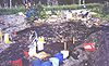 |
Yukon Island Yukon Island, Alaska The Yukon Island Main Site is an archaeological site on Yukon Island, an island in the Cook Inlet, in Kenai Peninsula Borough, Alaska, United States. Related to the Kachemak Bay Culture, it was declared a National Historic Landmark in 1962. Yukon Island is located at , about 9 miles south of... |
Kenai Peninsula Kenai Peninsula Borough, Alaska -National protected areas:* Alaska Maritime National Wildlife Refuge ** Chiswell Islands** Tuxedni Wilderness* Chugach National Forest * Katmai National Park and Preserve ** Katmai Wilderness... |
Related to the Kachemak Bay Culture. | |
| Table notes: see below. | ||||||
Historic areas of the NPS in Alaska
National Historic Sites, National Historical Parks, some National Monuments, and certain other areas listed in the National Park system are historic landmarks of national importance that are highly protected already, often before the inauguration of the NHL program in 1960, and are then often not also named NHLs per se. There are three of these in Alaska. The National Park Service lists these three together with the NHLs in the state,Cape Krusenstern National Monument
Cape Krusenstern National Monument
Cape Krusenstern National Monument and the colocated Cape Krusenstern Archeological District is a U.S. National Monument and a National Historic Landmark centered on Cape Krusenstern in northwestern Alaska....
is also an NHL and is listed above. The other two are:
| Landmark name |
Image | Date established | Location | County | Description | |
|---|---|---|---|---|---|---|
| Klondike Gold Rush National Historical Park Klondike Gold Rush National Historical Park Klondike Gold Rush National Historical Park is a United States National Historical Park commemorating the Klondike Gold Rush of the late 1890s. The gold rush was in the Yukon Territory, and this park comprises staging areas for the trek there, and routes leading in its direction... |
Skagway Skagway, Alaska Skagway is a first-class borough in Alaska, on the Alaska Panhandle. It was formerly a city first incorporated in 1900 that was re-incorporated as a borough on June 25, 2007. As of the 2000 census, the population of the city was 862... |
Skagway Skagway, Alaska Skagway is a first-class borough in Alaska, on the Alaska Panhandle. It was formerly a city first incorporated in 1900 that was re-incorporated as a borough on June 25, 2007. As of the 2000 census, the population of the city was 862... |
Park of Klondike Gold Rush Klondike Gold Rush The Klondike Gold Rush, also called the Yukon Gold Rush, the Alaska Gold Rush and the Last Great Gold Rush, was an attempt by an estimated 100,000 people to travel to the Klondike region the Yukon in north-western Canada between 1897 and 1899 in the hope of successfully prospecting for gold... , an NHL shared with Seattle, Washington Seattle, Washington Seattle is the county seat of King County, Washington. With 608,660 residents as of the 2010 Census, Seattle is the largest city in the Northwestern United States. The Seattle metropolitan area of about 3.4 million inhabitants is the 15th largest metropolitan area in the country... . |
|||
| Sitka National Historical Park Sitka National Historical Park Located approximately one–half mile from the Park, the Russian Bishop's House was constructed out of native spruce in 1842 by Finnish carpenters. It is one of only four surviving examples of Russian Colonial Style architecture in the Western Hemisphere... |
 |
Sitka | Sitka |
Former NHLs in Alaska
| Landmark name | Image | Year listed | Locality | Borough / Census Area | Description | |
|---|---|---|---|---|---|---|
| a | Gambell Sites Gambell Sites The Gambell Sites are five archeological sites which established a chronology of over 2000 years of human habitation on St. Lawrence Island near Gambell, Alaska.... |
 |
1962, withdrawn 1989 |
Gambell Gambell, Alaska Gambell is a village on St. Lawrence Island in Alaska, United States. At the 2000 census the population was 649.-Geography:Gambell is located on the northwest cape of St. Lawrence Island in the Bering Sea, southwest of Nome... 63°46′34"N 171°42′3"W |
Nome Nome Census Area, Alaska Nome Census Area is a census area located in the state of Alaska, United States. As of the 2000 census, the population was 9,196. It is part of the unorganized borough and therefore has no borough seat. Its largest community by far is the city of Nome.... |
These five archeological Archaeology Archaeology, or archeology , is the study of human society, primarily through the recovery and analysis of the material culture and environmental data that they have left behind, which includes artifacts, architecture, biofacts and cultural landscapes... sites established a chronology Chronology Chronology is the science of arranging events in their order of occurrence in time, such as the use of a timeline or sequence of events. It is also "the determination of the actual temporal sequence of past events".Chronology is part of periodization... of human habitation on St. Lawrence Island St. Lawrence Island St. Lawrence Island is located west of mainland Alaska in the Bering Sea, just south of the Bering Strait, at about 63°30' North 173°20' West. The village of Gambell is located on the northwest cape, from the Chukchi Peninsula in the Russian Far East. The island is part of Alaska, but closer to... , with evidence of four cultural phases Archaeological culture An archaeological culture is a recurring assemblage of artifacts from a specific time and place, which are thought to constitute the material culture remains of a particular past human society. The connection between the artifacts is based on archaeologists' understanding and interpretation and... of the Thule Thule people The Thule or proto-Inuit were the ancestors of all modern Inuit. They developed in coastal Alaska by AD 1000 and expanded eastwards across Canada, reaching Greenland by the 13th century. In the process, they replaced people of the earlier Dorset culture that had previously inhabited the region... tradition, beginning about 2000 years before the present. Over the 20th century, the archeological value of the sites was largely destroyed due to ivory Ivory Ivory is a term for dentine, which constitutes the bulk of the teeth and tusks of animals, when used as a material for art or manufacturing. Ivory has been important since ancient times for making a range of items, from ivory carvings to false teeth, fans, dominoes, joint tubes, piano keys and... mining, and landmark designation was withdrawn. |
| c | Sourdough Lodge Sourdough Lodge The Sourdough Lodge was built in Alaska between 1903 and 1905 of logs. It was one of a number of roadhouses built along the Valdez Trail . The roadhouses were about apart and offered shelter for travellers and road construction crew... |
.jpg) |
1978, withdrawn 1994 |
Gakona Gakona, Alaska Gakona is a census-designated place in the Valdez-Cordova Census Area in the U.S. state of Alaska. As of the 2000 census, the population of the CDP was 215.-Geography and climate:... 62.301940°N 145.30194°W |
Valdez-Cordova Valdez-Cordova Census Area, Alaska Valdez-Cordova Census Area is a census area located in the state of Alaska, United States. As of the 2000 census, the population was 10,195. It is part of the unorganized borough and therefore has no borough seat... |
Built Construction In the fields of architecture and civil engineering, construction is a process that consists of the building or assembling of infrastructure. Far from being a single activity, large scale construction is a feat of human multitasking... of logs Log cabin A log cabin is a house built from logs. It is a fairly simple type of log house. A distinction should be drawn between the traditional meanings of "log cabin" and "log house." Historically most "Log cabins" were a simple one- or 1½-story structures, somewhat impermanent, and less finished or less... in 1903-05, this was one of a number of roadhouses built along the Valdez Trail Richardson Highway The Richardson Highway is a highway in the U.S. state of Alaska, running 368 miles from Valdez to Fairbanks. It is marked as Alaska Route 4 from Valdez to Delta Junction and as Alaska Route 2 from there to Fairbanks. It is also connects segments of Alaska Route 1 between the Glenn Highway and the... . It was destroyed by fire in 1992, leading to withdrawal of its landmark status. By the time of its destruction, it was one of the oldest continuously-operating roadhouses in Alaska. |
See also
- List of Registered Historic Places in Alaska
- History of AlaskaHistory of AlaskaThe history of Alaska dates back to the Upper Paleolithic period , when Asiatic groups crossed the Bering land bridge into what is now western Alaska. At the time of European contact by the Russian explorers, the area was populated by Alaska Native groups...
- Historic preservationHistoric preservationHistoric preservation is an endeavor that seeks to preserve, conserve and protect buildings, objects, landscapes or other artifacts of historical significance...
- National Register of Historic PlacesNational Register of Historic PlacesThe National Register of Historic Places is the United States government's official list of districts, sites, buildings, structures, and objects deemed worthy of preservation...
- List of U.S. National Historic Landmarks by state
External links
- National Historic Landmark Program at the National Park ServiceNational Park ServiceThe National Park Service is the U.S. federal agency that manages all national parks, many national monuments, and other conservation and historical properties with various title designations...
- Lists of National Historic Landmarks