
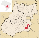
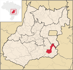
Ipameri
Encyclopedia
| Ipameri | |
|---|---|
| State | Goiás Goiás Goiás is a state of Brazil, located in the central part of the country. The name Goiás comes from the name of an indigenous community... |
| Coordinates: | 17°43′29"S 48°09′35"W |
| Area: | 4,368.6 km² |
| Population: | 23,114 (IBGE 2007) |
| Elevation: | 764m above sea level |
| Postcode (CEP): | 75780-000 |
| IBGE statistical microregion: | 017 Catalão Catalão Microregion The Catalão Microregion is a statistical microregion created by IBGE in south-eastern Goiás state, Brazil.*Population: 131.741 inhabitants *Cities: 11*Total Area: 15,238.60 km²... |
| Became a city: | 1870 |
| Mayor: | Wilson Geraldo Sugai |
| Distance to Goiânia Goiânia -Climate:The city has a tropical wet and dry climate with an average temperature of . There's a wet season, from October to April, and a dry one, from May to September. Annual rainfall is around 1,520 mm.... : |
193 km. |
| Website: | Official site of the Prefeitura |
City
A city is a relatively large and permanent settlement. Although there is no agreement on how a city is distinguished from a town within general English language meanings, many cities have a particular administrative, legal, or historical status based on local law.For example, in the U.S...
and municipality
Municipality
A municipality is essentially an urban administrative division having corporate status and usually powers of self-government. It can also be used to mean the governing body of a municipality. A municipality is a general-purpose administrative subdivision, as opposed to a special-purpose district...
in southeastern Goiás
Goiás
Goiás is a state of Brazil, located in the central part of the country. The name Goiás comes from the name of an indigenous community...
state, in Brazil
Brazil
Brazil , officially the Federative Republic of Brazil , is the largest country in South America. It is the world's fifth largest country, both by geographical area and by population with over 192 million people...
. The population was 23,114 (2007) in a total area of 4,368.6 km² (10/10/2002). It is a major producer of soybeans, corn, and livestock.
Location and connections
Ipameri is located east of Caldas NovasCaldas Novas
Caldas Novas is a Brazilian city and municipality in the state of Goiás. It is considered by many to be the largest hydro-thermal resort in the world.-Location:...
and 65 km. northwest of Catalão
Catalão
Catalão is a small city and municipality located in the south of the state of Goiás, in Brazil. It is a large producer of grains, cattle, and phosphates and has a John Deere and Mitsubishi factory.-Demographics:*Population density: 17.85 inhab/km²...
. It is part of the statistical micro-region of Catalão
Catalão Microregion
The Catalão Microregion is a statistical microregion created by IBGE in south-eastern Goiás state, Brazil.*Population: 131.741 inhabitants *Cities: 11*Total Area: 15,238.60 km²...
.
- Limiting municipalities: Caldas NovasCaldas NovasCaldas Novas is a Brazilian city and municipality in the state of Goiás. It is considered by many to be the largest hydro-thermal resort in the world.-Location:...
, Campo Alegre de GoiásCampo Alegre de GoiásCampo Alegre de Goiás is a small town and municipality in southeastern Goiás state, Brazil. It is the largest producer of coffee in the state and an important producer of soybeans, corn, and wheat.-Geography:...
, CatalãoCatalãoCatalão is a small city and municipality located in the south of the state of Goiás, in Brazil. It is a large producer of grains, cattle, and phosphates and has a John Deere and Mitsubishi factory.-Demographics:*Population density: 17.85 inhab/km²...
, CristalinaCristalinaCristalina is a small city located in the southeast of the state of Goiás, Brazil.-Location:Cristalina is located directly south of the federal capital, Brasília, and is connected to that city by BR-040...
, CorumbaíbaCorumbaíbaCorumbaíba is a small town and municipality in southeastern Goiás state, Brazil.-Location and Connections:Corumbaíba is located 222 kilometers from the state capital, Goiânia...
, GoiandiraGoiandiraGoiandira is a small town and municipality in the southeastern portion of the Brazilian state of Goiás. The population was 4,925 in a total area of 560.7 km² .-Geography:...
, LuziâniaLuziâniaLuziânia is a city and municipality in the state of Goiás, Brazil. This fast-growing city is a great producer of agricultural products including soybeans and beans.-Location:Luziânia is located 68 km...
, Nova AuroraNova Aurora, GoiásNova Aurora is a small town and municipality in south Goiás state, Brazil.-Location:Nova Aurora is located about fifty kilometers north of the Paranaíba River, which forms the boundary between the states of Goiás and Minas Gerais. It is part of the Catalão Microregion and is 32 kilometers west of...
, OrizonaOrizonaOrizona is a small town and municipality in Goiás state, Brazil.-Location:Orizona is 138 km from the state capital of Goiânia, 200 km from Brasília, 150 from Catalão and 260 from Uberlândia, which is located in the rich Triângulo Mineiro of Minas Gerais. It is part of the Pires do Rio...
, Pires do RioPires do RioPires do Rio is a small city and municipality in Goiás state, Brazil. It is a prosperous town and a major producer of poultry.-Location:It is located in the Pires do Rio Microregion. . It is located 144 kilometers from the state capital and is served by highways GO-020, 330 and 414, as well as...
, UrutaíUrutaíUrutaí is a small town and municipality in southeast Goiás state, Brazil. It is a major producer of poultry products.-Location:Urutaí is located 163 kilometers from the state capital, Goiânia. Highway connections are made by BR-352 / Bela Vista de Goiás / Cristianópolis / BR-352 / G-020 / Santa...
and ParacatuParacatuParacatu may refer to:*Paracatu, Minas Gerais, a city and a municipality in Minas Gerais state, Brazil*Paracatu River, a river near the city of Paracatu...
- MG
Ipameri is 193 km from the state capital, Goiânia
Goiânia
-Climate:The city has a tropical wet and dry climate with an average temperature of . There's a wet season, from October to April, and a dry one, from May to September. Annual rainfall is around 1,520 mm....
, and 300 km. from the federal capital, Brasília
Brasília
Brasília is the capital city of Brazil. The name is commonly spelled Brasilia in English. The city and its District are located in the Central-West region of the country, along a plateau known as Planalto Central. It has a population of about 2,557,000 as of the 2008 IBGE estimate, making it the...
. The city is on the railroad linking Goiânia
Goiânia
-Climate:The city has a tropical wet and dry climate with an average temperature of . There's a wet season, from October to April, and a dry one, from May to September. Annual rainfall is around 1,520 mm....
and Anápolis
Anápolis
Anápolis is the third largest city in the State of Goiás in Brazil. It lies in the center of a rich agricultural region and has become a leader in food processing and pharmaceutical plants.-Location and population:...
with São Paulo
São Paulo
São Paulo is the largest city in Brazil, the largest city in the southern hemisphere and South America, and the world's seventh largest city by population. The metropolis is anchor to the São Paulo metropolitan area, ranked as the second-most populous metropolitan area in the Americas and among...
and Belo Horizonte
Belo Horizonte
Belo Horizonte is the capital of and largest city in the state of Minas Gerais, located in the southeastern region of Brazil. It is the third largest metropolitan area in the country...
. It is also accessible by highway from Goiânia, which lies to the northwest.
Highway connections from Goiânia
Goiânia
-Climate:The city has a tropical wet and dry climate with an average temperature of . There's a wet season, from October to April, and a dry one, from May to September. Annual rainfall is around 1,520 mm....
are by BR-352 / Bela Vista de Goiás
Bela Vista de Goiás
Bela Vista de Goiás is a small city located in central Goiás state in Brazil.-Location:It is 45 kilometers from the state capital of Goiânia...
/ Cristianópolis
Cristianópolis
This article is about Cristianópolis, Goiás. For Cristianópolis, Mato Grosso see Cristianópolis, Mato GrossoCristianópolis is a small town and municipality in south-eastern Goiás state, Brazil.-Geographical Information:...
/ GO-020 / Pires do Rio
Pires do Rio
Pires do Rio is a small city and municipality in Goiás state, Brazil. It is a prosperous town and a major producer of poultry.-Location:It is located in the Pires do Rio Microregion. . It is located 144 kilometers from the state capital and is served by highways GO-020, 330 and 414, as well as...
/ GO-330. Other distances from Ipameri are: Catalão 50 km, Campo Alegre 55 km, Goiandira 63 km, Três Ranchos 89 km, Caldas Novas 60 km and Urutaí 32 km.
History
The region of Ipameri was first settled by Europeans in the middle of the nineteenth century. The first houses were built along the banks of the Vai-Vem River, on the Fazenda Vai-Vem, belonging to Francisco José Dutra. According to legend this rancher was bitten by a poisonous snake and promised, if he were cured, to donate all the lands he could see from the heights of a hill called São Domingos to the Divine Holy Spirit. As he survived he donated all the lands which would make up the future municipality of Ipameri. The origin of the name of the first settlement, Vai-Vem" (It comes and goes), has two versions. One is that it refers to the comings and goings of the Indians (Xavantes and Caiapós), who crossed the river on a makeshift bridge, and another that the name refers to the stream seemed to zigzag. In 1845 Vai-Vem was made a district of CatalãoCatalão
Catalão is a small city and municipality located in the south of the state of Goiás, in Brazil. It is a large producer of grains, cattle, and phosphates and has a John Deere and Mitsubishi factory.-Demographics:*Population density: 17.85 inhab/km²...
, becoming a municipality in 1880, with the name "Entre-Rios". In 1904 the name was changed to Ipameri, from the Indigenous word "Ipau-meri", meaning "entre-rios" or between the rivers.
In 1913 the first hydroelectric station in Goiás was built here. In 1915 a cinema was opened. The automobile appeared in 1914 and a newspaper was founded in 1917. In 1921 the first bank in the state opened its doors here. In 1922 a military base was built. In 1938 the main Catholic church, the Igreja Matriz do Divino Espírito Santo, was inaugurated. After the middle of the twentieth century the city began a period of decline, caused by the decadence of the national railroad system and the distance of the main national highways. Ipameri became known as the city that "already had", or "already was". The city began to prosper again the 1980s with rural electrification, mechanization of agriculture and paved highways leading to other centers. Agroindustries began to arrive together with institutes of higher education. Today Ipameri is considered one of the more prosperous small cities in the state. Source: Ipameri.go.gov.br
Political data
- Eligible voters: 18,339 (12/2007)
- Mayor: Wilson Geraldo Sugai (January 2009)
- Vice-mayor: Ludmila de Queiroz Cozac Roos Machado
- Councilmembers: 09
Demographics
- Population growth rate 2000/2007: 0.30.%
- Urban population in 2007: 19,548
- Rural population in 2007: 3,566
The economy
Lying in rolling uplands between the Veríssimo and CorumbáCorumbá River
The Corumbá River is the most important river in the Central Plateau region of Brazil. Its source is in the Montes de Pireneus, near Pirenópolis, state of Goiás, near the boundary with the Federal District and its length ifs 567 km. It receives the waters of the Descoberto and São Bartolomeu,...
rivers, tributaries of the Paranaíba
Paranaíba River
The Paranaíba River is a Brazilian river whose source lies in the state of Minas Gerais in the Mata da Corda mountains, municipality of Rio Paranaíba, at an altitude of 1,148 meters; on the other face of this mountain chain are the sources of the Abaeté river, tributary of the São Francisco River...
, Ipameri is primarily a cattle-shipping centre that also houses meat-processing and rice-hulling plants.
Ipameri has a modern and mechanized agriculture. The municipality is the largest producer of cereals in the Southeast region of Goiás and one of the biggest in the state. The most important crops are cotton and soy, but there is also cultivation of corn, rice, potato, tomato, coffee, manioc, and garlic.
Main agricultural products in total planted area (2006)
- coffee: 565 ha.
- cotton: 5,800 ha.
- sugarcane: 2,700 ha.
- corn: 14,000 ha.
- soybeans: 66,000 ha.
Cattle raising is also very important. There was a herd of approximately 180,000 head, divided between beef and dairy cattle.
Main industries are in cotton processing, soybean oil production, dairy products, and bricks and tiles.
Economic data
- Industrial units: 49 (06/2007)
- Retail units: 255 (August/2007)
- Lodging and restaurants: 36
- Banking institutions: - Banco do Brasil S.A. - Banco Itaú S.A. - CEF (Aug/2007)
- Dairies: - Laticínios Carvalho Ltda.; - Cooperativa Agropecuária do Vale do Corumbá Ltda (07/06/2005)
- Meat-packing plants: FRI-SOL - Frigorífico Sol Nascente Ltda.; - GAASA e Alimentos Ltda.; - Carvalho e Pinheiro Ltda. (07/06/2005)
- Distilleries: LASA - Lago Azul S/A (Jul/2007)
- Industrial zone: Distrito Agroindustrial - DIAIPA (Jun/2006)
Agricultural data 2006
- Farms: 1,246
- Total area: 284,247 ha.
- Area of permanent crops: 3,099 ha.
- Area of perennial crops: 51,075 ha.
- Area of natural pasture: 143,365 ha.
- Area of woodland and forests: 75,638 ha.
- Persons dependent on farming: 3,000
- Farms with tractors: 308
- Number of tractors: 704
- Cattle herd: 180,000
Education and health
- Literacy rate: 89.5%
- Infant mortality rate: 24.5 in 1,000 live births
- Schools: 30 (2006)
- Students: 7,017
- Higher education: Unidade Universitária da UEG. - Campus IV da Universidade Católica (Jul/2007)
- Hospitals: 03 (2007)
- Hospital beds: 113
- Walk-in clinics: 16
Municipal Human Development Index
Human Development Index
The Human Development Index is a composite statistic used to rank countries by level of "human development" and separate "very high human development", "high human development", "medium human development", and "low human development" countries...
- MHDI: 0.758
- State ranking: 61 (out of 242 municipalities in 2000)
- National ranking: 1,653 (out of 5,507 municipalities in 2000)
(All data are from 2000)
For a complete list see Frigoletto
See also
- List of municipalities in Goiás
- Catalão MicroregionCatalão MicroregionThe Catalão Microregion is a statistical microregion created by IBGE in south-eastern Goiás state, Brazil.*Population: 131.741 inhabitants *Cities: 11*Total Area: 15,238.60 km²...
- Microregions of Goiás