
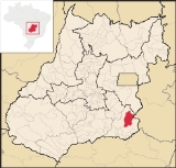
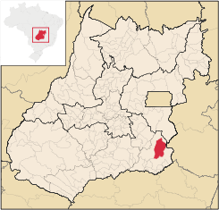
Campo Alegre de Goiás
Encyclopedia
| Campo Alegre de Goiás | |
|---|---|
| State | Goiás Goiás Goiás is a state of Brazil, located in the central part of the country. The name Goiás comes from the name of an indigenous community... |
| Coordinates: | 17°38′20"S 47°46′55"W |
| Area: | 2.463.0 km² |
| Population: | 5,767 (IBGE 2007) |
| Elevation: | 877m above sea level |
| Postcode (CEP): | 75795-000 |
| IBGE statistical microregion: | 017 Catalão Catalão Microregion The Catalão Microregion is a statistical microregion created by IBGE in south-eastern Goiás state, Brazil.*Population: 131.741 inhabitants *Cities: 11*Total Area: 15,238.60 km²... |
| Became a city: | 1953 |
| Mayor: | José Lourenço Peixoto (2005–2009) |
| Distance to Goiânia Goiânia -Climate:The city has a tropical wet and dry climate with an average temperature of . There's a wet season, from October to April, and a dry one, from May to September. Annual rainfall is around 1,520 mm.... : |
255 km. |
| Website: | none |
Town
A town is a human settlement larger than a village but smaller than a city. The size a settlement must be in order to be called a "town" varies considerably in different parts of the world, so that, for example, many American "small towns" seem to British people to be no more than villages, while...
and municipality
Municipality
A municipality is essentially an urban administrative division having corporate status and usually powers of self-government. It can also be used to mean the governing body of a municipality. A municipality is a general-purpose administrative subdivision, as opposed to a special-purpose district...
in southeastern Goiás state, Brazil
Brazil
Brazil , officially the Federative Republic of Brazil , is the largest country in South America. It is the world's fifth largest country, both by geographical area and by population with over 192 million people...
. It is the largest producer of coffee in the state and an important producer of soybeans, corn, and wheat.
Geography
Campo Alegre is located in the statistical micro-region of CatalãoCatalão Microregion
The Catalão Microregion is a statistical microregion created by IBGE in south-eastern Goiás state, Brazil.*Population: 131.741 inhabitants *Cities: 11*Total Area: 15,238.60 km²...
. It is 326 km. from the state capital, Goiânia
Goiânia
-Climate:The city has a tropical wet and dry climate with an average temperature of . There's a wet season, from October to April, and a dry one, from May to September. Annual rainfall is around 1,520 mm....
and is connected by BR-352 / Bela Vista de Goiás
Bela Vista de Goiás
Bela Vista de Goiás is a small city located in central Goiás state in Brazil.-Location:It is 45 kilometers from the state capital of Goiânia...
/ Cristianópolis
Cristianópolis
This article is about Cristianópolis, Goiás. For Cristianópolis, Mato Grosso see Cristianópolis, Mato GrossoCristianópolis is a small town and municipality in south-eastern Goiás state, Brazil.-Geographical Information:...
/ GO-020 / Pires do Rio
Pires do Rio
Pires do Rio is a small city and municipality in Goiás state, Brazil. It is a prosperous town and a major producer of poultry.-Location:It is located in the Pires do Rio Microregion. . It is located 144 kilometers from the state capital and is served by highways GO-020, 330 and 414, as well as...
/ GO-330 / Ipameri
Ipameri
Ipameri is a small city and municipality in southeastern Goiás state, in Brazil. The population was 23,114 in a total area of 4,368.6 km² . It is a major producer of soybeans, corn, and livestock.-Location and connections:...
/ Catalão
Catalão
Catalão is a small city and municipality located in the south of the state of Goiás, in Brazil. It is a large producer of grains, cattle, and phosphates and has a John Deere and Mitsubishi factory.-Demographics:*Population density: 17.85 inhab/km²...
/ BR-050.
It has boundaries with Catalão
Catalão
Catalão is a small city and municipality located in the south of the state of Goiás, in Brazil. It is a large producer of grains, cattle, and phosphates and has a John Deere and Mitsubishi factory.-Demographics:*Population density: 17.85 inhab/km²...
(south), Ipameri
Ipameri
Ipameri is a small city and municipality in southeastern Goiás state, in Brazil. The population was 23,114 in a total area of 4,368.6 km² . It is a major producer of soybeans, corn, and livestock.-Location and connections:...
(north and east), and Paracatu
Paracatu
Paracatu may refer to:*Paracatu, Minas Gerais, a city and a municipality in Minas Gerais state, Brazil*Paracatu River, a river near the city of Paracatu...
(east). Three rivers cross the municipality: Rio Veríssimo, Rio São Marcos and Rio Pirapitinga.
History
Campo Alegre de Goiás began as a stopping point in 1833 for the muleteers crossing the different routes in the province of Goiás. The first name was Calaça. It became a district of IpameriIpameri
Ipameri is a small city and municipality in southeastern Goiás state, in Brazil. The population was 23,114 in a total area of 4,368.6 km² . It is a major producer of soybeans, corn, and livestock.-Location and connections:...
in 1907. In 1944 the name was changed to Rudá, which means God of love in the local indigenous language. Later the name was changed back to Campo Alegre de Goiás when the town was dismembered from Ipameri and made a municipality.
Demographic and political data
- Population density in 2007: 2,34 inhab/km²
- Population growth rate 2000/2007: 3.52.%
- Urban population in 2007: 4,160
- Rural population in 2007: 1,607
- Eligible voters in 2007: 3,966
- City government in 2005: mayor (José Lourenço Peixoto), vice-mayor (Luiz Manteiga Alvares de Campos), and 09 councilmembers
Economy
The economy is based on agriculture, with important plantations of coffee, soybeans, wheat, corn, and cattle raising. There are also extensive plantations of eucalyptusEucalyptus
Eucalyptus is a diverse genus of flowering trees in the myrtle family, Myrtaceae. Members of the genus dominate the tree flora of Australia...
, which is used to make charcoal and transported to the metallurgy industries of the Belo Horizonte
Belo Horizonte
Belo Horizonte is the capital of and largest city in the state of Minas Gerais, located in the southeastern region of Brazil. It is the third largest metropolitan area in the country...
industrial belt.
Economic data
- Industrial establishments in 2007: 15
- Retail establishments in 2007: 93
- Financial institutions in 2007: Banco Itaú, Banco do Brasil
- Cattle: 68,500
- Main crops: In 2006 the main crops were cotton (2,800 hectares), garlic, rice, potatoes, coffee, beans (2,500 hectares), and soybeans (57,000 hectares). There were 339 farms with a total area of 232,672 ha., of which 105,419 ha. were pasture, 3,870 ha. were permanent crops, 70,157 were perennial crops, and 49,330 ha. were woodland. There were 1,250 persons dependent on agriculture. There were 331 tractors and 105 farms had tractors.
Health and education
- Infant mortality rate in 2000: 14.32
- Public health clinics in 2007: 03
- Hospitals in 2007: 01 with 6 beds
- Literacy rate in 2000: 89.4
- Schools in 2006: 10 with 1,662 students
- Higher education: none in 2005
Campo Alegre is a prosperous town and has a relatively high standard of living. On the United Nations Human Development Index
Human Development Index
The Human Development Index is a composite statistic used to rank countries by level of "human development" and separate "very high human development", "high human development", "medium human development", and "low human development" countries...
Campo Alegre had a rating of 0.802,which ranked it 9 out of a total of 242 municipalities in the state of Goiás
Goiás
Goiás is a state of Brazil, located in the central part of the country. The name Goiás comes from the name of an indigenous community...
. Nationally it was ranked 532 out of 5,507 municipalities. (All data are from 2000.) For the complete list see Frigoletto
See also
- List of municipalities in Goiás
- Microregions of Goiás