
Orizona
Encyclopedia
| Orizona | |
|---|---|
| State | Goiás Goiás Goiás is a state of Brazil, located in the central part of the country. The name Goiás comes from the name of an indigenous community... |
| Coordinates: | 17°02′02"S 48°17′52"W |
| Area: | 1,972.8 km² |
| Population: | 14,374 (IBGE 2007) |
| Elevation of municipal seat: | 806 m above sea level |
| Postcode (CEP): | 75280-000 |
| Became a city: | 1906 |
| Distance to Goiânia Goiânia -Climate:The city has a tropical wet and dry climate with an average temperature of . There's a wet season, from October to April, and a dry one, from May to September. Annual rainfall is around 1,520 mm.... : |
138 km. |
| IBGE statistical microregion: | Pires do Rio Microregion Pires do Rio Microregion The Pires do Rio Microregion is a statistical region of south-central Goiás state, Brazil. The most important city is Pires do Rio. The area includes 10 cities with a population of 90,327 in an area of 9,449.80 km²... |
| Website: | Prefeitura de Orizona |
Town
A town is a human settlement larger than a village but smaller than a city. The size a settlement must be in order to be called a "town" varies considerably in different parts of the world, so that, for example, many American "small towns" seem to British people to be no more than villages, while...
and municipality
Municipality
A municipality is essentially an urban administrative division having corporate status and usually powers of self-government. It can also be used to mean the governing body of a municipality. A municipality is a general-purpose administrative subdivision, as opposed to a special-purpose district...
in Goiás
Goiás
Goiás is a state of Brazil, located in the central part of the country. The name Goiás comes from the name of an indigenous community...
state, Brazil
Brazil
Brazil , officially the Federative Republic of Brazil , is the largest country in South America. It is the world's fifth largest country, both by geographical area and by population with over 192 million people...
.
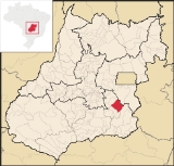
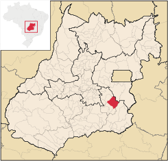
Location
Orizona is 138 km from the state capital of GoiâniaGoiânia
-Climate:The city has a tropical wet and dry climate with an average temperature of . There's a wet season, from October to April, and a dry one, from May to September. Annual rainfall is around 1,520 mm....
, 200 km from Brasília
Brasília
Brasília is the capital city of Brazil. The name is commonly spelled Brasilia in English. The city and its District are located in the Central-West region of the country, along a plateau known as Planalto Central. It has a population of about 2,557,000 as of the 2008 IBGE estimate, making it the...
, 150 from Catalão
Catalão
Catalão is a small city and municipality located in the south of the state of Goiás, in Brazil. It is a large producer of grains, cattle, and phosphates and has a John Deere and Mitsubishi factory.-Demographics:*Population density: 17.85 inhab/km²...
and 260 from Uberlândia
Uberlândia
Uberlândia is the main town in the Triangle region, west of the state of Minas Gerais, Brazil. With a population of 604,013 inhabitants, according to 2010 estimates, the city is the second largest in the state second only to Belo Horizonte...
, which is located in the rich Triângulo Mineiro
Triângulo Mineiro
The Triangle Mineiro Portuguese pronunciation: [tɾiɐɡulu minejru] is an officer in the region west of the state of Minas Gerais, Brazil. The area is 93.500 km ² and is limited by the Serra da Canastra and Marcela, east, south of Sao Paulo, Goias in the north and west of the junction of the rivers...
of Minas Gerais
Minas Gerais
Minas Gerais is one of the 26 states of Brazil, of which it is the second most populous, the third richest, and the fourth largest in area. Minas Gerais is the Brazilian state with the largest number of Presidents of Brazil, the current one, Dilma Rousseff, being one of them. The capital is the...
. It is part of the Pires do Rio Microregion
Pires do Rio Microregion
The Pires do Rio Microregion is a statistical region of south-central Goiás state, Brazil. The most important city is Pires do Rio. The area includes 10 cities with a population of 90,327 in an area of 9,449.80 km²...
. See Citybrazil for all the regions.
Highway connections from Goiânia
Goiânia
-Climate:The city has a tropical wet and dry climate with an average temperature of . There's a wet season, from October to April, and a dry one, from May to September. Annual rainfall is around 1,520 mm....
are made by BR-357 / GO-010 / Bonfinópolis
Bonfinópolis
Bonfinópolis is a small town and municipality in central Goiás state, Brazil. It is located a short distance east of Goiânia and is part of the Goiânia metropolitan area.The distance to Goiânia is 33 km...
/ Vianópolis
Vianópolis
Vianópolis is a small town and municipality in the center of the Brazilian state of Goiás.-Location:Vianópolis is located 90 km. from the state capital, Goiânia. Highway connections are made by BR-457 / GO-010 / GO-330 / passing through the cities of Bonfinópolis, Leopoldo de Bulhões and...
/ GO-330. See Sepin for all the distances.
It borders Silvânia
Silvânia
Silvânia is a small city and municipality in southcentral Goiás state, Brazil.-Location and highway connections:Silvânia is located 77 kilometers from the state capital of Goiânia, 180 km...
, Luziânia
Luziânia
Luziânia is a city and municipality in the state of Goiás, Brazil. This fast-growing city is a great producer of agricultural products including soybeans and beans.-Location:Luziânia is located 68 km...
, Cristalina
Cristalina
Cristalina is a small city located in the southeast of the state of Goiás, Brazil.-Location:Cristalina is located directly south of the federal capital, Brasília, and is connected to that city by BR-040...
, Pires do Rio
Pires do Rio
Pires do Rio is a small city and municipality in Goiás state, Brazil. It is a prosperous town and a major producer of poultry.-Location:It is located in the Pires do Rio Microregion. . It is located 144 kilometers from the state capital and is served by highways GO-020, 330 and 414, as well as...
, Ipameri
Ipameri
Ipameri is a small city and municipality in southeastern Goiás state, in Brazil. The population was 23,114 in a total area of 4,368.6 km² . It is a major producer of soybeans, corn, and livestock.-Location and connections:...
, Urutaí
Urutaí
Urutaí is a small town and municipality in southeast Goiás state, Brazil. It is a major producer of poultry products.-Location:Urutaí is located 163 kilometers from the state capital, Goiânia. Highway connections are made by BR-352 / Bela Vista de Goiás / Cristianópolis / BR-352 / G-020 / Santa...
and Vianópolis
Vianópolis
Vianópolis is a small town and municipality in the center of the Brazilian state of Goiás.-Location:Vianópolis is located 90 km. from the state capital, Goiânia. Highway connections are made by BR-457 / GO-010 / GO-330 / passing through the cities of Bonfinópolis, Leopoldo de Bulhões and...
.
History
Orizona was founded by Joaquim Fernandes de Castro and José Pereira Cardoso in 1850 when they started construction of a chapel on the banks of the Ribeirão Santa Bárbara, a tributary of the Corumbá River. In 1890 the settlement became a district called Capela dos Correias, and in 1909 it became a city called Campo Formoso. In 1943 the name was changed to Orizona, "oriza", meaning rice, and "zona", meaning region--Region of Rice. The name was chosen is a public contest, in which 42 people voted. It was suggested by a doctor, Dr. Raphael Leme Franco. The names proposed were Caruaba, Coema, Manhana, Orizona, Porangatu, Potira, Jubara and Oriza. See Prefeitura de Orizona for the history.Political information
- In January 2005 the Mayor was Itamar Dias Teixeira. The city council had 9 members and there were 10,750 eligible voters in December 2007.
Demographics
In 2007 the population density was 7.29 inhab/km². A large part of the population is still rural, relatively uncommon in the state of Goiás. In 2007 there were 7,6673 inhabitants in the urban area and 6,707 inhabitants in the rural area. The population has grown by about a thousand inhabitants since 1980.The Economy
Orizona has been prospering with the production of high quality CachaçaCachaça
Cachaça is a liquor made from fermented sugarcane.It is the most popular distilled alcoholic beverage in Brazil. It is also known as aguardente, pinga, caninha and many other names...
made from sugarcane, which is exported to several countries. There are about 30 small rum distilleries in the town. Cachaça
Cachaça
Cachaça is a liquor made from fermented sugarcane.It is the most popular distilled alcoholic beverage in Brazil. It is also known as aguardente, pinga, caninha and many other names...
(kaˈʃasɐ), also called pinga, caninha, aguardente, cana, or mé, is a rum like drink, which differs from rum
Rum
Rum is a distilled alcoholic beverage made from sugarcane by-products such as molasses, or directly from sugarcane juice, by a process of fermentation and distillation. The distillate, a clear liquid, is then usually aged in oak barrels...
in that it is made from sugarcane juice while rum
Rum
Rum is a distilled alcoholic beverage made from sugarcane by-products such as molasses, or directly from sugarcane juice, by a process of fermentation and distillation. The distillate, a clear liquid, is then usually aged in oak barrels...
is made from molasses
Molasses
Molasses is a viscous by-product of the processing of sugar cane, grapes or sugar beets into sugar. The word molasses comes from the Portuguese word melaço, which ultimately comes from mel, the Latin word for "honey". The quality of molasses depends on the maturity of the sugar cane or sugar beet,...
.
Crossed by state highway GO-330 and several municipal roads, and bathed by the Corumbá
Corumbá River
The Corumbá River is the most important river in the Central Plateau region of Brazil. Its source is in the Montes de Pireneus, near Pirenópolis, state of Goiás, near the boundary with the Federal District and its length ifs 567 km. It receives the waters of the Descoberto and São Bartolomeu,...
and Piracanjuba rivers, the main economic activities of the area are the growing of corn, soybeans, rice sugarcane, and dairy cattle. There are several milk processing factories that receive over a million liters a day. Orizona is the fifth largest producer of milk in the state. Out of a total of two thousand milk producers, about 90% are small farmers. In addition, there are brickworks and mining companies that extract phosphates and sand.
In 2007 there were 26 industrial units and 159 retail units. There was an industrial park. There were 2 dairies: Laticínios JL Ltda.
- COAPRO - Cooperativa Agropecuária de Produtos Rurais de Orizona Ltda.
In June 2005 there were 2 financial institutions: Banco Itaú S.A. - Banco do Brasil S.A.
In 2007 there were 1,497 automobiles in the city. In 2005 the biggest sectors of employment were commerce and public administration.
In 2006 there were 127,000 head of cattle, 931,400 head of poultry, and 9,600 head of swine. The main agricultural products were sugarcane, coffee, passion fruit, hearts of palm, rice, beans, manioc, corn (3,300 hectares), soybeans (25,000 hectares) and sorghum (1,800 hectares).
Agricultural data 2006
- Number of farms: 1,588
- Total area: 135,590 ha.
- Area of permanent crops: 1,127 ha.
- Area of perennial crops: 23,227 ha.
- Area of natural pasture: 68.933 ha.
- Area of woodland and forests: 37,359 ha.
- Persons dependent on farming: 5,000
- Farms with tractors: 289
- Number of tractors: 577
- Cattle herd: 127,000 head IBGE
Health and education
In 2007 there was 1 hospital with 33 beds and 12 walk-in health clinics. In 2000 the infant mortality rate was 19.70, well below the national average of 33.0.In 2006 the school system had 17 schools, 140 classrooms, 265 teachers, and 3,621 students. The adult literacy rate was 89.4%, above the national average of 86.4%. There were no institutions of higher education.
Ranking on the Municipal Human Development Index
Human Development Index
The Human Development Index is a composite statistic used to rank countries by level of "human development" and separate "very high human development", "high human development", "medium human development", and "low human development" countries...
- MHDI: 0.768
- State ranking: 42 (out of 242 municipalities)
- National ranking: 1,380 (out of 5,507 municipalities) For the complete list see Frigoletto.com
See also
- List of municipalities in Goiás
- Microregions of Goiás