
Cristalina
Encyclopedia
| Cristalina | |
|---|---|
| State | Goiás Goiás Goiás is a state of Brazil, located in the central part of the country. The name Goiás comes from the name of an indigenous community... |
| Area: | 6,160.7 km² |
| Population: | 36,614 (IBGE 2007) |
| Population density: | 5.94 inhab/km² (2007) |
| Urban / Rural population: | 30,292 / 6,322 |
| Elevation: | 1,189 m above sea level |
| Postcode (CEP): | 73850-000 |
| IBGE statistical microregion: | Entorno de Brasília |
| Became a city: | 1916 |
| Distance to Goiânia Goiânia -Climate:The city has a tropical wet and dry climate with an average temperature of . There's a wet season, from October to April, and a dry one, from May to September. Annual rainfall is around 1,520 mm.... : |
274 km |
| Mayor: | Antonino Camilo de Andrade (2005) |
| Website: | Prefeitura Municipal de Cristalina |
| Coordinates: | 16°46′04"S 47°36′47"W |
Goiás
Goiás is a state of Brazil, located in the central part of the country. The name Goiás comes from the name of an indigenous community...
, Brazil
Brazil
Brazil , officially the Federative Republic of Brazil , is the largest country in South America. It is the world's fifth largest country, both by geographical area and by population with over 192 million people...
.
Location
Cristalina is located directly south of the federal capital, BrasíliaBrasília
Brasília is the capital city of Brazil. The name is commonly spelled Brasilia in English. The city and its District are located in the Central-West region of the country, along a plateau known as Planalto Central. It has a population of about 2,557,000 as of the 2008 IBGE estimate, making it the...
, and is connected to that city by BR-040. It lies on a plateau between the basins of two rivers: the Corumbá River
Corumbá River
The Corumbá River is the most important river in the Central Plateau region of Brazil. Its source is in the Montes de Pireneus, near Pirenópolis, state of Goiás, near the boundary with the Federal District and its length ifs 567 km. It receives the waters of the Descoberto and São Bartolomeu,...
and the São Marcos.
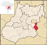
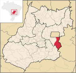
Cristalina belongs to the micro-region called Entorno de Brasília, which consists of several cities in Goiás state located outside the boundaries of the Federal District.
Cristalina has municipal boundaries with:
- North: BrasíliaBrasíliaBrasília is the capital city of Brazil. The name is commonly spelled Brasilia in English. The city and its District are located in the Central-West region of the country, along a plateau known as Planalto Central. It has a population of about 2,557,000 as of the 2008 IBGE estimate, making it the...
- South: IpameriIpameriIpameri is a small city and municipality in southeastern Goiás state, in Brazil. The population was 23,114 in a total area of 4,368.6 km² . It is a major producer of soybeans, corn, and livestock.-Location and connections:...
- East: Mundo NovoMundo NovoMundo Novo is a small town and municipality in northeastern Goiás state, Brazil.Mundo Novo is located in the São Miguel do Araguaia Microregion in the extreme north-west of the state. It is cut by the Rio Palmital, which flows north into the Araguaia River...
(Minas GeraisMinas GeraisMinas Gerais is one of the 26 states of Brazil, of which it is the second most populous, the third richest, and the fourth largest in area. Minas Gerais is the Brazilian state with the largest number of Presidents of Brazil, the current one, Dilma Rousseff, being one of them. The capital is the...
) - West: LuziâniaLuziâniaLuziânia is a city and municipality in the state of Goiás, Brazil. This fast-growing city is a great producer of agricultural products including soybeans and beans.-Location:Luziânia is located 68 km...
and Cidade OcidentalCidade OcidentalCidade Ocidental is a small city and municipality located in central Goiás state, Brazil. It is a suburb of Brasília.-Geography:It is bordered on the north by the Federal District, on the south by Luziânia, on the east by Cristalina and Luziânia, and on the west by Luziânia and Valparaíso de...
Cristalina is located at the junction of two important highways—the BR 040, which links Brasília to Belo Horizonte
Belo Horizonte
Belo Horizonte is the capital of and largest city in the state of Minas Gerais, located in the southeastern region of Brazil. It is the third largest metropolitan area in the country...
, and the BR 050, which links Brasília
Brasília
Brasília is the capital city of Brazil. The name is commonly spelled Brasilia in English. The city and its District are located in the Central-West region of the country, along a plateau known as Planalto Central. It has a population of about 2,557,000 as of the 2008 IBGE estimate, making it the...
to São Paulo
São Paulo
São Paulo is the largest city in Brazil, the largest city in the southern hemisphere and South America, and the world's seventh largest city by population. The metropolis is anchor to the São Paulo metropolitan area, ranked as the second-most populous metropolitan area in the Americas and among...
. This location alone has been responsible for much of the growth of the city, which had an increase in population with the foundation and continuous growth of Brasília, which is located at a distance of 125 km.
As the name indicates the town is famous for being one of the largest centers of production and commerce of precious and semi-precious stones and crystals in Brazil. The immense variety of stones (such as amethysts, sapphires, emeralds, blue topazes, and tourmaline) and of crystals (found in diverse sizes, shapes and colors) are responsible for the large number of tourists that visit the city. Because of the altitude the climate is mild, with temperatures between 10 and 28 degrees Celsius.
Economy
Today Cristalina is known for its large production of grains, especially seeds. It produces soybeans (140,000 hectares), corn (21,000 hectares), beans (34,000 hectares), sorghum (5,000 hectares), and rice (3,000 hectares). The cattle herd is large with 125,000 head in 2006. In 2007 there were 03 financial institutions (Banco do Brasil S.A, BRADESCO S.A., and Banco Itaú S.A.) and 01 meat-packing house—Cooperativa Agrícola Três Barras Ltda. (22/05/2006)Agricultural data 2006
- Farms: 1,136
- Total area: 330,663 ha.
- Area of permanent crops: 7,837 ha.
- Area of perennial crops: 143,532 ha.
- Area of natural pasture: 101,157 ha.
- Area of woodland and forests: 72,679 ha.
- Persons dependent on farming: 4,800
- Number of tractors: 967
- Cattle herd: 125,000
Cristalina was the state's largest producer of garlic, coffee, onions, peas, beans, tomatoes, and wheat.
Health and education
- Literacy rate in 2000: 82.3
- Infant mortality rate in 2000: 16.88 in 1,000 live births
- Schools: 36 with 13,555 students
- Hospitals: 02 with 30 beds
- Higher education was represented by two schools: Faculdade Central de Cristalina and Pólo Universitário da UEG.
- MHDI (2000): 0.760
- State ranking: 53 (out of 242 municipalities in 2000)
- National ranking: 1.571 (out of 5,507 municipalities in 2000)
History
The history of Cristalina began in the eighteenth century with gold exploration. An abundance of rock crystal and in 1879 two Frenchmen, Etienne Lopes and Leon Laboissière, residents of ParacatuParacatu
Paracatu may refer to:*Paracatu, Minas Gerais, a city and a municipality in Minas Gerais state, Brazil*Paracatu River, a river near the city of Paracatu...
, bought some of the crystal and exported it to Paris. They then settled in a place called Serra Velha where they set up their operations. Later, after the failure of the first miners, another Frenchman, Emílio Levy, arrived trading cloth for crystal and built his house, stimulating others to arrive. In 1901 the district of Serra dos Cristais was created belonging to the municipality of Santa Luzia, now Luziânia
Luziânia
Luziânia is a city and municipality in the state of Goiás, Brazil. This fast-growing city is a great producer of agricultural products including soybeans and beans.-Location:Luziânia is located 68 km...
. In 1916 it was emancipated as São Sebastião dos Cristais, later changed to Cristalina.
Notes