

Geography of London
Encyclopedia
London
London is the capital city of :England and the :United Kingdom, the largest metropolitan area in the United Kingdom, and the largest urban zone in the European Union by most measures. Located on the River Thames, London has been a major settlement for two millennia, its history going back to its...
is the largest urban area
Urban area
An urban area is characterized by higher population density and vast human features in comparison to areas surrounding it. Urban areas may be cities, towns or conurbations, but the term is not commonly extended to rural settlements such as villages and hamlets.Urban areas are created and further...
and capital city of the United Kingdom
United Kingdom
The United Kingdom of Great Britain and Northern IrelandIn the United Kingdom and Dependencies, other languages have been officially recognised as legitimate autochthonous languages under the European Charter for Regional or Minority Languages...
.
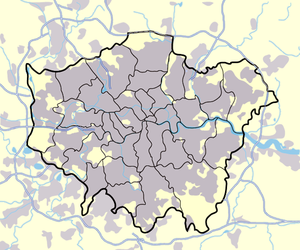
Greater London
Greater London
Greater London is the top-level administrative division of England covering London. It was created in 1965 and spans the City of London, including Middle Temple and Inner Temple, and the 32 London boroughs. This territory is coterminate with the London Government Office Region and the London...
covered an area of 1579 square kilometres (609.7 sq mi), an area which had a population of 7,172,036 in 2001 and a population density of 4,542 people per square kilometre. A larger area, referred to as the London Metropolitan Region or the London Metropolitan Agglomeration covered an area of 8382 square kilometres (3,236.3 sq mi) had a population of 12,653,500 and a population density of 1,510 people per square kilometre. London is a port
Port
A port is a location on a coast or shore containing one or more harbors where ships can dock and transfer people or cargo to or from land....
on the Thames (see main article Port of London
Port of London
The Port of London lies along the banks of the River Thames from London, England to the North Sea. Once the largest port in the world, it is currently the United Kingdom's second largest port, after Grimsby & Immingham...
), a navigable river. The river has had a major influence on the development of the city. London began on the Thames' north bank and for a long time the main focus of the city remained on the north side of the Thames. For many centuries London Bridge
London Bridge
London Bridge is a bridge over the River Thames, connecting the City of London and Southwark, in central London. Situated between Cannon Street Railway Bridge and Tower Bridge, it forms the western end of the Pool of London...
was the only bridge in or close to the city. When more bridges were built in the 18th century, the city expanded in all directions as the mostly flat or gently rolling countryside presented no obstacle to growth.
360 degree panorama
River Thames
The River ThamesRiver Thames
The River Thames flows through southern England. It is the longest river entirely in England and the second longest in the United Kingdom. While it is best known because its lower reaches flow through central London, the river flows alongside several other towns and cities, including Oxford,...
is by far the largest river of the London area, flowing west to east across the London Basin
London Basin
The London Basin is an elongated, roughly triangular sedimentary basin approximately long which underlies London and a large area of south east England, south eastern East Anglia and the adjacent North Sea...
. It is rather larger than would be expected if it only drained the basin, since its headwaters cut into the London basin through the Goring Gap
Goring Gap
The Goring Gap is a British geological feature located on the River Thames approximately 8 miles upstream from Reading.Half a million years ago the River Thames flowed on its existing course through Oxfordshire, but then turned northeast to flow through Hertfordshire before eventually reaching the...
and also drain parts of the Cotswolds
Cotswolds
The Cotswolds are a range of hills in west-central England, sometimes called the Heart of England, an area across and long. The area has been designated as the Cotswold Area of Outstanding Natural Beauty...
and Vale of Aylesbury. Similarly tributaries such as the Mole
River Mole, Surrey
The River Mole is a tributary of the River Thames in southern England. It rises in West Sussex near Gatwick Airport and flows north west through Surrey for to the Thames near Hampton Court Palace. The river gives its name to the Surrey district of Mole Valley...
cut through the North Downs
North Downs
The North Downs are a ridge of chalk hills in south east England that stretch from Farnham in Surrey to the White Cliffs of Dover in Kent. The North Downs lie within two Areas of Outstanding Natural Beauty , the Surrey Hills and the Kent Downs...
into the basin from the south. Further downstream the flow of the Thames is boosted by springs which open onto the riverbed where this is on chalk.
The Thames was once a much broader, shallower river than it is today. It has been extensively embanked. The Thames is tidal (the Tideway
Tideway
The Tideway is a name given to the part of the River Thames in England that is subject to tides. This stretch of water is downstream from Teddington Lock and is just under long...
) up to Teddington Lock
Teddington Lock
Teddington Lock is a complex of three locks and a weir on the River Thames in England at Ham in the western suburbs of London. The lock is on the southern Surrey side of the river....
, and London is vulnerable to flooding by storm surge
Storm surge
A storm surge is an offshore rise of water associated with a low pressure weather system, typically tropical cyclones and strong extratropical cyclones. Storm surges are caused primarily by high winds pushing on the ocean's surface. The wind causes the water to pile up higher than the ordinary sea...
s. The threat has increased over time due to a slow but continuous rise in high water level, caused by both the slow 'tilting' of Britain (up in the north and down in the south) caused by post-glacial rebound
Post-glacial rebound
Post-glacial rebound is the rise of land masses that were depressed by the huge weight of ice sheets during the last glacial period, through a process known as isostasy...
and the gradual rise in sea levels due to climate change. The Thames Barrier
Thames Barrier
The Thames Barrier is the world's second-largest movable flood barrier and is located downstream of central London. Its purpose is to prevent London from being flooded by exceptionally high tides and storm surges moving up from the sea...
was constructed across the Thames at Woolwich
Woolwich
Woolwich is a district in south London, England, located in the London Borough of Greenwich. The area is identified in the London Plan as one of 35 major centres in Greater London.Woolwich formed part of Kent until 1889 when the County of London was created...
in the 1970s to deal with this threat, but in early 2005 it was suggested that a ten mile long barrier further downstream might be required to deal with the flood risk in the future.
Within London a considerable number of rivers and streams flow into the Thames, some large enough to have exerted a significant influence on the geography of the area. Many of the smaller London tributaries now flow underground
Subterranean rivers of London
The subterranean or underground rivers of London are the tributaries of the River Thames and River Lea that were built over during the growth of the metropolis of London...
.
Left bank tributaries
Larger left bank tributaries include the ColneRiver Colne, Hertfordshire
The Colne is a river in England which is a tributary of the River Thames. It flows mainly through Hertfordshire and forms the boundary between the South Bucks district of Buckinghamshire and the London Borough of Hillingdon...
, Crane
River Crane, London
The River Crane is a river in west London, England, and is a tributary of the River Thames.-Location:The River Crane is 8.5 miles in length...
, Brent
River Brent
The Brent is a river within Greater London which is a tributary of the River Thames. It is 17.9 miles long, running north-east to south-west, and it joins the Thames on the Tideway at Brentford, Hounslow.- Hydronymy and etymology :...
, River Lea (tidal reach known as 'Bow Creek
Bow Creek
Bow Creek is a long tidal estuary of the River Lea and is part of the Bow Back Rivers. Below Bow Locks the creek forms the boundary between the London Boroughs of Newham and Tower Hamlets, in east London....
'), Roding
River Roding
The River Roding is a river in England that rises near Dunmow, flows through Essex and forms Barking Creek as it reaches the River Thames in London....
(tidal reach known as 'Barking Creek
Barking Creek
Barking Creek joins the River Roding to the River Thames. It is fully tidal up to the Barking Barrage, which impounds a minimum water level through Barking in Barking. In the 1850s, the creek was home to England's largest fishing fleet, and the Victorian icehouse - where the fish were landed and...
'), Rom
River Rom
The River Rom, also in places known as the River Beam, is a tributary of the River Thames in England that flows through the north east London suburbs, forming the boundary between the London boroughs of Barking and Dagenham and Havering in the south and flowing through channels underneath Romford...
(lower reaches known as the Beam) and Ingrebourne
River Ingrebourne
The River Ingrebourne, 27 miles in length, is a tributary of the River Thames. It is considered a strategic waterway in London, forming part of the Blue Ribbon Network...
. There are many smaller, now often largely subterranean streams including Stamford Brook
Stamford Brook
Stamford Brook is a tributary of the River Thames which is the confluence of two smaller streams, arising in West London, flowing into Hammersmith Creek on the Tideway....
, Counter's Creek
Counter's Creek
Counter's Creek is a largely subterranean stream that arises in Kensal Green, west London and flows south into the River Thames on the Tideway at Sands End, Chelsea...
(also known as 'Chelsea Creek'), Westbourne
River Westbourne
The River Westbourne is a river in London, England. It flows from Hampstead down through Hyde Park to Sloane Square and into the River Thames at Chelsea...
, Tyburn
Tyburn (stream)
The Tyburn is a stream in London, which runs underground from South Hampstead through St. James's Park to meet the River Thames at Pimlico near Vauxhall Bridge. It is not to be confused with the Tyburn Brook which is a tributary of the River Westbourne....
, Tyburn Brook
Tyburn Brook
Tyburn Brook is a tributary stream to the River Westbourne. Both watercourses are subterranean.Although similarly named, the Tyburn Brook does not connect with the River Tyburn.-See also:*Subterranean rivers of London...
, Fleet
River Fleet
The River Fleet is the largest of London's subterranean rivers. Its two headwaters are two streams on Hampstead Heath; each is now dammed into a series of ponds made in the 18th century, the Hampstead Ponds and the Highgate Ponds. At the south edge of Hampstead Heath these two streams flow...
and Walbrook
Walbrook
Walbrook is the name of a ward, a street and a subterranean river in the City of London.-Underground river:The river played a key role in the Roman settlement of Londinium, the city now known as London. It is thought that the river was named because it ran through or under the London Wall; another...
. Some of the tributaries are themselves large enough to have named tributary streams, for example the Moselle
River Moselle (London)
The River Moselle, also referred to as Moselle Brook, is in North London and flows through Tottenham towards the Lea Valley. The river was originally a tributary of the River Lea, but it now flows into Pymmes Brook, another Lea tributary....
, Salmons Brook
Salmons Brook
Salmons Brook is located in the London Borough of Enfield and is a minor tributary of the River Lea. - Etymology :Salmons Brook is marked thus on Rocque's map of 1754, probably named from the family of John Salemon of Edmonton mentioned in 1274...
and Pymmes Brook
Pymmes Brook
Pymmes Brook is located in North London and named after William Pymme, a local land owner. It is a minor tributary of the River Lea. The brook mostly flows through urban areas and is particularly prone to flooding in its lower reaches. To alleviate the problem the brook has been culverted in many...
that feed the Lea, and the Silk Stream
Silk Stream
The Silk Stream is a brook in the London Borough of Barnet. It is one of the major components of the Blue Ribbon Network.The Silk Stream is a tributary of the River Brent, which it joins at Brent Reservoir. It has several tributaries including Burnt Oak Brook, Edgware Brook, the Edgwarebury Brook...
and Dollis Brook
Dollis Brook
Dollis Brook runs through the London Borough of Barnet in North London. It is a tributary of the River Brent, which is itself a tributary of the River Thames. The Dollis Valley Greenwalk follows almost all of Dollis Brook, apart from a short section at the beginning which passes through private...
that feed the Brent.
Larger rivers such as the Lea have influenced local geography in several ways. Firstly a river and its marshland formed a significant barrier to east-west movement - the Lea formed a natural boundary between the historic areas of Middlesex
Middlesex
Middlesex is one of the historic counties of England and the second smallest by area. The low-lying county contained the wealthy and politically independent City of London on its southern boundary and was dominated by it from a very early time...
and Essex
Essex
Essex is a ceremonial and non-metropolitan county in the East region of England, and one of the home counties. It is located to the northeast of Greater London. It borders with Cambridgeshire and Suffolk to the north, Hertfordshire to the west, Kent to the South and London to the south west...
. Secondly the valley of the Lea formed a route - both the river and later Lee Navigation, and roads including the Roman Ermine Street
Ermine Street
Ermine Street is the name of a major Roman road in England that ran from London to Lincoln and York . The Old English name was 'Earninga Straete' , named after a tribe called the Earningas, who inhabited a district later known as Armingford Hundred, around Arrington, Cambridgeshire and Royston,...
, the Hertford Road (A1010) and the later Great Cambridge Road (A10) and A1055. The Lea Valley
Lea Valley
The Lea Valley, the valley of the River Lea, has been used as a transport corridor, a source of sand and gravel, an industrial area, a water supply for London, and a recreational area...
is also followed by two routes of what became the Great Eastern Railway
Great Eastern Railway
The Great Eastern Railway was a pre-grouping British railway company, whose main line linked London Liverpool Street to Norwich and which had other lines through East Anglia...
and had important marshalling yards and locomotive works at Temple Mills
Temple Mills
Temple Mills is a northerly part of Stratford, south of Leyton, located within the London borough of Newham in east LondonToday, Temple Mills is surrounded at present by former railway tracks and works belonging to the Great Eastern Railway...
. Thirdly the river provided power for numerous water mills - well known examples being the Royal Small Arms Factory
Royal Small Arms Factory
The Royal Small Arms Factory was a UK government-owned rifle factory in the London Borough of Enfield in an area generally known as the Lea Valley. The factory produced British military rifles, muskets and swords from 1816...
at Enfield and nearby Waltham Abbey Royal Gunpowder Mills
Waltham Abbey Royal Gunpowder Mills
The Royal Gunpowder Mills, Waltham Abbey, an Anchor Point of the European Route of Industrial Heritage, , set in of parkland and containing 21 buildings of major historical importance, mixes history, science, and attractive surroundings...
, Wright's Flour Mill
Wright's Flour Mill
Wright's Flour Mill is located at Wharf Road Ponders End which is part of the London Borough of Enfield. It is Enfield's oldest working industrial building.- History :...
(London's last surviving working mill) at Ponders End
Ponders End
Ponders End is a place in the London Borough of Enfield, North London located in an area generally known as the Lea Valley. It is roughly located in the area either side of Hertford Road between The Ride and the Boundary Public House and Wharf Road and the Southbury railway station/Kingsway...
and the Three Mills
Three Mills
The Three Mills are former working mills on the River Lea in the East End of London, one of London’s oldest extant industrial centres. The largest and most powerful of the four remaining tidal mills is possibly the largest tidal mill in the world...
at Stratford. In the 19th Century the lower Lea became an important area for the manufacture of chemicals, in part based on the supply of by-products such as sulphur and ammonia from the Gas Light and Coke Company
Gas Light and Coke Company
The Gas Light and Coke Company , was a company that made and supplied coal gas and coke. The Company was located on Horseferry Road in Westminster, London...
's works at Bow Common. In the 20th Century the combination of transport, wide expanses of flat land and electricity from riverside and canalside plants such as Brimsdown
Brimsdown Power Station
Brimsdown Power Station was a coal-fired power station on the Lee Navigation at Brimsdown in Enfield, North London. The station had seven cooling towers which were visible from a wide area.-History:...
, Hackney
Hackney Power Station
Hackney Power Station was a coal-fired power station situated at Lea Bridge on the River Lee Navigation in London.-History:...
, Bow and West Ham
West Ham Power Station
West Ham Power Station was a coal-fired power station on Bow Creek at Canning Town, in east London. It was often referred to informally as Canning Town Power Station.-History:...
led to expansion of industries including for example Enfield Rolling Mills and Enfield Cables
Enfield Cables Ltd
Enfield Cables Ltd was a British manufacturer of electric cables.The company was founded in 1913 by James Grimston as the Enfield Electric Cable Manufacturing Co Ltd, located on the River Lea in Enfield Lock. In 1959, as Enfield Cables Ltd, it was acquired by Enfield Rolling Mills Ltd and a new...
, Thorn Electrical Industries
THORN Electrical Industries
Thorn Electrical Industries, Limited was an electrical engineering business. It was listed on the London Stock Exchange but it merged with EMI Group to form Thorn EMI in 1979...
, Belling, Glover and Main
Glover and Main
Glover and Main was a British manufacturer of gas meters and stoves, located at Angel Road, Edmonton, London.-History:T.Glover & Co manufactured Gas Meters at the Gothic Works from 1897. Thomas Glover invented the original diaphragm gas meter in 1843. The company later amalgamated with R&A Main...
, MK Electric
MK electric
MK Electric is a company that makes electrical accessories. The company's headquarters are in Basildon, Essex, England, from where it makes and sells goods worldwide.-History:...
, Gestetner
Gestetner
The Gestetner, named after its inventor David Gestetner, is a duplicating machine brand and company.David Gestetner, born in Csorna, Hungary, moved to London, England, and in 1881 established the Gestetner Cyclograph Company to produce stencils, styli, ink rollers, etc. He guarded his invention...
, JAP Industries
JA Prestwich Industries Ltd
JA Prestwich Industries, was an English engineering company named after founder John Alfred Prestwich, which produced cinematographic equipment, internal combustion engines , and other examples of precision engineering.-History:J. A...
, etc. Much industry has now gone, to be replaced by warehousing and retail parks.
The valley also became very important for London's water supply, as the source of the water transported by the New River
New River (England)
The New River is an artificial waterway in England, opened in 1613 to supply London with fresh drinking water taken from the River Lea and from Amwell Springs , and other springs and wells along its course....
aqueduct, but also as the location for the Lee Valley Reservoir Chain
Lee Valley Reservoir Chain
The Lee Valley Reservoir Chain is located in the Lee Valley, and comprises 13 reservoirs that supply drinking water to London.- Reservoirs :The following waters are located in the London Borough of Enfield and are known collectively as the Chingford Reservoirs, which are a Site of Special...
, stretching from Enfield through Tottenham
Tottenham
Tottenham is an area of the London Borough of Haringey, England, situated north north east of Charing Cross.-Toponymy:Tottenham is believed to have been named after Tota, a farmer, whose hamlet was mentioned in the Domesday Book; hence Tota's hamlet became Tottenham...
and Walthamstow
Walthamstow
Walthamstow is a district of northeast London, England, located in the London Borough of Waltham Forest. It is situated north-east of Charing Cross...
.
A second significant corridor of canal, railways and industries was associated with the Brent
River Brent
The Brent is a river within Greater London which is a tributary of the River Thames. It is 17.9 miles long, running north-east to south-west, and it joins the Thames on the Tideway at Brentford, Hounslow.- Hydronymy and etymology :...
, stretching from the Thames at Brentford
Brentford
Brentford is a suburban town in west London, England, and part of the London Borough of Hounslow. It is located at the confluence of the River Thames and the River Brent, west-southwest of Charing Cross. Its former ceremonial county was Middlesex.-Toponymy:...
, through Isleworth
Isleworth
Isleworth is a small town of Saxon origin sited within the London Borough of Hounslow in west London, England. It lies immediately east of the town of Hounslow and west of the River Thames and its tributary the River Crane. Isleworth's original area of settlement, alongside the Thames, is known as...
, Greenford
Greenford
Greenford is a large suburb in the London Borough of Ealing in west London, UK. It was historically an ancient parish in the former county of Middlesex. The most prominent landmarks in the suburb are the A40, a major dual-carriageway; Horsenden Hill, above sea level; the small Parish Church of...
, Alperton
Alperton
Alperton is a district in the London Borough of Brent in northwest London.There is a high incidence of Indians living in Alperton . There is also a small Sri Lankan community in Alperton , and 10% stated as others....
and Park Royal
Park Royal
Park Royal is an area in northwest London, UK. It is the largest industrial and business park in London, occupying about , and is promoted commercially by the Park Royal Partnership...
.
The Colne
River Colne, Hertfordshire
The Colne is a river in England which is a tributary of the River Thames. It flows mainly through Hertfordshire and forms the boundary between the South Bucks district of Buckinghamshire and the London Borough of Hillingdon...
(the historic boundary between Middlesex and Buckinghamshire
Buckinghamshire
Buckinghamshire is a ceremonial and non-metropolitan home county in South East England. The county town is Aylesbury, the largest town in the ceremonial county is Milton Keynes and largest town in the non-metropolitan county is High Wycombe....
) forms much of the western boundary of the county of Greater London.
Right-bank tributaries
Significant tributaries include the MoleRiver Mole, Surrey
The River Mole is a tributary of the River Thames in southern England. It rises in West Sussex near Gatwick Airport and flows north west through Surrey for to the Thames near Hampton Court Palace. The river gives its name to the Surrey district of Mole Valley...
, Wandle
River Wandle
The River Wandle is a river in south-east England. The names of the river and of Wandsworth are thought to have derived from the Old English "Wendlesworth" meaning "Wendle's Settlement". The river runs through southwest London and is about long...
, Ravensbourne
River Ravensbourne
The River Ravensbourne is a tributary of the River Thames in South London, England. It flows into the River Thames on the Tideway at Deptford, where its tidal reach is known as Deptford Creek.- Geography :...
(tidal reach known as 'Deptford Creek') with its tributary the Quaggy
River Quaggy
The River Quaggy is an urban river, 17 km in length, passing through the south-east London boroughs of Bromley, Greenwich and Lewisham; it is known as the Kyd Brook, in its upper reaches...
, and the Darent and its tributary the Cray
River Cray
The River Cray is a tributary of the River Darent in southern England. It rises in Priory Gardens in Orpington in the London Borough of Bromley, where rainwater permeates the chalk bedrock and forms a pond at the boundary between the chalk and impermeable clay...
which together form part of the eastern boundary of Greater London. Smaller, some mainly subterranean tributaries include the Hogsmill River, Beverley Brook
Beverley Brook
Beverley Brook is a minor English urban river about 14.3 km long located in south-west London. It rises at Cuddington Recreation Park in Worcester Park, flows through Motspur Park, New Malden, Wimbledon Common, Richmond Park and Barnes...
, Neckinger
River Neckinger
The River Neckinger is a subterranean river that rises in Southwark and flows through London to St Saviour's Dock where it enters the River Thames. The river is now totally enclosed and runs underground.-History:...
and Effra
River Effra
The River Effra is a river in south London, England. It is now mainly underground. The name cannot be traced back much earlier than 1840 , so speculation that it came from a Celtic word for torrent is unwarranted...
.
The Wandle formed south London's nearest equivalent to the Lea Valley, with an industrial corridor stretching from the Thames at Wandsworth
Wandsworth
Wandsworth is a district of south London, England, in the London Borough of Wandsworth. It is situated southwest of Charing Cross. The area is identified in the London Plan as one of 35 major centres in Greater London.-Toponymy:...
through Merton
London Borough of Merton
The London Borough of Merton is a borough in southwest London, England.The borough was formed under the London Government Act in 1965 by the merger of the Municipal Borough of Mitcham, the Municipal Borough of Wimbledon and the Merton and Morden Urban District, all formerly within Surrey...
and Mitcham
Mitcham
Mitcham is a district in the south west area of London, in the London Borough of Merton. A suburban area, Mitcham is located on the border of Inner London and Outer London. It is both residentially and financially developed, well served by Transport for London, and home to Mitcham Town Centre,...
to Beddington
Beddington
Beddington is a settlement between the London Boroughs of Sutton and Croydon. The BedZED low energy housing scheme is located here. In Beddington was a static inverter plant of HVDC Kingsnorth....
and Croydon
Croydon
Croydon is a town in South London, England, located within the London Borough of Croydon to which it gives its name. It is situated south of Charing Cross...
. A smaller corridor followed the Ravensbourne from the Thames at Deptford Creek through Lewisham
Lewisham
Lewisham is a district in South London, England, located in the London Borough of Lewisham. It is situated south-east of Charing Cross. The area is identified in the London Plan as one of 35 major centres in Greater London.-History:...
, and many of the smaller rivers also once had mills.
Canals
A number of canals or canalised rivers have been constructed in the London area, mostly in the late 18th and early 19th centuries. These were originally for goods traffic, which has largely ceased. Within London the canals carried coal from the docks to many canal-side gas works and power stations (for example BrimsdownBrimsdown Power Station
Brimsdown Power Station was a coal-fired power station on the Lee Navigation at Brimsdown in Enfield, North London. The station had seven cooling towers which were visible from a wide area.-History:...
), and timber to timber yards, furniture manufacturers etc. (for example in Edmonton
Edmonton, London
Edmonton is an area in the east of the London Borough of Enfield, England, north-north-east of Charing Cross. It has a long history as a settlement distinct from Enfield.-Location:...
). Although most of the canals still survive today, they are used primarily for leisure craft.
North of the Thames
Canal construction in the London area started with navigation works on the LeaRiver Lee (England)
The River Lea in England originates in Marsh Farm , Leagrave, Luton in the Chiltern Hills and flows generally southeast, east, and then south to London where it meets the River Thames , the last section being known as Bow Creek.-Etymology:...
and Stort
River Stort
River Stort is a tributary of the River Lea which it joins at Hoddesdon, Hertfordshire at Feildes Weir-Overview:River Stort takes its name from Bishop's Stortford, a town through which it flows. It was given the name in the 16th century....
from 1424 onwards, leading to the River Lee Navigation
River Lee Navigation
The Lee Navigation is a canalised river incorporating the River Lea . Its course runs from Hertford Castle Weir all the way to the River Thames at Bow Creek. The first lock of the navigation is Hertford Lock the last being Bow Locks....
and Bow Back Rivers
Bow Back Rivers
The Bow Back Rivers are part of the River Lea in the London Borough of Newham, east London, England, and form a complex system of waterways. The River Lea was originally tidal as far as Hackney Wick; man-made changes to the river had changed this dramatically in the 9th century, and in 1110 a...
. Initially used for transport of agricultural product from Hertfordshire
Hertfordshire
Hertfordshire is a ceremonial and non-metropolitan county in the East region of England. The county town is Hertford.The county is one of the Home Counties and lies inland, bordered by Greater London , Buckinghamshire , Bedfordshire , Cambridgeshire and...
, this later became an important industrial waterway connecting the heavily industrialised Lea Valley with the docks
Port of London
The Port of London lies along the banks of the River Thames from London, England to the North Sea. Once the largest port in the world, it is currently the United Kingdom's second largest port, after Grimsby & Immingham...
. A short-cut to the Thames avoiding the winding mouth of the Lea (Bow Creek
Bow Creek
Bow Creek is a long tidal estuary of the River Lea and is part of the Bow Back Rivers. Below Bow Locks the creek forms the boundary between the London Boroughs of Newham and Tower Hamlets, in east London....
) and closer to central London was provided by the Limehouse Cut
Limehouse Cut
The Limehouse Cut is a straight, broad canal in the East End of London, which linked the lower reaches of the River Lee Navigation to the River Thames...
(1760).
A connection from London to the Midlands
English Midlands
The Midlands, or the English Midlands, is the traditional name for the area comprising central England that broadly corresponds to the early medieval Kingdom of Mercia. It borders Southern England, Northern England, East Anglia and Wales. Its largest city is Birmingham, and it was an important...
had been provided by the Oxford Canal
Oxford Canal
The Oxford Canal is a narrow canal in central England linking Oxford with Coventry via Banbury and Rugby. It connects with the River Thames at Oxford, to the Grand Union Canal at the villages of Braunston and Napton-on-the-Hill, and to the Coventry Canal at Hawkesbury Junction in Bedworth just...
since 1790, but this required navigation up the winding the upper Thames to Oxford
Oxford
The city of Oxford is the county town of Oxfordshire, England. The city, made prominent by its medieval university, has a population of just under 165,000, with 153,900 living within the district boundary. It lies about 50 miles north-west of London. The rivers Cherwell and Thames run through...
. The completion of the Grand Junction Canal
Grand Junction Canal
The Grand Junction Canal is a canal in England from Braunston in Northamptonshire to the River Thames at Brentford, with a number of branches. The mainline was built between 1793 and 1805, to improve the route from the Midlands to London, by-passing the upper reaches of the River Thames near Oxford...
(later Grand Union
Grand Union Canal
The Grand Union Canal in England is part of the British canal system. Its main line connects London and Birmingham, stretching for 137 miles with 166 locks...
) from the Thames at Brentford
Brentford
Brentford is a suburban town in west London, England, and part of the London Borough of Hounslow. It is located at the confluence of the River Thames and the River Brent, west-southwest of Charing Cross. Its former ceremonial county was Middlesex.-Toponymy:...
(1798 onwards) provided a more convenient route. In 1801 an arm was opened from the Grand Junction at Hayes
Hayes, Hillingdon
Hayes is a town in the London Borough of Hillingdon, West London. It is a suburban development situated west of Charing Cross. Hayes was developed in the late 19th and 20th centuries as an industrial locality to which residential districts were later added in order to house factory workers...
to a large basin at Paddington
Paddington Basin
Paddington Basin is an area of Paddington, London named after the nearby canal basin.The junction of the Regent's Canal and the Grand Junction Canal is close to this point but the basin itself is the terminus of the Paddington Arm of the Grand Junction Canal. It was opened in 1801...
. This was later linked to the Thames at Limehouse
Limehouse
Limehouse is a place in the London Borough of Tower Hamlets. It is on the northern bank of the River Thames opposite Rotherhithe and between Ratcliff to the west and Millwall to the east....
(close to the Limehouse Cut) by the Regent's Canal
Regent's Canal
Regent's Canal is a canal across an area just north of central London, England. It provides a link from the Paddington arm of the Grand Union Canal, just north-west of Paddington Basin in the west, to the Limehouse Basin and the River Thames in east London....
, completed in 1820. This in turn was linked to the Lea system by the Hertford Union Canal
Hertford Union Canal
The Hertford Union Canal or Duckett's Canal is a short stretch of canal in the London Borough of Tower Hamlets in east London. It connects the Regent's Canal to the Lee Navigation. It was opened in 1830 but quickly proved to be a commercial failure...
or Hackney Cut (1830). The Regent's Canal had many substantial basins (City Road Basin
City Road Basin
The City Road Basin is a canal basin and part of the Regent's Canal in London, owned by British Waterways. There are currently several large-scale residential developments in progress....
, Kingsland Basin
Kingsland Basin
Kingsland Basin is a canal basin in Kingsland, London, part of the London Borough of Hackney. The basin is located off the Regents Canal.The basin is a site of planned redevelopment.-See also:*Canals of the United Kingdom...
, Battlebridge Basin, St Pancras Basin
St Pancras Basin
The St Pancras Basin, also known as St Pancras Yacht Basin, is part of the Regent's Canal in the London Borough of Camden, owned by British Waterways. There are currently several large-scale developments in progress, related to King's Cross Central and the redevelopment of St Pancras railway...
, Cumberland Basin
Cumberland Basin (London)
Cumberland Basin was a former canal basin near to Euston railway station in London, England and a part of the Regent's Canal....
etc.), originally lined with industries dependent on traffic from the docks.
The City Canal
City Canal
The City Canal was a short, and short-lived, canal excavated across the Isle of Dogs in east London, linking two reaches of the River Thames. Today, it has been almost completely reconstructed to form the South Dock of the West India Docks.-History:...
(1805) was built to provide a short-cut across the Isle of Dogs
Isle of Dogs
The Isle of Dogs is a former island in the East End of London that is bounded on three sides by one of the largest meanders in the River Thames.-Etymology:...
. This was later incorporated into the West India Docks
West India Docks
The West India Docks are a series of three docks on the Isle of Dogs in London, the first of which opened in 1802. The docks closed to commercial traffic in 1980 and the Canary Wharf development was built on the site.-History:...
and is no longer connected to the Thames at its upstream end. Other short canals connecting to the Thames included the Grosvenor Canal
Grosvenor Canal
Grosvenor Canal was a canal in the Pimlico area of London, opened in 1825. Almost nothing of it remains today.The canal started as the ponds of the Chelsea Waterworks Company, constructed in 1723 to supply west London with drinking water...
(1825) and the Kensington Canal
Kensington Canal
The Kensington Canal was a canal, 1.75 miles long, opened in 1828 in London from the River Thames at Chelsea, along the line of Counter's Creek, to a basin near Warwick Road in Kensington...
(1828).
South of the Thames
The former Grand Surrey CanalGrand Surrey Canal
The Grand Surrey Canal was a canal constructed in south London, England during the early 19th century. It opened to the Old Kent Road in 1807, to Camberwell in 1810, and to Peckham in 1826. Its main cargo was timber. It closed progressively from the 1940s, with all but the Greenland Dock closing in...
(1807) was intended to run from the Thames at Rotherhithe
Rotherhithe
Rotherhithe is a residential district in inner southeast London, England and part of the London Borough of Southwark. It is located on a peninsula on the south bank of the Thames, facing Wapping and the Isle of Dogs on the north bank, and is a part of the Docklands area...
to the industrial town of Mitcham
Mitcham
Mitcham is a district in the south west area of London, in the London Borough of Merton. A suburban area, Mitcham is located on the border of Inner London and Outer London. It is both residentially and financially developed, well served by Transport for London, and home to Mitcham Town Centre,...
, but got no further than Camberwell
Camberwell
Camberwell is a district of south London, England, and forms part of the London Borough of Southwark. It is a built-up inner city district located southeast of Charing Cross. To the west it has a boundary with the London Borough of Lambeth.-Toponymy:...
. It closed with the Surrey Commercial Docks
Surrey Commercial Docks
The Surrey Commercial Docks were a large group of docks in Rotherhithe on the south bank of the Thames in South East London. The docks operated in one form or another from 1696 to 1969...
in 1970 and has been filled. The Grand Surrey Canal linked to the Croydon Canal
Croydon Canal
The Croydon Canal ran from Croydon, via Forest Hill, to the Grand Surrey Canal at New Cross in south London, England. It opened in 1809, and closed in 1836, making it the first canal to be formally abandoned by an Act of Parliament.-History:...
(1809) which continued as far as West Croydon
West Croydon station
West Croydon station is a transport interchange for National Rail and Tramlink services, as well as London Buses. It is in the London Borough of Croydon and Travelcard Zone 5...
; this closed in 1836.
Further afield a link from London to Bristol
Bristol
Bristol is a city, unitary authority area and ceremonial county in South West England, with an estimated population of 433,100 for the unitary authority in 2009, and a surrounding Larger Urban Zone with an estimated 1,070,000 residents in 2007...
is provided by the Kennet & Avon Canal which connects the Avon
River Avon, Bristol
The River Avon is an English river in the south west of the country. To distinguish it from a number of other River Avons in Britain, this river is often also known as the Lower Avon or Bristol Avon...
at Bath via the River Kennet
River Kennet
The Kennet is a river in the south of England, and a tributary of the River Thames. The lower reaches of the river are navigable to river craft and are known as the Kennet Navigation, which, together with the Avon Navigation, the Kennet and Avon Canal and the Thames, links the cities of Bristol...
to the Thames at Reading
Reading, Berkshire
Reading is a large town and unitary authority area in England. It is located in the Thames Valley at the confluence of the River Thames and River Kennet, and on both the Great Western Main Line railway and the M4 motorway, some west of London....
. Basingstoke
Basingstoke
Basingstoke is a town in northeast Hampshire, in south central England. It lies across a valley at the source of the River Loddon. It is southwest of London, northeast of Southampton, southwest of Reading and northeast of the county town, Winchester. In 2008 it had an estimated population of...
could once be reached via the Thames, Wey Navigation and the Basingstoke Canal
Basingstoke Canal
The Basingstoke Canal is a British Canal, completed in 1794, built to connect Basingstoke with the River Thames at Weybridge via the Wey Navigation....
. The south coast at Littlehampton
Littlehampton
Littlehampton is a seaside resort town and civil parish in the Arun District of West Sussex, England, on the east bank at the mouth of the River Arun. It lies south southwest of London, west of Brighton and east of the county town of Chichester....
could be reached via the Thames, Wey and the Wey and Arun Canal
Wey and Arun Canal
The Wey and Arun Canal is a 23-mile-long canal in the south of England, between the River Wey at Shalford, Surrey and the River Arun at Pallingham, in West Sussex...
.
Islands in the Thames
- Note: Only the largest islands are listed here. A longer list can be found in Islands in the River ThamesIslands in the River ThamesThis article lists the islands in the River Thames, in England. It excludes many of the smaller lock islands that were created when weirs and locks were built, and also some very small islands that immediately adjoin the larger ones. The Isle of Dogs and Isle of Grain are no longer islands although...
- Chiswick EyotChiswick EyotChiswick Eyot is a small, narrow, uninhabited ait in the River Thames. It is on the Tideway near Chiswick, in the Borough of Hounslow, London, England, and has an area of ....
- Eel Pie IslandEel Pie IslandEel Pie Island is an island in the River Thames in England at Twickenham, in the Borough of Richmond upon Thames, London. It is situated on the Tideway and can be reached only by footbridge or boat...
- Isle of DogsIsle of DogsThe Isle of Dogs is a former island in the East End of London that is bounded on three sides by one of the largest meanders in the River Thames.-Etymology:...
- MillwallMillwallMillwall is an area in London, on the western side of the Isle of Dogs, in the London Borough of Tower Hamlets. It lies to the south of the developments at West India Docks, including Canary Wharf.-History:...
- Cubitt TownCubitt TownCubitt Town is an area on the Isle of Dogs in Tower Hamlets in London, England. It is on the east of the Isle, facing Greenwich across the River Thames. To the west is Millwall, to the northwest Canary Wharf and to the north, across the Blue Bridge, Blackwall...
- Millwall
- Chiswick Eyot
Topography
A list of the highest points can be found in List of highest points in LondonAt the largest scale London lies within the bowl of the London Basin
London Basin
The London Basin is an elongated, roughly triangular sedimentary basin approximately long which underlies London and a large area of south east England, south eastern East Anglia and the adjacent North Sea...
, with most of the built-up area lying on the Tertiary
Tertiary
The Tertiary is a deprecated term for a geologic period 65 million to 2.6 million years ago. The Tertiary covered the time span between the superseded Secondary period and the Quaternary...
and younger sediments, and only a small part of south London (Sutton
Sutton, London
Sutton is a large suburban town in southwest London, England, and the administrative headquarters of the London Borough of Sutton. It is located south-southwest of Charing Cross and is one of the major metropolitan centres identified in the London Plan. The town was connected to central London by...
, Banstead
Banstead
Banstead is a town in the borough of Reigate and Banstead in the county of Surrey, England, on the border with Greater London. It lies south of London, west of Croydon and of the county town of Kingston-Upon-Thames. Banstead is on the North Downs and is protected by the Metropolitan Green Belt;...
and Croydon
Croydon
Croydon is a town in South London, England, located within the London Borough of Croydon to which it gives its name. It is situated south of Charing Cross...
) lying on the chalk backslope of the North Downs
North Downs
The North Downs are a ridge of chalk hills in south east England that stretch from Farnham in Surrey to the White Cliffs of Dover in Kent. The North Downs lie within two Areas of Outstanding Natural Beauty , the Surrey Hills and the Kent Downs...
. The centre of the basin is dominated by the modern valley of the Thames, which forms a level corridor running from west to east. The modern floodplain is around half a mile wide to the west of Greater London, expanding to two miles wide to the east. This is bordered by slightly higher and older terraces often extending several miles from the floodplain, for example in Hounslow
Hounslow
Hounslow is the principal town in the London Borough of Hounslow. It is a suburban development situated 10.6 miles west south-west of Charing Cross. It forms a post town in the TW postcode area.-Etymology:...
and Southwark
Southwark
Southwark is a district of south London, England, and the administrative headquarters of the London Borough of Southwark. Situated east of Charing Cross, it forms one of the oldest parts of London and fronts the River Thames to the north...
. Other significant river valleys include those of the Colne, Crane, Brent, Lea (with a floodplain more than a mile wide in places), Wandle and Ravensbourne, which run north and south towards the Thames.
There are a few notable hills in Greater London
Greater London
Greater London is the top-level administrative division of England covering London. It was created in 1965 and spans the City of London, including Middle Temple and Inner Temple, and the 32 London boroughs. This territory is coterminate with the London Government Office Region and the London...
, but none of them more than a few hundred feet high, and they have not impeded the development of the city in all directions. It is therefore very roughly circular.
The City
The hills in the City of LondonCity of London
The City of London is a small area within Greater London, England. It is the historic core of London around which the modern conurbation grew and has held city status since time immemorial. The City’s boundaries have remained almost unchanged since the Middle Ages, and it is now only a tiny part of...
, from west to east, Ludgate Hill
Ludgate Hill
Ludgate Hill is a hill in the City of London, near the old Ludgate, a gate to the City that was taken down, with its attached gaol, in 1780. Ludgate Hill is the site of St Paul's Cathedral, traditionally said to have been the site of a Roman temple of the goddess Diana. It is one of the three...
, Corn Hill and Tower Hill, are presumed to have influenced the precise siting of the early city, but they are very minor, and most of central London is almost flat. These hills are developed in various gravel terrace deposits of the river Thames.
North London
To the north of the City a ridge capped by sands of the Bagshot formationBagshot Beds
In geology, the Bagshot Beds are a series of sands and clays of shallow-water origin, some being fresh-water, some marine. They belong to the upper Eocene formation of the London and Hampshire basins, in England and derive their name from Bagshot Heath in Surrey. They are also well developed in...
forms high ground (in places around 130m) including Hampstead Heath
Hampstead Heath
Hampstead Heath is a large, ancient London park, covering . This grassy public space sits astride a sandy ridge, one of the highest points in London, running from Hampstead to Highgate, which rests on a band of London clay...
and Highgate Hill. The ridge continues eastwards in the London clay to Crouch Hill
Crouch Hill
Crouch Hill is a street in north London, England, running between Crouch End and Stroud Green in the boroughs of Haringey and Islington.The street has a railway station of the same name on the Islington slope of the hill, which is served by the Gospel Oak to Barking line.- The Parkland Walk...
and Queen's Wood
Queen's Wood
Queen's Wood is a 21 hectare area of ancient woodland in North London, abutting Highgate Wood and lying between East Finchley, Highgate Village, Muswell Hill and Crouch End...
. To the south, fingers of the ridge run down towards Primrose Hill
Primrose Hill
Primrose Hill is a hill of located on the north side of Regent's Park in London, England, and also the name for the surrounding district. The hill has a clear view of central London to the south-east, as well as Belsize Park and Hampstead to the north...
and Parliament Hill
Parliament Hill, London
Parliament Hill is an area of open parkland in the south-east corner of Hampstead Heath in north-west London. The hill, which is high, is notable for its excellent views of the capital's skyline...
. This ridge is a surviving area of Tertiary
Tertiary
The Tertiary is a deprecated term for a geologic period 65 million to 2.6 million years ago. The Tertiary covered the time span between the superseded Secondary period and the Quaternary...
rocks younger than the London Clay, surrounded by former routes of the Thames where much younger deposits overlie the clay. Smaller outliers of younger Tertiary high ground exist to the west of the main ridge including Harrow Hill where Bagshot sands survive and at Horsendon Hill and Hanger Lane
Hanger Lane
Hanger Lane is a major road in the Ealing and Park Royal areas of London. It forms the westernmost part of the A406 North Circular as it runs north from Gunnersbury Avenue as it crosses the A4020 Uxbridge Road at Ealing Common to meet the A40 Western Avenue at the Hanger Lane Gyratory System...
, where the Claygate Beds of the top of the London Clay formation are capped by much younger gravels deposited by the Thames.
To the north of this ridge, between the modern valleys of the rivers Lea and Brent, lies a second ridge (a little under 100m), formed of much younger Pleistocene
Pleistocene
The Pleistocene is the epoch from 2,588,000 to 11,700 years BP that spans the world's recent period of repeated glaciations. The name pleistocene is derived from the Greek and ....
deposits. Running west from Muswell Hill
Muswell Hill
Muswell Hill is a suburb of north London, mostly in the London Borough of Haringey. It is situated about north of Charing Cross and around from the City of London. Muswell Hill is in the N10 postal district and mostly in the Hornsey and Wood Green parliamentary constituency.- History :The...
to Church End and north to Whetstone
Whetstone, London
-Buses:* 34 - Barnet Church to Walthamstow Central bus/tube/railway station* 125 - Winchmore Hill to Finchley Central* 234 - Barnet to Highgate Wood * 251 - Edgware bus/tube station to Arnos Grove tube station...
, this is capped by glacial till
Till
thumb|right|Closeup of glacial till. Note that the larger grains in the till are completely surrounded by the matrix of finer material , and this characteristic, known as matrix support, is diagnostic of till....
marking the southern limit of glaciation. This overlies Dollis Hill Gravel marking a former course of the Thames. At its eastern end at Alexandra Palace
Alexandra Palace
Alexandra Palace is a building in North London, England. It stands in Alexandra Park, in an area between Hornsey, Muswell Hill and Wood Green...
the gravel forms the top of the ridge, as it does in smaller hills to the west including Dollis Hill
Dollis Hill
Dollis Hill is an area of north-west London. It lies close to Willesden, in the London Borough of Brent. As a result, Dollis Hill is sometimes referred as being part of Willesden, especially by the national press...
itself,
Further north, ridges of Claygate Beds overlain by the pre-glacial Stanmore
Stanmore
Stanmore is a suburban area of the London Borough of Harrow, in northwest London. It is situated northwest of Charing Cross. The area is home to Stanmore Hill, one of the highest points of London, high.-Toponymy:...
gravel form hills and ridges including Mill Hill
Mill Hill
Mill Hill is a place in the London Borough of Barnet. It is a suburb situated 9 miles north west of Charing Cross. Mill Hill was in the historic county of Middlesex until it was absorbed by London...
, Totteridge
Totteridge
Totteridge is an area of the London Borough of Barnet in north London, England. It is a mixture of suburban development and open land situated 8.20 miles north north-west of Charing Cross....
, Arkley
Arkley
Arkley is a village in the London Borough of Barnet. It is located north north-west of Charing Cross, and at above sea level is one of the highest points in London....
and Monken Hadley
Monken Hadley
Monken Hadley is a place in the London Borough of Barnet. An ancient country village north of Barnet, it is now a suburban development situated on the very edge of Greater London north north-west of Charing Cross, while retaining much of its rural character....
, Elstree
Elstree
Elstree is a village in the Hertsmere borough of Hertfordshire on the A5 road, about 10 miles north of London. In 2001, its population was 4,765, and forms part of the civil parish of Elstree and Borehamwood, originally known simply as Elstree....
, and Stanmore and Harrow Weald
Harrow Weald
Harrow Weald is an area in north-west London, England. It includes a suburban development and forms part of the London Borough of Harrow.-Locale, geography and history:...
Commons.
Much of east and northeast London lies on the modern floodplain of the Thames or older terraces, a notable interruption being the remains of the artificial Beckton Alps. Pole Hill
Pole Hill
Pole Hill is a geographical feature on the border between Greater London and Essex. From its summit there is an extensive view over much of East, North and West London, although in the summer the leaves of the trees in Epping Forest have a tendency to mask some of the visibility to the North and...
at Chingford
Chingford
Chingford is a district of north east London, bordering on Enfield and Edmonton to the west, Woodford to the east, Walthamstow and Stratford to the south and Essex to the north. It is situated northeast of Charing Cross and forms part of the London Borough of Waltham Forest...
and Lippitts Hill near Gilwell Park
Gilwell Park
Gilwell Park is a camp site and activity centre for Scouting groups, as well as a training and conference centre for Scout Leaders. The 44 hectare site is in Sewardstonebury, Epping Forest, close to Chingford, London....
are capped by small outliers of Claygate Beds, while the higher parts of Epping Forest
Epping Forest
Epping Forest is an area of ancient woodland in south-east England, straddling the border between north-east Greater London and Essex. It is a former royal forest, and is managed by the City of London Corporation....
such as High Beach are Claygate and Bagshot beds with later gravels.
South London
Faulting and folding brings the chalk close to the surface just south of the Thames in Lewisham and Greenwich. This has resulted in a notable ridge formed of Palaeocene deposits (the Lambeth GroupLambeth Group
The Lambeth Group is a stratigraphic group, a set of geological rock strata in the London and Hampshire Basins of southern England. It comprises a complex of vertically and laterally varying gravels, sands, silts and clays deposited between 56-55 million years before present during the Ypresian age...
), which includes Shooter's Hill
Shooter's Hill
Shooter's Hill is a district and electoral ward in south London, England, located in the London Borough of Greenwich. It lies east of Blackheath and west of Welling, south of Woolwich and north of Eltham...
, Greenwich Park
Greenwich Park
Greenwich Park is a former hunting park in Greenwich and one of the largest single green spaces in south east London. One of the Royal Parks of London, and the first to be enclosed , it covers , and is part of the Greenwich World Heritage Site. It commands fine views over the River Thames, Isle of...
and Blackheath
Blackheath, London
Blackheath is a district of South London, England. It is named from the large open public grassland which separates it from Greenwich to the north and Lewisham to the west...
. West of the valley of the Ravensbourne, this ridge continues as Telegraph Hill
Telegraph Hill, Lewisham
' is a place and electoral ward just south of New Cross in the London Borough of Lewisham in southeast London, England.The hill rises to around 30 metres. It was formerly known as Plowed Garlic Hill. It gained its current name from a semaphore telegraph station which was constructed on the summit...
, Nunhead
Nunhead
Nunhead is a place in the London Borough of Southwark in London, England. It is an inner-city suburb located southeast of Charing Cross. It is the location of the Nunhead Cemetery. Nunhead has traditionally been a working-class area and, with the adjacent neighbourhoods, is currently going...
and Honor Oak
Honor Oak
Honor Oak is an inner suburban area principally of the London Borough of Lewisham, with part in The London Borough of Southwark. The name originates from Oak of Honor Hill, or One Tree Hill. The legend is that on 1 May 1602, Elizabeth I picnicked with Sir Richard Bulkeley of Beaumaris in the...
, towards Denmark Hill
Denmark Hill
Denmark Hill is an area and road in the London Borough of Southwark. The road forms part of the A215; north of Camberwell Green it becomes Camberwell Road; south of Red Post Hill it becomes Herne Hill. Its postcode is SE5. Nearby streets whose names refer to different aspects of the same...
. To the south Crystal Palace
Crystal Palace, London
Crystal Palace is a residential area in south London, England named from the former local landmark, The Crystal Palace, which occupied the area from 1854 to 1936. The area is located approximately 8 miles south east of Charing Cross, and offers impressive views over the capital...
and Sydenham Hill
Sydenham Hill
For other uses of 'Sydenham', see Sydenham .Sydenham Hill is a hill or ridge and a locality in South-East London and the name of a road which runs along the northern eastern part of the ridge and forms the boundary between the London Borough of Southwark and the London Borough of Lewisham. The...
lie on another outlier of Claygate beds.
In south-west London the lower terraces of the Thames stop abruptly at a notable bluff cut into the London Clay and running south from Richmond Hill
Richmond Hill, London
Richmond Hill in Richmond, London is a hill that rises gently on its northern side from the ancient Thames meadowlands around the site of Richmond Palace up to and slightly beyond the Richmond Gate entrance to Richmond Park, the former royal hunting grounds enclosed by Charles I...
. The higher ground to the east is capped in places by Claygate Beds and older Thames gravels dissected by the valley of Beverley Brook
Beverley Brook
Beverley Brook is a minor English urban river about 14.3 km long located in south-west London. It rises at Cuddington Recreation Park in Worcester Park, flows through Motspur Park, New Malden, Wimbledon Common, Richmond Park and Barnes...
, which separates Richmond Park
Richmond Park
Richmond Park is a 2,360 acre park within London. It is the largest of the Royal Parks in London and Britain's second largest urban walled park after Sutton Park, Birmingham. It is close to Richmond, Ham, Kingston upon Thames, Wimbledon, Roehampton and East Sheen...
from Wimbledon Common.
See also
- Agriculture in LondonAgriculture in LondonAgriculture in London is a rather small enterprise, with only 8.6% of the Greater London area being used for commercial farming, nearly all of which is close to Greater London's outer boundaries. There are a few city farms closer to the centre of the city and about 30,000 allotments. There are of...
- Climate of London