Hertford Union Canal
Encyclopedia
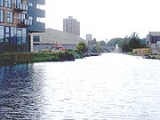
The Hertford Union Canal or Duckett's Canal is a short stretch (c. 1.5 km) of canal
in the London Borough of Tower Hamlets
in east London. It connects the Regent's Canal
to the Lee Navigation
. It was opened in 1830 but quickly proved to be a commercial failure. It was acquired by the Regents Canal Company in 1857, and became part of the Grand Union Canal
in 1927.
, the Hertford Union Canal was intended to provide a short-cut between the River Thames and the River Lee Navigation
. It allowed traffic on the Lea heading for the Thames to bypass the tidal, tortuous and often silted Bow Back Rivers
of the Lea via a short stretch of the Regent's Canal
, and provided a short-cut from the Lea to places west along the Regent's Canal.
The canal was promoted by Sir George Duckett who succeeded in gaining an Act of Parliament
that gained its Royal Assent on 17 May 1824, entitled An Act for making and maintaining a navigable Canal from the River Lee Navigation, in the parish of St. Mary Stratford Bow, in the county of Middlesex, to join the Regent's Canal at or near a Place called Old Ford Lock, in the parish of St. Matthew Bethnal Green, in the said county of Middlesex.
The Act authorised Duckett to borrow up to £50,000 to fund construction, and to charge tolls for using the canal, initially one shilling
(£0.05) per ton
of goods carried.
With Francis Giles
appointed as engineer, the canal opened in 1830 and was for some years known as Duckett's Canal or Duckett's Cut. It was not a commercial success, and within a year offers to waive the tolls were being made. For several years around the 1850s it was unnavigable, as a dam was built across it to prevent the Regent's Canal losing water to it. After failed attempts to sell it in 1851, it was eventually acquired by the Regent's Canal Company and became a branch of that canal on 28 October 1857. The new owners removed the dam, and deepened and widened the channel. When the Grand Union Canal
Company acquired the Regent's Canal in 1929, it became part of that network. Today, it is maintained by British Waterways
.
and Old Ford Lock on the Regent's Canal
. It passes along the north of Bow Wharf, redeveloped in the 1990s with shops and bars, and after Grove Road, passes south of Lakeview Estate
, completed in 1958. For much of the rest of its route it is bounded on the north by Victoria Park
. The canal joins the Lee Navigation
just above Old Ford Lock
.
Many of the associated locks, bridges and other features around the canal, date from the canal's opening in 1830 and are designated listed structures within a scheduled ancient monument
.


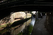
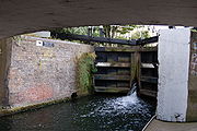
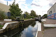
 The three locks
on this canal are named Old Ford Locks, all lying within the district of Old Ford. They are grouped together towards the north-eastern end, and descend approximately 19 feet (5.8 m) from the Regent's Canal to the Lee Navigation. These locks are all single manual locks, and the largest craft that can use them have a length of 72 feet and a beam of 14 feet.
Proceeding west to east, the locks are:
, with the tail of the lock passing beneath a cast iron footbridge accessing the park from Parnell Road. It has a fall of 6 in 3 in (1.91 m).
The lock was designated a Grade II listed structure in 1990, and its bottom gates have rare cast iron balance beams. One of the adjacent cottages (No 3 Lock Cottages) is also a Grade II listed building.
51.538056°N 0.029783°W
51.539082°N 0.027568°W
The public house
, now the "Top of the Morning", but then the Mitford Castle, by the ramp to the canal, on Wick Road, was where Thomas Briggs – the first victim of a railway murder – was taken to die from his wounds, in July 1864 (see Hackney Wick).
51.540610°N 0.024636°W
is Hackney Wick
The canal towpath is open to walkers and cyclists — without permit. At its eastern end, the towpath joins the Lea Valley Walk
. At Hackney Wick, the Capital Ring
crosses the canal; with section 13 proceeding north-west toward Stoke Newington
and section 14, south-east — using The Greenway towards Beckton District Park
. The towpath forms part of the "Limehouse Circuit"; commencing at Limehouse Basin
and utilising the Limehouse Cut
, Lee Navigation, Regent's Canal and Hertford Union in a circular five-mile walk.
The Olympic Park, London
is under construction to the east of the Lee Navigation. During the games, there is proposed pedestrian and cycle access to the stadia via newly constructed bridges. In the legacy phase of the 2012 Summer Olympics
, there is promised access to the Olympic Park and Bow Back Rivers
.
Canal
Canals are man-made channels for water. There are two types of canal:#Waterways: navigable transportation canals used for carrying ships and boats shipping goods and conveying people, further subdivided into two kinds:...
in the London Borough of Tower Hamlets
London Borough of Tower Hamlets
The London Borough of Tower Hamlets is a London borough to the east of the City of London and north of the River Thames. It is in the eastern part of London and covers much of the traditional East End. It also includes much of the redeveloped Docklands region of London, including West India Docks...
in east London. It connects the Regent's Canal
Regent's Canal
Regent's Canal is a canal across an area just north of central London, England. It provides a link from the Paddington arm of the Grand Union Canal, just north-west of Paddington Basin in the west, to the Limehouse Basin and the River Thames in east London....
to the Lee Navigation
River Lee Navigation
The Lee Navigation is a canalised river incorporating the River Lea . Its course runs from Hertford Castle Weir all the way to the River Thames at Bow Creek. The first lock of the navigation is Hertford Lock the last being Bow Locks....
. It was opened in 1830 but quickly proved to be a commercial failure. It was acquired by the Regents Canal Company in 1857, and became part of the Grand Union Canal
Grand Union Canal
The Grand Union Canal in England is part of the British canal system. Its main line connects London and Birmingham, stretching for 137 miles with 166 locks...
in 1927.
History
Like its 1766 predecessor, the Limehouse CutLimehouse Cut
The Limehouse Cut is a straight, broad canal in the East End of London, which linked the lower reaches of the River Lee Navigation to the River Thames...
, the Hertford Union Canal was intended to provide a short-cut between the River Thames and the River Lee Navigation
River Lee Navigation
The Lee Navigation is a canalised river incorporating the River Lea . Its course runs from Hertford Castle Weir all the way to the River Thames at Bow Creek. The first lock of the navigation is Hertford Lock the last being Bow Locks....
. It allowed traffic on the Lea heading for the Thames to bypass the tidal, tortuous and often silted Bow Back Rivers
Bow Back Rivers
The Bow Back Rivers are part of the River Lea in the London Borough of Newham, east London, England, and form a complex system of waterways. The River Lea was originally tidal as far as Hackney Wick; man-made changes to the river had changed this dramatically in the 9th century, and in 1110 a...
of the Lea via a short stretch of the Regent's Canal
Regent's Canal
Regent's Canal is a canal across an area just north of central London, England. It provides a link from the Paddington arm of the Grand Union Canal, just north-west of Paddington Basin in the west, to the Limehouse Basin and the River Thames in east London....
, and provided a short-cut from the Lea to places west along the Regent's Canal.
The canal was promoted by Sir George Duckett who succeeded in gaining an Act of Parliament
Act of Parliament
An Act of Parliament is a statute enacted as primary legislation by a national or sub-national parliament. In the Republic of Ireland the term Act of the Oireachtas is used, and in the United States the term Act of Congress is used.In Commonwealth countries, the term is used both in a narrow...
that gained its Royal Assent on 17 May 1824, entitled An Act for making and maintaining a navigable Canal from the River Lee Navigation, in the parish of St. Mary Stratford Bow, in the county of Middlesex, to join the Regent's Canal at or near a Place called Old Ford Lock, in the parish of St. Matthew Bethnal Green, in the said county of Middlesex.
The Act authorised Duckett to borrow up to £50,000 to fund construction, and to charge tolls for using the canal, initially one shilling
Shilling
The shilling is a unit of currency used in some current and former British Commonwealth countries. The word shilling comes from scilling, an accounting term that dates back to Anglo-Saxon times where it was deemed to be the value of a cow in Kent or a sheep elsewhere. The word is thought to derive...
(£0.05) per ton
Ton
The ton is a unit of measure. It has a long history and has acquired a number of meanings and uses over the years. It is used principally as a unit of weight, and as a unit of volume. It can also be used as a measure of energy, for truck classification, or as a colloquial term.It is derived from...
of goods carried.
With Francis Giles
Francis Giles
Francis Giles was a canal engineer and surveyor who worked under John Rennie and later became a railway engineer-Works and appointments:...
appointed as engineer, the canal opened in 1830 and was for some years known as Duckett's Canal or Duckett's Cut. It was not a commercial success, and within a year offers to waive the tolls were being made. For several years around the 1850s it was unnavigable, as a dam was built across it to prevent the Regent's Canal losing water to it. After failed attempts to sell it in 1851, it was eventually acquired by the Regent's Canal Company and became a branch of that canal on 28 October 1857. The new owners removed the dam, and deepened and widened the channel. When the Grand Union Canal
Grand Union Canal
The Grand Union Canal in England is part of the British canal system. Its main line connects London and Birmingham, stretching for 137 miles with 166 locks...
Company acquired the Regent's Canal in 1929, it became part of that network. Today, it is maintained by British Waterways
British Waterways
British Waterways is a statutory corporation wholly owned by the government of the United Kingdom, serving as the navigation authority in England, Scotland and Wales for the vast majority of the canals as well as a number of rivers and docks...
.
Route
The canal starts at Hertford Union Junction between Mile End LockMile End Lock
Mile End Lock is a lock on the Regent's Canal, in the London Borough of Tower Hamlets. The lock spans the Regent's Canal between Queen Mary, University of London and Mile End ParkThe nearest London Underground station is Mile End.-See also:...
and Old Ford Lock on the Regent's Canal
Regent's Canal
Regent's Canal is a canal across an area just north of central London, England. It provides a link from the Paddington arm of the Grand Union Canal, just north-west of Paddington Basin in the west, to the Limehouse Basin and the River Thames in east London....
. It passes along the north of Bow Wharf, redeveloped in the 1990s with shops and bars, and after Grove Road, passes south of Lakeview Estate
Lakeview Estate
Lakeview Estate is a housing estate in Bow, east London designed by Berthold Lubetkin. It was built on a site damaged by bombing in World War II, on Grove Road between Old Ford Road and the Hertford Union Canal. The estate opened in 1958. It overlooks the lake in Victoria Park....
, completed in 1958. For much of the rest of its route it is bounded on the north by Victoria Park
Victoria Park, East London
Victoria Park is 86.18 hectares of open space that stretches out across part of the East End of London, England bordering parts of Bethnal Green, Hackney, and Bow, such as along Old Ford Road, London E3 and Victoria Park Road E9. The park is entirely within the London Borough of Tower Hamlets...
. The canal joins the Lee Navigation
River Lee Navigation
The Lee Navigation is a canalised river incorporating the River Lea . Its course runs from Hertford Castle Weir all the way to the River Thames at Bow Creek. The first lock of the navigation is Hertford Lock the last being Bow Locks....
just above Old Ford Lock
Old Ford Lock
Old Ford Lock is a paired lock and weir on the River Lee Navigation, in the London Borough of Tower Hamlets, England. It is at Bow on the east side of London...
.
Many of the associated locks, bridges and other features around the canal, date from the canal's opening in 1830 and are designated listed structures within a scheduled ancient monument
Scheduled Ancient Monument
In the United Kingdom, a scheduled monument is a 'nationally important' archaeological site or historic building, given protection against unauthorized change. The various pieces of legislation used for legally protecting heritage assets from damage and destruction are grouped under the term...
.
Locks


Lock (water transport)
A lock is a device for raising and lowering boats between stretches of water of different levels on river and canal waterways. The distinguishing feature of a lock is a fixed chamber in which the water level can be varied; whereas in a caisson lock, a boat lift, or on a canal inclined plane, it is...
on this canal are named Old Ford Locks, all lying within the district of Old Ford. They are grouped together towards the north-eastern end, and descend approximately 19 feet (5.8 m) from the Regent's Canal to the Lee Navigation. These locks are all single manual locks, and the largest craft that can use them have a length of 72 feet and a beam of 14 feet.
Proceeding west to east, the locks are:
Old Ford Upper Lock No. 1
This is lock No.1, and is 0.63 miles (1 km) from the Hertford Union Junction with the Regent's Canal. It is to the south of Victoria ParkVictoria Park, East London
Victoria Park is 86.18 hectares of open space that stretches out across part of the East End of London, England bordering parts of Bethnal Green, Hackney, and Bow, such as along Old Ford Road, London E3 and Victoria Park Road E9. The park is entirely within the London Borough of Tower Hamlets...
, with the tail of the lock passing beneath a cast iron footbridge accessing the park from Parnell Road. It has a fall of 6 in 3 in (1.91 m).
The lock was designated a Grade II listed structure in 1990, and its bottom gates have rare cast iron balance beams. One of the adjacent cottages (No 3 Lock Cottages) is also a Grade II listed building.
51.538056°N 0.029783°W
Old Ford Middle Lock No. 2
The middle lock has a fall of 8 in 11 in (2.72 m) The tail of the lock passes under Cardogan Terrace.51.539082°N 0.027568°W
Old Ford Lower Lock No. 3
The lower lock has a fall of 3 in 9 in (1.14 m). It is just 0.13 mile (0.2092142 km) from the junction with the River Lee.The public house
Public house
A public house, informally known as a pub, is a drinking establishment fundamental to the culture of Britain, Ireland, Australia and New Zealand. There are approximately 53,500 public houses in the United Kingdom. This number has been declining every year, so that nearly half of the smaller...
, now the "Top of the Morning", but then the Mitford Castle, by the ramp to the canal, on Wick Road, was where Thomas Briggs – the first victim of a railway murder – was taken to die from his wounds, in July 1864 (see Hackney Wick).
51.540610°N 0.024636°W
Transport
The nearest London Overground stationLondon Overground
London Overground is a suburban rail network in London and Hertfordshire. It has been operated by London Overground Rail Operations since 2007 as part of the National Rail network, under the franchise control and branding of Transport for London...
is Hackney Wick
Hackney Wick railway station
Hackney Wick railway station is on the North London Line in the London Borough of Hackney, on the northern side of the boundary between Hackney and the London Borough of Tower Hamlets, in east London. It is in Travelcard Zone 2. The station and all trains serving it are operated by London Overground...
The canal towpath is open to walkers and cyclists — without permit. At its eastern end, the towpath joins the Lea Valley Walk
Lea Valley Walk
The Lea Valley Walk is a long-distance path located between Leagrave, the source of the River Lea near Luton, and the Thames, at Limehouse Basin, Limehouse, east London. From its source much of the walk is rural. At Hertford the path follows the towpath of the River Lee Navigation, and it becomes...
. At Hackney Wick, the Capital Ring
Capital Ring
The Capital Ring is a strategic walking route that is being promoted by London's 33 local councils, led by the City of London Corporation in partnership with the Greater London Authority and its functional body for regional transport, Transport for London, through which much of the funding is...
crosses the canal; with section 13 proceeding north-west toward Stoke Newington
Stoke Newington
Stoke Newington is a district in the London Borough of Hackney. It is north-east of Charing Cross.-Boundaries:In modern terms, Stoke Newington can be roughly defined by the N16 postcode area . Its southern boundary with Dalston is quite ill-defined too...
and section 14, south-east — using The Greenway towards Beckton District Park
Beckton
Beckton is part of the London Borough of Newham, England, located east of Charing Cross.Its boundaries are the A13 trunk road to the north, Barking Creek to the east, the Royal Docks to the south, and Prince Regent Lane to the west. The area around Prince Regent Lane is also known as Custom House...
. The towpath forms part of the "Limehouse Circuit"; commencing at Limehouse Basin
Limehouse Basin
The Limehouse Basin in Limehouse, in the London Borough of Tower Hamlets provides a navigable link between the Regent's Canal and the River Thames, through the Limehouse Basin Lock. A basin in the north of Mile End, near Victoria Park connects with the Hertford Union Canal leading to the River Lee...
and utilising the Limehouse Cut
Limehouse Cut
The Limehouse Cut is a straight, broad canal in the East End of London, which linked the lower reaches of the River Lee Navigation to the River Thames...
, Lee Navigation, Regent's Canal and Hertford Union in a circular five-mile walk.
The Olympic Park, London
Olympic Park, London
The Olympic Park in London is a new sporting complex currently under construction, adjacent to the Stratford City development in Stratford, Bow, Leyton & Homerton in East London for the 2012 Summer Olympics and Paralympics....
is under construction to the east of the Lee Navigation. During the games, there is proposed pedestrian and cycle access to the stadia via newly constructed bridges. In the legacy phase of the 2012 Summer Olympics
2012 Summer Olympics
The 2012 Summer Olympic Games, officially known as the "London 2012 Olympic Games", are scheduled to take place in London, England, United Kingdom from 27 July to 12 August 2012...
, there is promised access to the Olympic Park and Bow Back Rivers
Bow Back Rivers
The Bow Back Rivers are part of the River Lea in the London Borough of Newham, east London, England, and form a complex system of waterways. The River Lea was originally tidal as far as Hackney Wick; man-made changes to the river had changed this dramatically in the 9th century, and in 1110 a...
.
See also
- Canals of Great Britain
- History of the British canal systemHistory of the British canal systemThe British canal system of water transport played a vital role in the United Kingdom's Industrial Revolution at a time when roads were only just emerging from the medieval mud and long trains of pack horses were the only means of "mass" transit by road of raw materials and finished products The...

