

Agriculture in London
Encyclopedia
Agriculture
in London
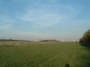
is a rather small enterprise, with only 8.6% of the Greater London
area being used for commercial farming, nearly all of which is close to Greater London's outer boundaries. There are a few city farm
s closer to the centre of the city and about 30,000 allotment
s. There are 135.66 square kilometres (135,660,000 m²) of farmland in the Greater London area. Nearly all of the farmland in the London area is a basis for the growing culture.
 Many areas which now form part of Greater London were formerly rural and agricultural outskirts but still bear names which indicate this past: Ealing Common
, Lincoln's Inn Fields
, Shepherd's Bush
and Wormwood Scrubs
, for example.
In 1938, the Greater London area became the first region in Britain to use a green belt policy and introduced the Metropolitan Green Belt
in order to combat urban sprawl
. A 2005 agricultural census carried out by ADAS
showed that 423 holdings were located in the London part of the metropolitan green belt, around 0.25% of the total number in Britain. The total land managed was 13,608 hectares, half of which was rented. Less than 10% of the land farmed was used for cultivation of organic materials, and the total contribution
that farming made to the economy, excluding diversification activities, was less than £8 m. However, London's agricultural industry was shown to be much more reliant on activities pertaining to diversification, with just under a third of farm income attributed to it, exceeding the national average. The report stated that whilst farming was not a significant part of London's economy, it did have a vital role to play.
The report showed that farming was mainly concentrated in northeast London
, but only included figures on arable farming
(the surrounding regions of East
and South East
are where cereal
farming is most prevalent). The report commented that livestock
farming had decreased in recent years due to a lack of infrastructure (poor access to abbatoirs and markets) and problems associated with being located close to the urban fringe (such as dogs). The report concluded that the low levels of stock in relation to permanent pasture suggested equine usage, something often related to diversification activities; the figures produced in the survey showed that 37% of London's diversification activities were equine related. Horticultural activities were mainly confined to the east of London, south of the River Thames
.
This survey, as well as one carried out by Farmer's Voice in 2004, showed that the majority of farmers (47% and 35%) felt that planning restrictions, which are more widely and stringently enforced in the green belt, were the greatest barrier to diversification. The next highest was a lack of capital, and both polls showed that the Common Agricultural Policy
of the EU was perceived to be smallest obstacle towards furthering diversification. The profitability of agriculture in the London green belt was shown to have increased: in 1999, only 4% of London farms reported an increased or maintained profit level, whereas 27% did in 2008. Forty-eight percent said they feared for their business's survival in 1999; 23% felt this way in 2008.
Agriculture
Agriculture is the cultivation of animals, plants, fungi and other life forms for food, fiber, and other products used to sustain life. Agriculture was the key implement in the rise of sedentary human civilization, whereby farming of domesticated species created food surpluses that nurtured the...
in London
London
London is the capital city of :England and the :United Kingdom, the largest metropolitan area in the United Kingdom, and the largest urban zone in the European Union by most measures. Located on the River Thames, London has been a major settlement for two millennia, its history going back to its...
is a rather small enterprise, with only 8.6% of the Greater London
Greater London
Greater London is the top-level administrative division of England covering London. It was created in 1965 and spans the City of London, including Middle Temple and Inner Temple, and the 32 London boroughs. This territory is coterminate with the London Government Office Region and the London...
area being used for commercial farming, nearly all of which is close to Greater London's outer boundaries. There are a few city farm
City farm
City farms are usually community-run projects in urban areas, which involve people interacting and working with animals and plants. They aim to improve community relationships and offer an awareness of agriculture and farming to people who live in built-up areas.They vary in size from small plots...
s closer to the centre of the city and about 30,000 allotment
Allotment (gardening)
An allotment garden, often called simply an allotment, is a plot of land made available for individual, non-professional gardening. Such plots are formed by subdividing a piece of land into a few or up to several hundreds of land parcels that are assigned to individuals or families...
s. There are 135.66 square kilometres (135,660,000 m²) of farmland in the Greater London area. Nearly all of the farmland in the London area is a basis for the growing culture.
History
Ealing Common
Ealing Common is a large open space in Ealing, west London, bounded by Gunnersbury Ave to the east and the Uxbridge Road to the north. A smaller area of the common extends to the east of Gunnersbury Ave, including Leopold Road...
, Lincoln's Inn Fields
Lincoln's Inn Fields
Lincoln's Inn Fields is the largest public square in London, UK. It was laid out in the 1630s under the initiative of the speculative builder and contractor William Newton, "the first in a long series of entrepreneurs who took a hand in developing London", as Sir Nikolaus Pevsner observes...
, Shepherd's Bush
Shepherd's Bush
-Commerce:Commercial activity in Shepherd's Bush is now focused on the Westfield shopping centre next to Shepherd's Bush Central line station and on the many small shops which run along the northern side of the Green....
and Wormwood Scrubs
Wormwood Scrubs
Wormwood Scrubs, known locally as The Scrubs, is an open space located in the north-eastern corner of the London Borough of Hammersmith and Fulham in west London. It is the largest open space in the Borough, at 80 ha , and one of the largest areas of common land in London...
, for example.
In 1938, the Greater London area became the first region in Britain to use a green belt policy and introduced the Metropolitan Green Belt
Metropolitan Green Belt
The Metropolitan Green Belt is a statutory green belt around London, England. It includes designated parts of Greater London and the surrounding counties of Bedfordshire, Berkshire, Buckinghamshire, Essex, Hertfordshire, Kent and Surrey in the South East and East of England regions.-History:The...
in order to combat urban sprawl
Urban sprawl
Urban sprawl, also known as suburban sprawl, is a multifaceted concept, which includes the spreading outwards of a city and its suburbs to its outskirts to low-density and auto-dependent development on rural land, high segregation of uses Urban sprawl, also known as suburban sprawl, is a...
. A 2005 agricultural census carried out by ADAS
ADAS(Company)
ADAS is an environmental consultancy in the United Kingdom and a provider of environmental solutions, rural development services and policy advice...
showed that 423 holdings were located in the London part of the metropolitan green belt, around 0.25% of the total number in Britain. The total land managed was 13,608 hectares, half of which was rented. Less than 10% of the land farmed was used for cultivation of organic materials, and the total contribution
Contribution margin
In cost-volume-profit analysis, a form of management accounting, contribution margin is the marginal profit per unit sale. It is a useful quantity in carrying out various calculations, and can be used as a measure of operating leverage...
that farming made to the economy, excluding diversification activities, was less than £8 m. However, London's agricultural industry was shown to be much more reliant on activities pertaining to diversification, with just under a third of farm income attributed to it, exceeding the national average. The report stated that whilst farming was not a significant part of London's economy, it did have a vital role to play.
The report showed that farming was mainly concentrated in northeast London
North East (London sub region)
The North East is a sub-region of the London Plan corresponding to the London Boroughs of Tower Hamlets, Newham, Waltham Forest, Redbridge, Havering, Barking and Dagenham, and the City of London. The sub region was established in 2008 and replaced the larger East sub region that had been...
, but only included figures on arable farming
Agronomy
Agronomy is the science and technology of producing and using plants for food, fuel, feed, fiber, and reclamation. Agronomy encompasses work in the areas of plant genetics, plant physiology, meteorology, and soil science. Agronomy is the application of a combination of sciences like biology,...
(the surrounding regions of East
East of England
The East of England is one of the nine official regions of England. It was created in 1994 and was adopted for statistics from 1999. It includes the ceremonial counties of Essex, Hertfordshire, Bedfordshire, Cambridgeshire, Norfolk and Suffolk. Essex has the highest population in the region.Its...
and South East
South East England
South East England is one of the nine official regions of England, designated in 1994 and adopted for statistical purposes in 1999. It consists of Berkshire, Buckinghamshire, East Sussex, Hampshire, Isle of Wight, Kent, Oxfordshire, Surrey and West Sussex...
are where cereal
Cereal
Cereals are grasses cultivated for the edible components of their grain , composed of the endosperm, germ, and bran...
farming is most prevalent). The report commented that livestock
Livestock
Livestock refers to one or more domesticated animals raised in an agricultural setting to produce commodities such as food, fiber and labor. The term "livestock" as used in this article does not include poultry or farmed fish; however the inclusion of these, especially poultry, within the meaning...
farming had decreased in recent years due to a lack of infrastructure (poor access to abbatoirs and markets) and problems associated with being located close to the urban fringe (such as dogs). The report concluded that the low levels of stock in relation to permanent pasture suggested equine usage, something often related to diversification activities; the figures produced in the survey showed that 37% of London's diversification activities were equine related. Horticultural activities were mainly confined to the east of London, south of the River Thames
River Thames
The River Thames flows through southern England. It is the longest river entirely in England and the second longest in the United Kingdom. While it is best known because its lower reaches flow through central London, the river flows alongside several other towns and cities, including Oxford,...
.
This survey, as well as one carried out by Farmer's Voice in 2004, showed that the majority of farmers (47% and 35%) felt that planning restrictions, which are more widely and stringently enforced in the green belt, were the greatest barrier to diversification. The next highest was a lack of capital, and both polls showed that the Common Agricultural Policy
Common Agricultural Policy
The Common Agricultural Policy is a system of European Union agricultural subsidies and programmes. It represents 48% of the EU's budget, €49.8 billion in 2006 ....
of the EU was perceived to be smallest obstacle towards furthering diversification. The profitability of agriculture in the London green belt was shown to have increased: in 1999, only 4% of London farms reported an increased or maintained profit level, whereas 27% did in 2008. Forty-eight percent said they feared for their business's survival in 1999; 23% felt this way in 2008.