

Freeways in Australia
Encyclopedia
This is a list of freeways and motorways in Australia
, sorted by states and territories
and their corresponding routes. This list includes toll roads such as the CityLink
freeway system in Melbourne
. This list has over 70 entries. The only jurisdiction in Australia without freeways is the Northern Territory
.
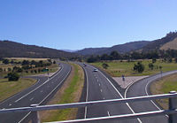
Australian Capital Territory
Tasmania
While the overall quality of Tasmania's Highway network has been constructed to a high standard, its grade separated
Freeway network is limited. In the past, Hobart
and Launceston
have each had comprehensive transport studies conducted, proposing Grade separated Freeways running through and around them. While some of these roads have been constructed, the majority are limited access
featuring At-grade
intersections. Devonport
and Burnie
are the only major population centres with Freeway standard roads linking each other. There has been repeated proposals in recent years to fully upgrade the Midland Highway to grade separated Freeway standards.
This List is limited to Tasmania's Freeway standard Roads.


South Australia


Victoria


Western Australia


Australia
Australia , officially the Commonwealth of Australia, is a country in the Southern Hemisphere comprising the mainland of the Australian continent, the island of Tasmania, and numerous smaller islands in the Indian and Pacific Oceans. It is the world's sixth-largest country by total area...
, sorted by states and territories
States and territories of Australia
The Commonwealth of Australia is a union of six states and various territories. The Australian mainland is made up of five states and three territories, with the sixth state of Tasmania being made up of islands. In addition there are six island territories, known as external territories, and a...
and their corresponding routes. This list includes toll roads such as the CityLink
CityLink
CityLink is a system of tolled urban Highways in Melbourne, Victoria, Australia. The company Transurban was awarded the contract to augment two existing freeways and construct two new Toll roads—labelled the Western and Southern Links—directly linking a number of existing freeways to...
freeway system in Melbourne
Melbourne
Melbourne is the capital and most populous city in the state of Victoria, and the second most populous city in Australia. The Melbourne City Centre is the hub of the greater metropolitan area and the Census statistical division—of which "Melbourne" is the common name. As of June 2009, the greater...
. This list has over 70 entries. The only jurisdiction in Australia without freeways is the Northern Territory
Northern Territory
The Northern Territory is a federal territory of Australia, occupying much of the centre of the mainland continent, as well as the central northern regions...
.
Australian Capital TerritoryAustralian Capital TerritoryThe Australian Capital Territory, often abbreviated ACT, is the capital territory of the Commonwealth of Australia and is the smallest self-governing internal territory...
- Adelaide Avenue
- Yarra Glen
- Tuggeranong ParkwayTuggeranong ParkwayThe Tuggeranong Parkway is a major dual carriageway link in Canberra, Australia. Often referred to as "The Parkway" by locals, the Tuggeranong Parkway links Civic to the southern Canberra metro district of Tuggeranong, and is a bypass road to the Woden Valley-Weston Creek district of Canberra...
- Gungahlin Drive
- Parkes WayParkes Way, CanberraParkes Way is a road in Canberra, Australia, which runs east-west between Kings Avenue and the Glenloch Interchange. At Glenloch Interchange it intersects with William Hovell Drive, Tuggeranong Parkway and Caswell Drive.The road is a freeway from Glenloch Interchange to the Commonwealth Avenue...
- Majura Road
TasmaniaTasmaniaTasmania is an Australian island and state. It is south of the continent, separated by Bass Strait. The state includes the island of Tasmania—the 26th largest island in the world—and the surrounding islands. The state has a population of 507,626 , of whom almost half reside in the greater Hobart...
While the overall quality of Tasmania's Highway network has been constructed to a high standard, its grade separatedGrade separation
Grade separation is the method of aligning a junction of two or more transport axes at different heights so that they will not disrupt the traffic flow on other transit routes when they cross each other. The composition of such transport axes does not have to be uniform; it can consist of a...
Freeway network is limited. In the past, Hobart
Hobart
Hobart is the state capital and most populous city of the Australian island state of Tasmania. Founded in 1804 as a penal colony,Hobart is Australia's second oldest capital city after Sydney. In 2009, the city had a greater area population of approximately 212,019. A resident of Hobart is known as...
and Launceston
Launceston, Tasmania
Launceston is a city in the north of the state of Tasmania, Australia at the junction of the North Esk and South Esk rivers where they become the Tamar River. Launceston is the second largest city in Tasmania after the state capital Hobart...
have each had comprehensive transport studies conducted, proposing Grade separated Freeways running through and around them. While some of these roads have been constructed, the majority are limited access
Limited-access road
A limited-access road known by various terms worldwide, including limited-access highway, dual-carriageway and expressway, is a highway or arterial road for high-speed traffic which has many or most characteristics of a controlled-access highway , including limited or no access to adjacent...
featuring At-grade
At-grade intersection
An at-grade intersection is a junction at which two or more transport axes cross at the same level .-Traffic management:With areas of high or fast traffic, an at-grade intersection normally requires a traffic control device such as a stop sign, traffic light or railway signal to manage conflicting...
intersections. Devonport
Devonport, Tasmania
-Sport:The Devonport Football Club is an Australian Rules team competing in the Tasmanian Statewide League. The Devonport Rugby Club is a Rugby Union team competing in the Tasmanian Rugby Union Statewide League...
and Burnie
Burnie, Tasmania
- Sport :Australian rules football is popular in Burnie. The city's team is the Burnie Dockers Football Club in the Tasmanian State League.Rugby union is also played in Burnie. The local club is the Burnie Rugby Union Club. They are the current Tasmanian Rugby Union Statewide Division Two Premiers...
are the only major population centres with Freeway standard roads linking each other. There has been repeated proposals in recent years to fully upgrade the Midland Highway to grade separated Freeway standards.
This List is limited to Tasmania's Freeway standard Roads.
Hobart Region
- Brooker HighwayBrooker HighwayThe Brooker Highway is a highway in the State of Tasmania, Australia. Also known as the Northern Outlet, the highway is the major arterial route through Hobart's northern suburbs and is Hobart's major road connection to the cities and towns of Northern Tasmania...
(RosettaRosetta, TasmaniaRosetta is a suburb in the northern suburbs of Hobart, capital of the Australian state of Tasmania. It is in the local government area of City of Glenorchy. The suburb is situated between the suburbs of Berriedale and Montrose and is approximately 15 minutes drive from Hobart. There is a primary...
to GrantonGranton, TasmaniaGranton is a suburb of Hobart, capital city of Tasmania, Australia. It is the most northern suburb of the City of Glenorchy Local Government Area....
) - Midland Highway (Brighton BypassBrighton BypassThe Brighton Bypass is a A$164 million bypass currently under construction on the Midland Highway between Bridgewater and Pontville, just north of Hobart in southern Tasmania. Construction of the 9.5 km federally funded Dual carriageway started in April 2009, and is expected to be completed in...
under construction)
- Tasman HighwayTasman HighwayThe Tasman Highway is a highway in Tasmania, Australia. Like the Midland Highway, it connects the major cities of Hobart and Launceston — however it takes a different route, via the north-eastern and eastern coasts of the state. The Highway also acts as a major commuter road to Hobart...
(Tasman BridgeTasman BridgeThe Tasman Bridge is a five-lane bridge crossing the Derwent River, near the CBD of Hobart, Tasmania. The bridge has a total length of 1,395 metres . It provides the main traffic route from the CBD to the eastern shore - particularly Hobart International Airport and Bellerive Oval...
to Hobart Airport)
- Southern OutletSouthern Outlet, HobartThe Southern Outlet is a 13km dual-carriageway limited-access highway that connects Hobart to the southern parts of Tasmania, Australia...
(Hobart to KingstonKingston, TasmaniaKingston is a township and region on the outskirts of Hobart, Tasmania, Australia. Nestled 15 km south of the city between and around several hills, Kingston is the council seat of its wider municipality, the Kingborough Council, and today serves as the gateway between Hobart and the...
)
Rural Region
- Bass HighwayBass Highway, TasmaniaThe Bass Highway is a highway in Tasmania, Australia. It is a part of the National Highway, designated as National Highway 1 and connects the major cities across the north of the state - Burnie, Devonport and Launceston....
(BurnieBurnie, Tasmania- Sport :Australian rules football is popular in Burnie. The city's team is the Burnie Dockers Football Club in the Tasmanian State League.Rugby union is also played in Burnie. The local club is the Burnie Rugby Union Club. They are the current Tasmanian Rugby Union Statewide Division Two Premiers...
to DevonportDevonport, Tasmania-Sport:The Devonport Football Club is an Australian Rules team competing in the Tasmanian Statewide League. The Devonport Rugby Club is a Rugby Union team competing in the Tasmanian Rugby Union Statewide League...
and ProspectProspect, TasmaniaProspect is a small suburb of Launceston.The Mount Pleasant Laboratories are Tasmanian government laboratories located in Prospect and include:* Diagnostic Services - Researching the Tasmanian Devil Facial Tumor Disease* Animal Health Laboratory...
to Illawarra Main Road) - Midland Highway (South LauncestonSouth Launceston, TasmaniaSouth Launceston is a suburb of Launceston in the Australian state of Tasmania, it also contains the minor suburbs of Glen Dhu and Sandhill .-History:...
to Breadalbane)
Sydney region
- Gore Hill FreewayGore Hill FreewayThe Gore Hill Freeway is a major freeway in Sydney, New South Wales, Australia. This freeway forms part of Metroad 1 andthe Sydney Orbital Network to provide access to most of the suburbs in Sydney and is also a major route to the north, south, east and west of the metropolis.It connects to the...
- Warringah FreewayWarringah FreewayThe Warringah Freeway is a major road in Sydney, New South Wales, Australia. This freeway forms part of the Sydney Orbital Network to provide access to most of the suburbs in Sydney and is also a major route to the north, south, east and west of the metropolis.-History:Planning began in 1951...
- Sydney Harbour TunnelSydney Harbour TunnelThe Sydney Harbour Tunnel is a twin-tube road tunnel in Sydney, Australia. The tunnel was completed and opened to traffic in August 1992 to provide a second vehicular crossing of Sydney Harbour to alleviate congestion on the Sydney Harbour Bridge....
(fully electronically tolled for southbound traffic) - Cahill ExpresswayCahill ExpresswayThe Cahill Expressway is the first true freeway constructed in Sydney, Australia. It starts from the Eastern Distributor and Cross City Tunnel in Woolloomooloo, and runs through a series of sunken cuttings and tunnels between the Royal Botanical Gardens and The Domain...
- Eastern DistributorEastern DistributorThe Eastern Distributor, also identified as the M1, is a long motorway in Sydney, New South Wales, Australia. Part of Metroad 1, it links the Sydney central business district with the Airport...
(tolled for northbound traffic, yet to be fully electronically tolled) - Southern Cross DriveSouthern Cross DriveSouthern Cross Drive is a major road in Sydney, New South Wales, Australia. This freeway links the Eastern Distributor at Moore Park to General Holmes Drive at Sydney Airport. Eastlakes Golf Club runs alongside Southern Cross Drive...
- General Holmes DriveGeneral Holmes DriveGeneral Holmes Drive is a major road that runs through Brighton-Le-Sands and Kyeemagh in New South Wales, Australia.General Holmes Drive starts from the The Grand Parade in Brighton-Le-Sands, continues into the suburb of Kyeemagh, running along Cook Park, over the Cooks River , past Sydney Airport...
, the Airport Tunnel
- Lane Cove TunnelLane Cove TunnelThe Lane Cove Tunnel is a A$1.1 billion, 3.6 km twin tunnel tollway in Sydney, Australia, connecting the M2 Motorway at North Ryde with the Gore Hill Freeway at Artarmon. It forms part of Sydney Metroad 2 and the 110 km Sydney Orbital Network...
(fully electronically tolled) - M2 Hills MotorwayM2 Hills MotorwayThe M2 Hills Motorway is a motorway in north-western Sydney, New South Wales, Australia. It forms part of Sydney Metroad 2 and the 110 km Sydney Orbital Network. West of Pennant Hills Road, the M2 is also part of the National Highway.-History:Previously, Sydney's western suburbs were poorly served...
(tolled in both directions, yet to be fully electronically tolled)
- Cross City TunnelCross City TunnelThe Cross City Tunnel is a 2.1 km-long tunnel located in Sydney, Australia. It links Darling Harbour on the Western fringe of the central business district to Rushcutters Bay in the Eastern Suburbs...
(fully electronically tolled) - M4 Western MotorwayM4 Western MotorwayThe M4 Western Motorway,, is a motorway in central Sydney, New South Wales, Australia...
- Western DistributorWestern DistributorThe Western Distributor is a primarily elevated small freeway in Sydney, New South Wales, Australia that links Victoria Road, White Bay , with the Bradfield Highway at the southern end of the Sydney Harbour Bridge...
- M5 South Western MotorwayM5 South Western MotorwayThe M5 South Western Motorway is a privately operated tolled motorway in south-western Sydney, New South Wales, Australia. It forms part of Sydney Metroad 5 and the Sydney Orbital Network...
(partly tolled in both directions, yet to be fully electronically tolled) - M5 East
- Westlink M7Westlink M7Westlink M7 - formerly Western Sydney Orbital - is one of Sydney, Australia's urban motorways and a part of Metroad 7 and the Sydney Orbital Network. It connects three Metroads: M5 at Prestons, M4 at Eastern Creek and M2 at Baulkham Hills...
(fully electronically tolled)
Rural region
- Pacific MotorwayPacific MotorwayThe Pacific Motorway is a 100 km long motorway in Australia between Brisbane, Queensland, and the New South Wales-Queensland border at Tweed Heads. The motorway starts at Coronation Drive at Milton in Brisbane, and from 2008 links the Tweed Heads bypass in New South Wales...
- Sydney-Newcastle FreewaySydney-Newcastle FreewayThe Sydney-Newcastle Freeway is a stretch of motorway linking Sydney to the Central Coast, Newcastle and Hunter regions of New South Wales. It is part of the AusLink road corridor between Sydney and Brisbane, carrying the route designation....
, also known as the F3 - Pacific HighwayPacific Highway (Australia)The Pacific Highway is a major transport route along part of the east coast of Australia and is part of Australia's national route 1.It is 960 km long and links Sydney, the capital of New South Wales, to Brisbane, the capital of Queensland, along the coast, via Gosford, Newcastle, Taree, Port...
, 60% of which is of freeway standard. - Southern FreewaySouthern FreewaySouthern Freeway is a freeway linking Sydney to Wollongong. It currently is designated as part of National Route 1, however was formerly signposted as F6 under a former route numbering system, and is commonly known by this latter name...
, also known as the F6 - Princes HighwayPrinces HighwayThe Princes Highway extends from Sydney to Port Augusta via the coast through the states of New South Wales, Victoria and South Australia, a distance of 1941 km or 1898 km via the former alignments of the highway ....
, 10% of which is of freeway standard.
- Newcastle Inner City BypassNewcastle Inner City BypassThe Newcastle Inner City Bypass is a ring road in Newcastle New South Wales, Australia. Alternate titles include State Highway 23, Main Road 123 and H23....
- Hume FreewayHume HighwayThe Hume Highway/Hume Freeway is one of Australia's major inter-city highways, running for 880 km between Sydney and Melbourne. It is part of the Auslink National Network and is a vital link for road freight to transport goods to and from the two cities as well as serving Albury-Wodonga and...
, also known as the F5 - Hume HighwayHume HighwayThe Hume Highway/Hume Freeway is one of Australia's major inter-city highways, running for 880 km between Sydney and Melbourne. It is part of the Auslink National Network and is a vital link for road freight to transport goods to and from the two cities as well as serving Albury-Wodonga and...
, 97% of which is of freeway standard.
- Hunter Expressway (Proposed)
Brisbane region
- Bruce HighwayBruce HighwayThe Bruce Highway is a major highway in Queensland, Australia. Commencing in the state capital, Brisbane, it passes through areas close to the eastern coast to Cairns in Far North Queensland. The route is a part of the Australian National Highway and also part of Highway 1...
- Gateway MotorwayGateway MotorwayThe Gateway Motorway is a major motorway in Brisbane, Queensland, Australia. The Gateway Bridge is owned and operated by Queensland Motorways....
(Gateway Bridge crossing over Brisbane RiverBrisbane RiverThe Brisbane River is the longest river in south east Queensland, Australia, and flows through the city of Brisbane, before emptying into Moreton Bay. John Oxley was the first European to explore the river who named it after the Governor of New South Wales, Thomas Brisbane in 1823...
) - Pacific MotorwayPacific MotorwayThe Pacific Motorway is a 100 km long motorway in Australia between Brisbane, Queensland, and the New South Wales-Queensland border at Tweed Heads. The motorway starts at Coronation Drive at Milton in Brisbane, and from 2008 links the Tweed Heads bypass in New South Wales...
- Ipswich MotorwayIpswich MotorwayThe M7 runs from the junction of Ipswich Road and Granard Road to the M2 Logan Motorway interchange. It is then signed M2 until the junction of the Warrego Highway and the Cunningham Highway between Brisbane and Ipswich in South East Queensland, Australia.It initially passes through the suburbs of...
- Logan MotorwayLogan MotorwayThe M2/MR6 Logan Motorway offers motorists a quick link between Ipswich and the M1 or Pacific Motorway at Loganholme, and the Gateway Motorway, providing access to the Gold Coast on the eastern seaboard and to the rural areas of the Darling Downs to the west....
(Tolled)
- Gympie Arterial RoadGympie Arterial RoadThe Gympie Arterial Road is a freeway in the northern suburbs of Brisbane in Queensland, Australia. This section of the road starts in Carseldine at Gympie Road and terminates at the Pine River where it becomes the Bruce Highway. Approximately 800m south of this crossing is the interchange with...
- Inner City BypassInner City BypassM3 Inner City Bypass is a major motorway standard road in Brisbane, Australia. The 4.5km bypass is north of the city. Bypassing the Brisbane central business district, it connects Brisbane’s Pacific Motorway and Go Between Bridge at Hale Street to Kingsford Smith Drive, the Clem Jones Tunnel and...
- Pacific MotorwayPacific MotorwayThe Pacific Motorway is a 100 km long motorway in Australia between Brisbane, Queensland, and the New South Wales-Queensland border at Tweed Heads. The motorway starts at Coronation Drive at Milton in Brisbane, and from 2008 links the Tweed Heads bypass in New South Wales...
- Riverside ExpresswayRiverside ExpresswayThe Riverside Expressway is part of the Pacific Motorway that runs through Brisbane, Queensland, Australia. It is located on the western side of the Brisbane CBD and is made up of various bridges and overpasses...
- Centenary FreewayCentenary Freeway, BrisbaneThe M5 is a motorway in the western suburbs of Brisbane, Australia.It starts as a two-lane arterial road at Yamanto, travelling to Springfield, where it becomes a two-lane highway and travels across the M2 Logan Motorway at Ellen Grove and ends at Kenmore where it changes its name to the M5...
- Western Freeway
- Logan MotorwayLogan MotorwayThe M2/MR6 Logan Motorway offers motorists a quick link between Ipswich and the M1 or Pacific Motorway at Loganholme, and the Gateway Motorway, providing access to the Gold Coast on the eastern seaboard and to the rural areas of the Darling Downs to the west....
(Tolled)
- Ipswich MotorwayIpswich MotorwayThe M7 runs from the junction of Ipswich Road and Granard Road to the M2 Logan Motorway interchange. It is then signed M2 until the junction of the Warrego Highway and the Cunningham Highway between Brisbane and Ipswich in South East Queensland, Australia.It initially passes through the suburbs of...
(Goodna to Archerfield) - Brisbane Airport LinkAirport Link, BrisbaneThe Airport Link is a tunnelled motorway grade road which is under construction in the northern suburbs of Brisbane, Queensland, Australia. It will connect the Brisbane central business district and the Clem Jones Tunnel to the East-West Arterial Road which leads to the Brisbane Airport...
(Under Construction) - North South Bypass Tunnel / Clem7
- Deagon Deviation
- Port of Brisbane MotorwayPort of Brisbane MotorwayPort of Brisbane Motorway is a motorway, which connects the Port of Brisbane to the Gateway Motorway. Stage 1 was opened in December 2002. The motorway was built to take freight traffic off Lytton Road, with about 4,000 vehicles travelling to the Port of Brisbane in 2002...
Gold Coast region
- Pacific MotorwayPacific MotorwayThe Pacific Motorway is a 100 km long motorway in Australia between Brisbane, Queensland, and the New South Wales-Queensland border at Tweed Heads. The motorway starts at Coronation Drive at Milton in Brisbane, and from 2008 links the Tweed Heads bypass in New South Wales...
- Smith Street Motorway
Sunshine Coast region
- Bruce HighwayBruce HighwayThe Bruce Highway is a major highway in Queensland, Australia. Commencing in the state capital, Brisbane, it passes through areas close to the eastern coast to Cairns in Far North Queensland. The route is a part of the Australian National Highway and also part of Highway 1...
- Sunshine MotorwaySunshine MotorwayThe Sunshine Motorway is a thirty-three kilometre Australian motorway on the Sunshine Coast region of Queensland, just north of Brisbane. It was initially a tolled motorway before these were removed in 1993 after excessive complaint regarding any such need of a toll.-Overview:The Sunshine Motorway...
Townsville region
- Douglas Arterial RoadDouglas Arterial RoadThe Douglas Arterial Road is a two-lane motorway grade road located in Townsville, Queensland. The road is commonly known by locals as either the Ring Road or the Douglas Motorway...
(part of the greater Townsville Ring RoadTownsville Ring RoadThe Townsville Ring Road, is the future A1/M1 Route that will eventually bypass the inner metro area of Townsville, Australia. The road will be built in 4 stages with the first three stages built as a two-laned main road...
)
South AustraliaSouth AustraliaSouth Australia is a state of Australia in the southern central part of the country. It covers some of the most arid parts of the continent; with a total land area of , it is the fourth largest of Australia's six states and two territories.South Australia shares borders with all of the mainland...
- Adelaide-Crafers HighwayAdelaide-Crafers HighwayThe Adelaide-Crafers Highway is a 10 kilometre controlled-access highway linking Adelaide city centre to Crafers in the Adelaide hills, and continuing from Crafers as the South Eastern Freeway. The highway is ten kilometres long, including 500 metre long twin-tube tunnels , the first of their kind...
- South Eastern FreewaySouth Eastern FreewayThe South Eastern Freeway is a 66 kilometre four-lane divided carriageway road in South Australia linking the Adelaide-Crafers Highway to the Princes Highway at the Swanport Bridge, a one kilometre long bridge over the River Murray, near Murray Bridge...
- Southern ExpresswaySouthern ExpresswayThe Southern Expressway is the world's longest reversible one way freeway. Originally proposed as 'Noarlunga Freeway', it was built as a corridor to relieve heavy traffic from the major arterial, Main South Road, in Adelaide's south. The expressway was built in two stages — the first...
- Port River ExpresswayPort River ExpresswayThe Port River Expressway is a freeway-grade road. The expressway links Port Adelaide and the LeFevre Peninsula to the northern suburbs of Adelaide and major interstate routes via Salisbury Highway to Port Wakefield Road and the Northern Expressway to Perth and Sydney.The expressway is only...
- South Road SuperwaySouth Road SuperwayThe South Road Superway is a proposed elevated freeway in the northern suburbs of the South Australian capital city of Adelaide. It will be constructed over a 4 km section of South Road as part of a long term plan to upgrade this road into a non-stop north-south route. At a cost of AUD$812...
(proposed upgrade)
- Gawler BypassGawler bypass roadGawler Bypass Road is a major north-south route in the outer northern suburbs of the city of Adelaide, South Australia. It has the National designation of north of the Northern Expressway, while south of this intersection it has the State designation of ....
- freeway grade road
- Northern ExpresswayNorthern ExpresswayThe Northern Expressway is a 23 kilometre long controlled-access highway in Adelaide, South Australia. It travels from Gawler to Port Wakefield Road...
- Northern ConnectorNorthern ConnectorThe Northern Connector is a 15 kilometre long proposed expressway in Adelaide, South Australia. It will travel from the proposed South Road Superway at Wingfield to the new Northern Expressway as part of an ongoing plan to develop a continuous freeway grade road between Victor Harbor and Nuriootpa...
(proposed)
VictoriaVictoria (Australia)Victoria is the second most populous state in Australia. Geographically the smallest mainland state, Victoria is bordered by New South Wales, South Australia, and Tasmania on Boundary Islet to the north, west and south respectively....
Melbourne region
- CityLinkCityLinkCityLink is a system of tolled urban Highways in Melbourne, Victoria, Australia. The company Transurban was awarded the contract to augment two existing freeways and construct two new Toll roads—labelled the Western and Southern Links—directly linking a number of existing freeways to...
(Fully electronically tolled) - Monash FreewayMonash FreewayMonash Freeway is an urban freeway in Victoria, Australia linking Melbourne's CBD to its southeastern suburbs and the Gippsland region. The entire stretch of the Monash Freeway bears the designation...
- West Gate FreewayWest Gate FreewayWest Gate Freeway is a freeway in Melbourne, Australia, linking Geelong to Melbourne CBD and beyond. It is also a link between Melbourne and the west and linking industrial and residential areas west of the Yarra River with the city and port areas. The iconic West Gate Bridge is a part of the...
- Princes FreewayPrinces FreewayThe Princes Freeway is a , 2 section freeway, which links Melbourne to Geelong on the west and Morwell on the east . It continues beyond these extremities as the Princes Highway towards Adelaide to the west and Sydney to the east...
- CityLinkCityLinkCityLink is a system of tolled urban Highways in Melbourne, Victoria, Australia. The company Transurban was awarded the contract to augment two existing freeways and construct two new Toll roads—labelled the Western and Southern Links—directly linking a number of existing freeways to...
(also ) (Fully electronically tolled)
 - Tullamarine FreewayTullamarine FreewayThe Tullamarine Freeway is an urban freeway in Melbourne, Australia, linking Melbourne Airport to the central business district.-History:Tullamarine Freeway is one of the oldest freeways in Melbourne, originally constructed in 1968-1970...
(also )
)
- Eastern Freeway
- EastLinkEastLink, MelbourneEastLink is a A$2.5 billion tolled freeway linking a large area through the eastern and south-eastern suburbs of Melbourne, Australia. It is a part of Melbourne's Metropolitan Ring Road project....
(Fully electronically tolled)
- Frankston FreewayFrankston FreewayFrankston Freeway is a very short stretch of Melbourne freeway that was designed to upgrade Wells Road to freeway standard in the 1970s and provides a link from suburban Melbourne to Frankston...
- Mornington Peninsula FreewayMornington Peninsula FreewayMornington Peninsula Freeway is an incomplete freeway in Melbourne, Victoria, Australia, that provides a link from outer suburban Melbourne to the Mornington Peninsula.- History :...
- Metropolitan Ring Road
- Western Ring Road
- South Gippsland FreewaySouth Gippsland FreewaySouth Gippsland Freeway is a short freeway linking Dandenong in Melbourne's south-east to other south-eastern destinations, including the Mornington Peninsula and the Gippsland region...
Rural region
- Princes FreewayPrinces FreewayThe Princes Freeway is a , 2 section freeway, which links Melbourne to Geelong on the west and Morwell on the east . It continues beyond these extremities as the Princes Highway towards Adelaide to the west and Sydney to the east...
- Western FreewayWestern Freeway (Victoria)The Western Freeway is a 125 kilometre Australian freeway linking the state capital of Victoria to the major regional city of Ballarat...
- Hume Freeway
- Goulburn Valley FreewayGoulburn Valley FreewayThe Goulburn Valley Freeway is currently a 43 kilometre freeway located in Victoria, Australia. The section north beyond the Hume Freeway is part of the Melbourne to Brisbane National Highway and is the main link between these two cities as well as a major link between Victoria and inland New...
- Calder FreewayCalder FreewayCalder Freeway is a freeway linking Melbourne to Ravenswood South in Victoria, Australia, superseding stretches of the Calder Highway. Originally just a short spur of the Tullamarine Freeway linking to the Calder Highway in Keilor in suburban Melbourne, it has been extended in phases to Ravenswood...
(also)
Under Construction
- Geelong Ring Road (Stage 4)
- Peninsula Link (Commencing early 2010http://www.abigroup.com.au/News--Publications/Abigroup-News/?ItemID=52&count=1)
Western AustraliaWestern AustraliaWestern Australia is a state of Australia, occupying the entire western third of the Australian continent. It is bounded by the Indian Ocean to the north and west, the Great Australian Bight and Indian Ocean to the south, the Northern Territory to the north-east and South Australia to the south-east...
- Kwinana FreewayKwinana FreewayThe Kwinana Freeway is a major arterial road in Perth, Western Australia, linking Perth with the southern suburbs and then further on towards Mandurah, a distance of . It has a speed limit of , except in central Perth and south of Lakes Road . Like all Western Australian freeways, the minimum...
(also) - Mitchell FreewayMitchell FreewayMitchell Freeway is a long freeway in Perth, Western Australia, linking Perth's central business district with its outer northern suburbs. It is allocated Route 2 for its entire length and is named after former state Premier and Governor Sir James Mitchell....
- Graham Farmer FreewayGraham Farmer FreewayThe Graham Farmer Freeway is a major part of the metropolitan road infrastructure in Perth, Western Australia. It is long and links Rivervale and East Perth with West Perth, bypassing Perth's central business district...
See also
- Highways in AustraliaHighways in AustraliaThis is a list of highways in Australia, listed alphabetically along with each highway's route number and location. Note that some highways service more than one state or territory.-Route numbering systems:...
- Highway 1Highway 1 (Australia)Australia's Highway 1 is a network of highways that circumnavigate the Australian continent, joining all mainland state capitals. At a total length of approximately it is the longest national highway in the world, longer than the Trans-Siberian Highway and the Trans-Canada Highway...
- National Highway (Australia)National Highway (Australia)thumb|right|150px|The National Highway Shield in NSW, QLD, WA, NT & TAS.The National Highway is a system of roads connecting all the States and Territories of Australia, and is the major network of highways connecting Australia's largest and most important cities.The National Highway was...
- Transport in AustraliaTransport in Australia-Roads:Australia has the second highest level of car ownership in the world. It has three to four times more road per capita than Europe and seven to nine times more than Asia. Australia also has the third highest per capita rate of fuel consumption in the world. Perth, Adelaide and Brisbane are...
- Road transport in AustraliaRoad transport in AustraliaRoad transport is an essential element of the Australian transport network, and enabler of the Australian economy. Australia relies heavily on road transport due to Australia's large area and low population density in considerable parts of the country....
- List of roads and highways
- List of Australian airports
- List of Australian ports