
Princes Freeway
Encyclopedia
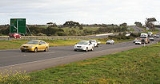
The Princes Freeway is a 159 kilometres (99 mi), 2 section freeway, which links Melbourne
to Geelong on the west (47 kilometres (29 mi)) and Morwell
on the east (112 kilometres (70 mi)). It continues beyond these extremities as the Princes Highway
towards Adelaide
to the west and Sydney
to the east. The freeway bears the designation M1
.
The western section linking Geelong and Melbourne is an important commuter and freight route between the two cities; the eastern section links Melbourne with the Latrobe Valley
. The entire freeway is one of the busiest sections of rural highway in Victoria, used by large numbers of freight and commercial vehicles and provides access to tourist attractions in central and east Gippsland
. It supports Victoria's rural industries and tourism.
at the West Gate Interchange, where the Western Ring Road and the old Geelong Road can be accessed by off ramps, and ends at Geelong. This section ranges from six lanes (three in each direction) between Geelong and Werribee, to ten lanes near the Ring Road interchange. It is a high quality freeway with a speed limit of 100km/h.
The eastern section (also known as Princes Freeway East) starts from Berwick
, a four lane (two lanes in each direction) divided freeway. There are also several highway standard at-grade intersections, most notably between Nar Nar Goon
and Longwarry
. These intersections are speed limited to 100 km/h, with the only 110 km/h section on the freeway from Longwarry
to Morwell
. However, traffic still travel through the towns of Yarragon
and Trafalgar
, therefore urban speed limits apply to these towns (between 60 and 80km/h) where the road reverts to the Princes Highway (though planning for bypasses of these towns are underway).
The western and eastern sections are connected together through the Melbourne suburbs by the West Gate Freeway
, CityLink Tollway
and the Monash Freeway
. These five sections of road together constitute the route M1
which is part of National Highway 1
.
The Princes Freeway subsumes and bypasses most sections of the older Princes Highway
. Former bypassed sections of the Princes Highway
are generally signed with a National Route
Alt 1 shield (within eastern Melbourne) or designated from C101 to C104 and C109.
In March 2010 it was announced by the State Government that trucks would be banned from the right-hand lane along a 38-kilometre section of freeway between Geelong and Melbourne. Suggestions of a ban began in 2005 but increased after the fatal 2007 Burnley Tunnel
fire that killed three people. The ban was put into place from 1 July 2010 between Kororoit Creek Road, Altona, and Avalon Road, Lara and covers all heavy vehicles weighing more than 4.5 tonnes, except buses and caravans. A fine of $358 applies to those breaking the rules, the ban being a trial before a full roll-out on the other major roads in the state.
Note
Exits are numbered to Duncans Road only.
Note
Exits are numbered to Clyde Road only.
Although the freeway itself did not disintegrate, the entire M1 Morwell bypass section was closed and will remain so indefinitely; pending a thorough investigation.
Construction is expected to begin in early 2012.
East of Traralgon, the A1 between Traralgon and Sale is currently being duplicated and upgraded to M road standard.
The Federal Government allocated $186 million in funding with the State Government providing the remainder, giving a total of $380 million. Construction works for Section 1, between Corio and Bell Post Hill commenced in February 2006. Contracts for Section 2, between Hamlyn Heights and Fyansford, commenced in September 2006 and construction of Section 3, between Fyansford and Waurn Ponds, commenced in November 2007. All 3 stages were scheduled for completion in June 2009.
Sources:
commenced in 2004 with public hearings being held on route options. It is expected that a bypass will not be needed for many years, as the volume of bypassable traffic on the Princes Highway in Traralgon is relatively low at present, but planning will ensure route will be available in the future.
Melbourne
Melbourne is the capital and most populous city in the state of Victoria, and the second most populous city in Australia. The Melbourne City Centre is the hub of the greater metropolitan area and the Census statistical division—of which "Melbourne" is the common name. As of June 2009, the greater...
to Geelong on the west (47 kilometres (29 mi)) and Morwell
Morwell, Victoria
-Transport:The main form of transport in Morwell is the automobile. The Princes Freeway now bypasses the town to the south while the old Princes Highway which once passed through east-west through its centre is now Princes Drive and Commercial Road. The highway connects Morwell with other...
on the east (112 kilometres (70 mi)). It continues beyond these extremities as the Princes Highway
Princes Highway
The Princes Highway extends from Sydney to Port Augusta via the coast through the states of New South Wales, Victoria and South Australia, a distance of 1941 km or 1898 km via the former alignments of the highway ....
towards Adelaide
Adelaide
Adelaide is the capital city of South Australia and the fifth-largest city in Australia. Adelaide has an estimated population of more than 1.2 million...
to the west and Sydney
Sydney
Sydney is the most populous city in Australia and the state capital of New South Wales. Sydney is located on Australia's south-east coast of the Tasman Sea. As of June 2010, the greater metropolitan area had an approximate population of 4.6 million people...
to the east. The freeway bears the designation M1
M1 (Australia)
The M1 is designated stretches of Australia's National Highway 1 that are: Dual-carriageway, Freeway or Motorway.Such stretches of highway include:-Queensland:* Bruce Highway from Cooroy to Bald Hills....
.
The western section linking Geelong and Melbourne is an important commuter and freight route between the two cities; the eastern section links Melbourne with the Latrobe Valley
Latrobe Valley
The Latrobe Valley is an inland geographical region and urban area of Gippsland in the state of Victoria, Australia. It is east of the City Of Melbourne and nestled between the Strzelecki Ranges to the south and the Great Dividing Range to the north – with the highest peak to the north of the...
. The entire freeway is one of the busiest sections of rural highway in Victoria, used by large numbers of freight and commercial vehicles and provides access to tourist attractions in central and east Gippsland
Gippsland
Gippsland is a large rural region in Victoria, Australia. It begins immediately east of the suburbs of Melbourne and stretches to the New South Wales border, lying between the Great Dividing Range to the north and Bass Strait to the south...
. It supports Victoria's rural industries and tourism.
Current route
The western section (also known as Princes Freeway West or Geelong Road) starts from AltonaAltona, Victoria
Altona is a suburb in Melbourne, Victoria, Australia, 13 km south-west from Melbourne's central business district. Its Local Government Area is the City of Hobsons Bay. At the 2006 Census, Altona had a population of 9685....
at the West Gate Interchange, where the Western Ring Road and the old Geelong Road can be accessed by off ramps, and ends at Geelong. This section ranges from six lanes (three in each direction) between Geelong and Werribee, to ten lanes near the Ring Road interchange. It is a high quality freeway with a speed limit of 100km/h.
The eastern section (also known as Princes Freeway East) starts from Berwick
Berwick, Victoria
Berwick is a suburb in Melbourne, Victoria, Australia, south-east from Melbourne's central business district. Its Local Government Area is the City of Casey. At the 2006 Census, Berwick had a population of 36,420....
, a four lane (two lanes in each direction) divided freeway. There are also several highway standard at-grade intersections, most notably between Nar Nar Goon
Nar Nar Goon, Victoria
Nar Nar Goon is a town in Gippsland, Victoria, Australia, 61 km southeast from Melbourne's central business district. Its Local Government Area is the Shire of Cardinia...
and Longwarry
Longwarry, Victoria
Longwarry is a town in Victoria, Australia, situated south-east of Melbourne. It is bypassed by the Princes Freeway. Its Local Government Area is the Shire of Baw Baw.-History:The Post Office opened on 20 June 1881 some time after the railway arrived in 1879...
. These intersections are speed limited to 100 km/h, with the only 110 km/h section on the freeway from Longwarry
Longwarry, Victoria
Longwarry is a town in Victoria, Australia, situated south-east of Melbourne. It is bypassed by the Princes Freeway. Its Local Government Area is the Shire of Baw Baw.-History:The Post Office opened on 20 June 1881 some time after the railway arrived in 1879...
to Morwell
Morwell, Victoria
-Transport:The main form of transport in Morwell is the automobile. The Princes Freeway now bypasses the town to the south while the old Princes Highway which once passed through east-west through its centre is now Princes Drive and Commercial Road. The highway connects Morwell with other...
. However, traffic still travel through the towns of Yarragon
Yarragon, Victoria
Yarragon is a small town in the West Gippsland region of Victoria, Australia. The town lies on the Princes Highway and the main Gippsland Railway line approximately halfway between the major towns of Warragul and Moe...
and Trafalgar
Trafalgar, Victoria
Trafalgar is a town in the West Gippsland region of Victoria, Australia. The town lies on the Princes Highway and main Gippsland railway line about west of Moe. The town backs onto the foothills of the Strzelecki Ranges to the south...
, therefore urban speed limits apply to these towns (between 60 and 80km/h) where the road reverts to the Princes Highway (though planning for bypasses of these towns are underway).
The western and eastern sections are connected together through the Melbourne suburbs by the West Gate Freeway
West Gate Freeway
West Gate Freeway is a freeway in Melbourne, Australia, linking Geelong to Melbourne CBD and beyond. It is also a link between Melbourne and the west and linking industrial and residential areas west of the Yarra River with the city and port areas. The iconic West Gate Bridge is a part of the...
, CityLink Tollway
CityLink
CityLink is a system of tolled urban Highways in Melbourne, Victoria, Australia. The company Transurban was awarded the contract to augment two existing freeways and construct two new Toll roads—labelled the Western and Southern Links—directly linking a number of existing freeways to...
and the Monash Freeway
Monash Freeway
Monash Freeway is an urban freeway in Victoria, Australia linking Melbourne's CBD to its southeastern suburbs and the Gippsland region. The entire stretch of the Monash Freeway bears the designation...
. These five sections of road together constitute the route M1
M1 (Australia)
The M1 is designated stretches of Australia's National Highway 1 that are: Dual-carriageway, Freeway or Motorway.Such stretches of highway include:-Queensland:* Bruce Highway from Cooroy to Bald Hills....
which is part of National Highway 1
Highway 1 (Australia)
Australia's Highway 1 is a network of highways that circumnavigate the Australian continent, joining all mainland state capitals. At a total length of approximately it is the longest national highway in the world, longer than the Trans-Siberian Highway and the Trans-Canada Highway...
.
The Princes Freeway subsumes and bypasses most sections of the older Princes Highway
Princes Highway
The Princes Highway extends from Sydney to Port Augusta via the coast through the states of New South Wales, Victoria and South Australia, a distance of 1941 km or 1898 km via the former alignments of the highway ....
. Former bypassed sections of the Princes Highway
Princes Highway
The Princes Highway extends from Sydney to Port Augusta via the coast through the states of New South Wales, Victoria and South Australia, a distance of 1941 km or 1898 km via the former alignments of the highway ....
are generally signed with a National Route
Highways in Australia
This is a list of highways in Australia, listed alphabetically along with each highway's route number and location. Note that some highways service more than one state or territory.-Route numbering systems:...
Alt 1 shield (within eastern Melbourne) or designated from C101 to C104 and C109.
In March 2010 it was announced by the State Government that trucks would be banned from the right-hand lane along a 38-kilometre section of freeway between Geelong and Melbourne. Suggestions of a ban began in 2005 but increased after the fatal 2007 Burnley Tunnel
Burnley Tunnel
The Burnley Tunnel is a tollway tunnel in Melbourne, in Victoria, Australia, which carries traffic eastbound from the West Gate Freeway to the Monash Freeway. It is part of the CityLink Tollway operated by Transurban. Running under the Yarra River and the inner suburbs of Richmond and Burnley, the...
fire that killed three people. The ban was put into place from 1 July 2010 between Kororoit Creek Road, Altona, and Avalon Road, Lara and covers all heavy vehicles weighing more than 4.5 tonnes, except buses and caravans. A fine of $358 applies to those breaking the rules, the ban being a trial before a full roll-out on the other major roads in the state.
Western section
Princes Freeway West (Geelong Road)  |
|||
| Northbound exits | Exit Number Distance to Melbourne |
Southbound exits | |
| End Princes Freeway West continues as West Gate Freeway West Gate Freeway West Gate Freeway is a freeway in Melbourne, Australia, linking Geelong to Melbourne CBD and beyond. It is also a link between Melbourne and the west and linking industrial and residential areas west of the Yarra River with the city and port areas. The iconic West Gate Bridge is a part of the... to Melbourne Melbourne Melbourne is the capital and most populous city in the state of Victoria, and the second most populous city in Australia. The Melbourne City Centre is the hub of the greater metropolitan area and the Census statistical division—of which "Melbourne" is the common name. As of June 2009, the greater... |
-- (15km) |
Start Princes Freeway West from West Gate Freeway West Gate Freeway West Gate Freeway is a freeway in Melbourne, Australia, linking Geelong to Melbourne CBD and beyond. It is also a link between Melbourne and the west and linking industrial and residential areas west of the Yarra River with the city and port areas. The iconic West Gate Bridge is a part of the... |
|
| Footscray Footscray, Victoria Footscray is a suburb 5 km west of Melbourne, Victoria, Australia. Its Local Government Area is the City of Maribyrnong. At the 2006 Census, Footscray had a population of 11,401.... , Parkville Parkville, Victoria Parkville is an inner city suburb in Melbourne, Victoria, Australia, 3 km north from Melbourne's central business district. Its Local Government Area is the City of Melbourne. At the 2006 Census, the population was 4,980.... Princes Highway Princes Highway, Melbourne The Princes Highway route through Melbourne, runs along former alignments with which originally Highway 1 now run on Melbourne's freeway network.-Werribee section:...  |
W9 (15km) |
||
| Adelaide Adelaide Adelaide is the capital city of South Australia and the fifth-largest city in Australia. Adelaide has an estimated population of more than 1.2 million... , Sydney Sydney Sydney is the most populous city in Australia and the state capital of New South Wales. Sydney is located on Australia's south-east coast of the Tasman Sea. As of June 2010, the greater metropolitan area had an approximate population of 4.6 million people... Western Ring Road   |
W10 (15km) |
||
| Williamstown Williamstown, Victoria Williamstown is a suburb in Melbourne, Victoria, Australia, 8 km south-west from Melbourne's central business district. Its Local Government Area is the City of Hobsons Bay. At the 2006 Census, Williamstown had a population of 12,733.... Kororoit Creek Road  |
11 (17km) |
Williamstown Williamstown, Victoria Williamstown is a suburb in Melbourne, Victoria, Australia, 8 km south-west from Melbourne's central business district. Its Local Government Area is the City of Hobsons Bay. At the 2006 Census, Williamstown had a population of 12,733.... , Tarneit Tarneit, Victoria Tarneit is a suburb in Melbourne, Victoria, Australia, 25 km south-west from Melbourne's central business district. Its Local Government Area is the City of Wyndham.... Kororoit Creek Road |
|
| Tarneit Tarneit, Victoria Tarneit is a suburb in Melbourne, Victoria, Australia, 25 km south-west from Melbourne's central business district. Its Local Government Area is the City of Wyndham.... , Deer Park Deer Park, Victoria Deer Park is a suburb in Melbourne, Victoria, Australia, 17 km west from Melbourne's central business district. Its Local Government Area is the City of Brimbank... Old Geelong Road Fitzgerald Road  |
12 (18km) |
no exit | |
| GEELONG RAIL LINE | -- (20km) |
GEELONG RAIL LINE | |
| Laverton Laverton, Victoria Laverton is a suburb in Melbourne, Victoria, Australia, 17 km south-west from Melbourne's central business district. Its Local Government Area are the Cities of Hobsons Bay and Wyndham. At the 2006 Census, Laverton had a population of 4508.-History:... High Street |
13 (21km) |
Altona Meadows Altona Meadows, Victoria Altona Meadows is a suburb in Melbourne, Victoria, Australia, 17 km south-west from Melbourne's central business district. Its Local Government Area is the City of Hobsons Bay. At the 2006 Census, Altona Meadows had a population of 18,748.... Newland Street |
|
| Laverton Laverton, Victoria Laverton is a suburb in Melbourne, Victoria, Australia, 17 km south-west from Melbourne's central business district. Its Local Government Area are the Cities of Hobsons Bay and Wyndham. At the 2006 Census, Laverton had a population of 4508.-History:... , Point Cook Point Cook, Victoria Point Cook is a suburb in Melbourne, Victoria, Australia, 25 km south-west from Melbourne's central business district. Its Local Government Area is the City of Wyndham. At the 2006 Census, Point Cook had a population of 14,162, now it is estimated that the population of Point Cook is 32,167... Point Cook Road via Aviation Road |
14 (22km) |
Point Cook Point Cook, Victoria Point Cook is a suburb in Melbourne, Victoria, Australia, 25 km south-west from Melbourne's central business district. Its Local Government Area is the City of Wyndham. At the 2006 Census, Point Cook had a population of 14,162, now it is estimated that the population of Point Cook is 32,167... , Laverton Laverton, Victoria Laverton is a suburb in Melbourne, Victoria, Australia, 17 km south-west from Melbourne's central business district. Its Local Government Area are the Cities of Hobsons Bay and Wyndham. At the 2006 Census, Laverton had a population of 4508.-History:... Point Cook Road via Central Avenue  |
|
| no exit | 15 (23km) |
Point Cook Point Cook, Victoria Point Cook is a suburb in Melbourne, Victoria, Australia, 25 km south-west from Melbourne's central business district. Its Local Government Area is the City of Wyndham. At the 2006 Census, Point Cook had a population of 14,162, now it is estimated that the population of Point Cook is 32,167... Palmers Road |
|
| Hoppers Crossing Hoppers Crossing, Victoria Hoppers Crossing is an outer suburb of Melbourne, Victoria, Australia, 28.8 km south-west of Melbourne's central business district. Its Local Government Area is the City of Wyndham. According to estimated Population figures from 2006 the population of Hoppers Crossing was 39,051... , Point Cook Point Cook, Victoria Point Cook is a suburb in Melbourne, Victoria, Australia, 25 km south-west from Melbourne's central business district. Its Local Government Area is the City of Wyndham. At the 2006 Census, Point Cook had a population of 14,162, now it is estimated that the population of Point Cook is 32,167... Forsyth Road  Boardwalk Boulevard |
16 (24km) |
Point Cook Point Cook, Victoria Point Cook is a suburb in Melbourne, Victoria, Australia, 25 km south-west from Melbourne's central business district. Its Local Government Area is the City of Wyndham. At the 2006 Census, Point Cook had a population of 14,162, now it is estimated that the population of Point Cook is 32,167... , Hoppers Crossing Hoppers Crossing, Victoria Hoppers Crossing is an outer suburb of Melbourne, Victoria, Australia, 28.8 km south-west of Melbourne's central business district. Its Local Government Area is the City of Wyndham. According to estimated Population figures from 2006 the population of Hoppers Crossing was 39,051... Boardwalk Boulevard Forsyth Road |
|
| Hoppers Crossing Hoppers Crossing, Victoria Hoppers Crossing is an outer suburb of Melbourne, Victoria, Australia, 28.8 km south-west of Melbourne's central business district. Its Local Government Area is the City of Wyndham. According to estimated Population figures from 2006 the population of Hoppers Crossing was 39,051... , Werribee Werribee, Victoria Werribee is a city in Melbourne, Australia, 32 km south-west from Melbourne's central business district. Its Local Government Area is the City of Wyndham. At the 2006 Census, Werribee had a population of 36,641. Statistically, Werribee is considered part of Greater Melbourne.Werribee is... Princes Highway Princes Highway, Melbourne The Princes Highway route through Melbourne, runs along former alignments with which originally Highway 1 now run on Melbourne's freeway network.-Werribee section:...  |
17 (26km) |
Hoppers Crossing Hoppers Crossing, Victoria Hoppers Crossing is an outer suburb of Melbourne, Victoria, Australia, 28.8 km south-west of Melbourne's central business district. Its Local Government Area is the City of Wyndham. According to estimated Population figures from 2006 the population of Hoppers Crossing was 39,051... , Werribee Werribee, Victoria Werribee is a city in Melbourne, Australia, 32 km south-west from Melbourne's central business district. Its Local Government Area is the City of Wyndham. At the 2006 Census, Werribee had a population of 36,641. Statistically, Werribee is considered part of Greater Melbourne.Werribee is... Princes Highway Princes Highway, Melbourne The Princes Highway route through Melbourne, runs along former alignments with which originally Highway 1 now run on Melbourne's freeway network.-Werribee section:... |
|
| no exit | 19 (31km) |
Werribee Open Range Zoo Werribee Open Range Zoo Werribee Open Range Zoo is an African themed zoo in Werribee, about south-west of Melbourne, Victoria, Australia. It is part of the Zoological Parks and Gardens Board or 'Zoos Victoria' which also includes Melbourne Zoo and Healesville Sanctuary. It is situated on approximately and is located on... , Werribee Werribee, Victoria Werribee is a city in Melbourne, Australia, 32 km south-west from Melbourne's central business district. Its Local Government Area is the City of Wyndham. At the 2006 Census, Werribee had a population of 36,641. Statistically, Werribee is considered part of Greater Melbourne.Werribee is... Duncans Road  |
|
| Northbound exits | Distance to Melbourne (km) |
Distance to Geelong (km) |
Southbound exits |
| Werribee Werribee, Victoria Werribee is a city in Melbourne, Australia, 32 km south-west from Melbourne's central business district. Its Local Government Area is the City of Wyndham. At the 2006 Census, Werribee had a population of 36,641. Statistically, Werribee is considered part of Greater Melbourne.Werribee is... Princes Highway Princes Highway, Melbourne The Princes Highway route through Melbourne, runs along former alignments with which originally Highway 1 now run on Melbourne's freeway network.-Werribee section:... |
37 | 36 | Werribee Werribee, Victoria Werribee is a city in Melbourne, Australia, 32 km south-west from Melbourne's central business district. Its Local Government Area is the City of Wyndham. At the 2006 Census, Werribee had a population of 36,641. Statistically, Werribee is considered part of Greater Melbourne.Werribee is... Princes Highway Princes Highway, Melbourne The Princes Highway route through Melbourne, runs along former alignments with which originally Highway 1 now run on Melbourne's freeway network.-Werribee section:... |
| Little River Little River, Victoria Little River is a town in Victoria, Australia, 51 km south-west from Melbourne's central business district. Its Local Government Area are the Cities of Wyndham and Greater Geelong. At the 2006 Census, Little River had a population of 375.-History:... , Cocoroc Cocoroc, Victoria Cocoroc is a rural locality in Victoria, Australia, 44 km south-west from Melbourne's central business district. Its Local Government Area is the City of Wyndham.... Little River Road South Road |
46 | 27 | Cocoroc Cocoroc, Victoria Cocoroc is a rural locality in Victoria, Australia, 44 km south-west from Melbourne's central business district. Its Local Government Area is the City of Wyndham.... , Little River Little River, Victoria Little River is a town in Victoria, Australia, 51 km south-west from Melbourne's central business district. Its Local Government Area are the Cities of Wyndham and Greater Geelong. At the 2006 Census, Little River had a population of 375.-History:... South Road Little River Road |
| no exit | 49 | 24 | Point Wilson Point Wilson, Victoria Point Wilson is a locality located on the northern shores of Corio Bay, Victoria. it is approximately 60 kilometres by road from Melbourne, and 25 kilometres by road from Geelong.... Point Wilson Road Argyle Street |
| BP SERVICE CENTRE BP BP p.l.c. is a global oil and gas company headquartered in London, United Kingdom. It is the third-largest energy company and fourth-largest company in the world measured by revenues and one of the six oil and gas "supermajors"... |
54 | 19 | BP SERVICE CENTRE BP BP p.l.c. is a global oil and gas company headquartered in London, United Kingdom. It is the third-largest energy company and fourth-largest company in the world measured by revenues and one of the six oil and gas "supermajors"... |
| To Old Melbourne Road, Point Wilson Point Wilson, Victoria Point Wilson is a locality located on the northern shores of Corio Bay, Victoria. it is approximately 60 kilometres by road from Melbourne, and 25 kilometres by road from Geelong.... Beach Road Avalon Airport Avalon Airport is the second busiest of the four airports serving Melbourne and is located in Avalon, Victoria, Australia, which is north-east of the city of Geelong and to the south-west of the state's capital city of Melbourne.... |
56 | 17 | Point Wilson Point Wilson, Victoria Point Wilson is a locality located on the northern shores of Corio Bay, Victoria. it is approximately 60 kilometres by road from Melbourne, and 25 kilometres by road from Geelong.... , To Old Melbourne Road Beach Road Avalon Airport Avalon Airport is the second busiest of the four airports serving Melbourne and is located in Avalon, Victoria, Australia, which is north-east of the city of Geelong and to the south-west of the state's capital city of Melbourne.... |
| Lara Lara, Victoria Lara is a residential rural suburb, 15 km north-east of Geelong, inland from the Princes Freeway to Melbourne.- History :The explorers Hume and Hovell arrived at Lara on December 16, 1824, believing that they had reached Westernport Bay... , Avalon Avalon, Victoria Avalon is a locality situated north east of Geelong, Victoria. Its Local Government Area is the City of Greater Geelong and its Ward is Windermere... Avalon Road  |
60 | 13 | Avalon Avalon, Victoria Avalon is a locality situated north east of Geelong, Victoria. Its Local Government Area is the City of Greater Geelong and its Ward is Windermere... , Lara Lara, Victoria Lara is a residential rural suburb, 15 km north-east of Geelong, inland from the Princes Freeway to Melbourne.- History :The explorers Hume and Hovell arrived at Lara on December 16, 1824, believing that they had reached Westernport Bay... Avalon Road |
| GEELONG RAIL LINE | 63 | 10 | Corio Corio, Victoria Corio is a residential, industrial and one of the largest suburbs of Geelong, Victoria, Australia, located approximately 9 km north of the Geelong central business district... , Geelong Princes Highway Princes Highway, Geelong The Princes Highway route through Geelong, Victoria, Australia, runs along former alignments with which originally Highway 1 now runs along the Geelong Ring Road....  |
| North Shore North Shore, Victoria North Shore is an industrial and residential suburb of Geelong, Victoria, Australia. The suburb overlooks Corio Bay. A small residential area is east of the North Shore railway station with a few neighbourhood shops.... Shell Parade  |
|||
| GEELONG RAIL LINE | |||
| Start Princes Freeway West from Geelong Ring Road |
End Princes Freeway West continues as Geelong Ring Road to Colac Colac, Victoria Colac is a small city located in the Western District of Victoria, Australia, situated approximately 150 kilometres south-west of Melbourne on the southern shore of Lake Colac and the surrounding volcanic plains, approximately 40 km inland from Bass Strait. Colac is the largest city in and... / Warrnambool Warrnambool, Victoria -Cityscape:The original City of Warrnambool was a 4x8 grid, with boundaries of Lava Street , Japan Street , Merri Street and Henna Street . In the nineteenth century, it was intended that Fairy Street – with its proximity to the Warrnambool Railway Station – would be the main street of... |
||
Note
Exits are numbered to Duncans Road only.
Source
Princes Freeway West on Google Maps.Eastern section
| Princes Freeway East |
|||
| Northbound exits | Exit Number Distance to Melbourne |
Southbound exits | |
| End Princes Freeway East continues as Monash Freeway Monash Freeway Monash Freeway is an urban freeway in Victoria, Australia linking Melbourne's CBD to its southeastern suburbs and the Gippsland region. The entire stretch of the Monash Freeway bears the designation... to Melbourne Melbourne Melbourne is the capital and most populous city in the state of Victoria, and the second most populous city in Australia. The Melbourne City Centre is the hub of the greater metropolitan area and the Census statistical division—of which "Melbourne" is the common name. As of June 2009, the greater... |
-- (44km) |
Start Princes Freeway East from Monash Freeway Monash Freeway Monash Freeway is an urban freeway in Victoria, Australia linking Melbourne's CBD to its southeastern suburbs and the Gippsland region. The entire stretch of the Monash Freeway bears the designation... |
|
| Dandenong Dandenong, Victoria Dandenong is a suburb and major urban centre in metropolitan Melbourne, Victoria, Australia, 30 km south-east from Melbourne's central business district. Situated on Dandenong Creek and mostly flat land at the foothills of Mount Dandenong, it is the main administrative centre for the City of... , Berwick Berwick, Victoria Berwick is a suburb in Melbourne, Victoria, Australia, south-east from Melbourne's central business district. Its Local Government Area is the City of Casey. At the 2006 Census, Berwick had a population of 36,420.... Princes Highway Princes Highway, Melbourne The Princes Highway route through Melbourne, runs along former alignments with which originally Highway 1 now run on Melbourne's freeway network.-Werribee section:...   |
23 (44km) |
||
| GIPPSLAND RAIL LINE Orbost railway line The Orbost railway line is a railway serving the Latrobe Valley and Gippsland regions of Victoria, Australia... |
-- (45km) |
GIPPSLAND RAIL LINE Orbost railway line The Orbost railway line is a railway serving the Latrobe Valley and Gippsland regions of Victoria, Australia... |
|
| Cranbourne Cranbourne, Victoria Cranbourne is a suburb in Melbourne, Victoria, Australia, 43 km south-east from Melbourne's central business district. Its Local Government Area is the City of Casey. At the 2006 Census, Cranbourne had a population of 14,750.... , Berwick Berwick, Victoria Berwick is a suburb in Melbourne, Victoria, Australia, south-east from Melbourne's central business district. Its Local Government Area is the City of Casey. At the 2006 Census, Berwick had a population of 36,420.... Clyde Road  |
24 (46km) |
Berwick Berwick, Victoria Berwick is a suburb in Melbourne, Victoria, Australia, south-east from Melbourne's central business district. Its Local Government Area is the City of Casey. At the 2006 Census, Berwick had a population of 36,420.... , Cranbourne Cranbourne, Victoria Cranbourne is a suburb in Melbourne, Victoria, Australia, 43 km south-east from Melbourne's central business district. Its Local Government Area is the City of Casey. At the 2006 Census, Cranbourne had a population of 14,750.... Clyde Road |
|
Westbound exits / intersections .svg.png) |
Distance to Melbourne (km) |
Distance to Traralgon (km) |
Eastbound exits / intersections |
| no exit | 49 | 116 | Beaconsfield Beaconsfield, Victoria Beaconsfield is a suburb in Melbourne, Victoria, Australia, 46 km south-east from Melbourne's central business district. Its Local Government Area is the Shire of Cardinia... , Officer Officer, Victoria Officer is a suburb in Melbourne, Victoria, Australia, 49 km south-east from Melbourne's central business district. Its Local Government Area is the Shire of Cardinia. At the 2006 Census, Officer had a population of 1417.- History :... Princes Highway Old Princes Highway, Victoria -East:The Old Princes Highway route through the outer south-eastern suburbs of Melbourne and eastern Victoria, Australia, along former alignments with which originally Highway 1 had traversed through now runs as bypasses of towns, including Pakenham, Warragul and Moe via the Princes Freeway.It... |
| BP SERVICE CENTRE BP BP p.l.c. is a global oil and gas company headquartered in London, United Kingdom. It is the third-largest energy company and fourth-largest company in the world measured by revenues and one of the six oil and gas "supermajors"... |
51 | 114 | BP SERVICE CENTRE BP BP p.l.c. is a global oil and gas company headquartered in London, United Kingdom. It is the third-largest energy company and fourth-largest company in the world measured by revenues and one of the six oil and gas "supermajors"... |
| Cardinia Cardinia, Victoria Cardinia is a town in Victoria, Australia, 52 km south-east from Melbourne's central business district. Its Local Government Area is the Shire of Cardinia.Cardinia is located between Pakenham and Tooradin on the south-eastern fringe of Melbourne.... , Officer Officer, Victoria Officer is a suburb in Melbourne, Victoria, Australia, 49 km south-east from Melbourne's central business district. Its Local Government Area is the Shire of Cardinia. At the 2006 Census, Officer had a population of 1417.- History :... Cardinia Road |
55 | 110 | Officer Officer, Victoria Officer is a suburb in Melbourne, Victoria, Australia, 49 km south-east from Melbourne's central business district. Its Local Government Area is the Shire of Cardinia. At the 2006 Census, Officer had a population of 1417.- History :... , Cardinia Cardinia, Victoria Cardinia is a town in Victoria, Australia, 52 km south-east from Melbourne's central business district. Its Local Government Area is the Shire of Cardinia.Cardinia is located between Pakenham and Tooradin on the south-eastern fringe of Melbourne.... Cardinia Road |
| no exit | 58 | 107 | Pakenham Pakenham, Victoria Pakenham is a satellite suburb of Melbourne on the edge of the West Gippsland region of Victoria, Australia, south-east from Melbourne's central business district. Its Local Government Area is Cardinia Shire. At the 2006 Census, Pakenham had a population of 19,644... , Rythdale McGregor Road |
| Koo Wee Rup Koo Wee Rup, Victoria Koo Wee Rup is a town in Victoria, Australia, 63 km south-east from Melbourne's central business district. Its Local Government Area is the Shire of Cardinia... , Pakenham Pakenham, Victoria Pakenham is a satellite suburb of Melbourne on the edge of the West Gippsland region of Victoria, Australia, south-east from Melbourne's central business district. Its Local Government Area is Cardinia Shire. At the 2006 Census, Pakenham had a population of 19,644... Koo Wee Rup Road  |
60 | 105 | Pakenham Pakenham, Victoria Pakenham is a satellite suburb of Melbourne on the edge of the West Gippsland region of Victoria, Australia, south-east from Melbourne's central business district. Its Local Government Area is Cardinia Shire. At the 2006 Census, Pakenham had a population of 19,644... , Koo Wee Rup Koo Wee Rup, Victoria Koo Wee Rup is a town in Victoria, Australia, 63 km south-east from Melbourne's central business district. Its Local Government Area is the Shire of Cardinia... Koo Wee Rup Road |
| GIPPSLAND RAIL LINE Orbost railway line The Orbost railway line is a railway serving the Latrobe Valley and Gippsland regions of Victoria, Australia... |
62 | 103 | GIPPSLAND RAIL LINE Orbost railway line The Orbost railway line is a railway serving the Latrobe Valley and Gippsland regions of Victoria, Australia... |
| Nar Nar Goon Nar Nar Goon, Victoria Nar Nar Goon is a town in Gippsland, Victoria, Australia, 61 km southeast from Melbourne's central business district. Its Local Government Area is the Shire of Cardinia... , Pakenham Pakenham, Victoria Pakenham is a satellite suburb of Melbourne on the edge of the West Gippsland region of Victoria, Australia, south-east from Melbourne's central business district. Its Local Government Area is Cardinia Shire. At the 2006 Census, Pakenham had a population of 19,644... Nar Nar Goon Road  Princes Highway Old Princes Highway, Victoria -East:The Old Princes Highway route through the outer south-eastern suburbs of Melbourne and eastern Victoria, Australia, along former alignments with which originally Highway 1 had traversed through now runs as bypasses of towns, including Pakenham, Warragul and Moe via the Princes Freeway.It... |
69 | 96 | Pakenham Pakenham, Victoria Pakenham is a satellite suburb of Melbourne on the edge of the West Gippsland region of Victoria, Australia, south-east from Melbourne's central business district. Its Local Government Area is Cardinia Shire. At the 2006 Census, Pakenham had a population of 19,644... , Nar Nar Goon Nar Nar Goon, Victoria Nar Nar Goon is a town in Gippsland, Victoria, Australia, 61 km southeast from Melbourne's central business district. Its Local Government Area is the Shire of Cardinia... Princes Highway Old Princes Highway, Victoria -East:The Old Princes Highway route through the outer south-eastern suburbs of Melbourne and eastern Victoria, Australia, along former alignments with which originally Highway 1 had traversed through now runs as bypasses of towns, including Pakenham, Warragul and Moe via the Princes Freeway.It... Nar Nar Goon Road |
| Maryknoll Maryknoll, Victoria Maryknoll is a town in Victoria, Australia, 61 km south-east from Melbourne's central business district. Its Local Government Area is the Shire of Cardinia... Snell Road |
71 | 94 | Maryknoll Maryknoll, Victoria Maryknoll is a town in Victoria, Australia, 61 km south-east from Melbourne's central business district. Its Local Government Area is the Shire of Cardinia... Snell Road |
| Tynong Tynong, Victoria Tynong is a town in Gippsland, Victoria, Australia, 66 km south-east from Melbourne's central business district. Its Local Government Area is the Shire of Cardinia... , Bunyip State Park Bunyip State Park Bunyip State Park is a state park east of Melbourne, near the town of Gembrook. The area was used for logging from 1898 until 1990, and was turned into a state park two years later... Tynong Road Tynong North Road |
73 | 92 | Bunyip State Park Bunyip State Park Bunyip State Park is a state park east of Melbourne, near the town of Gembrook. The area was used for logging from 1898 until 1990, and was turned into a state park two years later... , Tynong Tynong, Victoria Tynong is a town in Gippsland, Victoria, Australia, 66 km south-east from Melbourne's central business district. Its Local Government Area is the Shire of Cardinia... Tynong North Road Tynong Road |
| Gumbuya Park | 76 | 89 | Gumbuya Park |
| Garfield Garfield, Victoria Garfield is a town in Gippsland, Victoria, Australia, 69 km south-east from the Melbourne central business district. Its Local Government Area is the Shire of Cardinia... , Garfield North Garfield Road Garfield North Road |
78 | 87 | Garfield North, Garfield Garfield, Victoria Garfield is a town in Gippsland, Victoria, Australia, 69 km south-east from the Melbourne central business district. Its Local Government Area is the Shire of Cardinia... Garfield North Road Garfield Road |
| Tonimbuk Tonimbuk Road |
80 | 85 | Tonimbuk Tonimbuk Road |
| Bunyip Bunyip, Victoria Bunyip is a town in Gippsland, Victoria, Australia, 77 km east from Melbourne's central business district. Its Local Government Area is the Shire of Cardinia... Nash Road |
82 | 83 | Bunyip Bunyip, Victoria Bunyip is a town in Gippsland, Victoria, Australia, 77 km east from Melbourne's central business district. Its Local Government Area is the Shire of Cardinia... Nash Road |
| Longwarry Longwarry, Victoria Longwarry is a town in Victoria, Australia, situated south-east of Melbourne. It is bypassed by the Princes Freeway. Its Local Government Area is the Shire of Baw Baw.-History:The Post Office opened on 20 June 1881 some time after the railway arrived in 1879... , Labertouche Sand Road  |
88 | 77 | BP SERVICE CENTRE BP BP p.l.c. is a global oil and gas company headquartered in London, United Kingdom. It is the third-largest energy company and fourth-largest company in the world measured by revenues and one of the six oil and gas "supermajors"... |
| BP SERVICE CENTRE BP BP p.l.c. is a global oil and gas company headquartered in London, United Kingdom. It is the third-largest energy company and fourth-largest company in the world measured by revenues and one of the six oil and gas "supermajors"... |
Labertouche, Longwarry Longwarry, Victoria Longwarry is a town in Victoria, Australia, situated south-east of Melbourne. It is bypassed by the Princes Freeway. Its Local Government Area is the Shire of Baw Baw.-History:The Post Office opened on 20 June 1881 some time after the railway arrived in 1879... Sand Road |
||
| Drouin Drouin, Victoria Drouin is a major service town, located in West Gippsland, east of Melbourne. Its local government area is the Shire of Baw Baw. The town is supposedly named after a Frenchman who invented a chlorination process for the extraction of ore or an Aboriginal word meaning "north wind". New estate... , Mount Baw Baw Mount Baw Baw Mount Baw Baw is a mountain in Victoria, Australia. Mount Baw Baw Alpine Resort is an Unincorporated area of Victoria surrounded by the Shire of Baw Baw.-Location:... Drouin-Warragul Road (Princes Way) Old Princes Highway, Victoria -East:The Old Princes Highway route through the outer south-eastern suburbs of Melbourne and eastern Victoria, Australia, along former alignments with which originally Highway 1 had traversed through now runs as bypasses of towns, including Pakenham, Warragul and Moe via the Princes Freeway.It...   |
93 | 72 | Mount Baw Baw Mount Baw Baw Mount Baw Baw is a mountain in Victoria, Australia. Mount Baw Baw Alpine Resort is an Unincorporated area of Victoria surrounded by the Shire of Baw Baw.-Location:... , Drouin Drouin, Victoria Drouin is a major service town, located in West Gippsland, east of Melbourne. Its local government area is the Shire of Baw Baw. The town is supposedly named after a Frenchman who invented a chlorination process for the extraction of ore or an Aboriginal word meaning "north wind". New estate... Drouin-Warragul Road (Princes Way) Old Princes Highway, Victoria -East:The Old Princes Highway route through the outer south-eastern suburbs of Melbourne and eastern Victoria, Australia, along former alignments with which originally Highway 1 had traversed through now runs as bypasses of towns, including Pakenham, Warragul and Moe via the Princes Freeway.It... |
| Drouin Drouin, Victoria Drouin is a major service town, located in West Gippsland, east of Melbourne. Its local government area is the Shire of Baw Baw. The town is supposedly named after a Frenchman who invented a chlorination process for the extraction of ore or an Aboriginal word meaning "north wind". New estate... , Warragul Warragul, Victoria Warragul is a rural centre with a population of 12,943 people east-southeast of Melbourne in Victoria. Warragul lies between the Strzelecki Ranges to the south and the Mount Baw Baw Plateau of the Great Dividing Range to the north... Drouin-Warragul Road (Princes Way) Old Princes Highway, Victoria -East:The Old Princes Highway route through the outer south-eastern suburbs of Melbourne and eastern Victoria, Australia, along former alignments with which originally Highway 1 had traversed through now runs as bypasses of towns, including Pakenham, Warragul and Moe via the Princes Freeway.It... |
100 | 65 | Warragul Warragul, Victoria Warragul is a rural centre with a population of 12,943 people east-southeast of Melbourne in Victoria. Warragul lies between the Strzelecki Ranges to the south and the Mount Baw Baw Plateau of the Great Dividing Range to the north... , Drouin Drouin, Victoria Drouin is a major service town, located in West Gippsland, east of Melbourne. Its local government area is the Shire of Baw Baw. The town is supposedly named after a Frenchman who invented a chlorination process for the extraction of ore or an Aboriginal word meaning "north wind". New estate... Drouin-Warragul Road (Princes Way) Old Princes Highway, Victoria -East:The Old Princes Highway route through the outer south-eastern suburbs of Melbourne and eastern Victoria, Australia, along former alignments with which originally Highway 1 had traversed through now runs as bypasses of towns, including Pakenham, Warragul and Moe via the Princes Freeway.It... |
| GIPPSLAND RAIL LINE Orbost railway line The Orbost railway line is a railway serving the Latrobe Valley and Gippsland regions of Victoria, Australia... |
GIPPSLAND RAIL LINE Orbost railway line The Orbost railway line is a railway serving the Latrobe Valley and Gippsland regions of Victoria, Australia... |
||
| Korumburra Korumburra, Victoria Korumburra is a town in the Australian state of Victoria. It is located on the South Gippsland Highway, kilometres south-east of Melbourne, in the South Gippsland Shire local government area.... , Warragul Warragul, Victoria Warragul is a rural centre with a population of 12,943 people east-southeast of Melbourne in Victoria. Warragul lies between the Strzelecki Ranges to the south and the Mount Baw Baw Plateau of the Great Dividing Range to the north... Warragul-Korumburra Road  |
106 | 59 | Warragul Warragul, Victoria Warragul is a rural centre with a population of 12,943 people east-southeast of Melbourne in Victoria. Warragul lies between the Strzelecki Ranges to the south and the Mount Baw Baw Plateau of the Great Dividing Range to the north... , Korumburra Korumburra, Victoria Korumburra is a town in the Australian state of Victoria. It is located on the South Gippsland Highway, kilometres south-east of Melbourne, in the South Gippsland Shire local government area.... Warragul-Korumburra Road |
| Nilma Nilma, Victoria Nilma is a small town in the West Gippsland region of Victoria, Australia located between Warragul and Darnum. At the 2006 census Nilma had a population of 218.... , Noojee Noojee, Victoria Noojee is a town in the Gippsland region of Victoria, Australia, located north of Warragul and east of Melbourne, in the Baw Baw local government area. At the 2006 census, Noojee and the surrounding area had a population of 261.... Bloomfield Road (Princes Way) Old Princes Highway, Victoria -East:The Old Princes Highway route through the outer south-eastern suburbs of Melbourne and eastern Victoria, Australia, along former alignments with which originally Highway 1 had traversed through now runs as bypasses of towns, including Pakenham, Warragul and Moe via the Princes Freeway.It...  |
109 | 56 | Noojee Noojee, Victoria Noojee is a town in the Gippsland region of Victoria, Australia, located north of Warragul and east of Melbourne, in the Baw Baw local government area. At the 2006 census, Noojee and the surrounding area had a population of 261.... , Nilma Nilma, Victoria Nilma is a small town in the West Gippsland region of Victoria, Australia located between Warragul and Darnum. At the 2006 census Nilma had a population of 218.... Bloomfield Road (Princes Way) Old Princes Highway, Victoria -East:The Old Princes Highway route through the outer south-eastern suburbs of Melbourne and eastern Victoria, Australia, along former alignments with which originally Highway 1 had traversed through now runs as bypasses of towns, including Pakenham, Warragul and Moe via the Princes Freeway.It... |
| Cloverlea, Darnum Darnum, Victoria Darnum is a small town in West Gippsland, Victoria, Australia, located 110 km east of Melbourne, in the Shire of Baw Baw. At the 2006 census the town and surrounding area had a population of 598.... East-West Road |
113 | 52 | Darnum Darnum, Victoria Darnum is a small town in West Gippsland, Victoria, Australia, located 110 km east of Melbourne, in the Shire of Baw Baw. At the 2006 census the town and surrounding area had a population of 598.... , Cloverlea East-West Road |
| Start Freeway | 118 | 47 | End Freeway |
| Shady Creek Yarragon-Shady Creek Road  |
119 | 46 | Yarragon Yarragon, Victoria Yarragon is a small town in the West Gippsland region of Victoria, Australia. The town lies on the Princes Highway and the main Gippsland Railway line approximately halfway between the major towns of Warragul and Moe... |
| Yarragon Yarragon, Victoria Yarragon is a small town in the West Gippsland region of Victoria, Australia. The town lies on the Princes Highway and the main Gippsland Railway line approximately halfway between the major towns of Warragul and Moe... |
Shady Creek Yarragon-Shady Creek Road |
||
| Willow Grove Willow Grove, Victoria Willow Grove is a village and rural farming community north of Moe in Victoria, Australia. It has a primary school, football club, tennis courts, community hall, general store, CFA shed, and kindergarten. The next town to the west is Hill End and to the east Tanjil South. Willow Grove is situated... , Mount Baw Baw Mount Baw Baw Mount Baw Baw is a mountain in Victoria, Australia. Mount Baw Baw Alpine Resort is an Unincorporated area of Victoria surrounded by the Shire of Baw Baw.-Location:... Willow Grove Road  Thorpdale Thorpdale, Victoria Thorpdale is a small country town in the Gippsland area of eastern Victoria, Australia, less than 20 km south of Trafalgar. Famous for its potatoes, it is located amongst the rich farmland of the Latrobe Valley. Thorpdale spuds are eaten around the country and also exported overseas. The name... Trafalgar-Thorpdale Road |
125 | 40 | Willow Grove Willow Grove, Victoria Willow Grove is a village and rural farming community north of Moe in Victoria, Australia. It has a primary school, football club, tennis courts, community hall, general store, CFA shed, and kindergarten. The next town to the west is Hill End and to the east Tanjil South. Willow Grove is situated... , Mount Baw Baw Mount Baw Baw Mount Baw Baw is a mountain in Victoria, Australia. Mount Baw Baw Alpine Resort is an Unincorporated area of Victoria surrounded by the Shire of Baw Baw.-Location:... Willow Grove Road Thorpdale Thorpdale, Victoria Thorpdale is a small country town in the Gippsland area of eastern Victoria, Australia, less than 20 km south of Trafalgar. Famous for its potatoes, it is located amongst the rich farmland of the Latrobe Valley. Thorpdale spuds are eaten around the country and also exported overseas. The name... Trafalgar-Thorpdale Road |
| Trafalgar Trafalgar, Victoria Trafalgar is a town in the West Gippsland region of Victoria, Australia. The town lies on the Princes Highway and main Gippsland railway line about west of Moe. The town backs onto the foothills of the Strzelecki Ranges to the south... |
126 | 39 | Trafalgar Trafalgar, Victoria Trafalgar is a town in the West Gippsland region of Victoria, Australia. The town lies on the Princes Highway and main Gippsland railway line about west of Moe. The town backs onto the foothills of the Strzelecki Ranges to the south... |
| End Freeway | 128 | 37 | Start Freeway |
| Moe Moe, Victoria Moe is a city in the Latrobe Valley and Gippsland region of Victoria, Australia. It is about east of Melbourne and at the 2006 census had a population of 15,582 . It is administered by the City of Latrobe council.... Moe-Glengarry Road Old Princes Highway, Victoria -East:The Old Princes Highway route through the outer south-eastern suburbs of Melbourne and eastern Victoria, Australia, along former alignments with which originally Highway 1 had traversed through now runs as bypasses of towns, including Pakenham, Warragul and Moe via the Princes Freeway.It...  via Lloyd Street Link Road |
134 | 31 | Moe Moe, Victoria Moe is a city in the Latrobe Valley and Gippsland region of Victoria, Australia. It is about east of Melbourne and at the 2006 census had a population of 15,582 . It is administered by the City of Latrobe council.... Moe-Glengarry Road Old Princes Highway, Victoria -East:The Old Princes Highway route through the outer south-eastern suburbs of Melbourne and eastern Victoria, Australia, along former alignments with which originally Highway 1 had traversed through now runs as bypasses of towns, including Pakenham, Warragul and Moe via the Princes Freeway.It... |
| Moe Moe, Victoria Moe is a city in the Latrobe Valley and Gippsland region of Victoria, Australia. It is about east of Melbourne and at the 2006 census had a population of 15,582 . It is administered by the City of Latrobe council.... , Newborough Newborough, Victoria Newborough is a town in the Latrobe Valley in Victoria, Australia which shares a border to its west, mostly along the Narracan Creek, with the town of Moe. It can be divided into three areas, Old Newborough, East Newborough and North Newborough... Moe-Glengarry Road Old Princes Highway, Victoria -East:The Old Princes Highway route through the outer south-eastern suburbs of Melbourne and eastern Victoria, Australia, along former alignments with which originally Highway 1 had traversed through now runs as bypasses of towns, including Pakenham, Warragul and Moe via the Princes Freeway.It... |
138 | 27 | Newborough Newborough, Victoria Newborough is a town in the Latrobe Valley in Victoria, Australia which shares a border to its west, mostly along the Narracan Creek, with the town of Moe. It can be divided into three areas, Old Newborough, East Newborough and North Newborough... , Glengarry Glengarry, Victoria Glengarry is a town in the Gippsland region of Victoria, Australia. The town is located in the City of Latrobe Local Government area, south east of the state capital, Melbourne... Moe-Glengarry Road Old Princes Highway, Victoria -East:The Old Princes Highway route through the outer south-eastern suburbs of Melbourne and eastern Victoria, Australia, along former alignments with which originally Highway 1 had traversed through now runs as bypasses of towns, including Pakenham, Warragul and Moe via the Princes Freeway.It... |
| Hernes Oak Morwell-Yallourn Road |
142 | 23 | Hernes Oak Morwell-Yallourn Road |
| no exit | 147.5 | 17.5 | Morwell Morwell, Victoria -Transport:The main form of transport in Morwell is the automobile. The Princes Freeway now bypasses the town to the south while the old Princes Highway which once passed through east-west through its centre is now Princes Drive and Commercial Road. The highway connects Morwell with other... Morwell-Traralgon Road (Princes Drive) Old Princes Highway, Victoria -East:The Old Princes Highway route through the outer south-eastern suburbs of Melbourne and eastern Victoria, Australia, along former alignments with which originally Highway 1 had traversed through now runs as bypasses of towns, including Pakenham, Warragul and Moe via the Princes Freeway.It...  |
| Leongatha Leongatha, Victoria Leongatha is a town in the foothills of the Strzelecki Ranges, South Gippsland Shire, Victoria, Australia, located south-east of Melbourne. The town is the commercial, religious, educational and civic centre of the region. At the 2006 census, Leongatha had a population of 4,504.The Murray... , Morwell Morwell, Victoria -Transport:The main form of transport in Morwell is the automobile. The Princes Freeway now bypasses the town to the south while the old Princes Highway which once passed through east-west through its centre is now Princes Drive and Commercial Road. The highway connects Morwell with other... Strzelecki Highway Strzelecki Highway Strzelecki Highway is a short 55 kilometre highway that connects the towns of Leongatha, Victoria and Morwell, Victoria, through the major junctions of South Gippsland Highway and Princes Freeway....  |
148 | 17 | Morwell Morwell, Victoria -Transport:The main form of transport in Morwell is the automobile. The Princes Freeway now bypasses the town to the south while the old Princes Highway which once passed through east-west through its centre is now Princes Drive and Commercial Road. The highway connects Morwell with other... , Leongatha Leongatha, Victoria Leongatha is a town in the foothills of the Strzelecki Ranges, South Gippsland Shire, Victoria, Australia, located south-east of Melbourne. The town is the commercial, religious, educational and civic centre of the region. At the 2006 census, Leongatha had a population of 4,504.The Murray... Strzelecki Highway Strzelecki Highway Strzelecki Highway is a short 55 kilometre highway that connects the towns of Leongatha, Victoria and Morwell, Victoria, through the major junctions of South Gippsland Highway and Princes Freeway.... |
| Churchill Churchill, Victoria Churchill is a town in the Latrobe Valley, located in central Gippsland in the east of Victoria, Australia. The town had a population of 4,588 at the 2006 census, and is part of the Latrobe City local government area... , Morwell Morwell, Victoria -Transport:The main form of transport in Morwell is the automobile. The Princes Freeway now bypasses the town to the south while the old Princes Highway which once passed through east-west through its centre is now Princes Drive and Commercial Road. The highway connects Morwell with other... Monash Way |
153 | 12 | Morwell Morwell, Victoria -Transport:The main form of transport in Morwell is the automobile. The Princes Freeway now bypasses the town to the south while the old Princes Highway which once passed through east-west through its centre is now Princes Drive and Commercial Road. The highway connects Morwell with other... , Churchill Churchill, Victoria Churchill is a town in the Latrobe Valley, located in central Gippsland in the east of Victoria, Australia. The town had a population of 4,588 at the 2006 census, and is part of the Latrobe City local government area... Monash Way |
| GIPPSLAND RAIL LINE Orbost railway line The Orbost railway line is a railway serving the Latrobe Valley and Gippsland regions of Victoria, Australia... |
156 | 9 | GIPPSLAND RAIL LINE Orbost railway line The Orbost railway line is a railway serving the Latrobe Valley and Gippsland regions of Victoria, Australia... |
| Morwell Morwell, Victoria -Transport:The main form of transport in Morwell is the automobile. The Princes Freeway now bypasses the town to the south while the old Princes Highway which once passed through east-west through its centre is now Princes Drive and Commercial Road. The highway connects Morwell with other... Morwell-Traralgon Road (Princes Drive) Old Princes Highway, Victoria -East:The Old Princes Highway route through the outer south-eastern suburbs of Melbourne and eastern Victoria, Australia, along former alignments with which originally Highway 1 had traversed through now runs as bypasses of towns, including Pakenham, Warragul and Moe via the Princes Freeway.It... |
End Princes Freeway East continues as Princes Highway Princes Highway The Princes Highway extends from Sydney to Port Augusta via the coast through the states of New South Wales, Victoria and South Australia, a distance of 1941 km or 1898 km via the former alignments of the highway .... to Traralgon Traralgon, Victoria Traralgon is a regional city located in the Latrobe Valley in the Gippsland region of Victoria, Australia. Traralgon is a city within the City of Latrobe.... / Sale Sale, Victoria Sale is a city in the Gippsland region of the Australian state of Victoria. It is the seat of the Shire of Wellington as well as the Roman Catholic Diocese of Sale and the Anglican Diocese of Gippsland. It has a population of around 13,336, and is expected to reach a population of 14,000 soon... |
||
| Start Princes Freeway East from Princes Highway Princes Highway The Princes Highway extends from Sydney to Port Augusta via the coast through the states of New South Wales, Victoria and South Australia, a distance of 1941 km or 1898 km via the former alignments of the highway .... |
|||
Note
Exits are numbered to Clyde Road only.
Source
Princes Freeway East on Google Maps.Landslip and Morwell section closure
On Thursday 10 February 2011 a major landslip occurred adjacent to the freeway on the outskirts of Morwell.Although the freeway itself did not disintegrate, the entire M1 Morwell bypass section was closed and will remain so indefinitely; pending a thorough investigation.
Traralgon Bypass & Duplication to Sale
Vicroads has completed a final startegy and plans for the M1 Traralgon Bypass. 4 options were put to the public, with Option 2 chosen as the preferred route.Construction is expected to begin in early 2012.
East of Traralgon, the A1 between Traralgon and Sale is currently being duplicated and upgraded to M road standard.
Geelong Ring Road
The Federal and State Government announced the construction of a new bypass extending 23 kilometres along Geelong's western outskirts from the Princes Freeway in Corio to the Princes Highway in Waurn Ponds. Drivers using the Bypass between Corio and Waurn Ponds will avoid up to 29 sets of traffic lights, with a travel time at freeway speeds of less than 15 minutes compared with the current 25 - 60 minute trip through Geelong.The Federal Government allocated $186 million in funding with the State Government providing the remainder, giving a total of $380 million. Construction works for Section 1, between Corio and Bell Post Hill commenced in February 2006. Contracts for Section 2, between Hamlyn Heights and Fyansford, commenced in September 2006 and construction of Section 3, between Fyansford and Waurn Ponds, commenced in November 2007. All 3 stages were scheduled for completion in June 2009.
Pakenham bypass
The Pakenham Bypass was the final missing link of a continuous freeway from Melbourne to Gippsland in the East of Victoria (excluding the single sets of traffic lights in the small rural towns of Yarragon and Trafalgar). Federal and State Governments jointly funded construction of the bypass at a cost of $242 million which commenced in April 2005 and was completed on 1 December 2007.The 24km freeway which runs from Beaconsfield to Nar Nar Goon bypasses the townships of Pakenham and Officer and provides an important link between Gippsland and Melbourne.Sources:
- Bypass eases town traffic
- Community celebrates the completion of the Pakenham bypass
- All go for a bypass
- Boom times ahead - The Age paper
- Vicroads, Pakenham Bypass
Safety improvements
Proposed safety improvements, Princes Freeway East - Nar Nar Goon to Longwarry North, included in the Victorian Government's Auslink 2 funding statement National Transport Links - Growing Victoria's Economy (aka "the Mothership") http://www.doi.vic.gov.au/DOI/DOIElect.nsf/$UNIDS+for+Web+Display/CCC3CE556495361ACA2573A80015249F/$FILE/AusLink2_PrincesHighwayEastUpgrade.pdf.Traralgon Bypass
Planning for a bypass of TraralgonTraralgon, Victoria
Traralgon is a regional city located in the Latrobe Valley in the Gippsland region of Victoria, Australia. Traralgon is a city within the City of Latrobe....
commenced in 2004 with public hearings being held on route options. It is expected that a bypass will not be needed for many years, as the volume of bypassable traffic on the Princes Highway in Traralgon is relatively low at present, but planning will ensure route will be available in the future.
Princes Highway East
Proposed duplication of the Princes Highway - Traralgon to Sale, to be funded by Auslink 2 (2009-2014) http://www.doi.vic.gov.au/DOI/DOIElect.nsf/$UNIDS+for+Web+Display/E5B1C205CAB58751CA2573A800151EE7/$FILE/AusLink2_PrincesHighwayEast.pdf.Princes Highway West
Proposed duplication of the Princes Hwy - Waurn Ponds to Colac, to be funded by Auslink 2 (2009-2014) http://www.doi.vic.gov.au/DOI/DOIElect.nsf/$UNIDS+for+Web+Display/755DE642745498FDCA2573A80015A4BF/$FILE/AusLink2_PrincesHighwayWestDup.pdf.See also
- Freeways in AustraliaFreeways in AustraliaThis is a list of freeways and motorways in Australia, sorted by states and territories and their corresponding routes. This list includes toll roads such as the CityLink freeway system in Melbourne. This list has over 70 entries...
- Freeways in Victoria