

List of highways in Tasmania
Encyclopedia

The Highway
Highway
A highway is any public road. In American English, the term is common and almost always designates major roads. In British English, the term designates any road open to the public. Any interconnected set of highways can be variously referred to as a "highway system", a "highway network", or a...
s in Tasmania
Tasmania
Tasmania is an Australian island and state. It is south of the continent, separated by Bass Strait. The state includes the island of Tasmania—the 26th largest island in the world—and the surrounding islands. The state has a population of 507,626 , of whom almost half reside in the greater Hobart...
generally expand from Hobart
Hobart
Hobart is the state capital and most populous city of the Australian island state of Tasmania. Founded in 1804 as a penal colony,Hobart is Australia's second oldest capital city after Sydney. In 2009, the city had a greater area population of approximately 212,019. A resident of Hobart is known as...
and other major cities with secondary roads interconnecting the highways to each other. Functions of these highways include freight, personal travel and tourism.
The AusLink
AusLink
AusLink was an Australian Government land transport funding program, established in June 2004 and administered by the Department of Transport and Regional Services. In 2009 it was replaced with the Nation Building Program under the Nation Building Program Act 2009...
Network currently consists of the Midland, Bass, Brooker
Brooker Highway
The Brooker Highway is a highway in the State of Tasmania, Australia. Also known as the Northern Outlet, the highway is the major arterial route through Hobart's northern suburbs and is Hobart's major road connection to the cities and towns of Northern Tasmania...
, East Tamar Highway
East Tamar Highway
The East Tamar Highway is a highway in Tasmania, Australia. It covers the eastern edge of the Tamar River, from Launceston to the lighthouse at Low Head.It is labelled as state route A8.-External links:*...
and the southern section of the Tasman Highway
Tasman Highway
The Tasman Highway is a highway in Tasmania, Australia. Like the Midland Highway, it connects the major cities of Hobart and Launceston — however it takes a different route, via the north-eastern and eastern coasts of the state. The Highway also acts as a major commuter road to Hobart...
(Hobart-Hobart Airport).
Tasmanian highway naming is straightforward. Most are generally named after the geographical regions and features, cities, towns and settlements along the way.
Excluding the old National Highway
National Highway (Australia)
thumb|right|150px|The National Highway Shield in NSW, QLD, WA, NT & TAS.The National Highway is a system of roads connecting all the States and Territories of Australia, and is the major network of highways connecting Australia's largest and most important cities.The National Highway was...
(Brooker, Midland, Bass), Tasmanian routes have been marked with the alphanumeric marking scheme since 1979 . Prior to this Tasmanian roads were markerd with a National and State Route Numbering System.
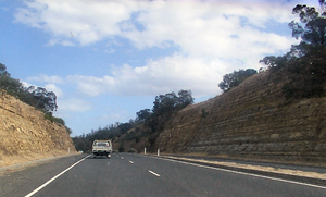
This is the list of highways in Tasmania, Australia. It covers 53 Major Roads.
National Highway

- Bass Highway
- Brooker HighwayBrooker HighwayThe Brooker Highway is a highway in the State of Tasmania, Australia. Also known as the Northern Outlet, the highway is the major arterial route through Hobart's northern suburbs and is Hobart's major road connection to the cities and towns of Northern Tasmania...
- Midland Highway (Bridgewater BridgeBridgewater BridgeThe Bridgewater Bridge and Causeway spans the Derwent River in Tasmania, Australia between Bridgewater and Granton. It consists of a vertical lift bridge and a specially-built causeway connecting the bridge to the east bank of the river. It accommodates a two-lane highway, a single track railway...
and the Red BridgeRed Bridge (Tasmania)The Red Bridge in Tasmania crosses the Elizabeth River at Campbell Town. Built in 1838 using penal labour, it is the oldest surviving brick arch bridge in Australia, as well as the oldest bridge anywhere on the National Highway. The bridge contains three arch spans of 7.6 m each and holds two...
)
State Highways
- Bass Highway
 Bass Highway, TasmaniaThe Bass Highway is a highway in Tasmania, Australia. It is a part of the National Highway, designated as National Highway 1 and connects the major cities across the north of the state - Burnie, Devonport and Launceston....
 - Tasman Highway
 Tasman HighwayThe Tasman Highway is a highway in Tasmania, Australia. Like the Midland Highway, it connects the major cities of Hobart and Launceston — however it takes a different route, via the north-eastern and eastern coasts of the state. The Highway also acts as a major commuter road to Hobart...
(Mcgees BridgeMcgees BridgeMcgees Bridge and causeway crosses Pitt Water within the greater area of Hobart, Tasmania.The bridge provides a vital link between Hobart and two of Tasmania's principal tourist attractions - Port Arthur Historic Site on the Tasman Peninsula and the picturesque East Coast via the Tasman...
, the Sorell CausewaySorell CausewayThe Sorell Causeway is a causeway that stretches from the western side of Midway Point across Orielton Lagoon to Sorell. Together with Mcgees Bridge they connect Sorell with Hobart via the Tasman Highway....
and the Tasman BridgeTasman BridgeThe Tasman Bridge is a five-lane bridge crossing the Derwent River, near the CBD of Hobart, Tasmania. The bridge has a total length of 1,395 metres . It provides the main traffic route from the CBD to the eastern shore - particularly Hobart International Airport and Bellerive Oval...
) - Esk Highway
 Esk HighwayThe Esk Highway is a highway in Tasmania, Australia. It connects the Midland Highway, located down the centre of the state, with the Tasman Highway, which is located on the east coast of the state....
 - Lake Highway


- Davey StreetDavey Street, HobartDavey Street is one of the main streets of the central business district of the city of Hobart, capital of Tasmania, Australia. As well as forming the southern border of the CBD, it is part of the A6, technically making it part of the Huon Highway....
- Huon HighwayHuon HighwayThe Huon Highway is an highway in southern Tasmania, Australia. The highway forms part of the and connects Hobart with the southern parts of Tasmania. The original Huon Highway was a twisty two-lane road skirting around Mount Wellington, but that section of the Highway was bypassed in stages...
- Macquarie StreetMacquarie Street, HobartMacquarie Street is one of the main streets of the central business district of the city of Hobart, capital of Tasmania, Australia. It is part of the A6, technically making it part of the Huon Highway...
- Southern OutletSouthern Outlet, HobartThe Southern Outlet is a 13km dual-carriageway limited-access highway that connects Hobart to the southern parts of Tasmania, Australia...
- Davey Street
- West Tamar Highway
 West Tamar HighwayThe West Tamar Highway is a highway in Tasmania, Australia. It covers the western edge of the Tamar River, from Launceston to the beach town of Greens Beach.It is labelled as state route A7.-External links:*...
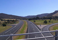
- East Tamar Highway
 East Tamar HighwayThe East Tamar Highway is a highway in Tasmania, Australia. It covers the eastern edge of the Tamar River, from Launceston to the lighthouse at Low Head.It is labelled as state route A8.-External links:*...
 - Arthur Highway
 Arthur HighwayThe Arthur Highway is a Tasmanian highway which runs from Sorell in the near south to Port Arthur in the far south-east.It is notorious for crashes and was the focus of a media campaign to make it safer until late 2004, where it was superseded in danger by the equally notorious Lyell Highway....
- Lyell HighwayLyell HighwayThe Lyell Highway is a highway in Tasmania, running from Hobart to Queenstown. The name is derived from Mount Lyell, the mountain peak where copper was found in the late 19th century, and the site of the Mount Lyell copper mine, and the sole reason for the existence of Queenstown...
- Zeehan Highway
- Murchison HighwayMurchison HighwayThe Murchison Highway runs from the West Coast of Tasmania to Burnie, and was opened on 13 December 1963. The part of the Highway from Waratah to Burnie was known as the Waratah Highway until 1973 at the latest....
- Lyell Highway
Major Arterial Roads
- Boyer Road

- Marlborough Highway
 Marlborough HighwayThe Marlborough Highway is a minor highway in Tasmania. It links the Lyell Highway to the Lake Highway and cuts short the otherwise very long journey from the West Coast to the Central Highlands....
 - Mole Creek Road

- Sheffield Road
- Castra Road
- Kindred Road
-
- Gawler Road
- Preston Road
- Gunns Plains Road
- S Riana Road
- Pine Road
- W Pine Road
- Mission Hill Road
- Ridgley Highway
- Forth Road

- Lyell HighwayLyell HighwayThe Lyell Highway is a highway in Tasmania, running from Hobart to Queenstown. The name is derived from Mount Lyell, the mountain peak where copper was found in the late 19th century, and the site of the Mount Lyell copper mine, and the sole reason for the existence of Queenstown...
-
- Zeehan Highway
- Henty Road

- Cambridge Road
- Richmond Road
- Colebrook Road
- Mud Walls Road
- East Derwent Highway
 East Derwent HighwayThe East Derwent Highway is a highway in Hobart, Australia. The highway is a Trunk road that carries heavy commuter traffic much like the Brooker Highway, except on the Eastern side of the Derwent River...
(Jordan River BridgeJordan River BridgeThe Jordan River Bridge is a two Lane bridge crossing the Jordan River within the greater area of Hobart, Tasmania.The bridge's main function is to carry East Derwent Highway traffic, as well as pedestrians who travel between Bridgewater and Gagebrook....
) - South Arm Highway
 South Arm HighwayThe South Arm Highway is a highway in Hobart, Australia. The highway is a major Trunk road that carries heavy commuter traffic much like the Southern Outlet, except on the Eastern side of the Derwent River...
 - Lake Leake Highway
- Goodwood Road
 Goodwood Road, TasmaniaGoodwood Road is a 4 lane link road that connects the City of Glenorchy to the City of Clarence in the greater area of Hobart, Tasmania. Using the Bowen Bridge the road travels over the Derwent River in semi-highway road layout...
(Bowen BridgeBowen BridgeThe Bowen Bridge is a four-lane road bridge crossing the Derwent River in Tasmania, Australia. The Bridge lies on the river approximately half way between the Tasman Bridge and the Bridgewater Bridge. The Bridge links the East Derwent Highway with the Brooker Highway at Glenorchy some 10...
) - Domain Highway
 Domain HighwayThe Domain Highway is a highway in Hobart, Tasmania. The Highway is a Link road bypassing Hobart, starting at the Brooker Highway and heading southeast between the banks of the Derwent River and the Hobart Domain and botanical gardens...
 -
- Poatina Road
- Cressy Road
- Illawarra Main Road

- Powranna Road
- Meander Valley Highway

- Gordon River RoadGordon River Road- was a road built to service the Hydro Tasmania construction of the Gordon Dam, and the Serpentine Dam, Tasmania leading to the flooding of Lake Pedder in South West Tasmania....
- Glenora Road
- Huon Road


- Sandy Bay RoadSandy Bay RoadSandy Bay Road is one of the main streets of the central business district of the city of Hobart, capital of Tasmania, Australia. It is the B68. It is a two-way street beginning at the intersection where Davey Street converts into Harrington Street. From there, Sandy Bay Road travels southwards...
- Channel HighwayChannel HighwayThe Channel Highway is a regional highway that travels south from Hobart To Huonville, Tasmania, Australia. The Channel Highway starts from the end of Sandy Bay Road and travels south toward Huonville via Taroona, Kingston, Huntingfield, Margate, Kettering, Woodbridge and Cygnet. The shortest way...
- Sandy Bay Road
- Frankford Road
- Biralee Road
- Batman HighwayBatman HighwayBatman Highway is a two-lane rural highway in northern Tasmania. The highway links the East Tamar and West Tamar Highways via the Batman Bridge and provides the only crossing of the Tamar River north of the city of Launceston. The highway also serves traffic from the West Tamar area to the port of...
(Batman BridgeBatman BridgeThe Batman Bridge is a modern bridge spanning the Tamar River in northern Tasmania. The bridge is on the Batman Highway connecting the West Tamar Highway to the East Tamar Highway . The eastern end of the bridge is located at Whirlpool Reach, George Town Council and the western end is located...
) - Hollow Tree Road

See also
- Highways in AustraliaHighways in AustraliaThis is a list of highways in Australia, listed alphabetically along with each highway's route number and location. Note that some highways service more than one state or territory.-Route numbering systems:...
for highways in other statesStates and territories of AustraliaThe Commonwealth of Australia is a union of six states and various territories. The Australian mainland is made up of five states and three territories, with the sixth state of Tasmania being made up of islands. In addition there are six island territories, known as external territories, and a...
Further reading
- Commonwealth Bureau of Roads (Australia) (1978) National highways linking Hobart, Launceston and Burnie : approaches to Hobart Canberra : Australian Government Publishing Service, Parliamentary paper PP no. 124/1977 Chairman: H.T. Loxton. ISBN 064291799X
- Newitt, Lyn, (1988) Convicts & carriageways : Tasmanian road development until 1880 edited by Alan Jones. Hobart : Dept. of Main Roads, Tasmania, ISBN 0724623523