
Southern Cross Drive
Encyclopedia
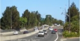
Southern Cross Drive is a major road in Sydney
, New South Wales
, Australia
. This freeway links the Eastern Distributor
at Moore Park
to General Holmes Drive at Sydney Airport
. Eastlakes Golf Club runs alongside Southern Cross Drive. It was opened in 1969.
The road was originally built to provide access to the Sydney central business district
for suburbs in Southern Sydney
and South-eastern Sydney
.
With the development of many other motorways and freeways, Southern Cross Drive is part of the 110 kilometre Sydney Orbital Network, providing links without interruption between Greater Western Sydney
, Eastern Suburbs
, the North Shore
and Hills District
. It allows a continuous link from the M5 Motorway, General Holmes Drive
, Westlink M7
, Eastern Distributor
, Cahill Expressway
, Sydney Harbour Tunnel
, Sydney Harbour Bridge
, Warringah Freeway
, M4 Motorway
, Gore Hill Freeway
, Lane Cove Tunnel
and the M2 Hills Motorway
.
It has connection points at Mill Pond Drive / Botany Road, Wentworth Avenue, Link Road and O'dea / Todman Avenues. There are plans to construct south-facing ramps from Gardeners Road to Southern Cross Drive.
Sydney
Sydney is the most populous city in Australia and the state capital of New South Wales. Sydney is located on Australia's south-east coast of the Tasman Sea. As of June 2010, the greater metropolitan area had an approximate population of 4.6 million people...
, New South Wales
New South Wales
New South Wales is a state of :Australia, located in the east of the country. It is bordered by Queensland, Victoria and South Australia to the north, south and west respectively. To the east, the state is bordered by the Tasman Sea, which forms part of the Pacific Ocean. New South Wales...
, Australia
Australia
Australia , officially the Commonwealth of Australia, is a country in the Southern Hemisphere comprising the mainland of the Australian continent, the island of Tasmania, and numerous smaller islands in the Indian and Pacific Oceans. It is the world's sixth-largest country by total area...
. This freeway links the Eastern Distributor
Eastern Distributor
The Eastern Distributor, also identified as the M1, is a long motorway in Sydney, New South Wales, Australia. Part of Metroad 1, it links the Sydney central business district with the Airport...
at Moore Park
Moore Park, New South Wales
Moore Park is a large area of parkland in the Eastern Suburbs of Sydney, in the state of New South Wales, Australia. It is part of Centennial Parklands, a collective of three parks being Moore Park, Centennial Park and Queens Park. Centennial Parklands is administered by the Centennial Park &...
to General Holmes Drive at Sydney Airport
Sydney Airport
Sydney Airport may refer to:* Sydney Airport, also known as Kingsford Smith International Airport, in Sydney, Australia* Sydney/J.A. Douglas McCurdy Airport, in Nova Scotia, Canada...
. Eastlakes Golf Club runs alongside Southern Cross Drive. It was opened in 1969.
The road was originally built to provide access to the Sydney central business district
Sydney central business district
The Sydney central business district is the main commercial centre of Sydney, New South Wales, Australia. It extends southwards for about 3 kilometres from Sydney Cove, the point of first European settlement. Its north–south axis runs from Circular Quay in the north to Central railway station in...
for suburbs in Southern Sydney
Southern Sydney
This article refers to an area the same as a combination of St George and SutherlandSouthern Sydney is a general term which is used to describe the southern metropolitan area of Sydney, in the state of New South Wales, Australia....
and South-eastern Sydney
South-eastern Sydney
South-Eastern Sydney is a term which is used to describe the metropolitan area directly to the south and east of the Sydney central business district in Sydney, New South Wales, Australia.The area stretches from the inner city to the foreshores of Botany Bay...
.
With the development of many other motorways and freeways, Southern Cross Drive is part of the 110 kilometre Sydney Orbital Network, providing links without interruption between Greater Western Sydney
Greater Western Sydney
Greater Western Sydney is a term used to describe the western region of the metropolitan area of Sydney, Australia. The University of Western Sydney defines Greater Western Sydney as comprising 14 local government areas...
, Eastern Suburbs
Eastern Suburbs (Sydney)
The Eastern Suburbs is a general term used to describe the metropolitan area directly to the east and south-east of the Sydney central business district in Sydney, New South Wales, Australia. Eastern Suburbs can refer to the suburbs within the local government areas of Woollahra, Waverley, Dover...
, the North Shore
North Shore (Sydney)
The North Shore is an informal term used to describe the primarily residential area of northern metropolitan Sydney, in the state of New South Wales, Australia. The term usually refers to the suburbs located on the north shore of Sydney Harbour between Middle Harbour and the Lane Cove River, up to...
and Hills District
Hills District (Sydney)
Hills District or The Hills is a general term for the north-western suburbs of Sydney, in the state of New South Wales, Australia. The Hills District is also referred to as The Sydney Hills and The Hills Shire...
. It allows a continuous link from the M5 Motorway, General Holmes Drive
General Holmes Drive
General Holmes Drive is a major road that runs through Brighton-Le-Sands and Kyeemagh in New South Wales, Australia.General Holmes Drive starts from the The Grand Parade in Brighton-Le-Sands, continues into the suburb of Kyeemagh, running along Cook Park, over the Cooks River , past Sydney Airport...
, Westlink M7
Westlink M7
Westlink M7 - formerly Western Sydney Orbital - is one of Sydney, Australia's urban motorways and a part of Metroad 7 and the Sydney Orbital Network. It connects three Metroads: M5 at Prestons, M4 at Eastern Creek and M2 at Baulkham Hills...
, Eastern Distributor
Eastern Distributor
The Eastern Distributor, also identified as the M1, is a long motorway in Sydney, New South Wales, Australia. Part of Metroad 1, it links the Sydney central business district with the Airport...
, Cahill Expressway
Cahill Expressway
The Cahill Expressway is the first true freeway constructed in Sydney, Australia. It starts from the Eastern Distributor and Cross City Tunnel in Woolloomooloo, and runs through a series of sunken cuttings and tunnels between the Royal Botanical Gardens and The Domain...
, Sydney Harbour Tunnel
Sydney Harbour Tunnel
The Sydney Harbour Tunnel is a twin-tube road tunnel in Sydney, Australia. The tunnel was completed and opened to traffic in August 1992 to provide a second vehicular crossing of Sydney Harbour to alleviate congestion on the Sydney Harbour Bridge....
, Sydney Harbour Bridge
Sydney Harbour Bridge
The Sydney Harbour Bridge is a steel through arch bridge across Sydney Harbour that carries rail, vehicular, bicycle and pedestrian traffic between the Sydney central business district and the North Shore. The dramatic view of the bridge, the harbour, and the nearby Sydney Opera House is an iconic...
, Warringah Freeway
Warringah Freeway
The Warringah Freeway is a major road in Sydney, New South Wales, Australia. This freeway forms part of the Sydney Orbital Network to provide access to most of the suburbs in Sydney and is also a major route to the north, south, east and west of the metropolis.-History:Planning began in 1951...
, M4 Motorway
Metroad 4
Metroad 4 is a Metroad in Sydney, New South Wales, Australia. It connects the inner-west of Sydney with the outer western suburbs. It mostly follows what was previously National Highway 32 from the Western Distributor in the CBD, west to the Great Western Highway at Lapstone...
, Gore Hill Freeway
Gore Hill Freeway
The Gore Hill Freeway is a major freeway in Sydney, New South Wales, Australia. This freeway forms part of Metroad 1 andthe Sydney Orbital Network to provide access to most of the suburbs in Sydney and is also a major route to the north, south, east and west of the metropolis.It connects to the...
, Lane Cove Tunnel
Lane Cove Tunnel
The Lane Cove Tunnel is a A$1.1 billion, 3.6 km twin tunnel tollway in Sydney, Australia, connecting the M2 Motorway at North Ryde with the Gore Hill Freeway at Artarmon. It forms part of Sydney Metroad 2 and the 110 km Sydney Orbital Network...
and the M2 Hills Motorway
M2 Hills Motorway
The M2 Hills Motorway is a motorway in north-western Sydney, New South Wales, Australia. It forms part of Sydney Metroad 2 and the 110 km Sydney Orbital Network. West of Pennant Hills Road, the M2 is also part of the National Highway.-History:Previously, Sydney's western suburbs were poorly served...
.
It has connection points at Mill Pond Drive / Botany Road, Wentworth Avenue, Link Road and O'dea / Todman Avenues. There are plans to construct south-facing ramps from Gardeners Road to Southern Cross Drive.
Exits and Interchanges
Southern Cross Drive  |
|||
| Northbound exits | Distance to Sydney CBD (km) |
Distance to Sydney Airport (km) |
Southbound exits |
| End Southern Cross Drive continues as Eastern Distributor Eastern Distributor The Eastern Distributor, also identified as the M1, is a long motorway in Sydney, New South Wales, Australia. Part of Metroad 1, it links the Sydney central business district with the Airport... to Sydney CBD Sydney Sydney is the most populous city in Australia and the state capital of New South Wales. Sydney is located on Australia's south-east coast of the Tasman Sea. As of June 2010, the greater metropolitan area had an approximate population of 4.6 million people... / Newcastle Newcastle, New South Wales The Newcastle metropolitan area is the second most populated area in the Australian state of New South Wales and includes most of the Newcastle and Lake Macquarie Local Government Areas... |
9 | 5 | Start Southern Cross Drive from Eastern Distributor Eastern Distributor The Eastern Distributor, also identified as the M1, is a long motorway in Sydney, New South Wales, Australia. Part of Metroad 1, it links the Sydney central business district with the Airport... |
| no exit | 11 | 3 | Maroubra Maroubra, New South Wales Maroubra is a beachside suburb in the Eastern Suburbs of Sydney, in the state of New South Wales, Australia. Maroubra is located 10 kilometres south-east of the Sydney central business district in the local government area of the City of Randwick. Maroubra is the largest suburb in the area governed... , Mascot Mascot, New South Wales Mascot is a suburb in south-eastern Sydney, in the state of New South Wales, Australia. Mascot is located 7 kilometres south of the Sydney central business district and is the administrative centre of the City of Botany Bay... Wentworth Avenue |
| no exit | 12 | 2 | Botany Botany, New South Wales Botany is a suburb in south-eastern Sydney, in the state of New South Wales, Australia. Botany is located 10 kilometres south of the Sydney central business district and is part of the City of Botany Bay.... , Mascot Mascot, New South Wales Mascot is a suburb in south-eastern Sydney, in the state of New South Wales, Australia. Mascot is located 7 kilometres south of the Sydney central business district and is the administrative centre of the City of Botany Bay... Botany Road |
| Arncliffe Arncliffe, New South Wales Arncliffe is a suburb in southern Sydney, in the state of New South Wales, Australia. Arncliffe is located 11 kilometres south of the Sydney central business district, in the local government area of the City of Rockdale. Arncliffe is part of the St George area.Arncliffe is located south of the... General Holmes Drive General Holmes Drive General Holmes Drive is a major road that runs through Brighton-Le-Sands and Kyeemagh in New South Wales, Australia.General Holmes Drive starts from the The Grand Parade in Brighton-Le-Sands, continues into the suburb of Kyeemagh, running along Cook Park, over the Cooks River , past Sydney Airport...  |
|||
| Mascot Mascot, New South Wales Mascot is a suburb in south-eastern Sydney, in the state of New South Wales, Australia. Mascot is located 7 kilometres south of the Sydney central business district and is the administrative centre of the City of Botany Bay... General Holmes Drive General Holmes Drive General Holmes Drive is a major road that runs through Brighton-Le-Sands and Kyeemagh in New South Wales, Australia.General Holmes Drive starts from the The Grand Parade in Brighton-Le-Sands, continues into the suburb of Kyeemagh, running along Cook Park, over the Cooks River , past Sydney Airport... |
13 | -- | no exit |
| Start Southern Cross Drive continues from General Holmes Drive General Holmes Drive General Holmes Drive is a major road that runs through Brighton-Le-Sands and Kyeemagh in New South Wales, Australia.General Holmes Drive starts from the The Grand Parade in Brighton-Le-Sands, continues into the suburb of Kyeemagh, running along Cook Park, over the Cooks River , past Sydney Airport... |
End Southern Cross Drive continues as General Holmes Drive General Holmes Drive General Holmes Drive is a major road that runs through Brighton-Le-Sands and Kyeemagh in New South Wales, Australia.General Holmes Drive starts from the The Grand Parade in Brighton-Le-Sands, continues into the suburb of Kyeemagh, running along Cook Park, over the Cooks River , past Sydney Airport... to Wollongong Wollongong, New South Wales Wollongong is a seaside city located in the Illawarra region of New South Wales, Australia. It lies on the narrow coastal strip between the Illawarra Escarpment and the Pacific Ocean, 82 kilometres south of Sydney... / Canberra |
||