

Southern Freeway
Encyclopedia
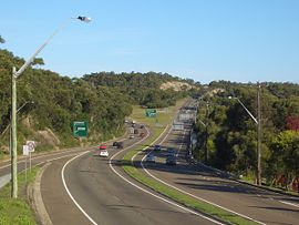
Southern Freeway is a freeway linking Sydney
to Wollongong. It currently is designated as part of National Route 1
, however was formerly signposted as F6 (Freeway Route 6) under a former route numbering system, and is commonly known by this latter name. The freeway will be designated as M1 when alpha-numeric route marking is introduced.
The Southern Freeway has two sections: the northern section between Waterfall
and Bulli Tops interchange (with a speed limit
of 110 km/h (68.4 mph), except for the southbound approach to the Interchange, which is 80 km/h (49.7 mph)) and the southern section between Wollongong suburb of Gwynneville
to Yallah
(with a 100 km/h (62.1 mph) speed limit), where it rejoins the Princes Highway. Mount Ousley
Road connects these two sections together (also 100 km/h (62.1 mph) speed limit) with an interchange at Picton Road
.
As Wollongong and Port Kembla
are important industrial centres, freight traffic is heavy. Despite the current decline of the local steel industry, emergence of Wollongong as a commuter city of Sydney has kept the freeway and the adjacent Mount Ousley Road busy.
 The Southern Freeway route starts at Waterfall
in the north, taking more or less a parallel route with Princes Highway
until the sprawling Bulli Tops interchange (with Appin Road
(State Route 69) and Princes Highway). There it continues downhill, avoiding the steep Bulli Pass
, as Mount Ousley Road (dual carriageway) and bypasses Wollongong CBD
. The freeway re-emerges at Gwynneville
and continues for 20 kilometres (12.4 mi) to Yallah
where it rejoins the Princes Highway.
From its opening on 24 July 1975, the Waterfall to Bulli Tops section of the F6 Southern Freeway incurred a toll. This part of the freeway did not feature the Helensburgh Interchange (which subsequently opened in February 2000). The toll operated for 20 years, which was 10 years short of its intended operating length. The main reason for this was local residents complaining that the F3 (Sydney–Newcastle Freeway) had their toll dropped in 1988, which was at the time intended to be dropped as its loans had been fully paid off unlike those of the F6.
After much pressure the toll for the F6 freeway was removed on 30 July 1995 as the loans had been repaid. Remnants of the tollbooths are still able to be seen at the old toll plaza at Waterfall. One of the lanes and very faint markings are still intact. Heading southbound one set of warning lights to slow down for the toll plaza are also still intact minus signage. There is also signage on Bulli Pass and Appin Road which are now coverplating the words "TOLLWAY F6 2km" and "TOLLWAY 1 1km".
Scheme of 1948 outlined an F6 extension from the current-day end-point at Waterfall. As such, an F6 corridor was set aside that passes through the Royal National Park
from Waterfall to Campbell Road in St Peters
. The land reservation tract currently passes through the suburbs of Loftus
, Kirrawee
, Gymea
, Miranda
, Taren Point
, Sandringham
, Sans Souci
, Ramsgate
, Monterey
, Kogarah
, Brighton-Le-Sands
, Rockdale
, Banksia
, Kyeemagh
and Tempe
.
Of the proposed extension, only the six-lane Captain Cook Bridge
and a short connecting section of Taren Point Road
to the south has been constructed. Establishment of the bridge section of the F6 extension began in 1962, expedited to replace the ferry
service that had operated from Taren Point to Sans Souci since 1916. Captain Cook Bridge was opened for general use in May 1965.
In the original plan, the F6 would connect to the Western Distributor
. Then in August 1977, premier Neville Wran
cancelled the inner section of the F6 link, which at the time had an estimated construction cost of $96 million. At the same time, Wran announced that the inner section reservation would be sold off and the proposed extension would instead terminate at St Peters, a medium density industrial suburb. This would create a congestion problem similar to that of the M4 Western Motorway
, ending at the arterial Parramatta Road
in Strathfield, New South Wales
. Like the F6, the M4 in its original form was intended to connect to the Western Distributor but this was cancelled in October 1977 by the Wran government. The proposed M4 extension, the M4 East tunnel would extend the current motorway from Strathfield to the City West Link
, itself connecting to the Western Distributor via Victoria Road
and the Anzac Bridge
. There has also been a proposal for an extension of the M4 East known as the "Inner-West Motorway
", comprising a tunnel running underneath the Inner West
of Sydney and connecting to the M5 East at St Peters. Thus, under the new plan, the F6 would connect to this proposed tunnel.
Prior to the 2007 federal election, the Liberal
-Nationals
(Coalition
) promised to allocate A$20 million towards planning for the F6 extension. Although the Coalition did not win the 2007 election, the funding was once again promised at the subsequent 2010 federal election. This funding would ensure the project is "shovel ready" when funding becomes available.
Sydney
Sydney is the most populous city in Australia and the state capital of New South Wales. Sydney is located on Australia's south-east coast of the Tasman Sea. As of June 2010, the greater metropolitan area had an approximate population of 4.6 million people...
to Wollongong. It currently is designated as part of National Route 1
Highway 1 (Australia)
Australia's Highway 1 is a network of highways that circumnavigate the Australian continent, joining all mainland state capitals. At a total length of approximately it is the longest national highway in the world, longer than the Trans-Siberian Highway and the Trans-Canada Highway...
, however was formerly signposted as F6 (Freeway Route 6) under a former route numbering system, and is commonly known by this latter name. The freeway will be designated as M1 when alpha-numeric route marking is introduced.
The Southern Freeway has two sections: the northern section between Waterfall
Waterfall, New South Wales
Waterfall is a small suburb in southern Sydney, in the state of New South Wales, Australia. Waterfall is located 38 kilometers south of the Sydney central business district in the Sutherland Shire....
and Bulli Tops interchange (with a speed limit
Speed limit
Road speed limits are used in most countries to regulate the speed of road vehicles. Speed limits may define maximum , minimum or no speed limit and are normally indicated using a traffic sign...
of 110 km/h (68.4 mph), except for the southbound approach to the Interchange, which is 80 km/h (49.7 mph)) and the southern section between Wollongong suburb of Gwynneville
Gwynneville, New South Wales
Gwynneville is an inner city suburb of Wollongong, New South Wales, Australia located approximately 2 km north west of the city centre.It was originally named Gwynne Ville after the Gwynne family who owned the property. It was sold it two large lots, both of which were subdivided...
to Yallah
Yallah, New South Wales
Yallah is a southern suburb of Wollongong, New South Wales, Australia, located on the western shore of Lake Illawarra. It contains a mixture of rural, commercial and light industrial areas and is home to the Tallawarra Power Station....
(with a 100 km/h (62.1 mph) speed limit), where it rejoins the Princes Highway. Mount Ousley
Mount Ousley, New South Wales
Mount Ousley is a residential suburb situated on the foothills of Mount Keira about four kilometres northwest from the city of Wollongong, New South Wales, Australia. It is also the name of the road which crosses the nearby Illawarra Escarpment and is adjacent to the University of Wollongong. Mount...
Road connects these two sections together (also 100 km/h (62.1 mph) speed limit) with an interchange at Picton Road
Picton Road
Picton Road is a New South Wales highway linking Picton and Wollongong. It provides an important link between the Hume and Southern freeways. From Picton, the highway runs in the southeastern direction, crosses the Hume Highway and continues over grass-forested ranges east of Wilton until it meets...
.
As Wollongong and Port Kembla
Port Kembla, New South Wales
Port Kembla is a suburb of Wollongong 8 km south of the CBD and part of the Illawarra region of New South Wales. The suburb comprises a seaport, industrial complex , a small harbour foreshore nature reserve, and a small commercial sector. It is situated on the tip of Red Point, first sighted...
are important industrial centres, freight traffic is heavy. Despite the current decline of the local steel industry, emergence of Wollongong as a commuter city of Sydney has kept the freeway and the adjacent Mount Ousley Road busy.
History
Waterfall, New South Wales
Waterfall is a small suburb in southern Sydney, in the state of New South Wales, Australia. Waterfall is located 38 kilometers south of the Sydney central business district in the Sutherland Shire....
in the north, taking more or less a parallel route with Princes Highway
Princes Highway, Wollongong
The Princes Highway is the main coastal route connecting Sydney and Melbourne. It is both a secondary north-south route through Wollongong, New South Wales, and a major linking road for the Wollongong suburbs.- Route :...
until the sprawling Bulli Tops interchange (with Appin Road
Appin Road
Appin Road is a New South Wales secondary highway linking Campbelltown and the Sydney's western suburbs with Wollongong. It gets its name from Appin, which lies on its path and is the southern half of the State Route 69...
(State Route 69) and Princes Highway). There it continues downhill, avoiding the steep Bulli Pass
Bulli Pass
Bulli Pass is a mountain pass northwest of Bulli, New South Wales, Australia. It is situated on the Illawarra Escarpment west of the Illawarra coastal plain. It was built during the 19th century for use by loggers and locals transporting goods to and from Sydney...
, as Mount Ousley Road (dual carriageway) and bypasses Wollongong CBD
Central business district
A central business district is the commercial and often geographic heart of a city. In North America this part of a city is commonly referred to as "downtown" or "city center"...
. The freeway re-emerges at Gwynneville
Gwynneville, New South Wales
Gwynneville is an inner city suburb of Wollongong, New South Wales, Australia located approximately 2 km north west of the city centre.It was originally named Gwynne Ville after the Gwynne family who owned the property. It was sold it two large lots, both of which were subdivided...
and continues for 20 kilometres (12.4 mi) to Yallah
Yallah, New South Wales
Yallah is a southern suburb of Wollongong, New South Wales, Australia, located on the western shore of Lake Illawarra. It contains a mixture of rural, commercial and light industrial areas and is home to the Tallawarra Power Station....
where it rejoins the Princes Highway.
From its opening on 24 July 1975, the Waterfall to Bulli Tops section of the F6 Southern Freeway incurred a toll. This part of the freeway did not feature the Helensburgh Interchange (which subsequently opened in February 2000). The toll operated for 20 years, which was 10 years short of its intended operating length. The main reason for this was local residents complaining that the F3 (Sydney–Newcastle Freeway) had their toll dropped in 1988, which was at the time intended to be dropped as its loans had been fully paid off unlike those of the F6.
After much pressure the toll for the F6 freeway was removed on 30 July 1995 as the loans had been repaid. Remnants of the tollbooths are still able to be seen at the old toll plaza at Waterfall. One of the lanes and very faint markings are still intact. Heading southbound one set of warning lights to slow down for the toll plaza are also still intact minus signage. There is also signage on Bulli Pass and Appin Road which are now coverplating the words "TOLLWAY F6 2km" and "TOLLWAY 1 1km".
Extension
The County of CumberlandCumberland County, New South Wales
Cumberland County is a county in the State of New South Wales, Australia. Most of the Sydney metropolitan area is located within the County of Cumberland....
Scheme of 1948 outlined an F6 extension from the current-day end-point at Waterfall. As such, an F6 corridor was set aside that passes through the Royal National Park
Royal National Park
Royal National Park is a national park in New South Wales, Australia, 29 km south of Sydney CBD.Founded by Sir John Robertson, Acting Premier of New South Wales, and formally proclaimed on 26 April 1879, it is the world's second oldest purposed national park, the first usage of the term...
from Waterfall to Campbell Road in St Peters
St Peters, New South Wales
St Peters is a suburb in the inner west of Sydney, in the state of New South Wales, Australia. St Peters is located 7 kilometres south of the Sydney central business district, in the local government area of Marrickville Council.-History:...
. The land reservation tract currently passes through the suburbs of Loftus
Loftus, New South Wales
Loftus is a suburb, in southern Sydney, in the state of New South Wales, Australia. Loftus is located 29 kilometres south of the Sydney central business district, in the local government area of the Sutherland Shire....
, Kirrawee
Kirrawee, New South Wales
Kirrawee is a suburb in southern Sydney, in the state of New South Wales, Australia. Kirrawee is located 25 kilometres south of the Sydney central business district in the Sutherland Shire. Kirrawee lies between Sutherland, to the west and Gymea and Grays Point, to the east...
, Gymea
Gymea, New South Wales
Gymea is a suburb in southern Sydney, in the state of New South Wales, Australia. Gymea is located 26 kilometres south of the Sydney central business district in the local government area of the Sutherland Shire. The postcode is 2227, which it shares with adjacent suburb Gymea Bay.-History:The...
, Miranda
Miranda, New South Wales
Miranda is a suburb in southern Sydney, in the state of New South Wales, Australia. Miranda is located 24 kilometres south of the Sydney central business district, in the Sutherland Shire....
, Taren Point
Taren Point, New South Wales
Taren Point is a suburb, in southern Sydney, in the state of New South Wales, Australia. Taren Point is located 20 kilometres south of the Sydney central business district in the local government area of the Sutherland Shire....
, Sandringham
Sandringham, New South Wales
Sandringham is a suburb in southern Sydney, in the state of New South Wales, Australia. Sandringham is located 18 kilometres south of the Sydney central business district and is part of the St George area. Sandringham is in the local government area of the City of Rockdale.Sandringham is a quiet...
, Sans Souci
Sans Souci, New South Wales
Sans Souci is a southern Sydney suburb in the state of New South Wales, Australia. Sans Souci is 17 kilometres south of the Sydney central business district and lies across the local government areas of the City of Rockdale and the Municipality of Kogarah. It is part of the St George area.Sans...
, Ramsgate
Ramsgate, New South Wales
Ramsgate is a suburb in southern Sydney, in the state of New South Wales, Australia. Ramsgate is located 16 km south of the Sydney central business district and is part of the St George area. Ramsgate is in the local government area of the City of Rockdale...
, Monterey
Monterey, New South Wales
Monterey is a suburb in southern Sydney, in the state of New South Wales, Australia. Monterey is located 15km south of the Sydney central business district and is part of the St George area. Monterey is in the local government area of the City of Rockdale....
, Kogarah
Kogarah, New South Wales
Kogarah is a suburb of southern Sydney, in the state of New South Wales, Australia. Kogarah is located 14 kilometres south of the Sydney central business district and is considered to be the centre of the St George area...
, Brighton-Le-Sands
Brighton-Le-Sands, New South Wales
Brighton-Le-Sands , is a suburb in southern Sydney, in the state of New South Wales, Australia. Brighton-Le-Sands is located 13 kilometres south of the Sydney central business district, on the western shore of Botany Bay...
, Rockdale
Rockdale, New South Wales
Rockdale is a suburb in southern Sydney, in the state of New South Wales, Australia. Rockdale is located 13 kilometres south of the Sydney central business district and is part of the St George area...
, Banksia
Banksia, New South Wales
Banksia is a suburb in southern Sydney, in the state of New South Wales, Australia. Banksia is located 12 kilometres south of the Sydney central business district, in the local government area of the City of Rockdale and is part of the St George area....
, Kyeemagh
Kyeemagh, New South Wales
Kyeemagh is a suburb in southern Sydney, in the state of New South Wales, Australia. Kyeemagh is located 12 kilometres south of the Sydney central business district, on the western shore of Botany Bay. Kyeemagh is in the local government area of the City of Rockdale and is part of the St George...
and Tempe
Tempe, New South Wales
Tempe is a suburb in the inner west of Sydney, in the state of New South Wales, Australia. Tempe is located 9 kilometres south of the Sydney central business district in the local government area of Marrickville Council....
.
Of the proposed extension, only the six-lane Captain Cook Bridge
Captain Cook Bridge, New South Wales
The Captain Cook Bridge is one of three major road crossings of the Georges River in Sydney, Australia. It crosses at the mouth of the river into Botany Bay....
and a short connecting section of Taren Point Road
Taren Point Road
Taren Point Road is a major road found in Taren Point and Caringbah, New South Wales, Australia.Taren Point Road starts from Captain Cook Bridge, Taren Point and continues to Gardere Street, Caringbah. Traffic travelling north heads towards Sans Souci, and onwards to the city. Traffic travelling...
to the south has been constructed. Establishment of the bridge section of the F6 extension began in 1962, expedited to replace the ferry
Ferry
A ferry is a form of transportation, usually a boat, but sometimes a ship, used to carry primarily passengers, and sometimes vehicles and cargo as well, across a body of water. Most ferries operate on regular, frequent, return services...
service that had operated from Taren Point to Sans Souci since 1916. Captain Cook Bridge was opened for general use in May 1965.
In the original plan, the F6 would connect to the Western Distributor
Western Distributor
The Western Distributor is a primarily elevated small freeway in Sydney, New South Wales, Australia that links Victoria Road, White Bay , with the Bradfield Highway at the southern end of the Sydney Harbour Bridge...
. Then in August 1977, premier Neville Wran
Neville Wran
Neville Kenneth Wran, AC, CNZM, QC was the Premier of New South Wales from 1976 until 1986. He was National President of the Australian Labor Party from 1980 to 1986 and Chairman of both the Lionel Murphy Foundation and the Commonwealth Scientific and Industrial Research Organisation from 1986...
cancelled the inner section of the F6 link, which at the time had an estimated construction cost of $96 million. At the same time, Wran announced that the inner section reservation would be sold off and the proposed extension would instead terminate at St Peters, a medium density industrial suburb. This would create a congestion problem similar to that of the M4 Western Motorway
M4 Western Motorway
The M4 Western Motorway,, is a motorway in central Sydney, New South Wales, Australia...
, ending at the arterial Parramatta Road
Parramatta Road
.Parramatta Road is the major historical east-west artery of metropolitan Sydney, Australia, connecting the Sydney with Parramatta. It is the eastern-most part of the Great Western Highway. Much of its traffic has been diverted to modern expressways such as the M4 and the City West Link...
in Strathfield, New South Wales
Strathfield, New South Wales
Strathfield is an Inner West suburb of Sydney, in the state of New South Wales, Australia. Strathfield is located 14 kilometres west of the Sydney central business district and is the administrative centre of the local government area of the Municipality of Strathfield...
. Like the F6, the M4 in its original form was intended to connect to the Western Distributor but this was cancelled in October 1977 by the Wran government. The proposed M4 extension, the M4 East tunnel would extend the current motorway from Strathfield to the City West Link
City West Link Road
City West Link Road is a link road in Sydney, Australia. It makes up a section of Metroad 4 between Leichhardt, Haberfield and Five Dock. As such, it provides an alternative route to Parramatta Road into Sydney's CBD from the Inner-West....
, itself connecting to the Western Distributor via Victoria Road
Victoria Road, Sydney
Victoria Road is a major road in Sydney, Australia.Victoria Road connects Parramatta with the Rozelle end of Anzac Bridge. Victoria Road passes through the Sydney suburbs of Rydalmere, Ermington, West Ryde, Ryde, Gladesville and Drummoyne and is currently one of the longest roads in Sydney.The road...
and the Anzac Bridge
ANZAC Bridge
The ANZAC Bridge or Anzac Bridge , replacing the earlier Glebe Island Bridge, is a large cable-stayed bridge spanning Johnstons Bay between Pyrmont and Glebe Island in proximity to the central business district of Sydney, Australia...
. There has also been a proposal for an extension of the M4 East known as the "Inner-West Motorway
Marrickville Tunnel
The Marrickville Tunnel is a possible underground road tunnel that would link Sydney Airport to an undetermined location on Parramatta Road. Two possibilities mentioned in the media have been a link to Lewisham, whilst others mention a possible connection to the end of the Metroad 4 motorway at...
", comprising a tunnel running underneath the Inner West
Inner West (Sydney)
The Inner West is a general term which is used to describe the metropolitan area directly to the west of the Sydney central business district, New South Wales, Australia...
of Sydney and connecting to the M5 East at St Peters. Thus, under the new plan, the F6 would connect to this proposed tunnel.
Prior to the 2007 federal election, the Liberal
Liberal Party of Australia
The Liberal Party of Australia is an Australian political party.Founded a year after the 1943 federal election to replace the United Australia Party, the centre-right Liberal Party typically competes with the centre-left Australian Labor Party for political office...
-Nationals
National Party of Australia
The National Party of Australia is an Australian political party.Traditionally representing graziers, farmers and rural voters generally, it began as the The Country Party, but adopted the name The National Country Party in 1975, changed to The National Party of Australia in 1982. The party is...
(Coalition
Coalition (Australia)
The Coalition in Australian politics refers to a group of centre-right parties that has existed in the form of a coalition agreement since 1922...
) promised to allocate A$20 million towards planning for the F6 extension. Although the Coalition did not win the 2007 election, the funding was once again promised at the subsequent 2010 federal election. This funding would ensure the project is "shovel ready" when funding becomes available.
Exits and interchanges
Southern Freeway  |
|||
| Northbound exits | Distance to Sydney (km) |
Distance to Nowra (km) |
Southbound exits |
| End Southern Freeway continues as Princes Highway Princes Highway The Princes Highway extends from Sydney to Port Augusta via the coast through the states of New South Wales, Victoria and South Australia, a distance of 1941 km or 1898 km via the former alignments of the highway ....  to Sydney Sydney Sydney is the most populous city in Australia and the state capital of New South Wales. Sydney is located on Australia's south-east coast of the Tasman Sea. As of June 2010, the greater metropolitan area had an approximate population of 4.6 million people...  |
45 | 116 | Start Southern Freeway from Princes Highway Princes Highway The Princes Highway extends from Sydney to Port Augusta via the coast through the states of New South Wales, Victoria and South Australia, a distance of 1941 km or 1898 km via the former alignments of the highway .... |
| Woronora Dam Old Princes Highway |
|||
| no exit | 55 | 110 | Helensburgh Helensburgh, New South Wales Helensburgh is a small town in New South Wales, Australia. Helensburgh is located 45 kilometres south of the Sydney central business district and north of Wollongong. Helensburgh is in the local government area of Wollongong City Council and marks the northern end of the Illawarra region... , Stanwell Park Stanwell Park, New South Wales Stanwell Park is a picturesque coastal village and northern suburb of Wollongong, New South Wales, Australia. It is the northernmost point of the Illawarra coastal strip and lies south of Sydney's Royal National Park. It is situated in a small valley between Bald Hill to the north, Stanwell Tops... Lawrence Hargrave Drive Lawrence Hargrave Drive Lawrence Hargrave Drive is a scenic coastal road and popular tourist drive connecting the northernmost suburbs of Wollongong, New South Wales, Australia to both Wollongong and Sydney.... |
| Darkes Forest, Helensburgh Helensburgh, New South Wales Helensburgh is a small town in New South Wales, Australia. Helensburgh is located 45 kilometres south of the Sydney central business district and north of Wollongong. Helensburgh is in the local government area of Wollongong City Council and marks the northern end of the Illawarra region... Old Princes Highway |
53 | 108 | no exit |
| Maddens Plains, Darkes Forest Old Princes Highway |
63 | 98 | Maddens Plains, Darkes Forest Old Princes Highway |
| no exit | 64 | 97 | Appin Appin, New South Wales Appin is a town in the Macarthur Region of New South Wales, Australia in Wollondilly Shire. It is situated about 16 kilometres south of Campbelltown and 35 kilometres north west of Wollongong.-Early history:... , Campbelltown Campbelltown, New South Wales Campbelltown is a suburb in south-western Sydney, in the state of New South Wales, Australia. Campbelltown is located 51 kilometres south-west of the Sydney central business district and is the administrative centre for the local government area of the City of Campbelltown.- History :Campbelltown... Appin Road Appin Road Appin Road is a New South Wales secondary highway linking Campbelltown and the Sydney's western suburbs with Wollongong. It gets its name from Appin, which lies on its path and is the southern half of the State Route 69...  |
| continues as Southern Freeway from Mount Ousley Road |
65 | 96 | Thirroul Thirroul, New South Wales Thirroul is a northern seaside suburb of the city of Wollongong, Australia, with the name supposedly Aboriginal for "Valley of Cabbage Tree Palms". Situated between Austinmer and Bulli, it is approximately 13 kilometres north of Wollongong, and 69 km south of Sydney... , Bulli Bulli, New South Wales Bulli is a northern suburb of Wollongong situated on the south coast of New South Wales, Australia. Bulli is derived from an Aboriginal word signifying "double or two mountains".... Princes Highway Princes Highway, Wollongong The Princes Highway is the main coastal route connecting Sydney and Melbourne. It is both a secondary north-south route through Wollongong, New South Wales, and a major linking road for the Wollongong suburbs.- Route :...  |
| Appin Appin, New South Wales Appin is a town in the Macarthur Region of New South Wales, Australia in Wollondilly Shire. It is situated about 16 kilometres south of Campbelltown and 35 kilometres north west of Wollongong.-Early history:... , Campbelltown Campbelltown, New South Wales Campbelltown is a suburb in south-western Sydney, in the state of New South Wales, Australia. Campbelltown is located 51 kilometres south-west of the Sydney central business district and is the administrative centre for the local government area of the City of Campbelltown.- History :Campbelltown... Appin Road Appin Road Appin Road is a New South Wales secondary highway linking Campbelltown and the Sydney's western suburbs with Wollongong. It gets its name from Appin, which lies on its path and is the southern half of the State Route 69... |
continues as Mount Ousley Road to Wollongong Wollongong, New South Wales Wollongong is a seaside city located in the Illawarra region of New South Wales, Australia. It lies on the narrow coastal strip between the Illawarra Escarpment and the Pacific Ocean, 82 kilometres south of Sydney... |
||
| Picton Picton, New South Wales Picton is a small town in the Macarthur Region of New South Wales, Australia, in the Wollondilly Shire. The town is located 80 kilometres South-west of Sydney, close to Camden and Campbelltown. It is also the administrative centre of Wollondilly Shire.... Picton Road Picton Road Picton Road is a New South Wales highway linking Picton and Wollongong. It provides an important link between the Hume and Southern freeways. From Picton, the highway runs in the southeastern direction, crosses the Hume Highway and continues over grass-forested ranges east of Wilton until it meets...  |
74 | 87 | Picton Picton, New South Wales Picton is a small town in the Macarthur Region of New South Wales, Australia, in the Wollondilly Shire. The town is located 80 kilometres South-west of Sydney, close to Camden and Campbelltown. It is also the administrative centre of Wollondilly Shire.... Picton Road Picton Road Picton Road is a New South Wales highway linking Picton and Wollongong. It provides an important link between the Hume and Southern freeways. From Picton, the highway runs in the southeastern direction, crosses the Hume Highway and continues over grass-forested ranges east of Wilton until it meets... |
| continues as Mount Ousley Road to Picton Picton, New South Wales Picton is a small town in the Macarthur Region of New South Wales, Australia, in the Wollondilly Shire. The town is located 80 kilometres South-west of Sydney, close to Camden and Campbelltown. It is also the administrative centre of Wollondilly Shire.... / Sydney Sydney Sydney is the most populous city in Australia and the state capital of New South Wales. Sydney is located on Australia's south-east coast of the Tasman Sea. As of June 2010, the greater metropolitan area had an approximate population of 4.6 million people... |
80 | 81 | Wollongong Wollongong, New South Wales Wollongong is a seaside city located in the Illawarra region of New South Wales, Australia. It lies on the narrow coastal strip between the Illawarra Escarpment and the Pacific Ocean, 82 kilometres south of Sydney... Mount Ousley Road |
| continues as Southern Freeway from Mount Ousley Road |
|||
| Keiraville Northfields Avenue |
81.5 | 79.5 | Gwynneville Gwynneville, New South Wales Gwynneville is an inner city suburb of Wollongong, New South Wales, Australia located approximately 2 km north west of the city centre.It was originally named Gwynne Ville after the Gwynne family who owned the property. It was sold it two large lots, both of which were subdivided... , Keiraville, University of Wollongong University Avenue |
| Gwynneville Gwynneville, New South Wales Gwynneville is an inner city suburb of Wollongong, New South Wales, Australia located approximately 2 km north west of the city centre.It was originally named Gwynne Ville after the Gwynne family who owned the property. It was sold it two large lots, both of which were subdivided... Irvine Street |
|||
| North Wollongong North Wollongong, New South Wales North Wollongong is the immediate northern coastal suburb of Wollongong, New South Wales, Australia. North Wollongong is used to refer to the northern area of Wollongong as well as North Wollongong by locals, despite the official suburb not including the northern apartment areas of Wollongong and... , Bulli Bulli, New South Wales Bulli is a northern suburb of Wollongong situated on the south coast of New South Wales, Australia. Bulli is derived from an Aboriginal word signifying "double or two mountains".... Northern Distributor |
82 | 79 | no exit |
| Dapto Dapto, New South Wales Dapto is a southern suburb of Wollongong in the Illawarra region of New South Wales, Australia, located on the western side of Lake Illawarra and covering an area 7.15 square kilometres in size... , Figtree Figtree, New South Wales Figtree is an inner western suburb of Wollongong, New South Wales, Australia. It is southwest of West Wollongong and connected to Wollongong by the Princes Highway and The Avenue.... , Wollongong Wollongong, New South Wales Wollongong is a seaside city located in the Illawarra region of New South Wales, Australia. It lies on the narrow coastal strip between the Illawarra Escarpment and the Pacific Ocean, 82 kilometres south of Sydney... Princes Highway Princes Highway, Wollongong The Princes Highway is the main coastal route connecting Sydney and Melbourne. It is both a secondary north-south route through Wollongong, New South Wales, and a major linking road for the Wollongong suburbs.- Route :... |
84 | 77 | Wollongong Wollongong, New South Wales Wollongong is a seaside city located in the Illawarra region of New South Wales, Australia. It lies on the narrow coastal strip between the Illawarra Escarpment and the Pacific Ocean, 82 kilometres south of Sydney... , Figtree Figtree, New South Wales Figtree is an inner western suburb of Wollongong, New South Wales, Australia. It is southwest of West Wollongong and connected to Wollongong by the Princes Highway and The Avenue.... , Dapto Dapto, New South Wales Dapto is a southern suburb of Wollongong in the Illawarra region of New South Wales, Australia, located on the western side of Lake Illawarra and covering an area 7.15 square kilometres in size... Princes Highway Princes Highway, Wollongong The Princes Highway is the main coastal route connecting Sydney and Melbourne. It is both a secondary north-south route through Wollongong, New South Wales, and a major linking road for the Wollongong suburbs.- Route :... |
| no exit | – | 75 | Coniston Coniston, New South Wales Coniston is a suburb of Wollongong in New South Wales.Coniston has one public primary school, east of the railway, and its main street is Gladstone Avenue which is the business center of the suburb. The suburb has a beach, Coniston Beach, to the east of Wollongong Golf Course, and Coniston railway... , Port Kembla Port Kembla, New South Wales Port Kembla is a suburb of Wollongong 8 km south of the CBD and part of the Illawarra region of New South Wales. The suburb comprises a seaport, industrial complex , a small harbour foreshore nature reserve, and a small commercial sector. It is situated on the tip of Red Point, first sighted... Masters Road  |
| Unanderra Unanderra, New South Wales Unanderra is a suburb of Wollongong in New South Wales, Australia. It is located approximately 10 km south-west of the Wollongong CBD. It is bordered to the west by Farmborough, Cordeaux Heights and Farmborough Heights in the Mount Kembla foothills, the north by Figtree, the east by Berkeley... , Port Kembla Port Kembla, New South Wales Port Kembla is a suburb of Wollongong 8 km south of the CBD and part of the Illawarra region of New South Wales. The suburb comprises a seaport, industrial complex , a small harbour foreshore nature reserve, and a small commercial sector. It is situated on the tip of Red Point, first sighted... Five Islands Road  |
88 | 73 | Port Kembla Port Kembla, New South Wales Port Kembla is a suburb of Wollongong 8 km south of the CBD and part of the Illawarra region of New South Wales. The suburb comprises a seaport, industrial complex , a small harbour foreshore nature reserve, and a small commercial sector. It is situated on the tip of Red Point, first sighted... , Unanderra Unanderra, New South Wales Unanderra is a suburb of Wollongong in New South Wales, Australia. It is located approximately 10 km south-west of the Wollongong CBD. It is bordered to the west by Farmborough, Cordeaux Heights and Farmborough Heights in the Mount Kembla foothills, the north by Figtree, the east by Berkeley... Five Islands Road |
| Warrawong Warrawong, New South Wales Warrawong is a suburb of Wollongong, in the Illawarra region of New South Wales, Australia. It is situated on the northeast corner of Lake Illawarra.Warrawong is home to Westfield Warrawong, one of three major regional shopping centres... Northcliffe Drive |
91 | 70 | Warrawong Warrawong, New South Wales Warrawong is a suburb of Wollongong, in the Illawarra region of New South Wales, Australia. It is situated on the northeast corner of Lake Illawarra.Warrawong is home to Westfield Warrawong, one of three major regional shopping centres... Northcliffe Drive |
| no exit | 93 | 68 | Kanahooka, Dapto Dapto, New South Wales Dapto is a southern suburb of Wollongong in the Illawarra region of New South Wales, Australia, located on the western side of Lake Illawarra and covering an area 7.15 square kilometres in size... Kanahooka Road |
| no exit | 95 | 66 | Koonawarra, Dapto Dapto, New South Wales Dapto is a southern suburb of Wollongong in the Illawarra region of New South Wales, Australia, located on the western side of Lake Illawarra and covering an area 7.15 square kilometres in size... Fowlers Road |
| Dapto Dapto, New South Wales Dapto is a southern suburb of Wollongong in the Illawarra region of New South Wales, Australia, located on the western side of Lake Illawarra and covering an area 7.15 square kilometres in size... Princes Highway Princes Highway, Wollongong The Princes Highway is the main coastal route connecting Sydney and Melbourne. It is both a secondary north-south route through Wollongong, New South Wales, and a major linking road for the Wollongong suburbs.- Route :... |
98 | 63 | End Southern Freeway continues as Princes Highway to Kiama Kiama, New South Wales -Transport:The town is served by Kiama Station on the South Coast Line. It is served by road in the form of the Princes Highway and the Kiama Bypass.-Attractions:... / Nowra Nowra, New South Wales Nowra is a city in the South Coast region of New South Wales, Australia. Located SSW and approximately by road south of the state capital of Sydney, it has an estimated population together with its twin-town of Bomaderry of 34,479. It is also the seat and commercial centre of the City of Shoalhaven... |
| Start Southern Freeway from Princes Highway |
|||
See also
- Freeways in AustraliaFreeways in AustraliaThis is a list of freeways and motorways in Australia, sorted by states and territories and their corresponding routes. This list includes toll roads such as the CityLink freeway system in Melbourne. This list has over 70 entries...
- Freeways in New South Wales
- Captain Cook BridgeCaptain Cook Bridge, New South WalesThe Captain Cook Bridge is one of three major road crossings of the Georges River in Sydney, Australia. It crosses at the mouth of the river into Botany Bay....