

Westlink M7
Encyclopedia
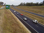
Westlink M7 - formerly Western Sydney Orbital - is one of Sydney, Australia's urban motorways and a part of Metroad 7
and the Sydney Orbital Network. It connects three Metroad
s: M5 at Prestons
, M4
at Eastern Creek
and M2
at Baulkham Hills
. It opened on 16 December 2005, eight months ahead of schedule.
By the late 1990s and first decade of the 21st century Western Sydney had become the third biggest producer of Australia
's GDP, after the Sydney CBD and Melbourne
. The growth of industrial and residential areas brought about a massive increase in traffic on its local roads. This led to the planning of the Western Sydney Orbital which, among its original purposes, was to serve the stillborn second international airport at Badgerys Creek
.
In January 2001 the federal government made a commitment to progressively contribute A$356 million to the M7 project, with the remaining A$1.5 billion required for the design and construction provided by the private sector. The NSW Minister for Planning authorised the undertaking in February 2002.
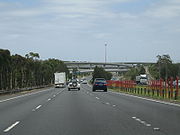
The M7 Motorway way privately funded through an innovative construction contract method known as a "deed" to facilitate the expedition of the tendering phase several deeds were draw up based on the contractors proposals. The deed was for the full design, construction, operation and maintenance of the motorway including more than 40 kilometres (24.9 mi) of continuously reinforced concrete (CRCP) and asphalt roads, upgrading of local roads, the longest free-flowing (no toll booths) toll road in the world at the time. More than 90 bridges (of four different types) and the largest shared path network in the southern hemisphere. The design, construct, operate and maintain contract worth at least A$2.0 billion was awarded to WSO (Western Sydney Orbital Pty Ltd) by the NSW Roads and Traffic Authority. The design and construct portion of the contract valued at AU$1.8 billion was awarded to a joint venture between ABI Group and Leighton Contractors (ALJV) with design work undertaken by a further joint venture by Maunsell Australia and SMEC (Snowy Mountains Electricity Company) with further subcontracting to other designers (Arup
) and independent verification by Sinclair Knight Merz
(SKM). The motorway was opened to traffic in 2005. WSO (commonly known as Westlink) operate the motorway with maintenance subcontracted to Westlink Services and tolling to ROAM. With its opening, Metroad 7
between Liverpool
and Beecroft
was transferred from Cumberland Highway to Westlink M7. Westlink M7 was the first Sydney motorway to be marked with the rectangular shield rather than the hexagonal
  shield.
On 25 December 2005, just 9 days after opening, the M7 suffered its first fatality: a 12-year old boy died at Cecil Park when the four-wheel drive he was travelling in rolled down an embankment and onto Elizabeth Drive, almost crushing another car.
 The M7 originates at the Roden Cutler Interchange, a Y-junction with the M5 South Western Motorway
at Prestons
http://www.parliament.nsw.gov.au/prod/parlment/HansArt.nsf/66662d17d79b79d7ca256cfd000e0c22/b06c1e29c5a7a061ca2572360007535b!OpenDocument, and weaves to the west of Liverpool
to the junction of Elizabeth Road and Wallgrove Road in Abbotsbury
. From then on it runs parallel to Wallgrove Road north towards the Great Western Highway
and the Light Horse interchange, a stack junction
with the M4
. Continuing north, it leads to Minchinbury and follows alongside Rooty Hill Road up to Dean Park
at an exit with Rooty Hill Road North and Richmond Road
. From this junction the M7 turns eastward through Quakers Hill
and Kings Langley
up to the interchange with Old Windsor Road
to Norwest Business Park
and continues southeast to reconcile with the existing M2 Hills Motorway
in Baulkham Hills
.
. It was named in honor of an Australian World War One formation, the Australian Light Horse.
.
Metroad 7
Metroad 7 is a Metroad in Sydney, New South Wales, Australia. Metroad 7 links the Hume Highway at Casula with the Pacific Highway and Pennant Hills Road at Wahroonga....
and the Sydney Orbital Network. It connects three Metroad
Metroad
Metroads are the primary road routes serving the Sydney and Brisbane metropolitan areas in Australia. The Metroads form a network of radial and circumferential routes throughout the city, lengths of some of which are of freeway grade.-History:...
s: M5 at Prestons
Prestons, New South Wales
Prestons is a suburb of Sydney in the state of New South Wales, Australia. Prestons is located 37 kilometres south-west of the Sydney central business district, in the local government area of the City of Liverpool.-History:...
, M4
Metroad 4
Metroad 4 is a Metroad in Sydney, New South Wales, Australia. It connects the inner-west of Sydney with the outer western suburbs. It mostly follows what was previously National Highway 32 from the Western Distributor in the CBD, west to the Great Western Highway at Lapstone...
at Eastern Creek
Eastern Creek, New South Wales
Eastern Creek is a suburb of Sydney, in the state of New South Wales, Australia. Eastern Creek is located 35 kilometres west of the Sydney central business district, in the local government area of the City of Blacktown and is part of the Greater Western Sydney region.Eastern Creek is west of the...
and M2
Metroad 2
Metroad 2 is a Metroad in Sydney, New South Wales, Australia. It links Windsor to Artarmon.-Route Information:* Extremities: Lane Cove Tunnel at Artarmon to Windsor* Approximate length: 53 km...
at Baulkham Hills
Baulkham Hills, New South Wales
Baulkham Hills is a suburb in the north-west of Sydney, in the state of New South Wales, Australia. Baulkham Hills is located 31 kilometres north-west of the Sydney central business district in the local government area of The Hills Shire...
. It opened on 16 December 2005, eight months ahead of schedule.
History
Western Sydney is the fastest growing part of the Sydney metropolitan area. The Ring Road 5 and State Route 55 - and later State Route 77 - originally meant to bypass Sydney, had instead become primary arteries for the western suburbs.By the late 1990s and first decade of the 21st century Western Sydney had become the third biggest producer of Australia
Australia
Australia , officially the Commonwealth of Australia, is a country in the Southern Hemisphere comprising the mainland of the Australian continent, the island of Tasmania, and numerous smaller islands in the Indian and Pacific Oceans. It is the world's sixth-largest country by total area...
's GDP, after the Sydney CBD and Melbourne
Melbourne
Melbourne is the capital and most populous city in the state of Victoria, and the second most populous city in Australia. The Melbourne City Centre is the hub of the greater metropolitan area and the Census statistical division—of which "Melbourne" is the common name. As of June 2009, the greater...
. The growth of industrial and residential areas brought about a massive increase in traffic on its local roads. This led to the planning of the Western Sydney Orbital which, among its original purposes, was to serve the stillborn second international airport at Badgerys Creek
Badgerys Creek, New South Wales
-People:According to the 2006 census taken by the Australian Bureau of Statistics, Badgerys Creek had a population of 721, an improvement on the 1996 figure but still less than half the number in 1981. Well over half the houses were being rented , largely because of the federal government's...
.
In January 2001 the federal government made a commitment to progressively contribute A$356 million to the M7 project, with the remaining A$1.5 billion required for the design and construction provided by the private sector. The NSW Minister for Planning authorised the undertaking in February 2002.
The M7 Motorway way privately funded through an innovative construction contract method known as a "deed" to facilitate the expedition of the tendering phase several deeds were draw up based on the contractors proposals. The deed was for the full design, construction, operation and maintenance of the motorway including more than 40 kilometres (24.9 mi) of continuously reinforced concrete (CRCP) and asphalt roads, upgrading of local roads, the longest free-flowing (no toll booths) toll road in the world at the time. More than 90 bridges (of four different types) and the largest shared path network in the southern hemisphere. The design, construct, operate and maintain contract worth at least A$2.0 billion was awarded to WSO (Western Sydney Orbital Pty Ltd) by the NSW Roads and Traffic Authority. The design and construct portion of the contract valued at AU$1.8 billion was awarded to a joint venture between ABI Group and Leighton Contractors (ALJV) with design work undertaken by a further joint venture by Maunsell Australia and SMEC (Snowy Mountains Electricity Company) with further subcontracting to other designers (Arup
Arup
Arup is a global professional services firm headquartered in London, United Kingdom which provides engineering, design, planning, project management and consulting services for all aspects of the built environment. The firm is present in Africa, the Americas, Australasia, East Asia, Europe and the...
) and independent verification by Sinclair Knight Merz
Sinclair Knight Merz
Sinclair Knight Merz is an engineering, sciences and project delivery firm. It is based in Australia with offices in Asia, South America, Europe, the Middle East, and New Zealand.-Overview:...
(SKM). The motorway was opened to traffic in 2005. WSO (commonly known as Westlink) operate the motorway with maintenance subcontracted to Westlink Services and tolling to ROAM. With its opening, Metroad 7
Metroad 7
Metroad 7 is a Metroad in Sydney, New South Wales, Australia. Metroad 7 links the Hume Highway at Casula with the Pacific Highway and Pennant Hills Road at Wahroonga....
between Liverpool
Liverpool, New South Wales
Liverpool is a suburb in south-western Sydney, in the state of New South Wales, Australia. Liverpool is located 32 km south-west of the Sydney central business district, and is the administrative centre of the local government area of the City of Liverpool...
and Beecroft
Beecroft, New South Wales
Beecroft is a suburb of northern Sydney, in the state of New South Wales, Australia. Beecroft is located 22 kilometres north-west of the Sydney central business district in the local government area of Hornsby Shire. Beecroft is considered to be in the Northern Suburbs of Sydney.- History :Beecroft...
was transferred from Cumberland Highway to Westlink M7. Westlink M7 was the first Sydney motorway to be marked with the
On 25 December 2005, just 9 days after opening, the M7 suffered its first fatality: a 12-year old boy died at Cecil Park when the four-wheel drive he was travelling in rolled down an embankment and onto Elizabeth Drive, almost crushing another car.
Route
M5 South Western Motorway
The M5 South Western Motorway is a privately operated tolled motorway in south-western Sydney, New South Wales, Australia. It forms part of Sydney Metroad 5 and the Sydney Orbital Network...
at Prestons
Prestons, New South Wales
Prestons is a suburb of Sydney in the state of New South Wales, Australia. Prestons is located 37 kilometres south-west of the Sydney central business district, in the local government area of the City of Liverpool.-History:...
http://www.parliament.nsw.gov.au/prod/parlment/HansArt.nsf/66662d17d79b79d7ca256cfd000e0c22/b06c1e29c5a7a061ca2572360007535b!OpenDocument, and weaves to the west of Liverpool
Liverpool, New South Wales
Liverpool is a suburb in south-western Sydney, in the state of New South Wales, Australia. Liverpool is located 32 km south-west of the Sydney central business district, and is the administrative centre of the local government area of the City of Liverpool...
to the junction of Elizabeth Road and Wallgrove Road in Abbotsbury
Abbotsbury, New South Wales
Abbotsbury is a suburb of Sydney, New South Wales, Australia. Abbotsbury is located 39 kilometres west of the Sydney central business district in the local government area of the City of Fairfield. Abbotsbury is part of the Greater Western Sydney region....
. From then on it runs parallel to Wallgrove Road north towards the Great Western Highway
Great Western Highway
The Great Western Highway is a highway in New South Wales, Australia. It runs 210 km from Sydney to Bathurst.Starting as Broadway at the intersection of City Road near the fringe of the Sydney CBD, and becoming Parramatta Road to Parramatta itself, the Great Western Highway heads due west from...
and the Light Horse interchange, a stack junction
Stack interchange
A stack interchange is a free-flowing grade separated junction between two roads.In countries where one drives on the right, left turns are handled by semi-directional flyover/under ramps...
with the M4
M4 Western Motorway
The M4 Western Motorway,, is a motorway in central Sydney, New South Wales, Australia...
. Continuing north, it leads to Minchinbury and follows alongside Rooty Hill Road up to Dean Park
Dean Park, New South Wales
Dean Park is a suburb of Sydney, in the state of New South Wales, Australia. Dean Park is located 43 kilometres west of the Sydney central business district, in the local government area of the City of Blacktown and is part of the Western Sydney region....
at an exit with Rooty Hill Road North and Richmond Road
Richmond Road, Sydney
Richmond Road is an arterial road in Sydney, Australia.It leads from Blacktown towards Richmond, passing through the suburbs of Woodcroft, Marayong, Doonside, Quakers Hill, Dean Park, Glendenning, Hassall Grove, Colebee, Marsden Park, Windsor Downs and Berkshire Park, until at the intersection with...
. From this junction the M7 turns eastward through Quakers Hill
Quakers Hill, New South Wales
Quakers Hill is a suburb of Sydney, in the state of New South Wales, Australia. Quakers Hill is located 40 kilometres west of the Sydney central business district, in the local government area of the City of Blacktown. Quakers Hill is part of the Greater Western Sydney...
and Kings Langley
Kings Langley, New South Wales
Kings Langley is a suburb of Sydney, in the state of New South Wales, Australia. Kings Langley is located 39 kilometres west of the Sydney central business district in the local government area of the City of Blacktown...
up to the interchange with Old Windsor Road
Metroad 2
Metroad 2 is a Metroad in Sydney, New South Wales, Australia. It links Windsor to Artarmon.-Route Information:* Extremities: Lane Cove Tunnel at Artarmon to Windsor* Approximate length: 53 km...
to Norwest Business Park
Norwest Business Park
The Norwest Business Park is a business park in the suburb of Bella Vista, New South Wales in Australia. Norwest Business is bordered by Windsor Road to the East, and Old Windsor Road to the West, with Norwest Boulevard stretching the length of the park between the two main arterial roads. It is...
and continues southeast to reconcile with the existing M2 Hills Motorway
M2 Hills Motorway
The M2 Hills Motorway is a motorway in north-western Sydney, New South Wales, Australia. It forms part of Sydney Metroad 2 and the 110 km Sydney Orbital Network. West of Pennant Hills Road, the M2 is also part of the National Highway.-History:Previously, Sydney's western suburbs were poorly served...
in Baulkham Hills
Baulkham Hills, New South Wales
Baulkham Hills is a suburb in the north-west of Sydney, in the state of New South Wales, Australia. Baulkham Hills is located 31 kilometres north-west of the Sydney central business district in the local government area of The Hills Shire...
.
Light Horse Interchange
The Light Horse Interchange is the junction of the M4 and M7 motorways. It is a stack interchangeStack interchange
A stack interchange is a free-flowing grade separated junction between two roads.In countries where one drives on the right, left turns are handled by semi-directional flyover/under ramps...
. It was named in honor of an Australian World War One formation, the Australian Light Horse.
Tolls
It was built as a fully tolled, gateless motorway employing electronic payment, the toll free period ending on 15 January 2006. The toll was originally 29.91 cents per kilometre, capped after 20 kilometres at $5.98, but on 1 April 2006, this increased to 30.07 cents per kilometre, capped after 20 kilometres at $6.01. Currently the toll is 35.60 cents per kilometre, capped at $7.12, being adjusted quarterly according to the CPIConsumer price index
A consumer price index measures changes in the price level of consumer goods and services purchased by households. The CPI, in the United States is defined by the Bureau of Labor Statistics as "a measure of the average change over time in the prices paid by urban consumers for a market basket of...
.
Exits and Interchanges
| WestLink |
|||
| Northbound exits | Distance to Brisbane (km) |
Distance to Melbourne (km) |
Southbound exits |
| End WestLink continues as Hills Motorway M2 Hills Motorway The M2 Hills Motorway is a motorway in north-western Sydney, New South Wales, Australia. It forms part of Sydney Metroad 2 and the 110 km Sydney Orbital Network. West of Pennant Hills Road, the M2 is also part of the National Highway.-History:Previously, Sydney's western suburbs were poorly served...  to Sydney Sydney Sydney is the most populous city in Australia and the state capital of New South Wales. Sydney is located on Australia's south-east coast of the Tasman Sea. As of June 2010, the greater metropolitan area had an approximate population of 4.6 million people... / Newcastle Newcastle, New South Wales The Newcastle metropolitan area is the second most populated area in the Australian state of New South Wales and includes most of the Newcastle and Lake Macquarie Local Government Areas... / Brisbane Brisbane Brisbane is the capital and most populous city in the Australian state of Queensland and the third most populous city in Australia. Brisbane's metropolitan area has a population of over 2 million, and the South East Queensland urban conurbation, centred around Brisbane, encompasses a population of... |
928 | 878 | Start WestLink from Hills Motorway M2 Hills Motorway The M2 Hills Motorway is a motorway in north-western Sydney, New South Wales, Australia. It forms part of Sydney Metroad 2 and the 110 km Sydney Orbital Network. West of Pennant Hills Road, the M2 is also part of the National Highway.-History:Previously, Sydney's western suburbs were poorly served... |
| no exit | 930 | 876 | Seven Hills Seven Hills, New South Wales Seven Hills is a suburb of Sydney, in the state of New South Wales, Australia. Seven Hills is located 34 kilometres west of the Sydney central business district in the local government area of the City of Blacktown. Seven Hills is part of the Greater Western Sydney region... , Windsor Windsor, New South Wales Windsor is a town in the state of New South Wales, Australia. Windsor is located in the local government area of the City of Hawkesbury. It sits on the Hawkesbury River, on the north-western outskirts of the Sydney metropolitan area. At the 2006 census, Windsor had a population of... Old Windsor Road |
| Bella Vista Bella Vista, New South Wales Bella Vista is a suburb of north-western Sydney, in the state of New South Wales, Australia. Bella Vista is located 33 kilometres west of the Sydney central business district, in the local government area of the The Hills Shire. Bella Vista is part of the Greater Western Sydney region and the Hills... , Castle Hill Castle Hill, New South Wales Castle Hill is a suburb in the north-west of Sydney, in the state of New South Wales, Australia. Castle Hill is located 31 kilometres north-west of the Sydney central business district, in the Hills District of the Greater Western Sydney region... Norwest Boulevard |
931 | 875 | no exit |
| Glenwood Glenwood, New South Wales Glenwood is a suburb of Sydney, in the state of New South Wales, Australia. Glenwood is located 40 kilometres west of the Sydney central business district in the local government area of the City of Blacktown... , Blacktown Blacktown, New South Wales Blacktown is a suburb in the City of Blacktown, in Western Sydney, in the state of New South Wales, Australia. Blacktown is located 34 kilometres west of the Sydney central business district and is the administrative centre of the local government area of City of Blacktown.Blacktown is the largest... Sunnyholt Road |
933 | 873 | Blacktown Blacktown, New South Wales Blacktown is a suburb in the City of Blacktown, in Western Sydney, in the state of New South Wales, Australia. Blacktown is located 34 kilometres west of the Sydney central business district and is the administrative centre of the local government area of City of Blacktown.Blacktown is the largest... , Glenwood Glenwood, New South Wales Glenwood is a suburb of Sydney, in the state of New South Wales, Australia. Glenwood is located 40 kilometres west of the Sydney central business district in the local government area of the City of Blacktown... Sunnyholt Road |
| no exit | 937 | 869 | Doonside Doonside, New South Wales Doonside is a suburb of Sydney, in the state of New South Wales, Australia. Doonside is located 40 kilometres west of the Sydney central business district, in the local government area of the City of Blacktown and is part of the Greater Western Sydney region. Featherdale Wildlife Park and the... , Quakers Hill Quakers Hill, New South Wales Quakers Hill is a suburb of Sydney, in the state of New South Wales, Australia. Quakers Hill is located 40 kilometres west of the Sydney central business district, in the local government area of the City of Blacktown. Quakers Hill is part of the Greater Western Sydney... Quakers Hill Parkway |
| Richmond Richmond, New South Wales Richmond is a town in New South Wales, north-west of Sydney, in the Local Government Area of the City of Hawkesbury. It is located at a latitude of 33° 35' 54" South and a longitude of 150°45' 04" east, 19 metres above sea level on the alluvial Hawkesbury River flats, at the foot of the Blue... , Blacktown Blacktown, New South Wales Blacktown is a suburb in the City of Blacktown, in Western Sydney, in the state of New South Wales, Australia. Blacktown is located 34 kilometres west of the Sydney central business district and is the administrative centre of the local government area of City of Blacktown.Blacktown is the largest... Richmond Road |
940 | 866 | Blacktown Blacktown, New South Wales Blacktown is a suburb in the City of Blacktown, in Western Sydney, in the state of New South Wales, Australia. Blacktown is located 34 kilometres west of the Sydney central business district and is the administrative centre of the local government area of City of Blacktown.Blacktown is the largest... , Richmond Richmond, New South Wales Richmond is a town in New South Wales, north-west of Sydney, in the Local Government Area of the City of Hawkesbury. It is located at a latitude of 33° 35' 54" South and a longitude of 150°45' 04" east, 19 metres above sea level on the alluvial Hawkesbury River flats, at the foot of the Blue... Richmond Road |
| Rooty Hill Rooty Hill, New South Wales Rooty Hill is a suburb of Sydney, in the state of New South Wales, Australia. Rooty Hill is located 42 kilometres west of the Sydney central business district, in the local government area of the City of Blacktown and is part of the Greater Western Sydney region.-History:Rooty Hill was named after... Rooty Hill Road North |
Rooty Hill Rooty Hill, New South Wales Rooty Hill is a suburb of Sydney, in the state of New South Wales, Australia. Rooty Hill is located 42 kilometres west of the Sydney central business district, in the local government area of the City of Blacktown and is part of the Greater Western Sydney region.-History:Rooty Hill was named after... Rooty Hill Road North |
||
| no exit | 942 | 864 | Woodcroft Woodcroft, New South Wales Woodcroft is a suburb of Sydney, in the state of New South Wales, Australia. Woodcroft is located 42 kilometres west of the Sydney central business district, in the local government area of the City of Blacktown and is part of the Greater Western Sydney region.... , Plumpton Plumpton, New South Wales Plumpton is a suburb of Sydney, in the state of New South Wales, Australia. Plumpton is located 46 kilometres west of the Sydney central business district, in the local government area of the City of Blacktown and is part of the Greater Western Sydney region.... Power Street |
| Rooty Hill Rooty Hill, New South Wales Rooty Hill is a suburb of Sydney, in the state of New South Wales, Australia. Rooty Hill is located 42 kilometres west of the Sydney central business district, in the local government area of the City of Blacktown and is part of the Greater Western Sydney region.-History:Rooty Hill was named after... , Glendenning Glendenning, New South Wales Glendenning is a suburb of Sydney, in the state of New South Wales, Australia. Glendenning is located 44 kilometres west of the Sydney central business district, in the local government area of the City of Blacktown and is part of the Greater Western Sydney region.-History:Glendenning was... Woodstock Avenue |
943 | 863 | no exit |
| no exit | 946 | 860 | Parramatta Parramatta, New South Wales Parramatta is a suburb of Sydney, in the state of New South Wales, Australia. It is located in Greater Western Sydney west of the Sydney central business district on the banks of the Parramatta River. Parramatta is the administrative seat of the Local Government Area of the City of Parramatta... , Penrith Penrith, New South Wales Penrith is a suburb in western Sydney, in the state of New South Wales, Australia. Penrith is located west of the Sydney central business district and is the administrative centre for the local government area of the City of Penrith... Great Western Highway Great Western Highway The Great Western Highway is a highway in New South Wales, Australia. It runs 210 km from Sydney to Bathurst.Starting as Broadway at the intersection of City Road near the fringe of the Sydney CBD, and becoming Parramatta Road to Parramatta itself, the Great Western Highway heads due west from...  |
| Lithgow Lithgow, New South Wales Lithgow is a city in the Central Tablelands of New South Wales, Australia and is the centre of the local political division City of Lithgow. It is located in a mountain valley named Lithgow's Valley by John Oxley in honour of William Lithgow, the first Auditor-General of New South Wales.Lithgow is... , Sydney Sydney Sydney is the most populous city in Australia and the state capital of New South Wales. Sydney is located on Australia's south-east coast of the Tasman Sea. As of June 2010, the greater metropolitan area had an approximate population of 4.6 million people... Western Motorway M4 Western Motorway The M4 Western Motorway,, is a motorway in central Sydney, New South Wales, Australia...  |
947 | 859 | Sydney Sydney Sydney is the most populous city in Australia and the state capital of New South Wales. Sydney is located on Australia's south-east coast of the Tasman Sea. As of June 2010, the greater metropolitan area had an approximate population of 4.6 million people... , Lithgow Lithgow, New South Wales Lithgow is a city in the Central Tablelands of New South Wales, Australia and is the centre of the local political division City of Lithgow. It is located in a mountain valley named Lithgow's Valley by John Oxley in honour of William Lithgow, the first Auditor-General of New South Wales.Lithgow is... Western Motorway M4 Western Motorway The M4 Western Motorway,, is a motorway in central Sydney, New South Wales, Australia... |
| Horsley Park Horsley Park, New South Wales Horsley Park is a suburb of Sydney in the state of New South Wales, Australia. Horsley Park is located 39 kilometres west of the Sydney central business district in the local government area of the City of Fairfield. Horsley Park is part of the Greater Western Sydney region... , Rooty Hill Rooty Hill, New South Wales Rooty Hill is a suburb of Sydney, in the state of New South Wales, Australia. Rooty Hill is located 42 kilometres west of the Sydney central business district, in the local government area of the City of Blacktown and is part of the Greater Western Sydney region.-History:Rooty Hill was named after... Wallgrove Road |
949 | 857 | Horsley Park Horsley Park, New South Wales Horsley Park is a suburb of Sydney in the state of New South Wales, Australia. Horsley Park is located 39 kilometres west of the Sydney central business district in the local government area of the City of Fairfield. Horsley Park is part of the Greater Western Sydney region... , Rooty Hill Rooty Hill, New South Wales Rooty Hill is a suburb of Sydney, in the state of New South Wales, Australia. Rooty Hill is located 42 kilometres west of the Sydney central business district, in the local government area of the City of Blacktown and is part of the Greater Western Sydney region.-History:Rooty Hill was named after... Wallgrove Road |
| Horsley Park Horsley Park, New South Wales Horsley Park is a suburb of Sydney in the state of New South Wales, Australia. Horsley Park is located 39 kilometres west of the Sydney central business district in the local government area of the City of Fairfield. Horsley Park is part of the Greater Western Sydney region... , Fairfield Fairfield, New South Wales Fairfield is a western suburb of Sydney, in the state of New South Wales, Australia. Fairfield is located 29 kilometres west of the Sydney central business district and is the administrative centre for the local government area of the City of Fairfield and is also partly in the local government... The Horsley Drive |
953 | 853 | Fairfield Fairfield, New South Wales Fairfield is a western suburb of Sydney, in the state of New South Wales, Australia. Fairfield is located 29 kilometres west of the Sydney central business district and is the administrative centre for the local government area of the City of Fairfield and is also partly in the local government... , Horsley Park Horsley Park, New South Wales Horsley Park is a suburb of Sydney in the state of New South Wales, Australia. Horsley Park is located 39 kilometres west of the Sydney central business district in the local government area of the City of Fairfield. Horsley Park is part of the Greater Western Sydney region... The Horsley Drive |
| Luddenham Luddenham, New South Wales Luddenham is a suburb of Sydney, in the state of New South Wales, Australia. Luddenham is located 42 kilometres west of the Sydney central business district, in the local government areas of the City of Penrith and City of Liverpool... , Liverpool Liverpool, New South Wales Liverpool is a suburb in south-western Sydney, in the state of New South Wales, Australia. Liverpool is located 32 km south-west of the Sydney central business district, and is the administrative centre of the local government area of the City of Liverpool... Elizabeth Drive |
958 | 848 | Liverpool Liverpool, New South Wales Liverpool is a suburb in south-western Sydney, in the state of New South Wales, Australia. Liverpool is located 32 km south-west of the Sydney central business district, and is the administrative centre of the local government area of the City of Liverpool... , Luddenham Luddenham, New South Wales Luddenham is a suburb of Sydney, in the state of New South Wales, Australia. Luddenham is located 42 kilometres west of the Sydney central business district, in the local government areas of the City of Penrith and City of Liverpool... Elizabeth Drive |
| Horningsea Park Horningsea Park, New South Wales Horningsea Park is a suburb of Sydney, in the state of New South Wales, Australia. Horningsea Park is located 39 kilometres south-west of the Sydney central business district, in the local government area of the City of Liverpool and is part of the Greater Western Sydney region.-History:In 1819,... , Cecil Hills Cecil Hills, New South Wales Cecil Hills is a suburb of Sydney, in the state of New South Wales, Australia. Cecil Hills is located 38 kilometres west of the Sydney central business district, in the local government area of the City of Liverpool and is part of the Greater Western Sydney region.-History:In 1817, John Wylde, the... Cowpasture Road |
964 | 842 | Cecil Hills Cecil Hills, New South Wales Cecil Hills is a suburb of Sydney, in the state of New South Wales, Australia. Cecil Hills is located 38 kilometres west of the Sydney central business district, in the local government area of the City of Liverpool and is part of the Greater Western Sydney region.-History:In 1817, John Wylde, the... , Horningsea Park Horningsea Park, New South Wales Horningsea Park is a suburb of Sydney, in the state of New South Wales, Australia. Horningsea Park is located 39 kilometres south-west of the Sydney central business district, in the local government area of the City of Liverpool and is part of the Greater Western Sydney region.-History:In 1819,... Cowpasture Road |
| Prestons Prestons, New South Wales Prestons is a suburb of Sydney in the state of New South Wales, Australia. Prestons is located 37 kilometres south-west of the Sydney central business district, in the local government area of the City of Liverpool.-History:... , Hinchinbrook Hinchinbrook, New South Wales Hinchinbrook is a suburb of Sydney in the state of New South Wales, Australia. Hinchinbrook is located 39 kilometres south-west of the Sydney central business district, in the local government area of the City of Liverpool. It is bordered by Hoxton Park and Green Valley.The main shopping precinct... Bernera Road |
966 | 840 | Hinchinbrook Hinchinbrook, New South Wales Hinchinbrook is a suburb of Sydney in the state of New South Wales, Australia. Hinchinbrook is located 39 kilometres south-west of the Sydney central business district, in the local government area of the City of Liverpool. It is bordered by Hoxton Park and Green Valley.The main shopping precinct... , Prestons Prestons, New South Wales Prestons is a suburb of Sydney in the state of New South Wales, Australia. Prestons is located 37 kilometres south-west of the Sydney central business district, in the local government area of the City of Liverpool.-History:... Bernera Road |
| Start WestLink continues from South Western Freeway Hume Highway The Hume Highway/Hume Freeway is one of Australia's major inter-city highways, running for 880 km between Sydney and Melbourne. It is part of the Auslink National Network and is a vital link for road freight to transport goods to and from the two cities as well as serving Albury-Wodonga and...  |
968 | 838 | Bankstown Bankstown, New South Wales Bankstown is a suburb of south-western Sydney, in the state of New South Wales, Australia. Bankstown is located 20 kilometres south-west of the Sydney central business district and is the administrative centre of the local government area of the City of Bankstown.-History:Prior to European... , Sydney Sydney Sydney is the most populous city in Australia and the state capital of New South Wales. Sydney is located on Australia's south-east coast of the Tasman Sea. As of June 2010, the greater metropolitan area had an approximate population of 4.6 million people... South Western Motorway M5 South Western Motorway The M5 South Western Motorway is a privately operated tolled motorway in south-western Sydney, New South Wales, Australia. It forms part of Sydney Metroad 5 and the Sydney Orbital Network...  |
| Liverpool Liverpool, New South Wales Liverpool is a suburb in south-western Sydney, in the state of New South Wales, Australia. Liverpool is located 32 km south-west of the Sydney central business district, and is the administrative centre of the local government area of the City of Liverpool... , Camden Camden, New South Wales -Education:Camden is the location of research facilities for the veterinary and agricultural schools of the University of Sydney. The local government area has two public high schools, Camden High School and Elderslie High School, as well as eight Catholic and three Anglican schools.-Culture:The... Camden Valley Way  |
|||
| End WestLink continues as South Western Freeway Hume Highway The Hume Highway/Hume Freeway is one of Australia's major inter-city highways, running for 880 km between Sydney and Melbourne. It is part of the Auslink National Network and is a vital link for road freight to transport goods to and from the two cities as well as serving Albury-Wodonga and... to Campbelltown Campbelltown, New South Wales Campbelltown is a suburb in south-western Sydney, in the state of New South Wales, Australia. Campbelltown is located 51 kilometres south-west of the Sydney central business district and is the administrative centre for the local government area of the City of Campbelltown.- History :Campbelltown... / Canberra Canberra Canberra is the capital city of Australia. With a population of over 345,000, it is Australia's largest inland city and the eighth-largest city overall. The city is located at the northern end of the Australian Capital Territory , south-west of Sydney, and north-east of Melbourne... / Melbourne Melbourne Melbourne is the capital and most populous city in the state of Victoria, and the second most populous city in Australia. The Melbourne City Centre is the hub of the greater metropolitan area and the Census statistical division—of which "Melbourne" is the common name. As of June 2009, the greater... |
|||