

A57 road
Encyclopedia
The A57 is a major road in England
. It runs east from Liverpool
to Lincoln, via Warrington
, Cadishead
, Irlam
, Patricroft
, Eccles
, Salford and Manchester
, then through the Pennines
over the Snake Pass
(between the high moor lands of Bleaklow
and Kinder Scout
), around the Ladybower Reservoir
, through Sheffield
and past Worksop
. Within Manchester a short stretch becomes the A57(M) motorway
(the Mancunian Way).
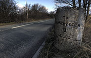
The 3 miles (4.8 km) £4 million Aston relief road in Sheffield
opened in mid-1985, with the old route now designated as the B6200.
, as a one way system of James Street, Castle Street and Water Street. It forms the east-west route through the north of the city centre with another one-way road system as Tithebarn Street (passing part of JMU
), Great Crosshall Street and Churchill Way in the east direction and Churchill Way and Dale Street in the west direction. The connecting roads Moorfields and Hatton Garden are also part of the A57, which join the east and west directions. In both directions, Churchill Way crosses the A59
near the entrance of the Queensway Tunnel
. It overlaps briefly with the A580
as Islington, separated as two one-way roads, then becomes Prescot Street, passing the Royal Liverpool University Hospital
. At the junction with the B5340, it becomes Kensington, meeting the A5089 to the south and B5188 to the north, becoming Prescot Road. It crosses a railway at Fairfield
passing St Anne's Church on the left near the Stanley pub, overlapping with the B5189 Green Lane to the north. It meets the A5047 to the south near a Tesco
and the B5189 at Old Swan
. At the junction with the A5058
Queens Drive it enters Knotty Ash
(with Alder Hey Children's Hospital
to the north), becoming East Prescot Road and a trunk road. There is a roundabout and it enters Dovecot
before it passes through Huyton
. It meets the A526 Seth Powell Way to the north (for the M57
), becoming Liverpool Road, At junction two of the M57, it meets the B5194 Knowsley Lane to the north and B5199 Huyton Lane to the south, and the start of the A58
. It passes through Prescot
as the non-trunk Derby Street then High Street. It meets the A58 again and becomes a trunk road, then meets the B5200 (former route of the A57) at a roundabout, becoming Warrington Road. It crosses the Liverpool to Wigan Line
near Scotchbarn Leisure Centre. It meets the B5201 to the north opposite Whiston
Hospital. It passes through Rainhill
passes meeting the B5413 near the railway station
. It passes Rainhill High School to the left, then St Bartholomew RC Primary School. At junction 7 of the M62
, it meets the A557 (for Widnes
) and the St Helens Linkway A570
(for St Helens
). The road runs along the road from junction 7 for about 1 miles (1.6 km), then it meets the B5419 at crossroads, and the A569 to the left at Bold Heath
near the Griffin Inn. At Lingley Green http://www.geograph.org.uk/photo/21651 it enters as Liverpool Road, passing the Trigger Pond pub on the left. It crosses the Liverpool to Manchester Line (southern route)
. At Great Sankey
, it becomes a dual-carriageway and meets the A562 at a roundabout.
 The original route through Warrington town centre included the narrow Sankey Street, which required special narrow buses to be operated. The road now bypasses Warrington town centre via a new elevated road, Midland Way, before emerging at a roundabout junction with the A49
. The road loses its trunk road status and becomes School Brow. Warrington Parish Church, St Elphin, is to the right, near the right turn for Church Street. The road becomes Manchester Road, and meets the A50
at crossroads. It passes through Bruche
, home of a former police training centre
, and its running track. At Paddington, the road becomes dual-carriageway as New Manchester Road, passing close to Woolston Community High School. In Woolston, it becomes Manchester Road. It passes a 40 mph (17.9 m/s) speed camera near Woolston Leisure Cenmtre and enters Martinscroft
. At junction 21 of the M6
, it becomes a trunk road and meets the B5210 Woolston Grange Avenue at a roundabout, then passes the Mascrat Manor at another roundabout. It traverses Rixton Moss, passing Ramswood Nurseries. It passes briefly through Rixton, with a right turn for Warburton
over the Warburton toll bridge, and becomes dual-carriageway at Hollins Green
. At the end of the dual-carriageway is a left turn for the B5212 for Glazebrook
and its railway station
, and then it crosses Glaze Brook as Liverpool Road, entering the metropolitan district of Salford
.
There is a new roundabout with the former road through Cadishead
, and a new section of the A57 follows the Manchester Ship Canal
. The former route is partly the B5417 (and the B5320 is an earlier route), continuing as Liverpool Road. The £11.3 million Cadishead Way opened on 16 September 2005. It meets the B5417 at a roundabout near Northbank Industrial Estate. It passes under the railway near the junction of the River Mersey and Manchester Ship Canal, and there is a left turn for the B5311. There is a new roundabout next to Irlam Locks and the Boat House pub and another with the B5320 at the end of the Cadishead Way, which bypasses Irlam
. Entering Eccles
as Liverpool Road, it passes Boysnope Park Golf Club on Barton Moss, where the road becomes dual-carriageway. It passes the City Airport Manchester on the left (AKA Barton Aerodrome before March 2007). At Peel Green
, it meets the M60
at junction 11, with the Barton High Level Bridge and Barton-upon-Irwell
close by to the south.
Soon after this junction the road enters Patricroft
and is no longer a trunk road, passing the Unicorn pub. It meets the B5211 at crossroads (Patricroft Bridge) and crosses the Bridgewater Canal
, then there is a left turn for the B5231 (Green Lane) towards Patricroft railway station
and Monton
. Before long it enters the centre of Eccles proper, splitting into two as Church Street and Irwell Place going east, passing the library and a Morrisons
, and Corporation Road going west. It meets a roundabout near the Eccles
terminus of the Manchester Metrolink
. It becomes the dual-carriageway Bentcliffe Way, meeting the A576 (for Trafford Park
. It leaves the A576 near junction 2 of the M602
, heading east as the single-carriageway Eccles New Road. It passes the Ladywell
station on the right and meets the A5185 to the left. The Metrolink folloews the road on the right hand side. There is the B5228 to the left near the Weaste
station. In Weaste
, there is the Langworthy
station near the A5186 left turn where the Metrolink leaves the road to the south. The road runs parallel to the M602 100m to the north.
The road becomes the trunk road dual carriageway Regent Road at the junction with the terminus of the M602 and the A5063 (Albion Way north for the A6, and Trafford Road south for Salford Quays
). It is now the main route into Manchester from the west, meeting the A5066 at crossroads, passes a Sainsbury's on the left, then meets the B5461 and crosses the River Irwell
where it enters the city of Manchester. There is a left turn for the A6143 Water Street (for Castlefield
) and it becomes Dawson Street, is crossed by the Metrolink (for Altrincham
), passes over the Bridgewater Canal and Cheshire Ring
, then becomes Egerton Street. It runs into the A57(M)
- the Mancunian Way at the GSJ
with the A56
Bridgewater Way. The Beetham Tower Manchester
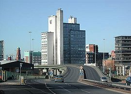
is seen nearby to the left.
 It leaves the A57(M) at the A6 exit and follows Downing Street, and Ardwick Green South, passing through Brunswick and the Ardwick Green Barracks of the King's and Cheshire Regiment
. The A6 leaves at a roundabout, and the road temporarily loses its trunk status. At the Ellen Wilkinson High School, it meets the A665, and becomes a trunk road as Hyde Road. It crosses under a railway and meets the A6010 at crossroads. It passes through Belle Vue, meets the B6178 (for Levenshulme
), crosses a railway near the Belle Vue railway station
, entering Gorton
. It meets the B6167 (for North Reddish
). It enters the borough of Tameside
, becoming the dual-carriageway Manchester Road.
It meets the M60
at junction 24, and divides into two east and west routes next to Denton railway station
on the left and a Sainsbury's on the right, either side of the M67
. They meet and the road loses its trunk status, entering Denton
, passing the Christ Church Denton on the right. It meets the A6017 at crossroads, becoming Hyde Road with a Morrisons
on the right. It meets junction 2 of the M67, which follows the road, near the church of St Anne and crosses the River Tame
, becoming Manchester Road. It crosses the Peak Forest Canal
and goes under the Hope Valley Line
near Hyde Central railway station
. The A627 overlaps and there it meets junction 3 of the M67 with an Asda
on the right as it passes through Hyde
as Market Street and Union Street and passes Tameside College
on the right. It leaves the A627 to the right as Mottram
Road, with a Morrisons
on the left next to the M67, entering Godley and passing under the Glossop Line near Godley railway station
and Godley Reservoir. It passes through Hattersley
, and mets the final junction of the M67 - junction 4 - at a roundabout with the dual-carriageway A560
(for Stockport
).
It resumes its trunk road status as Hyde Road, passing through Mottram in Longdendale
, where there are crossroads at traffic lights with the B6174. Leaving Mottram, it meets the A6018 to the left (from Stalybridge
) at traffic lights. It becomes Mottram Moor and at the next junction, it leaves to the right, with the A628
continuing straight on. It loses trunk road status and becomes Woolley Lane, passing through part of Hollingworth
. It crosses the River Etherow
, entering Derbyshire
and the High Peak district. It enters Brookfield and meets the A626 (for Marple
) from the right. It passes under the Glossop Line, at the Dinting viaduct, again near Dinting railway station
as it passes through Dinting
and the primary school. The A6016 leaves to the right and the road enters Glossop
as High Street West passing a Tesco
on the left. It meets the A624 (for Hayfield
) and the B6105 at crossroads in the middle of the town, near the railway station
. It becomes High Street East, passing Glossop Leisure Centre on the right. There is a roundabout and it becomes Sheffield Road, then Woodcock Road as it leaves Glossop and enters the Peak District National Park
(Dark Peak
). There is a sharp bend to the right and it becomes Snake Pass
.
It climbs up Holden Clough and at Featherbed Moss, it is crossed by the Pennine Way
at the summit at 1550 ft, with the hills of Bleaklow
to the left and Kinder Scout
to the right. Here it enters the National Trust
's High Peak Estate
. It passes the Doctor's Gate and follows the Lady Clough valley downhill to a point where Lady Clough meets the River Ashop, passing the Snake Pass Inn on the left. It follows the River Ashop
closely to the north in the Woodlands Valley for about 4 miles (6.4 km), and leaves the High Peak Estate. It crosses the River Alport
. It crosses Ladybower Reservoir
at Ashopton Bridge. It meets the A6013 (for Bamford) and passes the Ladybower Inn. It climbs the valley and passes over Cutthroat Bridge. It is at about 1200 ft as it enters South Yorkshire
and the city of Sheffield
. It follows down the hill as Manchester Road past Hollow Meadows.
Following the hill down into Sheffield, it passes the New Norfolk Arms on the left, with the Rivelin Dams
on the right with the Rivelin Rocks
high on the left, and leaves the Peak District National Park. At the Rivelin Mill Bridge it crosses the River Rivelin
and the A6101 leaves to the left. It passes the Bell Hagg Inn on the left, then the Sportsman in Crosspool
. It enters Tapton Hill and passes the Lydgate Junior School and Tapton School. It meets Fulwood Road in Broomhill. The B6069 leaves to the right, and it becomes Whitham Road.
It passes Weston Hospital and as Western Bank, it passes Sheffield Children's Hospital
then the Octagon Centre
on the right and becomes the dual-carriageway Brook Hill, passing straight through the University of Sheffield
with its Arts Tower
and Alfred Denny Building
seen to the left, and the Hicks Building
seen to the right. It becomes Broad Lane in Netherthorpe
, passing the former Jessop Hospital
and then St George's Church
in Portobello (now part of Sheffield University). At a roundabout it passes the City Plaza, becoming Tenter Street then Westbar Green. It becomes West Bar, passing the Law Courts on the left, then the police
headquarters and Castle Market
on the right as Bridge Street. It passes close to the River Don on Castlegate, becoming Exchange Place. It becomes the Sheffield Parkway
(built in 1974), Sheffield's main route to the M1
, meeting a roundabout.
. At Bowden Housteads Woods
, it leaves to the right at a GSJ, passing Athelstan Primary School becoming single-carriageway (three lanes). It passes the City School
in Richmond
and meets the B6064 at a roundabout, being followed by the Trans Pennine Trail
. It passes Hackenthorpe and meets the B6053 (for Crystal Peaks
) at a roundabout, becoming a short section of dual-carriageway until another nearby roundabout at Beighton
. It crosses the River Rother
, entering the borough of Rotherham
, and meets a roundabout.
It crosses the Sheffield to Lincoln Line
and at the roundabout at Swallownest with the former route (B6200) turns right onto Aston Way. At Aston
, it meets the A618 from the left, then the A618 leaves to the right at the next roundabout. The Aston Relief Road ends where it meets the M1
at junction 31, just after the junction for the former route (B6067). It becomes the dual-carriageway Worksop Road, and now the level of traffic increases as it is a major east-west route. It becomes single-carriageway and meets the B6463 from the left, near Todwick
and Red Lion Inn. At South Anston
, it meets the B6059 at the Shell
Worksop Road station. It crosses a railway and Lindrick Common near Woodsetts
.
Southern Bypass opened in May 1986. It starts at the roundabout with the B6041 (for Gateford
and the former route through Worksop). The next short section is dual-carriageway to the Shireoaks
roundabout, which also has access to the Gateford and Dukeries industrial estates. It becomes single-carriageway and crosses the Sheffield to Lincoln Line
, at the junction with the Robin Hood Line
, and over the Chesterfield Canal
. It meets the A60 (for Worksop) at the Rhodesia Roundabout, near Rhodesia
, a Sainsbury's and a McDonald's
. The next short section, overlapping with the A60 and crossing the River Ryton
, is dual-carriageway to the roundabout with the A60 (for Mansfield
) and B6024, near the Total
Dukeries Garage and the Worksop Little Chef
. From here, it is single carriageway (excluding the A1 section). There is a roundabout with the B6034 (for Ollerton
) near Worksop College
and Portland School.
It passes the former site of Manton Colliery
, and a large B & Q depot on the left. There is a roundabout with the B6040 (former route through Worksop), which has access to Manton Wood Enterprise Zone. It passes a large Wilkinson's
depot on the left and goes through Clumber Park
. It meets the A1 at the Apleyhead Junction, with the A614
, also known as Five Lanes End. The former roundabout was grade-separated in November 2007. Via the A1, it passes Elkesley
(on the former route) with two 50 mph speed cameras and the Retford Gamston Airport
, where it crosses the River Idle
. Prior to the A1(M) Doncaster
bypass opening in August 1961, this section of the road was the A57 - the A1 (now A638) went straight through Retford. Near to West Drayton it crosses the River Maun
; this section shared with the A1 was dualled in the lated 1950s, and the West Drayton Diversion was a completely new section, with the bridge over the Maun and Markham Moor roundabout, and opened in February 1957. At the next roundabout with the A638
(for Retford
) and B1164 (for West Markham) at Markham Moor
(again being grade-separated) there is the Markham Hotel and two Little Chef
s, including one designed by Sam Scorer
with a hyperbolic paraboloid-shaped roof that was destined to be demolished. The Markham Hotel is currently situated on the former pre-1957 route, 330 yards to the north, and there are two large Markham Moor Shell
stations. It leaves up the steep Cliff Gate to the left, which now has a crawler lane
over Beacon Hill. It bypasses East Markham
(on the former route to the south), and crosses the East Coast Main Line
. 550 yards east of the village it resumes its former route. It meets the A6075 (for Tuxford
and Ollerton) from the right west of Darlton
where it passes St Giles' Church. There are turns for East Drayton
to the left and Ragnall
on the right, and the power stations of Cottam
and (former) High Marnham are to the north and south, with many lines of pylons following the Trent.
It goes through Dunham on Trent
, where it passes the White Swan, Bridge Inn and St Oswald's Church; the width of road through the village is not suited for the volume of traffic. It crosses the River Trent
at Dunham Bridge
(toll
, rebuilt in the mid-1970s), where there are queues, entering Lincolnshire
and the district of West Lindsey
as Dunham Road. The Trent Valley Way joins at Dunham and leaves to the south at the other end of the bridge. It meets the A1133 (for Gainsborough
) at a staggered junction at Newton on Trent
; the former route of both routed went through the village along High Street - 330 yards east of the junction it resumes the former route (Southmoor Road further to the south). On entering the parish (but not the village) of Kettlethorpe
the road formerly followed the turn for Thorney (in Nottinghamshire) to the right, and then further to the south, with the new section of road resuming the old route close where it crosses Darnsdyke. The road follows the boundary of Lincolnshire and Nottinghamshire
for about 2 miles (3.2 km), and this section of Lincolnshire encloses former parishes in Nottinghamshire. The (Roman) Fossdyke Navigation runs alongside from the junction with the A156
; the road becomes Gainsborough Road passing Drinsey Nook, with the A156 taking priority from the left (north) at the traffic-light-controlled junction. On the bend at Drinsey Nook, the road briefly re-enters Nottinghamshire - the Fossdyke is the boundary. At the junction with the B1190 at Tom Otter's Bridge, the boundary follows the B1190 to the south, along Ox Pasture Drain. It enters Saxilby
, passing the BP
Lincolnshire Co-operative Otter's Bridge Service Station and a similarly named Total service station. The Bridge Inn is on the left, with a turn for Broadholme
(former Nottinghamshire) to the right. It crosses the Sheffield to Lincoln Line
and Fossdyke, meeting the B1241, for Sturton by Stow
.
It crosses the River Till
as Lincoln Road; a former section of the road from here passed closer to Odder Farm to the north. There is a roundabout, where the road rejoins the old route, for Burton
, and Burton Waters Marina, then the road enters the borough of Lincoln at the bend in the road to the left before Bishop Bridge (over Catchwater Drain and Main Drain) and meets the A46
Lincoln Bypass at a roundabout. It enters Lincoln as Carholme Road passing the Total
Winning Post Service Station, with Carholme Golf Club to the right, then meets the B1273 Lincoln inner ring road, becoming Newland, where it passes the offices of Lincolnshire County Council on the left. It follows the dual-carriageway Wigford Way next to Brayford Pool
and the University of Lincoln
, over the River Witham
, where it meets the B1262 High Street. It becomes St Mary's Street and passes the railway station on the right. It splits into Oxford Street, Pelham Street and Norman Street where it meets the A15 at Pelham Bridge, close to the large Siemens
engineering company.
Although the terminus of the road is in Lincoln, most of the A57 follows the former Liverpool-Skegness trunk road, created by the 1946 Trunk Roads Act. The road from Lincoln to Skegness was formerly also known as the A157.
England
England is a country that is part of the United Kingdom. It shares land borders with Scotland to the north and Wales to the west; the Irish Sea is to the north west, the Celtic Sea to the south west, with the North Sea to the east and the English Channel to the south separating it from continental...
. It runs east from Liverpool
Liverpool
Liverpool is a city and metropolitan borough of Merseyside, England, along the eastern side of the Mersey Estuary. It was founded as a borough in 1207 and was granted city status in 1880...
to Lincoln, via Warrington
Warrington
Warrington is a town, borough and unitary authority area of Cheshire, England. It stands on the banks of the River Mersey, which is tidal to the west of the weir at Howley. It lies 16 miles east of Liverpool, 19 miles west of Manchester and 8 miles south of St Helens...
, Cadishead
Cadishead
Cadishead is a suburban town within the City of Salford, in Greater Manchester, England. Historically a part of Lancashire, Cadishead is the most southwesterly settlement in the city of Salford.-History:...
, Irlam
Irlam
Irlam is a suburban town and unparished area within the City of Salford in Greater Manchester, England. At the 2001 census it had a population of 18,504. The town lies on flat ground on the south side of the M62 motorway and the north bank of the Manchester Ship Canal, and is west-southwest of...
, Patricroft
Patricroft
Patricroft is a district of Eccles, England, within the historic county boundaries of Lancashire.-History:Patricroft may derive its name from 'Pear-tree croft', or more likely, 'Patrick's Croft'. In 1836, James Nasmyth, in partnership with Holbrook Gaskell, built the Bridgewater Foundry in...
, Eccles
Eccles, Greater Manchester
Eccles is a town in the City of Salford, a metropolitan borough of Greater Manchester in North West England, west of Salford and west of Manchester city centre...
, Salford and Manchester
Manchester
Manchester is a city and metropolitan borough in Greater Manchester, England. According to the Office for National Statistics, the 2010 mid-year population estimate for Manchester was 498,800. Manchester lies within one of the UK's largest metropolitan areas, the metropolitan county of Greater...
, then through the Pennines
Pennines
The Pennines are a low-rising mountain range, separating the North West of England from Yorkshire and the North East.Often described as the "backbone of England", they form a more-or-less continuous range stretching from the Peak District in Derbyshire, around the northern and eastern edges of...
over the Snake Pass
Snake Pass
The Snake Pass is the name given to the remote, higher reaches of the A57 road where it crosses the Peak District between Manchester and Sheffield in the north of England...
(between the high moor lands of Bleaklow
Bleaklow
Bleaklow is a high, largely peat covered, gritstone moorland, just north of Kinder Scout, across the Snake Pass , in the Derbyshire High Peak near the town of Glossop...
and Kinder Scout
Kinder Scout
Kinder Scout is a moorland plateau in the Dark Peak of the Derbyshire Peak District in England. Part of the moor, at 636 m above sea level, is the highest point in the Peak District, the highest point in Derbyshire, and the highest point in the East Midlands. It is accessible from the villages of...
), around the Ladybower Reservoir
Ladybower Reservoir
Ladybower Reservoir is a large Y-shaped reservoir, the lowest of three in the Upper Derwent Valley in Derbyshire, England. The River Ashop flows into the reservoir from the west; the River Derwent flows south, initially through Howden Reservoir, then Derwent Reservoir, and finally through Ladybower...
, through Sheffield
Sheffield
Sheffield is a city and metropolitan borough of South Yorkshire, England. Its name derives from the River Sheaf, which runs through the city. Historically a part of the West Riding of Yorkshire, and with some of its southern suburbs annexed from Derbyshire, the city has grown from its largely...
and past Worksop
Worksop
Worksop is the largest town in the Bassetlaw district of Nottinghamshire, England on the River Ryton at the northern edge of Sherwood Forest. It is about east-south-east of the City of Sheffield and its population is estimated to be 39,800...
. Within Manchester a short stretch becomes the A57(M) motorway
A57(M) motorway
The Mancunian Way, officially the A57, is a two mile long motorway in Manchester, England. It is part of the A57, which runs east-west through Greater Manchester and links the M602 and M67 motorways.-Route:...
(the Mancunian Way).
The 3 miles (4.8 km) £4 million Aston relief road in Sheffield
Sheffield
Sheffield is a city and metropolitan borough of South Yorkshire, England. Its name derives from the River Sheaf, which runs through the city. Historically a part of the West Riding of Yorkshire, and with some of its southern suburbs annexed from Derbyshire, the city has grown from its largely...
opened in mid-1985, with the old route now designated as the B6200.
Liverpool - Warrington
It begins at the A5036 the Strand Goree near the River MerseyRiver Mersey
The River Mersey is a river in North West England. It is around long, stretching from Stockport, Greater Manchester, and ending at Liverpool Bay, Merseyside. For centuries, it formed part of the ancient county divide between Lancashire and Cheshire....
, as a one way system of James Street, Castle Street and Water Street. It forms the east-west route through the north of the city centre with another one-way road system as Tithebarn Street (passing part of JMU
Liverpool John Moores University
Liverpool John Moores University is a British 'modern' university located in the city of Liverpool, England. The university is named after John Moores and was previously called Liverpool Mechanics' School of Arts and later Liverpool Polytechnic before gaining university status in 1992, thus...
), Great Crosshall Street and Churchill Way in the east direction and Churchill Way and Dale Street in the west direction. The connecting roads Moorfields and Hatton Garden are also part of the A57, which join the east and west directions. In both directions, Churchill Way crosses the A59
A59 road
The A59 is a major road in the United Kingdom that runs from Liverpool in Merseyside, to York in North Yorkshire.-Merseyside:The A59 begins in the centre of Liverpool at the mouth of the Birkenhead Tunnel, and heads north out of the city, first as Scotland Road in Vauxhall, then Kirkdale Road,...
near the entrance of the Queensway Tunnel
Queensway Tunnel
The Queensway Tunnel is a road tunnel under the River Mersey, in the north west of England, between Liverpool and Birkenhead. It is often called the Birkenhead Tunnel, to distinguish it from the Kingsway Tunnel, which serves Wallasey.-History:...
. It overlaps briefly with the A580
A580 road
The A580 is a primary A road in England that connects Walton, near Liverpool and Salford, near Manchester and known officially as Liverpool-East Lancashire Road. Locally, the road is shortened to the "East Lancs". The road was designed and built to provide better access to the Port of Liverpool for...
as Islington, separated as two one-way roads, then becomes Prescot Street, passing the Royal Liverpool University Hospital
Royal Liverpool University Hospital
The Royal Liverpool University Hospital is a large teaching hospital in Liverpool, England. Along with Broadgreen Hospital, the hospital operates on behalf of the Royal Liverpool and Broadgreen University Hospital NHS Trust and is associated with the University of Liverpool and Liverpool John...
. At the junction with the B5340, it becomes Kensington, meeting the A5089 to the south and B5188 to the north, becoming Prescot Road. It crosses a railway at Fairfield
Fairfield, Liverpool
Fairfield is an area of Liverpool, in Merseyside, England, encompassing streets between Tuebrook and Kensington and stretching to Old Swan. It consists of a variety of houses; there are some traditional red-brick terraces, larger Victorian villas and also the notable and rather wonderful 300...
passing St Anne's Church on the left near the Stanley pub, overlapping with the B5189 Green Lane to the north. It meets the A5047 to the south near a Tesco
Tesco
Tesco plc is a global grocery and general merchandise retailer headquartered in Cheshunt, United Kingdom. It is the third-largest retailer in the world measured by revenues and the second-largest measured by profits...
and the B5189 at Old Swan
Old Swan
Old Swan is an inner-city area of Liverpool, Merseyside, England and a Liverpool City Council Ward. It is located fairly centrally in the city, bordered by Stoneycroft, Broadgreen, Fairfield and Wavertree...
. At the junction with the A5058
A5058 road
The A5058 road, known as Queens Drive for much of its length, is a major ring road in Liverpool. It is that part of the A5058 that connects Breeze Hill in Bootle, at the intersection with the A59, with Aigburth Vale in Allerton. The road was designed by civil engineer John Alexander...
Queens Drive it enters Knotty Ash
Knotty Ash
Knotty Ash is an area of Liverpool, Merseyside, England and a Liverpool City Council Ward. Historically within Lancashire, at the 2001 Census, the population was 13,200.-Description:...
(with Alder Hey Children's Hospital
Alder Hey Children's Hospital
Alder Hey Children Hospital is a children's hospital in West Derby, Liverpool. It is run by the Alder Hey Children's NHS Foundation Trust as part of the National Health Service in England...
to the north), becoming East Prescot Road and a trunk road. There is a roundabout and it enters Dovecot
Dovecot, Merseyside
Dovecot is a district of Liverpool, Merseyside, England. It is situated to the east of the city, bordered by Knotty Ash, West Derby, Broadgreen and to the east, Roby...
before it passes through Huyton
Huyton
Huyton is a suburb of Liverpool within the Metropolitan Borough of Knowsley, with some parts belonging to the borough of Liverpool in Merseyside, England. It is part of the Liverpool Urban Area and has close associations with its neighbour, Roby, having both formerly been part of the Huyton with...
. It meets the A526 Seth Powell Way to the north (for the M57
M57 motorway
The M57 motorway, also known as the Liverpool Outer Ring Road, is a road in England. Designed as a bypass road for Liverpool, it is long and links various towns east of the city, as well as the M62 and M58 motorways.-Route:...
), becoming Liverpool Road, At junction two of the M57, it meets the B5194 Knowsley Lane to the north and B5199 Huyton Lane to the south, and the start of the A58
A58 road
The A58 is a major road in northern England that runs between Prescot, Merseyside and Wetherby, West Yorkshire.It runs north east from Prescot on the outskirts of Liverpool via St Helens, Ashton-in-Makerfield, Hindley, Westhoughton, Bolton, Bury, Heywood, Rochdale and Littleborough then over the...
. It passes through Prescot
Prescot
Prescot is a town and civil parish, within the Metropolitan Borough of Knowsley in Merseyside, England. It is 8 miles to the east of Liverpool city centre and lies within the historic boundaries of Lancashire. At the 2001 Census, the population was 11,184 .Prescot marks the beginning of the...
as the non-trunk Derby Street then High Street. It meets the A58 again and becomes a trunk road, then meets the B5200 (former route of the A57) at a roundabout, becoming Warrington Road. It crosses the Liverpool to Wigan Line
Liverpool to Wigan Line
The Liverpool to Wigan Line is a railway line in the north-west of England, running between Liverpool Lime Street and Wigan North Western via St Helens Central.-Description:...
near Scotchbarn Leisure Centre. It meets the B5201 to the north opposite Whiston
Whiston, Merseyside
Whiston is a large village and civil parish within the Metropolitan Borough of Knowsley on Merseyside, England. At the 2001 Census the population was recorded as 13,629...
Hospital. It passes through Rainhill
Rainhill
Rainhill is a large village and civil parish of the Metropolitan Borough of St Helens, in Merseyside, England.Historically a part of Lancashire, Rainhill was formerly a township within the ecclesiastical parish of Prescot, and hundred of West Derby...
passes meeting the B5413 near the railway station
Rainhill railway station
Rainhill railway station serves the district of Rainhill in Merseyside, England. It is situated on the northern route of the Liverpool to Manchester Line, forming part of the Liverpool City Line. The original Liverpool and Manchester Railway which opened in 1830...
. It passes Rainhill High School to the left, then St Bartholomew RC Primary School. At junction 7 of the M62
M62 motorway
The M62 motorway is a west–east trans-Pennine motorway in Northern England, connecting the cities of Liverpool and Hull via Manchester and Leeds. The road also forms part of the unsigned Euroroutes E20 and E22...
, it meets the A557 (for Widnes
Widnes
Widnes is an industrial town within the borough of Halton, in Cheshire, England, with an urban area population of 57,663 in 2004. It is located on the northern bank of the River Mersey where the estuary narrows to form the Runcorn Gap. Directly to the south across the Mersey is the town of Runcorn...
) and the St Helens Linkway A570
A570 road
The A570 is a primary route in northern England, that runs from St Helens to Southport. The road begins at junction 7 of the M62 motorway in Merseyside, and runs in a northerly direction as a dual carriageway through the centre of St Helens, meeting the A58 road, then the A580 road to the north of...
(for St Helens
St Helens, Merseyside
St Helens is a large town in Merseyside, England. It is the largest settlement and administrative centre of the Metropolitan Borough of St Helens with a population of just over 100,000, part of an urban area with a total population of 176,843 at the time of the 2001 Census...
). The road runs along the road from junction 7 for about 1 miles (1.6 km), then it meets the B5419 at crossroads, and the A569 to the left at Bold Heath
Bold, Merseyside
Bold is a civil parish in the Metropolitan Borough of St Helens in Merseyside, England. Bold itself is situated to the south east of St Helens, near to the boundaries with Halton and Warrington in Cheshire. The parish extends southwards beyond the M62 motorway and includes the hamlet of Bold Heath...
near the Griffin Inn. At Lingley Green http://www.geograph.org.uk/photo/21651 it enters as Liverpool Road, passing the Trigger Pond pub on the left. It crosses the Liverpool to Manchester Line (southern route)
Liverpool to Manchester Lines
There are two Liverpool to Manchester railway lines between the cities of Liverpool and Manchester in the North West of England. The 'Northern Route' via and to either or follows the route of the original Liverpool and Manchester Railway...
. At Great Sankey
Great Sankey
Great Sankey is a civil parish and suburban area of the Borough of Warrington and the ceremonial county of Cheshire in England. It is west of Warrington town centre. It has a population of 24,211.-History:...
, it becomes a dual-carriageway and meets the A562 at a roundabout.
Warrington - Manchester
A49 road
The A49 is a major road in western England, which traverses the Welsh Marches region. It runs north from Ross-on-Wye in Herefordshire via Hereford, Leominster, Ludlow, Shrewsbury and Whitchurch, then continues through central Cheshire to Warrington and Wigan before terminating at its junction with...
. The road loses its trunk road status and becomes School Brow. Warrington Parish Church, St Elphin, is to the right, near the right turn for Church Street. The road becomes Manchester Road, and meets the A50
A50 road
The A50 is a major trunk road in England. It runs from Warrington to Leicester; however, it was once a much longer route.-Current route:...
at crossroads. It passes through Bruche
Bruche
Bruche is a large suburb of Warrington, England.It forms the old border of Poulton and Warrington.As of 2005 it is home to the Bruche Police Training Centre, a national police training centre.- See also :...
, home of a former police training centre
Bruche Police National Training Centre
The Bruche Police Training Centre was a training complex for probationary police officers in the United Kingdom. It trained many thousands of officers over a period of around sixty years, until its closure in May 2006. The site in a suburb of Warrington was operated by CENTREX, the 'Central...
, and its running track. At Paddington, the road becomes dual-carriageway as New Manchester Road, passing close to Woolston Community High School. In Woolston, it becomes Manchester Road. It passes a 40 mph (17.9 m/s) speed camera near Woolston Leisure Cenmtre and enters Martinscroft
Martinscroft
Martinscroft is a part of the civil parish of Woolston in Warrington, Cheshire, England.It is rumoured that Battery Lane in the village got its name from where Oliver Cromwell stored his weapons during his visit in the civil war....
. At junction 21 of the M6
M6 motorway
The M6 motorway runs from junction 19 of the M1 at the Catthorpe Interchange, near Rugby via Birmingham then heads north, passing Stoke-on-Trent, Manchester, Preston, Carlisle and terminating at the Gretna junction . Here, just short of the Scottish border it becomes the A74 which continues to...
, it becomes a trunk road and meets the B5210 Woolston Grange Avenue at a roundabout, then passes the Mascrat Manor at another roundabout. It traverses Rixton Moss, passing Ramswood Nurseries. It passes briefly through Rixton, with a right turn for Warburton
Warburton, Greater Manchester
Warburton is a village and civil parish within the Metropolitan Borough of Trafford in Greater Manchester, England. Historically a part of Cheshire, Warburton lies on the south bank of the River Mersey between the borough of Warrington and Greater Manchester. Today, the village remains...
over the Warburton toll bridge, and becomes dual-carriageway at Hollins Green
Hollins Green
Hollins Green is a village located on the eastern edge of Warrington, England close to the border of the City of Salford, as designated by the River Glaze...
. At the end of the dual-carriageway is a left turn for the B5212 for Glazebrook
Glazebrook
Glazebrook is a village on the very eastern edge of the Warrington conurbation.It has a small housing estate, a post office and Glazebrook railway station which marks the westernmost boundary of the GMPTE....
and its railway station
Glazebrook railway station
Glazebrook railway station is in the Warrington unitary authority in the north west of England. The station, and all trains serving it, are operated by Northern Rail...
, and then it crosses Glaze Brook as Liverpool Road, entering the metropolitan district of Salford
City of Salford
The City of Salford is a city and metropolitan borough of Greater Manchester, England. It is named after its largest settlement, Salford, but covers a far larger area which includes the towns of Eccles, Swinton-Pendlebury, Walkden and Irlam which apart from Irlam each have a population of over...
.
There is a new roundabout with the former road through Cadishead
Cadishead
Cadishead is a suburban town within the City of Salford, in Greater Manchester, England. Historically a part of Lancashire, Cadishead is the most southwesterly settlement in the city of Salford.-History:...
, and a new section of the A57 follows the Manchester Ship Canal
Manchester Ship Canal
The Manchester Ship Canal is a river navigation 36 miles long in the North West of England. Starting at the Mersey Estuary near Liverpool, it generally follows the original routes of the rivers Mersey and Irwell through the historic counties of Cheshire and Lancashire. Several sets of locks lift...
. The former route is partly the B5417 (and the B5320 is an earlier route), continuing as Liverpool Road. The £11.3 million Cadishead Way opened on 16 September 2005. It meets the B5417 at a roundabout near Northbank Industrial Estate. It passes under the railway near the junction of the River Mersey and Manchester Ship Canal, and there is a left turn for the B5311. There is a new roundabout next to Irlam Locks and the Boat House pub and another with the B5320 at the end of the Cadishead Way, which bypasses Irlam
Irlam
Irlam is a suburban town and unparished area within the City of Salford in Greater Manchester, England. At the 2001 census it had a population of 18,504. The town lies on flat ground on the south side of the M62 motorway and the north bank of the Manchester Ship Canal, and is west-southwest of...
. Entering Eccles
Eccles, Greater Manchester
Eccles is a town in the City of Salford, a metropolitan borough of Greater Manchester in North West England, west of Salford and west of Manchester city centre...
as Liverpool Road, it passes Boysnope Park Golf Club on Barton Moss, where the road becomes dual-carriageway. It passes the City Airport Manchester on the left (AKA Barton Aerodrome before March 2007). At Peel Green
Peel Green
Peel Green is a district, which along with Patricroft and Barton upon Irwell forms the western end of the town of Eccles, in the City of Salford, Greater Manchester, England and lying within the historic county boundaries of Lancashire...
, it meets the M60
M60 motorway
The M60 motorway, or Manchester Orbital, is an orbital motorway circling Greater Manchester, a metropolitan county in North West England. It passes through all Greater Manchester's metropolitan boroughs except for Wigan and Bolton...
at junction 11, with the Barton High Level Bridge and Barton-upon-Irwell
Barton-upon-Irwell
Barton-upon-Irwell is a suburban area of Eccles, Greater Manchester, England.-History:...
close by to the south.
Soon after this junction the road enters Patricroft
Patricroft
Patricroft is a district of Eccles, England, within the historic county boundaries of Lancashire.-History:Patricroft may derive its name from 'Pear-tree croft', or more likely, 'Patrick's Croft'. In 1836, James Nasmyth, in partnership with Holbrook Gaskell, built the Bridgewater Foundry in...
and is no longer a trunk road, passing the Unicorn pub. It meets the B5211 at crossroads (Patricroft Bridge) and crosses the Bridgewater Canal
Bridgewater Canal
The Bridgewater Canal connects Runcorn, Manchester and Leigh, in North West England. It was commissioned by Francis Egerton, 3rd Duke of Bridgewater, to transport coal from his mines in Worsley to Manchester...
, then there is a left turn for the B5231 (Green Lane) towards Patricroft railway station
Patricroft railway station
Patricroft railway station serves the Patricroft district of Eccles, England. The station is located on Green Lane, Patricroft just north of the junction with Cromwell Road...
and Monton
Monton
Monton is an area of Eccles in the metropolitan borough of the City of Salford, Greater Manchester, England.-Geography and administration:It was administered by the municipal borough of Eccles in the administrative county of Lancashire until its abolition in 1974...
. Before long it enters the centre of Eccles proper, splitting into two as Church Street and Irwell Place going east, passing the library and a Morrisons
Morrisons
Wm Morrison Supermarkets plc is the fourth largest chain of supermarkets in the United Kingdom, headquartered in Bradford, West Yorkshire, England. The company is usually referred to and is branded as Morrisons formerly Morrison's, and it is part of the FTSE 100 Index of companies...
, and Corporation Road going west. It meets a roundabout near the Eccles
Eccles Metrolink station
Eccles Interchange is an interchange comprising a single platform Manchester Metrolink station and a small bus station serving Eccles town centre.The interchange opened as part of the second stage of the Eccles extension in July 2000....
terminus of the Manchester Metrolink
Manchester Metrolink
Metrolink is a light rail system in Greater Manchester, England. It consists of four lines which converge in Manchester city centre and terminate in Bury, Altrincham, Eccles and Chorlton-cum-Hardy. The system is owned by Transport for Greater Manchester and operated under contract by RATP Group...
. It becomes the dual-carriageway Bentcliffe Way, meeting the A576 (for Trafford Park
Trafford Park
Trafford Park is an area of the Metropolitan Borough of Trafford, in Greater Manchester, England. Located opposite Salford Quays, on the southern side of the Manchester Ship Canal, it is west-southwest of Manchester city centre, and north of Stretford. Until the late 19th century it was the...
. It leaves the A576 near junction 2 of the M602
M602 motorway
The M602 motorway is a relatively short motorway, leading traffic into Manchester and Salford by-passing the suburban town of Eccles.The motorway itself was meant to be a part of a bigger scheme, the South Lancashire Motorway...
, heading east as the single-carriageway Eccles New Road. It passes the Ladywell
Ladywell Metrolink station
Ladywell Metrolink station is a Manchester Metrolink tram stop in the Ladywell district of Salford, North West England. The station is a purpose built Park and ride station on the Eccles Line....
station on the right and meets the A5185 to the left. The Metrolink folloews the road on the right hand side. There is the B5228 to the left near the Weaste
Weaste Metrolink station
Weaste Metrolink station is a Manchester Metrolink station in the Weaste district of Salford, North West England.The station is close to the M602 motorway. The station is also close to The Willows, the current home ground of Salford RLFC, although the club will be moving to the City of Salford...
station. In Weaste
Weaste
Weaste is an inner city area of Salford, in Greater Manchester, England. It is an industrial area, with many industrial estates. The A57 road passes through Weaste, which lies close to the M602 motorway...
, there is the Langworthy
Langworthy Metrolink station
Langworthy Metrolink station is an on-street Metrolink station on the Eccles Line, between the town of Eccles and Salford Quays in the City of Salford, North West England....
station near the A5186 left turn where the Metrolink leaves the road to the south. The road runs parallel to the M602 100m to the north.
The road becomes the trunk road dual carriageway Regent Road at the junction with the terminus of the M602 and the A5063 (Albion Way north for the A6, and Trafford Road south for Salford Quays
Salford Quays
Salford Quays is an area of Salford in Greater Manchester, England, near the end of the Manchester Ship Canal. Previously the site of Manchester Docks, it became one of the first and largest urban regeneration projects in the United Kingdom following the closure of the dockyards in...
). It is now the main route into Manchester from the west, meeting the A5066 at crossroads, passes a Sainsbury's on the left, then meets the B5461 and crosses the River Irwell
River Irwell
The River Irwell is a long river which flows through the Irwell Valley in the counties of Lancashire and Greater Manchester in North West England. The river's source is at Irwell Springs on Deerplay Moor, approximately north of Bacup, in the parish of Cliviger, Lancashire...
where it enters the city of Manchester. There is a left turn for the A6143 Water Street (for Castlefield
Castlefield
Castlefield is an inner city area of Manchester, in North West England. The conservation area which bears its name is bounded by the River Irwell, Quay Street, Deansgate and the Chester Road. It was the site of the Roman era fort of Mamucium or Mancunium which gave its name to Manchester...
) and it becomes Dawson Street, is crossed by the Metrolink (for Altrincham
Altrincham
Altrincham is a market town within the Metropolitan Borough of Trafford, in Greater Manchester, England. It lies on flat ground south of the River Mersey about southwest of Manchester city centre, south-southwest of Sale and east of Warrington...
), passes over the Bridgewater Canal and Cheshire Ring
Cheshire Ring
The Cheshire Ring is a popular canal cruising circuit, or canal ring which includes six of the canals in and around Cheshire, England.Because it takes approximately a week to complete, it is suited to narrowboat holidays which start and return to the same location. The route has 92 locks and is long...
, then becomes Egerton Street. It runs into the A57(M)
A57(M) motorway
The Mancunian Way, officially the A57, is a two mile long motorway in Manchester, England. It is part of the A57, which runs east-west through Greater Manchester and links the M602 and M67 motorways.-Route:...
- the Mancunian Way at the GSJ
Grade separation
Grade separation is the method of aligning a junction of two or more transport axes at different heights so that they will not disrupt the traffic flow on other transit routes when they cross each other. The composition of such transport axes does not have to be uniform; it can consist of a...
with the A56
A56 road
The A56 is a road in England which extends between the city of Chester in Cheshire and the village of Broughton in North Yorkshire. The road contains a mixture of single and dual carriageway sections, and traverses environments as diverse as the dense urban sprawl of inner city Manchester and the...
Bridgewater Way. The Beetham Tower Manchester
Beetham Tower, Manchester
Beetham Tower is a landmark 47-storey residential skyscraper in Manchester city centre, England. Completed in 2006, it is named after the developers, Beetham Organization, was designed by Ian Simpson, and built by Carillion....
is seen nearby to the left.
Manchester - Sheffield
King's and Cheshire Regiment
The King's and Cheshire Regiment was a regiment of the British Territorial Army, with HQ in Warrington, Cheshire.The regiment was the territorial battalion of the regular King's Regiment and Cheshire Regiment...
. The A6 leaves at a roundabout, and the road temporarily loses its trunk status. At the Ellen Wilkinson High School, it meets the A665, and becomes a trunk road as Hyde Road. It crosses under a railway and meets the A6010 at crossroads. It passes through Belle Vue, meets the B6178 (for Levenshulme
Levenshulme
Levenshulme is an urban area of the City of Manchester, in North West England. It borders Longsight, Gorton, Burnage, Heaton Chapel and Reddish, and is approximately halfway between Stockport and Manchester City Centre on the A6 road. The A6 bisects Levenshulme. The Manchester to London railway...
), crosses a railway near the Belle Vue railway station
Belle Vue railway station
Belle Vue railway station serves Gorton and Belle Vue in Manchester.It was built by the Sheffield and Midland Railway Companies' Committee in 1875, on the line between New Mills and Manchester London Road ....
, entering Gorton
Gorton
Gorton is an area of the city of Manchester, in North West England. It is located to the southeast of Manchester city centre. Neighbouring areas include Longsight and Levenshulme....
. It meets the B6167 (for North Reddish
North Reddish
North Reddish is the northern part of Reddish, in Stockport, Greater Manchester.North Reddish or Reddish North can refer to:* A loosely defined geographical area covering the northern part of Reddish;...
). It enters the borough of Tameside
Tameside
The Metropolitan Borough of Tameside is a metropolitan borough of Greater Manchester in North West England. It is named after the River Tame which flows through the borough and spans the towns of Ashton-under-Lyne, Audenshaw, Denton, Droylsden, Dukinfield, Hyde, Mossley and Stalybridge. Its western...
, becoming the dual-carriageway Manchester Road.
It meets the M60
M60 motorway
The M60 motorway, or Manchester Orbital, is an orbital motorway circling Greater Manchester, a metropolitan county in North West England. It passes through all Greater Manchester's metropolitan boroughs except for Wigan and Bolton...
at junction 24, and divides into two east and west routes next to Denton railway station
Denton railway station
Denton railway station is a station in Denton, Greater Manchester, on the Stockport-Stalybridge line, famous for having one train a week in one direction only , christened the "Denton Flyer"...
on the left and a Sainsbury's on the right, either side of the M67
M67 motorway
The M67 is a urban motorway in Greater Manchester, England which heads east from the M60 motorway passing through Denton and Hyde before ending near Mottram. It had originally conceived as the first part of a trans-Pennine motorway between Manchester and Sheffield connecting the A57 motorway to...
. They meet and the road loses its trunk status, entering Denton
Denton, Greater Manchester
Denton is a town within the Metropolitan Borough of Tameside, in Greater Manchester, England. It is five miles to the east of Manchester city centre, and has a population of 26,866....
, passing the Christ Church Denton on the right. It meets the A6017 at crossroads, becoming Hyde Road with a Morrisons
Morrisons
Wm Morrison Supermarkets plc is the fourth largest chain of supermarkets in the United Kingdom, headquartered in Bradford, West Yorkshire, England. The company is usually referred to and is branded as Morrisons formerly Morrison's, and it is part of the FTSE 100 Index of companies...
on the right. It meets junction 2 of the M67, which follows the road, near the church of St Anne and crosses the River Tame
River Tame, Greater Manchester
The River Tame flows through Greater Manchester, England.-Source:The Tame rises on Denshaw Moor in Greater Manchester, close to the border with West Yorkshire but within the historic West Riding of Yorkshire.-Course:...
, becoming Manchester Road. It crosses the Peak Forest Canal
Peak Forest Canal
The Peak Forest Canal, is a narrow locked artificial waterway in northern England. It is long and forms part of the connected English/Welsh inland waterway network.-General description:...
and goes under the Hope Valley Line
Hope Valley Line
The Hope Valley Line is a railway line in England linking Sheffield with Manchester. It was completed in 1894.From Sheffield, trains head down the Midland Main Line to Dore, where the Hope Valley Line branches off to run through the Totley Tunnel .It emerges in the stunning scenery of the Hope...
near Hyde Central railway station
Hyde Central railway station
Hyde Central railway station is the main station serving Hyde, Greater Manchester, England.Originally simply Hyde, it was built by the Manchester, Sheffield and Lincolnshire Railway, opening in 1858 as a branch from its main line through Penistone to Sheffield. From 1862 the branch was extended to...
. The A627 overlaps and there it meets junction 3 of the M67 with an Asda
Asda
Asda Stores Ltd is a British supermarket chain which retails food, clothing, general merchandise, toys and financial services. It also has a mobile telephone network, , Asda Mobile...
on the right as it passes through Hyde
Hyde, Greater Manchester
Hyde is a town in the Metropolitan Borough of Tameside, Greater Manchester, England. As of the 2001 census, the town had a population of 31,253. Historically part of Cheshire, it is northeast of Stockport, west of Glossop and east of Manchester....
as Market Street and Union Street and passes Tameside College
Tameside College
Tameside College is a further education college located in Ashton-under-Lyne, Greater Manchester, England.The college offers a range of courses for students from Ashton-under-Lyne and the surrounding area. These courses include NVQs, BTECs, Apprenticeships and Access courses...
on the right. It leaves the A627 to the right as Mottram
Mottram in Longdendale
Mottram in Longdendale is an unparished village within the Metropolitan Borough of Tameside, in Greater Manchester, England. It lies in the valley of Longdendale, on the border with Derbyshire and close to the Peak District neighbouring Broadbottom and Hattersley. Mottram in Longdendale Parish was...
Road, with a Morrisons
Morrisons
Wm Morrison Supermarkets plc is the fourth largest chain of supermarkets in the United Kingdom, headquartered in Bradford, West Yorkshire, England. The company is usually referred to and is branded as Morrisons formerly Morrison's, and it is part of the FTSE 100 Index of companies...
on the left next to the M67, entering Godley and passing under the Glossop Line near Godley railway station
Godley railway station
Godley railway station serves the Godley area of Hyde, Tameside, Greater Manchester. It is 14 km east of Manchester Piccadilly on the Manchester-Glossop Line....
and Godley Reservoir. It passes through Hattersley
Hattersley
Hattersley is a residential area within the Metropolitan Borough of Tameside, in Greater Manchester, England. It is to the east of Hyde and 6 miles west of the Peak District National Park....
, and mets the final junction of the M67 - junction 4 - at a roundabout with the dual-carriageway A560
A560 road
The A560 is a primary route that runs from the A56 in Altrincham, Greater Manchester, to Hattersley, Tameside following a complex route that involves Primary Route, non-primary route, single and dual carriage way, some complex motorway junctions and, at one point, carriageways running on both...
(for Stockport
Stockport
Stockport is a town in Greater Manchester, England. It lies on elevated ground southeast of Manchester city centre, at the point where the rivers Goyt and Tame join and create the River Mersey. Stockport is the largest settlement in the metropolitan borough of the same name...
).
It resumes its trunk road status as Hyde Road, passing through Mottram in Longdendale
Mottram in Longdendale
Mottram in Longdendale is an unparished village within the Metropolitan Borough of Tameside, in Greater Manchester, England. It lies in the valley of Longdendale, on the border with Derbyshire and close to the Peak District neighbouring Broadbottom and Hattersley. Mottram in Longdendale Parish was...
, where there are crossroads at traffic lights with the B6174. Leaving Mottram, it meets the A6018 to the left (from Stalybridge
Stalybridge
Stalybridge is a town in the Metropolitan Borough of Tameside in Greater Manchester, England, with a population of 22,568. Historically a part of Cheshire, it is east of Manchester city centre and northwest of Glossop. With the construction of a cotton mill in 1776, Stalybridge became one of...
) at traffic lights. It becomes Mottram Moor and at the next junction, it leaves to the right, with the A628
A628 road
The A628 is a major road in the north of England connecting Greater Manchester and South Yorkshire by crossing the Pennine chain of hills by way of the Woodhead Pass through the Peak District National Park. The height and the exposure of the road often creates problems during poor weather in winter...
continuing straight on. It loses trunk road status and becomes Woolley Lane, passing through part of Hollingworth
Hollingworth
Hollingworth is a village within the Metropolitan Borough of Tameside, in Greater Manchester, England. It is about twelve miles east of Manchester on the Derbyshire border at Glossop...
. It crosses the River Etherow
River Etherow
The River Etherow is a river in northern England, and a tributary of the River Goyt. Although now passing through South Yorkshire, Derbyshire and Greater Manchester, it historically formed the ancient county boundary between Cheshire and Derbyshire. The upper valley is known as Longdendale...
, entering Derbyshire
Derbyshire
Derbyshire is a county in the East Midlands of England. A substantial portion of the Peak District National Park lies within Derbyshire. The northern part of Derbyshire overlaps with the Pennines, a famous chain of hills and mountains. The county contains within its boundary of approx...
and the High Peak district. It enters Brookfield and meets the A626 (for Marple
Marple, Greater Manchester
Marple is a small town within the Metropolitan Borough of Stockport, in Greater Manchester, England. It lies on the River Goyt southeast of Stockport.Historically part of Cheshire, Marple has a population of 23,480 .-Toponymy:...
) from the right. It passes under the Glossop Line, at the Dinting viaduct, again near Dinting railway station
Dinting railway station
Dinting railway station serves the village of Dinting near Glossop in Derbyshire, England. The station is on the Manchester-Glossop Line 20 km east of Manchester Piccadilly. Prior to the Woodhead Line closure in 1981 Dinting was a station on a major cross Pennine route...
as it passes through Dinting
Dinting
Dinting is a district of Glossop in Derbyshire, England. It is a small village and has no shops; the nearest are in neighbouring Glossop or Hadfield. However, there is a small primary school, Dinting C of E, located near the viaduct. The village is served by Dinting railway station...
and the primary school. The A6016 leaves to the right and the road enters Glossop
Glossop
Glossop is a market town within the Borough of High Peak in Derbyshire, England. It lies on the Glossop Brook, a tributary of the River Etherow, about east of the city of Manchester, west of the city of Sheffield. Glossop is situated near Derbyshire's county borders with Cheshire, Greater...
as High Street West passing a Tesco
Tesco
Tesco plc is a global grocery and general merchandise retailer headquartered in Cheshunt, United Kingdom. It is the third-largest retailer in the world measured by revenues and the second-largest measured by profits...
on the left. It meets the A624 (for Hayfield
Hayfield
Hayfield is a village and civil parish in the Borough of High Peak, in the county of Derbyshire, England. The village lies approximately east of New Mills, south of Glossop and north of Buxton by road....
) and the B6105 at crossroads in the middle of the town, near the railway station
Glossop railway station
Glossop railway station serves the town of Glossop in Derbyshire, England and is the third busiest railway station in the county of Derbyshire after Derby and Chesterfield, with an estimated 700,000 people using the station in 2009/10....
. It becomes High Street East, passing Glossop Leisure Centre on the right. There is a roundabout and it becomes Sheffield Road, then Woodcock Road as it leaves Glossop and enters the Peak District National Park
Peak District
The Peak District is an upland area in central and northern England, lying mainly in northern Derbyshire, but also covering parts of Cheshire, Greater Manchester, Staffordshire, and South and West Yorkshire....
(Dark Peak
Dark Peak
The Dark Peak is the higher, wilder northern part of the Peak District in England.It gets its name because , the underlying limestone is covered by a cap of Millstone Grit which means that in winter the soil is almost always saturated with water...
). There is a sharp bend to the right and it becomes Snake Pass
Snake Pass
The Snake Pass is the name given to the remote, higher reaches of the A57 road where it crosses the Peak District between Manchester and Sheffield in the north of England...
.
It climbs up Holden Clough and at Featherbed Moss, it is crossed by the Pennine Way
Pennine Way
The Pennine Way is a National Trail in England. The trail runs from Edale, in the northern Derbyshire Peak District, north through the Yorkshire Dales and the Northumberland National Park and ends at Kirk Yetholm, just inside the Scottish border. The path runs along the Pennine hills, sometimes...
at the summit at 1550 ft, with the hills of Bleaklow
Bleaklow
Bleaklow is a high, largely peat covered, gritstone moorland, just north of Kinder Scout, across the Snake Pass , in the Derbyshire High Peak near the town of Glossop...
to the left and Kinder Scout
Kinder Scout
Kinder Scout is a moorland plateau in the Dark Peak of the Derbyshire Peak District in England. Part of the moor, at 636 m above sea level, is the highest point in the Peak District, the highest point in Derbyshire, and the highest point in the East Midlands. It is accessible from the villages of...
to the right. Here it enters the National Trust
National Trust for Places of Historic Interest or Natural Beauty
The National Trust for Places of Historic Interest or Natural Beauty, usually known as the National Trust, is a conservation organisation in England, Wales and Northern Ireland...
's High Peak Estate
High Peak Estate
The High Peak Estate is an area of Pennine moorland in the ownership of the National Trust in the Dark Peak area of Derbyshire, England.The National Trust High Peak Estate is to be known as the 'Dark Peak Area' from summer 2010 which is now part of the Peak District Estate...
. It passes the Doctor's Gate and follows the Lady Clough valley downhill to a point where Lady Clough meets the River Ashop, passing the Snake Pass Inn on the left. It follows the River Ashop
River Ashop
The River Ashop is a river in the Derbyshire Peak District, England. Its source is on Black Ashop Moor, just east of the Pennine Way, and north of Kinder Scout....
closely to the north in the Woodlands Valley for about 4 miles (6.4 km), and leaves the High Peak Estate. It crosses the River Alport
River Alport
The River Alport flows for 9 km in the Dark Peak of the Peak District in Derbyshire, England. Its source is on Bleaklow, from which it flows south through the Grains in the Water swamp, then over gritstone to Alport Bridge on the A57 Snake Pass route from Sheffield to Manchester, where it joins...
. It crosses Ladybower Reservoir
Ladybower Reservoir
Ladybower Reservoir is a large Y-shaped reservoir, the lowest of three in the Upper Derwent Valley in Derbyshire, England. The River Ashop flows into the reservoir from the west; the River Derwent flows south, initially through Howden Reservoir, then Derwent Reservoir, and finally through Ladybower...
at Ashopton Bridge. It meets the A6013 (for Bamford) and passes the Ladybower Inn. It climbs the valley and passes over Cutthroat Bridge. It is at about 1200 ft as it enters South Yorkshire
South Yorkshire
South Yorkshire is a metropolitan county in the Yorkshire and the Humber region of England. It has a population of 1.29 million. It consists of four metropolitan boroughs: Barnsley, Doncaster, Rotherham, and City of Sheffield...
and the city of Sheffield
Sheffield
Sheffield is a city and metropolitan borough of South Yorkshire, England. Its name derives from the River Sheaf, which runs through the city. Historically a part of the West Riding of Yorkshire, and with some of its southern suburbs annexed from Derbyshire, the city has grown from its largely...
. It follows down the hill as Manchester Road past Hollow Meadows.
Following the hill down into Sheffield, it passes the New Norfolk Arms on the left, with the Rivelin Dams
Rivelin Dams
Rivelin Dams are a pair of water storage reservoirs situated in the upper part of the Rivelin Valley, eight km west of Sheffield in South Yorkshire, England. The dams are owned by Yorkshire Water and provide water to 319,000 people as well as compensation water for the River Rivelin...
on the right with the Rivelin Rocks
Rivelin Rocks
Rivelin Rocks are a gritstone edge or escarpment that are situated in the upper Rivelin Valley at grid reference , 9 km west of Sheffield just off the A57 road in the county of South Yorkshire, England, United Kingdom.- Overview :...
high on the left, and leaves the Peak District National Park. At the Rivelin Mill Bridge it crosses the River Rivelin
River Rivelin
The River Rivelin is a river in South Yorkshire, England.It rises on the Hallam moors, north west of Sheffield, and on the outskirts of Sheffield joins the River Loxley . The Rivelin Valley, through which the river flows, is a three and a half mile long woodland valley which includes the popular...
and the A6101 leaves to the left. It passes the Bell Hagg Inn on the left, then the Sportsman in Crosspool
Crosspool
Crosspool is a suburb of the City of Sheffield, South Yorkshire, England, located west of the city centre. It is a Middle class residential area in an elevated position above the Porter and Rivelin valleys and stands at around 200 metres above sea level...
. It enters Tapton Hill and passes the Lydgate Junior School and Tapton School. It meets Fulwood Road in Broomhill. The B6069 leaves to the right, and it becomes Whitham Road.
It passes Weston Hospital and as Western Bank, it passes Sheffield Children's Hospital
Sheffield Children's Hospital
The Sheffield Children's Hospital is part of and the headquarters of the Sheffield Children's NHS Foundation Trust in Broomhill, Sheffield, South Yorkshire, England...
then the Octagon Centre
Octagon Centre
The Octagon Centre, built in 1983, is a multi-purpose conference centre and music venue at the University of Sheffield. Situated in the Western Bank campus, it is joined by a skyway to University House and comprises an eight-sided auditorium , offices, meeting rooms, and a lounge with bar and...
on the right and becomes the dual-carriageway Brook Hill, passing straight through the University of Sheffield
University of Sheffield
The University of Sheffield is a research university based in the city of Sheffield in South Yorkshire, England. It is one of the original 'red brick' universities and is a member of the Russell Group of leading research intensive universities...
with its Arts Tower
Arts Tower
The Arts Tower is a building at 12 Bolsover Street in Sheffield, England belonging to the University of Sheffield and opened in 1966. English Heritage has called it "the most elegant university tower block in Britain of its period...
and Alfred Denny Building
Alfred Denny Building
The Alfred Denny Building is a 7-storey red brick building in Sheffield, England. It is a part of the University of Sheffield, linked to Firth Court via the Addison Building, the original site of the Firth College, one of the forerunners of the university, and still its current administrative...
seen to the left, and the Hicks Building
Hicks Building
The Hicks Building is a building in the city of Sheffield, South Yorkshire, England, part of the University of Sheffield. It is named in honour after William Mitchinson Hicks....
seen to the right. It becomes Broad Lane in Netherthorpe
Netherthorpe
Netherthorpe can refer to various locations in England:*Netherthorpe, a district of Walkley in Sheffield*Netherthorpe Airfield, near Worksop*Netherthorpe in Derbyshire...
, passing the former Jessop Hospital
Jessop Hospital
The Jessop Hospital for Women was opened in 1878 with funds from Thomas Jessop, a wealthy steelworks-owner. The architect was John Dodsley Webster. It was built to replace the old Sheffield Hospital for Women, which had only nine beds. The building cost £26,000 - a lot of money at the time - all...
and then St George's Church
St George's Church, Portobello
St George's Church, Portobello was a Church of England church in the City of Sheffield, England. It is now part of the University of Sheffield and functions as a lecture theatre and student housing....
in Portobello (now part of Sheffield University). At a roundabout it passes the City Plaza, becoming Tenter Street then Westbar Green. It becomes West Bar, passing the Law Courts on the left, then the police
South Yorkshire Police
South Yorkshire Police is the territorial police force responsible for policing South Yorkshire in England.The police force covers an area of approximately 1,554 square kilometres which is made up of the county's three boroughs , along with the City of Sheffield. The resident population is 1.2...
headquarters and Castle Market
Castle Market
Castle Market is an indoor market in Sheffield, England. It lies in the north east of the present city centre, by the River Don, and is built on top of the remains of Sheffield Castle, which can still be seen via guided tours....
on the right as Bridge Street. It passes close to the River Don on Castlegate, becoming Exchange Place. It becomes the Sheffield Parkway
Sheffield Parkway
The Sheffield Parkway is a major dual carriageway which runs between the City of Sheffield and junction 33 of the M1 in South Yorkshire, England. The 5.5 mile road was opened in 1974, and runs to the east of the City, connecting Park Square in the City centre with the inner ring road, outer ring...
(built in 1974), Sheffield's main route to the M1
M1 motorway
The M1 is a north–south motorway in England primarily connecting London to Leeds, where it joins the A1 near Aberford. While the M1 is considered to be the first inter-urban motorway to be completed in the United Kingdom, the first road to be built to motorway standard in the country was the...
, meeting a roundabout.
Sheffield - Worksop
It meets the A6102 at a GSJ, near the Sheffield Park AcademySheffield Park Academy
Sheffield Park Academy, a secondary school in Sheffield, South Yorkshire, England, opened in September 2006, replacing Waltheof School. It is run in tandem with Sheffield Springs Academy by the United Learning Trust.- Age range :...
. At Bowden Housteads Woods
Bowden Housteads Woods
Bowden Housteads Woods are situated between Darnall and Handsworth, Sheffield,, South Yorkshire, England. the woods are encircled by Sheffield Outer Ring Road, Sheffield Parkway and Handsworth Road....
, it leaves to the right at a GSJ, passing Athelstan Primary School becoming single-carriageway (three lanes). It passes the City School
The City School (Sheffield)
The City School, Stradbroke Road, Sheffield, South Yorkshire, England, was formerly known as City Grammar School...
in Richmond
Richmond, South Yorkshire
Richmond ward—which includes the districts of Four Lane Ends, Intake, Richmond, and Woodthorpe—is one of the 28 electoral wards in City of Sheffield, England. It is located in the southern part of the city and covers an area of 4.5 km2. The population of this ward in 2001 was...
and meets the B6064 at a roundabout, being followed by the Trans Pennine Trail
Trans Pennine Trail
The Trans Pennine Trail is a long distance path running from coast to coast across northern England entirely on surfaced paths and using only gentle gradients ....
. It passes Hackenthorpe and meets the B6053 (for Crystal Peaks
Crystal Peaks
Crystal Peaks is a shopping centre and retail park near Sheffield, South Yorkshire, England. Located seven miles from Sheffield city centre Crystal Peaks is accessible from Junction 30 and 31 off the M1 motorway.-Shopping centre and retail park:...
) at a roundabout, becoming a short section of dual-carriageway until another nearby roundabout at Beighton
Beighton
Beighton ward —which includes the districts of Beighton, Hackenthorpe, Owlthorpe, and Sothall—is one of the 28 electoral wards in City of Sheffield, England. It is located in the eastern part of the city, on the border with Rotherham and covers an area of 5.7 km2...
. It crosses the River Rother
River Rother, South Yorkshire
The River Rother is a river in the northern midlands of England, after which the town of Rotherham and the Rother Valley parliamentary constituency are named. It rises near Clay Cross in Derbyshire, and flows through the centre of Chesterfield, where it feeds the Chesterfield Canal...
, entering the borough of Rotherham
Rotherham
Rotherham is a town in South Yorkshire, England. It lies on the River Don, at its confluence with the River Rother, between Sheffield and Doncaster. Rotherham, at from Sheffield City Centre, is surrounded by several smaller settlements, which together form the wider Metropolitan Borough of...
, and meets a roundabout.
It crosses the Sheffield to Lincoln Line
Sheffield to Lincoln Line
The Sheffield to Lincoln line is a railway line in England. It runs from Sheffield east to Lincoln via Worksop, Retford and Gainsborough Lea Road. The route comprises the main line of the former Manchester, Sheffield and Lincolnshire Railway, to Gainsborough, Trent Junction, where it then follows...
and at the roundabout at Swallownest with the former route (B6200) turns right onto Aston Way. At Aston
Aston cum Aughton
Aston cum Aughton is a civil parish in the Metropolitan Borough of Rotherham in South Yorkshire, England, with a population of 13,961 according to the 2001 census....
, it meets the A618 from the left, then the A618 leaves to the right at the next roundabout. The Aston Relief Road ends where it meets the M1
M1 motorway
The M1 is a north–south motorway in England primarily connecting London to Leeds, where it joins the A1 near Aberford. While the M1 is considered to be the first inter-urban motorway to be completed in the United Kingdom, the first road to be built to motorway standard in the country was the...
at junction 31, just after the junction for the former route (B6067). It becomes the dual-carriageway Worksop Road, and now the level of traffic increases as it is a major east-west route. It becomes single-carriageway and meets the B6463 from the left, near Todwick
Todwick
Todwick is a village and civil parish in the Metropolitan Borough of Rotherham in South Yorkshire, England. It has a population of 1,637, and contains a primary school and a nursery, "Todwick Early Years". Todwick also is home to one pub, The Red Lion, and a church...
and Red Lion Inn. At South Anston
Anston
The villages of North Anston and South Anston are the principal constituents of the civil parish of North and South Anston, in the Metropolitan Borough of Rotherham in South Yorkshire, England...
, it meets the B6059 at the Shell
Royal Dutch Shell
Royal Dutch Shell plc , commonly known as Shell, is a global oil and gas company headquartered in The Hague, Netherlands and with its registered office in London, United Kingdom. It is the fifth-largest company in the world according to a composite measure by Forbes magazine and one of the six...
Worksop Road station. It crosses a railway and Lindrick Common near Woodsetts
Woodsetts
Woodsetts is a village and civil parish in the Metropolitan Borough of Rotherham in South Yorkshire, England, on the border with Nottinghamshire. It lies between the towns of Dinnington and Worksop at an elevation of around 60 metres above sea level, and has a population of 1,802.Originally a...
.
Worksop - Lincoln
The 5 miles (8 km) £11.3 million WorksopWorksop
Worksop is the largest town in the Bassetlaw district of Nottinghamshire, England on the River Ryton at the northern edge of Sherwood Forest. It is about east-south-east of the City of Sheffield and its population is estimated to be 39,800...
Southern Bypass opened in May 1986. It starts at the roundabout with the B6041 (for Gateford
Gateford
Gateford is a village in Nottinghamshire, England. It is located 1 mile north-west of Worksop. Since 1995 radical changes have developed in Gateford, such as the Celtic Point shopping centre and the Ashes Park Avenue estate. Gateford also has a primary school called Gateford Park Primary School....
and the former route through Worksop). The next short section is dual-carriageway to the Shireoaks
Shireoaks
Shireoaks is a former pit village in Nottinghamshire, located between Worksop and Thorpe Salvin.The Chesterfield Canal and River Ryton both run through the village...
roundabout, which also has access to the Gateford and Dukeries industrial estates. It becomes single-carriageway and crosses the Sheffield to Lincoln Line
Sheffield to Lincoln Line
The Sheffield to Lincoln line is a railway line in England. It runs from Sheffield east to Lincoln via Worksop, Retford and Gainsborough Lea Road. The route comprises the main line of the former Manchester, Sheffield and Lincolnshire Railway, to Gainsborough, Trent Junction, where it then follows...
, at the junction with the Robin Hood Line
Robin Hood Line
The Robin Hood Line is a railway line running from Nottingham to Worksop, Nottinghamshire. The stations between Shirebrook and Whitwell are in Derbyshire.The towns and villages served by the route are listed below:*Nottingham*Bulwell*Hucknall...
, and over the Chesterfield Canal
Chesterfield Canal
The Chesterfield Canal is in the north of England and it is known locally as 'Cuckoo Dyke'. It was opened in 1777 and ran 46 miles from the River Trent at West Stockwith, Nottinghamshire to Chesterfield, Derbyshire...
. It meets the A60 (for Worksop) at the Rhodesia Roundabout, near Rhodesia
Rhodesia, Nottinghamshire
Rhodesia is a village and parish located in the county of Nottinghamshire, in central England. The village lies 20 miles from Sheffield and is a part of the Sheffield city region. It was named after the erstwhile Chairman of the nearby Shireoaks Colliery, G. Preston Rhodes.Rhodesia is a small...
, a Sainsbury's and a McDonald's
McDonald's
McDonald's Corporation is the world's largest chain of hamburger fast food restaurants, serving around 64 million customers daily in 119 countries. Headquartered in the United States, the company began in 1940 as a barbecue restaurant operated by the eponymous Richard and Maurice McDonald; in 1948...
. The next short section, overlapping with the A60 and crossing the River Ryton
River Ryton
The River Ryton is a tributary of the River Idle. It is formed from a series of tributaries but begins at Lindrick Common in the Metropolitan Borough of Rotherham, South Yorkshire, England. Most of its course is in Nottinghamshire, flowing through the town of Worksop...
, is dual-carriageway to the roundabout with the A60 (for Mansfield
Mansfield
Mansfield is a town in Nottinghamshire, England. It is the main town in the Mansfield local government district. Mansfield is a part of the Mansfield Urban Area....
) and B6024, near the Total
Total S.A.
Total S.A. is a French multinational oil company and one of the six "Supermajor" oil companies in the world.Its businesses cover the entire oil and gas chain, from crude oil and natural gas exploration and production to power generation, transportation, refining, petroleum product marketing, and...
Dukeries Garage and the Worksop Little Chef
Little Chef
Little Chef is a chain of roadside restaurants in the United Kingdom, founded in 1958 and owned by the UK private equity group RCapital. Little Chef's previous owners were The People's Restaurant Group Ltd., a company belonging to British catering entrepreneurs Simon Heath and Lawrence Wosskow,...
. From here, it is single carriageway (excluding the A1 section). There is a roundabout with the B6034 (for Ollerton
Ollerton
Ollerton is a town in Nottinghamshire, England, on the edge of Sherwood Forest in the area known as the Dukeries. It forms part of the civil parish of Ollerton and Boughton....
) near Worksop College
Worksop College
Worksop College is a co-educational day and boarding school for boys and girls aged 13 to 18 in England. Worksop is split into eight houses - Talbot, Mason, Portland, Pelham and Shirley for boys and Gibbs, Derry and School House for girls.- Origins :...
and Portland School.
It passes the former site of Manton Colliery
Manton, Nottinghamshire
Manton is a former mining village and suburb of south-east Worksop, north Nottinghamshire. Manton Colliery was one of the few pits in the county to generally support the strike in 1984-5...
, and a large B & Q depot on the left. There is a roundabout with the B6040 (former route through Worksop), which has access to Manton Wood Enterprise Zone. It passes a large Wilkinson's
Wilkinson (shop)
Wilkinson or Wilko is a British high-street discount chain with over 300 stores, selling primarily homewares and household goods.Founded in 1930 Wilkinson Cash Stores by James Kemsey Wilkinson, the company has remained largely in the hands of the founding family since...
depot on the left and goes through Clumber Park
Clumber Park
Clumber Park is a country park in the Dukeries near Worksop in Nottinghamshire, England. It was the seat of the Pelham-Clintons, Dukes of Newcastle.It is owned by the National Trust and open to the public.-History:...
. It meets the A1 at the Apleyhead Junction, with the A614
A614 road
The A614 is a main road in England running through the counties of Nottinghamshire, South Yorkshire and the East Riding of Yorkshire.Beginning at Redhill, near Calverton in Nottinghamshire at a roundabout with the A60, the road meets the A6097 at a junction which looks like a roundabout but...
, also known as Five Lanes End. The former roundabout was grade-separated in November 2007. Via the A1, it passes Elkesley
Elkesley
Elkesley is a village in Nottinghamshire, England. According to the 2001 census it had a population of 805. It is located 6 miles south of Retford.The parish church of St Giles was built c. 1300 in Decorated style, and was partially reconstructed in 1845...
(on the former route) with two 50 mph speed cameras and the Retford Gamston Airport
Retford Gamston Airport
Retford Gamston Airport is a small English airport, located south of Retford and close to Gamston, Bassetlaw, Nottinghamshire. It is used mainly for small private aircraft as well as a base for several private flying schools....
, where it crosses the River Idle
River Idle
The River Idle is a river in Nottinghamshire, England. Its source is the confluence of the River Maun and River Meden, near Markham Moor. From there, it flows north through Retford and Bawtry before entering the River Trent at Stockwith near Misterton...
. Prior to the A1(M) Doncaster
Doncaster
Doncaster is a town in South Yorkshire, England, and the principal settlement of the Metropolitan Borough of Doncaster. The town is about from Sheffield and is popularly referred to as "Donny"...
bypass opening in August 1961, this section of the road was the A57 - the A1 (now A638) went straight through Retford. Near to West Drayton it crosses the River Maun
River Maun
The River Maun is a river in Nottinghamshire, England. Its source lies in Kirkby-in-Ashfield, and from there it flows north east through Mansfield , Edwinstowe and Ollerton, these being the heart of the Sherwood Forest area...
; this section shared with the A1 was dualled in the lated 1950s, and the West Drayton Diversion was a completely new section, with the bridge over the Maun and Markham Moor roundabout, and opened in February 1957. At the next roundabout with the A638
A638 road
The A638 is a main road in England that runs between the A1 at Markham Moor in Nottinghamshire and Chain Bar Junction 26 of the M62 motorway south of Bradford in West Yorkshire....
(for Retford
Retford
Retford is a market town in Nottinghamshire in the East Midlands of England, located 31 miles from the city of Nottingham, and 23 miles west of Lincoln, in the district of Bassetlaw. The town is situated in a valley with the River Idle and the Chesterfield Canal running through the centre of the...
) and B1164 (for West Markham) at Markham Moor
Markham Moor
Markham Moor is a village which lies five miles south of the town of Retford in the county of Nottinghamshire. Markham Moor lies on the junction between the A1, A638 and A57 roads...
(again being grade-separated) there is the Markham Hotel and two Little Chef
Little Chef
Little Chef is a chain of roadside restaurants in the United Kingdom, founded in 1958 and owned by the UK private equity group RCapital. Little Chef's previous owners were The People's Restaurant Group Ltd., a company belonging to British catering entrepreneurs Simon Heath and Lawrence Wosskow,...
s, including one designed by Sam Scorer
Sam Scorer
Sam Scorer FRSA was an innovative architect from Lincolnshire.-Early life:He was brought up in Lincoln, one of five children. His father was a senior partner in a firm of solicitors, and later became clerk to the district council.He read Mechanical Sciences at Corpus Christi College, Cambridge in...
with a hyperbolic paraboloid-shaped roof that was destined to be demolished. The Markham Hotel is currently situated on the former pre-1957 route, 330 yards to the north, and there are two large Markham Moor Shell
Royal Dutch Shell
Royal Dutch Shell plc , commonly known as Shell, is a global oil and gas company headquartered in The Hague, Netherlands and with its registered office in London, United Kingdom. It is the fifth-largest company in the world according to a composite measure by Forbes magazine and one of the six...
stations. It leaves up the steep Cliff Gate to the left, which now has a crawler lane
Climbing lane
Climbing lanes are a roadway lane design typically used on Interstate highways. They allow slower travel for large vehicles, such as large trucks or Semi-trailer trucks, up a steep grade...
over Beacon Hill. It bypasses East Markham
East Markham
East Markham, historically also known as Great Markham, is a small village near Tuxford, Nottinghamshire. It lies about 8 km south of Retford...
(on the former route to the south), and crosses the East Coast Main Line
East Coast Main Line
The East Coast Main Line is a long electrified high-speed railway link between London, Peterborough, Doncaster, Wakefield, Leeds, York, Darlington, Newcastle and Edinburgh...
. 550 yards east of the village it resumes its former route. It meets the A6075 (for Tuxford
Tuxford
-Geography:Tuxford is a village and a civil parish on the southern edge of the Bassetlaw district of Nottinghamshire, England. It may also be considered a small town as it was historically a market town. Nearby larger towns are Retford and Newark-on-Trent. From Harvest Cottage, near the ECML, the...
and Ollerton) from the right west of Darlton
Darlton
Darlton is a small village and civil parish in Nottinghamshire, England. It is on the A57 road about north-east of Tuxford.The Church of England parish church of St Giles is 12th century and is in the Transitional style. In 1855 it was heavily restored by the architect T.C...
where it passes St Giles' Church. There are turns for East Drayton
East Drayton
East Drayton is a village in Nottinghamshire, England. According to the 2001 census it had a population of 212. It is located 3 miles west of Dunham-on-Trent.The parish church of St Peter and St Paul is 13th or 14th century in date....
to the left and Ragnall
Ragnall
Ragnall is a village and former civil parish in Nottinghamshire, England. At the time of the 2001 census it had a population of 102. It is located on the A57 road one mile west of the River Trent. The parish church of St Leonard was extensively rebuilt in 1864-67...
on the right, and the power stations of Cottam
Cottam Power Station
The Cottam power stations are a pair of power stations, located on the River Trent at Cottam near Retford in Nottinghamshire. The largest of the two is a coal-fired power station, which was commissioned in 1969 by the Central Electricity Generating Board, and has a generating capacity of 1,970...
and (former) High Marnham are to the north and south, with many lines of pylons following the Trent.
It goes through Dunham on Trent
Dunham, Nottinghamshire
Dunham-on-Trent is a village in Nottinghamshire, England. It is located on the A57 road, about west of Dunham Bridge, a toll bridge crossing the River Trent. According to the 2001 census it has a population of 351. The earliest part of the Grade 1 listed parish church of St Oswald is the tower,...
, where it passes the White Swan, Bridge Inn and St Oswald's Church; the width of road through the village is not suited for the volume of traffic. It crosses the River Trent
River Trent
The River Trent is one of the major rivers of England. Its source is in Staffordshire on the southern edge of Biddulph Moor. It flows through the Midlands until it joins the River Ouse at Trent Falls to form the Humber Estuary, which empties into the North Sea below Hull and Immingham.The Trent...
at Dunham Bridge
Dunham Bridge
Dunham Bridge is a toll bridge across the River Trent in England. It spans the border between the administrative counties of Nottinghamshire and Lincolnshire to the west and east respectively. It forms part of the A57 road, in the section between the Great North Road and Lincoln...
(toll
Toll bridge
A toll bridge is a bridge over which traffic may pass upon payment of a toll, or fee.- History :The practice of collecting tolls on bridges probably harks back to the days of ferry crossings where people paid a fee to be ferried across stretches of water. As boats became impractical to carry large...
, rebuilt in the mid-1970s), where there are queues, entering Lincolnshire
Lincolnshire
Lincolnshire is a county in the east of England. It borders Norfolk to the south east, Cambridgeshire to the south, Rutland to the south west, Leicestershire and Nottinghamshire to the west, South Yorkshire to the north west, and the East Riding of Yorkshire to the north. It also borders...
and the district of West Lindsey
West Lindsey
West Lindsey is a local government district in Lincolnshire, England.-History:The district was formed on 1 April 1974, from the urban districts of Gainsborough, Market Rasen, along with Caistor Rural District, Gainsborough Rural District and Welton Rural District...
as Dunham Road. The Trent Valley Way joins at Dunham and leaves to the south at the other end of the bridge. It meets the A1133 (for Gainsborough
Gainsborough, Lincolnshire
Gainsborough is a town 15 miles north-west of Lincoln on the River Trent within the West Lindsey district of Lincolnshire, England. At one time it served as an important port with trade downstream to Hull, and was the most inland in England, being more than 55 miles from the North...
) at a staggered junction at Newton on Trent
Newton on Trent
Newton on Trent is a village and civil parish in the West Lindsey district of Lincolnshire, England. It lies about south of Gainsborough and west of Lincoln east of the River Trent at the junction of the A57 running east to west, and the A1133 running north to south.West of the village, between...
; the former route of both routed went through the village along High Street - 330 yards east of the junction it resumes the former route (Southmoor Road further to the south). On entering the parish (but not the village) of Kettlethorpe
Kettlethorpe, Lincolnshire
Kettlethorpe is a village and civil parish west of the city of Lincoln, Lincolnshire, England. The hamlets of Hardwick and Laughterton lie within this parish.-Church:...
the road formerly followed the turn for Thorney (in Nottinghamshire) to the right, and then further to the south, with the new section of road resuming the old route close where it crosses Darnsdyke. The road follows the boundary of Lincolnshire and Nottinghamshire
Nottinghamshire
Nottinghamshire is a county in the East Midlands of England, bordering South Yorkshire to the north-west, Lincolnshire to the east, Leicestershire to the south, and Derbyshire to the west...
for about 2 miles (3.2 km), and this section of Lincolnshire encloses former parishes in Nottinghamshire. The (Roman) Fossdyke Navigation runs alongside from the junction with the A156
A156 road
The A156 road runs from the A57 and heads north to Gainsborough. The road runs entirely within Lincolnshire right next to the border with Nottinghamshire. It is a single carriageway for its entire length. It is approximately long....
; the road becomes Gainsborough Road passing Drinsey Nook, with the A156 taking priority from the left (north) at the traffic-light-controlled junction. On the bend at Drinsey Nook, the road briefly re-enters Nottinghamshire - the Fossdyke is the boundary. At the junction with the B1190 at Tom Otter's Bridge, the boundary follows the B1190 to the south, along Ox Pasture Drain. It enters Saxilby
Saxilby
Saxilby is a large village in the West Lindsey district of Lincolnshire, England, about north-west of Lincoln, on the A57 road at the junction of the B1241. It is part of the civil parish of Saxilby and Ingleby, along with the nearby village of Ingleby. Population of the civil parish in 2001 was...
, passing the BP
BP
BP p.l.c. is a global oil and gas company headquartered in London, United Kingdom. It is the third-largest energy company and fourth-largest company in the world measured by revenues and one of the six oil and gas "supermajors"...
Lincolnshire Co-operative Otter's Bridge Service Station and a similarly named Total service station. The Bridge Inn is on the left, with a turn for Broadholme
Broadholme
Broadholme is a village and civil parish in the West Lindsey district of Lincolnshire, England. According to the 2001 census it had a population of 88.Prior to 1989 the parish was in the Newark and Sherwood district of Nottinghamshire.-External links:...
(former Nottinghamshire) to the right. It crosses the Sheffield to Lincoln Line
Sheffield to Lincoln Line
The Sheffield to Lincoln line is a railway line in England. It runs from Sheffield east to Lincoln via Worksop, Retford and Gainsborough Lea Road. The route comprises the main line of the former Manchester, Sheffield and Lincolnshire Railway, to Gainsborough, Trent Junction, where it then follows...
and Fossdyke, meeting the B1241, for Sturton by Stow
Sturton by Stow
Sturton by Stow is a village and civil parish in the West Lindsey district of Lincolnshire, England.The village is situated on the north-south B1241 and east-west A1500 Tillbridge Road . Nearby to the north is Stow. Sturton falls within the ecclesiastical parish of Stow, consequently the parish...
.
It crosses the River Till
River Till
The River Till in Northumberland is the only tributary of the River Tweed which flows wholly in England. . The upper part of the Till, which rises on Comb Fell, is known as the River Breamish...
as Lincoln Road; a former section of the road from here passed closer to Odder Farm to the north. There is a roundabout, where the road rejoins the old route, for Burton
Burton, Lincolnshire
Burton is a village in the West Lindsey district of Lincolnshire, England, situated approximately north of Lincoln. It sits on the side of the cliff overlooking the Trent Valley.Burton Grade II listed Anglican church is dedicated to St Vincent....
, and Burton Waters Marina, then the road enters the borough of Lincoln at the bend in the road to the left before Bishop Bridge (over Catchwater Drain and Main Drain) and meets the A46
A46 road
The A46 is an A road in England. It starts east of Bath, Somerset and ends in Cleethorpes, North East Lincolnshire, but it does not form a continuous route. Large portions of the old road have been lost, bypassed, or replaced by motorway development...
Lincoln Bypass at a roundabout. It enters Lincoln as Carholme Road passing the Total
Total S.A.
Total S.A. is a French multinational oil company and one of the six "Supermajor" oil companies in the world.Its businesses cover the entire oil and gas chain, from crude oil and natural gas exploration and production to power generation, transportation, refining, petroleum product marketing, and...
Winning Post Service Station, with Carholme Golf Club to the right, then meets the B1273 Lincoln inner ring road, becoming Newland, where it passes the offices of Lincolnshire County Council on the left. It follows the dual-carriageway Wigford Way next to Brayford Pool
Brayford Pool
The Brayford Pool is a natural lake formed from a widening of the River Witham in the centre of the city of Lincoln in England. It was used as a port by the Romans - who connected it to the River Trent by constructing the Foss Dyke - and has a long industrial heritage.-History:The Pool has been the...
and the University of Lincoln
University of Lincoln
The University of Lincoln is an English university founded in 1992, with origins tracing back to the foundation and association with the Hull School of Art 1861....
, over the River Witham
River Witham
The River Witham is a river, almost entirely in the county of Lincolnshire, in the east of England. It rises south of Grantham close to South Witham, at SK8818, passes Lincoln at SK9771 and at Boston, TF3244, flows into The Haven, a tidal arm of The Wash, near RSPB Frampton Marsh...
, where it meets the B1262 High Street. It becomes St Mary's Street and passes the railway station on the right. It splits into Oxford Street, Pelham Street and Norman Street where it meets the A15 at Pelham Bridge, close to the large Siemens
Ruston (engine builder)
Ruston & Hornsby, later known as Ruston, was an industrial equipment manufacturer in Lincoln, England, the company's history going back to 1840. The company is best known as a manufacturer of narrow and standard gauge diesel locomotives and also of steam shovels. Other products included cars, steam...
engineering company.
Although the terminus of the road is in Lincoln, most of the A57 follows the former Liverpool-Skegness trunk road, created by the 1946 Trunk Roads Act. The road from Lincoln to Skegness was formerly also known as the A157.