
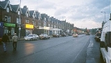
A58 road
Encyclopedia
The A58 is a major road
in northern England
that runs between Prescot
, Merseyside
and Wetherby
, West Yorkshire
.
It runs north east from Prescot
on the outskirts of Liverpool
via St Helens
, Ashton-in-Makerfield
, Hindley
, Westhoughton
, Bolton
, Bury
, Heywood
, Rochdale
and Littleborough then over the Pennines
into West Yorkshire
.
The road then goes through Ripponden
, Sowerby Bridge
to Halifax
and onwards to Leeds
via the villages of Hipperholme
, Birkenshaw
and Drighlington
. It runs through Leeds as the A58(M) motorway (part of the Leeds Inner Ring Road
), then north-east through Scarcroft
, Bardsey
and Collingham
to its terminus at Wetherby
.
The original route between Leeds
and Wetherby
partially bypasses its original route, diverting from Roundhay Road/ Wetherby Road, at the old Fforde Green junction in Harehills
. It runs along the Easterly Road dual carriageway
passing Oakwood
and Gipton
. The re-routed A58 meets its original route at Boggart Hill in Seacroft
. The re-routed section was constructed in the 1930s and had a branch of the Leeds Tramway
running along the central reservation until the 1950s. The proposed Leeds Supertram
was also to run this route.
Road
A road is a thoroughfare, route, or way on land between two places, which typically has been paved or otherwise improved to allow travel by some conveyance, including a horse, cart, or motor vehicle. Roads consist of one, or sometimes two, roadways each with one or more lanes and also any...
in northern England
England
England is a country that is part of the United Kingdom. It shares land borders with Scotland to the north and Wales to the west; the Irish Sea is to the north west, the Celtic Sea to the south west, with the North Sea to the east and the English Channel to the south separating it from continental...
that runs between Prescot
Prescot
Prescot is a town and civil parish, within the Metropolitan Borough of Knowsley in Merseyside, England. It is 8 miles to the east of Liverpool city centre and lies within the historic boundaries of Lancashire. At the 2001 Census, the population was 11,184 .Prescot marks the beginning of the...
, Merseyside
Merseyside
Merseyside is a metropolitan county in North West England, with a population of 1,365,900. It encompasses the metropolitan area centred on both banks of the lower reaches of the Mersey Estuary, and comprises five metropolitan boroughs: Knowsley, St Helens, Sefton, Wirral, and the city of Liverpool...
and Wetherby
Wetherby
Wetherby is a market town and civil parish within the metropolitan borough of the City of Leeds, in West Yorkshire, England. It stands on the River Wharfe, and has been for centuries a crossing place and staging post on the Great North Road, being mid-way between London and Edinburgh...
, West Yorkshire
West Yorkshire
West Yorkshire is a metropolitan county within the Yorkshire and the Humber region of England with a population of 2.2 million. West Yorkshire came into existence as a metropolitan county in 1974 after the passage of the Local Government Act 1972....
.
It runs north east from Prescot
Prescot
Prescot is a town and civil parish, within the Metropolitan Borough of Knowsley in Merseyside, England. It is 8 miles to the east of Liverpool city centre and lies within the historic boundaries of Lancashire. At the 2001 Census, the population was 11,184 .Prescot marks the beginning of the...
on the outskirts of Liverpool
Liverpool
Liverpool is a city and metropolitan borough of Merseyside, England, along the eastern side of the Mersey Estuary. It was founded as a borough in 1207 and was granted city status in 1880...
via St Helens
St Helens, Merseyside
St Helens is a large town in Merseyside, England. It is the largest settlement and administrative centre of the Metropolitan Borough of St Helens with a population of just over 100,000, part of an urban area with a total population of 176,843 at the time of the 2001 Census...
, Ashton-in-Makerfield
Ashton-in-Makerfield
Ashton-in-Makerfield is a town in the Metropolitan Borough of Wigan, Greater Manchester. It is situated south of Wigan, north-northwest of Warrington and west of the city of Manchester. In 2001 it had a population of 28,505....
, Hindley
Hindley, Greater Manchester
Hindley is a town within the Metropolitan Borough of Wigan in Greater Manchester, England. Lying three miles east of Wigan it covers an area of 1044 hectares. Historically a part of Lancashire, Hindley which includes Hindley Green borders the towns of Ince-in-Makerfield and Leigh within Wigan...
, Westhoughton
Westhoughton
Westhoughton is a town and civil parish of the Metropolitan Borough of Bolton in Greater Manchester, England. It is southwest of Bolton, east of Wigan and northwest of Manchester....
, Bolton
Bolton
Bolton is a town in Greater Manchester, in the North West of England. Close to the West Pennine Moors, it is north west of the city of Manchester. Bolton is surrounded by several smaller towns and villages which together form the Metropolitan Borough of Bolton, of which Bolton is the...
, Bury
Bury
Bury is a town in Greater Manchester, England. It lies on the River Irwell, east of Bolton, west-southwest of Rochdale, and north-northwest of the city of Manchester...
, Heywood
Heywood, Greater Manchester
Heywood is a town within the Metropolitan Borough of Rochdale, in Greater Manchester, England. It lies on the south bank of the River Roch and is east of Bury, west-southwest of Rochdale, and north of the city of Manchester. The town of Middleton lies to the south, whilst to the north is the...
, Rochdale
Rochdale
Rochdale is a large market town in Greater Manchester, England. It lies amongst the foothills of the Pennines on the River Roch, north-northwest of Oldham, and north-northeast of the city of Manchester. Rochdale is surrounded by several smaller settlements which together form the Metropolitan...
and Littleborough then over the Pennines
Pennines
The Pennines are a low-rising mountain range, separating the North West of England from Yorkshire and the North East.Often described as the "backbone of England", they form a more-or-less continuous range stretching from the Peak District in Derbyshire, around the northern and eastern edges of...
into West Yorkshire
West Yorkshire
West Yorkshire is a metropolitan county within the Yorkshire and the Humber region of England with a population of 2.2 million. West Yorkshire came into existence as a metropolitan county in 1974 after the passage of the Local Government Act 1972....
.
The road then goes through Ripponden
Ripponden
Ripponden is a village and civil parish within the Metropolitan Borough of Calderdale, in West Yorkshire, England, near Halifax, on the River Ryburn. It is the site of a Roman settlement, and there is a Roman Road over nearby Blackstone Edge, a rocky ridge of Millstone Grit...
, Sowerby Bridge
Sowerby Bridge
Sowerby Bridge is a market town that lies within the Upper Calder Valley in the district of Calderdale in the county of West Yorkshire, in northern England.-Geography:Sowerby Bridge is situated on the edge of Halifax, about three miles from its centre...
to Halifax
Halifax, West Yorkshire
Halifax is a minster town, within the Metropolitan Borough of Calderdale in West Yorkshire, England. It has an urban area population of 82,056 in the 2001 Census. It is well-known as a centre of England's woollen manufacture from the 15th century onward, originally dealing through the Halifax Piece...
and onwards to Leeds
Leeds
Leeds is a city and metropolitan borough in West Yorkshire, England. In 2001 Leeds' main urban subdivision had a population of 443,247, while the entire city has a population of 798,800 , making it the 30th-most populous city in the European Union.Leeds is the cultural, financial and commercial...
via the villages of Hipperholme
Hipperholme
Hipperholme is a village in the Calderdale area of West Yorkshire, England, located between the towns of Halifax and Brighouse. It is located on the busy A58 road and includes Hipperholme Grammar School, a local private school....
, Birkenshaw
Birkenshaw, West Yorkshire
Birkenshaw is a village in the county of West Yorkshire, England. It lies at the crossroads between the A58 Leeds to Halifax road and the A651 Bradford to Heckmondwike road....
and Drighlington
Drighlington
Drighlington is a village and civil parish in the City of Leeds metropolitan district, West Yorkshire, England. The village lies 5 miles south west of Leeds and 4 miles south east of Bradford...
. It runs through Leeds as the A58(M) motorway (part of the Leeds Inner Ring Road
Leeds Inner Ring Road
The Leeds Inner Ring Road is part-motorway and part-A roads in Leeds, West Yorkshire, England, which forms a ring road around the city centre. It has six different road numbers that are all sections of longer roads...
), then north-east through Scarcroft
Scarcroft
Scarcroft is an upmarket village and civil parish north east of Leeds city centre in the City of Leeds metropolitan borough, West Yorkshire, England. The village lies on the main A58 road between Leeds and Wetherby. Scarcroft has a LS14 postcode and two of the most expenisve streets in Yorkshire...
, Bardsey
Bardsey, West Yorkshire
Bardsey, West Yorkshire, England is a small village in the City of Leeds metropolitan borough, north east of Leeds city centre. The village is in the LS17 Leeds postcode district. It is part of the civil parish of Bardsey cum Rigton...
and Collingham
Collingham, West Yorkshire
Collingham is a village and civil parish south east of Wetherby in West Yorkshire, England. It is in the City of Leeds metropolitan borough. The clergyman, the Reverend William Mompesson was born there in 1639....
to its terminus at Wetherby
Wetherby
Wetherby is a market town and civil parish within the metropolitan borough of the City of Leeds, in West Yorkshire, England. It stands on the River Wharfe, and has been for centuries a crossing place and staging post on the Great North Road, being mid-way between London and Edinburgh...
.
The original route between Leeds
Leeds
Leeds is a city and metropolitan borough in West Yorkshire, England. In 2001 Leeds' main urban subdivision had a population of 443,247, while the entire city has a population of 798,800 , making it the 30th-most populous city in the European Union.Leeds is the cultural, financial and commercial...
and Wetherby
Wetherby
Wetherby is a market town and civil parish within the metropolitan borough of the City of Leeds, in West Yorkshire, England. It stands on the River Wharfe, and has been for centuries a crossing place and staging post on the Great North Road, being mid-way between London and Edinburgh...
partially bypasses its original route, diverting from Roundhay Road/ Wetherby Road, at the old Fforde Green junction in Harehills
Harehills
Harehills is an inner-city area of east Leeds, West Yorkshire, England. It is approximately north east of Leeds city centre. Harehills is situated between the A58 and the A64 .- Overview :...
. It runs along the Easterly Road dual carriageway
Dual carriageway
A dual carriageway is a class of highway with two carriageways for traffic travelling in opposite directions separated by a central reservation...
passing Oakwood
Oakwood, Leeds
Oakwood is an affluent suburb of north-east Leeds, West Yorkshire, England, that lies between Gipton and Roundhay Park. It is within the LS8 postcode and part of the Roundhay City Council Ward.-Notable features:...
and Gipton
Gipton
Gipton is a suburb of East Leeds, West Yorkshire, England, between the A58 to the north and the A64 to the south. It is joined with Harehills as a City Council Ward...
. The re-routed A58 meets its original route at Boggart Hill in Seacroft
Seacroft
Seacroft is an outer-city suburb consisting mainly of council estate housing covering an extensive area of east Leeds, West Yorkshire, England. It is east of Leeds city centre and lies in the LS14 Leeds postcode area....
. The re-routed section was constructed in the 1930s and had a branch of the Leeds Tramway
Leeds Tramway
Leeds Corporation Tramways formerly served the city of Leeds, England. The original trams were horse-drawn, however by 1901 electrification had been completed. The tramway opened on 29 October 1891-Routes:...
running along the central reservation until the 1950s. The proposed Leeds Supertram
Leeds Supertram
The Leeds Supertram was a proposed light rail/tram system in Leeds and West Yorkshire in England.-Initial proposals:Proposals for the reinstatement of trams or a light rail system in Leeds which were withdrawn in 1959 have been ongoing since the 1970s with various plans for varying light rail...
was also to run this route.