

U.S. Route 441 in Florida
Encyclopedia
U.S. Route 441 in Florida
is a north–south United States Highway. It runs 459 miles (738.7 km) from Miami in South Florida
northwest to the Georgia
border north of the Lake City area
.
Hidden state roads along the route consist of SR 7 from Miami to Royal Palm Beach (of which many locals in this area generally call US 441 as "State Road 7" instead of US 441), SR 80
from Royal Palm Beach to Belle Glade, SR 15 from Belle Glade to Holopaw, SR 500
from Holopaw to Ocala, SR 25
from Leesburg to Lady lake, and again from Belleview to Lake City, SR 25A within Lake City, and SR 47 from Lake City to the Florida-Georgia State line.
Concurrencies include US 98
from Royal Palm Beach to Okeechobee, within the vicinity of Lake Okeechobee
, US 192 between Holopaw and Kissimmee, US 17-92 from Kissimmee to Orlando, SR 44 from Mount Dora to Leesburg, US 27
from Leesburg to Ocala, US 301
from Belleview to near Sparr, and US 41 from High Springs to Lake City.
 US 441 begins northbound at Southwest 7th Street, which is westbound U.S. Route 41, and ends southbound on Southwest 8th Street, which is eastbound U.S. Route 41 in downtown Miami
(both are one way streets). The route is concurrent with SR 7 from its southern terminus and parallels Interstate 95 north out of Miami to western Aventura
, where I-95 heads northeast to access Fort Lauderdale
and the remainder of the eastern Florida coast. However, the route is soon joined by the tolled Florida's Turnpike
and I-95 (Exits 12 and 12C), which follows US 441 north to West Palm Beach
. In between, the route interchanges with the Turnpike at exit 62 via State Road 870 (Commercial Blvd.) in Tamarac
. Additionally, US 441 meets Interstate 595
(Exits 8 and 8B) west of Fort Lauderdale and the tolled State Road 869 in Coconut Creek
.
At West Palm Beach, US 441 intersects U.S. Route 98, ending the concurrency with SR 7, and overlaps the highway through central Palm Beach County
, along with two hidden state routes Florida State Road 80
and Florida State Road 700. In Twenty Mile Bend SR 700 branches off to the northwest, which is where US Routes 98 and 441 split until 2007. US 98-441 continues west to Belle Glade
at the intersection of Florida State Road 15, along the eastern shore of Lake Okeechobee
, where SR 80 turns south and US 98-441 turns north to follow the shoreline to Pahokee
. Just north of Pahokee in Canal Point
, SR 700 rejoins US 98-441 and remains concurrent with US 441 along the eastern edge of the lake. North of Lake Okeechobee in Okeechobee
, US 98 splits away from US 441 making a left turn at Florida State Road 70. US 441 continues north, meeting the Turnpike at Yeehaw Junction
(via State Road 60) prior to intersecting U.S. Route 192 at Holopaw
. US 441 turns west onto US 192, forming an overlap into Kissimmee
. At the concurrent routes of U.S. Route 17/92, US 441 separates from US 192 and follows US 17/US 92 north onto the Orange Blossom Trail.
, and others, US 17/US 92/US 441 intersects many toll roads between Kissimmee and Orlando, the first of which is the partially tolled and partial limited-access Osceola Parkway
in Kissimmee. Immediateley after this in Orlando is the Central Florida GreeneWay (exit 11). North of here the Central Florida Parkway lead to Sea World. Neither of these intersections or interchanges however, compare to the combined interchanges of Florida's Turnpike
and the Beachline Expressway, in Sky Lake
, which contains a series of convoluted interchanges and partial ramps from side roads.
In Holden Heights
, US 441 has an interchange with I-4 (Exit 80). Eastbound access from I-4 comes from partial cloverleaf ramps, and westbound access comes from a left-turn ramp between the two carriageways that runs under the eastbound lane and merges with the east to southbound ramp before merging with southbound OBT. The interchange provides no south to east access and no west to north access, but such access can found from the intersection with West Michigan Street. Further north is the interchange with SR 408 (East-West Tollway) at exit 9, which is a diamond interchange. After curving around Givens Street and Springdale Road, both of which can only be accessed from West Concord Street, OBT moves closer to a parallel railroad freight line and meets the intersection of SR 50
(Colonial Drive) northwest of downtown. Here, US 17/92 turns east onto State Road 50 while US 441 continues north on the Orange Blossom Trail. North of downtown, US 441 encounters intersections with Florida State Road 438
, then Florida State Road 416, and after running along the western edge of Lake Fairview, an intersection with Florida State Road 423 which changes from the north-and-south John Young Parkway to the east-and-west Lee Avenue.
The road moves away from the freight line north of SR 423, but in Lockhart
it runs over a bridge for that line again between Rose Avenue and Beggs Road. Further northwest it runs beneath an interchange with Florida State Road 414, then cuts through a corner of Seminole County and re-enters Orange County in Apopka
where it meets the northern terminus of West Orange Trail
and the tolled State Road 429 before leaving the Orlando area. This road was intended to be part of the Central Florida GreeneWay loop around the Orlando Metropolitan Area. The road cuts through Plymouth
and back to Apopka again, but the last sites in Apopka are Orlando Apopka Airport
along the west side and Zellwood Cemetery on the east side before entering Zellwood, Florida
. Intersections here include Ponkan Road and then Jones Avenue which lead to another airport known as Bob White Field The road takes a slight reverse curve before the intersection with Sadler Avenue (Orange CR 448), and then approaches Lake Ola in Tangerine
, where the road turns straight north and serves as the southern terminus of Old Orange County Road 441 (former Florida State Road 500A), before both roads cross the Orange-Lake County Line and enter Mount Dora
. But while Old CR 441 remains a local downtown street, US 441 continues as a rural at-grade four-lane divided highway, with the exception of an un-numbered diamond interchange with Florida State Road 46 and Lake CR 46.
, US 441-SR 44 encounter another un-numbered interchange with Florida State Road 19
and Lake County Road 19A, taking SR 19 in a wrong way concurrency until it reaches a wye in Tavares
, where SR 19 heads south toward Howey-in-the-Hills and Groveland, and Old Lake County Road 441 rejoins US 441. From here, US 441-SR 44 is a six-lane highway with bicycle lanes that squeezes between Lake Harris and Lake Eustis where it crosses over the Dead River
on a bridge between the two lakes. The road passes by Leesburg Municipal Airport, then serves as the western terminus of Lake County Road 44, all the while winding around the northern shores of Lake Harris. In Leesburg
, SR 44 leaves US 441 heading toward Wildwood, Inverness, and Crystal River, while US 441 curves to the northwest, then intersects U.S. Route 27 in another concurrency, and as a result, the hidden state routes are officially SR 25
-500
. The concurrency with SR 25 is short-lived, because in Lady Lake, SR 25 branches away as Marion County Road 25. This once served as the southern terminus of the US 27-441 Alternate Route around Lake Weir into Belleview
, but still remains a scenic route.
Around the Lake-Marion county border, US 27-441 enters a retirement community known as The Villages
. Because of the frequent use of street-legal golf cars in the community, bridges and tunnels for these carts can be found throughout the road. US 27-441 leaves The Villages as it approaches Marion County Road 42, a bi-county east-west scenic route through Central Florida. North of here, it serves as the newly constructed eastern terminus of Marion CR 484, in Summerfield
. Within Belleview, the road encounters two somewhat important intersections; Marion County Road 25A, and then Florida State Road 35
. SR 35 joins US 27-441 in a wrong-way concurrency with SR 500 as the road curves more to the west, until it reaches the intersection with US 301
, where SR 35 turns south, and SR 500 becomes the hidden state road for US 27-301-441 for a few blocks. However SR 25 reunites with the triplex at the former eastern terminus of Marion CR 484, and shares a concurrency with SR 25
, and US 27-301-441's new secret route becomes SRs 25-500 once again. After that the road curves more to the north again. Near the right of way for the formerly proposed Cross Florida Barge Canal
in Santos, the median for the road widens, as it contains supports for a bridge that was never completed once the Canal project was cancelled. Before the median narrows back down to normal again, it intersects Marion CR 328, where a police station exists in the median. To the west of this intersection is the Santos Trailhead of the Cross Florida Greenway.
Before US 27-301-441 enters Ocala
, it veers off to the left at an intersection with Marion County Road Old 441 (Southeast Lake Weir Avenue), a former segment of US 441 that eventually leads to Ocala Union Station
. The first major intersection after this is 31st Street. Then it crosses under a railroad bridge before reaching the City Limits and the intersections with the northern terminus of Marion CR 475 and crossing SR 464 (17th Street). US 27-301-441 intersects with SR 200 (becoming the new hidden state road until US 301 reaches US 1-23). The highway reaches the heart of Ocala at the intersection with SR 40 (West Silver Springs Boulevard). After this, the road crosses a railroad bridge west of Ocala Union Station. Five blocks later, it reaches the intersection of SR 492 (Northwest 10th Street) only to move in the opposite direction, leaving the US 301-441 overlap and taking SR 500
with it as they head northwest towards Williston
, Perry
, Tallahassee
, and points north. Before US 301-441 leaves Ocala, it has an intersection with Marion County Road 200A (Northwest 20th Street), which runs east and then north. This road was the former State Road 200A and decommissioned US Route 301 Alternate.
After Marion County Road Old 441 (North Magnolia Avenue) terminates at the southeast corner of the intersection of US 301-441 and Northwest 28th Street, another county alternate which was a former section of US 441-SR 25 begins on the opposite side. This road is Marion CR 25A (Northwest Gainesville Road), which is also the decommissioned US Route 441 Alternate, and runs northwest through towns such as Zuber
, Lowell
, and Reddick
. East of Zuber, the road intersects SR 326, which originally had a short concurrency, but now directly crosses US 301-441. South of the intersection with Marion CR 329 is an interchange with U.S. Route 441
between Sparr
and Lowell, where the US 301-441 concurrency ends. US 301 moves northeast towards Waldo
, Starke
, and Jacksonville
taking SR 200 with it, while US 441 moves northwest.
US 441 continues to the northwest, serving as the northern terminus of Marion CR 25A. From there it intersects Marion CR 318, which provides access to I-75 in Irvine
to the west and Salt Springs
in Ocala National Forest
to the east. The road then runs through communities such as Orange Lake
and McIntosh
, where it passes through the McIntosh Historic District
before crossing the Marion-Alachua County Line near the town of Evinston
. It passes by a turnoff to Cross Creek
before entering Micanopy
, then runs across Paynes Prairie
Preserve State Park and goes through Gainesville
. After intersecting SR 331
and later SRs 24A-226, Florida State Road 24 joins US 441 in a brief concurrency until it reaches Florida State Road 26 and turns east. US 441 continues north as it becomes the western terminus of Florida State Road 120
, then intersects Florida State Road 222
before curving to the northwest and finally joining Florida State Road 20
, thereby converting it into an additional hidden state road. At the intersection of SR 121
, the DeSoto Trail moves from SR 121 to US 441. In Alachua
, US 441 intersects with SR 235, and then runs under an interchange with Interstate 75
(Exit 399), with quarter-cloverleaf interchanges on the northeast and northwest corners.
Just as it did in Leesburg, US 441 in High Springs
curves to the right while a state road becomes independent, specifically SR 20, which runs west only to join US 27 as they head towards Perry
, Tallahassee
, and Niceville
. Meanwhile as it did with US 27 in Leesburg, US 441 joins US 41 north, but here it also serves as the northern terminus of hidden SR 45. US 41-441 crosses the Santa Fe River
then runs north passing by O'Leno State Park
and River Rise Preserve State Park
, near which it shares a brief concurrency with Florida State Road 18
. It then runs through Ellsville, where it has another interchange with I-75 (Exit 414), just south of the western terminus of Florida State Road 238
.
Entering Lake City
, US 441 splits from US 41 onto Florida State Road 25A south of the city. The routes remain parallel, and at some point Route 441 is joined by Florida State Road 47 which was signed as terminating at US 41. However, past U.S. Route 90 (where the DeSoto Trail heads west) to the northern extents of Lake City. Past Lake City, US 441 has an interchange with Interstate 10 (Exit 303), then skirts the western edge of the Okefenokee Swamp
and east bank of the Suwannee River
as it enters Georgia
.
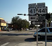
.svg.png) From 1956, signs for U.S. Highways in Florida had different colors for each highway. The "shield" for US 441 was brown, until the state was forced by the federal government to conform to standards that required consistent black-and-white signs in 1993.
From 1956, signs for U.S. Highways in Florida had different colors for each highway. The "shield" for US 441 was brown, until the state was forced by the federal government to conform to standards that required consistent black-and-white signs in 1993.
Although the southern terminus of US 441 is US 41 in Miami, the current, temporary terminus has been the Miami River
since early 2007, when the Florida Department of Transportation demolished the NW 7th Avenue Bridge over which the highway passed. The replacement bridge will not be finished until 2011.
Florida
Florida is a state in the southeastern United States, located on the nation's Atlantic and Gulf coasts. It is bordered to the west by the Gulf of Mexico, to the north by Alabama and Georgia and to the east by the Atlantic Ocean. With a population of 18,801,310 as measured by the 2010 census, it...
is a north–south United States Highway. It runs 459 miles (738.7 km) from Miami in South Florida
South Florida metropolitan area
The South Florida metropolitan area, also known as the Miami metropolitan area, and designated the Miami–Fort Lauderdale–Pompano Beach, FL Metropolitan Statistical Area by the U.S...
northwest to the Georgia
Georgia (U.S. state)
Georgia is a state located in the southeastern United States. It was established in 1732, the last of the original Thirteen Colonies. The state is named after King George II of Great Britain. Georgia was the fourth state to ratify the United States Constitution, on January 2, 1788...
border north of the Lake City area
Columbia County, Florida
Columbia County is a county located in the U.S. state of Florida. As of 2000, the population was 56,513. The U.S. Census Bureau 2005 estimate for the county is 64,040 . Its county seat is Lake City, Florida....
.
Hidden state roads along the route consist of SR 7 from Miami to Royal Palm Beach (of which many locals in this area generally call US 441 as "State Road 7" instead of US 441), SR 80
Florida State Road 80
Florida State Road 80 is a route linking US 41 in Fort Myers and Florida State Road A1A in Palm Beach. The road is the northernmost of three linking Southwest Florida to South Florida via the Everglades...
from Royal Palm Beach to Belle Glade, SR 15 from Belle Glade to Holopaw, SR 500
Florida State Road 500
State Road 500 is a major state highway running through Florida as a mostly unsigned route under several US Highways. From Chiefland to Williston it is U.S. Highway 27 Alternate. From Williston to Ocala, it is U.S. Highway 27. From Ocala to Kissimmee, it is U.S. Highway 441. From Kissimmee to...
from Holopaw to Ocala, SR 25
Florida State Road 25
State Road 25 is a state highway in the U.S. state of Florida.It is mainly signed as U.S. Highways:*U.S. Highway 27 from Miami to Lady Lake and Belleview to Ocala*U.S. Highway 301 from Belleview to near Sparr...
from Leesburg to Lady lake, and again from Belleview to Lake City, SR 25A within Lake City, and SR 47 from Lake City to the Florida-Georgia State line.
Concurrencies include US 98
U.S. Route 98 in Florida
U.S. Route 98 is an east-west United States highway that runs from western Mississippi to southern Florida. It was established in 1933 as a route between Pensacola, Florida and Apalachicola, Florida, and has since been extended eastward across the Florida Peninsula and westward into Mississippi...
from Royal Palm Beach to Okeechobee, within the vicinity of Lake Okeechobee
Lake Okeechobee
Lake Okeechobee , locally referred to as The Lake or The Big O, is the largest freshwater lake in the state of Florida. It is the seventh largest freshwater lake in the United States and the second largest freshwater lake contained entirely within the lower 48 states...
, US 192 between Holopaw and Kissimmee, US 17-92 from Kissimmee to Orlando, SR 44 from Mount Dora to Leesburg, US 27
U.S. Route 27 in Florida
U.S. Route 27 in Florida is a north–south United States Highway. It runs from the South Florida Metropolitan Area northwest to the Tallahassee Metropolitan Statistical Area. Throughout the state, US 27 has been designated the Claude Pepper Memorial Highway by the Florida State Legislature...
from Leesburg to Ocala, US 301
U.S. Route 301 in Florida
U.S. Route 301 in Florida runs from the Sarasota-Bradenton-Venice, Florida Metropolitan Statistical Area northeast to the Greater Jacksonville Metropolitan Area. The road is a spur of U.S...
from Belleview to near Sparr, and US 41 from High Springs to Lake City.
Miami to Kissimmee
Miami, Florida
Miami is a city located on the Atlantic coast in southeastern Florida and the county seat of Miami-Dade County, the most populous county in Florida and the eighth-most populous county in the United States with a population of 2,500,625...
(both are one way streets). The route is concurrent with SR 7 from its southern terminus and parallels Interstate 95 north out of Miami to western Aventura
Aventura, Florida
Aventura is a planned, suburban city located in northeastern Miami-Dade County, Florida. The city name is from the Spanish word for "adventure", and was named "Aventura" after one of the developers of the original group of condominiums in the area remarked to the others, "What an adventure this is...
, where I-95 heads northeast to access Fort Lauderdale
Fort Lauderdale, Florida
Fort Lauderdale is a city in the U.S. state of Florida, on the Atlantic coast. It is the county seat of Broward County. As of the 2010 census, the city had a population of 165,521. It is a principal city of the South Florida metropolitan area, which was home to 5,564,635 people at the 2010...
and the remainder of the eastern Florida coast. However, the route is soon joined by the tolled Florida's Turnpike
Florida's Turnpike
Florida's Turnpike , designated as the Ronald Reagan Turnpike, and originally known as the Sunshine State Parkway is a north–south toll road that runs through 11 counties in the Florida peninsula, from U.S...
and I-95 (Exits 12 and 12C), which follows US 441 north to West Palm Beach
West Palm Beach, Florida
West Palm Beach, is a city located on the Atlantic coast in southeastern Florida and is the most populous city in and county seat of Palm Beach County, the third most populous county in Florida with a 2010 population of 1,320,134. The city is also the oldest incorporated municipality in South Florida...
. In between, the route interchanges with the Turnpike at exit 62 via State Road 870 (Commercial Blvd.) in Tamarac
Tamarac, Florida
Tamarac is a city in Broward County, Florida, United States. As of the 2010 census, the city had a population of 60,427. It is part of the Miami–Fort Lauderdale–Pompano Beach Metropolitan Statistical Area, which was home to 5,564,635 people at the 2010 census....
. Additionally, US 441 meets Interstate 595
Interstate 595 (Florida)
Interstate 595 , also known as the Port Everglades Expressway and as the unsigned State Road 862, is a Interstate highway that connects Interstate 75 and Alligator Alley in the west with Florida's Turnpike, Interstate 95, Fort Lauderdale-Hollywood International Airport, US 1, and SR A1A before...
(Exits 8 and 8B) west of Fort Lauderdale and the tolled State Road 869 in Coconut Creek
Coconut Creek, Florida
Coconut Creek is a city in Broward County, Florida , nestled between Miami-Dade and Palm Beach counties. It had a population of 52,909 at the 2010 census...
.
At West Palm Beach, US 441 intersects U.S. Route 98, ending the concurrency with SR 7, and overlaps the highway through central Palm Beach County
Palm Beach County, Florida
Palm Beach County is the largest county in the state of Florida in total area, and third in population. As of 2010, the county's estimated population was 1,320,134, making it the twenty-eighth most populous in the United States...
, along with two hidden state routes Florida State Road 80
Florida State Road 80
Florida State Road 80 is a route linking US 41 in Fort Myers and Florida State Road A1A in Palm Beach. The road is the northernmost of three linking Southwest Florida to South Florida via the Everglades...
and Florida State Road 700. In Twenty Mile Bend SR 700 branches off to the northwest, which is where US Routes 98 and 441 split until 2007. US 98-441 continues west to Belle Glade
Belle Glade, Florida
Belle Glade is a city in Palm Beach County, Florida on the southeastern shore of Lake Okeechobee. The population was 14,906 at the 2000 census. According to the U.S Census estimates of 2007, the city had a population of 16,739....
at the intersection of Florida State Road 15, along the eastern shore of Lake Okeechobee
Lake Okeechobee
Lake Okeechobee , locally referred to as The Lake or The Big O, is the largest freshwater lake in the state of Florida. It is the seventh largest freshwater lake in the United States and the second largest freshwater lake contained entirely within the lower 48 states...
, where SR 80 turns south and US 98-441 turns north to follow the shoreline to Pahokee
Pahokee, Florida
Pahokee is a city located on the shore of Lake Okeechobee in Palm Beach County, Florida, United States. The population was 5,985 at the 2000 census. As of 2007, the population recorded by the U.S. Census Bureau is 6,459. Culturally, Pahokee is associated with the Florida Heartland, although...
. Just north of Pahokee in Canal Point
Canal Point, Florida
The unincorporated community of Canal Point is a census-designated place in Palm Beach County, Florida, United States. The population was 525 at the 2000 census.-Geography:Canal Point is located at ....
, SR 700 rejoins US 98-441 and remains concurrent with US 441 along the eastern edge of the lake. North of Lake Okeechobee in Okeechobee
Okeechobee, Florida
Okeechobee is a city in Okeechobee County, Florida, United States. The population was 5,376 at the 2000 census. As of 2004, the population recorded by the U.S. Census Bureau is 5,784. It is the county seat of Okeechobee County. The Speckled Perch Festival is held annually in honor of the most...
, US 98 splits away from US 441 making a left turn at Florida State Road 70. US 441 continues north, meeting the Turnpike at Yeehaw Junction
Yeehaw Junction, Florida
Yeehaw Junction is a census-designated place in Osceola County, Florida, United States. As of the 2010 census, it had a population of 240...
(via State Road 60) prior to intersecting U.S. Route 192 at Holopaw
Holopaw, Florida
Holopaw, Florida is a small unincorporated community in Osceola County, Florida, United States. It is located at the eastern end of the multiplex of highways US 192 and US 441. It has a population of fewer than 5,000 people and is part of the Orlando–Kissimmee Metropolitan Statistical...
. US 441 turns west onto US 192, forming an overlap into Kissimmee
Kissimmee, Florida
Kissimmee is a city in Osceola County, Florida, United States. As of the 2010 census, the population was 59,682. It is the county seat of Osceola County...
. At the concurrent routes of U.S. Route 17/92, US 441 separates from US 192 and follows US 17/US 92 north onto the Orange Blossom Trail.
Kissimmee through Mount Dora
Due to its proximity with Walt Disney World and affiliated resorts as well as Sea World, Universal StudiosUniversal Orlando Resort
Universal Orlando Resort is a theme park resort in Orlando, Florida. It is wholly owned by NBCUniversal and its affiliates. The resort consists of two theme parks , Universal CityWalk , and three Loews Hotels...
, and others, US 17/US 92/US 441 intersects many toll roads between Kissimmee and Orlando, the first of which is the partially tolled and partial limited-access Osceola Parkway
Osceola Parkway
The Osceola Parkway, signed as County Road 522 since around 2003 , is a long, partially-tolled arterial road extending east-west across the northern boundary of Osceola County, Florida, USA roughly paralleling the border with Orange County...
in Kissimmee. Immediateley after this in Orlando is the Central Florida GreeneWay (exit 11). North of here the Central Florida Parkway lead to Sea World. Neither of these intersections or interchanges however, compare to the combined interchanges of Florida's Turnpike
Florida's Turnpike
Florida's Turnpike , designated as the Ronald Reagan Turnpike, and originally known as the Sunshine State Parkway is a north–south toll road that runs through 11 counties in the Florida peninsula, from U.S...
and the Beachline Expressway, in Sky Lake
Sky Lake, Florida
Sky Lake is a census-designated place and an unincorporated area in Orange County, Florida, United States. The population was 5,651 at the 2000 census. It is part of the Orlando-Kissimmee, Florida Metropolitan Statistical Area.-Geography:...
, which contains a series of convoluted interchanges and partial ramps from side roads.
In Holden Heights
Holden Heights, Florida
Holden Heights is a census-designated place and an unincorporated area in Orange County, Florida, United States. The population was 3,856 at the 2000 census. The ZIP code serving the CDP is 32839...
, US 441 has an interchange with I-4 (Exit 80). Eastbound access from I-4 comes from partial cloverleaf ramps, and westbound access comes from a left-turn ramp between the two carriageways that runs under the eastbound lane and merges with the east to southbound ramp before merging with southbound OBT. The interchange provides no south to east access and no west to north access, but such access can found from the intersection with West Michigan Street. Further north is the interchange with SR 408 (East-West Tollway) at exit 9, which is a diamond interchange. After curving around Givens Street and Springdale Road, both of which can only be accessed from West Concord Street, OBT moves closer to a parallel railroad freight line and meets the intersection of SR 50
State Road 50 (Florida)
State Road 50 runs across the center of the U.S. state of Florida through Orlando, with its termini at SR 55 at Weeki Wachee and SR 5 in Titusville....
(Colonial Drive) northwest of downtown. Here, US 17/92 turns east onto State Road 50 while US 441 continues north on the Orange Blossom Trail. North of downtown, US 441 encounters intersections with Florida State Road 438
Florida State Road 438
State Road 438 is a state highway in Orange and Lake counties. It is one of the 3 roads that goes through Killarney, the other 2 are SR 50 and Florida's Turnpike. In Oakland, it is the 2nd closest to Lake Apopka than any other Florida State Road, after SR 91....
, then Florida State Road 416, and after running along the western edge of Lake Fairview, an intersection with Florida State Road 423 which changes from the north-and-south John Young Parkway to the east-and-west Lee Avenue.
The road moves away from the freight line north of SR 423, but in Lockhart
Lockhart, Florida
Lockhart is a census-designated place and an unincorporated area in Orange County, Florida, United States. The population was 12,944 at the 2000 census. It is part of the Orlando–Kissimmee Metropolitan Statistical Area...
it runs over a bridge for that line again between Rose Avenue and Beggs Road. Further northwest it runs beneath an interchange with Florida State Road 414, then cuts through a corner of Seminole County and re-enters Orange County in Apopka
Apopka, Florida
Apopka is a city located in Orange County, Florida, United States. The population was 26,969 at the 2000 census. According to the U.S Census estimates of 2006, the city grew to 53,563. It is part of the Orlando–Kissimmee Metropolitan Statistical Area. Apopka is an Indian word for “Potato...
where it meets the northern terminus of West Orange Trail
West Orange Trail
The West Orange Trail is a long multi-use rail trail owned by Orange County Parks and Recreation in Orange County, Florida, in the United States.It passes through downtown Oakland, Winter Garden, and Apopka...
and the tolled State Road 429 before leaving the Orlando area. This road was intended to be part of the Central Florida GreeneWay loop around the Orlando Metropolitan Area. The road cuts through Plymouth
Plymouth, Florida
Plymouth is an unincorporated community in Orange County, Florida, United States. It is located northwest of downtown Apopka along US 441 , at the intersection with Plymouth-Sorrento Road...
and back to Apopka again, but the last sites in Apopka are Orlando Apopka Airport
Orlando Apopka Airport
Orlando Apopka Airport is a privately-owned, public-use airport located four nautical miles northwest of the central business district of Apopka, in Orange County, Florida, United States. It was formerly known as Orlando Country Airport....
along the west side and Zellwood Cemetery on the east side before entering Zellwood, Florida
Zellwood, Florida
Zellwood is a census-designated place and an unincorporated area in Orange County, Florida, United States. The population was 2,540 at the 2000 census. It is part of the Orlando–Kissimmee Metropolitan Statistical Area...
. Intersections here include Ponkan Road and then Jones Avenue which lead to another airport known as Bob White Field The road takes a slight reverse curve before the intersection with Sadler Avenue (Orange CR 448), and then approaches Lake Ola in Tangerine
Tangerine, Florida
Tangerine is a census-designated place and an unincorporated area in Orange County, Florida, United States. The population was 826 at the 2000 census. It is part of the Orlando–Kissimmee Metropolitan Statistical Area.-Geography:...
, where the road turns straight north and serves as the southern terminus of Old Orange County Road 441 (former Florida State Road 500A), before both roads cross the Orange-Lake County Line and enter Mount Dora
Mount Dora, Florida
Mount Dora is a U.S. city in Lake County, Florida. As of July 1, 2006, the U.S. Census Bureau estimates the Mount Dora population at 11,564. It is part of the Orlando–Kissimmee Metropolitan Statistical Area.-History:...
. But while Old CR 441 remains a local downtown street, US 441 continues as a rural at-grade four-lane divided highway, with the exception of an un-numbered diamond interchange with Florida State Road 46 and Lake CR 46.
Mount Dora through Sparr
Continuing with the rural surroundings, US 441 maintains its straight north and south position until it curves to the northwest between Lincoln and East Pine Avenues. Approaching Loch Leven, it turns straight west, and then Florida State Road 44 joins US 441 after having run west from New Smyrna Beach and DeLand. This intersection is also shared with Lake County Road 44B, which takes motorists to Downtown Mount Dora. In southern EustisEustis, Florida
Eustis is a city in Lake County, Florida, United States. The population was 15,106 at the 2000 census. The Census Bureau estimated the population in 2008 to be 19,129. It is part of the Orlando–Kissimmee Metropolitan Statistical Area.-Geography:...
, US 441-SR 44 encounter another un-numbered interchange with Florida State Road 19
Florida State Road 19
State Road 19 is a Florida State Road in Putnam, Marion, and Lake counties. It runs from Groveland to Palatka. It provides access to areas in Ocala National Forest, like Pittman.-Groveland to Tavares:...
and Lake County Road 19A, taking SR 19 in a wrong way concurrency until it reaches a wye in Tavares
Tavares, Florida
Tavares is a city in central Florida in the United States. It is the county seat of Lake County. The population was 9,700 at the 2000 census. The Census Bureau estimated the population in 2008 to be 13,746. It is part of the Orlando–Kissimmee Metropolitan Statistical Area...
, where SR 19 heads south toward Howey-in-the-Hills and Groveland, and Old Lake County Road 441 rejoins US 441. From here, US 441-SR 44 is a six-lane highway with bicycle lanes that squeezes between Lake Harris and Lake Eustis where it crosses over the Dead River
Dead River (Lake County, Florida)
Found in Lake County, Florida, the Dead River serves as the division between the cities of Tavares and Leesburg.It received its name due to lack of a current; studies have shown that a simple john boat can remain in nearly same position if left on the river overnight with less than five feet of...
on a bridge between the two lakes. The road passes by Leesburg Municipal Airport, then serves as the western terminus of Lake County Road 44, all the while winding around the northern shores of Lake Harris. In Leesburg
Leesburg, Florida
Leesburg is a city in Lake County, Florida, United States. The population was 15,956 at the 2000 census. As of 2005, the population recorded by the U.S. Census Bureau is 19,086.. Leesburg is located in central Florida, between Lake Harris and Lake Griffin, at the head of the Oklawaha River system....
, SR 44 leaves US 441 heading toward Wildwood, Inverness, and Crystal River, while US 441 curves to the northwest, then intersects U.S. Route 27 in another concurrency, and as a result, the hidden state routes are officially SR 25
Florida State Road 25
State Road 25 is a state highway in the U.S. state of Florida.It is mainly signed as U.S. Highways:*U.S. Highway 27 from Miami to Lady Lake and Belleview to Ocala*U.S. Highway 301 from Belleview to near Sparr...
-500
Florida State Road 500
State Road 500 is a major state highway running through Florida as a mostly unsigned route under several US Highways. From Chiefland to Williston it is U.S. Highway 27 Alternate. From Williston to Ocala, it is U.S. Highway 27. From Ocala to Kissimmee, it is U.S. Highway 441. From Kissimmee to...
. The concurrency with SR 25 is short-lived, because in Lady Lake, SR 25 branches away as Marion County Road 25. This once served as the southern terminus of the US 27-441 Alternate Route around Lake Weir into Belleview
Belleview, Florida
Belleview is a city in Marion County, Florida. The population was 3,478 at the 2000 census. According to the U.S Census estimates of 2009, the city had a population of 4,483. It is part of the Ocala Metropolitan Statistical Area. The name, Belleview, which means beautiful view, came from one of...
, but still remains a scenic route.
Around the Lake-Marion county border, US 27-441 enters a retirement community known as The Villages
The Villages, Florida
The Villages is a master-planned age-restricted retirement community located mainly in Sumter County, Florida, United States, but also includes portions of Lake and Marion counties. The community is controlled by several Community Development Districts , most of which are controlled by H. Gary...
. Because of the frequent use of street-legal golf cars in the community, bridges and tunnels for these carts can be found throughout the road. US 27-441 leaves The Villages as it approaches Marion County Road 42, a bi-county east-west scenic route through Central Florida. North of here, it serves as the newly constructed eastern terminus of Marion CR 484, in Summerfield
Summerfield, Florida
Summerfield is an unincorporated community in Marion County, Florida, United States. It is located near the intersection of US 301 and County Road 475A. The community is part of the Ocala Metropolitan Statistical Area.-Geography:...
. Within Belleview, the road encounters two somewhat important intersections; Marion County Road 25A, and then Florida State Road 35
Florida State Road 35
State Road 35 is a north–south state highway in the western counties of the U.S. state of Florida.-Route Description:It is mainly signed as a hidden route along U.S. Highways:*U.S. Route 17: Punta Gorda to Bartow....
. SR 35 joins US 27-441 in a wrong-way concurrency with SR 500 as the road curves more to the west, until it reaches the intersection with US 301
U.S. Route 301 in Florida
U.S. Route 301 in Florida runs from the Sarasota-Bradenton-Venice, Florida Metropolitan Statistical Area northeast to the Greater Jacksonville Metropolitan Area. The road is a spur of U.S...
, where SR 35 turns south, and SR 500 becomes the hidden state road for US 27-301-441 for a few blocks. However SR 25 reunites with the triplex at the former eastern terminus of Marion CR 484, and shares a concurrency with SR 25
Florida State Road 25
State Road 25 is a state highway in the U.S. state of Florida.It is mainly signed as U.S. Highways:*U.S. Highway 27 from Miami to Lady Lake and Belleview to Ocala*U.S. Highway 301 from Belleview to near Sparr...
, and US 27-301-441's new secret route becomes SRs 25-500 once again. After that the road curves more to the north again. Near the right of way for the formerly proposed Cross Florida Barge Canal
Cross Florida Barge Canal
The Cross Florida Barge Canal was a canal project to connect the Gulf of Mexico and the Atlantic Ocean across Florida for barge traffic. Two sections were built but the project was cancelled, mainly for environmental reasons. It is now a protected green belt corridor, one mile wide...
in Santos, the median for the road widens, as it contains supports for a bridge that was never completed once the Canal project was cancelled. Before the median narrows back down to normal again, it intersects Marion CR 328, where a police station exists in the median. To the west of this intersection is the Santos Trailhead of the Cross Florida Greenway.
Before US 27-301-441 enters Ocala
Ocala, Florida
Ocala is a city in Marion County, Florida. As of 2007, the population recorded by the U.S. Census Bureau was 53,491. It is the county seat of Marion County, and the principal city of the Ocala, Florida Metropolitan Statistical Area, which had an estimated 2007 population of 324,857.-History:Ocala...
, it veers off to the left at an intersection with Marion County Road Old 441 (Southeast Lake Weir Avenue), a former segment of US 441 that eventually leads to Ocala Union Station
Ocala Union Station
The Ocala Union Station is a historic site in Ocala, Florida, United States. It is located at 531 Northeast First Avenue, and was built in 1917 by both the Atlantic Coast Line and Seaboard Air Line Railroads. Prior to this, ACL and SAL had separate depots in Ocala...
. The first major intersection after this is 31st Street. Then it crosses under a railroad bridge before reaching the City Limits and the intersections with the northern terminus of Marion CR 475 and crossing SR 464 (17th Street). US 27-301-441 intersects with SR 200 (becoming the new hidden state road until US 301 reaches US 1-23). The highway reaches the heart of Ocala at the intersection with SR 40 (West Silver Springs Boulevard). After this, the road crosses a railroad bridge west of Ocala Union Station. Five blocks later, it reaches the intersection of SR 492 (Northwest 10th Street) only to move in the opposite direction, leaving the US 301-441 overlap and taking SR 500
Florida State Road 500
State Road 500 is a major state highway running through Florida as a mostly unsigned route under several US Highways. From Chiefland to Williston it is U.S. Highway 27 Alternate. From Williston to Ocala, it is U.S. Highway 27. From Ocala to Kissimmee, it is U.S. Highway 441. From Kissimmee to...
with it as they head northwest towards Williston
Williston, Florida
Williston is a city in Levy County, Florida, United States. The population was 2,297 at the 2000 census. According to the U.S. Census Bureau's 2004 estimates, the city had a population of 2,467.-Geography:Williston is located at ....
, Perry
Perry, Florida
Perry is a city in Taylor County, Florida, United States. The population was 7,017 at the 2010 census. As of 2010, the population recorded by the U.S. Census Bureau is 7,017....
, Tallahassee
Tallahassee, Florida
Tallahassee is the capital of the U.S. state of Florida. It is the county seat and only incorporated municipality in Leon County, and is the 128th largest city in the United States. Tallahassee became the capital of Florida, then the Florida Territory, in 1824. In 2010, the population recorded by...
, and points north. Before US 301-441 leaves Ocala, it has an intersection with Marion County Road 200A (Northwest 20th Street), which runs east and then north. This road was the former State Road 200A and decommissioned US Route 301 Alternate.
After Marion County Road Old 441 (North Magnolia Avenue) terminates at the southeast corner of the intersection of US 301-441 and Northwest 28th Street, another county alternate which was a former section of US 441-SR 25 begins on the opposite side. This road is Marion CR 25A (Northwest Gainesville Road), which is also the decommissioned US Route 441 Alternate, and runs northwest through towns such as Zuber
Zuber, Florida
Zuber is an unincorporated community in Marion County, Florida, United States. It is located near the intersection of State Road 326 and County Road 25A. Its commerce is supported by its proximity to Interstate 75....
, Lowell
Lowell, Florida
Lowell is an unincorporated community in Marion County, Florida, United States. It is located near the intersection of County Road 329 and County Road 25A. The community is part of the Ocala Metropolitan Statistical Area....
, and Reddick
Reddick, Florida
Reddick is a town in Marion County, Florida, United States. As of the 2000 census, the town population was 571. As of 2004, the population recorded by the U.S. Census Bureau is 618...
. East of Zuber, the road intersects SR 326, which originally had a short concurrency, but now directly crosses US 301-441. South of the intersection with Marion CR 329 is an interchange with U.S. Route 441
U.S. Route 441
U.S. Route 441 is a spur route of U.S. Route 41. It currently runs for 939 miles from U.S. Route 41 in Miami, Florida to U.S. Route 25W in Lake City, Tennessee. Between its termini, US 441 passes through the states of Florida, Georgia, North Carolina, and Tennessee...
between Sparr
Sparr, Florida
Sparr is an unincorporated community in Marion County, Florida, United States. It is located near the intersection of County Road 200A and County Road 329. The community is part of the Ocala Metropolitan Statistical Area.-Geography:...
and Lowell, where the US 301-441 concurrency ends. US 301 moves northeast towards Waldo
Waldo, Florida
Waldo is a city in Alachua County, Florida, United States. The population was 821 at the 2000 census. According to the U.S. Census Bureau's 2004 estimates, the city had a population of 784....
, Starke
Starke, Florida
Starke is a city in Bradford County, Florida, United States. The population was 5,593 at the 2000 census. As of 2004, the population recorded by the U.S. Census Bureau is 5,769 ....
, and Jacksonville
Jacksonville, Florida
Jacksonville is the largest city in the U.S. state of Florida in terms of both population and land area, and the largest city by area in the contiguous United States. It is the county seat of Duval County, with which the city government consolidated in 1968...
taking SR 200 with it, while US 441 moves northwest.
Reddick through the Georgia State Line
In ReddickReddick, Florida
Reddick is a town in Marion County, Florida, United States. As of the 2000 census, the town population was 571. As of 2004, the population recorded by the U.S. Census Bureau is 618...
US 441 continues to the northwest, serving as the northern terminus of Marion CR 25A. From there it intersects Marion CR 318, which provides access to I-75 in Irvine
Irvine, Florida
Irvine is an unincorporated community in Marion County, Florida, United States. Irvine is located along Interstate 75 north of Ocala....
to the west and Salt Springs
Salt Springs, Florida
Salt Springs is an unincorporated community in Marion County, Florida, United States. It is located near Lake George. The community is part of the Ocala Metropolitan Statistical Area....
in Ocala National Forest
Ocala National Forest
The Ocala National Forest is the second largest National Forest in the U.S. state of Florida and covers approximately of Central Florida. It is located three miles east of Ocala and southeast of Gainesville...
to the east. The road then runs through communities such as Orange Lake
Orange Lake, Florida
Orange Lake is an unincorporated community in Marion County, Florida, United States. It is located on US 441, on Orange Lake south of McIntosh....
and McIntosh
McIntosh, Florida
McIntosh is a town in Marion County, Florida, in the United States. As of the 2000 census, the town population was 453. As of 2004, the population recorded by the U.S. Census Bureau is 486...
, where it passes through the McIntosh Historic District
McIntosh Historic District
The McIntosh Historic District is a U.S. historic district located in McIntosh, Florida. The district is bounded by an RR Right-of-Way, 10th Street, Avenues C and H. It contains 75 buildings. Contributing properties in the district include the McIntosh Presbyterian Church.-External links:* at...
before crossing the Marion-Alachua County Line near the town of Evinston
Evinston, Florida
Evinston is an unincorporated community in Alachua County and Marion County, Florida, United States.The Alachua County portion of Evinston is part of the Gainesville Metropolitan Statistical Area, while the Marion County portion is part of the Ocala Metropolitan Statistical Area.-Geography:Evinston...
. It passes by a turnoff to Cross Creek
Cross Creek, Florida
Cross Creek is an unincorporated community in Alachua County, Florida, United States. It is located on Cross Creek, a short stream connecting Orange Lake and Lochloosa Lake.-Geography:Cross Creek is located at .-History:...
before entering Micanopy
Micanopy, Florida
Micanopy is a town in Alachua County, Florida, United States. It is south of Gainesville. The population in the 2000 census was 653. As of 2004, the population according to the U.S. Census Bureau was 652...
, then runs across Paynes Prairie
Paynes Prairie
Paynes Prairie is a Florida State Park, encompassing a savanna south of Gainesville, Florida, in Micanopy. It is also a U.S. National Natural Landmark. It is crossed by both I-75 and U.S. 441 .- History :...
Preserve State Park and goes through Gainesville
Gainesville, Florida
Gainesville is the largest city in, and the county seat of, Alachua County, Florida, United States as well as the principal city of the Gainesville, Florida Metropolitan Statistical Area . The preliminary 2010 Census population count for Gainesville is 124,354. Gainesville is home to the sixth...
. After intersecting SR 331
Florida State Road 331
Florida State Road 331 is a short state highway running south and east of Gainesville, Florida, although it may have once stretched as far south as Williston. It also serves as a truck route for State Roads 24, 26, and 121...
and later SRs 24A-226, Florida State Road 24 joins US 441 in a brief concurrency until it reaches Florida State Road 26 and turns east. US 441 continues north as it becomes the western terminus of Florida State Road 120
Florida State Road 120
-Route description:Starting from US 441 in Gainesville, State Road 120 runs eastward through Gainesville to SR 24 on the eastern side of town....
, then intersects Florida State Road 222
Florida State Road 222
State Road 222 is a state road that serves northern Gainesville. The western terminus is at I-75, and the eastern terminus is at a fork at SR 26.It is 4 lanes wide, but narrows to 2 lanes east of Airport Access Road...
before curving to the northwest and finally joining Florida State Road 20
Florida State Road 20
State Road 20 is an east–west route across northern Florida and the Florida Panhandle.-Route description:The western terminus of State Road 20 is at State Road 85 in Niceville. The route proceeds east through Blountstown, crossing the Apalachicola River on the Trammell Bridge, then proceeding...
, thereby converting it into an additional hidden state road. At the intersection of SR 121
Florida State Road 121
State Road 121 is a major state highway that runs north and south in northern Florida. The road is actually part of a long multi-state route that also goes through Georgia and South Carolina. Some see it as a de-facto auxiliary route from U.S. Route 21 in Rock Hill, South Carolina...
, the DeSoto Trail moves from SR 121 to US 441. In Alachua
Alachua, Florida
Alachua is a city in Alachua County, Florida, United States. According to 2006 U.S. Census Bureau estimates, the city's population was 7,554. The city is part of the Gainesville, Florida Metropolitan Statistical Area, which is home to 243,985 people....
, US 441 intersects with SR 235, and then runs under an interchange with Interstate 75
Interstate 75 in Florida
Interstate 75 is a part of the Interstate Highway System and runs from Hialeah, Florida, a few miles northwest of Miami to Sault Ste. Marie in the Upper Peninsula of Michigan...
(Exit 399), with quarter-cloverleaf interchanges on the northeast and northwest corners.
Just as it did in Leesburg, US 441 in High Springs
High Springs, Florida
High Springs is a city in Alachua County, Florida, United States. The population was 3,863 at the 2000 census. As of 2004, the population recorded by the U.S. Census Bureau is 4,139 .-Geography:High Springs is located at ....
curves to the right while a state road becomes independent, specifically SR 20, which runs west only to join US 27 as they head towards Perry
Perry, Florida
Perry is a city in Taylor County, Florida, United States. The population was 7,017 at the 2010 census. As of 2010, the population recorded by the U.S. Census Bureau is 7,017....
, Tallahassee
Tallahassee, Florida
Tallahassee is the capital of the U.S. state of Florida. It is the county seat and only incorporated municipality in Leon County, and is the 128th largest city in the United States. Tallahassee became the capital of Florida, then the Florida Territory, in 1824. In 2010, the population recorded by...
, and Niceville
Niceville, Florida
Niceville is a city in Okaloosa County, Florida, United States, located close to Eglin Air Force Base. It originally began with the name Valparaiso, then to separate itself from the neighboring town took the unofficial name of Boggy. Upon incorporation as an official city, the name was changed to...
. Meanwhile as it did with US 27 in Leesburg, US 441 joins US 41 north, but here it also serves as the northern terminus of hidden SR 45. US 41-441 crosses the Santa Fe River
Santa Fe River
The Santa Fe River is a river in northern Florida. The watershed of the river is approximately and spreads across southern Columbia, southern Suwannee, western Bradford, far southern Baker, Union, northern and eastern Gilchrist, and northern Alachua counties. The headwaters of the river are...
then runs north passing by O'Leno State Park
O'Leno State Park
O'Leno State Park is a Florida State Park located on the Santa Fe River six miles north of High Springs on U.S. 441. Many facilities at the park were built by the Civilian Conservation Corps in the 1930s.-Geology:...
and River Rise Preserve State Park
River Rise Preserve State Park
River Rise Preserve State Park is a Florida State Park, located six miles north of High Springs, off U.S. Route 441 within O'Leno State Park. The name derives from it being where the Santa Fe River comes to the surface after having travelled underground for some distance beneath O'Leno State...
, near which it shares a brief concurrency with Florida State Road 18
Florida State Road 18
State Road 18 is a short state road in the U.S. state of Florida. It begins in Worthington Springs in southern Union County and travels eastward for into Bradford County until it becomes County Road 18 at Brooker. As a county road, CR 18 crosses US 301 at Hampton, with its eastern terminus at SR...
. It then runs through Ellsville, where it has another interchange with I-75 (Exit 414), just south of the western terminus of Florida State Road 238
Florida State Road 238
State Road 238 is a Florida State Road in Union and Columbia counties in Florida. It is long from U.S. Route 441 in unincorporated Columbia County to State Road 100 in Lake Butler, carrying only of State Road 231. The entire route of SR 238 is only 2 lanes wide. Oddly, it slightly heads...
.
Entering Lake City
Lake City, Florida
Lake City is the county seat of Columbia County, Florida, in the United States. In 2009, the U.S. Census Bureau estimated the city's population at 12,614. In addition, it is the Principal City of the Lake City Micropolitan Statistical Area, which is composed of Columbia County, and had an...
, US 441 splits from US 41 onto Florida State Road 25A south of the city. The routes remain parallel, and at some point Route 441 is joined by Florida State Road 47 which was signed as terminating at US 41. However, past U.S. Route 90 (where the DeSoto Trail heads west) to the northern extents of Lake City. Past Lake City, US 441 has an interchange with Interstate 10 (Exit 303), then skirts the western edge of the Okefenokee Swamp
Okefenokee Swamp
The Okefenokee Swamp is a shallow, 438,000 acre , peat-filled wetland straddling the Georgia–Florida border in the United States. A majority of the swamp is in Georgia and protected by the Okefenokee National Wildlife Refuge and the Okefenokee Wilderness. The Okefenokee Swamp is considered to be...
and east bank of the Suwannee River
Suwannee River
The Suwannee River is a major river of southern Georgia and northern Florida in the United States. It is a wild blackwater river, about long. The Suwannee River is the site of the prehistoric Suwannee Straits which separated peninsular Florida from the panhandle.-Geography:The river rises in the...
as it enters Georgia
Georgia (U.S. state)
Georgia is a state located in the southeastern United States. It was established in 1732, the last of the original Thirteen Colonies. The state is named after King George II of Great Britain. Georgia was the fourth state to ratify the United States Constitution, on January 2, 1788...
.
History
Although the southern terminus of US 441 is US 41 in Miami, the current, temporary terminus has been the Miami River
Miami River (Florida)
The Miami River is a river in the United States state of Florida that drains out of the Everglades and runs through the Downtown and the city of Miami. The long river flows from the terminus of the Miami Canal at Miami International Airport to Biscayne Bay...
since early 2007, when the Florida Department of Transportation demolished the NW 7th Avenue Bridge over which the highway passed. The replacement bridge will not be finished until 2011.
Related routes
At least six other bannered routes of US 441 have existed in Florida, however only one exists today.- U.S. Route 441 Business – TangerineTangerine, FloridaTangerine is a census-designated place and an unincorporated area in Orange County, Florida, United States. The population was 826 at the 2000 census. It is part of the Orlando–Kissimmee Metropolitan Statistical Area.-Geography:...
to TavaresTavares, FloridaTavares is a city in central Florida in the United States. It is the county seat of Lake County. The population was 9,700 at the 2000 census. The Census Bureau estimated the population in 2008 to be 13,746. It is part of the Orlando–Kissimmee Metropolitan Statistical Area...
; former Mount Dora Business route, now County Road Old 441. - U.S. Route 441 Truck – EustisEustis, FloridaEustis is a city in Lake County, Florida, United States. The population was 15,106 at the 2000 census. The Census Bureau estimated the population in 2008 to be 19,129. It is part of the Orlando–Kissimmee Metropolitan Statistical Area.-Geography:...
; Main line US 441 signed as a truck route to keep truck drivers out of downtown Eustis. - U.S. Route 441 Truck – LeesburgLeesburg, FloridaLeesburg is a city in Lake County, Florida, United States. The population was 15,956 at the 2000 census. As of 2005, the population recorded by the U.S. Census Bureau is 19,086.. Leesburg is located in central Florida, between Lake Harris and Lake Griffin, at the head of the Oklawaha River system....
; runs west along SR 44 then north along US 27U.S. Route 27 in FloridaU.S. Route 27 in Florida is a north–south United States Highway. It runs from the South Florida Metropolitan Area northwest to the Tallahassee Metropolitan Statistical Area. Throughout the state, US 27 has been designated the Claude Pepper Memorial Highway by the Florida State Legislature...
. - U.S. Route 441 Alternate – Lady LakeLady Lake, FloridaLady Lake is a town in Lake County, Florida, United States. The population was 11,828 at the 2000 census. As of 2005, the population recorded by the U.S. Census Bureau is 13,244...
to BelleviewBelleview, FloridaBelleview is a city in Marion County, Florida. The population was 3,478 at the 2000 census. According to the U.S Census estimates of 2009, the city had a population of 4,483. It is part of the Ocala Metropolitan Statistical Area. The name, Belleview, which means beautiful view, came from one of...
; former route co-signed with Alternate U.S. Route 27. - U.S. Route 441 Alternate – OcalaOcala, FloridaOcala is a city in Marion County, Florida. As of 2007, the population recorded by the U.S. Census Bureau was 53,491. It is the county seat of Marion County, and the principal city of the Ocala, Florida Metropolitan Statistical Area, which had an estimated 2007 population of 324,857.-History:Ocala...
to ReddickReddick, FloridaReddick is a town in Marion County, Florida, United States. As of the 2000 census, the town population was 571. As of 2004, the population recorded by the U.S. Census Bureau is 618...
; Today Marion CR 25A. - U.S. Route 441 Truck – Lake CityLake City, FloridaLake City is the county seat of Columbia County, Florida, in the United States. In 2009, the U.S. Census Bureau estimated the city's population at 12,614. In addition, it is the Principal City of the Lake City Micropolitan Statistical Area, which is composed of Columbia County, and had an...