

Taylor County, Wisconsin
Encyclopedia
Taylor County is a county
in the U.S. state
of Wisconsin
. As of 2010, the population was 20,689. Its county seat
is Medford
.
. A band of Huron Indians from eastern Ontario
had fled
the Iroquois
and taken refuge near the headwaters of the Black River, probably around Lake Chelsea in the northeast part of the county. Father René Menard
, a French Jesuit priest
who had travelled up the Great Lakes
as far as Keweenaw Bay
in upper Michigan, heard that these Hurons were starving. He decided to try to reach the m to baptize
them, despite his own weak health and scant supplies. In mid-summer he and a French fur trader
set out, following rivers and streams in birchbark
canoes
down into Wisconsin. Finally, a day's journey from the Huron camp, Father Menard separated from his travelling companion at a rapids
to carry some supplies. He was never seen again. The place where he disappeared is believed to be the dells of the Big Rib River
, below Goodrich
in the southeast corner of Taylor county.
On June 8, 1847, before any settlers or loggers, a team of surveyors
entered the county southwest of Medford, where County E now enters from Clark County. They were working for the U.S. government, marking a north-south line called the Fourth Principal Meridian
, from which much of the land in the state would be measured. For six days they worked their way through woods and swamps, up what is now the southern part of E and across the valley that is now the Mondeaux Flowage, before continuing north into what is now Price County. The head of the team wrote of the trip:
On their way through the county, they and other surveyors recorded a forest then dominated by hemlock, yellow birch and sugar maple
, with white pine
the fourth or sixth most frequent. The mix of tree species then resembled today's Gerstberger Pines grove southeast of Rib Lake.
Logging began in this area in the 1870s. Loggers came up the rivers and floated pine logs out in spring and early summer log drives
, down the Big Rib River
into the Wisconsin River
, down the Black River to the south, and west down the Jump
and the Yellow River
into the Chippewa
.
In the early 1870s the Wisconsin Central Railway built its line up through Stetsonville, Medford, Whittlesey, Chelsea, and Westboro, with a spur to Rib Lake, and began to haul out the trees that didn't float well.
In 1875 Taylor County with its current boundaries was carved out of the larger Chippewa, Lincoln and Clark counties and a bit of Marathon with the county seat at Medford. The county was probably named for Wisconsin's governor at the time, William E. Taylor.
From around 1902 to 1905 the Stanley, Merrill and Phillips Railway ran a line up the west end of the county through Polley, Gilman
, Hannibal
and Jump River. In 1902 the Eau Claire, Chippewa Falls, and Northeastern Railroad (better known as Omaha) pushed in from Holcombe
through Hannibal to now-abandoned Hughey on the Yellow River. In 1905 the Wisconsin Central Railroad built its line through Clark (now a ghost town
), Lublin
, Polley, Gilman and Donald, heading for Superior. The SM&P and Omaha were primarily logging railroads, which hauled out lumber and incidentally transported passengers and other cargo. With the lumber gone, the SM&P shut down in 1933.
After the good timber was gone, the lumber companies sold many of the cutover forties to farm families. Initially they tried making their living in various ways: selling milk, eggs, beef and wool, growing cucumbers and peas, and various other schemes. But before long dairy
had become the predominant form of agriculture in the county. By 1923 Medford had the second largest co-op creamery in Wisconsin. The number of dairy farms peaked around 3,300 in the early 1940s and had dropped to 1,090 by 1995.
Much of the cut-over north-central part of the county was designated part of the Chequamegon National Forest
in 1933. Mondeaux Dam Recreation Area and other parts of the forest were developed by the Civilian Conservation Corps
starting in 1933. CCC camps were at Mondeaux, Perkinstown, and near the current Jump River fire tower. Today hikers can follow the Ice Age National Scenic Trail
through the national forest and the northeast corner of the county.
The major early industry was the production of sawlogs, lumber, and shingles. Large sawmills were at Medford and Rib Lake. Medford, Perkinstown
and Rib Lake had tanneries
, which used local hemlock bark in the tanning process. Whittlesey had an early brickyard
. Industry has diversified since, into creameries
, window
manufacturers, plastic
s, and food processing
- mostly at Medford.
was shaped chiefly by glaciers
. Geologists believe that 15,000 to 25,000 years ago the Laurentide ice sheet
pushed down from Canada across what are now the Great Lakes, and over much of the northern U.S. One of the ice sheet's lobes bulldozed down over two thirds of Taylor county, at its farthest extent covering a line from Westboro through Perkinstown to Lublin. The ice sheet pushed down that far, then melted back, leaving the band of choppy hills and little lakes that cuts diagonally across the county. This band of hills is called the Perkinstown terminal moraine
. North and west of the moraine, in the corner of the county toward Jump River, that last glacier left behind a more gently rolling plain of glacial till. The striking glacial features in this area are glacial erratic boulders
and eskers
. Along with the Mondeaux and Lost Lake eskers, there are others in the towns of Westboro, Pershing, Aurora and Taft. The southeast corner of the county toward Stetsonville and Goodrich was not covered by the last glacier, but was covered by earlier ones. Here too they left glacial till, but the land is generally flatter and less rocky since erosion has had more time to level things.
Beneath the glacial till lies Cambrian
and Precambrian
bedrock
. Outcrops have been exposed in places by the Jump and Yellow Rivers. An unmined copper and gold deposit known as "the Bend Project" lies north of Perkinstown.
The county straddles a divide between three river systems. The Jump River
and Yellow
flow west into the Chippewa river
valley. The Big Rib River
flows southeast to the Wisconsin
. And the Black River flows out to the south. All eventually feed the Mississippi
.
According to the U.S. Census Bureau
, the county has a total area of 984 square miles (2,548.5 km²), of which 975 square miles (2,525.2 km²) is land and 10 square miles (25.9 km²) (0.98%) is water.
As of the census
of 2000, there were 19,680 people, 7,529 households, and 5,345 families residing in the county. The population density
was 20 people per square mile (8/km²). There were 8,595 housing units at an average density of 9 per square mile (3/km²). The racial makeup of the county was 98.71% White
, 0.09% Black
or African American
, 0.19% Native American
, 0.23% Asian
, 0.19% from other races
, and 0.59% from two or more races. 0.65% of the population were Hispanic
or Latino
of any race. 57.9% were of German, 9.1% Polish, 5.3% American
and 5.3% Norwegian ancestry according to Census 2000. 96.2% spoke English
, 1.7% German
and 1.2% Spanish
as their first language.
There were 7,529 households out of which 33.80% had children under the age of 18 living with them, 59.30% were married couples
living together, 7.10% had a female householder with no husband present, and 29.00% were non-families. 24.70% of all households were made up of individuals and 11.20% had someone living alone who was 65 years of age or older. The average household size was 2.58 and the average family size was 3.10.
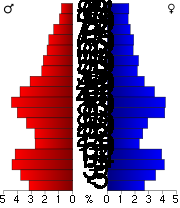
In the county, the population was spread out with 27.10% under the age of 18, 7.60% from 18 to 24, 28.30% from 25 to 44, 21.80% from 45 to 64, and 15.20% who were 65 years of age or older. The median age was 37 years. For every 100 females there were 102.60 males. For every 100 females age 18 and over, there were 100.40 males.
Source: Demographics Services Center, Wisconsin Department of Administration NA- Not Available (DSC only prepares population projections for WI municipalities to 2025) Chelsea and Molitor estimates prepared by NWRPC
A network of 250 miles (402.3 km) of county highways serves Taylor County's rural areas. Major east-west highways include A, D, M, and O. Major north-south routes include C, E, and H.
Towns in Taylor County are responsible for the maintenance and upkeep of their individual town roads.
There is one designated Rustic Road in Taylor County. Dedicated in 1975, Rustic Road No. 1, a five-mile (8 km) long gravel road between STH 102 and CTH D near Rib Lake was the first Rustic Road in Wisconsin. This road crosses through scenic hills and valleys created by glaciers nearly 12,000 years ago. A historical marker alongside the road commemorates the designation.
County (United States)
In the United States, a county is a geographic subdivision of a state , usually assigned some governmental authority. The term "county" is used in 48 of the 50 states; Louisiana is divided into parishes and Alaska into boroughs. Parishes and boroughs are called "county-equivalents" by the U.S...
in the U.S. state
U.S. state
A U.S. state is any one of the 50 federated states of the United States of America that share sovereignty with the federal government. Because of this shared sovereignty, an American is a citizen both of the federal entity and of his or her state of domicile. Four states use the official title of...
of Wisconsin
Wisconsin
Wisconsin is a U.S. state located in the north-central United States and is part of the Midwest. It is bordered by Minnesota to the west, Iowa to the southwest, Illinois to the south, Lake Michigan to the east, Michigan to the northeast, and Lake Superior to the north. Wisconsin's capital is...
. As of 2010, the population was 20,689. Its county seat
County seat
A county seat is an administrative center, or seat of government, for a county or civil parish. The term is primarily used in the United States....
is Medford
Medford, Wisconsin
Medford is a city in Taylor County, in north-central Wisconsin, United States. The population was 4,326 at the 2010 census. The city is located mostly within the boundaries of the Town of Medford.- Geography :Medford is located at Medford is a city in Taylor County, in north-central Wisconsin,...
.
History
The earliest recorded event in Taylor county probably occurred in 1661, when Wisconsin was part of New FranceNew France
New France was the area colonized by France in North America during a period beginning with the exploration of the Saint Lawrence River by Jacques Cartier in 1534 and ending with the cession of New France to Spain and Great Britain in 1763...
. A band of Huron Indians from eastern Ontario
Ontario
Ontario is a province of Canada, located in east-central Canada. It is Canada's most populous province and second largest in total area. It is home to the nation's most populous city, Toronto, and the nation's capital, Ottawa....
had fled
Beaver Wars
The Beaver Wars, also sometimes called the Iroquois Wars or the French and Iroquois Wars, commonly refers to a series of conflicts fought in the mid-17th century in eastern North America...
the Iroquois
Iroquois
The Iroquois , also known as the Haudenosaunee or the "People of the Longhouse", are an association of several tribes of indigenous people of North America...
and taken refuge near the headwaters of the Black River, probably around Lake Chelsea in the northeast part of the county. Father René Menard
René Menard
René Menard was a French Jesuit missionary explorer who traveled to Canada in 1641, learned the language of the Wyandot, and was soon in charge of many of the satellite missions around Sainte-Marie among the Hurons...
, a French Jesuit priest
Society of Jesus
The Society of Jesus is a Catholic male religious order that follows the teachings of the Catholic Church. The members are called Jesuits, and are also known colloquially as "God's Army" and as "The Company," these being references to founder Ignatius of Loyola's military background and a...
who had travelled up the Great Lakes
Great Lakes
The Great Lakes are a collection of freshwater lakes located in northeastern North America, on the Canada – United States border. Consisting of Lakes Superior, Michigan, Huron, Erie, and Ontario, they form the largest group of freshwater lakes on Earth by total surface, coming in second by volume...
as far as Keweenaw Bay
Keweenaw Bay
Keweenaw Bay is an arm of Lake Superior in North America. It is located adjacent to the Upper Peninsula of the U.S. state of Michigan, to the southeast of the Keweenaw Peninsula. It is also the name of a small community near the bay....
in upper Michigan, heard that these Hurons were starving. He decided to try to reach the m to baptize
Baptism
In Christianity, baptism is for the majority the rite of admission , almost invariably with the use of water, into the Christian Church generally and also membership of a particular church tradition...
them, despite his own weak health and scant supplies. In mid-summer he and a French fur trader
Fur trade
The fur trade is a worldwide industry dealing in the acquisition and sale of animal fur. Since the establishment of world market for in the early modern period furs of boreal, polar and cold temperate mammalian animals have been the most valued...
set out, following rivers and streams in birchbark
Birch bark
Birch bark or birchbark is the bark of several Eurasian and North American birch trees of the genus Betula.The strong and water-resistant cardboard-like bark can be easily cut, bent, and sewn, which made it a valuable building, crafting, and writing material, since pre-historic times...
canoes
Canoe
A canoe or Canadian canoe is a small narrow boat, typically human-powered, though it may also be powered by sails or small electric or gas motors. Canoes are usually pointed at both bow and stern and are normally open on top, but can be decked over A canoe (North American English) or Canadian...
down into Wisconsin. Finally, a day's journey from the Huron camp, Father Menard separated from his travelling companion at a rapids
Rapid
A rapid is a section of a river where the river bed has a relatively steep gradient causing an increase in water velocity and turbulence. A rapid is a hydrological feature between a run and a cascade. A rapid is characterised by the river becoming shallower and having some rocks exposed above the...
to carry some supplies. He was never seen again. The place where he disappeared is believed to be the dells of the Big Rib River
Big Rib River
The Big Rib River is a river in the U.S. state of Wisconsin. It originates in northeastern Taylor County at Rib Lake and flows into Marathon County where it joins the Wisconsin River....
, below Goodrich
Goodrich, Wisconsin
Goodrich is a town in Taylor County, Wisconsin, United States. The population was 487 at the 2000 census. The unincorporated community of Goodrich is located in the town.-Geography:...
in the southeast corner of Taylor county.
On June 8, 1847, before any settlers or loggers, a team of surveyors
Surveying
See Also: Public Land Survey SystemSurveying or land surveying is the technique, profession, and science of accurately determining the terrestrial or three-dimensional position of points and the distances and angles between them...
entered the county southwest of Medford, where County E now enters from Clark County. They were working for the U.S. government, marking a north-south line called the Fourth Principal Meridian
Fourth Principal Meridian
The Fourth Principal Meridian, set in 1815, is the principal meridian for land surveys in northwestern Illinois and west-central Illinois, and its 1831 extension is the principal meridian for land surveys in Wisconsin and northeastern Minnesota...
, from which much of the land in the state would be measured. For six days they worked their way through woods and swamps, up what is now the southern part of E and across the valley that is now the Mondeaux Flowage, before continuing north into what is now Price County. The head of the team wrote of the trip:
During four consecutive weeks there was not a dry garment in the party, day or night… we were constantly surrounded and as constantly excoriated by swarms or rather clouds of mosquitoes, and still more troublesome insects…
On their way through the county, they and other surveyors recorded a forest then dominated by hemlock, yellow birch and sugar maple
Sugar Maple
Acer saccharum is a species of maple native to the hardwood forests of northeastern North America, from Nova Scotia west to southern Ontario, and south to Georgia and Texas...
, with white pine
Eastern White Pine
Pinus strobus, commonly known as the eastern white pine, is a large pine native to eastern North America, occurring from Newfoundland west to Minnesota and southeastern Manitoba, and south along the Appalachian Mountains to the northern edge of Georgia.It is occasionally known as simply white pine,...
the fourth or sixth most frequent. The mix of tree species then resembled today's Gerstberger Pines grove southeast of Rib Lake.
Logging began in this area in the 1870s. Loggers came up the rivers and floated pine logs out in spring and early summer log drives
Log driving
Log driving is a means of log transport which makes use of a river's current to move floating tree trunks downstream to sawmills and pulp mills.It was the main transportation method of the early logging industry in Europe and North America...
, down the Big Rib River
Big Rib River
The Big Rib River is a river in the U.S. state of Wisconsin. It originates in northeastern Taylor County at Rib Lake and flows into Marathon County where it joins the Wisconsin River....
into the Wisconsin River
Wisconsin River
-External links:* * * , Wisconsin Historical Society* * * *...
, down the Black River to the south, and west down the Jump
Jump River
The Jump River is a small rocky river in north-central Wisconsin. In the late 19th century it was used to drive logs down to the Chippewa. Today it is recreational, rambling through woods and farmlands, used mostly by fishermen and paddlers.-Geography:...
and the Yellow River
Yellow River (Chippewa River)
The Yellow River in north central Wisconsin is a tributary of the Chippewa River. For the most part it is a mud and rock-bottomed river flowing through forest and farmland...
into the Chippewa
Chippewa River (Wisconsin)
The Chippewa River in Wisconsin flows approximately 183 miles through west-central and northwestern Wisconsin. It was once navigable for approximately 50 miles of its length, from the Mississippi River, by Durand, northeast to Eau Claire. Its catchment defines a portion of the northern boundary...
.
In the early 1870s the Wisconsin Central Railway built its line up through Stetsonville, Medford, Whittlesey, Chelsea, and Westboro, with a spur to Rib Lake, and began to haul out the trees that didn't float well.
In 1875 Taylor County with its current boundaries was carved out of the larger Chippewa, Lincoln and Clark counties and a bit of Marathon with the county seat at Medford. The county was probably named for Wisconsin's governor at the time, William E. Taylor.
From around 1902 to 1905 the Stanley, Merrill and Phillips Railway ran a line up the west end of the county through Polley, Gilman
Gilman, Taylor County, Wisconsin
Gilman is a village in Taylor County, Wisconsin, United States. The population was 474 at the 2000 census. The village is located between the towns of Aurora and Ford.-Geography:Gilman is located at ....
, Hannibal
Hannibal, Wisconsin
Hannibal is an unincorporated community located in Taylor County, Wisconsin, United States. Hannibal is located on Wisconsin Highway 73 and County Highway M north of Gilman, in the town of Cleveland...
and Jump River. In 1902 the Eau Claire, Chippewa Falls, and Northeastern Railroad (better known as Omaha) pushed in from Holcombe
Holcombe, Wisconsin
Holcombe is an unincorporated census-designated place located in Chippewa County, Wisconsin, United States. Holcombe is located on the Chippewa River north-northeast of Cornell, in the town of Lake Holcombe. Holcombe has a post office with ZIP code 54745. As of the 2010 census, its population was...
through Hannibal to now-abandoned Hughey on the Yellow River. In 1905 the Wisconsin Central Railroad built its line through Clark (now a ghost town
Ghost town
A ghost town is an abandoned town or city. A town often becomes a ghost town because the economic activity that supported it has failed, or due to natural or human-caused disasters such as floods, government actions, uncontrolled lawlessness, war, or nuclear disasters...
), Lublin
Lublin, Wisconsin
Lublin is a village in Taylor County, Wisconsin, United States. The population was 110 at the 2000 census.-Geography:Lublin is located at , along the North Fork Eau Claire River near its headwaters....
, Polley, Gilman and Donald, heading for Superior. The SM&P and Omaha were primarily logging railroads, which hauled out lumber and incidentally transported passengers and other cargo. With the lumber gone, the SM&P shut down in 1933.
After the good timber was gone, the lumber companies sold many of the cutover forties to farm families. Initially they tried making their living in various ways: selling milk, eggs, beef and wool, growing cucumbers and peas, and various other schemes. But before long dairy
Dairy farming
Dairy farming is a class of agricultural, or an animal husbandry, enterprise, for long-term production of milk, usually from dairy cows but also from goats and sheep, which may be either processed on-site or transported to a dairy factory for processing and eventual retail sale.Most dairy farms...
had become the predominant form of agriculture in the county. By 1923 Medford had the second largest co-op creamery in Wisconsin. The number of dairy farms peaked around 3,300 in the early 1940s and had dropped to 1,090 by 1995.
Much of the cut-over north-central part of the county was designated part of the Chequamegon National Forest
Chequamegon-Nicolet National Forest
The Chequamegon-Nicolet National Forest is a 1,530,647 acre U.S. National Forest in northern Wisconsin in the United States. Much of the old growth forest in this region was destroyed by logging in the early part of the 20th century...
in 1933. Mondeaux Dam Recreation Area and other parts of the forest were developed by the Civilian Conservation Corps
Civilian Conservation Corps
The Civilian Conservation Corps was a public work relief program that operated from 1933 to 1942 in the United States for unemployed, unmarried men from relief families, ages 18–25. A part of the New Deal of President Franklin D...
starting in 1933. CCC camps were at Mondeaux, Perkinstown, and near the current Jump River fire tower. Today hikers can follow the Ice Age National Scenic Trail
Ice Age Trail
The Ice Age Trail is a designated National Scenic Trail in the United States that will run some through the state of Wisconsin once completed. The trail is administered by the National Park Service, and is constructed and maintained by numerous private and public agencies including, most notably,...
through the national forest and the northeast corner of the county.
The major early industry was the production of sawlogs, lumber, and shingles. Large sawmills were at Medford and Rib Lake. Medford, Perkinstown
Perkinstown, Wisconsin
Perkinstown is an unincorporated community located in the town of Grover, Taylor County, Wisconsin, United States. Perkinstown is located on County Highway M in the Chequamegon National Forest, east-northeast of Gilman....
and Rib Lake had tanneries
Tanning
Tanning is the making of leather from the skins of animals which does not easily decompose. Traditionally, tanning used tannin, an acidic chemical compound from which the tanning process draws its name . Coloring may occur during tanning...
, which used local hemlock bark in the tanning process. Whittlesey had an early brickyard
Brick
A brick is a block of ceramic material used in masonry construction, usually laid using various kinds of mortar. It has been regarded as one of the longest lasting and strongest building materials used throughout history.-History:...
. Industry has diversified since, into creameries
Creamery
In a dairy, the creamery is the location of cream processing. Cream is separated from whole milk; pasteurization is done to the skimmed milk and cream separately. Whole milk for sale has had some cream returned to the skimmed milk....
, window
Window
A window is a transparent or translucent opening in a wall or door that allows the passage of light and, if not closed or sealed, air and sound. Windows are usually glazed or covered in some other transparent or translucent material like float glass. Windows are held in place by frames, which...
manufacturers, plastic
Plastic
A plastic material is any of a wide range of synthetic or semi-synthetic organic solids used in the manufacture of industrial products. Plastics are typically polymers of high molecular mass, and may contain other substances to improve performance and/or reduce production costs...
s, and food processing
Food processing
Food processing is the set of methods and techniques used to transform raw ingredients into food or to transform food into other forms for consumption by humans or animals either in the home or by the food processing industry...
- mostly at Medford.
Geography
Taylor county's terrainTerrain
Terrain, or land relief, is the vertical and horizontal dimension of land surface. When relief is described underwater, the term bathymetry is used...
was shaped chiefly by glaciers
Glacier
A glacier is a large persistent body of ice that forms where the accumulation of snow exceeds its ablation over many years, often centuries. At least 0.1 km² in area and 50 m thick, but often much larger, a glacier slowly deforms and flows due to stresses induced by its weight...
. Geologists believe that 15,000 to 25,000 years ago the Laurentide ice sheet
Laurentide ice sheet
The Laurentide Ice Sheet was a massive sheet of ice that covered hundreds of thousands of square miles, including most of Canada and a large portion of the northern United States, multiple times during Quaternary glacial epochs. It last covered most of northern North America between c. 95,000 and...
pushed down from Canada across what are now the Great Lakes, and over much of the northern U.S. One of the ice sheet's lobes bulldozed down over two thirds of Taylor county, at its farthest extent covering a line from Westboro through Perkinstown to Lublin. The ice sheet pushed down that far, then melted back, leaving the band of choppy hills and little lakes that cuts diagonally across the county. This band of hills is called the Perkinstown terminal moraine
Terminal moraine
A terminal moraine, also called end moraine, is a moraine that forms at the end of the glacier called the snout.Terminal moraines mark the maximum advance of the glacier. An end moraine is at the present boundary of the glacier....
. North and west of the moraine, in the corner of the county toward Jump River, that last glacier left behind a more gently rolling plain of glacial till. The striking glacial features in this area are glacial erratic boulders
Glacial erratic
A glacial erratic is a piece of rock that differs from the size and type of rock native to the area in which it rests. "Erratics" take their name from the Latin word errare, and are carried by glacial ice, often over distances of hundreds of kilometres...
and eskers
Esker
An esker is a long winding ridge of stratified sand and gravel, examples of which occur in glaciated and formerly glaciated regions of Europe and North America...
. Along with the Mondeaux and Lost Lake eskers, there are others in the towns of Westboro, Pershing, Aurora and Taft. The southeast corner of the county toward Stetsonville and Goodrich was not covered by the last glacier, but was covered by earlier ones. Here too they left glacial till, but the land is generally flatter and less rocky since erosion has had more time to level things.
Beneath the glacial till lies Cambrian
Cambrian
The Cambrian is the first geological period of the Paleozoic Era, lasting from Mya ; it is succeeded by the Ordovician. Its subdivisions, and indeed its base, are somewhat in flux. The period was established by Adam Sedgwick, who named it after Cambria, the Latin name for Wales, where Britain's...
and Precambrian
Precambrian
The Precambrian is the name which describes the large span of time in Earth's history before the current Phanerozoic Eon, and is a Supereon divided into several eons of the geologic time scale...
bedrock
Bedrock
In stratigraphy, bedrock is the native consolidated rock underlying the surface of a terrestrial planet, usually the Earth. Above the bedrock is usually an area of broken and weathered unconsolidated rock in the basal subsoil...
. Outcrops have been exposed in places by the Jump and Yellow Rivers. An unmined copper and gold deposit known as "the Bend Project" lies north of Perkinstown.
The county straddles a divide between three river systems. The Jump River
Jump River
The Jump River is a small rocky river in north-central Wisconsin. In the late 19th century it was used to drive logs down to the Chippewa. Today it is recreational, rambling through woods and farmlands, used mostly by fishermen and paddlers.-Geography:...
and Yellow
Yellow River (Chippewa River)
The Yellow River in north central Wisconsin is a tributary of the Chippewa River. For the most part it is a mud and rock-bottomed river flowing through forest and farmland...
flow west into the Chippewa river
Chippewa River (Wisconsin)
The Chippewa River in Wisconsin flows approximately 183 miles through west-central and northwestern Wisconsin. It was once navigable for approximately 50 miles of its length, from the Mississippi River, by Durand, northeast to Eau Claire. Its catchment defines a portion of the northern boundary...
valley. The Big Rib River
Big Rib River
The Big Rib River is a river in the U.S. state of Wisconsin. It originates in northeastern Taylor County at Rib Lake and flows into Marathon County where it joins the Wisconsin River....
flows southeast to the Wisconsin
Wisconsin River
-External links:* * * , Wisconsin Historical Society* * * *...
. And the Black River flows out to the south. All eventually feed the Mississippi
Mississippi River
The Mississippi River is the largest river system in North America. Flowing entirely in the United States, this river rises in western Minnesota and meanders slowly southwards for to the Mississippi River Delta at the Gulf of Mexico. With its many tributaries, the Mississippi's watershed drains...
.
According to the U.S. Census Bureau
United States Census Bureau
The United States Census Bureau is the government agency that is responsible for the United States Census. It also gathers other national demographic and economic data...
, the county has a total area of 984 square miles (2,548.5 km²), of which 975 square miles (2,525.2 km²) is land and 10 square miles (25.9 km²) (0.98%) is water.
Adjacent counties
- Price CountyPrice County, WisconsinPrice County is a county in the U.S. state of Wisconsin. As of 2000, the population was 15,822. Its county seat is Phillips.-Geography:According to the U.S. Census Bureau, the county has a total area of , of which is land and is water...
- north - Lincoln CountyLincoln County, WisconsinLincoln County is a county located in the U.S. state of Wisconsin. As of 2000, the population was 29,641. Its county seat is Merrill.-Geography:According to the U.S...
- east - Marathon CountyMarathon County, WisconsinMarathon County is a county located in the U.S. state of Wisconsin. It is part of the Wausau, WI, Metropolitan Statistical Area. As of 2010, the population was 134,063. Its county seat is Wausau.-Geography:...
- southeast - Clark County - south
- Chippewa CountyChippewa County, WisconsinChippewa County is a county located in the U.S. state of Wisconsin. As of 2000, the population was 55,195. Its county seat is Chippewa Falls. The United States Census Bureau's Eau Claire Metropolitan Statistical Area includes all of Chippewa County...
- west - Rusk CountyRusk County, WisconsinRusk County is a county in the U.S. state of Wisconsin. As of 2000, the population was 15,347. Its county seat is Ladysmith. Founded in 1901, Rusk County was originally named "Gates" County. It was formed out of the northern portion of Chippewa County....
- northwest
Major highways
 Highway 73 (Wisconsin) Highway 73 (Wisconsin)Highway 73 (Wisconsin) State Trunk Highway 73 is a state highway in the U.S. state of Wisconsin. It runs north–south across central Wisconsin from Ingram to Edgerton, with the exception of Wood and Adams counties, where this route runs east–west.-Municipalities:Highway 73 travels through Rock, Dane,...  Highway 97 (Wisconsin) Highway 97 (Wisconsin)Highway 97 (Wisconsin) State Trunk Highway 97 is a state highway in the U.S. state of Wisconsin. It runs north–south in central Wisconsin from near Goodrich to Marshfield....  Highway 102 (Wisconsin) Highway 102 (Wisconsin)Highway 102 (Wisconsin) State Trunk Highway 102 is a state highway in the north central region of the U.S. state of Wisconsin. It runs from WIS 13 north of Chelsea northeast to WIS 86 in Spirit... |


Demographics
As of the census
Census
A census is the procedure of systematically acquiring and recording information about the members of a given population. It is a regularly occurring and official count of a particular population. The term is used mostly in connection with national population and housing censuses; other common...
of 2000, there were 19,680 people, 7,529 households, and 5,345 families residing in the county. The population density
Population density
Population density is a measurement of population per unit area or unit volume. It is frequently applied to living organisms, and particularly to humans...
was 20 people per square mile (8/km²). There were 8,595 housing units at an average density of 9 per square mile (3/km²). The racial makeup of the county was 98.71% White
Race (United States Census)
Race and ethnicity in the United States Census, as defined by the Federal Office of Management and Budget and the United States Census Bureau, are self-identification data items in which residents choose the race or races with which they most closely identify, and indicate whether or not they are...
, 0.09% Black
Race (United States Census)
Race and ethnicity in the United States Census, as defined by the Federal Office of Management and Budget and the United States Census Bureau, are self-identification data items in which residents choose the race or races with which they most closely identify, and indicate whether or not they are...
or African American
Race (United States Census)
Race and ethnicity in the United States Census, as defined by the Federal Office of Management and Budget and the United States Census Bureau, are self-identification data items in which residents choose the race or races with which they most closely identify, and indicate whether or not they are...
, 0.19% Native American
Race (United States Census)
Race and ethnicity in the United States Census, as defined by the Federal Office of Management and Budget and the United States Census Bureau, are self-identification data items in which residents choose the race or races with which they most closely identify, and indicate whether or not they are...
, 0.23% Asian
Race (United States Census)
Race and ethnicity in the United States Census, as defined by the Federal Office of Management and Budget and the United States Census Bureau, are self-identification data items in which residents choose the race or races with which they most closely identify, and indicate whether or not they are...
, 0.19% from other races
Race (United States Census)
Race and ethnicity in the United States Census, as defined by the Federal Office of Management and Budget and the United States Census Bureau, are self-identification data items in which residents choose the race or races with which they most closely identify, and indicate whether or not they are...
, and 0.59% from two or more races. 0.65% of the population were Hispanic
Race (United States Census)
Race and ethnicity in the United States Census, as defined by the Federal Office of Management and Budget and the United States Census Bureau, are self-identification data items in which residents choose the race or races with which they most closely identify, and indicate whether or not they are...
or Latino
Race (United States Census)
Race and ethnicity in the United States Census, as defined by the Federal Office of Management and Budget and the United States Census Bureau, are self-identification data items in which residents choose the race or races with which they most closely identify, and indicate whether or not they are...
of any race. 57.9% were of German, 9.1% Polish, 5.3% American
United States
The United States of America is a federal constitutional republic comprising fifty states and a federal district...
and 5.3% Norwegian ancestry according to Census 2000. 96.2% spoke English
English language
English is a West Germanic language that arose in the Anglo-Saxon kingdoms of England and spread into what was to become south-east Scotland under the influence of the Anglian medieval kingdom of Northumbria...
, 1.7% German
German language
German is a West Germanic language, related to and classified alongside English and Dutch. With an estimated 90 – 98 million native speakers, German is one of the world's major languages and is the most widely-spoken first language in the European Union....
and 1.2% Spanish
Spanish language
Spanish , also known as Castilian , is a Romance language in the Ibero-Romance group that evolved from several languages and dialects in central-northern Iberia around the 9th century and gradually spread with the expansion of the Kingdom of Castile into central and southern Iberia during the...
as their first language.
There were 7,529 households out of which 33.80% had children under the age of 18 living with them, 59.30% were married couples
Marriage
Marriage is a social union or legal contract between people that creates kinship. It is an institution in which interpersonal relationships, usually intimate and sexual, are acknowledged in a variety of ways, depending on the culture or subculture in which it is found...
living together, 7.10% had a female householder with no husband present, and 29.00% were non-families. 24.70% of all households were made up of individuals and 11.20% had someone living alone who was 65 years of age or older. The average household size was 2.58 and the average family size was 3.10.
In the county, the population was spread out with 27.10% under the age of 18, 7.60% from 18 to 24, 28.30% from 25 to 44, 21.80% from 45 to 64, and 15.20% who were 65 years of age or older. The median age was 37 years. For every 100 females there were 102.60 males. For every 100 females age 18 and over, there were 100.40 males.
Cities, villages, and towns
|
Grover, Taylor County, Wisconsin Grover is a town in Taylor County, Wisconsin, in the United States. As of the 2000 census, the town population was 233. The unincorporated community of Perkinstown is located in the town.-Geography:Grover is a large town - six miles by twelve... Hammel, Wisconsin Hammel is a town in Taylor County, Wisconsin, United States. The population was 735 at the 2000 census. The unincorporated community of Murat is located in the town.-Geography:... Holway, Wisconsin Holway is a town in Taylor County, Wisconsin, United States. The population was 854 at the 2000 census.-Geography:According to the United States Census Bureau, the town has a total area of 36.4 square miles , of which, 36.3 square miles of it is land and 0.03% is water.-History:The... Jump River (town), Wisconsin Jump River is a town in Taylor County, Wisconsin, United States. The population was 311 at the 2000 census. The town takes its name from the Jump River which flows through its northwest corner... Little Black, Wisconsin Little Black is a town located in Taylor County, Wisconsin. As of the 2000 census, the town had a total population of 1,148. The unincorporated community of Little Black is located in the town.-Geography:... Lublin, Wisconsin Lublin is a village in Taylor County, Wisconsin, United States. The population was 110 at the 2000 census.-Geography:Lublin is located at , along the North Fork Eau Claire River near its headwaters.... Maplehurst, Wisconsin Maplehurst is a town in Taylor County, Wisconsin, United States. The population was 359 at the 2000 census.-Geography:According to the United States Census Bureau, the town has a total area of 35.9 square miles , of which, 35.9 square miles of it is land and 0.04 square miles of it... McKinley, Taylor County, Wisconsin McKinley is a town in Taylor County, Wisconsin, United States. The population was 418 at the 2000 census. The census-designated place of Jump River is located partially in the town.-Geography:... Medford (town), Wisconsin Medford is a town in Taylor County, Wisconsin, United States. The population was 2,216 at the 2000 census. The City of Medford lies mostly within the town boundaries.-Geography:... |
Medford, Wisconsin Medford is a city in Taylor County, in north-central Wisconsin, United States. The population was 4,326 at the 2010 census. The city is located mostly within the boundaries of the Town of Medford.- Geography :Medford is located at Medford is a city in Taylor County, in north-central Wisconsin,... Molitor, Wisconsin Molitor is a town in Taylor County, Wisconsin, United States. The population was 324 at the 2010 census.-Geography:According to the United States Census Bureau, the town has a total area of 36.0 square miles , of which, 35.3 square miles of it is land and 0.7 square miles of it is... Pershing, Wisconsin Pershing is a town in Taylor County, Wisconsin, United States. The population was 180 at the 2000 census. The unincorporated community of Donald is located in the town.-Geography:... Rib Lake (town), Wisconsin Rib Lake is a town in Taylor County, Wisconsin, United States. The population was 768 at the 2000 census. The Village of Rib Lake is located within the town.-Geography:... Rib Lake, Wisconsin Rib Lake is a village in Taylor County, Wisconsin, United States. The population was 878 at the 2000 census. The village is within the Town of Rib Lake.-Geography:Rib Lake is located at .... Roosevelt, Taylor County, Wisconsin Roosevelt is a town in Taylor County, Wisconsin, United States. The population was 444 at the 2000 census. The village of Lublin lies within the town of Roosevelt... Stetsonville, Wisconsin Stetsonville is a village in Taylor County, Wisconsin, United States. The population was 563 at the 2000 census.-Geography:Stetsonville is located at .... Taft, Wisconsin Taft is a town in the southwest corner of Taylor County, Wisconsin, United States. The population was 361 at the 2000 census. The town of Bellinger is located partially in the town.-Geography:... Westboro, Wisconsin Westboro is a town in Taylor County, Wisconsin, United States. The population was 660 at the 2000 census. The census-designated place of Westboro is located in the town. The unincorporated community of Queenstown is also located in the town.-Geography:... |
Unincorporated communities
- BellingerBellinger, WisconsinBellinger is an unincorporated community located in the towns of Roosevelt and Taft, in Taylor County, Wisconsin, United States....
- Chelsea
- DonaldDonald, WisconsinDonald is an unincorporated community located in the town of Pershing, Taylor County, Wisconsin, United States....
- GoodrichGoodrich (community), WisconsinGoodrich is an unincorporated community located in the town of Goodrich, Taylor County, Wisconsin, United States....
- HannibalHannibal, WisconsinHannibal is an unincorporated community located in Taylor County, Wisconsin, United States. Hannibal is located on Wisconsin Highway 73 and County Highway M north of Gilman, in the town of Cleveland...
- HugheyHughey, WisconsinHughey is an unincorporated community located in the town of Cleveland, Taylor County, Wisconsin, United States....
- InterwaldInterwald, WisconsinInterwald is an unincorporated community located in the town of Greenwood, Taylor County, Wisconsin, United States....
- Jump River
- Little BlackLittle Black (community), WisconsinLittle Black is an unincorporated community located in the town of Little Black, Taylor County, Wisconsin, United States. Little Black is located along Wisconsin Highway 13 and the Canadian National Railway south of Medford....
- MuratMurat, WisconsinMurat is an unincorporated community located in the town of Hammel, Taylor County, Wisconsin, United States....
- PerkinstownPerkinstown, WisconsinPerkinstown is an unincorporated community located in the town of Grover, Taylor County, Wisconsin, United States. Perkinstown is located on County Highway M in the Chequamegon National Forest, east-northeast of Gilman....
- PolleyPolley, WisconsinPolley is an unincorporated community located in the town of Ford, Taylor County, Wisconsin, United States....
- QueenstownQueenstown, WisconsinQueenstown is an unincorporated community located in the town of Westboro, Taylor County, Wisconsin, United States....
- Westboro
- WhittleseyWhittlesey, WisconsinWhittlesey is a census-designated place in the town of Chelsea, Taylor County, Wisconsin, United States. Its population was 105 as of the 2010 census....
Population characteristics
Taylor County has experienced moderate population growth over the past 50 years. Overall there was a decrease between 1950 and 1970, but since 1970 the county has seen moderate but steady growth, gaining 2,722 people.| Area | 1950 | 1960 | 1970 | 1980 | 1990 | 2000 | Numeric Change 1950-2000 | Jan 1, 2006 Estimate |
|---|---|---|---|---|---|---|---|---|
| T. Aurora | 564 | 563 | 466 | 461 | 473 | 386 | -178 | 375 |
| T. Browning | 630 | 630 | 644 | 702 | 740 | 850 | 220 | 889 |
| T. Chelsea | 603 | 566 | 554 | 677 | 731 | 719 | 116 | 754 |
| T. Cleveland | 458 | 358 | 250 | 286 | 235 | 262 | -196 | 272 |
| T. Deer Creek | 780 | 810 | 764 | 747 | 738 | 733 | -47 | 750 |
| T. Ford | 334 | 306 | 248 | 274 | 254 | 276 | -58 | 271 |
| T. Goodrich | 460 | 414 | 373 | 408 | 454 | 487 | 27 | 497 |
| T. Greenwood | 758 | 653 | 635 | 705 | 634 | 642 | -116 | 672 |
| T. Grover | 266 | 232 | 210 | 229 | 214 | 233 | -33 | 239 |
| T. Hammel | 516 | 526 | 509 | 562 | 633 | 735 | 219 | 749 |
| T. Holway | 834 | 859 | 837 | 903 | 779 | 854 | 20 | 879 |
| T. Jump River | 448 | 391 | 355 | 365 | 330 | 311 | -137 | 317 |
| T. Little Black | 1216 | 1182 | 1133 | 1169 | 1195 | 1148 | -68 | 1187 |
| T. McKinley | 570 | 491 | 461 | 416 | 403 | 418 | -152 | 440 |
| T. Maplehurst | 462 | 405 | 348 | 345 | 300 | 359 | -103 | 364 |
| T. Medford | 1661 | 1622 | 1546 | 1834 | 1962 | 2216 | 555 | 2253 |
| T. Molitor | 200 | 168 | 199 | 212 | 183 | 263 | 63 | 269 |
| T. Pershing | 418 | 358 | 295 | 276 | 217 | 180 | -238 | 181 |
| T. Rib Lake | 769 | 657 | 615 | 682 | 746 | 768 | -1 | 775 |
| T.Roosevelt | 678 | 602 | 518 | 491 | 429 | 444 | -234 | 446 |
| T. Taft | 499 | 418 | 355 | 347 | 367 | 361 | -138 | 380 |
| T. Westboro | 783 | 720 | 631 | 706 | 663 | 660 | -123 | 699 |
| V. Gilman | 402 | 379 | 328 | 436 | 412 | 474 | 72 | 460 |
| V. Lublin | 161 | 160 | 143 | 142 | 129 | 110 | -51 | 100 |
| V. Rib Lake | 853 | 794 | 782 | 945 | 887 | 878 | 25 | 878 |
| V. Stetsonville | 334 | 319 | 305 | 487 | 511 | 563 | 229 | 563 |
| C. Medford | 2799 | 3260 | 3454 | 4010 | 4282 | 4350 | 1551 | 4260 |
| Taylor County | 18456 | 17843 | 16958 | 18817 | 18901 | 19680 | 1224 | 19917 |
Population projections (2010-2030)
| Area | 2010 | 2015 | 2020 | 2025 | 2030 |
|---|---|---|---|---|---|
| T. Aurora | 352 | 337 | 321 | 304 | N/A |
| T. Browning | 930 | 974 | 1016 | 1055 | N/A |
| T. Chelsea | 737 | 751 | 763 | 771 | 776 |
| T. Cleveland | 280 | 291 | 301 | 309 | N/A |
| T. Deer Creek | 738 | 745 | 749 | 752 | N/A |
| T. Ford | 294 | 305 | 315 | 324 | N/A |
| T. Goodrich | 502 | 513 | 521 | 529 | N/A |
| T. Greenwood | 649 | 655 | 660 | 663 | N/A |
| T. Grover | 251 | 262 | 271 | 280 | N/A |
| T. Hammel | 794 | 827 | 858 | 887 | N/A |
| T. Holway | 868 | 880 | 889 | 896 | N/A |
| T. Jump River | 291 | 282 | 272 | 262 | N/A |
| T. Little Black | 1142 | 1145 | 1145 | 1142 | N/A |
| T. McKinley | 431 | 440 | 447 | 454 | N/A |
| T. Maplehurst | 366 | 371 | 375 | 379 | N/A |
| T. Medford | 2362 | 2447 | 2525 | 2596 | N/A |
| T. Molitor | 271 | 277 | 283 | 286 | 288 |
| T. Pershing | 163 | 155 | 147 | 132 | N/A |
| T. Rib Lake | 784 | 796 | 806 | 813 | N/A |
| T. Roosevelt | 436 | 433 | 430 | 426 | N/A |
| T. Taft | 366 | 370 | 373 | 375 | N/A |
| T. Westboro | 666 | 672 | 677 | 680 | N/A |
| V. Gilman | 498 | 513 | 526 | 538 | N/A |
| V. Lublin | 100 | 95 | 90 | 85 | N/A |
| V. Rib Lake | 861 | 857 | 851 | 842 | N/A |
| V. Stetsonville | 575 | 584 | 592 | 597 | N/A |
| C. Medford | 4280 | 4262 | 4238 | 4200 | N/A |
| Taylor County | 19987 | 20239 | 20441 | 20584 | 20637 |
| Wisconsin | 5751470 | 5931386 | 6110878 | 6274867 | 6415923 |
Source: Demographics Services Center, Wisconsin Department of Administration NA- Not Available (DSC only prepares population projections for WI municipalities to 2025) Chelsea and Molitor estimates prepared by NWRPC
Transportation
The state of Wisconsin has jurisdiction over 120 miles (193.1 km) of state highways in Taylor County, including STH 13, 64, 73, 97, and 102. STH 13 runs north-south through the eastern half of the county and STH 73 is the major north-south highway in the western half of the county. STH 64 is the major highway running east-west through Taylor county. Through a contractual agreement with the state, the Taylor County Highway Department is responsible for maintenance of state highways and right-of-ways.A network of 250 miles (402.3 km) of county highways serves Taylor County's rural areas. Major east-west highways include A, D, M, and O. Major north-south routes include C, E, and H.
Towns in Taylor County are responsible for the maintenance and upkeep of their individual town roads.
There is one designated Rustic Road in Taylor County. Dedicated in 1975, Rustic Road No. 1, a five-mile (8 km) long gravel road between STH 102 and CTH D near Rib Lake was the first Rustic Road in Wisconsin. This road crosses through scenic hills and valleys created by glaciers nearly 12,000 years ago. A historical marker alongside the road commemorates the designation.
Air transportation
The primary airport in the county is the Taylor County Airport. There are six other private landing strips in the county. Located in the Town of Deer Creek, approximately three miles southeast of the City of Medford in T.30N-R.2E Section 7, the Taylor County Airport is the only public airport in the county. It has a 4100 feet (1,249.7 m) paved and lighted runway with an NDB non-precision approach. Services provided include: Jet A fuel, 100 low-lead AV gas, 24-hour fuel service, car rental, taxi service, large ramp/tie down area, flight instruction, and computerized weather briefing/flight planning service. The addition of an east/west 5001 ft (1,524.3 m) paved and lighted runway and an automated weather observation system (AWOS) was completed in 1996. All runways are paved and in excellent condition.| Location | Airport Name | Status | Location |
|---|---|---|---|
| Roosevelt | Baldez Field | Private | T .30N-R.3W Sec.2 |
| Goodrich | Charlie's Field | Private | T.31N-R.3E Sec. 19 |
| Aurora | East Gilman Field | Private | T.31N-R.3W Sec. 18 |
| Browning | Lee's Flight Park | Private | T.31N-R.2E Sec 2 |
| Medford | Memorial Hospital of Taylor Co. Heliport | Private | T.31N-R.1E Sec. 28 |
| Little Black | Taylor County Airport | Public | T.30N-R.2E Sec. 7 |
| Goodrich | John's Field | Private | T.31N-R.3E Sec. 24 |
See also
- National Register of Historic Places listings in Taylor County, Wisconsin
External links
- Reminiscences and Anecdotes of early Taylor County, Arthur J. Latton's early history, courtesy of the Wisconsin Historical Society.
- Taylor County official website
- Tannery, Dr. Loretta Kuse's page on early tanneries in Taylor County, with old photos.