
South Uist
Encyclopedia
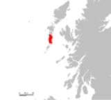
South Uist is an island
of the Outer Hebrides
in Scotland
. In the 2001 census it had a usually resident population of 1,818. There is a nature reserve and a number of sites of archaeological
interest, including the only location in Great Britain
where prehistoric mummies
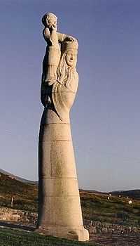
have been found. The population is about 70% Roman Catholic
. The island, in common with the rest of the Hebrides, is one of the last remaining strongholds of the Gaelic
language in Scotland. In 2006 South Uist, and neighbouring Benbecula
and Eriskay
were involved in Scotland's biggest community land buyout to date. In the north west there is a missile testing range. Its inhabitants are known in Gaelic as "Deasaich" (Southerners).
 The west is machair
(fertile low-lying coastal plain) with a continuous sandy beach
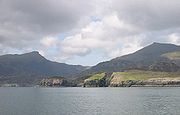
whilst the east coast is mountainous with the peaks of Beinn Mhòr 620 metres (2,034 ft) and Hecla 606 metres (1,988 ft).
The main village on the island is Lochboisdale
(Loch Baghasdail), from which ferries sail to Oban
on the mainland and to Castlebay
(Bàgh a' Chaisteil) on Barra
. The island is also linked to Eriskay
and Benbecula
by causeway
s. Smaller settlements include Daliburgh
(Dalabrog), Howmore
(Tobha Mòr) and Ludag.
South Uist has a bedrock
of Lewisian Gneiss
, high grade Regional Metamorphism
dating back to 2900 million years ago in the Archaean. Some show Granulite facies metamorphism, but most are the slightly lower temperature Amphibolite facies. These formed part of the Earth’s deep ancient crust, left here when the North Atlantic was formed. These are the oldest rocks in the British Isles today and they have been brought to the surface by tectonic movements. They now bear the scars of the last glaciation which has exposed them.
"South Uist Machair" on the west coast is one of 40 National Scenic Area
s in Scotland.
community. The island is covered in archaeological sites including chambered tombs, Beaker sites, a Bronze Age
hoard, roundhouses, brochs, cairns, ogham inscriptions, Viking
settlements, medieval longhouses and post-medieval industry. After the Norse occupation, South Uist was held by the MacDonalds of Clanranald until 1838 when Colonel Gordon of Cluny bought the island and initiated Highland Clearances
to make way for sheep farming, supplanting the crofters with farmers from the Borders and their Blackface flocks. The population of South Uist fell from a total of 5093 in 1841 to its present level of 2285. As a result there was large scale emigration from the island.
Lochboisdale
became a major herring port later in the nineteenth century. The island is one of the last surviving strongholds of the Gaelic language in Scotland and the crofting industries of peat cutting and seaweed gathering are still an important part of everyday life.
South Uist is home to the Askernish Golf Course. The oldest course in the Outer Hebrides, Askernish was designed by Old Tom Morris, who also worked on the Old Course at St. Andrews. The Askernish course existed intact until the 1930s, but was partly destroyed to make way for a runway, abandoned, and ultimately lost. Its identity remained hidden for many years before its apparent discovery, a claim disputed by many locals.
Restoration of the course to Morris' original design was held up by disagreements with local crofters, but after legal challenges were resolved in the courts, the course opened in August 2008.
After a protracted campaign South Uist residents took control of the island on 30 November 2006 in Scotland's biggest community land buyout to date. The previous landowners, a sporting syndicate, sold the assets of the 92000 acres (372.31 km²) estate for £4.5 million to a Community Company known as Stòras Uibhist which was set up to purchase the land and to manage it in perpetuity. The buyout resulted in most of South Uist, and neighbouring Benbecula, and all of Eriskay coming under community control.
The proposal for community ownership has received the overwhelming support of the people of the islands who look forward to participating in the opportunity to regenerate the local economy, to reverse decline and depopulation, to reduce dependency while remaining aware of the environmental needs, culture and history of the islands. The company name Stòras Uibhist symbolises hope for the future wealth and prosperity of the islands.
would not survive the influx of English-speaking army personnel. The British Government claimed that there was an 'overriding national interest' in establishing a training range for their newly purchased Corporal, a weapon that was to be at the front line of Cold War
defence. The Corporal missile was tested from 1959 to 1963, before giving way to Sergeant and Lance tactical nuclear missiles. The 'rocket range' as it is known locally has also been used to test high altitude research rockets, Skua
and Petrel
.
The range is still owned by the MoD
operated by QinetiQ
as a testing facility for missile systems such as the surface-to-air Rapier missile
and Unmanned Air Vehicles In 2009 the MOD announced that is was considering running down its missile testing ranges in the Western Isles, with potentially serious consequences for the local economy.
.jpg) Loch Druidibeg in the north of the island is a National Nature Reserve
Loch Druidibeg in the north of the island is a National Nature Reserve
owned and managed by Scottish Natural Heritage
. The reserve covers 1,677 hectares of machair
, bog
, freshwater loch
s, estuary
, heather moorland and hill. Over 200 species of flowering plants have been recorded on the reserve, some of which are nationally scarce. South Uist is considered the best place in the UK for the aquatic plant Slender Naiad (Najas flexilis) which is a European Protected Species
.
Nationally important populations of breeding waders are also present, including redshank
, dunlin
, lapwing
and ringed plover
. The reserve is also home to greylag geese
on the loch and in summer corncrake
s on the machair. Otter
s and hen harrier
s are also seen.
There has been considerable controversy over hedgehog
s on South Uist. The animals are not native to the islands, having been introduced in the 1970s to reduce garden pests. It is claimed they pose a threat to the eggs of ground nesting wading birds on the island. In 2003 the Uist Wader Project - headed by Scottish Natural Heritage - began a cull of hedgehogs in the area. Following a campaign and concerns over animal welfare, this cull was called off in 2007, instead hedgehogs are being captured and translocated to mainland Scotland.
 The SEARCH project (Sheffield Environmental and Archaeological Research Campaign in the Hebrides) on South Uist has been developing a long-term perspective on changes in settlement and house form from the Bronze Age
to the 19th century. Organisation within Iron Age
roundhouses
appears to have been very different from 19th century blackhouses in which the dwelling was shared with stock.
The archaeological
site of Cladh Hallan
, the only site in Great Britain
where prehistoric mummies
have been found, is on South Uist.
Island
An island or isle is any piece of sub-continental land that is surrounded by water. Very small islands such as emergent land features on atolls can be called islets, cays or keys. An island in a river or lake may be called an eyot , or holm...
of the Outer Hebrides
Outer Hebrides
The Outer Hebrides also known as the Western Isles and the Long Island, is an island chain off the west coast of Scotland. The islands are geographically contiguous with Comhairle nan Eilean Siar, one of the 32 unitary council areas of Scotland...
in Scotland
Scotland
Scotland is a country that is part of the United Kingdom. Occupying the northern third of the island of Great Britain, it shares a border with England to the south and is bounded by the North Sea to the east, the Atlantic Ocean to the north and west, and the North Channel and Irish Sea to the...
. In the 2001 census it had a usually resident population of 1,818. There is a nature reserve and a number of sites of archaeological
Archaeology
Archaeology, or archeology , is the study of human society, primarily through the recovery and analysis of the material culture and environmental data that they have left behind, which includes artifacts, architecture, biofacts and cultural landscapes...
interest, including the only location in Great Britain
Great Britain
Great Britain or Britain is an island situated to the northwest of Continental Europe. It is the ninth largest island in the world, and the largest European island, as well as the largest of the British Isles...
where prehistoric mummies
Mummy
A mummy is a body, human or animal, whose skin and organs have been preserved by either intentional or incidental exposure to chemicals, extreme coldness , very low humidity, or lack of air when bodies are submerged in bogs, so that the recovered body will not decay further if kept in cool and dry...
have been found. The population is about 70% Roman Catholic
Roman Catholic Church
The Catholic Church, also known as the Roman Catholic Church, is the world's largest Christian church, with over a billion members. Led by the Pope, it defines its mission as spreading the gospel of Jesus Christ, administering the sacraments and exercising charity...
. The island, in common with the rest of the Hebrides, is one of the last remaining strongholds of the Gaelic
Scottish Gaelic language
Scottish Gaelic is a Celtic language native to Scotland. A member of the Goidelic branch of the Celtic languages, Scottish Gaelic, like Modern Irish and Manx, developed out of Middle Irish, and thus descends ultimately from Primitive Irish....
language in Scotland. In 2006 South Uist, and neighbouring Benbecula
Benbecula
Benbecula is an island of the Outer Hebrides in the Atlantic Ocean off the west coast of Scotland. In the 2001 census it had a usually resident population of 1,249, with a sizable percentage of Roman Catholics. It forms part of the area administered by Comhairle nan Eilean Siar or the Western...
and Eriskay
Eriskay
Eriskay , from the Old Norse for "Eric's Isle", is an island and community council area of the Outer Hebrides in northern Scotland. It lies between South Uist and Barra and is connected to South Uist by a causeway which was opened in 2001. In the same year Eriskay became the ferry terminal for...
were involved in Scotland's biggest community land buyout to date. In the north west there is a missile testing range. Its inhabitants are known in Gaelic as "Deasaich" (Southerners).
Geography and geology
Machair (geography)
The machair refers to a fertile low-lying grassy plain found on some of the north-west coastlines of Ireland and Scotland, in particular the Outer Hebrides...
(fertile low-lying coastal plain) with a continuous sandy beach
Beach
A beach is a geological landform along the shoreline of an ocean, sea, lake or river. It usually consists of loose particles which are often composed of rock, such as sand, gravel, shingle, pebbles or cobblestones...
whilst the east coast is mountainous with the peaks of Beinn Mhòr 620 metres (2,034 ft) and Hecla 606 metres (1,988 ft).
The main village on the island is Lochboisdale
Lochboisdale
Lochboisdale is a community and the main population centre on the island of South Uist, Outer Hebrides, Scotland.The town profited from the herring boom in the 19th century, and a steamer pier was built in 1880...
(Loch Baghasdail), from which ferries sail to Oban
Oban
Oban Oban Oban ( is a resort town within the Argyll and Bute council area of Scotland. It has a total resident population of 8,120. Despite its small size, it is the largest town between Helensburgh and Fort William and during the tourist season the town can be crowded by up to 25,000 people. Oban...
on the mainland and to Castlebay
Castlebay
Castlebay is the main village and a community council area on the island of Barra in the Outer Hebrides of Scotland. It is located on the south coast of the island, and overlooks a bay in the Atlantic Ocean dominated by Kisimul Castle, as well as nearby islands such as Vatersay.- Church :The...
(Bàgh a' Chaisteil) on Barra
Barra
The island of Barra is a predominantly Gaelic-speaking island, and apart from the adjacent island of Vatersay, to which it is connected by a causeway, is the southernmost inhabited island of the Outer Hebrides in Scotland.-Geography:The 2001 census showed that the resident population was 1,078...
. The island is also linked to Eriskay
Eriskay
Eriskay , from the Old Norse for "Eric's Isle", is an island and community council area of the Outer Hebrides in northern Scotland. It lies between South Uist and Barra and is connected to South Uist by a causeway which was opened in 2001. In the same year Eriskay became the ferry terminal for...
and Benbecula
Benbecula
Benbecula is an island of the Outer Hebrides in the Atlantic Ocean off the west coast of Scotland. In the 2001 census it had a usually resident population of 1,249, with a sizable percentage of Roman Catholics. It forms part of the area administered by Comhairle nan Eilean Siar or the Western...
by causeway
Causeway
In modern usage, a causeway is a road or railway elevated, usually across a broad body of water or wetland.- Etymology :When first used, the word appeared in a form such as “causey way” making clear its derivation from the earlier form “causey”. This word seems to have come from the same source by...
s. Smaller settlements include Daliburgh
Daliburgh
Daliburgh is a crofting township in Scotland situated one and a half miles west from Lochboisdale and has the second largest population of any township in South Uist.Like Lochboisdale, Daliburgh has undergone major changes in recent years....
(Dalabrog), Howmore
Howmore
Howmore lies on the island of South Uist to the southwest of Loch Druidibeg. The mountain of Haarsal rises to 139 m to the east and immediately south is the smaller settlement of Howbeg....
(Tobha Mòr) and Ludag.
South Uist has a bedrock
Bedrock
In stratigraphy, bedrock is the native consolidated rock underlying the surface of a terrestrial planet, usually the Earth. Above the bedrock is usually an area of broken and weathered unconsolidated rock in the basal subsoil...
of Lewisian Gneiss
Lewisian complex
The Lewisian complex or Lewisian Gneiss is a suite of Precambrian metamorphic rocks that outcrop in the northwestern part of Scotland, forming part of the Hebridean Terrane. These rocks are of Archaean and Paleoproterozoic age, ranging from 3.0–1.7 Ga. They form the basement on which the...
, high grade Regional Metamorphism
Metamorphism
Metamorphism is the solid-state recrystallization of pre-existing rocks due to changes in physical and chemical conditions, primarily heat, pressure, and the introduction of chemically active fluids. Mineralogical, chemical and crystallographic changes can occur during this process...
dating back to 2900 million years ago in the Archaean. Some show Granulite facies metamorphism, but most are the slightly lower temperature Amphibolite facies. These formed part of the Earth’s deep ancient crust, left here when the North Atlantic was formed. These are the oldest rocks in the British Isles today and they have been brought to the surface by tectonic movements. They now bear the scars of the last glaciation which has exposed them.
"South Uist Machair" on the west coast is one of 40 National Scenic Area
National Scenic Area
National Scenic Area is a designation for areas of natural beauty used by more than one nation.* National Scenic Area * National Scenic Area * National scenic areas in Taiwan* National Scenic Area...
s in Scotland.
History
South Uist was clearly home to a thriving NeolithicNeolithic
The Neolithic Age, Era, or Period, or New Stone Age, was a period in the development of human technology, beginning about 9500 BC in some parts of the Middle East, and later in other parts of the world. It is traditionally considered as the last part of the Stone Age...
community. The island is covered in archaeological sites including chambered tombs, Beaker sites, a Bronze Age
Bronze Age
The Bronze Age is a period characterized by the use of copper and its alloy bronze as the chief hard materials in the manufacture of some implements and weapons. Chronologically, it stands between the Stone Age and Iron Age...
hoard, roundhouses, brochs, cairns, ogham inscriptions, Viking
Viking
The term Viking is customarily used to refer to the Norse explorers, warriors, merchants, and pirates who raided, traded, explored and settled in wide areas of Europe, Asia and the North Atlantic islands from the late 8th to the mid-11th century.These Norsemen used their famed longships to...
settlements, medieval longhouses and post-medieval industry. After the Norse occupation, South Uist was held by the MacDonalds of Clanranald until 1838 when Colonel Gordon of Cluny bought the island and initiated Highland Clearances
Highland Clearances
The Highland Clearances were forced displacements of the population of the Scottish Highlands during the 18th and 19th centuries. They led to mass emigration to the sea coast, the Scottish Lowlands, and the North American colonies...
to make way for sheep farming, supplanting the crofters with farmers from the Borders and their Blackface flocks. The population of South Uist fell from a total of 5093 in 1841 to its present level of 2285. As a result there was large scale emigration from the island.
Lochboisdale
Lochboisdale
Lochboisdale is a community and the main population centre on the island of South Uist, Outer Hebrides, Scotland.The town profited from the herring boom in the 19th century, and a steamer pier was built in 1880...
became a major herring port later in the nineteenth century. The island is one of the last surviving strongholds of the Gaelic language in Scotland and the crofting industries of peat cutting and seaweed gathering are still an important part of everyday life.
Economy
Tourism is important to the island's economy and attractions include the Kildonan Museum housing the sixteenth century Clanranald Stone and the ruins of the house where Flora MacDonald was born.South Uist is home to the Askernish Golf Course. The oldest course in the Outer Hebrides, Askernish was designed by Old Tom Morris, who also worked on the Old Course at St. Andrews. The Askernish course existed intact until the 1930s, but was partly destroyed to make way for a runway, abandoned, and ultimately lost. Its identity remained hidden for many years before its apparent discovery, a claim disputed by many locals.
Restoration of the course to Morris' original design was held up by disagreements with local crofters, but after legal challenges were resolved in the courts, the course opened in August 2008.
After a protracted campaign South Uist residents took control of the island on 30 November 2006 in Scotland's biggest community land buyout to date. The previous landowners, a sporting syndicate, sold the assets of the 92000 acres (372.31 km²) estate for £4.5 million to a Community Company known as Stòras Uibhist which was set up to purchase the land and to manage it in perpetuity. The buyout resulted in most of South Uist, and neighbouring Benbecula, and all of Eriskay coming under community control.
The proposal for community ownership has received the overwhelming support of the people of the islands who look forward to participating in the opportunity to regenerate the local economy, to reverse decline and depopulation, to reduce dependency while remaining aware of the environmental needs, culture and history of the islands. The company name Stòras Uibhist symbolises hope for the future wealth and prosperity of the islands.
Missile testing
In the north west of the island at (57°20′N 07°20′W), a missile testing range was built in 1957-58 to launch the Corporal missile, Britain and America's first guided nuclear weapon. This development went ahead despite significant protests, some locals expressing concern that the Scottish Gaelic languageScottish Gaelic language
Scottish Gaelic is a Celtic language native to Scotland. A member of the Goidelic branch of the Celtic languages, Scottish Gaelic, like Modern Irish and Manx, developed out of Middle Irish, and thus descends ultimately from Primitive Irish....
would not survive the influx of English-speaking army personnel. The British Government claimed that there was an 'overriding national interest' in establishing a training range for their newly purchased Corporal, a weapon that was to be at the front line of Cold War
Cold War
The Cold War was the continuing state from roughly 1946 to 1991 of political conflict, military tension, proxy wars, and economic competition between the Communist World—primarily the Soviet Union and its satellite states and allies—and the powers of the Western world, primarily the United States...
defence. The Corporal missile was tested from 1959 to 1963, before giving way to Sergeant and Lance tactical nuclear missiles. The 'rocket range' as it is known locally has also been used to test high altitude research rockets, Skua
Skua (rocket)
Skua is the designation of a British sounding rocket which was launched between 1959 and 1981 in 4 versions over 300 times. The Skua was developed by Bristol Aerojet and RPE Wescott. It consisted of a starting stage made up of several Chick rockets that burned for 0.2 seconds. They propelled the...
and Petrel
Petrel (rocket)
The Petrel was a British sounding rocket. The Petrel 1 was launched, like the Skua 1, with 3 Chick booster rockets. The Chick motors were fitted in a Booster Carriage that also carried the two parachutes that brought it back to earth for re-use. The Petrel 1 was 3.34 m long, had a diameter of...
.
The range is still owned by the MoD
Ministry of Defence (United Kingdom)
The Ministry of Defence is the United Kingdom government department responsible for implementation of government defence policy and is the headquarters of the British Armed Forces....
operated by QinetiQ
QinetiQ
Qinetiq is a British global defence technology company, formed from the greater part of the former UK government agency, Defence Evaluation and Research Agency , when it was split up in June 2001...
as a testing facility for missile systems such as the surface-to-air Rapier missile
Rapier missile
Rapier is a British surface-to-air missile developed for the British Army and Royal Air Force. Entering service in 1971, it eventually replaced all other anti-aircraft weapons in Army service; guns for low-altitude targets, and the English Electric Thunderbird, used against longer-range and...
and Unmanned Air Vehicles In 2009 the MOD announced that is was considering running down its missile testing ranges in the Western Isles, with potentially serious consequences for the local economy.
Nature reserve
National Nature Reserve
For details of National nature reserves in the United Kingdom see:*National Nature Reserves in England*National Nature Reserves in Northern Ireland*National Nature Reserves in Scotland*National Nature Reserves in Wales...
owned and managed by Scottish Natural Heritage
Scottish Natural Heritage
Scottish Natural Heritage is a Scottish public body. It is responsible for Scotland's natural heritage, especially its natural, genetic and scenic diversity. It advises the Scottish Government and acts as a government agent in the delivery of conservation designations, i.e...
. The reserve covers 1,677 hectares of machair
Machair (geography)
The machair refers to a fertile low-lying grassy plain found on some of the north-west coastlines of Ireland and Scotland, in particular the Outer Hebrides...
, bog
Bog
A bog, quagmire or mire is a wetland that accumulates acidic peat, a deposit of dead plant material—often mosses or, in Arctic climates, lichens....
, freshwater loch
Loch
Loch is the Irish and Scottish Gaelic word for a lake or a sea inlet. It has been anglicised as lough, although this is pronounced the same way as loch. Some lochs could also be called a firth, fjord, estuary, strait or bay...
s, estuary
Estuary
An estuary is a partly enclosed coastal body of water with one or more rivers or streams flowing into it, and with a free connection to the open sea....
, heather moorland and hill. Over 200 species of flowering plants have been recorded on the reserve, some of which are nationally scarce. South Uist is considered the best place in the UK for the aquatic plant Slender Naiad (Najas flexilis) which is a European Protected Species
European Protected Species
European Protected Species are species of plants and animals protected by law throughout the European Union. They are listed in Annexes II and IV of the European Habitats Directive....
.
Nationally important populations of breeding waders are also present, including redshank
Common Redshank
The Common Redshank or simply Redshank is an Eurasian wader in the large family Scolopacidae.- Description and systematics :...
, dunlin
Dunlin
The Dunlin, Calidris alpina, is a small wader, sometimes separated with the other "stints" in Erolia. It is a circumpolar breeder in Arctic or subarctic regions. Birds that breed in northern Europe and Asia are long-distance migrants, wintering south to Africa, southeast Asia and the Middle East...
, lapwing
Northern Lapwing
The Northern Lapwing , also known as the Peewit, Green Plover or just Lapwing, is a bird in the plover family. It is common through temperate Eurasia....
and ringed plover
Ringed Plover
The Common Ringed Plover or Ringed Plover is a small plover.Adults are 17-19.5 cm in length with a 35–41 cm wingspan. They have a grey-brown back and wings, a white belly, and a white breast with one black neckband. They have a brown cap, a white forehead, a black mask around the eyes...
. The reserve is also home to greylag geese
Greylag Goose
The Greylag Goose , Anser anser, is a bird with a wide range in the Old World. It is the type species of the genus Anser....
on the loch and in summer corncrake
Corn Crake
The Corn Crake, Corncrake or Landrail is a bird in the rail family. It breeds in Europe and Asia as far east as western China, and migrates to Africa for the winter...
s on the machair. Otter
European Otter
The European Otter , also known as the Eurasian otter, Eurasian river otter, common otter and Old World otter, is a European and Asian member of the Lutrinae or otter subfamily, and is typical of freshwater otters....
s and hen harrier
Hen Harrier
The Hen Harrier or Northern Harrier is a bird of prey. It breeds throughout the northern parts of the northern hemisphere in Canada and the northernmost USA, and in northern Eurasia. This species is polytypic, with two subspecies. Marsh Hawk is a historical name for the American form.It migrates...
s are also seen.
There has been considerable controversy over hedgehog
European Hedgehog
The European Hedgehog , Common hedgehog or just Hedgehog in the anglophone parts of Europe, is a hedgehog species found in northern and western Europe. It is about 20 to 30 cm in length. Adult mass typically ranges from 600 to up to 1,200 g ; occasionally, it may reach as much as...
s on South Uist. The animals are not native to the islands, having been introduced in the 1970s to reduce garden pests. It is claimed they pose a threat to the eggs of ground nesting wading birds on the island. In 2003 the Uist Wader Project - headed by Scottish Natural Heritage - began a cull of hedgehogs in the area. Following a campaign and concerns over animal welfare, this cull was called off in 2007, instead hedgehogs are being captured and translocated to mainland Scotland.
Archaeology
Bronze Age
The Bronze Age is a period characterized by the use of copper and its alloy bronze as the chief hard materials in the manufacture of some implements and weapons. Chronologically, it stands between the Stone Age and Iron Age...
to the 19th century. Organisation within Iron Age
Iron Age
The Iron Age is the archaeological period generally occurring after the Bronze Age, marked by the prevalent use of iron. The early period of the age is characterized by the widespread use of iron or steel. The adoption of such material coincided with other changes in society, including differing...
roundhouses
Atlantic roundhouse
In archaeology, an Atlantic roundhouse is an Iron Age stone building found in the northern and western parts of mainland Scotland, the Northern Isles and the Hebrides.-Types of structure:...
appears to have been very different from 19th century blackhouses in which the dwelling was shared with stock.
The archaeological
Archaeology
Archaeology, or archeology , is the study of human society, primarily through the recovery and analysis of the material culture and environmental data that they have left behind, which includes artifacts, architecture, biofacts and cultural landscapes...
site of Cladh Hallan
Cladh Hallan
Cladh Hallan is an archaeological site on the island of South Uist in the Outer Hebrides in Scotland. It is significant as the only place in Great Britain where prehistoric mummies have been found. Excavations were carried out there between 1988 and 2002....
, the only site in Great Britain
Great Britain
Great Britain or Britain is an island situated to the northwest of Continental Europe. It is the ninth largest island in the world, and the largest European island, as well as the largest of the British Isles...
where prehistoric mummies
Mummy
A mummy is a body, human or animal, whose skin and organs have been preserved by either intentional or incidental exposure to chemicals, extreme coldness , very low humidity, or lack of air when bodies are submerged in bogs, so that the recovered body will not decay further if kept in cool and dry...
have been found, is on South Uist.
Notable residents
- Flora MacDonald (1722–1790), born at Milton. Known for her help of Bonnie Prince Charlie.
- Angus McPheeAngus McPheeAngus McPhee or MacPhee was a Scottish outsider artist, who made his art by weaving found vegetation, such as grasses, into extraordinary garments. He also used sheep's wool picked from barbed wire fences, and leaves. McPhee created most of his work whilst in the Craig Dunain Psychiatric Hospital...
(1916–1997) born at Iochdar. Outsider artist.
See also
- Bun SruthBun SruthBun Sruth is a small loch about 70 yards in length at the southeast extremity of the island of South Uist in the Outer Hebrides of Scotland. It is surrounded by hills and is connected to the sea by a narrow passage between cliffs of sheer rock.-Access:...
, a loch in the southeast - EasavalEasavalEasaval is one of the smallest hills on the island of South Uist in the Outer Hebrides of Scotland, with a height of...
, a hill in the south - IochdarIochdarIochdar , also spelled Eochar, is a hamlet and community on the west coast of the island of South Uist, in the Outer Hebrides, Scotland. It is the largest of several crofting settlements in the north-west of South Uist, and is located west of the A865 road...
, a hamlet on the west coast - UshenishUshenishUshenish is a headland on the remote east coast of South Uist in the Outer Hebrides of Scotland. There has been a lighthouse on the headland since 1857.-Lighthouse:...
, a headland on the east coast
External links
- southuist.com - Photo galleries, accommodation, news and events
- Iochdar.co.uk, a website about outdoor recreation in South Uist
- StorasUibhist.com, the official website of the community-owned South Uist Estate
- Flags of the world - Hebrides
- An Gàrradh Mòr, Historic walled garden at Cille Bhrìghde
- Rocket launches at South Uist
- Corporal missile inaccuracy revealed, The Guardian Sept 6 2003
- Askernish Golf Club
- Daliburgh School
- Google Maps:Rocket launch site
- Am Paipear Community Newspaper