

Motul de San José
Encyclopedia
Motul de San José is an ancient Maya
site located just north of Lake Petén Itzá
in the Petén Basin
region of the southern Maya lowlands. It is located a few kilometres from the modern village of San José
, in Guatemala
's northern department
of Petén
. A medium sized civic-ceremonial centre, it was an important political and economic centre during the Late Classic
period (AD 650–950).
The site was first settled between 600 and 300 BC, in the latter portion of the Middle Preclassic
period, when it was probably a fairly small site. The city
then had a long and continuous occupational history until the Early Postclassic
, up to around AD 1250, with peaks in the Late Preclassic
and Late Classic periods.
Motul de San José has been identified as the source of Ik-style polychrome ceramics
bearing painted scenes of the Late Classic Maya aristocracy involved in a variety of courtly activities. The city was the capital of a polity that included various satellite sites of varying importance, including a port on the shore of Lake Petén Itzá
.
, 10.5 kilometres (6.5 mi) to the south as the crow flies, on the other side of the lake. The nearest villages are San José, 5 kilometres (3.1 mi) away, and San Andrés
, 6.5 kilometres (4 mi) away, both are to the south of the site, on the northern shore of the lake. The archaeological site is connected to Nuevo San José, a northern expansion of San José, by a dirt road. The site lies among land that has been cleared of forest within the last century and is now used to plant maize and graze cattle.
Motul de San José lies on a limestone
plateau
at the northern edge of the fault depression that underlies the central lakes of the Petén Basin. The local topography
consists of ridges, generally running east-west or northeast-southwest alternating with lower-lying areas with clay
soils. These low-lying areas tend to feed into drainage systems
flowing into either Lake Petén Itzá itself or into the Akte River. The Kantetul River is a seasonal watercourse with its origin 5 kilometres (3.1 mi) to the northeast of the site and flowing westwards into the Akte River, passing 2 kilometres (1.2 mi) from the site core. The Akte River in turn flows west into the San Pedro River
, which flows northwest into Mexico
where it joins the Usumacinta River
and ultimately empties into the Gulf of Mexico
. A mixture of ancient and modern agricultural terraces
line the riverbank 2 kilometres (1.2 mi) north of the site core.
 Motul de San José lies within a dense cluster of smaller satellite sites. It is 32 kilometres (19.9 mi) to the southwest of the major Classic Period
ruins of Tikal
. The site is about 275 kilometres (170.9 mi) north of Guatemala City
. The ruins are located on a hill about 180 metres (590.6 ft) above mean sea level
.
The site forms part of the Motul Ecological
Park (Parque Ecológico Motul in Spanish), which is administered by IDAEH (Instituto de Antropología e Historia, the Guatemalan Institute of Anthropology
and History
), the University of San Carlos of Guatemala (USAC) and the local communities of San José and Nuevo San José. The park covers an area of approximately 2.2 square kilometre (0.849424748903577 sq mi).
. Analysis has revealed that it was manufactured in Motul de San José, indicating some form of interaction between these distant sites.
Motul de San José's likely resource catchment zone probably extended between 5 and 7 km (3.1 and 4.3 mi) around the site core and included a number of satellite sites including Kantetul, La Trinidad de Nosotros, Akte, Buena Vista, Chachaklum and Chakokot. This region also includes two major water sources in the form of Lake Péten Itzá to the south and the Kantetul river 2 kilometres (1.2 mi) to the north. The area around the city included a variety of soils suitable for agriculture, with 20% of this being very fertile soil highly suited to agriculture, just over 50% of the area was very fertile but required high maintenance (consisting of either fertilization or crop rotation
) and 14% being low fertility soil consisting of lowland clay
and suitable only for maize
or being left unfarmed. Soil analysis has revealed that maize was not only grown in peripheral areas but also close to residential areas throughout Motul de San José.
Archaeological investigations have revealed that the diet of the inhabitants of Motul de San José included dog
s (Canis familiaris), turtle
s including Pond Sliders (Trachemys scripta) and Mesoamerican River Turtle
s (Dermatemys mawii), freshwater snail
s (mostly Pomacea flagellata
but also Jute snails (Pachychilus
spp.)), White-tailed deer
(Odocoileus virginianus), Red Brocket
(Mazama americana - a species of small deer) , White-lipped Peccary
(Tayassu pecari), rabbit
s (Sylvilagus spp.), Lowland Pacas (Cuniculus paca), Central American Agouti
(Dasyprocta punctata) and Nine-banded Armadillo
s (Dasypus novemcinctus). Only the dog had been domesticated by the Late Classic Maya so the majority of protein
in the diet of the inhabitants came from hunting and fishing within the catchment area around the city. The most common food animals were the white-tailed deer, river clam
and river turtle. Some animal remains were recovered that were clearly associated with elite status occupation, such as those of the jaguar
, the ocelot
or other small feline and the crocodile
(crocodilus spp.). These latter three appear more related to ritual and economic activity than nutritional needs. Freshwater snails were more an ingredient in the diet of lower status families while deer remains were associated with the elite residents of the city.
Among Motul de San José and its most important satellite La Trinidad de Nosotros, the majority of remains from Trinidad were from aquatic species, while at Motul de San José the majority were from terrestrial species. 10% of animal remains from Motul had been modified to form artefacts, compared with only 4% of animal remains at Trinidad. Artefact remains found at La Trinidad de Nosotros were more likely to be waste products from artefact manufacture while at Motul de San José they were more likely to be artefacts at the end of their usable life. Aquatic animal products arriving at Motul de San José were far more likely to be consumed by the elite than by commoners, whether used as food or to craft artefacts.
nodules were locally available from the first ridges to the north of the lake. A chert workshop has been discovered in the northern sector of Motul de San José. Ceramic figurines were produced in the Acropolis palace complex in Group C and also in a medium-sized palace complex in Group B, an elite plaza in Group E and also in two elite plazas in the northern part of the site.
The small satellite site of Chak Maman Tok' several kilometers to the southwest of Motul de San José, appears to have been an important centre for the production of chert tools, with only a few other centres within the Maya lowlands manufacturing chert on such a scale. Although very small, Chak Maman Tok' probably played a major part within the economy of the Motul de San José polity.
Differences in architectural style between elite residential complexes and in the activities carried out at them suggest that the aristocracy of Motul de San José was divided into several distinct classes, including the royal family resident in Group C, royal courtier
s and low to middle rank nobles.
The Kantetul River, although now seasonal, is reported to have been a navigable water channel until relatively recently. During the height of Motul de San José's power, it may have provided an important link to the San Pedro River, a significant trade route in ancient times.
, a theory that has recently received additional support from archaeological excavations at the site. These ceramic vessels, including finely painted plates and cylindrical vessels, were first asssociated with the then-unidentified site of Ik in the 1970s by the Emblem Glyph included in the hieroglyphic texts on them. The confirmation of Motul de San José as Ik came from investigations carried out from 1998 to 2004.
The Ik-style ceramic corpus includes a set of features such as hieroglyphs
painted in a pink or pale red colour and scenes with dancers wearing masks. One of the most distinctive features is the realistic representation of subjects as they appeared in life, something that is very rare in Mesoamerican art. The corpus is represented by more than 30 intact vessels, the majority of unknown provenance, which have been compared to ceramic fragments recovered from Motul de San José and its satellite sites. The subject matter of the vessels includes courtly life from the Petén region
in the 8th century AD, such as diplomatic representations, feasting, bloodletting, scenes of warriors and the sacrifice of prisoners of war
.
The variations in artistic style and chemical composition of the Ik-style ceramics suggests that they were produced in a number of workshops local to the Motul de San José area. They have been subdivided into five types, four from Motul de San José itself and one from one of its satellite sites. There are also various lower-quality examples that are presumed to have been manufactured in sites of lesser importance within the Motul de San José polity. The Ik-style ceramics are believed to have been produced in the period from 740–800 AD. In spite of differences, all the Ik-style ceramics are thought to have been made within a network of allied workshops dedicated to producing vessels for use in the banquets of the aristocracy of Motul de San José and of the petty nobility of the capital's satellites. The ceramics were distributed widely in the Maya region as gifts in order to seal alliances between the elites of various Maya kingdoms.
Of particular note is that chemical analysis of ceramic fragments has revealed that the very same workshops not only produced the highest-quality Ik-style polychrome ceramics but also general low-quality ceramics for household use. High quality Ik-style ceramics made at Motul de San José have been excavated from across the Maya region, including Tikal
and Uaxactún
to the northeast of the city, Copán
far to the south, and Altar de Sacrificios
, Tamarindito
and Seibal
, in western Petén.
A particularly rare feature found on Motul de San José ceramics is the so-called X-ray style, showing a figure wearing a mask but also portraying his face underneath it. All the other representations using this rare style are depicted on Late Classic sculptures at sites with which it is known that Motul de San José had contact at this time, including Dos Pilas, Machaquila
, Tikal and Yaxchilan. This X-ray style has been found on at least nine painted vessels from Motul de San José and is also used on the west side of Stela 2.
period, when it was probably a fairly small site. At this time some of its satellite sites were also settled, including La Trinidad de Nosotros and Buena Vista, both of which would have been small villages at this time, and they may have been settled even earlier in the Middle Preclassic, between 800 and 600 BC.
, Tikal's greatest enemy, before again coming under the power of Tikal in the early 8th century.
In the late 4th century Motul de San José began to refer to Tikal as its overlord.
, while it was slightly smaller than Nixtun Ch'ich'. There was renewed growth in the city's satellite sites, Chakokot reached its peak population and most of its residential complexes were built in the Late Classic. Buena Vista experienced only light occupation at this time. Major construction work took place at Akte including the building of the principal platform and its causeway. It also appears that the rulers of Akte erected several stelae. La Trinidad de Nosotros took on its final form and most of its major architecture was built at this time including the Mesoamerican ballcourt
, the major residential complexes, four plazas and the port facilities.
In the 8th century AD the city had important relationships with Maya cities to the southwest, especially in the Petexbatún
region, and on the Pasión
and Usumacinta
rivers, including Seibal (on the Pasión), Altar de Sacrificios (near where the Pasión becomes the Usumacinta), and Dos Pilas
, Aguateca
, Tamarindito
, Arroyo de Piedra
and Cueva de Sangre (all five in the Petexbatún region). It is possible that the widespread distribution of Ik-style ceramics in elite tombs at sites in the Petexbatún region may be linked to the military defeat of Motul de San José by Dos Pilas, with these high quality ceramics forming a part of the tribute payment made to the Petexbatún kingdom. After its defeat at the hands of the Petexbatún kingdom, Motul de San José no longer erected sculpted stelae but the history of the site continued to be recorded to a certain extent in texts on Ik-style ceramics.
 In the Late Classic period Motul de San José was located between two mutually hostile powers, the great city of Tikal to the north and the breakaway kingdom of Petexbatún to the southwest, which had become a vassal of Tikal's implacable enemy Calakmul
. In Mesoamerica, such border states as Motul de San José became centres of political activity as they tried to manipulate the shifting political fortunes of their neighbours to their own advantage. This seems to be the case at Motul de San José with its rich ceramic tradition being a testament to the politically motivated banqueting that took place in the city. In the 8th century, although Motul de San José was the capital of the Ik polity, the aristocracy of its satellite sites wielded great power and were able to challenge their own position within the political hierarchy of the state while remaining subordinate to the ruling lord of the capital city.
During the 7th century AD, Motul de San José is recorded in hieroglyphic inscriptions as being a vassal of Calakmul. By the early 8th century the city had switched its allegiance to Jasaw Chan K'awiil I, king of Tikal, then falling under the power of Petexbatún, itself a vassal of Calakmul, in the middle of the 8th century, before once again switching its allegiance to Tikal. In 711, Jasaw Chan K'awiil I, Lord of Tikal
, was recorded as overlord of Motul, perhaps reflecting Tikal's traditional overlordship of the city. In spite of these shifting alliances, Motul de San José acted with a degree of independence and was a powerful kingdom in the 8th century AD, with its ruler using the kaloomte title given to high kings. The city's rulers became very successful on the political scene in the wider Maya region, with the use of politically motivated feasting, war, economics and political marriages.
There is a glyphic record that sometime before 731 a lord of Motul was captured by a lord (Ruler B) of Machaquilá
. In 740, Machaquila attacked Motul de San José. Hieroglyphic Stairway 3 at Dos Pilas
records that in 745 a lord of Motul was captured by K'awiil Chan K'inich of Dos Pilas. In the middle of the 8th century AD, Motul de San José was closely allied with the important city of Yaxchilan on the Usumacinta River, as demonstrated by the fact that the king of Yaxchilan Yaxun B'alam IV
("Bird Jaguar IV") who ruled from 752 to 768, took two wives from Motul de San José - who are named in inscriptions at Yaxchilan as Lady Wak Tuun and Lady Wak Jalam Chan Ajaw. Lady Wak Jalam Chan Ajaw is shown preparing her husband for a battle that took place in 755 on Yaxchilan Lintel 41, now in the British Museum
in London
. In fact, the alliance with Yaxchilan may date further back to the early 8th century since Yaxchilan Lintel 25 (dedicated in AD 723) used the so-called X-ray style of imagery that is closely associated with the Motul de San José polity. However, relations with Yaxchilan were not always peaceful and Hieroglyphic Stairway 5 at Yaxchilan records that Itzamnaaj B'alam III of Yaxchilan defeated the lord of Motul some time in the latter part of the 8th century.
All dates A.D.
An Ik-style vessel possesses a hieroglyphic text declaring that it was the property of Chuy-ti Chan, the son of Sak Muwaan, divine lord of Motul de San Jose who ruled between AD 700 and 726. Chuy-ti Chan is described as an artist and ballplayer and appears to have been appointed as an ambassador to the site known as Maan.
Two rulers feature prominently on Ik-style ceramics, they are named as Yajawte' K'inich and Lamaw Ek'. Lamaw Ek' appears to have ruled directly after Yajawte' K'inich but was not his son, on one vessel his father is given the title k'uhul Ik'nal, a "divine noble of Motul de San José" but not the king (whose title is k'uhul ajaw
or "divine lord"). Each of these two rulers had his own dedicated master painter. The artist of Yajawte' K'inich is named on the ceramics as T'uubal Ajaw, Lord of T'uubal. This latter site, T'uubal, is thought to be located in Petén somewhere between Tikal
and Naranjo
. Yajawte' K'inich is depicted on one Ik-style vessel wearing a mask and dancing, he is also depicted on Stelae 2 and 6 in the site core. Yajawte' K'inich is recorded on one vessel as possibly having died in AD 755.
The name of the painter who produced the ceramic vessels for Lamaw Ek' is only partially deciphered, as well as painting the vessel that possibly records the death of Yajawte' K'inich, he also painted a vessel recording the death of Lamaw Ek' as having taken place in AD 779.
An inscription dating to AD 830 mentions the last known ruler of Machaquilá, which may be evidence of a long standing relationship between the two sites. If this is the case, then Machaquilá appears to have been the dominant city out of the two. Seibel Stela 10, dating to roughly 849 AD, has an inscription naming Kan Ek' as ruler of Motul de San José, which is recorded as being one of the four paramount polities in the mid-9th century (ca. 849), along with Calakmul
, Tikal
and Seibal
itself.
 It has been suggested that Itza
Maya from Motul de San José began the northward migration of Maya peoples to the Yucatán Peninsula
at the end of the Classic Period. Classic period stelae at the site refer to the King of the Itzá, demonstrating that the Itza were already in the Petén region at this time. The nearby village of San José, on the shore of Lake Petén Itzá, is one of the last Itzá communities in Petén.
There is little evidence of occupation in the Motul de San José area during the Late Postclassic, from AD 1250 to AD 1697. It is possible that La Trinidad de Nosotros was Xililchi, a settlement visited by conquistador
Martín de Ursúa
after the fall of the Itza capital Noj Petén
to the Spanish
in 1697, but no Late Postclassic remains have yet been identified by archaeologists.
visited Motul de San José in May 1895, and described one of the stelae in his report Explorations in the Department of Peten, Guatemala, published by the Peabody Museum of Archaeology and Ethnology
of Harvard University
in 1910. Ian Graham and Arlen Chase have separately mapped portions of the site core.
Before the establishment of the Motul Ecological Park, the site was used for agriculture, specifically the cultivation of maize
. The site has been damaged several times by wildfires caused by uncontrolled stubble burning in 1986, 1987 and again in 1998. This last fire badly damaged the stelae
in the site core.
In 1998, the mayor of San José oversaw the improvement of the road to Motul de San José, which involved surfacing the road with gravel and opened the archaeological site to easier access, resulting in increased tourism at the site.
The Proyecto Arqueológico Motul de San José (Motul de San José Archaeological Project) has been investigating Motul de San José and its satellites from 1998 to 2008, under the direction of Antonia Foias of Williams College
and Kitty Emery of the Florida Museum of Natural History
. The core of the satellite site of Akte was mapped in 2002 and Trinidad de Nosotros was investigated by the project in 2003.
 Around 230 structures have been mapped in an area covering 2 square kilometre (0.77220431718507 sq mi), however, the total area occupied by the city was probably much greater than this. The total size of Motul de San José is estimated at 4.18 square kilometres (1.6 sq mi), with only about a third of this having been mapped. The ceremonial centre of the city covers an area of 0.4 square kilometre (0.154440863437014 sq mi), an area which encompasses more than 144 structures including a sizeable palace, 6 stelae, 33 plazas of widely differing sizes, and various temples and elite residential areas. Further residential areas of the city cover an additional 1.2 square kilometres (12,916,692.5 sq ft), which includes both elite and commoner residences, with outlying settlements located for several kilometers to the north and east, with one residential group associated with agricultural terraces being situated 2 km to the north of the site. In total, 33 plaza groups have been mapped at Motul de San José.
By 2003, around 1,800 fragments of figurines had been excavated from the site, its periphery and its satellites, with 239 of these being either heads or complete figurines.
The site can be generally divided into three broad areas, the site core, a North Zone and an East Zone. The North Zone is separated from the site core by a wide depression containing clay soil that may have served as a reservoir for the city. Several quarries have been identified on the northern and southern edges of this depression.
The major architecture can be divided into five groups, labelled A to E. Each of these groups has at least one pyramid and various palace type structures. The major residential complexes of the site are found in Groups A, B and D, not including the royal palace in Group C. The major architectural groups are divided by lower lying areas that may have been used for intensive agriculture
. The urban area of the site extends for 1.2 kilometres (1,200 m) around the site core, with this area having been continuously occupied with a full range of structures from elite down to commoner in status.
Two distinct architectural styles date to the last period of the site's occupation in the Late Classic. One uses well-carved stone blocks for construction and is possibly earlier than the second style, which is believed to date to the Terminal Classic and uses thin, flat stones.
in the Petexbatún
region. The pyramid has been looted, with the looters' pits having been refilled by IDAEH. The highest structure in the palace complex measures 4.5 metres (14.8 ft) high and is on the south side of the west plaza, its stairways stylistically resemble stairways from the Petexbatún. The palace complex has been looted, with one of the smaller structures around the east plaza having been completely detsroyed.
A low wall runs north for 120 metres (393.7 ft) from the northeast corner of the east plaza, it measures between 0.3 and 0.5 m (11.8 and 19.7 in) high and 0.5 metres (19.7 in) wide. The wall ends in a platform supporting several structures, it may have divided different parts of the site or marked the edge of an avenue.
To the north of Group B are several smaller groups of structures. They consist of residential complexes laid out around small plazas and their occupation was limited purely to the Late Classic period. Stela 2 is situated on a low platform to the west of the main pyramid.
The Main Plaza in Group C measures approximately 100 by and is bordered by the Acropolis on the north and west sides, twin pyramids on the east side and the South Pyramid on the south side. It is the largest plaza at Motul de San José, encompassing an area greater than 11000 square metres (118,403 sq ft). There are five stelae in the plaza commemorating Classic Period rulers, they have all been badly damaged by bushfires. On the west side of the plaza is a lower pyramid, measuring 7.8 metres (25.6 ft) high, that has been damaged by looters. A badly eroded stela was found close to this pyramid, another stela was erected in front of the South Pyramid. All three of the principal pyramids in Group C still support the remains of their summit shrines, possibly even with parts of their roofs and roof comb
s. The construction of these remaining structures consists of the thin, flat stones associated with the Terminal Classic occupation of the site.
The Twin Temples were both built on the same platform on the east side of the Main Plaza and have heights of 17 metres (55.8 ft) and 18 metres (59.1 ft), three stelae (Stelae 3, 4 and 5) were erected in front of them in a north-south line. The south pyramid of the two has been somewhat damaged by looters. Both of these pyramids probably originally supported roof comb
s and were accessed by twin stairways rising from the plaza to the west.
The Acropolis is a palace complex laid out around six small plazas, which it completely encloses, and forms the north side of the Main Plaza. It is a massive architectural complex covering an area of more than 83000 square metres (893,404.6 sq ft) and is likely to have been the palace of the royal family. Two structures lying immediately to the south of the central plaza within the complex itself measure as high as 10.8 metres (35.4 ft) and 8.7 metres (28.5 ft) respectively. Investigations at the northern extreme of the Acropolis uncovered a piece of a plate dated to the Terminal Classic period. Excavations in the northwestern portion of tha Acropolis have revealed a series of stucco
floors and large amounts of ceramic
remains, as well as fragments of worked stone, obsidian
, bone and shell. Among the artefacts recovered were three polychrome vessels, two tripod vessels, a flute and a drum. Ceramic remains dated to the Late Classic have been found in all levels of the Acropolis. One of the ceramic vessels excavated from the acropolis was in a style associated with Tikal. Investigations behind the west structure of the northwest plaza in the Acropolis recovered fill that included ceramic fragments dating as far back as the Late Preclassic and Early Classic.
The South Pyramid is the highest structure at the site, measuring 20 metres (65.6 ft) tall. As its name suggests, it forms the south side of the Main Plaza. Excavations on the north (plaza) side of this temple uncovered Stela 6.
The occupation of Group D dates as far back as the Middle Preclassic period. Group D was occupied as late as the Terminal Classic, when a termination ritual was apparently performed, after which the northern building of the group was abandoned. The ritual included scattering a large amount of rubbish in front of the south entrance to the building and then possibly burning the building itself. The rubbish is presumed to have come from the area of Group D itself and included some items associated with weaving and the manufacture of paper.
The south structure in Group D had a patio with two circular columns, an architectural style that is characteristic of the Terminal Classic period.
Two palaces investigated in Group E are architecturally quite different from the palaces in Groups C and D. A notable feature is that their doors possess projecting corners. The western structure has a vaulted room with a central bench and also a cross-shaped exterior bench, the walls of the structure still stand 1 metres (3.3 ft) high. The north structure's walls stand 0.5 metres (1.6 ft) high and its western room had been divided in two by the placement of vertical stone slabs. This north structure did not possess any interior benches. It may be that the different architectural styles of Group E and the other main groups at Motul de San José result from their association with different lineages, each with its own style.
Group E is distinguished by a 200 metres (656.2 ft) long avenue, known as the North South Avenue, with residential groups on the east side. On the west side the avenue is bordered by a 1 metres (3.3 ft) high wall. The northern end of the avenue terminates at a small temple while the south ends at Plaza B.
are known from Motul de San José, all were found in Group C, with five of them being located in the Main Plaza.
Stela 1, dating to the 8th century AD, contains the first known mention anywhere of the phrase Itza Chul Ahau ("Divine Lord of the Itza"). It is situated on the west side of the Main Plaza in Group C and has the most well preserved hieroglyphic text at the site. The text describes the accession to the throne of a local lord under the supervision of Jasaw Chan K'awiil I of Tikal. Stela 1 also provides the best evidence yet found identifying Motul de San José as the Late Classic Ik polity.
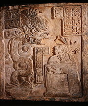
Stela 2 is situated some distance to the west of the Main Plaza in Group C, in Plaza B, in front of a small temple. This stela was photographed by Teoberto Maler
in the first decade of the 20th century. The stela depicts king Yajawte' K'inich, it shows dancing figures on its east face. On its west face it depicts a figure sculpted using the so-called X-ray style found on Ik-style ceramics, which depicts the face in profile wearing a mask that has been cut away to show the face underneath.
Stela 3 is located on the east side of the Main Plaza in Group C, north of Stela 4.
Stela 4 is situated on the east side of the Main Plaza in Group C, near the Twin Temples, just south of Stela 3 and north of Stela 5. The stela shows king Yajawte' K'inich performing a dance, with one foot raised.
Stela 5 is also located on the east side of the Main Plaza, just south of Stela 4.
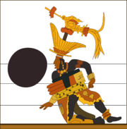
Stela 6 is located on the south side of the Main Plaza in Group C, just north of the South Pyramid. It was discovered in 1988 and had been broken into many pieces, although the base of the stela was still in situ. Two other large fragments were lying on the surface and more than 100 smaller fragments were collected. The stela appears to have shattered when it fell, some time after Motul de San José had been abandoned. The north and south faces of the stela bore sculpted designs, the remaining butt of the stela has the left foot of a human figure worked in profile on the south side. The sculpture on the north side has been pieced together in part and appears to have shown the figure of a ruler of the city dressed in rich clothing and regalia. The figure was positioned performing a dance, with one foot half lifted off the ground. In his right hand the ruler held a God K
sceptre. The prelimanry reconstruction of the sculpture would indicated that the figure of the king measured between 2.5 and 3 m (8.2 and 9.8 ft) high. Stela 6 is very similar to Stela 1 from Dos Pilas
with both depicting the ruler in an identical position. The stela appears to have been a relatively late addition to the plaza and dates to the Late Postclassic period.
Akte is situated 7.1 kilometres (4.4 mi) northwest of Motul de San José and is known for its sculptured monuments. The centre of Akte covers an area of 35 hectare (0.135135755507387 sq mi) and includes 32 structures on a 40 metres (131.2 ft) high artificially landscaped hill, with a number of other structures scattered through the surrounding area. The hill supporting the site core overlooks the rivers Akte and Kantetul. The main periods of occupation date to the Late Preclassic and Late Classic with further occupation in the Terminal Classic and Early Postclassic. The overall area of Akte is probably larger than that of Trinidad de Nosotros, covering a 2 to 3 km² (0.77220431718507 to 1.2 sqmi) area, but this includes less structures than at Trinidad, with small residential groups widely scattered on hilltops around the site core.
The main residential complex at Akte rests upon a 3 to 5 m (9.8 to 16.4 ft) platform and contains three patios, with other residential groups clustered around the east, south and west side of the platform's base. A small temple is located on the east side of the north patio. Akte may have served as a rural administrative centre or perhaps as a royal estate of the Motul de San José elite.
Seven sculpted monuments have been found at Akte, an unusual number for such a small site. If these monuments were originally erected at Akte, then this may mean that the site was actually outside of the Motul de San José polity. Archaeological investigations of the stelae carried out in 2003 were unable to determine if the monuments had been moved to Akte or not.
Stela 1 is the best preserved monument at Akte. It is badly eroded and can be dated by a damaged Long Count date inscribed on the back, which dates it to the end of the 7th century or the beginning of the 8th. The front of the stela bears the representation of a standing "divine lord" with attributes typical of the Late Classic.
Stela 2 is badly damaged, being broken into a number of fragments.
Stela 3 had a cache of 44 pieces of obsidian
buried near its base.
Buena Vista lies 3 kilometres (1.9 mi) to the southwest of the site core and 0.5 kilometre (0.310686368324903 mi) from the northwest shore of Lake Petén Itzá. 13 structures have been mapped, situated around a small plaza, with a small temple on the east side. The site is located on a hilltop and was once much larger but has been partially covered by the modern development of Nuevo San José. Structures 4 and 8 have been investigated, revealing that Buena Vista was probably occupied from the Middle Preclassic through to the Late Classic, with a much reduced population in the Early Postclassic. The site was surveyed in 2000 and preliminary excavations took place in 2001. The main pyramids of Motul de San José are visible from Buena Vista, as is a large part of the lake. Buena Vista has fairly good soil and the surviving portions of the site are currently used for milpa
cultivation.
The earliest ceramic evidence excavated at Buena Vista dates to the very end of the Early Preclassic period, indicating that the site was initially settled at the transition between the Early and Middle Preclassic periods. The long occupational history of Buena Vista may be linked to its proximity to chert
-rich hills. Excavations have revealed evidence of chert workshops dedicated to the production of tools, together with dumps of waste flakes.
Buena Vista features an early architectural style that differs from that at Motul de San José, consisting of platforms built from unworked stone, with wide front stairways and probably without superstructures. They were built in the Middle to Late Preclassic periods and then reused in the Late Classic. The differences in style between Buena Vista and Motul probably results from differing epochs of construction.
Group A is arranged around the main plaza. Group B is located a little to the southeast, and contains structures 11 to 14.
Structure 1 is the East Pyramid, it is located on the hillside a short distance from the rest of the mounds. It was a 2.5 metres (8.2 ft) high Late Classic funerary structure containing a looted tomb. From the summit of this temple both Lake Petén Itzá and the Twin Temples of Group C at Motul de San José are visible.
Structure 4 is the North Structure. It dates to the Late Classic but overlies construction dating to the Middle Preclassic. A stairway ascended the front of the building, under which were found the remains of Late Classic polychrome ceramics, perhaps belonging to a pre-construction ritual offering. The stucco floors on top of the mound supported asymmetric walls that perhaps date to the Postclassic Period, being associated with a mix of Late Classic and Postclassic pottery.
Structures 7, 8 and 9 were long, low rectangular platforms. They measure 15 metres (49.2 ft) long by 3.5 metres (11.5 ft) wide and 0.6 metres (2 ft) high. They had perishable roofs and date to the Late Classic, although Structures 7 and 8 may overlie Middle Preclassic remains.
has been identified. The site is located in an area of savanna
with poor soils considered unsuitable for the growing of maize
, somewhat at odds with the settlement density of the site. The contrast between the settlement density and poor soils has highlighted the need for further research into Maya agriculture
in a savanna environment. Chachaklum was a relatively large site of secondary rank within the Motul de San José polity.
Chachaklum's principal phase of occupation appears to date to the Terminal Classic period, during the 10th and 11th centuries AD. However, the site possesses massive basal platforms and these, together with the presence of the E-Group, suggests a longer occupational period than was immediately evident from the first excavations of the site. Further investigations have revealed a long occupational history beginning in the Late Preclassic period and continuing right through to the Late Classic.
The site has been severely damaged by modern construction with the chert deposits being reused as construction material.
Chakokot is located 2 kilometres (1.2 mi) to the east of the Main Plaza. It occupies an area of 16 hectare (0.0617763453748056 sq mi) and consists of 59 structures widely dispersed around a small plaza upon the flat summit of a 40 metres (131.2 ft) high hill. Principal occupation dates from the Late Preclassic and Late Classic periods. The soils at Chakokot are considered good for agriculture and maize was grown within the site itself. The area between Chakokot and Motul de San José is occupied by a bajo, or low-lying seasonal swamp.
The Plaza at Chakokot is small and covers an area of about 1200 square metres (12,916.7 sq ft). On the north and east sides it is bordered by residential groups, a 3 metres (9.8 ft) square platform is to the south and on the west by two low parallel structures measuring just 0.5 metres (1.6 ft) high.
The largest structure at Chakokot is a 10 metres (32.8 ft) tall temple to the east of a large residential area bordering the Plaza on the east side.
Most of the residential areas at Chakokot possess one or more bottle-shaped underground storage chambers, known as chultun
ob, with 14 having been found as of 2001. Because of the thick vegetation at the site, investigators consider that there are probably more to be found. These chultunob were closed with disc-shaped stone lids, many of which were found either still in place or close to the aperture of the chultun to which it belonged. The stone lids were without perforations so it is supposed that the chambers were used to store dry goods rather than water.
La Trinidad is known as Sik'u' in the Itza language. It is located 2.6 kilometres (1.6 mi) southeast of Motul de San José on the northern shore of Lake Petén Itzá. The site is located at the closest point to Motul on the lake shore and it may have served as a Maya port. The site has more than 115 structures located in an area of 35 hectare (0.135135755507387 sq mi), and the site may actually cover 55 hectare (0.212356187225894 sq mi) and contain about 150 structures. The site had a long occupational history stretching right through from the Middle Preclassic to the Early Postclassic, with two phases of greater activity in the Early Classic around AD 350 and in the Late Classic from AD 650–830. The Terminal Classic occupation was largely limited to the lake shore but was fairly dense. The monumental architecture, port and the ballcourt all identify La Trinidad de Nosotros as an important secondary centre within the Motul de San José polity. Additionally, the site was situated close to a source of chert and probably manufactured chert tools.
La Trinidad de Nosotros has been tentatively identified as Xililchi, a settlement visited by conquistador
Martín de Ursúa
after Spanish Conquest
of the Itza capital Noj Petén
in 1697, but no Late Postclassic remains have yet been securely identified.
The site is divided into two areas. The site core is located on a hill 40 metres (131.2 ft) above the lake and with a good view across it. The second area is spread along the lake shore and the hillside leading to the site core. The site core has at least 80 structures arranged around five plazas. The majority of the structures are residential in nature but La Trinidad has an unusual amount of ceremonial architecture for such a small site. La Trinidad seems to have been an important port for the import and export of goods to and from Motul de San José.
Group C is the main residential complex of the site, it has a small shrine at the eastern end. La Trinidad de Nosotros has five main plazas within its site core, labelled I through to V. All of them were resurfaced multiple times between the Late Preclassic and Late Classic. The combined surface areas of the five plazas cover over 20000 square metres (215,278.2 sq ft), with Plaza V making up about half of this, making it slightly smaller than the main plaza at Motul de San José itself.
Structure A-1 is the main temple, it is a 12 metres (39.4 ft) high radial pyramid.
Structure C-1 is an elite residence.
Structure E-1 may originally have been a circular building.
Structure G-1 is a sub-elite residence.
The ballcourt
is located in Group F. It is in the form of a T-shape, with 25 metres (82 ft) long sides, a closed northern end zone and a small temple adjoining the eastern side. The last phase of construction dates to the Late Classic. The ballcourt is similar in design to the ballcourt on the Main Plaza of Dos Pilas in the Petexbatún region. No ballcourt has been identified at the Motul de San José site itself, making the presence of one here of especial interest. Rich deposits were found associated with the ballcourt, including 21,000 potsherds, 239 pieces of obsidian, 155 fragments of ceramic figurines and 84 stone tools.
Group O is a small residential group to the west of Plaza V.
Various structures have been identified in the area of the port, including retaining walls, a possible breakwater and a quay. The port appears to have been partially enclosed by an artificial peninsula.
Maya civilization
The Maya is a Mesoamerican civilization, noted for the only known fully developed written language of the pre-Columbian Americas, as well as for its art, architecture, and mathematical and astronomical systems. Initially established during the Pre-Classic period The Maya is a Mesoamerican...
site located just north of Lake Petén Itzá
Lake Petén Itzá
Lake Petén Itzá is a lake in the northern department Petén in Guatemala. It is the second largest lake in Guatemala, the Izabal lake being the largest. It is located around . It has an area of 99 km² some 32 km. long and 5 km wide. Its maximum depth is 160 m...
in the Petén Basin
Petén Basin
The Petén Basin is a geographical subregion of Mesoamerica, located in the northern portion of the modern-day nation of Guatemala, and essentially contained within the department of El Petén...
region of the southern Maya lowlands. It is located a few kilometres from the modern village of San José
San José, El Petén
San José is a municipality in the El Petén department of Guatemala. It contains 3,602 people. It lies on the north shore of Lake Petén Itzá and is located a few kilometers from the Classic Period Maya ruin of Motul de San José...
, in Guatemala
Guatemala
Guatemala is a country in Central America bordered by Mexico to the north and west, the Pacific Ocean to the southwest, Belize to the northeast, the Caribbean to the east, and Honduras and El Salvador to the southeast...
's northern department
Departments of Guatemala
||Guatemala is divided into 22 departments :#Alta Verapaz#Baja Verapaz#Chimaltenango#Chiquimula#Petén#El Progreso#El Quiché#Escuintla#Guatemala#Huehuetenango#Izabal#Jalapa#Jutiapa#Quetzaltenango#Retalhuleu#Sacatepéquez...
of Petén
Petén (department)
Petén is a department of the nation of Guatemala. It is geographically the northernmost department of Guatemala, as well as the largest in size — at it accounts for about one third of Guatemala's area. The capital is Flores...
. A medium sized civic-ceremonial centre, it was an important political and economic centre during the Late Classic
Mesoamerican chronology
Mesoamerican chronology divides the history of pre-Columbian Mesoamerica into several periods: the Paleo-Indian , the Archaic , the Preclassic , the Classic , and the Postclassic...
period (AD 650–950).
The site was first settled between 600 and 300 BC, in the latter portion of the Middle Preclassic
Mesoamerican chronology
Mesoamerican chronology divides the history of pre-Columbian Mesoamerica into several periods: the Paleo-Indian , the Archaic , the Preclassic , the Classic , and the Postclassic...
period, when it was probably a fairly small site. The city
Maya city
A Maya city was a centre of population of the pre-Columbian Maya civilization of Mesoamerica. It served the specialised roles of administration, commerce, manufacturing and religion that characterised ancient cities worldwide...
then had a long and continuous occupational history until the Early Postclassic
Mesoamerican chronology
Mesoamerican chronology divides the history of pre-Columbian Mesoamerica into several periods: the Paleo-Indian , the Archaic , the Preclassic , the Classic , and the Postclassic...
, up to around AD 1250, with peaks in the Late Preclassic
Mesoamerican chronology
Mesoamerican chronology divides the history of pre-Columbian Mesoamerica into several periods: the Paleo-Indian , the Archaic , the Preclassic , the Classic , and the Postclassic...
and Late Classic periods.
Motul de San José has been identified as the source of Ik-style polychrome ceramics
Maya ceramics
Maya ceramics are important in the study of the Pre-Columbian Maya culture of Mesoamerica. Through the years, the vessels took on different shapes, colors, sizes, and purposes...
bearing painted scenes of the Late Classic Maya aristocracy involved in a variety of courtly activities. The city was the capital of a polity that included various satellite sites of varying importance, including a port on the shore of Lake Petén Itzá
Lake Petén Itzá
Lake Petén Itzá is a lake in the northern department Petén in Guatemala. It is the second largest lake in Guatemala, the Izabal lake being the largest. It is located around . It has an area of 99 km² some 32 km. long and 5 km wide. Its maximum depth is 160 m...
.
Location
Motul de San José is located 3 kilometres (1.9 mi) from the north shore of Lake Petén Itzá, in the centre of the department of El Petén. The nearest town is FloresFlores, El Petén
Flores is the capital city of Petén department of Guatemala. It is located at . The population is 13,700 .Flores serves as the municipal seat for the surrounding municipality, with which it shares a name ....
, 10.5 kilometres (6.5 mi) to the south as the crow flies, on the other side of the lake. The nearest villages are San José, 5 kilometres (3.1 mi) away, and San Andrés
San Andrés, El Petén
San Andrés is a municipality in the department of El Petén in Guatemala. The municipality is formed by the town of San Andrés, located on the north-western shore of Lake Petén Itzá, and 55 rural communities, with a total population of 20,295 people .The municipality was created in 1962 and has a...
, 6.5 kilometres (4 mi) away, both are to the south of the site, on the northern shore of the lake. The archaeological site is connected to Nuevo San José, a northern expansion of San José, by a dirt road. The site lies among land that has been cleared of forest within the last century and is now used to plant maize and graze cattle.
Motul de San José lies on a limestone
Limestone
Limestone is a sedimentary rock composed largely of the minerals calcite and aragonite, which are different crystal forms of calcium carbonate . Many limestones are composed from skeletal fragments of marine organisms such as coral or foraminifera....
plateau
Plateau
In geology and earth science, a plateau , also called a high plain or tableland, is an area of highland, usually consisting of relatively flat terrain. A highly eroded plateau is called a dissected plateau...
at the northern edge of the fault depression that underlies the central lakes of the Petén Basin. The local topography
Topography
Topography is the study of Earth's surface shape and features or those ofplanets, moons, and asteroids...
consists of ridges, generally running east-west or northeast-southwest alternating with lower-lying areas with clay
Clay
Clay is a general term including many combinations of one or more clay minerals with traces of metal oxides and organic matter. Geologic clay deposits are mostly composed of phyllosilicate minerals containing variable amounts of water trapped in the mineral structure.- Formation :Clay minerals...
soils. These low-lying areas tend to feed into drainage systems
Drainage system (Geomorphology)
In geomorphology, a drainage system is the pattern formed by the streams, rivers, and lakes in a particular drainage basin. They are governed by the topography of the land, whether a particular region is dominated by hard or soft rocks, and the gradient of the land. Geomorphologists and...
flowing into either Lake Petén Itzá itself or into the Akte River. The Kantetul River is a seasonal watercourse with its origin 5 kilometres (3.1 mi) to the northeast of the site and flowing westwards into the Akte River, passing 2 kilometres (1.2 mi) from the site core. The Akte River in turn flows west into the San Pedro River
San Pedro River (Guatemala)
The Río San Pedro is a river of Guatemala and Mexico. Its sources are located in the Guatemalan department of El Petén. at . The river flows westwards until it reaches the Mexican border and crosses into the state of Tabasco at . From there it continues northwest and joins the Usumacinta River...
, which flows northwest into Mexico
Mexico
The United Mexican States , commonly known as Mexico , is a federal constitutional republic in North America. It is bordered on the north by the United States; on the south and west by the Pacific Ocean; on the southeast by Guatemala, Belize, and the Caribbean Sea; and on the east by the Gulf of...
where it joins the Usumacinta River
Usumacinta River
The Usumacinta River is a river in southeastern Mexico and northwestern Guatemala. It is formed by the junction of the Pasión River, which arises in the Sierra de Santa Cruz and the Salinas River, also known as the Chixoy, or the Negro, which descends from the Sierra Madre de Guatemala...
and ultimately empties into the Gulf of Mexico
Gulf of Mexico
The Gulf of Mexico is a partially landlocked ocean basin largely surrounded by the North American continent and the island of Cuba. It is bounded on the northeast, north and northwest by the Gulf Coast of the United States, on the southwest and south by Mexico, and on the southeast by Cuba. In...
. A mixture of ancient and modern agricultural terraces
Terrace (agriculture)
Terraces are used in farming to cultivate sloped land. Graduated terrace steps are commonly used to farm on hilly or mountainous terrain. Terraced fields decrease erosion and surface runoff, and are effective for growing crops requiring much water, such as rice...
line the riverbank 2 kilometres (1.2 mi) north of the site core.
Mesoamerican chronology
Mesoamerican chronology divides the history of pre-Columbian Mesoamerica into several periods: the Paleo-Indian , the Archaic , the Preclassic , the Classic , and the Postclassic...
ruins of Tikal
Tikal
Tikal is one of the largest archaeological sites and urban centres of the pre-Columbian Maya civilization. It is located in the archaeological region of the Petén Basin in what is now northern Guatemala...
. The site is about 275 kilometres (170.9 mi) north of Guatemala City
Guatemala City
Guatemala City , is the capital and largest city of the Republic of Guatemala and Central America...
. The ruins are located on a hill about 180 metres (590.6 ft) above mean sea level
Above mean sea level
The term above mean sea level refers to the elevation or altitude of any object, relative to the average sea level datum. AMSL is used extensively in radio by engineers to determine the coverage area a station will be able to reach...
.
The site forms part of the Motul Ecological
Ecology
Ecology is the scientific study of the relations that living organisms have with respect to each other and their natural environment. Variables of interest to ecologists include the composition, distribution, amount , number, and changing states of organisms within and among ecosystems...
Park (Parque Ecológico Motul in Spanish), which is administered by IDAEH (Instituto de Antropología e Historia, the Guatemalan Institute of Anthropology
Anthropology
Anthropology is the study of humanity. It has origins in the humanities, the natural sciences, and the social sciences. The term "anthropology" is from the Greek anthrōpos , "man", understood to mean mankind or humanity, and -logia , "discourse" or "study", and was first used in 1501 by German...
and History
History
History is the discovery, collection, organization, and presentation of information about past events. History can also mean the period of time after writing was invented. Scholars who write about history are called historians...
), the University of San Carlos of Guatemala (USAC) and the local communities of San José and Nuevo San José. The park covers an area of approximately 2.2 square kilometre (0.849424748903577 sq mi).
Emblem glyph
The emblem glyph of Motul de San José contains the main sign ik, "breath" or "wind". It is found on monuments and ceramics from the 8th and 9th centuries. A vessel bearing this emblem and depicting king Lamaw Ek' was found as far away as Altar de SacrificiosAltar de Sacrificios
Altar de Sacrificios is a ceremonial center and archaeological site of the pre-Columbian Maya civilization, situated near the confluence of the Pasión and Salinas Rivers , in the present-day department of Petén, Guatemala...
. Analysis has revealed that it was manufactured in Motul de San José, indicating some form of interaction between these distant sites.
Occupation and diet
Motul de San José was occupied from the Middle Preclassic right through to the Early Postclassic. However, the height of the city's occupation was the Late Classic. Settlement density averages 250 structures per square kilometer (650 structures per square mile) in the site's monumental core, 125 structures per square kilometer (325 structures per square mile) in the city's suburban area and 79 structures per square kilometer (205 structures per square mile) in the site's periphery.Motul de San José's likely resource catchment zone probably extended between 5 and 7 km (3.1 and 4.3 mi) around the site core and included a number of satellite sites including Kantetul, La Trinidad de Nosotros, Akte, Buena Vista, Chachaklum and Chakokot. This region also includes two major water sources in the form of Lake Péten Itzá to the south and the Kantetul river 2 kilometres (1.2 mi) to the north. The area around the city included a variety of soils suitable for agriculture, with 20% of this being very fertile soil highly suited to agriculture, just over 50% of the area was very fertile but required high maintenance (consisting of either fertilization or crop rotation
Crop rotation
Crop rotation is the practice of growing a series of dissimilar types of crops in the same area in sequential seasons.Crop rotation confers various benefits to the soil. A traditional element of crop rotation is the replenishment of nitrogen through the use of green manure in sequence with cereals...
) and 14% being low fertility soil consisting of lowland clay
Clay
Clay is a general term including many combinations of one or more clay minerals with traces of metal oxides and organic matter. Geologic clay deposits are mostly composed of phyllosilicate minerals containing variable amounts of water trapped in the mineral structure.- Formation :Clay minerals...
and suitable only for maize
Maize
Maize known in many English-speaking countries as corn or mielie/mealie, is a grain domesticated by indigenous peoples in Mesoamerica in prehistoric times. The leafy stalk produces ears which contain seeds called kernels. Though technically a grain, maize kernels are used in cooking as a vegetable...
or being left unfarmed. Soil analysis has revealed that maize was not only grown in peripheral areas but also close to residential areas throughout Motul de San José.
Archaeological investigations have revealed that the diet of the inhabitants of Motul de San José included dog
Dog
The domestic dog is a domesticated form of the gray wolf, a member of the Canidae family of the order Carnivora. The term is used for both feral and pet varieties. The dog may have been the first animal to be domesticated, and has been the most widely kept working, hunting, and companion animal in...
s (Canis familiaris), turtle
Turtle
Turtles are reptiles of the order Testudines , characterised by a special bony or cartilaginous shell developed from their ribs that acts as a shield...
s including Pond Sliders (Trachemys scripta) and Mesoamerican River Turtle
Mesoamerican River Turtle
The Central American river turtle or Mesoamerican river turtle locally known as the "hickatee" or "tortuga blanca"- is the only living species in the family Dermatemydidae...
s (Dermatemys mawii), freshwater snail
Snail
Snail is a common name applied to most of the members of the molluscan class Gastropoda that have coiled shells in the adult stage. When the word is used in its most general sense, it includes sea snails, land snails and freshwater snails. The word snail without any qualifier is however more often...
s (mostly Pomacea flagellata
Pomacea flagellata
Pomacea flagellata is a species of freshwater snail with a gill and an operculum, an aquatic gastropod mollusk in the family Ampullariidae. In older literature this species was known as ghiesbrechti and today is still poorly understood....
but also Jute snails (Pachychilus
Pachychilus
Pachychilus, common name jute snails, is a genus of freshwater snails with an operculum, aquatic gastropod mollusk in the family Pachychilidae.Pachychilus is the type genus of the family Pachychilidae.- Distribution :...
spp.)), White-tailed deer
White-tailed Deer
The white-tailed deer , also known as the Virginia deer or simply as the whitetail, is a medium-sized deer native to the United States , Canada, Mexico, Central America, and South America as far south as Peru...
(Odocoileus virginianus), Red Brocket
Red Brocket
The Red Brocket , is a species of brocket deer from forests in South America, ranging from northern Argentina to Colombia and the Guianas...
(Mazama americana - a species of small deer) , White-lipped Peccary
White-lipped Peccary
The White-lipped Peccary, Tayassu pecari, is a peccary species found in Central and South America, living in rainforest, dry forest and chaco scrub. It is monotypic within the genus Tayassu....
(Tayassu pecari), rabbit
Rabbit
Rabbits are small mammals in the family Leporidae of the order Lagomorpha, found in several parts of the world...
s (Sylvilagus spp.), Lowland Pacas (Cuniculus paca), Central American Agouti
Central American Agouti
The Central American Agouti is an agouti species from the family Dasyproctidae. The species is widespread in Mesoamerica and South America. The northern section of the range occurs from Chiapas and the Yucatan Peninsula to northern Ecuador and Colombia and western Venezuela...
(Dasyprocta punctata) and Nine-banded Armadillo
Nine-banded Armadillo
The nine-banded armadillo , or the nine-banded, long-nosed armadillo, is a species of armadillo found in North, Central, and South America, making it the most widespread of the armadillos...
s (Dasypus novemcinctus). Only the dog had been domesticated by the Late Classic Maya so the majority of protein
Protein
Proteins are biochemical compounds consisting of one or more polypeptides typically folded into a globular or fibrous form, facilitating a biological function. A polypeptide is a single linear polymer chain of amino acids bonded together by peptide bonds between the carboxyl and amino groups of...
in the diet of the inhabitants came from hunting and fishing within the catchment area around the city. The most common food animals were the white-tailed deer, river clam
Freshwater bivalves
Freshwater bivalves are one kind of freshwater molluscs. They are bivalves which live in freshwater, as opposed to saltwater. Although the majority of species of bivalve molluscs live in the sea, a number of different families of bivalves live in freshwater...
and river turtle. Some animal remains were recovered that were clearly associated with elite status occupation, such as those of the jaguar
Jaguar
The jaguar is a big cat, a feline in the Panthera genus, and is the only Panthera species found in the Americas. The jaguar is the third-largest feline after the tiger and the lion, and the largest in the Western Hemisphere. The jaguar's present range extends from Southern United States and Mexico...
, the ocelot
Ocelot
The ocelot , pronounced /ˈɒsəˌlɒt/, also known as the dwarf leopard or McKenney's wildcat is a wild cat distributed over South and Central America and Mexico, but has been reported as far north as Texas and in Trinidad, in the Caribbean...
or other small feline and the crocodile
Crocodile
A crocodile is any species belonging to the family Crocodylidae . The term can also be used more loosely to include all extant members of the order Crocodilia: i.e...
(crocodilus spp.). These latter three appear more related to ritual and economic activity than nutritional needs. Freshwater snails were more an ingredient in the diet of lower status families while deer remains were associated with the elite residents of the city.
Among Motul de San José and its most important satellite La Trinidad de Nosotros, the majority of remains from Trinidad were from aquatic species, while at Motul de San José the majority were from terrestrial species. 10% of animal remains from Motul had been modified to form artefacts, compared with only 4% of animal remains at Trinidad. Artefact remains found at La Trinidad de Nosotros were more likely to be waste products from artefact manufacture while at Motul de San José they were more likely to be artefacts at the end of their usable life. Aquatic animal products arriving at Motul de San José were far more likely to be consumed by the elite than by commoners, whether used as food or to craft artefacts.
Economy
The majority of basic natural resources were readily available in the immediate vecinity of the city, with local soils being suitable for the production of maize and mixed crops to support the local populace. The subsidiary site of La Trinidad de Nosotros, located on the shore of Lake Petén Itzá some 2.6 kilometres (1.6 mi) southeast of the site core, appears to have been an important port for the import and export of goods to and from Motul de San José. Food resources not available in the immediate vicinity of the city were probably provided by the satellite sites dispersed at some distance from the site core, and La Trinidad is likely to have played an important part in supplying exotic goods to the city as well as freshwater foodstuffs such as crocodiles, fish and turtles. ChertChert
Chert is a fine-grained silica-rich microcrystalline, cryptocrystalline or microfibrous sedimentary rock that may contain small fossils. It varies greatly in color , but most often manifests as gray, brown, grayish brown and light green to rusty red; its color is an expression of trace elements...
nodules were locally available from the first ridges to the north of the lake. A chert workshop has been discovered in the northern sector of Motul de San José. Ceramic figurines were produced in the Acropolis palace complex in Group C and also in a medium-sized palace complex in Group B, an elite plaza in Group E and also in two elite plazas in the northern part of the site.
The small satellite site of Chak Maman Tok' several kilometers to the southwest of Motul de San José, appears to have been an important centre for the production of chert tools, with only a few other centres within the Maya lowlands manufacturing chert on such a scale. Although very small, Chak Maman Tok' probably played a major part within the economy of the Motul de San José polity.
Differences in architectural style between elite residential complexes and in the activities carried out at them suggest that the aristocracy of Motul de San José was divided into several distinct classes, including the royal family resident in Group C, royal courtier
Courtier
A courtier is a person who is often in attendance at the court of a king or other royal personage. Historically the court was the centre of government as well as the residence of the monarch, and social and political life were often completely mixed together...
s and low to middle rank nobles.
The Kantetul River, although now seasonal, is reported to have been a navigable water channel until relatively recently. During the height of Motul de San José's power, it may have provided an important link to the San Pedro River, a significant trade route in ancient times.
Ik style ceramics
Motul de San José is possibly the source of the so-called "Ik-style" painted polychrome ceramicsMaya ceramics
Maya ceramics are important in the study of the Pre-Columbian Maya culture of Mesoamerica. Through the years, the vessels took on different shapes, colors, sizes, and purposes...
, a theory that has recently received additional support from archaeological excavations at the site. These ceramic vessels, including finely painted plates and cylindrical vessels, were first asssociated with the then-unidentified site of Ik in the 1970s by the Emblem Glyph included in the hieroglyphic texts on them. The confirmation of Motul de San José as Ik came from investigations carried out from 1998 to 2004.
The Ik-style ceramic corpus includes a set of features such as hieroglyphs
Maya script
The Maya script, also known as Maya glyphs or Maya hieroglyphs, is the writing system of the pre-Columbian Maya civilization of Mesoamerica, presently the only Mesoamerican writing system that has been substantially deciphered...
painted in a pink or pale red colour and scenes with dancers wearing masks. One of the most distinctive features is the realistic representation of subjects as they appeared in life, something that is very rare in Mesoamerican art. The corpus is represented by more than 30 intact vessels, the majority of unknown provenance, which have been compared to ceramic fragments recovered from Motul de San José and its satellite sites. The subject matter of the vessels includes courtly life from the Petén region
Petén Basin
The Petén Basin is a geographical subregion of Mesoamerica, located in the northern portion of the modern-day nation of Guatemala, and essentially contained within the department of El Petén...
in the 8th century AD, such as diplomatic representations, feasting, bloodletting, scenes of warriors and the sacrifice of prisoners of war
Maya warfare
Although the Maya were once thought to have been peaceful , current theories emphasize the role of inter-polity warfare as a factor in the development and perpetuation of Maya society. The goals and motives of warfare in Maya culture are not thoroughly understood, but there are several kinds of...
.
The variations in artistic style and chemical composition of the Ik-style ceramics suggests that they were produced in a number of workshops local to the Motul de San José area. They have been subdivided into five types, four from Motul de San José itself and one from one of its satellite sites. There are also various lower-quality examples that are presumed to have been manufactured in sites of lesser importance within the Motul de San José polity. The Ik-style ceramics are believed to have been produced in the period from 740–800 AD. In spite of differences, all the Ik-style ceramics are thought to have been made within a network of allied workshops dedicated to producing vessels for use in the banquets of the aristocracy of Motul de San José and of the petty nobility of the capital's satellites. The ceramics were distributed widely in the Maya region as gifts in order to seal alliances between the elites of various Maya kingdoms.
Of particular note is that chemical analysis of ceramic fragments has revealed that the very same workshops not only produced the highest-quality Ik-style polychrome ceramics but also general low-quality ceramics for household use. High quality Ik-style ceramics made at Motul de San José have been excavated from across the Maya region, including Tikal
Tikal
Tikal is one of the largest archaeological sites and urban centres of the pre-Columbian Maya civilization. It is located in the archaeological region of the Petén Basin in what is now northern Guatemala...
and Uaxactún
Uaxactun
Uaxactun is an ancient ruin of the Maya civilization, located in the Petén Basin region of the Maya lowlands, in the present-day department of Petén, Guatemala. The site lies some north of the major center of Tikal...
to the northeast of the city, Copán
Copán
Copán is an archaeological site of the Maya civilization located in the Copán Department of western Honduras, not far from the border with Guatemala. It was the capital city of a major Classic period kingdom from the 5th to 9th centuries AD...
far to the south, and Altar de Sacrificios
Altar de Sacrificios
Altar de Sacrificios is a ceremonial center and archaeological site of the pre-Columbian Maya civilization, situated near the confluence of the Pasión and Salinas Rivers , in the present-day department of Petén, Guatemala...
, Tamarindito
Tamarindito
Tamarindito is an archaeological site of the Maya civilization located along an escarpment in the Petén department of Guatemala. The city was the capital of the Petexbatún region of the southwestern Petén during the Early Classic period but was displaced by the newly founded conquest state of Dos...
and Seibal
Seibal
Seibal, known as El Ceibal in Spanish, is a Classic Period archaeological site of the Maya civilization located in the northern Petén Department of Guatemala. It was the largest city in the Pasión River region....
, in western Petén.
A particularly rare feature found on Motul de San José ceramics is the so-called X-ray style, showing a figure wearing a mask but also portraying his face underneath it. All the other representations using this rare style are depicted on Late Classic sculptures at sites with which it is known that Motul de San José had contact at this time, including Dos Pilas, Machaquila
Machaquila
Machaquilá refers to a ruined city of the Maya civilization in what is now the El Peten department of Guatemala. There is also a small Guatemalan village several kilometers from the site that bears the name Machaquilá.-History:...
, Tikal and Yaxchilan. This X-ray style has been found on at least nine painted vessels from Motul de San José and is also used on the west side of Stela 2.
Middle Preclassic
Motul de San José was first settled between 600 and 300 BC, in the latter portion of the Middle PreclassicMesoamerican chronology
Mesoamerican chronology divides the history of pre-Columbian Mesoamerica into several periods: the Paleo-Indian , the Archaic , the Preclassic , the Classic , and the Postclassic...
period, when it was probably a fairly small site. At this time some of its satellite sites were also settled, including La Trinidad de Nosotros and Buena Vista, both of which would have been small villages at this time, and they may have been settled even earlier in the Middle Preclassic, between 800 and 600 BC.
Late Preclassic
Although investigation of Preclassic remains is difficult at Motul de San José due to the overlying Late Classic construction, it is evident that the site experienced major growth during the Late Preclassic (300 BC–AD 300) and became a sizeable centre. At roughly the same time, most of the major structures were built at Akte, and Chakokot experienced its earliest occupation during the Late Preclassic. In contrast, Buena Vista appears to have been lightly occupied. La Trinidad de Nosotros also underwent major expansion in the Late Preclassic and became larger and more important than Motul de San José, with its architectural layout being finalised in this period - later Classic period construction was superimposed upon pre-existing Late Preclassic structures.Classic Period
Although Motul de San José had begun to refer to Tikal as its overlord in the late 4th century, by the 7th century various hieroglyphic texts mention that it was under the dominion of CalakmulCalakmul
Calakmul is a Maya archaeological site in the Mexican state of Campeche, deep in the jungles of the greater Petén Basin region. It is from the Guatemalan border. Calakmul was one of the largest and most powerful ancient cities ever uncovered in the Maya lowlands...
, Tikal's greatest enemy, before again coming under the power of Tikal in the early 8th century.
Early Classic
Early Classic ceramic finds are scarce at Motul de San José and those that have been found were a minor component in mixed fill deposits. This suggests that Motul de San José was largely abandoned in the Early Classic. The best examples of Early Classic pottery come from outside of Motul de San José itself, with several complete ceramic vessels being recovered during the construction of a modern language school in Trinidad de Nosotros and some fragments of Early Classic pottery being retrieved from a looted chultun at Wakutal.In the late 4th century Motul de San José began to refer to Tikal as its overlord.
Late Classic
Motul de San José experienced its second major peak in occupation during the Late Classic period, between AD 600 and AD 830. Most of the major architecture at the site was built during this surge in activity and the city reached its maximum size. Motul de San José became one of the three most important cities around Lake Petén Itzá and was approximately the same size as TayasalTayasal
Tayasal is a pre-Columbian Maya archaeological site that dates to the Postclassic period. The site is located in the southern Maya lowlands on a small island in Lake Petén Itzá, now part of the Department of Petén in northern Guatemala...
, while it was slightly smaller than Nixtun Ch'ich'. There was renewed growth in the city's satellite sites, Chakokot reached its peak population and most of its residential complexes were built in the Late Classic. Buena Vista experienced only light occupation at this time. Major construction work took place at Akte including the building of the principal platform and its causeway. It also appears that the rulers of Akte erected several stelae. La Trinidad de Nosotros took on its final form and most of its major architecture was built at this time including the Mesoamerican ballcourt
Mesoamerican ballcourt
A Mesoamerican ballcourt is a large masonry structure of a type used in Mesoamerica for over 2,700 years to play the Mesoamerican ballgame, particularly the hip-ball version of the ballgame. Over 1,300 ballcourts have been identified, 60% in the last 20 years alone...
, the major residential complexes, four plazas and the port facilities.
In the 8th century AD the city had important relationships with Maya cities to the southwest, especially in the Petexbatún
Petexbatún
Petexbatún is a small lake formed by a river of the same name, which is a tributary of the La Pasion river. It is near Sayaxché, located in the southern area of the Guatemalan department of Petén....
region, and on the Pasión
Pasión River
The Pasión River is a river located in the northern lowlands region of Guatemala. The river is fed by a number of upstream tributaries whose sources lie in the hills of Alta Verapaz. These flow in a general northerly direction to form the Pasión, which then tends westwards to meet up with the...
and Usumacinta
Usumacinta River
The Usumacinta River is a river in southeastern Mexico and northwestern Guatemala. It is formed by the junction of the Pasión River, which arises in the Sierra de Santa Cruz and the Salinas River, also known as the Chixoy, or the Negro, which descends from the Sierra Madre de Guatemala...
rivers, including Seibal (on the Pasión), Altar de Sacrificios (near where the Pasión becomes the Usumacinta), and Dos Pilas
Dos Pilas
Dos Pilas is a Pre-Columbian site of the Maya civilization located in what is now the department of Petén, Guatemala. It dates to the Late Classic Period, being founded by an offshoot of the dynasty of the great city of Tikal in AD 629 in order to control trade routes in the Petexbatún region,...
, Aguateca
Aguateca
Aguateca is a Maya site located in northern Guatemala's Petexbatun Basin, in the department of Petén. The first settlements at Aguateca date to the Late Preclassic period , and the city was sacked and abandoned in the early 9th century. Aguateca sits on top of a tall limestone bluff, creating a...
, Tamarindito
Tamarindito
Tamarindito is an archaeological site of the Maya civilization located along an escarpment in the Petén department of Guatemala. The city was the capital of the Petexbatún region of the southwestern Petén during the Early Classic period but was displaced by the newly founded conquest state of Dos...
, Arroyo de Piedra
Arroyo de Piedra
Arroyo de Piedra is a pre-Columbian Maya archaeological site in Guatemala located approximately 2-3 km east/northeast of Dos Pilas and 3 km west of Tamarindito. The site dates to the middle half of the Classic period...
and Cueva de Sangre (all five in the Petexbatún region). It is possible that the widespread distribution of Ik-style ceramics in elite tombs at sites in the Petexbatún region may be linked to the military defeat of Motul de San José by Dos Pilas, with these high quality ceramics forming a part of the tribute payment made to the Petexbatún kingdom. After its defeat at the hands of the Petexbatún kingdom, Motul de San José no longer erected sculpted stelae but the history of the site continued to be recorded to a certain extent in texts on Ik-style ceramics.
Politics
Calakmul
Calakmul is a Maya archaeological site in the Mexican state of Campeche, deep in the jungles of the greater Petén Basin region. It is from the Guatemalan border. Calakmul was one of the largest and most powerful ancient cities ever uncovered in the Maya lowlands...
. In Mesoamerica, such border states as Motul de San José became centres of political activity as they tried to manipulate the shifting political fortunes of their neighbours to their own advantage. This seems to be the case at Motul de San José with its rich ceramic tradition being a testament to the politically motivated banqueting that took place in the city. In the 8th century, although Motul de San José was the capital of the Ik polity, the aristocracy of its satellite sites wielded great power and were able to challenge their own position within the political hierarchy of the state while remaining subordinate to the ruling lord of the capital city.
During the 7th century AD, Motul de San José is recorded in hieroglyphic inscriptions as being a vassal of Calakmul. By the early 8th century the city had switched its allegiance to Jasaw Chan K'awiil I, king of Tikal, then falling under the power of Petexbatún, itself a vassal of Calakmul, in the middle of the 8th century, before once again switching its allegiance to Tikal. In 711, Jasaw Chan K'awiil I, Lord of Tikal
Tikal
Tikal is one of the largest archaeological sites and urban centres of the pre-Columbian Maya civilization. It is located in the archaeological region of the Petén Basin in what is now northern Guatemala...
, was recorded as overlord of Motul, perhaps reflecting Tikal's traditional overlordship of the city. In spite of these shifting alliances, Motul de San José acted with a degree of independence and was a powerful kingdom in the 8th century AD, with its ruler using the kaloomte title given to high kings. The city's rulers became very successful on the political scene in the wider Maya region, with the use of politically motivated feasting, war, economics and political marriages.
There is a glyphic record that sometime before 731 a lord of Motul was captured by a lord (Ruler B) of Machaquilá
Machaquila
Machaquilá refers to a ruined city of the Maya civilization in what is now the El Peten department of Guatemala. There is also a small Guatemalan village several kilometers from the site that bears the name Machaquilá.-History:...
. In 740, Machaquila attacked Motul de San José. Hieroglyphic Stairway 3 at Dos Pilas
Dos Pilas
Dos Pilas is a Pre-Columbian site of the Maya civilization located in what is now the department of Petén, Guatemala. It dates to the Late Classic Period, being founded by an offshoot of the dynasty of the great city of Tikal in AD 629 in order to control trade routes in the Petexbatún region,...
records that in 745 a lord of Motul was captured by K'awiil Chan K'inich of Dos Pilas. In the middle of the 8th century AD, Motul de San José was closely allied with the important city of Yaxchilan on the Usumacinta River, as demonstrated by the fact that the king of Yaxchilan Yaxun B'alam IV
Yaxun B'alam IV
Yaxun B’alam IV, also called Bird Jaguar IV, is a Mayan king from Yaxchilan known by the name Yaxun B’alam. He ruled from 752 until 768 AD, continuing the period of prosperity started by his father Itzamnaaj B'alam II...
("Bird Jaguar IV") who ruled from 752 to 768, took two wives from Motul de San José - who are named in inscriptions at Yaxchilan as Lady Wak Tuun and Lady Wak Jalam Chan Ajaw. Lady Wak Jalam Chan Ajaw is shown preparing her husband for a battle that took place in 755 on Yaxchilan Lintel 41, now in the British Museum
British Museum
The British Museum is a museum of human history and culture in London. Its collections, which number more than seven million objects, are amongst the largest and most comprehensive in the world and originate from all continents, illustrating and documenting the story of human culture from its...
in London
London
London is the capital city of :England and the :United Kingdom, the largest metropolitan area in the United Kingdom, and the largest urban zone in the European Union by most measures. Located on the River Thames, London has been a major settlement for two millennia, its history going back to its...
. In fact, the alliance with Yaxchilan may date further back to the early 8th century since Yaxchilan Lintel 25 (dedicated in AD 723) used the so-called X-ray style of imagery that is closely associated with the Motul de San José polity. However, relations with Yaxchilan were not always peaceful and Hieroglyphic Stairway 5 at Yaxchilan records that Itzamnaaj B'alam III of Yaxchilan defeated the lord of Motul some time in the latter part of the 8th century.
Known rulers
All dates A.D.
| Name | Ruled |
|---|---|
| Sak Muwaan | sometime between 700–726 |
| Yajaw Te' K'inich | c.725–755? |
| Lamaw Ek' | 755?–779 |
| Sak Ch’een | ?–? Late Classic. |
| Kan Ek' | c.849 |
An Ik-style vessel possesses a hieroglyphic text declaring that it was the property of Chuy-ti Chan, the son of Sak Muwaan, divine lord of Motul de San Jose who ruled between AD 700 and 726. Chuy-ti Chan is described as an artist and ballplayer and appears to have been appointed as an ambassador to the site known as Maan.
Two rulers feature prominently on Ik-style ceramics, they are named as Yajawte' K'inich and Lamaw Ek'. Lamaw Ek' appears to have ruled directly after Yajawte' K'inich but was not his son, on one vessel his father is given the title k'uhul Ik'nal, a "divine noble of Motul de San José" but not the king (whose title is k'uhul ajaw
Ajaw
Ajaw is a political rulership title attested from the epigraphic inscriptions of the pre-Columbian Maya civilization, with a meaning variously interpreted as "lord", "ruler", "king" or "leader". It denoted any of the leading class of nobles in a particular polity and was not limited to a single...
or "divine lord"). Each of these two rulers had his own dedicated master painter. The artist of Yajawte' K'inich is named on the ceramics as T'uubal Ajaw, Lord of T'uubal. This latter site, T'uubal, is thought to be located in Petén somewhere between Tikal
Tikal
Tikal is one of the largest archaeological sites and urban centres of the pre-Columbian Maya civilization. It is located in the archaeological region of the Petén Basin in what is now northern Guatemala...
and Naranjo
Naranjo
Naranjo is an ancient city of the Maya civilization in the Petén Basin region of the central Maya lowlands. It is located in the present-day department of Petén, Guatemala about 10 km west of the border with Belize. It is located within the area of the Cultural Triangle of Yaxha, Nakum, Naranjo...
. Yajawte' K'inich is depicted on one Ik-style vessel wearing a mask and dancing, he is also depicted on Stelae 2 and 6 in the site core. Yajawte' K'inich is recorded on one vessel as possibly having died in AD 755.
The name of the painter who produced the ceramic vessels for Lamaw Ek' is only partially deciphered, as well as painting the vessel that possibly records the death of Yajawte' K'inich, he also painted a vessel recording the death of Lamaw Ek' as having taken place in AD 779.
Terminal Classic
Motul de San José underwent a major decline in population at the end of the Classic Period, between AD 830 and AD 1000, and construction also suffered. Terminal Classic ceramics are common but limited to the major centres of Motul de San José itself and its principal satellite La Trinidad de Nosotros. Although it declined, construction did not halt. Occupation at Group D in the site core continued while Late Classic structues at La Trinidad de Nosotros were modified in the Terminal Classic. There is little evidence for Terminal Classic occupation at the smaller satellite sites.An inscription dating to AD 830 mentions the last known ruler of Machaquilá, which may be evidence of a long standing relationship between the two sites. If this is the case, then Machaquilá appears to have been the dominant city out of the two. Seibel Stela 10, dating to roughly 849 AD, has an inscription naming Kan Ek' as ruler of Motul de San José, which is recorded as being one of the four paramount polities in the mid-9th century (ca. 849), along with Calakmul
Calakmul
Calakmul is a Maya archaeological site in the Mexican state of Campeche, deep in the jungles of the greater Petén Basin region. It is from the Guatemalan border. Calakmul was one of the largest and most powerful ancient cities ever uncovered in the Maya lowlands...
, Tikal
Tikal
Tikal is one of the largest archaeological sites and urban centres of the pre-Columbian Maya civilization. It is located in the archaeological region of the Petén Basin in what is now northern Guatemala...
and Seibal
Seibal
Seibal, known as El Ceibal in Spanish, is a Classic Period archaeological site of the Maya civilization located in the northern Petén Department of Guatemala. It was the largest city in the Pasión River region....
itself.
Itza migration
Itza
The Itza are a Guatemalan ethnic group of Maya affiliation speaking the Itza' language. They inhabit the Petén department of Guatemala in and around the city of Flores on the Lake Petén Itzá.- Numbers of ethnic group members and Itza speakers :...
Maya from Motul de San José began the northward migration of Maya peoples to the Yucatán Peninsula
Yucatán Peninsula
The Yucatán Peninsula, in southeastern Mexico, separates the Caribbean Sea from the Gulf of Mexico, with the northern coastline on the Yucatán Channel...
at the end of the Classic Period. Classic period stelae at the site refer to the King of the Itzá, demonstrating that the Itza were already in the Petén region at this time. The nearby village of San José, on the shore of Lake Petén Itzá, is one of the last Itzá communities in Petén.
Postclassic Period
The full extent of occupation and activity in the Motul de San José area is not well understood for the Postclassic Period. It is known that there was a moderate occupation of the area during the Early Postclassic period, between AD 1000 and AD 1250. Early Postclassic construction and ceramics have been identified at Motul de San José and all of its satellite sites, but construction was small scale and distribution of pottery was limited. La Trinidad de Nosotros was apparently a small village at this time and has produced some of the best examples of Early Postclassic ceramics.There is little evidence of occupation in the Motul de San José area during the Late Postclassic, from AD 1250 to AD 1697. It is possible that La Trinidad de Nosotros was Xililchi, a settlement visited by conquistador
Conquistador
Conquistadors were Spanish soldiers, explorers, and adventurers who brought much of the Americas under the control of Spain in the 15th to 16th centuries, following Europe's discovery of the New World by Christopher Columbus in 1492...
Martín de Ursúa
Martín de Ursua
Martin de Ursua was a Spanish Basque conquistador from Baztan, Navarre during the early colonial period of New Spain in Central America. He is noted for leading the 1696–97 expeditionary force which resulted in the fall of the last significant independent Maya stronghold, Tayasal, located on an...
after the fall of the Itza capital Noj Petén
Tayasal
Tayasal is a pre-Columbian Maya archaeological site that dates to the Postclassic period. The site is located in the southern Maya lowlands on a small island in Lake Petén Itzá, now part of the Department of Petén in northern Guatemala...
to the Spanish
Spanish people
The Spanish are citizens of the Kingdom of Spain. Within Spain, there are also a number of vigorous nationalisms and regionalisms, reflecting the country's complex history....
in 1697, but no Late Postclassic remains have yet been identified by archaeologists.
Modern history
Teoberto MalerTeoberto Maler
Teoberto Maler or Teobert Maler was an explorer who devoted his energies to documenting the ruins of the Maya civilization....
visited Motul de San José in May 1895, and described one of the stelae in his report Explorations in the Department of Peten, Guatemala, published by the Peabody Museum of Archaeology and Ethnology
Peabody Museum of Archaeology and Ethnology
The Peabody Museum of Archaeology and Ethnology is a museum affiliated with Harvard University in Cambridge, Massachusetts, USA.Founded in 1866, the Peabody Museum is one of the oldest and largest museums focusing on anthropological material, and is particularly strong in New World ethnography and...
of Harvard University
Harvard University
Harvard University is a private Ivy League university located in Cambridge, Massachusetts, United States, established in 1636 by the Massachusetts legislature. Harvard is the oldest institution of higher learning in the United States and the first corporation chartered in the country...
in 1910. Ian Graham and Arlen Chase have separately mapped portions of the site core.
Before the establishment of the Motul Ecological Park, the site was used for agriculture, specifically the cultivation of maize
Maize
Maize known in many English-speaking countries as corn or mielie/mealie, is a grain domesticated by indigenous peoples in Mesoamerica in prehistoric times. The leafy stalk produces ears which contain seeds called kernels. Though technically a grain, maize kernels are used in cooking as a vegetable...
. The site has been damaged several times by wildfires caused by uncontrolled stubble burning in 1986, 1987 and again in 1998. This last fire badly damaged the stelae
Stele
A stele , also stela , is a stone or wooden slab, generally taller than it is wide, erected for funerals or commemorative purposes, most usually decorated with the names and titles of the deceased or living — inscribed, carved in relief , or painted onto the slab...
in the site core.
In 1998, the mayor of San José oversaw the improvement of the road to Motul de San José, which involved surfacing the road with gravel and opened the archaeological site to easier access, resulting in increased tourism at the site.
The Proyecto Arqueológico Motul de San José (Motul de San José Archaeological Project) has been investigating Motul de San José and its satellites from 1998 to 2008, under the direction of Antonia Foias of Williams College
Williams College
Williams College is a private liberal arts college located in Williamstown, Massachusetts, United States. It was established in 1793 with funds from the estate of Ephraim Williams. Originally a men's college, Williams became co-educational in 1970. Fraternities were also phased out during this...
and Kitty Emery of the Florida Museum of Natural History
Florida Museum of Natural History
The Florida Museum of Natural History is the State of Florida's official state-sponsored and chartered natural history museum. Its main facilities are located on the campus of the University of Florida in Gainesville, Florida....
. The core of the satellite site of Akte was mapped in 2002 and Trinidad de Nosotros was investigated by the project in 2003.
Site description
By 2003, around 1,800 fragments of figurines had been excavated from the site, its periphery and its satellites, with 239 of these being either heads or complete figurines.
The site can be generally divided into three broad areas, the site core, a North Zone and an East Zone. The North Zone is separated from the site core by a wide depression containing clay soil that may have served as a reservoir for the city. Several quarries have been identified on the northern and southern edges of this depression.
The major architecture can be divided into five groups, labelled A to E. Each of these groups has at least one pyramid and various palace type structures. The major residential complexes of the site are found in Groups A, B and D, not including the royal palace in Group C. The major architectural groups are divided by lower lying areas that may have been used for intensive agriculture
Intensive farming
Intensive farming or intensive agriculture is an agricultural production system characterized by the high inputs of capital, labour, or heavy usage of technologies such as pesticides and chemical fertilizers relative to land area....
. The urban area of the site extends for 1.2 kilometres (1,200 m) around the site core, with this area having been continuously occupied with a full range of structures from elite down to commoner in status.
Two distinct architectural styles date to the last period of the site's occupation in the Late Classic. One uses well-carved stone blocks for construction and is possibly earlier than the second style, which is believed to date to the Terminal Classic and uses thin, flat stones.
Group A
Group A is the largest group west of the site core. The group includes a 5.5 metres (18 ft) tall pyramid, severely damaged by looters' pits, with one in the summit and one each on the north, east, south and west sides. IDAEH has since refilled all five pits. Six large rectangular palace-type structures are situated to the west of this pyramid, measuring up to 5 metres (16.4 ft) high. A plaza is formed in Group A by the pyramid on the east side and a palace on the west side, accessed from the plaza via a stairway. Southeast of the palace is another plaza surrounded on three sides by palace-type structures.Group B
Group B includes a 7.7 metres (25.3 ft) high pyramid located about 90 metres (295.3 ft) south of a palace complex laid out around two small plazas. The main complex in Group B closely resembles a complex at Dos PilasDos Pilas
Dos Pilas is a Pre-Columbian site of the Maya civilization located in what is now the department of Petén, Guatemala. It dates to the Late Classic Period, being founded by an offshoot of the dynasty of the great city of Tikal in AD 629 in order to control trade routes in the Petexbatún region,...
in the Petexbatún
Petexbatún
Petexbatún is a small lake formed by a river of the same name, which is a tributary of the La Pasion river. It is near Sayaxché, located in the southern area of the Guatemalan department of Petén....
region. The pyramid has been looted, with the looters' pits having been refilled by IDAEH. The highest structure in the palace complex measures 4.5 metres (14.8 ft) high and is on the south side of the west plaza, its stairways stylistically resemble stairways from the Petexbatún. The palace complex has been looted, with one of the smaller structures around the east plaza having been completely detsroyed.
A low wall runs north for 120 metres (393.7 ft) from the northeast corner of the east plaza, it measures between 0.3 and 0.5 m (11.8 and 19.7 in) high and 0.5 metres (19.7 in) wide. The wall ends in a platform supporting several structures, it may have divided different parts of the site or marked the edge of an avenue.
To the north of Group B are several smaller groups of structures. They consist of residential complexes laid out around small plazas and their occupation was limited purely to the Late Classic period. Stela 2 is situated on a low platform to the west of the main pyramid.
Group C
Group C is the principal group at Motul de San José. It includes the Main Plaza, which is surrounded by pyramids and palaces. The tallest pyramid is 20 metres (65.6 ft) high. The three largest pyramids in Group C belong to the architectural style possibly dating to the Terminal Classic, being built of thin, flat stones. Excavations have revealed that Group C was occupied from around 300 BC, in the Late Preclassic.The Main Plaza in Group C measures approximately 100 by and is bordered by the Acropolis on the north and west sides, twin pyramids on the east side and the South Pyramid on the south side. It is the largest plaza at Motul de San José, encompassing an area greater than 11000 square metres (118,403 sq ft). There are five stelae in the plaza commemorating Classic Period rulers, they have all been badly damaged by bushfires. On the west side of the plaza is a lower pyramid, measuring 7.8 metres (25.6 ft) high, that has been damaged by looters. A badly eroded stela was found close to this pyramid, another stela was erected in front of the South Pyramid. All three of the principal pyramids in Group C still support the remains of their summit shrines, possibly even with parts of their roofs and roof comb
Roof comb
Roof comb is the structure that tops a pyramid in monumental Mesoamerican architecture. Examination of the decorations and iconography of Maya civilization roof-combs indicates that each icon had specific sacred meanings.-External links:...
s. The construction of these remaining structures consists of the thin, flat stones associated with the Terminal Classic occupation of the site.
The Twin Temples were both built on the same platform on the east side of the Main Plaza and have heights of 17 metres (55.8 ft) and 18 metres (59.1 ft), three stelae (Stelae 3, 4 and 5) were erected in front of them in a north-south line. The south pyramid of the two has been somewhat damaged by looters. Both of these pyramids probably originally supported roof comb
Roof comb
Roof comb is the structure that tops a pyramid in monumental Mesoamerican architecture. Examination of the decorations and iconography of Maya civilization roof-combs indicates that each icon had specific sacred meanings.-External links:...
s and were accessed by twin stairways rising from the plaza to the west.
The Acropolis is a palace complex laid out around six small plazas, which it completely encloses, and forms the north side of the Main Plaza. It is a massive architectural complex covering an area of more than 83000 square metres (893,404.6 sq ft) and is likely to have been the palace of the royal family. Two structures lying immediately to the south of the central plaza within the complex itself measure as high as 10.8 metres (35.4 ft) and 8.7 metres (28.5 ft) respectively. Investigations at the northern extreme of the Acropolis uncovered a piece of a plate dated to the Terminal Classic period. Excavations in the northwestern portion of tha Acropolis have revealed a series of stucco
Stucco
Stucco or render is a material made of an aggregate, a binder, and water. Stucco is applied wet and hardens to a very dense solid. It is used as decorative coating for walls and ceilings and as a sculptural and artistic material in architecture...
floors and large amounts of ceramic
Maya ceramics
Maya ceramics are important in the study of the Pre-Columbian Maya culture of Mesoamerica. Through the years, the vessels took on different shapes, colors, sizes, and purposes...
remains, as well as fragments of worked stone, obsidian
Obsidian
Obsidian is a naturally occurring volcanic glass formed as an extrusive igneous rock.It is produced when felsic lava extruded from a volcano cools rapidly with minimum crystal growth...
, bone and shell. Among the artefacts recovered were three polychrome vessels, two tripod vessels, a flute and a drum. Ceramic remains dated to the Late Classic have been found in all levels of the Acropolis. One of the ceramic vessels excavated from the acropolis was in a style associated with Tikal. Investigations behind the west structure of the northwest plaza in the Acropolis recovered fill that included ceramic fragments dating as far back as the Late Preclassic and Early Classic.
The South Pyramid is the highest structure at the site, measuring 20 metres (65.6 ft) tall. As its name suggests, it forms the south side of the Main Plaza. Excavations on the north (plaza) side of this temple uncovered Stela 6.
Group D
Group D is an elaborate residential complex located to the north of the twin pyramids in Group C and northeast of the Acropolis, like the other groups it consists of various structures laid out around a plaza. The group includes two palaces, including one on the west side of the plaza that has been badly damaged by looters. A 5 metres (16.4 ft) pyramid is situated on the east side of the Group D plaza. A looters' trench that was cut into the pyramid revealed earlier levels of construction consisting of well made stone blocks, archaeological investigation of the looters' tunnel revealed that the looters had probably plundered a high-ranking noble, or royal, tomb. Items recovered from the looted tomb included polychrome ceramic fragments, 10 pieces of jade beads, 77 pieces of shell beads, 20 jade mosaic fragments, 145 shell mosaic fragments, 98 pyrite mosaic fragments, a shell necklace and a stingray spine. The human bones in the tomb had been painted red. The presence of the royal tomb suggests either that the palaces in Group D were royal residences or those of the priesthood dedicated to the rituals of the dead king.The occupation of Group D dates as far back as the Middle Preclassic period. Group D was occupied as late as the Terminal Classic, when a termination ritual was apparently performed, after which the northern building of the group was abandoned. The ritual included scattering a large amount of rubbish in front of the south entrance to the building and then possibly burning the building itself. The rubbish is presumed to have come from the area of Group D itself and included some items associated with weaving and the manufacture of paper.
The south structure in Group D had a patio with two circular columns, an architectural style that is characteristic of the Terminal Classic period.
Group E
Group E is the second largest group at Motul de San José, after Group C. It is situated to the west of Groups C and D. The group includes two pyramids, measuring 7 metres (23 ft) and 4 metres (13.1 ft) high, both have been looted and the taller pyramid being located north of the smaller pyramid. Residential groups lie to the south and east of the pyramids, they are made up of three to four rectangular structures laid out around small central plazas, the structures are all less than 3 metres (9.8 ft) high.Two palaces investigated in Group E are architecturally quite different from the palaces in Groups C and D. A notable feature is that their doors possess projecting corners. The western structure has a vaulted room with a central bench and also a cross-shaped exterior bench, the walls of the structure still stand 1 metres (3.3 ft) high. The north structure's walls stand 0.5 metres (1.6 ft) high and its western room had been divided in two by the placement of vertical stone slabs. This north structure did not possess any interior benches. It may be that the different architectural styles of Group E and the other main groups at Motul de San José result from their association with different lineages, each with its own style.
Group E is distinguished by a 200 metres (656.2 ft) long avenue, known as the North South Avenue, with residential groups on the east side. On the west side the avenue is bordered by a 1 metres (3.3 ft) high wall. The northern end of the avenue terminates at a small temple while the south ends at Plaza B.
Stelae
Six stelaeStele
A stele , also stela , is a stone or wooden slab, generally taller than it is wide, erected for funerals or commemorative purposes, most usually decorated with the names and titles of the deceased or living — inscribed, carved in relief , or painted onto the slab...
are known from Motul de San José, all were found in Group C, with five of them being located in the Main Plaza.
Stela 1, dating to the 8th century AD, contains the first known mention anywhere of the phrase Itza Chul Ahau ("Divine Lord of the Itza"). It is situated on the west side of the Main Plaza in Group C and has the most well preserved hieroglyphic text at the site. The text describes the accession to the throne of a local lord under the supervision of Jasaw Chan K'awiil I of Tikal. Stela 1 also provides the best evidence yet found identifying Motul de San José as the Late Classic Ik polity.
Stela 2 is situated some distance to the west of the Main Plaza in Group C, in Plaza B, in front of a small temple. This stela was photographed by Teoberto Maler
Teoberto Maler
Teoberto Maler or Teobert Maler was an explorer who devoted his energies to documenting the ruins of the Maya civilization....
in the first decade of the 20th century. The stela depicts king Yajawte' K'inich, it shows dancing figures on its east face. On its west face it depicts a figure sculpted using the so-called X-ray style found on Ik-style ceramics, which depicts the face in profile wearing a mask that has been cut away to show the face underneath.
Stela 3 is located on the east side of the Main Plaza in Group C, north of Stela 4.
Stela 4 is situated on the east side of the Main Plaza in Group C, near the Twin Temples, just south of Stela 3 and north of Stela 5. The stela shows king Yajawte' K'inich performing a dance, with one foot raised.
Stela 5 is also located on the east side of the Main Plaza, just south of Stela 4.
Stela 6 is located on the south side of the Main Plaza in Group C, just north of the South Pyramid. It was discovered in 1988 and had been broken into many pieces, although the base of the stela was still in situ. Two other large fragments were lying on the surface and more than 100 smaller fragments were collected. The stela appears to have shattered when it fell, some time after Motul de San José had been abandoned. The north and south faces of the stela bore sculpted designs, the remaining butt of the stela has the left foot of a human figure worked in profile on the south side. The sculpture on the north side has been pieced together in part and appears to have shown the figure of a ruler of the city dressed in rich clothing and regalia. The figure was positioned performing a dance, with one foot half lifted off the ground. In his right hand the ruler held a God K
God K
God K is the Schellhas-Zimmermann-Taube designation of a codical Maya deity representing lightning . In earlier, especially Classic depictions, his main characteristics are a blade or torch running through his forehead, and a serpent for one of his legs...
sceptre. The prelimanry reconstruction of the sculpture would indicated that the figure of the king measured between 2.5 and 3 m (8.2 and 9.8 ft) high. Stela 6 is very similar to Stela 1 from Dos Pilas
Dos Pilas
Dos Pilas is a Pre-Columbian site of the Maya civilization located in what is now the department of Petén, Guatemala. It dates to the Late Classic Period, being founded by an offshoot of the dynasty of the great city of Tikal in AD 629 in order to control trade routes in the Petexbatún region,...
with both depicting the ruler in an identical position. The stela appears to have been a relatively late addition to the plaza and dates to the Late Postclassic period.
Akte
17°4′53"N 89°56′13"WAkte is situated 7.1 kilometres (4.4 mi) northwest of Motul de San José and is known for its sculptured monuments. The centre of Akte covers an area of 35 hectare (0.135135755507387 sq mi) and includes 32 structures on a 40 metres (131.2 ft) high artificially landscaped hill, with a number of other structures scattered through the surrounding area. The hill supporting the site core overlooks the rivers Akte and Kantetul. The main periods of occupation date to the Late Preclassic and Late Classic with further occupation in the Terminal Classic and Early Postclassic. The overall area of Akte is probably larger than that of Trinidad de Nosotros, covering a 2 to 3 km² (0.77220431718507 to 1.2 sqmi) area, but this includes less structures than at Trinidad, with small residential groups widely scattered on hilltops around the site core.
The main residential complex at Akte rests upon a 3 to 5 m (9.8 to 16.4 ft) platform and contains three patios, with other residential groups clustered around the east, south and west side of the platform's base. A small temple is located on the east side of the north patio. Akte may have served as a rural administrative centre or perhaps as a royal estate of the Motul de San José elite.
Seven sculpted monuments have been found at Akte, an unusual number for such a small site. If these monuments were originally erected at Akte, then this may mean that the site was actually outside of the Motul de San José polity. Archaeological investigations of the stelae carried out in 2003 were unable to determine if the monuments had been moved to Akte or not.
Stela 1 is the best preserved monument at Akte. It is badly eroded and can be dated by a damaged Long Count date inscribed on the back, which dates it to the end of the 7th century or the beginning of the 8th. The front of the stela bears the representation of a standing "divine lord" with attributes typical of the Late Classic.
Stela 2 is badly damaged, being broken into a number of fragments.
Stela 3 had a cache of 44 pieces of obsidian
Obsidian
Obsidian is a naturally occurring volcanic glass formed as an extrusive igneous rock.It is produced when felsic lava extruded from a volcano cools rapidly with minimum crystal growth...
buried near its base.
Buena Vista
17°0′1"N 89°54′52"WBuena Vista lies 3 kilometres (1.9 mi) to the southwest of the site core and 0.5 kilometre (0.310686368324903 mi) from the northwest shore of Lake Petén Itzá. 13 structures have been mapped, situated around a small plaza, with a small temple on the east side. The site is located on a hilltop and was once much larger but has been partially covered by the modern development of Nuevo San José. Structures 4 and 8 have been investigated, revealing that Buena Vista was probably occupied from the Middle Preclassic through to the Late Classic, with a much reduced population in the Early Postclassic. The site was surveyed in 2000 and preliminary excavations took place in 2001. The main pyramids of Motul de San José are visible from Buena Vista, as is a large part of the lake. Buena Vista has fairly good soil and the surviving portions of the site are currently used for milpa
Milpa
right|thumb|A typical modern Central American Milpa. The corn stalks have been bent and left to dry with cobs still on, for other crops, such as beans, to be planted. Milpa is a crop-growing system used throughout Mesoamerica...
cultivation.
The earliest ceramic evidence excavated at Buena Vista dates to the very end of the Early Preclassic period, indicating that the site was initially settled at the transition between the Early and Middle Preclassic periods. The long occupational history of Buena Vista may be linked to its proximity to chert
Chert
Chert is a fine-grained silica-rich microcrystalline, cryptocrystalline or microfibrous sedimentary rock that may contain small fossils. It varies greatly in color , but most often manifests as gray, brown, grayish brown and light green to rusty red; its color is an expression of trace elements...
-rich hills. Excavations have revealed evidence of chert workshops dedicated to the production of tools, together with dumps of waste flakes.
Buena Vista features an early architectural style that differs from that at Motul de San José, consisting of platforms built from unworked stone, with wide front stairways and probably without superstructures. They were built in the Middle to Late Preclassic periods and then reused in the Late Classic. The differences in style between Buena Vista and Motul probably results from differing epochs of construction.
Group A is arranged around the main plaza. Group B is located a little to the southeast, and contains structures 11 to 14.
Structure 1 is the East Pyramid, it is located on the hillside a short distance from the rest of the mounds. It was a 2.5 metres (8.2 ft) high Late Classic funerary structure containing a looted tomb. From the summit of this temple both Lake Petén Itzá and the Twin Temples of Group C at Motul de San José are visible.
Structure 4 is the North Structure. It dates to the Late Classic but overlies construction dating to the Middle Preclassic. A stairway ascended the front of the building, under which were found the remains of Late Classic polychrome ceramics, perhaps belonging to a pre-construction ritual offering. The stucco floors on top of the mound supported asymmetric walls that perhaps date to the Postclassic Period, being associated with a mix of Late Classic and Postclassic pottery.
Structures 7, 8 and 9 were long, low rectangular platforms. They measure 15 metres (49.2 ft) long by 3.5 metres (11.5 ft) wide and 0.6 metres (2 ft) high. They had perishable roofs and date to the Late Classic, although Structures 7 and 8 may overlie Middle Preclassic remains.
Chachaklum
Chachaklum (also spelt Chächäklu'um) is situated 5 kilometres (3.1 mi) east of the site core and may also have formed a part of the Motul de San José polity. It is a large site covering over 2 square kilometre (0.77220431718507 sq mi), an area that includes over 141 structures. Chachaklum includes a small ceremonial centre where a possible E-GroupE-Group
E-Groups are unique architectural complexes found among a number of ancient Maya settlements. They are central components to the settlement organization of Maya sites and could have served as astronomical observatories. The alignment of these structural complexes corresponds to the sun's...
has been identified. The site is located in an area of savanna
Savanna
A savanna, or savannah, is a grassland ecosystem characterized by the trees being sufficiently small or widely spaced so that the canopy does not close. The open canopy allows sufficient light to reach the ground to support an unbroken herbaceous layer consisting primarily of C4 grasses.Some...
with poor soils considered unsuitable for the growing of maize
Maize
Maize known in many English-speaking countries as corn or mielie/mealie, is a grain domesticated by indigenous peoples in Mesoamerica in prehistoric times. The leafy stalk produces ears which contain seeds called kernels. Though technically a grain, maize kernels are used in cooking as a vegetable...
, somewhat at odds with the settlement density of the site. The contrast between the settlement density and poor soils has highlighted the need for further research into Maya agriculture
Agriculture in Mesoamerica
Agriculture in Mesoamerica dates to the Archaic period of Mesoamerican chronology . During this period, many of the hunter gatherer micro-bands in the region began to cultivate wild plants...
in a savanna environment. Chachaklum was a relatively large site of secondary rank within the Motul de San José polity.
Chachaklum's principal phase of occupation appears to date to the Terminal Classic period, during the 10th and 11th centuries AD. However, the site possesses massive basal platforms and these, together with the presence of the E-Group, suggests a longer occupational period than was immediately evident from the first excavations of the site. Further investigations have revealed a long occupational history beginning in the Late Preclassic period and continuing right through to the Late Classic.
Chak Maman Tok' (La Estrella)
Chak Maman Tok' is a very small site located 3.6 kilometres (2.2 mi) southwest of Motul de San José and about 0.5 kilometre (0.310686368324903 mi) de Buena Vista. The site includes a small number of mounds spread along the hillside overlooking Lake Petén Itzá. The site was investigated by archaeologists in 2005 and 2006. Although the site is very small, it seems to have been an important centre for the production of high-quality chert tools, and one of the major manufacturers of chert tools in the Petén lowlands with considerable economic importance within the Motul de San José polity.The site has been severely damaged by modern construction with the chert deposits being reused as construction material.
Chakokot
17°1′38"N 89°52′55"WChakokot is located 2 kilometres (1.2 mi) to the east of the Main Plaza. It occupies an area of 16 hectare (0.0617763453748056 sq mi) and consists of 59 structures widely dispersed around a small plaza upon the flat summit of a 40 metres (131.2 ft) high hill. Principal occupation dates from the Late Preclassic and Late Classic periods. The soils at Chakokot are considered good for agriculture and maize was grown within the site itself. The area between Chakokot and Motul de San José is occupied by a bajo, or low-lying seasonal swamp.
The Plaza at Chakokot is small and covers an area of about 1200 square metres (12,916.7 sq ft). On the north and east sides it is bordered by residential groups, a 3 metres (9.8 ft) square platform is to the south and on the west by two low parallel structures measuring just 0.5 metres (1.6 ft) high.
The largest structure at Chakokot is a 10 metres (32.8 ft) tall temple to the east of a large residential area bordering the Plaza on the east side.
Most of the residential areas at Chakokot possess one or more bottle-shaped underground storage chambers, known as chultun
Chultun
A chultun is a bottle-shaped underground storage chamber built by the pre-Columbian Maya in southern Mesoamerica. Their entrances were surrounded by plastered aprons which guided rainwater into them during the rainy seasons...
ob, with 14 having been found as of 2001. Because of the thick vegetation at the site, investigators consider that there are probably more to be found. These chultunob were closed with disc-shaped stone lids, many of which were found either still in place or close to the aperture of the chultun to which it belonged. The stone lids were without perforations so it is supposed that the chambers were used to store dry goods rather than water.
Ox Ool
Ox Ool is located in the hill country a few kilometers south of Motul de San José, and has fertile soil for agriculture.Tikalito
Tikalito is located in the hills a few kilometers north-northwest of Motul de San José, and possesses rich soils for agriculture.La Trinidad de Nosotros
17°0′34.61"N 89°52′56.55"WLa Trinidad is known as Sik'u' in the Itza language. It is located 2.6 kilometres (1.6 mi) southeast of Motul de San José on the northern shore of Lake Petén Itzá. The site is located at the closest point to Motul on the lake shore and it may have served as a Maya port. The site has more than 115 structures located in an area of 35 hectare (0.135135755507387 sq mi), and the site may actually cover 55 hectare (0.212356187225894 sq mi) and contain about 150 structures. The site had a long occupational history stretching right through from the Middle Preclassic to the Early Postclassic, with two phases of greater activity in the Early Classic around AD 350 and in the Late Classic from AD 650–830. The Terminal Classic occupation was largely limited to the lake shore but was fairly dense. The monumental architecture, port and the ballcourt all identify La Trinidad de Nosotros as an important secondary centre within the Motul de San José polity. Additionally, the site was situated close to a source of chert and probably manufactured chert tools.
La Trinidad de Nosotros has been tentatively identified as Xililchi, a settlement visited by conquistador
Conquistador
Conquistadors were Spanish soldiers, explorers, and adventurers who brought much of the Americas under the control of Spain in the 15th to 16th centuries, following Europe's discovery of the New World by Christopher Columbus in 1492...
Martín de Ursúa
Martín de Ursua
Martin de Ursua was a Spanish Basque conquistador from Baztan, Navarre during the early colonial period of New Spain in Central America. He is noted for leading the 1696–97 expeditionary force which resulted in the fall of the last significant independent Maya stronghold, Tayasal, located on an...
after Spanish Conquest
Spanish colonization of the Americas
Colonial expansion under the Spanish Empire was initiated by the Spanish conquistadores and developed by the Monarchy of Spain through its administrators and missionaries. The motivations for colonial expansion were trade and the spread of the Christian faith through indigenous conversions...
of the Itza capital Noj Petén
Tayasal
Tayasal is a pre-Columbian Maya archaeological site that dates to the Postclassic period. The site is located in the southern Maya lowlands on a small island in Lake Petén Itzá, now part of the Department of Petén in northern Guatemala...
in 1697, but no Late Postclassic remains have yet been securely identified.
The site is divided into two areas. The site core is located on a hill 40 metres (131.2 ft) above the lake and with a good view across it. The second area is spread along the lake shore and the hillside leading to the site core. The site core has at least 80 structures arranged around five plazas. The majority of the structures are residential in nature but La Trinidad has an unusual amount of ceremonial architecture for such a small site. La Trinidad seems to have been an important port for the import and export of goods to and from Motul de San José.
Group C is the main residential complex of the site, it has a small shrine at the eastern end. La Trinidad de Nosotros has five main plazas within its site core, labelled I through to V. All of them were resurfaced multiple times between the Late Preclassic and Late Classic. The combined surface areas of the five plazas cover over 20000 square metres (215,278.2 sq ft), with Plaza V making up about half of this, making it slightly smaller than the main plaza at Motul de San José itself.
Structure A-1 is the main temple, it is a 12 metres (39.4 ft) high radial pyramid.
Structure C-1 is an elite residence.
Structure E-1 may originally have been a circular building.
Structure G-1 is a sub-elite residence.
The ballcourt
Mesoamerican ballcourt
A Mesoamerican ballcourt is a large masonry structure of a type used in Mesoamerica for over 2,700 years to play the Mesoamerican ballgame, particularly the hip-ball version of the ballgame. Over 1,300 ballcourts have been identified, 60% in the last 20 years alone...
is located in Group F. It is in the form of a T-shape, with 25 metres (82 ft) long sides, a closed northern end zone and a small temple adjoining the eastern side. The last phase of construction dates to the Late Classic. The ballcourt is similar in design to the ballcourt on the Main Plaza of Dos Pilas in the Petexbatún region. No ballcourt has been identified at the Motul de San José site itself, making the presence of one here of especial interest. Rich deposits were found associated with the ballcourt, including 21,000 potsherds, 239 pieces of obsidian, 155 fragments of ceramic figurines and 84 stone tools.
Group O is a small residential group to the west of Plaza V.
Various structures have been identified in the area of the port, including retaining walls, a possible breakwater and a quay. The port appears to have been partially enclosed by an artificial peninsula.