
Maryland Route 390
Encyclopedia
Maryland Route 390 is a state highway
in the U.S. state
of Maryland
. The state highway runs 1.09 mi (1.8 km) from the boundary with Washington, D.C.
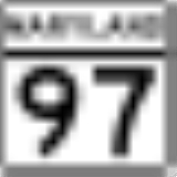
north to MD 97
in Silver Spring
. MD 390 is a continuation of 16th Street
into Maryland and serves as a major commuter route.
at the boundary between the District of Columbia and Silver Spring, Maryland. 16th Street Northwest heads south toward the White House
, Eastern Avenue
heads southeast along the border, North Portal Drive heads southwest toward Rock Creek Park
, and MD 384
(Colesville Road) heads northeast toward downtown Silver Spring, where Colesville Road continues as part of U.S. Route 29
(US 29). MD 390 heads north from Blair Portal as a six-lane divided highway between several apartment complexes. After intersecting MD 410
(East–West Highway) and Spring Street, which heads northeast into downtown Silver Spring, the state highway curves to the northwest and passing a shopping center on the northbound side. MD 390 curves north again and crosses over CSX
's Metropolitan Subdivision and MARC
's Brunswick Line
. North of the railroad tracks, the state highway passes through a residential area, cutting across the street grid at an angle, including an oblique intersection with Second Street. After passing Grace Church Road, the two directions of MD 390 split to terminate at separate intersections with MD 97 (Georgia Avenue) in the Montgomery Hills neighborhood of Silver Spring. There is no access between northbound MD 97 and southbound MD 390.
in Montgomery County
.
State highway
State highway, state road or state route can refer to one of three related concepts, two of them related to a state or provincial government in a country that is divided into states or provinces :#A...
in the U.S. state
U.S. state
A U.S. state is any one of the 50 federated states of the United States of America that share sovereignty with the federal government. Because of this shared sovereignty, an American is a citizen both of the federal entity and of his or her state of domicile. Four states use the official title of...
of Maryland
Maryland
Maryland is a U.S. state located in the Mid Atlantic region of the United States, bordering Virginia, West Virginia, and the District of Columbia to its south and west; Pennsylvania to its north; and Delaware to its east...
. The state highway runs 1.09 mi (1.8 km) from the boundary with Washington, D.C.
Washington, D.C.
Washington, D.C., formally the District of Columbia and commonly referred to as Washington, "the District", or simply D.C., is the capital of the United States. On July 16, 1790, the United States Congress approved the creation of a permanent national capital as permitted by the U.S. Constitution....
north to MD 97
Maryland Route 97
Maryland Route 97 is a state highway in the U.S. state of Maryland. The route runs from U.S. Route 29 in Silver Spring, Montgomery County north to the Pennsylvania border in Carroll County, where the road continues into that state as Pennsylvania Route 97...
in Silver Spring
Silver Spring, Maryland
Silver Spring is an unincorporated area and census-designated place in Montgomery County, Maryland, United States. It had a population of 71,452 at the 2010 census, making it the fourth most populous place in Maryland, after Baltimore, Columbia, and Germantown.The urbanized, oldest, and...
. MD 390 is a continuation of 16th Street
16th Street Northwest (Washington, D.C.)
16th Street Northwest is a prominent north-south thoroughfare in the northwest quadrant of Washington, D.C.Part of Pierre L'Enfant's design for the city, 16th Street begins just north of the White House across Lafayette Park at H Street and continues due north in a straight line passing K Street,...
into Maryland and serves as a major commuter route.
Route description
MD 390 begins at Blair Portal, a traffic circleTraffic circle
A traffic circle or rotary is a type of circular intersection in which traffic must travel in one direction around a central island. In some countries, traffic entering the circle has the right-of-way and drivers in the circle must yield. In many other countries, traffic entering the circle must...
at the boundary between the District of Columbia and Silver Spring, Maryland. 16th Street Northwest heads south toward the White House
White House
The White House is the official residence and principal workplace of the president of the United States. Located at 1600 Pennsylvania Avenue NW in Washington, D.C., the house was designed by Irish-born James Hoban, and built between 1792 and 1800 of white-painted Aquia sandstone in the Neoclassical...
, Eastern Avenue
Eastern Avenue (Washington, D.C.)
Eastern Avenue is one of three boundary streets between Washington, D.C., and the state of Maryland. It follows a northwest-to-southeast line, beginning at the intersection of 16th Street NW and Colesville Road...
heads southeast along the border, North Portal Drive heads southwest toward Rock Creek Park
Rock Creek Park
Rock Creek Park is a large urban natural area with public park facilities that bisects Washington, D.C. The park is administered by the National Park Service.-Rock Creek Park:The main section of the park contains , or , along the Rock Creek Valley...
, and MD 384
Maryland Route 384
Maryland Route 384 is a state highway in the U.S. state of Maryland. The state highway runs from MD 390 east to U.S. Route 29 and MD 97 within Silver Spring...
(Colesville Road) heads northeast toward downtown Silver Spring, where Colesville Road continues as part of U.S. Route 29
U.S. Route 29 in Maryland
U.S. Route 29 is a north–south United States highway that runs for from the western suburbs of Baltimore, Maryland, to Pensacola, Florida. In the U.S. state of Maryland, US 29 is a major highway that emerges from Washington D.C. and runs north into eastern Montgomery County, stretching...
(US 29). MD 390 heads north from Blair Portal as a six-lane divided highway between several apartment complexes. After intersecting MD 410
Maryland Route 410
Maryland Route 410 is a state highway in the U.S. state of Maryland. Known for most of its length as East–West Highway, the highway runs from MD 355 in Bethesda east to Pennsy Drive in Landover Hills...
(East–West Highway) and Spring Street, which heads northeast into downtown Silver Spring, the state highway curves to the northwest and passing a shopping center on the northbound side. MD 390 curves north again and crosses over CSX
CSX Transportation
CSX Transportation operates a Class I railroad in the United States known as the CSX Railroad. It is the main subsidiary of the CSX Corporation. The company is headquartered in Jacksonville, Florida, and owns approximately 21,000 route miles...
's Metropolitan Subdivision and MARC
MARC Train
MARC , known prior to 1984 as Maryland Rail Commuter Service, is a regional rail system comprising three lines in the Baltimore-Washington Metropolitan Area. MARC is administered by the Maryland Transit Administration , a Maryland Department of Transportation agency, and is operated under contract...
's Brunswick Line
Brunswick Line
The Brunswick Line is a MARC commuter rail line consisting of a main line running from Washington D.C. to Martinsburg, West Virginia and a branch line from just south of Point-of-Rocks station to Frederick, Maryland. The service is operated under contract by CSX Transportation, but is administered...
. North of the railroad tracks, the state highway passes through a residential area, cutting across the street grid at an angle, including an oblique intersection with Second Street. After passing Grace Church Road, the two directions of MD 390 split to terminate at separate intersections with MD 97 (Georgia Avenue) in the Montgomery Hills neighborhood of Silver Spring. There is no access between northbound MD 97 and southbound MD 390.
Junction list
The entire route is in Silver SpringSilver Spring, Maryland
Silver Spring is an unincorporated area and census-designated place in Montgomery County, Maryland, United States. It had a population of 71,452 at the 2010 census, making it the fourth most populous place in Maryland, after Baltimore, Columbia, and Germantown.The urbanized, oldest, and...
in Montgomery County
Montgomery County, Maryland
Montgomery County is a county in the U.S. state of Maryland, situated just to the north of Washington, D.C., and southwest of the city of Baltimore. It is one of the most affluent counties in the United States, and has the highest percentage of residents over 25 years of age who hold post-graduate...
.
| Mile |
Destinations | Notes |
|---|---|---|
| 0.00 | 16th Street 16th Street Northwest (Washington, D.C.) 16th Street Northwest is a prominent north-south thoroughfare in the northwest quadrant of Washington, D.C.Part of Pierre L'Enfant's design for the city, 16th Street begins just north of the White House across Lafayette Park at H Street and continues due north in a straight line passing K Street,... south / Eastern Avenue Eastern Avenue (Washington, D.C.) Eastern Avenue is one of three boundary streets between Washington, D.C., and the state of Maryland. It follows a northwest-to-southeast line, beginning at the intersection of 16th Street NW and Colesville Road... south / North Portal Drive west – Washington Washington, D.C. Washington, D.C., formally the District of Columbia and commonly referred to as Washington, "the District", or simply D.C., is the capital of the United States. On July 16, 1790, the United States Congress approved the creation of a permanent national capital as permitted by the U.S. Constitution.... |
Blair Portal; southern terminus; District of Columbia boundary |
| 0.02 | ||
| 0.16 | ||
| 0.85 | Second Avenue | Former MD 515 |
| 1.09 | Northern terminus |