
Maryland Route 193
Encyclopedia
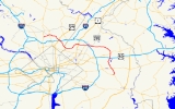
Maryland Route 193 is a state highway
in the U.S. state
of Maryland
. Known for most of its length as University Boulevard and Greenbelt Road, the state highway runs 26.07 mi (42 km) from MD 185
in Kensington
east to MD 202
in Greater Upper Marlboro
. MD 193 serves as a major east-west commuter route in eastern Montgomery County
and northern Prince George's County
, connecting Wheaton
, Silver Spring
, Langley Park
, College Park
, and Greenbelt
. The state highway also provides the primary access to the University of Maryland
and Goddard Space Flight Center
. In central Prince George's County, MD 193 is the main north-south highway connecting Glenn Dale
and Greater Upper Marlboro
with the affluent suburbs of Woodmore
and Kettering
.
MD 193 originally consisted of Connecticut Avenue between Chevy Chase
and Kensington and University Lane between Kensington and College Park. While MD 185 replaced MD 193 on the Connecticut Avenue portion in the 1970s, MD 193 grew on its eastern end by taking over the routing of MD 430 between College Park and Greenbelt and MD 199 in Glenn Dale in the early 1960s. MD 193 reached its final extent by taking over MD 556 between Glenn Dale and Greater Upper Marlboro in the late 1980s. The state highway's expansion from a two-lane road to a divided highway with four to six lanes began in the 1950s and continued through the 1990s.
shopping mall and intersects MD 586
(Veirs Mill Road). MD 586 south is used to access the Wheaton
station of the Washington Metro
. MD 193 continues east through the commercial area to meet MD 97
(Georgia Avenue
). There are no left turns allowed from MD 193 to MD 97; instead, the eastbound and westbound directions use Grandview Avenue and Amherst Avenue, respectively, to complete the missing movements.
After passing the WTOP-FM
radio transmitter
, MD 193 heads southeast through suburban residential areas. The state highway descends into the valley of Sligo Creek
, where the highway meets the northern end of Sligo Creek Parkway
and crosses the Sligo Creek Trail
. MD 193 passes a cluster of high-rise apartment buildings and Northwood High School
around the intersection with Arcola Avenue and turns south, passing Dennis Avenue. MD 193 splits into a one-way pair
upon entering the Four Corners commercial area, where the highway intersects U.S. Route 29
(US 29) and passes Montgomery Blair High School
. The state highway then meets the Capital Beltway
at a partial cloverleaf interchange that is missing the movements between I-495 west and MD 193 west. The missing movements are completed by using US 29 south of Four Corners. After crossing the Capital Beltway, MD 193 continues south through residential suburban areas of Silver Spring, intersecting Franklin Avenue. After meeting MD 320
and passing Quebec Terrace Park, the state highway turns southeast and enters an area of garden apartments and duplexes. After crossing MD 195
at an oblique angle, the speed limit falls to 35 mph (56.3 km/h) and MD 193 enters Prince George's County.
at Takoma-Langley Crossroads, an intersection with a shopping center on all four corners. The state highway continues straight southeast toward its junction with MD 212
, where MD 193 turns east. After passing Lane Manor Recreation Center, the state highway leaves the commercial area and crosses Northwest Branch
. Here the highway reduces to four lanes and the speed limit increases to 45 mph (72.4 km/h). MD 193 continues east through a forested area toward College Park. Campus Drive continues straight toward the University of Maryland campus as well as University of Maryland University College
, while MD 193 veers left and intersects Adelphi Road. Movements between MD 193 east and Adelphi Road south are made via Campus Drive. After passing Adelphi Road, the state highway heads northeast past the intersection with Stadium Drive, which is used to access Byrd Stadium and the Clarice Smith Performing Arts Center
. After turning east again, MD 193 intersects Paint Branch Drive, which serves the Comcast Center
. The state highway passes Paint Branch Golf Course and crosses Paint Branch
, after which the speed limit drops to 40 mph (64.4 km/h) and the highway intersects US 1
at a partial interchange. The missing movements are made via a right-in/right-out
interchange on the eastbound side just to the east of the partial interchange, and through Greenbelt Road (unsigned MD 430) just to the east of Rhode Island Avenue, which has a westbound at-grade exit and eastbound entrance.
After passing Greenbelt Road, MD 193 expands to six lanes and its name changes to Greenbelt Road. The state highway crosses CSX
's Capital Subdivision, MARC
's Camden Line
, and the Green Line (Washington Metro)
of the Washington Metro and Indian Creek, then enters a commercial area as the highway straddles the northern boundary of Berwyn Heights
. After passing Cherrywood Drive, which leads to the Greenbelt (Washington Metro)
Metro station, MD 193 passes Beltway Plaza
shopping mall. The state highway then meets MD 201
(Kenilworth Avenue) at a diamond interchange
. MD 193 continues east into Greenbelt as an eight-lane divided highway with a speed limit of 45 mph (72.4 km/h) past Greenbelt Park
until right before passing under the Capital Beltway, where the right lane eastbound exits for the southbound Baltimore-Washington Parkway
. Both directions of MD 193 access the southbound parkway via Southway, which heads north into the Greenbelt Historic District. After crossing the parkway, MD 193 has an intersection with the northbound ramps to the parkway, after which the speed limit drops to 35 mph (56.3 km/h). After passing Eleanor Roosevelt High School
, the speed limit returns to 45 mph (72.4 km/h), the road reduces to four lanes, and the state highway passes a series of apartment complexes on the south and the campus of Goddard Space Flight Center
on the north. Beyond Goddard, MD 193 passes Good Luck Road and some more apartments and shopping centers in Glenn Dale before meeting MD 564
(Lanham Severn Road).
MD 193 heads southeast from MD 564 as Glenn Dale Boulevard, a four-lane divided highway with a wide median through scattered residential subdivisions. The state highway immediately crosses the Amtrak Northeast Corridor and MARC's Penn Line
as well as Folly Branch. MD 193 passes Marietta, a historic home and museum, before its intersection with MD 450
(Annapolis Road), where the name of the highway changes to Enterprise Road. Beyond MD 450, the state highway slims down to two lanes and passes through residential subdivisions. After an intersection with the old alignment, MD 953
(Glenn Dale Road), MD 193 temporarily becomes a divided highway as it passes under the US 50 freeway. The state highway enters the affluent suburb of Woodmore, where it passes the Country Club at Woodmore
and Enterprise Golf Course, which features the Newton White Mansion
, before intersecting Lottsford Road and Woodmore Road. MD 193 continues south and temporarily expands to a four-lane divided highway with a speed limit of 30 mph (48.3 km/h) prior to crossing the Northeast Branch of the Western Branch of the Patuxent River
and meeting MD 214
(Central Avenue) in Kettering. Beyond MD 214, the state highway becomes a two-lane road with a speed limit of 35 mph (56.3 km/h) and changes its name to Watkins Park Drive. MD 193 passes Watkins Regional Park and First Baptist Church of Glenarden before encountering Oak Grove Drive at a roundabout
. From there, the state highway turns southwest and meets its eastern terminus at MD 202 (Largo Road) in Greater Upper Marlboro.
article. University Lane was paved from Kensington to Wheaton and from Four Corners to MD 320 in Silver Spring by 1927. The pavement extended from MD 320 to MD 212 in 1930; the segment of road on the University of Maryland campus was also paved. By 1933, MD 193 was fully paved from Kensington to US 1 in College Park when the portion between MD 212 and the university was completed on a new alignment.
The roads over which MD 193 would later be extended east consisted of three state highways:
The four-lane divided bypass of the University of Maryland was started by 1955 and completed in 1956. At that time, MD 193 turned south at the right-in/right-out ramps just east of the US 1 overpass to a right angle intersection with MD 430. The four-lane divided highway was extended west from College Park in stages, reaching MD 650 in 1957, Franklin Avenue (then MD 516) in 1959, US 29 in Four Corners in 1960, and Kensington in the early 1960s. MD 193's western terminus was moved from Chevy Chase to Kensington in the 1970s. MD 193 was expanded to six lanes between Kensington and Langley Park beginning in 1972.
Between 1962 and 1964, MD 193 was extended east as a four-lane divided highway from College Park along MD 430 and the remainder of Greenbelt Road to Glenn Dale. The state highway then headed south along Glenn Dale Road (former MD 199) to MD 450, then south along the part of Glenn Dale Road that had never been state-maintained to an intersection with MD 556 just north of the US 50 freeway. MD 193 was expanded to six lanes between MD 430 and just east of MD 201 in 1988, when the MD 201 interchange was completed. The six lane section was extended to the east edge of Greenbelt in 1994.
Glenn Dale Boulevard, a four-lane divided highway, was finished in 1986 when its bridge over the Penn Line was completed, replacing a grade crossing at Glenn Dale Road. Glenn Dale Boulevard extended south to the intersection of MD 450 and MD 556. MD 193 was extended south on Glenn Dale Boulevard then replaced MD 556 on Enterprise Road south to MD 214. Finally, Watkins Park Drive was built in 1988 on a new alignment, replacing Enterprise Road south of MD 214. MD 193 was extended along Watkins Park Drive and replaced the remaining segment of MD 556.
State highway
State highway, state road or state route can refer to one of three related concepts, two of them related to a state or provincial government in a country that is divided into states or provinces :#A...
in the U.S. state
U.S. state
A U.S. state is any one of the 50 federated states of the United States of America that share sovereignty with the federal government. Because of this shared sovereignty, an American is a citizen both of the federal entity and of his or her state of domicile. Four states use the official title of...
of Maryland
Maryland
Maryland is a U.S. state located in the Mid Atlantic region of the United States, bordering Virginia, West Virginia, and the District of Columbia to its south and west; Pennsylvania to its north; and Delaware to its east...
. Known for most of its length as University Boulevard and Greenbelt Road, the state highway runs 26.07 mi (42 km) from MD 185
Maryland Route 185
Maryland Route 185 is a state highway in the U.S. state of Maryland. Known as Connecticut Avenue, the state highway runs from Chevy Chase Circle at the Washington, D.C. border north to MD 97 in Aspen Hill...
in Kensington
Kensington, Maryland
Kensington is a town in Montgomery County, Maryland, United States. The population was 1,873 at the 2000 census. Greater Kensington encompasses the entire 20895 zip code and its population is an order of magnitude larger than that of the town at its center....
east to MD 202
Maryland Route 202
Maryland Route 202 is a north–south state highway in Prince George's County within the U.S. state of Maryland. MD 202 travels through many communities in central Prince George's County, and is known as Maryland Route 202 (MD 202) is a north–south state highway in Prince George's...
in Greater Upper Marlboro
Greater Upper Marlboro, Maryland
Greater Upper Marlboro is a census-designated place in Prince George's County, Maryland, United States that completely surrounds Upper Marlboro, the county seat...
. MD 193 serves as a major east-west commuter route in eastern Montgomery County
Montgomery County, Maryland
Montgomery County is a county in the U.S. state of Maryland, situated just to the north of Washington, D.C., and southwest of the city of Baltimore. It is one of the most affluent counties in the United States, and has the highest percentage of residents over 25 years of age who hold post-graduate...
and northern Prince George's County
Prince George's County, Maryland
Prince George's County is a county located in the U.S. state of Maryland, immediately north, east, and south of Washington, DC. As of 2010, it has a population of 863,420 and is the wealthiest African-American majority county in the nation....
, connecting Wheaton
Wheaton, Maryland
Wheaton is an unincorporated, urbanized area in Montgomery County, Maryland, USA, north of Washington, D.C., northwest of Silver Spring. Wheaton takes its name from Frank Wheaton , a career officer in the United States Army and volunteer from Rhode Island in the Union Army who rose to the rank of...
, Silver Spring
Silver Spring, Maryland
Silver Spring is an unincorporated area and census-designated place in Montgomery County, Maryland, United States. It had a population of 71,452 at the 2010 census, making it the fourth most populous place in Maryland, after Baltimore, Columbia, and Germantown.The urbanized, oldest, and...
, Langley Park
Langley Park, Maryland
Langley Park is an unincorporated area and census-designated place in the Washington, D.C. metro area. It is located inside the Capital Beltway, on the northwest edge of Prince George's County, Maryland, bordering Montgomery County, Maryland....
, College Park
College Park, Maryland
College Park is a city in Prince George's County, Maryland, USA. The population was 30,413 at the 2010 census. It is best known as the home of the University of Maryland, College Park, and since 1994 the city has also been home to the "Archives II" facility of the U.S...
, and Greenbelt
Greenbelt, Maryland
Greenbelt is a city in Prince George's County, Maryland, United States. Contained within today's City of Greenbelt is the historic planned community now known locally as "Old Greenbelt" and designated as the Greenbelt Historic District...
. The state highway also provides the primary access to the University of Maryland
University of Maryland, College Park
The University of Maryland, College Park is a top-ranked public research university located in the city of College Park in Prince George's County, Maryland, just outside Washington, D.C...
and Goddard Space Flight Center
Goddard Space Flight Center
The Goddard Space Flight Center is a major NASA space research laboratory established on May 1, 1959 as NASA's first space flight center. GSFC employs approximately 10,000 civil servants and contractors, and is located approximately northeast of Washington, D.C. in Greenbelt, Maryland, USA. GSFC,...
. In central Prince George's County, MD 193 is the main north-south highway connecting Glenn Dale
Glenn Dale, Maryland
Glenn Dale is an unincorporated area and census-designated place in Prince George's County, Maryland, United States. The population was 12,609 at the 2000 census...
and Greater Upper Marlboro
Greater Upper Marlboro, Maryland
Greater Upper Marlboro is a census-designated place in Prince George's County, Maryland, United States that completely surrounds Upper Marlboro, the county seat...
with the affluent suburbs of Woodmore
Woodmore, Maryland
Woodmore is an unincorporated area and Census-designated place composed of a gated community and country club in Mitchellville, Maryland, one of the most affluent predominantly African-American communities in the United States...
and Kettering
Kettering, Maryland
Kettering is an unincorporated area and census-designated place in Prince George's County, Maryland, United States. The population was 11,008 at the 2000 census, primarily African-American. The name Kettering was created by a suburban housing developer in the 1960s when development began...
.
MD 193 originally consisted of Connecticut Avenue between Chevy Chase
Chevy Chase, Maryland
Chevy Chase is the name of both a town and an unincorporated census-designated place in Montgomery County, Maryland. In addition, a number of villages in the same area of Montgomery County include "Chevy Chase" in their names...
and Kensington and University Lane between Kensington and College Park. While MD 185 replaced MD 193 on the Connecticut Avenue portion in the 1970s, MD 193 grew on its eastern end by taking over the routing of MD 430 between College Park and Greenbelt and MD 199 in Glenn Dale in the early 1960s. MD 193 reached its final extent by taking over MD 556 between Glenn Dale and Greater Upper Marlboro in the late 1980s. The state highway's expansion from a two-lane road to a divided highway with four to six lanes began in the 1950s and continued through the 1990s.
Montgomery County
MD 193 begins at an acute intersection with MD 185 (Connecticut Avenue) in Kensington. There is no access between southbound MD 185 and eastbound MD 193, as well as between westbound MD 193 and northbound MD 185; those movements use Perry Avenue. The state highway, named University Boulevard, heads northeast as a six-lane divided highway with a speed limit of 30 mph (48.3 km/h) through a commercial area. After leaving the town limits of Kensington, the speed limit increases to 40 mph (64.4 km/h) and MD 193 passes through a mix of apartment complexes and single family homes. The state highway enters the commercial district of Wheaton, where the road passes the Wheaton PlazaWestfield Wheaton
Westfield Wheaton is a two-level enclosed shopping mall in Wheaton, Maryland. It is owned by The Westfield Group.-History:...
shopping mall and intersects MD 586
Maryland Route 586
Maryland Route 586 is a state highway in the U.S. state of Maryland. Known as Veirs Mill Road, the state highway runs from MD 28 in Rockville east to MD 97 in Wheaton.-Route description:...
(Veirs Mill Road). MD 586 south is used to access the Wheaton
Wheaton (Washington Metro)
Wheaton is a Washington Metro station in Montgomery County, Maryland on the Red Line.The station serves the suburb of Wheaton, and is located at the intersection of Georgia Avenue and Reedie Drive. This station features the longest set of single-span escalators in the Western Hemisphere, each...
station of the Washington Metro
Washington Metro
The Washington Metro, commonly called Metro, and unofficially Metrorail, is the rapid transit system in Washington, D.C., United States, and its surrounding suburbs. It is administered by the Washington Metropolitan Area Transit Authority , which also operates Metrobus service under the Metro name...
. MD 193 continues east through the commercial area to meet MD 97
Maryland Route 97
Maryland Route 97 is a state highway in the U.S. state of Maryland. The route runs from U.S. Route 29 in Silver Spring, Montgomery County north to the Pennsylvania border in Carroll County, where the road continues into that state as Pennsylvania Route 97...
(Georgia Avenue
Georgia Avenue
Georgia Avenue is a major north-south artery in Northwest Washington, D.C. and Montgomery County, Maryland. Within the District of Columbia and a short distance in Silver Spring, Maryland, Georgia Avenue is also U.S. Route 29...
). There are no left turns allowed from MD 193 to MD 97; instead, the eastbound and westbound directions use Grandview Avenue and Amherst Avenue, respectively, to complete the missing movements.
After passing the WTOP-FM
WTOP-FM
WTOP is an all-news formatted broadcast radio station licensed to Washington, D.C., serving Metropolitan Washington, DC area. WTOP is owned by Hubbard Broadcasting.WTOP is one of two all-news stations in the Washington, D.C...
radio transmitter
Transmitter
In electronics and telecommunications a transmitter or radio transmitter is an electronic device which, with the aid of an antenna, produces radio waves. The transmitter itself generates a radio frequency alternating current, which is applied to the antenna. When excited by this alternating...
, MD 193 heads southeast through suburban residential areas. The state highway descends into the valley of Sligo Creek
Sligo Creek
Sligo Creek is a free-flowing tributary of the Northwest Branch of the Anacostia River in Maryland. The creek is approximately long, with a drainage area of about .- Geography :The creek rises in the Kemp Mill section of Silver Spring in Montgomery County and...
, where the highway meets the northern end of Sligo Creek Parkway
Sligo Creek Parkway
Sligo Creek Parkway is two-lane at-grade automobile parkway in Montgomery County in the U.S. state of Maryland. The two-lane parkway runs from Maryland Route 650 in Takoma Park through Silver Spring north to MD 193 in Maryland...
and crosses the Sligo Creek Trail
Sligo Creek Trail
Sligo Creek Trail is a paved hiker-biker trail running along Sligo Creek in the suburbs of Washington, D.C. Most of the trail passes through tree-filled parkland. The trail and surrounding park is a popular place for locals to jog, walk, bicycle, roller-skate, and take their children to the...
. MD 193 passes a cluster of high-rise apartment buildings and Northwood High School
Northwood High School (Silver Spring, Maryland)
Northwood High School is located in Silver Spring, Maryland, and is part of Montgomery County Public Schools. Northwood originally opened in 1956. In 1985 it was closed in a contested decision by the Montgomery County School Board in an effort to alleviate the concentration of minorities enrolling...
around the intersection with Arcola Avenue and turns south, passing Dennis Avenue. MD 193 splits into a one-way pair
One-way pair
A one-way pair, one-way couple, or just couplet is a pair of parallel, usually one-way streets that carry opposite directions of a signed route or major traffic flow, or sometimes opposite directions of a bus or streetcar route....
upon entering the Four Corners commercial area, where the highway intersects U.S. Route 29
U.S. Route 29 in Maryland
U.S. Route 29 is a north–south United States highway that runs for from the western suburbs of Baltimore, Maryland, to Pensacola, Florida. In the U.S. state of Maryland, US 29 is a major highway that emerges from Washington D.C. and runs north into eastern Montgomery County, stretching...
(US 29) and passes Montgomery Blair High School
Montgomery Blair High School
Montgomery Blair High School is a public high school located in unincorporated Silver Spring in Montgomery County, Maryland, United States...
. The state highway then meets the Capital Beltway
Interstate 495 (Capital Beltway)
Interstate 495 is a Interstate Highway that surrounds the United States' capital of Washington, D.C., and its inner suburbs in adjacent Maryland and Virginia. I-495 is widely known as the Capital Beltway or simply the Beltway, especially when the context of Washington, D.C., is clear...
at a partial cloverleaf interchange that is missing the movements between I-495 west and MD 193 west. The missing movements are completed by using US 29 south of Four Corners. After crossing the Capital Beltway, MD 193 continues south through residential suburban areas of Silver Spring, intersecting Franklin Avenue. After meeting MD 320
Maryland Route 320
Maryland Route 320 is a state highway in the U.S. state of Maryland. Known as Piney Branch Road, the route runs from Eastern Avenue at the Washington, D.C. border north to Maryland Route 650 in Adelphi.-Route description:...
and passing Quebec Terrace Park, the state highway turns southeast and enters an area of garden apartments and duplexes. After crossing MD 195
Maryland Route 195
Maryland Route 195 is a state highway in the U.S. state of Maryland. Known as Carroll Avenue, the state highway runs from Eastern Avenue at the border of Washington, D.C. north to Maryland Route 193 in Takoma Park...
at an oblique angle, the speed limit falls to 35 mph (56.3 km/h) and MD 193 enters Prince George's County.
Prince George's County
MD 193 continues east into Langley Park, an area with multiple shopping centers, garden apartments, and heavy pedestrian cross-traffic. MD 193 meets MD 650Maryland Route 650
Maryland Route 650 is a state highway in the U.S. state of Maryland. Known as New Hampshire Avenue for most of its length, the state highway runs from Eastern Avenue at the Washington, D.C. border north to MD 108 in Etchison...
at Takoma-Langley Crossroads, an intersection with a shopping center on all four corners. The state highway continues straight southeast toward its junction with MD 212
Maryland Route 212
Maryland Route 212, also known as Riggs Road south of MD 193 and Powder Mill Road to its northern end, is a state highway which crosses northern Prince George's County.-Route description:...
, where MD 193 turns east. After passing Lane Manor Recreation Center, the state highway leaves the commercial area and crosses Northwest Branch
Northwest Branch Anacostia River
Northwest Branch Anacostia River is a free-flowing stream in Montgomery County and Prince George's County, Maryland. It is a tributary of the Anacostia River, which flows to the Potomac River and the Chesapeake Bay.-Course:...
. Here the highway reduces to four lanes and the speed limit increases to 45 mph (72.4 km/h). MD 193 continues east through a forested area toward College Park. Campus Drive continues straight toward the University of Maryland campus as well as University of Maryland University College
University of Maryland University College
The University of Maryland University College is located in the unincorporated community of Adelphi in Prince George's County, Maryland in the United States. Serving over 90,000 students worldwide, UMUC is the largest 4-year public university in Maryland and one of the largest distance learning...
, while MD 193 veers left and intersects Adelphi Road. Movements between MD 193 east and Adelphi Road south are made via Campus Drive. After passing Adelphi Road, the state highway heads northeast past the intersection with Stadium Drive, which is used to access Byrd Stadium and the Clarice Smith Performing Arts Center
Clarice Smith Performing Arts Center
The Clarice Smith Performing Arts Center is a performing arts complex on the campus of the University of Maryland, College Park. The facility houses six performance venues; the UM School of Music; and the UM School of Theatre, Dance, and Performance Studies. It also houses the Michelle Smith...
. After turning east again, MD 193 intersects Paint Branch Drive, which serves the Comcast Center
Comcast Center (arena)
Comcast Center is the arena for the University of Maryland Terrapins men’s and women's basketball teams. The Comcast Center, dubbed "The House Gary Built", was ranked the 7th toughest venue to play in by EA Sports. The on-campus facility is named for the Comcast Corporation, which purchased a...
. The state highway passes Paint Branch Golf Course and crosses Paint Branch
Paint Branch
Paint Branch is a stream that flows through Montgomery County and Prince George's County, Maryland. It is a tributary of the Northeast Branch, which flows to the Anacostia River, Potomac River and the Chesapeake Bay....
, after which the speed limit drops to 40 mph (64.4 km/h) and the highway intersects US 1
U.S. Route 1 in Maryland
U.S. Route 1 is the easternmost and longest of the major north–south routes of the United States Numbered Highway System, running from Key West, Florida to Fort Kent, Maine. In the U.S...
at a partial interchange. The missing movements are made via a right-in/right-out
Right-in/right-out
Right-in/right-out and left-in/left-out refer to a type of road intersection where turning movements of vehicles are restricted. A RIRO permits only right turns and a LILO permits only left turns. RIRO is usual where vehicles drive on the right, and LILO is usual where vehicles drive on the left...
interchange on the eastbound side just to the east of the partial interchange, and through Greenbelt Road (unsigned MD 430) just to the east of Rhode Island Avenue, which has a westbound at-grade exit and eastbound entrance.
After passing Greenbelt Road, MD 193 expands to six lanes and its name changes to Greenbelt Road. The state highway crosses CSX
CSX Transportation
CSX Transportation operates a Class I railroad in the United States known as the CSX Railroad. It is the main subsidiary of the CSX Corporation. The company is headquartered in Jacksonville, Florida, and owns approximately 21,000 route miles...
's Capital Subdivision, MARC
MARC Train
MARC , known prior to 1984 as Maryland Rail Commuter Service, is a regional rail system comprising three lines in the Baltimore-Washington Metropolitan Area. MARC is administered by the Maryland Transit Administration , a Maryland Department of Transportation agency, and is operated under contract...
's Camden Line
Camden Line
The Camden Line is a MARC commuter rail line that runs between Union Station, Washington, D.C. and Camden Station, Baltimore, Maryland over the CSX Capital Subdivision. Service began along this route in 1835 as part of the Baltimore and Ohio Railroad , making it the oldest passenger rail line in...
, and the Green Line (Washington Metro)
Green Line (Washington Metro)
The Green Line is one of five heavy rail subway lines that constitute the Washington Metro rapid transit system in the Washington, D.C., metropolitan area. The Green Line consists of 21 stations, with termini at Branch Avenue and at Greenbelt. The Green Line runs through Prince George's County,...
of the Washington Metro and Indian Creek, then enters a commercial area as the highway straddles the northern boundary of Berwyn Heights
Berwyn Heights, Maryland
Berwyn Heights is a town in Prince George's County, Maryland, United States. The population was 2,942 at the 2000 census. It is bordered by College Park to the west, Greenbelt to the northeast, East Riverdale to the southwest, and Riverdale Park to the south....
. After passing Cherrywood Drive, which leads to the Greenbelt (Washington Metro)
Greenbelt (Washington Metro)
Greenbelt is a Washington Metro and MARC station in Prince George's County, Maryland on the Green Line. It is the northeastern end of the Green Line....
Metro station, MD 193 passes Beltway Plaza
Beltway Plaza
The Beltway Plaza mall is located in Greenbelt, Maryland. It was developed by the late Sidney J. Brown and First National Realty. It was originally composed of a massive S. Klein department store separated by a large parking lot from an A&P Supermarket located in a strip shopping center along with...
shopping mall. The state highway then meets MD 201
Maryland Route 201
-Route description:MD 201 begins at a large hybrid cloverleaf just outside the D.C. boundary at Tuxedo, Maryland that is maintained by the Maryland State Highway Administration...
(Kenilworth Avenue) at a diamond interchange
Diamond interchange
A diamond interchange is a common type of road junction, used where a freeway crosses a minor road. The freeway itself is grade-separated from the minor road, one crossing the other over a bridge...
. MD 193 continues east into Greenbelt as an eight-lane divided highway with a speed limit of 45 mph (72.4 km/h) past Greenbelt Park
Greenbelt Park
Greenbelt Park, located in Greenbelt, Maryland, is managed by the United States National Park Service. The forested park lies approximately 10 miles northeast of Washington, D.C., and is situated just within the Capital Beltway . The park land was originally intended to form part of the green...
until right before passing under the Capital Beltway, where the right lane eastbound exits for the southbound Baltimore-Washington Parkway
Baltimore-Washington Parkway
The Baltimore–Washington Parkway is a highway in the U.S. state of Maryland, running southwest from Baltimore to Washington, D.C. The road begins at an interchange with U.S. Route 50 and Maryland Route 201 near Cheverly in Prince George's County at the D.C...
. Both directions of MD 193 access the southbound parkway via Southway, which heads north into the Greenbelt Historic District. After crossing the parkway, MD 193 has an intersection with the northbound ramps to the parkway, after which the speed limit drops to 35 mph (56.3 km/h). After passing Eleanor Roosevelt High School
Eleanor Roosevelt High School (Greenbelt, Maryland)
Eleanor Roosevelt High School , is a Maryland public magnet high school specializing in science, mathematics, technology, and engineering. The school was established in 1978 at its current location in Greenbelt, Maryland and is part of the Prince George's County Public Schools system...
, the speed limit returns to 45 mph (72.4 km/h), the road reduces to four lanes, and the state highway passes a series of apartment complexes on the south and the campus of Goddard Space Flight Center
Goddard Space Flight Center
The Goddard Space Flight Center is a major NASA space research laboratory established on May 1, 1959 as NASA's first space flight center. GSFC employs approximately 10,000 civil servants and contractors, and is located approximately northeast of Washington, D.C. in Greenbelt, Maryland, USA. GSFC,...
on the north. Beyond Goddard, MD 193 passes Good Luck Road and some more apartments and shopping centers in Glenn Dale before meeting MD 564
Maryland Route 564
Maryland Route 564 is a state highway in the U.S. state of Maryland. Known for most of its length as Lanham Severn Road, the state highway runs from MD 450 in Lanham east to a dead end near a connection to MD 197 in Bowie.-Route description:...
(Lanham Severn Road).
MD 193 heads southeast from MD 564 as Glenn Dale Boulevard, a four-lane divided highway with a wide median through scattered residential subdivisions. The state highway immediately crosses the Amtrak Northeast Corridor and MARC's Penn Line
Penn Line (MARC)
The Penn Line is a MARC commuter rail line running from Union Station, Washington D.C. to Perryville, Maryland via Penn Station, Baltimore, Maryland on Amtrak's Northeast Corridor. It is MARC's busiest and only electric line. Currently the line is the fastest commuter rail line in the country, with...
as well as Folly Branch. MD 193 passes Marietta, a historic home and museum, before its intersection with MD 450
Maryland Route 450
Maryland Route 450 is a state highway in the U.S. state of Maryland. The state highway runs from U.S. Route 1 Alternate in Bladensburg east to US 50, US 301, and MD 2 near Annapolis. MD 450 is the original alignment of US 50 in Prince George's and Anne Arundel Counties...
(Annapolis Road), where the name of the highway changes to Enterprise Road. Beyond MD 450, the state highway slims down to two lanes and passes through residential subdivisions. After an intersection with the old alignment, MD 953
Maryland Route 953
Maryland Route 953 is a state highway in the U.S. state of Maryland. The state highway runs from MD 193 north to a dead end at the Amtrak Northeast Corridor in Glenn Dale. MD 953 is the old alignment of MD 193.-Route description:...
(Glenn Dale Road), MD 193 temporarily becomes a divided highway as it passes under the US 50 freeway. The state highway enters the affluent suburb of Woodmore, where it passes the Country Club at Woodmore
Country Club at Woodmore
The Country Club at Woodmore is a private country club, golf course, and gated community in Mitchellville, an unincorporated and affluent predominantly African-American community in Prince George's County, Maryland, United States...
and Enterprise Golf Course, which features the Newton White Mansion
Newton White Mansion
This Neo-Georgian home was built in 1939 by architect W.E. Bottomly for Captain Newton H. White of the United States Navy. Captain White had a long and distinguished career, serving on the USS Yorktown, the USS Lexington, and, prior to World War II, as the first commanding officer of the USS...
, before intersecting Lottsford Road and Woodmore Road. MD 193 continues south and temporarily expands to a four-lane divided highway with a speed limit of 30 mph (48.3 km/h) prior to crossing the Northeast Branch of the Western Branch of the Patuxent River
Patuxent River
The Patuxent River is a tributary of the Chesapeake Bay in the state of Maryland. There are three main river drainages for central Maryland: the Potomac River to the west passing through Washington D.C., the Patapsco River to the northeast passing through Baltimore, and the Patuxent River between...
and meeting MD 214
Maryland Route 214
Maryland Route 214 is an east–west state highway that runs through Prince George's County and Anne Arundel County within the U.S. state of Maryland. Central Avenue runs along the center of Prince George's County and divides it into north and south...
(Central Avenue) in Kettering. Beyond MD 214, the state highway becomes a two-lane road with a speed limit of 35 mph (56.3 km/h) and changes its name to Watkins Park Drive. MD 193 passes Watkins Regional Park and First Baptist Church of Glenarden before encountering Oak Grove Drive at a roundabout
Roundabout
A roundabout is the name for a road junction in which traffic moves in one direction around a central island. The word dates from the early 20th century. Roundabouts are common in many countries around the world...
. From there, the state highway turns southwest and meets its eastern terminus at MD 202 (Largo Road) in Greater Upper Marlboro.
History
MD 193 originally consisted of two named portions, Connecticut Avenue from Chevy Chase to Kensington and University Lane from Kensington to College Park. The Connecticut Avenue segment is now MD 185; that portion's history is covered in more detail in the Maryland Route 185Maryland Route 185
Maryland Route 185 is a state highway in the U.S. state of Maryland. Known as Connecticut Avenue, the state highway runs from Chevy Chase Circle at the Washington, D.C. border north to MD 97 in Aspen Hill...
article. University Lane was paved from Kensington to Wheaton and from Four Corners to MD 320 in Silver Spring by 1927. The pavement extended from MD 320 to MD 212 in 1930; the segment of road on the University of Maryland campus was also paved. By 1933, MD 193 was fully paved from Kensington to US 1 in College Park when the portion between MD 212 and the university was completed on a new alignment.
The roads over which MD 193 would later be extended east consisted of three state highways:
- MD 430 (Greenbelt Road) was completed on a new alignment in 1942 between US 1 in College Park and MD 205 (now MD 201) in Greenbelt. Greenbelt Road continued east as a county-maintained highway towards Glenn Dale.
- MD 199 (Glenn Dale Road) was paved from US 50 (now MD 450) north to the Penn Line in 1927. The MD 199 designation was extended north to MD 564 in 1950, then removed from the entire road in 1954.
- MD 556 (Enterprise Road) was paved from MD 214 north to near Woodmore Road in 1933. A second segment of MD 556 was signed from US 50 south to the present intersection of MD 193 and MD 953 by 1939. The two segments were connected by a county-maintained segment that was brought under state control by 1946. MD 556 was extended south along Enterprise Road to MD 202 in 1955.
The four-lane divided bypass of the University of Maryland was started by 1955 and completed in 1956. At that time, MD 193 turned south at the right-in/right-out ramps just east of the US 1 overpass to a right angle intersection with MD 430. The four-lane divided highway was extended west from College Park in stages, reaching MD 650 in 1957, Franklin Avenue (then MD 516) in 1959, US 29 in Four Corners in 1960, and Kensington in the early 1960s. MD 193's western terminus was moved from Chevy Chase to Kensington in the 1970s. MD 193 was expanded to six lanes between Kensington and Langley Park beginning in 1972.
Between 1962 and 1964, MD 193 was extended east as a four-lane divided highway from College Park along MD 430 and the remainder of Greenbelt Road to Glenn Dale. The state highway then headed south along Glenn Dale Road (former MD 199) to MD 450, then south along the part of Glenn Dale Road that had never been state-maintained to an intersection with MD 556 just north of the US 50 freeway. MD 193 was expanded to six lanes between MD 430 and just east of MD 201 in 1988, when the MD 201 interchange was completed. The six lane section was extended to the east edge of Greenbelt in 1994.
Glenn Dale Boulevard, a four-lane divided highway, was finished in 1986 when its bridge over the Penn Line was completed, replacing a grade crossing at Glenn Dale Road. Glenn Dale Boulevard extended south to the intersection of MD 450 and MD 556. MD 193 was extended south on Glenn Dale Boulevard then replaced MD 556 on Enterprise Road south to MD 214. Finally, Watkins Park Drive was built in 1988 on a new alignment, replacing Enterprise Road south of MD 214. MD 193 was extended along Watkins Park Drive and replaced the remaining segment of MD 556.
Junction list
| County | Location | Mile |
Destinations | Notes |
|---|---|---|---|---|
| Montgomery Montgomery County, Maryland Montgomery County is a county in the U.S. state of Maryland, situated just to the north of Washington, D.C., and southwest of the city of Baltimore. It is one of the most affluent counties in the United States, and has the highest percentage of residents over 25 years of age who hold post-graduate... 6.7 miles (10.8 km) |
Kensington Kensington, Maryland Kensington is a town in Montgomery County, Maryland, United States. The population was 1,873 at the 2000 census. Greater Kensington encompasses the entire 20895 zip code and its population is an order of magnitude larger than that of the town at its center.... |
0.00 | Western terminus | |
| Wheaton Wheaton, Maryland Wheaton is an unincorporated, urbanized area in Montgomery County, Maryland, USA, north of Washington, D.C., northwest of Silver Spring. Wheaton takes its name from Frank Wheaton , a career officer in the United States Army and volunteer from Rhode Island in the Union Army who rose to the rank of... |
1.24 | |||
| 1.46 | ||||
| 2.74 | Sligo Creek Parkway Sligo Creek Parkway Sligo Creek Parkway is two-lane at-grade automobile parkway in Montgomery County in the U.S. state of Maryland. The two-lane parkway runs from Maryland Route 650 in Takoma Park through Silver Spring north to MD 193 in Maryland... – Silver Spring Silver Spring, Maryland Silver Spring is an unincorporated area and census-designated place in Montgomery County, Maryland, United States. It had a population of 71,452 at the 2010 census, making it the fourth most populous place in Maryland, after Baltimore, Columbia, and Germantown.The urbanized, oldest, and... |
|||
| Silver Spring Silver Spring, Maryland Silver Spring is an unincorporated area and census-designated place in Montgomery County, Maryland, United States. It had a population of 71,452 at the 2010 census, making it the fourth most populous place in Maryland, after Baltimore, Columbia, and Germantown.The urbanized, oldest, and... |
4.32 | – Downtown Silver Spring Silver Spring, Maryland Silver Spring is an unincorporated area and census-designated place in Montgomery County, Maryland, United States. It had a population of 71,452 at the 2010 census, making it the fourth most populous place in Maryland, after Baltimore, Columbia, and Germantown.The urbanized, oldest, and... , Columbia Columbia, Maryland Columbia is a planned community that consists of ten self-contained villages, located in Howard County, Maryland, United States. It began with the idea that a city could enhance its residents' quality of life. Creator and developer James W. Rouse saw the new community in terms of human values, not... |
||
| 4.91 | , Northern Virginia Northern Virginia Northern Virginia consists of several counties and independent cities in the Commonwealth of Virginia, in a widespread region generally radiating southerly and westward from Washington, D.C... |
I-495 Interchange 29 | ||
| 5.17 | Franklin Avenue – Silver Spring Silver Spring, Maryland Silver Spring is an unincorporated area and census-designated place in Montgomery County, Maryland, United States. It had a population of 71,452 at the 2010 census, making it the fourth most populous place in Maryland, after Baltimore, Columbia, and Germantown.The urbanized, oldest, and... |
Former MD 516 | ||
| 6.15 | ||||
| Takoma Park Takoma Park, Maryland Takoma Park is a city in Montgomery County, Maryland, United States. It is a suburb of Washington, D.C., and part of the Washington Metropolitan Area. Founded in 1883 and incorporated in 1890, Takoma Park, informally called "Azalea City," is a Tree City USA and a nuclear-free zone... |
6.58 | |||
| Prince George's County Prince George's County, Maryland Prince George's County is a county located in the U.S. state of Maryland, immediately north, east, and south of Washington, DC. As of 2010, it has a population of 863,420 and is the wealthiest African-American majority county in the nation.... 19.37 miles (31.2 km) |
Langley Park Langley Park, Maryland Langley Park is an unincorporated area and census-designated place in the Washington, D.C. metro area. It is located inside the Capital Beltway, on the northwest edge of Prince George's County, Maryland, bordering Montgomery County, Maryland.... |
|||
| College Park College Park, Maryland College Park is a city in Prince George's County, Maryland, USA. The population was 30,413 at the 2010 census. It is best known as the home of the University of Maryland, College Park, and since 1994 the city has also been home to the "Archives II" facility of the U.S... |
Campus Drive east – University of Maryland University of Maryland, College Park The University of Maryland, College Park is a top-ranked public research university located in the city of College Park in Prince George's County, Maryland, just outside Washington, D.C... |
Eastbound exit, westbound entrance | ||
| Adelphi Road – Adelphi Adelphi, Maryland Adelphi is an unincorporated area and census-designated place in Prince George's County, Maryland, United States. The population was 14,998 at the 2000 census... , University Park University Park, Maryland University Park is a town in Prince George's County, Maryland, United States. The population was 2,318 at the 2000 census.-Geography:University Park is located at .... |
||||
| Partial cloverleaf interchange | ||||
| To | Eastbound right-in, right-out interchange | |||
| Greenbelt Road to | Unsigned MD 430; Westbound exit, eastbound entrance | |||
| Greenbelt Greenbelt, Maryland Greenbelt is a city in Prince George's County, Maryland, United States. Contained within today's City of Greenbelt is the historic planned community now known locally as "Old Greenbelt" and designated as the Greenbelt Historic District... |
Diamond interchange | |||
| – Washington Washington, D.C. Washington, D.C., formally the District of Columbia and commonly referred to as Washington, "the District", or simply D.C., is the capital of the United States. On July 16, 1790, the United States Congress approved the creation of a permanent national capital as permitted by the U.S. Constitution.... |
Eastbound exit only | |||
| Southway north to – Greenbelt Greenbelt, Maryland Greenbelt is a city in Prince George's County, Maryland, United States. Contained within today's City of Greenbelt is the historic planned community now known locally as "Old Greenbelt" and designated as the Greenbelt Historic District... , Washington Washington, D.C. Washington, D.C., formally the District of Columbia and commonly referred to as Washington, "the District", or simply D.C., is the capital of the United States. On July 16, 1790, the United States Congress approved the creation of a permanent national capital as permitted by the U.S. Constitution.... |
||||
| Glenn Dale Glenn Dale, Maryland Glenn Dale is an unincorporated area and census-designated place in Prince George's County, Maryland, United States. The population was 12,609 at the 2000 census... |
0 | |||
| Kettering Kettering, Maryland Kettering is an unincorporated area and census-designated place in Prince George's County, Maryland, United States. The population was 11,008 at the 2000 census, primarily African-American. The name Kettering was created by a suburban housing developer in the 1960s when development began... |
||||
| Greater Upper Marlboro Greater Upper Marlboro, Maryland Greater Upper Marlboro is a census-designated place in Prince George's County, Maryland, United States that completely surrounds Upper Marlboro, the county seat... |
Oak Grove Road | Roundabout | ||
| Eastern terminus | ||||