

A52 road
Encyclopedia
The A52 is a major road in the East Midlands
, England
. It runs east from the junction with the A53
at Newcastle-under-Lyme
near Stoke-on-Trent
via Ashbourne
, Derby
, Stapleford
, Nottingham
, West Bridgford
, Bingham
, Grantham
, Boston
and Skegness
before terminating on the east Lincolnshire
coast at Mablethorpe
. In total, it is approximately 147 miles (236.6 km) long.
The stretch between Derby and Nottingham is now also known as Brian Clough
Way in honour of the late Derby County
and Nottingham Forest
manager.
The road used to start at Nantwich
in Cheshire
, but was renumbered to become the A500
, A531
, and the B5500
, although the sections renumbered as the A500 are now unclassified.
. As Hartshill Road, it passes the University Hospital of North Staffordshire
and enters the town of Stoke-upon-Trent
. It takes two possible routes around the town centre, meeting the A500 D Road
. It goes under the West Coast Main Line
near Stoke-on-Trent railway station
and becomes Leek Road, passing one campus (Leek Road) of Staffordshire University
. It meets the A50
at a roundabout at Joiner's Square near Hanley. It meets the A5008 and A5009 (for Leek
) at crossroads, where it turns right. There is a junction with the A5272 (for Berry Hill). As Werrington Road in Bucknall
it passes the Mitchell High School and enters Staffordshire
and the borough of the Staffordshire Moorlands
. It passes through Ash Bank and Staffordshire
, then meets the A520 (for Leek) at crossroads, then overlaps the A522 (for Cheadle
). It passes through Kingsley
, and meets the A521 and B5053 (for Ipstones
). It passes through Whiston
and meets the B5417 (for Oakamoor
). It meets the A523 (for Leek) and passes through Swinscoe, then briefly enters East Staffordshire
.
The road enters Derbyshire
and the Derbyshire Dales
district where it crosses the River Dove
over the Hanging Bridge near the junction with the B5032 at Mayfield
close to the Queens Arms Hotel. The £3 million 1.5 miles (2.4 km) Ashbourne Relief Road opened in October 1994. There is a roundabout for the exit to Ashbourne and one with the A515. The road climbs up the side of the Dove Valley, and there is a central overtaking/crawler lane
. The roundabout with the eastern exit to Ashbourne is near an old airfield which is now an industrial estate. The area around the next section of road to Derby has links with Bonnie Prince Charlie. It passes through Brailsford
and the Rose and Crown and at Kirk Langley
, there is a junction with the B5020 for Mickleover
.
It passes Mackworth
, the Munday Arms and Mackworth Hotel, with part of the Mackworth Estate
to the south and Markeaton Park. Entering Derby as Ashbourne Road, it meets the busy A38
at a roundabout, and Esso
Mackworth Service Station. It passes the Shell
Friargate garage on the left which has now been closed down. From here to the dual-carriageway is a popular pub crawl
, with many student residences close by for the University of Derby
, such as St Christopher's Court. Close by to the north is the new Markeaton campus of the university. The road splits into east and west sections, passing St John the Evangelist church on the left, with the easterly section being Agard Street and the westerly section being Friargate. From the traffic lights at the eastern end of both, the road becomes Ford Street, passing the Friargate Studios.
building (to the west of the city centre) to Nottingham, it is dual-carriageway. It crosses the River Derwent
, the A601 leaves to the south, and it passes under the Midland Main Line
as Eastgate. There is the Pentagon Island Grade Separated Junction
(GSJ) with the A61
near Chaddesden
and the Texaco
Pentagon Service Station. The westbound-direction is not grade-separated and meets the roundabout, thus causing many severe queues at rush-hour. Westbound traffic would be better choosing another route from 8 - 9am. It passes a large Costco
, and the next junction is a GSJ for the Wyvern Retail Park, and passes a KFC
, McDonald's
, Pizza Hut
and Sainsbury's. Near Spondon
, there is a large GSJ with the A5111 Derby outer ring road (Raynesway - home of Rolls-Royce Marine Power Operations), also near a large Asda
. The £4.6 million (£ as of ), 0.5 mile (0.80467 km) Borrowash Bypass Extension, from Raynesway to Megaloughton Lane opened on May 29 1980 as well the £6 million (£ as of ), Nottingham Road Diversion, from the Pentagon Island to Raynesway. Both sections totalled 2.5 miles (4 km). 0.5 mile (0.80467 km) before Borrowash, it enters the district of Erewash
.
Further east, it is the main east-west route from Derby to Nottingham, connecting the two towns via the busy junction 25 of the M1
at Sandiacre, passing the Shell
Ockbrook garage on the left near Ockbrook
. The £250,000 3 miles (4.8 km) Borrowash Bypass opened in 1957, although the bridge at Ockbrook opened in 1969, from a roundabout with the A6005 to Hopwell Firs. The former route is partly the A6005. The 5 miles (8 km) £2 million (£ as of ),Sandiacre
Stapleford
Bypass opened in December 1964, being built two years before junction 25 of the M1 had been opened although all the bridges and roundabout were part of the bypass. It was the first major road project opened by the 1964 Labour government. The former route is the B5010. It crosses the Nottingham section of the Midland Main Line
, and the River Erewash
and Erewash Canal
, entering Nottinghamshire
and the borough of Broxtowe
.
Bardill's Island roundabout, which has been improved, is with Toton
Lane (B6003) which is for Stapleford and is near the George Spencer Academy and the garden centre after which the roundabout is named.. It passes through Bramcote
at the roundabout with the A6007 next to Bramcote leisure centre and becomes a three-lane dual carriageway, however the left lane is a bus lane. There is a right-turn at traffic lights for Wollaton
Road (B6006) for Beeston
near the Nurseryman pub.
It enters the City of Nottingham at the A6464 Priory roundabout (Woodside Road leading to the A6005) in Lenton Abbey
with the Shell
Priory garage on the right, and the Wollaton Park Toby Carvery pub on the left on Wollaton Vale road. To the left is Wollaton Park
and nearby to the south is the University of Nottingham
. The junction at the Queen's Medical Centre
with the A6514 Middleton Boulevard was originally a roundabout, but became a GSJ, costing £3.7 million in late 1983. The former route through Nottingham is now the A6200, then down Angel Row, Wheeler Gate, Lister Gate then through what is now the Broadmarsh Centre and past the train station on Carrington Street, through The Meadows
as Arkwright Street to a point near the A60/A6011 junction, over Trent Bridge
and along the current A6520 Radcliffe Road. South of here it follows the former A614
as Clifton Boulevard. There is a junction for Abbey Street (A6005 - former A453) which was originally a much smaller temporary flyover, but was improved in June 1990 at a cost of £5.5 million, which is where the former A614 terminated. It crosses the Beeston Canal and Nottingham - Derby/Loughborough
railway line and follows the Clifton Boulevard around the south of Nottingham. It overlaps the A453
, then the A453 exits for the M1
and Clifton near the Texaco
Silverdale Service Station and The Becket School
.
One of the bridges over the Trent
at Clifton Bridge includes a section of the former B680 (which followed the route into Nottingham now used by the A453). The 275ft east bridge opened in 1958, being officially opened by Princess Alexandra, The Honourable Lady Ogilvy
. The bridge was widened, with the west bridge, to dual-carriageway as the A614 as part of a 1+1/4 mi £3.2 million section, opening in 1972. This was the completion of the dual-carriageway Nottingham ring-road. It enters the borough of Rushcliffe
where it crosses the former Great Central Main Line
and meets the A60
(for Ruddington
and the Nottingham South Premier Inn), then the A606 at busy roundabouts. This section from the A606 roundabout, near the Wheatcroft Garden Centre, to the Dunkirk
junction (current A6005, then the A453) - the Nottingham Ring Road - was opened in 1963 as mostly single carriageway. The section from Clifton Bridge to the A60 roundabout was dualled in December 1968. The £6 million 2 miles (3.2 km) section from Gamston to Lings Bar opened in September 1981 as Gamston Lings Bar Road. It passes close to Tollerton
Airfield and a large Morrisons
(former Safeway
), and crosses the Grantham Canal
meeting the former route (A6011) at a busy roundabout near the Bridge pub. It will become a dual carriageway in 2011. The section from the QMC to the A606 Wheatcroft Island roundabout used to be the A614 until the Gamston section was opened. The former route of the A52 into Nottingham is now the A6200 and A6011.
to the right, the £25,000 (£ as of ), dual-carriageway section from Holme House built in 1956 finishes at the start of the Radcliffe on Trent
bypass as Grantham Road. There is the BP
Pierrepont Filling Station just before the turn-off for Radcliffe on Trent. This stretch has SPECS
cameras along it. Close by is the Holme Pierrepont National Watersports Centre
. The road goes past Upper Saxondale
, then meets the A46
at the large Saxondale roundabout, which has the Shell
Saxondale garage. The road runs roughly parallel with the Nottingham-Grantham railway
between Radcliffe on Trent and Grantham. From the A46, the road heads east past Bingham
on the £2.6 million (£ as of ), 2 miles (3.2 km) Bingham
bypass opened in December 1986. The road passes the Murco Petroleum Ltd
Kings Service Station on the left. There is a left turn for Scarrington, then it passes a prison at Whatton, near to where it crosses the River Smite.
It passes the Vale of Belvoir hotel, and after Elton
where it passes the Manor Arms, it enters Leicestershire
, the district of Melton, and the Vale of Belvoir
at the start of the Bottesford
bypass, which opened in February 1989 with an extremely wide concrete £3 million (£ as of ),3 miles (4.8 km) two-way road.
It passes by Muston
and enters Lincolnshire
and South Kesteven
at the crossing of Sewstern Lane (Viking Way
) next to the popular Muston Gap, passing through Sedgebrook. Belvoir Castle
can be seen in the distance. The road climbs the steep Mill Hill near Barrowby
, crosses the A1 and becomes Barrowby Road. The section of road from Radcliffe on Trent to Grantham was planned to become a dual-carriageway in the 1990s, but there are no plans at present.
It meets a roundabout with Barrowby Gate, next to the Muddle Go Nowhere, passing through Green Hill. At the bottom of Barrowby Road is a low-height railway bridge, which in 2005 was the most hit railway bridge in the UK. Only until recently was this busy trunk road part of the High Street in Grantham; now it is diverted alongside the East Coast Main Line
on Sankt Augustin
Way, which is also the A607.
At the start of Sankt Augustin Way, the road passes an Asda
on the left. It meets Dysart Road at traffic lights and turns left at a one way system onto Wharf Road, passing a large Morrisons
store and Churchills pub, then turning right at traffic lights onto London Road, passing Sainsburys
and the Reindeer Inn. The most sensible route around Grantham is to follow the A1 from Barrowby
and take the A607 exit into Grantham, although there is a low bridge (13') on Springfield Road (another part of the A607), which was the UK's most hit bridge in 2006.
There have been plans for an A52 bypass south of Grantham, which have many cycle-riding objectors. South of the town, it meets the B1174 at traffic lights near the Spotted Cow, with the Total
St Leonards Service Station on the left and Pizza Hut
and McDonalds on the right.
From Grantham, which was the A52's original eastern end, the road continues as Bridge End Road passing the White Lion, then Somerby Hill eastwards, passing the Shell
Somerby Hill Service Station on the left, rising up the valley of the River Witham
to reach the ancient Ermine Street
roman road
at the B6403/B1176 roundabout, which it follows for about 0.5 mile (0.80467 km). Ermine Street continues as the B6403 northwards at Cold Harbour. Traffic for Skegness may want to take the A153 instead (via the Sleaford
bypass), as from Boston - Wainfleet, the traffic slows down. It follows High Dike, and there is a left turn for Welby
and a right turn for Ropsley
.
There is a crossroads with the left for Oasby
. There is a right turn for Braceby
, then just before a right turn for Haceby
, the road enters North Kesteven
. There are turnings for Dembleby and Newton
and passes through Scott Willoughby. It meets the A15 at the Threekingham Bar
roundabout near Osbournby
becoming Holland Road, and passes through Threekingham
and crosses Mareham Lane (a Roman road), with the Holland Road Service Station on the right, where it re-enters South Kesteven. From here to the South-Forty Foot Drain (about 5 miles (8 km)), the road lies on the border of the districts of North Kesteven and South Kesteven. There are crossroads with the B1394 (for Swaton
and Horbling
), and the road meets the B1177 from nearby Billingborough
at Bridge End, becoming Bridge End Causeway.
At Donington High Bridge, it enters the district of South Holland
next to the Sloop Inn. It passes over the Sleaford-Spalding railway
and at Donington
there is a roundabout with the A152
(the former name of the A52 east of Grantham). It follows a 1 miles (1.6 km) bypass, which opened in the early 1990s, to the north becoming Bicker Road and there is a left turn for Northorpe. It enters the borough of Boston
just before the 1+1/2 mi bypass to the south of Bicker
, which opened in the early 1990s, where it meets the B1181 and becomes Donington Road. It passes the Texaco
Bicker Bar Service Station on the left at the roundabout with the A17. It meets a roundabout for Swineshead
and passes through Drayton, meets the B1391 as Abbey Lane, then Drayton Road. At Baythorpe
it becomes Boston Road and the B1192 joins to the left at Kirton Holme. At the Poachers Hotel it becomes Swineshead Road. There are crossroads again with the B1192 (for Hubbert's Bridge to the left) at the Four Crossroads Inn at Baker's Bridge. Near Boston, you won't find a straighter or flatter road, as the road follows the New Hammond Beck.
It passes Wyberton Fen and meets a roundabout with a Tesco
superstore and B&Q
on the left at Chain Bridge. The Hammer & Pincers pub is on the left just before a roundabout, where the main route follows to the left, and the straight-on direction is for Wyberton
. The Alban Retail Park is on the right before it crosses the South Forty-Foot Drain
and railway at a level crossing, then meets the A1121 from the left at a mini-roundabout close to a Peugeot
, Citroën
and BMW
garage. It enters Boston as Sleaford Road along a long straight avenue of trees, passing the Shell
Boston garage on the right.
There are crossroads for Brothertoft Road (A1137), which can be used to avoid the busy town centre, then a mini-roundabout with Carlton Road becoming Queen Street. There are crossroads, with Asda
to the left, just before a level crossing
with the railway
near the train station
. There is a mini-roundabout with West Street to the left near The Eagle pub and it becomes Liquorpond Street. There is a retail park with a McDonalds on the right. There are some crossroads with King Street, then Marriots Mazda
garage on the left before a traffic-light controlled roundabout with the A16 Spalding Road (which it overlaps through Boston). Some residents
want a bypass. An alternative for cars could be to take the B1192/B1184 through Hubbert's Bridge and Sibsey
, rejoining at Old Leake.
John Adams Way Service Station on the right, close to two speed cameras in either direction and overshadowed by the floodlight
s of Boston United
. There are traffic lights at a roundabout with the A1137/B1183 (for Horncastle), where the inner-relief road ends near the Red Cow Hotel. Boston Shopping Park is on the left, and the road becomes Spilsby Road where it crosses the Maud Foster Drain at Bargate Bridge near Maud Foster Windmill
. It passes Holy Trinity church on the left, and the Mill Inn which is close to Boston High School
. The road has a roundabout with the A16 and becomes Wainfleet Road. At the Burton Corner roundabout, Skegness is signposted in the direction of the A16. It passes the Burton House on the right, then passes the Ball House Inn at Willoughby Hills. It crosses the Hobhole Drain at Haltoft End where it passes the Freiston Centre for Environmental Education and the Castle Inn. There are right turns for Butterwick
and it goes through Benington
becoming Main Road where it passes All Saints church and the Admiral Nelson, then Leverton where it passes St Helena's church. Near to Leverton Highgate is the Traveller's Rest cafe, and Three Horseshoes. It passes through Old Leake
, and meets the B1184 near The Giles School and passes the Bricklayer's Arms and passes near to the Angel Inn in Wrangle, then the primary school towards Wrangle Lowgate.
The section between Boston and Skegness has had straighter sections since the late 1990s. Just before a bend to the right where it becomes Holland Lane then Main Road, it enters the district of East Lindsey
. There are left turns for Friskney
. It then passes through Friskney Tofts, where it passes the Barley Mow near Friskey Eaudyke then Wainfleet Tofts. It passes near to Wainfleet St Mary (near the home of Batemans Brewery
) which is now bypassed, and meets the B1195, then crosses the Steeping River and over a level crossing. There is a left turn for Croft
and it passes the Pine Trees Leisure Park. Entering Skegness as Wainfleet Road, it passes Skegness Retail Park with a Pizza Hut
and Skegness Hospital. It meets the B1451 roundabout in the centre of Skegness near a Morrisons
(former Safeway
) superstore and the train station
becoming Roman Bank. After the junction with the A158 (from Lincoln), it is no longer a trunk road, and passes the Total
North End Service Station on the right.
 North of Skegness, it meets Seathorne near the primary school, Garden City pub, Skegness Water Leisure Park, Butlins and Fantasy Island. It passes through Ingoldmells
and the primary school as Skegness Road, heading slightly westwards through Hogsthorpe
as South End then High Street. At Mumby, it meets the B1449 as Station Road and passes the St Thomas of Canterbury
church and Red Lion, with a left turn for Cumberworth
. Passing through Huttoft
there is the primary school and the Axe and Cleaver Inn on Mumby Road and Sutton Road. Next is Sandilands and it reaches Sutton-on-Sea
as Huttoft Road, passing the primary school and meets the A1111 at a roundabout, becoming Trusthorpe Road. At Trusthorpe
as Sutton Road, it passes some radio masts. It reaches Mablethorpe
as Seaholme Road and ends at the junction of Victoria Road and the High Street (A1104).
According to the AA, Newcastle-under-Lyme to Derby takes 56 minutes, Derby to Boston takes 100 minutes, and Boston to Mablethorpe takes 62 minutes, taking three hours and thirty eight minutes to travel the whole distance.
East Midlands
The East Midlands is one of the regions of England, consisting of most of the eastern half of the traditional region of the Midlands. It encompasses the combined area of Nottinghamshire, Derbyshire, Leicestershire, Rutland, Northamptonshire and most of Lincolnshire...
, England
England
England is a country that is part of the United Kingdom. It shares land borders with Scotland to the north and Wales to the west; the Irish Sea is to the north west, the Celtic Sea to the south west, with the North Sea to the east and the English Channel to the south separating it from continental...
. It runs east from the junction with the A53
A53 road
The A53 is a primary route in northern England, that runs from Buxton in Derbyshire to Shrewsbury in Shropshire.-Route of Road:The A53 begins in the centre of Buxton off the A6 road, before meeting the A515 road at a roundabout. Out of the town, it has a junction with the A54 road before...
at Newcastle-under-Lyme
Newcastle-under-Lyme
Newcastle-under-Lyme is a market town in Staffordshire, England, and is the principal town of the Borough of Newcastle-under-Lyme. It is part of The Potteries Urban Area and North Staffordshire. In the 2001 census the town had a population of 73,944...
near Stoke-on-Trent
Stoke-on-Trent
Stoke-on-Trent , also called The Potteries is a city in Staffordshire, England, which forms a linear conurbation almost 12 miles long, with an area of . Together with the Borough of Newcastle-under-Lyme Stoke forms The Potteries Urban Area...
via Ashbourne
Ashbourne, Derbyshire
Ashbourne is a small market town in the Derbyshire Dales, England. It has a population of 10,302.The town advertises itself as 'The Gateway to Dovedale'.- Local customs :...
, Derby
Derby
Derby , is a city and unitary authority in the East Midlands region of England. It lies upon the banks of the River Derwent and is located in the south of the ceremonial county of Derbyshire. In the 2001 census, the population of the city was 233,700, whilst that of the Derby Urban Area was 229,407...
, Stapleford
Stapleford, Nottinghamshire
-External links:***...
, Nottingham
Nottingham
Nottingham is a city and unitary authority in the East Midlands of England. It is located in the ceremonial county of Nottinghamshire and represents one of eight members of the English Core Cities Group...
, West Bridgford
West Bridgford
West Bridgford is a town in the Rushcliffe borough of Nottinghamshire, England. It lies immediately south of the city of Nottingham, delimited by the River Trent; this proximity means that it forms a continuous urban area with Nottingham, effectively makes West Bridgford a suburb of the city, and...
, Bingham
Bingham, Nottinghamshire
Bingham is a market town in the Rushcliffe borough of Nottinghamshire, England.-Geography:With a population of around 9,000 people it lies about nine miles east of Nottingham, a similar distance south-west of Newark-on-Trent and west of Grantham. It is situated where the A46 intersects the A52...
, Grantham
Grantham
Grantham is a market town within the South Kesteven district of Lincolnshire, England. It bestrides the East Coast Main Line railway , the historic A1 main north-south road, and the River Witham. Grantham is located approximately south of the city of Lincoln, and approximately east of Nottingham...
, Boston
Boston, Lincolnshire
Boston is a town and small port in Lincolnshire, on the east coast of England. It is the largest town of the wider Borough of Boston local government district and had a total population of 55,750 at the 2001 census...
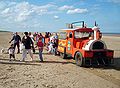
and Skegness
Skegness
Skegness is a seaside town and civil parish in the East Lindsey district of Lincolnshire, England. Located on the Lincolnshire coast of the North Sea, east of the city of Lincoln it has a total resident population of 18,910....
before terminating on the east Lincolnshire
Lincolnshire
Lincolnshire is a county in the east of England. It borders Norfolk to the south east, Cambridgeshire to the south, Rutland to the south west, Leicestershire and Nottinghamshire to the west, South Yorkshire to the north west, and the East Riding of Yorkshire to the north. It also borders...
coast at Mablethorpe
Mablethorpe
Mablethorpe is a small seaside town in East Lindsey on the coast of Lincolnshire, England.-Geography:Several small caravan parks exist around Mablethorpe. The town is administered with Sutton-on-Sea and Trusthorpe, as the civil parish of Mablethorpe and Sutton...
. In total, it is approximately 147 miles (236.6 km) long.
The stretch between Derby and Nottingham is now also known as Brian Clough
Brian Clough
Brian Howard Clough, OBE was an English footballer and football manager. He is most notable for his success with Derby County and Nottingham Forest. His achievement of winning back-to-back European Cups with Nottingham Forest, a traditionally moderate provincial English club, is considered to be...
Way in honour of the late Derby County
Derby County F.C.
Derby County Football Club is an English football based in Derby. the club play in the Football League Championship and is notable as being one of the twelve founder members of the Football League in 1888 and is, therefore, one of only ten clubs to have competed in every season of the English...
and Nottingham Forest
Nottingham Forest F.C.
Nottingham Forest Football Club is an English Association Football club based in West Bridgford, Nottingham, that plays in the Football League Championship...
manager.
The road used to start at Nantwich
Nantwich
Nantwich is a market town and civil parish in the Borough of Cheshire East and the ceremonial county of Cheshire, England. The town gives its name to the parliamentary constituency of Crewe and Nantwich...
in Cheshire
Cheshire
Cheshire is a ceremonial county in North West England. Cheshire's county town is the city of Chester, although its largest town is Warrington. Other major towns include Widnes, Congleton, Crewe, Ellesmere Port, Runcorn, Macclesfield, Winsford, Northwich, and Wilmslow...
, but was renumbered to become the A500
A500 road
The A500 is a major primary A road in Staffordshire and Cheshire, England. It is dual carriageway for most of its length and connects Nantwich, junctions 16 and 15 of the M6 motorway with the city of Stoke-on-Trent...
, A531
A531 road
The A531 is non-primary route in England that runs from Madeley Heath in Staffordshire to join the A500 close to Weston near Crewe, Cheshire....
, and the B5500
B roads in Zone 5 of the Great Britain numbering scheme
B roads are numbered routes in Great Britain of lesser importance than A roads. See the article Great Britain road numbering scheme for the rationale behind the numbers allocated.-Zone 5 :-Zone 5 :...
, although the sections renumbered as the A500 are now unclassified.
Newcastle-under-Lyme - Derby
The road starts as Ryecroft from the roundabout with the A34 and B5367. It is dual carriageway until the next roundabout, forming part of the Newcastle ring road, with the A527 and A53. It passes the leisure centre on the right, then veers right at a junction with the B5045 (which continues on the main road), where it enters the City of Stoke-on-TrentStoke-on-Trent
Stoke-on-Trent , also called The Potteries is a city in Staffordshire, England, which forms a linear conurbation almost 12 miles long, with an area of . Together with the Borough of Newcastle-under-Lyme Stoke forms The Potteries Urban Area...
. As Hartshill Road, it passes the University Hospital of North Staffordshire
University Hospital of North Staffordshire
The University Hospital of North Staffordshire is a major teaching & research hospital in Hartshill, Stoke-on-Trent, England, near the border with Newcastle-under-Lyme...
and enters the town of Stoke-upon-Trent
Stoke-upon-Trent
Stoke-upon-Trent, commonly called Stoke or Stoke town, is a component town of the city of Stoke-on-Trent, in the ceremonial county of Staffordshire, England....
. It takes two possible routes around the town centre, meeting the A500 D Road
A500 road
The A500 is a major primary A road in Staffordshire and Cheshire, England. It is dual carriageway for most of its length and connects Nantwich, junctions 16 and 15 of the M6 motorway with the city of Stoke-on-Trent...
. It goes under the West Coast Main Line
West Coast Main Line
The West Coast Main Line is the busiest mixed-traffic railway route in Britain, being the country's most important rail backbone in terms of population served. Fast, long-distance inter-city passenger services are provided between London, the West Midlands, the North West, North Wales and the...
near Stoke-on-Trent railway station
Stoke-on-Trent railway station
Stoke-on-Trent Railway Station is a main-line railway station in central England. It is located on the Stafford to Manchester branch of the West Coast Main Line and serves the Staffordshire city of Stoke-on-Trent...
and becomes Leek Road, passing one campus (Leek Road) of Staffordshire University
Staffordshire University
Staffordshire University is a university with its main campus based in the city of Stoke-on-Trent, and with other campuses in Stafford, Lichfield and Shrewsbury.- History :...
. It meets the A50
A50 road
The A50 is a major trunk road in England. It runs from Warrington to Leicester; however, it was once a much longer route.-Current route:...
at a roundabout at Joiner's Square near Hanley. It meets the A5008 and A5009 (for Leek
Leek, Staffordshire
Leek is a market town in the county of Staffordshire, England, on the River Churnet. It is an ancient borough and was granted its royal charter in 1214.It is the administrative centre for the Staffordshire Moorlands District Council...
) at crossroads, where it turns right. There is a junction with the A5272 (for Berry Hill). As Werrington Road in Bucknall
Bucknall, Staffordshire
Bucknall is a suburb of Stoke-on-Trent in the county of Staffordshire.It was recorded in the Domesday Book as having a taxable value of 0.3 geld and consisting of three ploughlands....
it passes the Mitchell High School and enters Staffordshire
Staffordshire
Staffordshire is a landlocked county in the West Midlands region of England. For Eurostat purposes, the county is a NUTS 3 region and is one of four counties or unitary districts that comprise the "Shropshire and Staffordshire" NUTS 2 region. Part of the National Forest lies within its borders...
and the borough of the Staffordshire Moorlands
Staffordshire Moorlands
Staffordshire Moorlands is a local government district in Staffordshire, England. Its council, Staffordshire Moorlands District Council, is based in Leek and is located between the city of Stoke-on-Trent and the Peak District National Park. The 2001 census recorded the population as...
. It passes through Ash Bank and Staffordshire
Werrington, Staffordshire
For other places with the same name, see Werrington.Werrington is a village and civil parish, located in the Staffordshire Moorlands district of Staffordshire, England.The village is the location of HMP Werrington, a prison for male juveniles....
, then meets the A520 (for Leek) at crossroads, then overlaps the A522 (for Cheadle
Cheadle, Staffordshire
Cheadle is a small market town near Stoke-on-Trent, Staffordshire, England, with a population of 12,158 according to the 2001 census. It is roughly from the city of Stoke-on-Trent, north of Birmingham and south of Manchester...
). It passes through Kingsley
Kingsley, Staffordshire
Kingsley is a small village in the Staffordshire Moorlands near to Cheadle, and situated on the A52 from Stoke on Trent to Ashbourne.Nowadays the village is a quiet rural village but 100 years ago the Village was the centre of the Churnet Valley Iron Mining Industry...
, and meets the A521 and B5053 (for Ipstones
Ipstones
Ipstones is a village and civil parish in north of the English county of Staffordshire.It is part of the Staffordshire Moorlands district; within the boundaries of the civil parish are the hamlets Foxt, Consall Forge and Bottomhouse...
). It passes through Whiston
Whiston
Whiston is the name of several places in England:* Whiston, Merseyside* Whiston, Northamptonshire* Whiston, South Yorkshire...
and meets the B5417 (for Oakamoor
Oakamoor
Oakamoor is a small village in north Staffordshire, England.Although it is now a rural area, it has an industrial past which drew on the natural resources of the Churnet valley....
). It meets the A523 (for Leek) and passes through Swinscoe, then briefly enters East Staffordshire
East Staffordshire
East Staffordshire is a local government district with borough status in Staffordshire in England. It has two main towns, Burton upon Trent, famous for its breweries, and Uttoxeter, for its racecourse....
.
The road enters Derbyshire
Derbyshire
Derbyshire is a county in the East Midlands of England. A substantial portion of the Peak District National Park lies within Derbyshire. The northern part of Derbyshire overlaps with the Pennines, a famous chain of hills and mountains. The county contains within its boundary of approx...
and the Derbyshire Dales
Derbyshire Dales
Derbyshire Dales is a local government district in Derbyshire, England. Much of the district is situated in the Peak District, although most of its population lies along the River Derwent....
district where it crosses the River Dove
River Dove, Derbyshire
The River Dove is the principal river of the southwestern Peak District, in the Midlands of England and is around in length. It rises on Axe Edge Moor near Buxton and flows generally south to its confluence with the River Trent at Newton Solney. From there, its waters reach the North Sea via the...
over the Hanging Bridge near the junction with the B5032 at Mayfield
Mayfield, Staffordshire
Mayfield is a village on the outskirts of Ashbourne in Derbyshire, and about 9 miles from Uttoxeter, situated in East Staffordshire.The village is divided into Church Mayfield, Upper Mayfield and Middle Mayfield. It has a population of approximately 2000. It lies on the banks of the River Dove...
close to the Queens Arms Hotel. The £3 million 1.5 miles (2.4 km) Ashbourne Relief Road opened in October 1994. There is a roundabout for the exit to Ashbourne and one with the A515. The road climbs up the side of the Dove Valley, and there is a central overtaking/crawler lane
Climbing lane
Climbing lanes are a roadway lane design typically used on Interstate highways. They allow slower travel for large vehicles, such as large trucks or Semi-trailer trucks, up a steep grade...
. The roundabout with the eastern exit to Ashbourne is near an old airfield which is now an industrial estate. The area around the next section of road to Derby has links with Bonnie Prince Charlie. It passes through Brailsford
Brailsford
Brailsford is a small red brick village in Derbyshire on the A52 midway between Derby and Ashbourne. The village has a pub, a post office, a petrol station and a school...
and the Rose and Crown and at Kirk Langley
Kirk Langley
Kirk Langley is a village in Derbyshire. The village is four miles north of Derby and two miles south east of Brailsford on the A52 road. There are in fact two villages: Kirk Langley and Meynell Langley....
, there is a junction with the B5020 for Mickleover
Mickleover
Mickleover is a suburb located two miles west of the city centre and is the most westerly suburb of the City of Derby in the United Kingdom.-History:...
.
It passes Mackworth
Mackworth
Mackworth Conservation Village, mentioned in the Domesday Book, and civil parish in the borough of Amber Valley, in Derbyshire, England. Historically, the parish also contained the neighbouring village of Markeaton, now within the Derby city boundary. Mackworth Estate shares its name with the...
, the Munday Arms and Mackworth Hotel, with part of the Mackworth Estate
Mackworth Estate
Mackworth Estate is a large council estate situated to the north-west of Derby near to Markeaton Park and the suburb of Mickleover and also the village of the same name but which is linked by no other means....
to the south and Markeaton Park. Entering Derby as Ashbourne Road, it meets the busy A38
A38 road
The A38, part of which is also known as the Devon Expressway, is a major A-class trunk road in England.The road runs from Bodmin in Cornwall to Mansfield in Nottinghamshire. It is long, making it one of the longest A-roads in England. It was formerly known as the Leeds — Exeter Trunk Road,...
at a roundabout, and Esso
Esso
Esso is an international trade name for ExxonMobil and its related companies. Pronounced , it is derived from the initials of the pre-1911 Standard Oil, and as such became the focus of much litigation and regulatory restriction in the United States. In 1972, it was largely replaced in the U.S. by...
Mackworth Service Station. It passes the Shell
Royal Dutch Shell
Royal Dutch Shell plc , commonly known as Shell, is a global oil and gas company headquartered in The Hague, Netherlands and with its registered office in London, United Kingdom. It is the fifth-largest company in the world according to a composite measure by Forbes magazine and one of the six...
Friargate garage on the left which has now been closed down. From here to the dual-carriageway is a popular pub crawl
Pub crawl
A pub crawl is the act of one or more people drinking in multiple pubs or bars in a single night, normally walking or busing to each one between drinking.-Origin of the term:...
, with many student residences close by for the University of Derby
University of Derby
The University of Derby is a university in the city of Derby, England. The main site is on Kedleston Road, Allestree in the north-west of Derby close to the A38 opposite Markeaton Park...
, such as St Christopher's Court. Close by to the north is the new Markeaton campus of the university. The road splits into east and west sections, passing St John the Evangelist church on the left, with the easterly section being Agard Street and the westerly section being Friargate. From the traffic lights at the eastern end of both, the road becomes Ford Street, passing the Friargate Studios.
Derby - Nottingham
It overlaps the £3.5 million (£ as of ), A601 Derby Inner Ring Road, which is called St Alkmunds Way and was opened on 30 July 1972. It is used by 70,000 motorists daily as they pass under the 2007 footbridge towards Pentagon Island. From the Radio DerbyBBC Radio Derby
BBC Radio Derby is the BBC Local Radio station for the English county of Derbyshire, covering all but the northern tip of the county, and also serves eastern Staffordshire, mainly Uttoxeter and Burton upon Trent. The station broadcasts from its studios in Derby on 104.5, 95.3 and 96.0 FM and 1116...
building (to the west of the city centre) to Nottingham, it is dual-carriageway. It crosses the River Derwent
River Derwent, Derbyshire
The Derwent is a river in the county of Derbyshire, England. It is 66 miles long and is a tributary of the River Trent which it joins south of Derby. For half its course, the river flows through the Peak District....
, the A601 leaves to the south, and it passes under the Midland Main Line
Midland Main Line
The Midland Main Line is a major railway route in the United Kingdom, part of the British railway system.The present-day line links London St...
as Eastgate. There is the Pentagon Island Grade Separated Junction
Grade separation
Grade separation is the method of aligning a junction of two or more transport axes at different heights so that they will not disrupt the traffic flow on other transit routes when they cross each other. The composition of such transport axes does not have to be uniform; it can consist of a...
(GSJ) with the A61
A61 road
The A61 is a major trunk road in England. It runs from Derby to Thirsk in North Yorkshire. From Derby, it heads north via Alfreton, Clay Cross, Chesterfield, Sheffield, Barnsley, Wakefield, Leeds, Harrogate and Ripon...
near Chaddesden
Chaddesden
Chaddesden, also known locally as Chad, is a large suburb of Derby, United Kingdom, formerly known as Cedesdene.-Cedesene village:The old village of Cedesene is situated two and a half miles east of the city...
and the Texaco
Texaco
Texaco is the name of an American oil retail brand. Its flagship product is its fuel "Texaco with Techron". It also owns the Havoline motor oil brand....
Pentagon Service Station. The westbound-direction is not grade-separated and meets the roundabout, thus causing many severe queues at rush-hour. Westbound traffic would be better choosing another route from 8 - 9am. It passes a large Costco
Costco
Costco Wholesale Corporation is the largest membership warehouse club chain in the United States. it is the third largest retailer in the United States, where it originated, and the ninth largest in the world...
, and the next junction is a GSJ for the Wyvern Retail Park, and passes a KFC
KFC
KFC, founded and also known as Kentucky Fried Chicken, is a chain of fast food restaurants based in Louisville, Kentucky, in the United States. KFC has been a brand and operating segment, termed a concept of Yum! Brands since 1997 when that company was spun off from PepsiCo as Tricon Global...
, McDonald's
McDonald's
McDonald's Corporation is the world's largest chain of hamburger fast food restaurants, serving around 64 million customers daily in 119 countries. Headquartered in the United States, the company began in 1940 as a barbecue restaurant operated by the eponymous Richard and Maurice McDonald; in 1948...
, Pizza Hut
Pizza Hut
Pizza Hut is an American restaurant chain and international franchise that offers different styles of pizza along with side dishes including pasta, buffalo wings, breadsticks, and garlic bread....
and Sainsbury's. Near Spondon
Spondon
Spondon is a ward within the city of Derby. Prior to this, Spondon was a separate village which dated from before the Domesday Book of 1086.-Description:The name Spondon is Anglo-Saxon and describes a gravelly hill....
, there is a large GSJ with the A5111 Derby outer ring road (Raynesway - home of Rolls-Royce Marine Power Operations), also near a large Asda
Asda
Asda Stores Ltd is a British supermarket chain which retails food, clothing, general merchandise, toys and financial services. It also has a mobile telephone network, , Asda Mobile...
. The £4.6 million (£ as of ), 0.5 mile (0.80467 km) Borrowash Bypass Extension, from Raynesway to Megaloughton Lane opened on May 29 1980 as well the £6 million (£ as of ), Nottingham Road Diversion, from the Pentagon Island to Raynesway. Both sections totalled 2.5 miles (4 km). 0.5 mile (0.80467 km) before Borrowash, it enters the district of Erewash
Erewash
Erewash is a local government district and borough in eastern Derbyshire, England, to the east of Derby and the west of Nottingham. It contains the towns of Ilkeston, Long Eaton and Sandiacre and fourteen civil parishes....
.
Further east, it is the main east-west route from Derby to Nottingham, connecting the two towns via the busy junction 25 of the M1
M1 motorway
The M1 is a north–south motorway in England primarily connecting London to Leeds, where it joins the A1 near Aberford. While the M1 is considered to be the first inter-urban motorway to be completed in the United Kingdom, the first road to be built to motorway standard in the country was the...
at Sandiacre, passing the Shell
Royal Dutch Shell
Royal Dutch Shell plc , commonly known as Shell, is a global oil and gas company headquartered in The Hague, Netherlands and with its registered office in London, United Kingdom. It is the fifth-largest company in the world according to a composite measure by Forbes magazine and one of the six...
Ockbrook garage on the left near Ockbrook
Ockbrook
Ockbrook is an ancient village in Derbyshire, England. It is almost contiguous with the village of Borrowash, the two only separated by the A52. Ockbrook lies about east of Derby.-History:...
. The £250,000 3 miles (4.8 km) Borrowash Bypass opened in 1957, although the bridge at Ockbrook opened in 1969, from a roundabout with the A6005 to Hopwell Firs. The former route is partly the A6005. The 5 miles (8 km) £2 million (£ as of ),Sandiacre
Sandiacre
Sandiacre is a town in the Borough of Erewash in Derbyshire, in the East Midlands region of England adjoining the border with Nottinghamshire....
Stapleford
Stapleford, Nottinghamshire
-External links:***...
Bypass opened in December 1964, being built two years before junction 25 of the M1 had been opened although all the bridges and roundabout were part of the bypass. It was the first major road project opened by the 1964 Labour government. The former route is the B5010. It crosses the Nottingham section of the Midland Main Line
Midland Main Line
The Midland Main Line is a major railway route in the United Kingdom, part of the British railway system.The present-day line links London St...
, and the River Erewash
River Erewash
The River Erewash is a river in England that flows roughly southwards through Derbyshire, close to its eastern border with Nottinghamshire.-Etymology:...
and Erewash Canal
Erewash Canal
The Erewash Canal is a broad canal in Derbyshire, England. It runs just under and has 14 locks. The first lock at Langley Bridge is actually part of the Cromford Canal.-Origins:...
, entering Nottinghamshire
Nottinghamshire
Nottinghamshire is a county in the East Midlands of England, bordering South Yorkshire to the north-west, Lincolnshire to the east, Leicestershire to the south, and Derbyshire to the west...
and the borough of Broxtowe
Broxtowe
Broxtowe is a local government district with borough status in Nottinghamshire, England, west of the City of Nottingham. It is part of the Greater Nottingham metropolitan area...
.
Bardill's Island roundabout, which has been improved, is with Toton
Toton
Toton is a small suburb of Nottingham. It forms part of the Greater Nottingham urban area, and is in the Borough of Broxtowe. The inhabited area is contained within the electoral ward of Toton and Chilwell Meadows...
Lane (B6003) which is for Stapleford and is near the George Spencer Academy and the garden centre after which the roundabout is named.. It passes through Bramcote
Bramcote
Bramcote is a settlement in the Broxtowe district of Nottinghamshire, about five miles west of Nottingham. It was a separate village but is now a suburb of Greater Nottingham. Originally one of the main roads between the cities of Nottingham and Derby passed through the village centre...
at the roundabout with the A6007 next to Bramcote leisure centre and becomes a three-lane dual carriageway, however the left lane is a bus lane. There is a right-turn at traffic lights for Wollaton
Wollaton
Wollaton is an area in the western part of Nottingham, England. It is home to Wollaton Hall with its museum, deer park, lake, walks and golf course...
Road (B6006) for Beeston
Beeston, Nottinghamshire
Beeston is a town in Nottinghamshire, England. It is southwest of Nottingham city centre. Although typically regarded as a suburb of the City of Nottingham, and officially designated as part of the Nottingham Urban Area, for local government purposes it is in the borough of Broxtowe, lying outside...
near the Nurseryman pub.
It enters the City of Nottingham at the A6464 Priory roundabout (Woodside Road leading to the A6005) in Lenton Abbey
Lenton Abbey
Lenton Abbey is a location in Nottingham, in the Wollaton East and Lenton Abbey ward of Nottingham City Council.Lenton Abbey adjoins Wollaton, Beeston and the University of Nottingham.There is a Church of England church St. Barnabas' Church, Lenton Abbey....
with the Shell
Royal Dutch Shell
Royal Dutch Shell plc , commonly known as Shell, is a global oil and gas company headquartered in The Hague, Netherlands and with its registered office in London, United Kingdom. It is the fifth-largest company in the world according to a composite measure by Forbes magazine and one of the six...
Priory garage on the right, and the Wollaton Park Toby Carvery pub on the left on Wollaton Vale road. To the left is Wollaton Park
Wollaton Hall
Wollaton Hall is a country house standing on a small but prominent hill in Wollaton, Nottingham, England. Wollaton Park is the area of parkland that the stately house stands in. The house itself is a natural history museum, with other museums in the out-buildings...
and nearby to the south is the University of Nottingham
University of Nottingham
The University of Nottingham is a public research university based in Nottingham, United Kingdom, with further campuses in Ningbo, China and Kuala Lumpur, Malaysia...
. The junction at the Queen's Medical Centre
Queen's Medical Centre
The Queen's Medical Centre situated in Nottingham, England, is the largest hospital in the United Kingdom, and the largest teaching hospital in Europe.-History:...
with the A6514 Middleton Boulevard was originally a roundabout, but became a GSJ, costing £3.7 million in late 1983. The former route through Nottingham is now the A6200, then down Angel Row, Wheeler Gate, Lister Gate then through what is now the Broadmarsh Centre and past the train station on Carrington Street, through The Meadows
The Meadows, Nottingham
The Meadows is an area of Nottingham, England located south of the city centre.- Overview :The area is close to the River Trent and is connected to West Bridgford in the Borough of Rushcliffe by Trent Bridge and the Wilford Suspension Bridge...
as Arkwright Street to a point near the A60/A6011 junction, over Trent Bridge
Trent Bridge (bridge)
Trent Bridge is an iron and stone road bridge across the River Trent in Nottingham, England. It is the principal river crossing for entrance to the city from the south, although the upstream Clifton Bridge is both larger and busier.-Medieval bridge:...
and along the current A6520 Radcliffe Road. South of here it follows the former A614
A614 road
The A614 is a main road in England running through the counties of Nottinghamshire, South Yorkshire and the East Riding of Yorkshire.Beginning at Redhill, near Calverton in Nottinghamshire at a roundabout with the A60, the road meets the A6097 at a junction which looks like a roundabout but...
as Clifton Boulevard. There is a junction for Abbey Street (A6005 - former A453) which was originally a much smaller temporary flyover, but was improved in June 1990 at a cost of £5.5 million, which is where the former A614 terminated. It crosses the Beeston Canal and Nottingham - Derby/Loughborough
Loughborough
Loughborough is a town within the Charnwood borough of Leicestershire, England. It is the seat of Charnwood Borough Council and is home to Loughborough University...
railway line and follows the Clifton Boulevard around the south of Nottingham. It overlaps the A453
A453 road
The A453 road was formerly the main trunk road connecting the English cities of Nottingham and Birmingham. However, the middle section of this mainly single-carriageway road has largely been downgraded to B roads or unclassified roads following the construction of the parallel M42-A42 link around...
, then the A453 exits for the M1
M1 motorway
The M1 is a north–south motorway in England primarily connecting London to Leeds, where it joins the A1 near Aberford. While the M1 is considered to be the first inter-urban motorway to be completed in the United Kingdom, the first road to be built to motorway standard in the country was the...
and Clifton near the Texaco
Texaco
Texaco is the name of an American oil retail brand. Its flagship product is its fuel "Texaco with Techron". It also owns the Havoline motor oil brand....
Silverdale Service Station and The Becket School
The Becket School
The Becket School is an 11-18 coeducational Roman Catholic comprehensive school in Nottinghamshire, England. It was formed in 1975 by the amalgamation of two schools, Corpus Christi Grammar School and Becket Grammar School for Boys....
.
One of the bridges over the Trent
River Trent
The River Trent is one of the major rivers of England. Its source is in Staffordshire on the southern edge of Biddulph Moor. It flows through the Midlands until it joins the River Ouse at Trent Falls to form the Humber Estuary, which empties into the North Sea below Hull and Immingham.The Trent...
at Clifton Bridge includes a section of the former B680 (which followed the route into Nottingham now used by the A453). The 275ft east bridge opened in 1958, being officially opened by Princess Alexandra, The Honourable Lady Ogilvy
Princess Alexandra, The Honourable Lady Ogilvy
Princess Alexandra, The Honourable Lady Ogilvy is the youngest granddaughter of King George V of the United Kingdom and Mary of Teck. She is the widow of Sir Angus Ogilvy...
. The bridge was widened, with the west bridge, to dual-carriageway as the A614 as part of a 1+1/4 mi £3.2 million section, opening in 1972. This was the completion of the dual-carriageway Nottingham ring-road. It enters the borough of Rushcliffe
Rushcliffe
Rushcliffe is a local government district with borough status in Nottinghamshire, England. Its council is based in West Bridgford. It was formed on 1 April 1974 by merging the West Bridgford Urban District, the Bingham Rural District and part of Basford Rural District.-Political representation:The...
where it crosses the former Great Central Main Line
Great Central Main Line
The Great Central Main Line , also known as the London Extension of the Manchester, Sheffield and Lincolnshire Railway , is a former railway line which opened in 1899 linking Sheffield with Marylebone Station in London via Nottingham and Leicester.The GCML was the last main line railway built in...
and meets the A60
A60 road
The A60 is a road linking Loughborough in Leicestershire, England, with Doncaster in South Yorkshire, via Nottingham.It takes the following route:*Loughborough**Rempstone**Costock**Bunny**Ruddington*West Bridgford*Nottingham**Sherwood**Arnold...
(for Ruddington
Ruddington
Ruddington is an English village situated five miles south of Nottingham in the Borough of Rushcliffe. It had a population of 6,441 at the 2001 UK census....
and the Nottingham South Premier Inn), then the A606 at busy roundabouts. This section from the A606 roundabout, near the Wheatcroft Garden Centre, to the Dunkirk
Dunkirk, Nottingham
Dunkirk is a residential area of Nottingham, England which is located to the south east of the University of Nottingham and the Queen's Medical Centre...
junction (current A6005, then the A453) - the Nottingham Ring Road - was opened in 1963 as mostly single carriageway. The section from Clifton Bridge to the A60 roundabout was dualled in December 1968. The £6 million 2 miles (3.2 km) section from Gamston to Lings Bar opened in September 1981 as Gamston Lings Bar Road. It passes close to Tollerton
Tollerton, Nottinghamshire
Tollerton is a village situated in Rushcliffe just to the south of Nottingham, United Kingdom.The village is located in the Borough of Rushcliffe. The Parish Council of nine members runs local affairs and the population of the parish is registered as 1,776 residents.There is an annual village...
Airfield and a large Morrisons
Morrisons
Wm Morrison Supermarkets plc is the fourth largest chain of supermarkets in the United Kingdom, headquartered in Bradford, West Yorkshire, England. The company is usually referred to and is branded as Morrisons formerly Morrison's, and it is part of the FTSE 100 Index of companies...
(former Safeway
Safeway (UK)
Safeway was a chain of supermarkets and convenience stores in the United Kingdom. It started as a subsidiary of the American Safeway Inc., before being sold off in 1987....
), and crosses the Grantham Canal
Grantham Canal
The Grantham Canal is a canal that runs for 33 miles from Grantham, falling through 18 locks to West Bridgford where it joins the River Trent. It was built primarily to allow for the transportation of coal to Grantham. It opened in 1797, and its profitability steadily increased until 1841...
meeting the former route (A6011) at a busy roundabout near the Bridge pub. It will become a dual carriageway in 2011. The section from the QMC to the A606 Wheatcroft Island roundabout used to be the A614 until the Gamston section was opened. The former route of the A52 into Nottingham is now the A6200 and A6011.
Nottingham- Grantham
Heading east as Radcliffe Road with BassingfieldBassingfield
Bassingfield is a hamlet in Nottinghamshire, England. It is located 3 miles south east of Nottingham, close to the A52. The Grantham Canal lies 200 yards to the south....
to the right, the £25,000 (£ as of ), dual-carriageway section from Holme House built in 1956 finishes at the start of the Radcliffe on Trent
Radcliffe on Trent
Radcliffe-on-Trent is a large village and civil parish in the Rushcliffe borough of Nottinghamshire-Location:Radcliffe has a population of around 8,000. It is to the east of Nottingham, and is close to but not quite part of the Greater Nottingham built-up area...
bypass as Grantham Road. There is the BP
BP
BP p.l.c. is a global oil and gas company headquartered in London, United Kingdom. It is the third-largest energy company and fourth-largest company in the world measured by revenues and one of the six oil and gas "supermajors"...
Pierrepont Filling Station just before the turn-off for Radcliffe on Trent. This stretch has SPECS
Automatic number plate recognition
Automatic number plate recognition is a mass surveillance method that uses optical character recognition on images to read the license plates on vehicles. They can use existing closed-circuit television or road-rule enforcement cameras, or ones specifically designed for the task...
cameras along it. Close by is the Holme Pierrepont National Watersports Centre
Holme Pierrepont National Watersports Centre
The National Watersports Centre, Holme Pierrepont is located in the hamlet of Holme Pierrepont near Nottingham, England and on the River Trent....
. The road goes past Upper Saxondale
Upper Saxondale
Upper Saxondale is a residential area situated mainly in the parish of Radcliffe on Trent, in the Nottinghamshire borough of Rushcliffe. A section also falls within the parish of Cropwell Butler...
, then meets the A46
A46 road
The A46 is an A road in England. It starts east of Bath, Somerset and ends in Cleethorpes, North East Lincolnshire, but it does not form a continuous route. Large portions of the old road have been lost, bypassed, or replaced by motorway development...
at the large Saxondale roundabout, which has the Shell
Royal Dutch Shell
Royal Dutch Shell plc , commonly known as Shell, is a global oil and gas company headquartered in The Hague, Netherlands and with its registered office in London, United Kingdom. It is the fifth-largest company in the world according to a composite measure by Forbes magazine and one of the six...
Saxondale garage. The road runs roughly parallel with the Nottingham-Grantham railway
Nottingham to Grantham Line
The Nottingham to Grantham Line is a branch line between the towns of Nottingham and Grantham in the East Midlands of England. It follows the A52.The following places are served by the line.* Nottingham* Netherfield* Radcliffe on Trent* Bingham...
between Radcliffe on Trent and Grantham. From the A46, the road heads east past Bingham
Bingham, Nottinghamshire
Bingham is a market town in the Rushcliffe borough of Nottinghamshire, England.-Geography:With a population of around 9,000 people it lies about nine miles east of Nottingham, a similar distance south-west of Newark-on-Trent and west of Grantham. It is situated where the A46 intersects the A52...
on the £2.6 million (£ as of ), 2 miles (3.2 km) Bingham
Bingham, Nottinghamshire
Bingham is a market town in the Rushcliffe borough of Nottinghamshire, England.-Geography:With a population of around 9,000 people it lies about nine miles east of Nottingham, a similar distance south-west of Newark-on-Trent and west of Grantham. It is situated where the A46 intersects the A52...
bypass opened in December 1986. The road passes the Murco Petroleum Ltd
Murco Petroleum Ltd
Murco Petroleum Ltd is a UK-based oil company, with headquarters in St. Albans, Hertfordshire. It refines oil and also has a network of petrol stations. It was founded in 1960 and is a subsidiary of the USA-based Murphy Oil Corporation. The company owns a chain of Costcutter convenience stores...
Kings Service Station on the left. There is a left turn for Scarrington, then it passes a prison at Whatton, near to where it crosses the River Smite.
It passes the Vale of Belvoir hotel, and after Elton
Elton on the Hill
For other uses of the name, see Elton .Elton on the Hill is a small Nottinghamshire village and civil parish in the Vale of Belvoir.-Situation and facilities:Elton lies about east of Nottingham, England, in the NG13 postcode district...
where it passes the Manor Arms, it enters Leicestershire
Leicestershire
Leicestershire is a landlocked county in the English Midlands. It takes its name from the heavily populated City of Leicester, traditionally its administrative centre, although the City of Leicester unitary authority is today administered separately from the rest of Leicestershire...
, the district of Melton, and the Vale of Belvoir
Vale of Belvoir
The Vale of Belvoir is an area of natural beauty on the borders of Leicestershire, Nottinghamshire and Lincolnshire in England. Indeed, the name itself derives from the Norman-French for beautiful view.-Extent and geology:...
at the start of the Bottesford
Bottesford, Leicestershire
This page is about the English village of Bottesford near Grantham. For the Bottesford near Scunthorpe, see Bottesford, LincolnshireBottesford is a village and civil parish within the Melton district of Leicestershire, England....
bypass, which opened in February 1989 with an extremely wide concrete £3 million (£ as of ),3 miles (4.8 km) two-way road.
It passes by Muston
Muston, Leicestershire
Muston is a village in north Leicestershire, fifteen miles east of Nottingham, 12.5 miles north of Melton Mowbray and five miles west of Grantham on the A52....
and enters Lincolnshire
Lincolnshire
Lincolnshire is a county in the east of England. It borders Norfolk to the south east, Cambridgeshire to the south, Rutland to the south west, Leicestershire and Nottinghamshire to the west, South Yorkshire to the north west, and the East Riding of Yorkshire to the north. It also borders...
and South Kesteven
South Kesteven
South Kesteven is a local government district in Lincolnshire, England, forming part of the traditional Kesteven division of the county. It covers Grantham, Stamford, Bourne and Market Deeping.-History:...
at the crossing of Sewstern Lane (Viking Way
Viking Way
The Viking Way is a long distance footpath in England running between the Humber Bridge in North Lincolnshire and Oakham in Rutland. The Countryside Commission recognised the significance of the Viking Way as a high quality long distance walk linking other major routes in Eastern England, these...
) next to the popular Muston Gap, passing through Sedgebrook. Belvoir Castle
Belvoir Castle
Belvoir Castle is a stately home in the English county of Leicestershire, overlooking the Vale of Belvoir . It is a Grade I listed building....
can be seen in the distance. The road climbs the steep Mill Hill near Barrowby
Barrowby
Barrowby is a large village and Civil Parish lying just to the west of Grantham, in the South Kesteven district of Lincolnshire, England, separated from that town by the main A1 road...
, crosses the A1 and becomes Barrowby Road. The section of road from Radcliffe on Trent to Grantham was planned to become a dual-carriageway in the 1990s, but there are no plans at present.
It meets a roundabout with Barrowby Gate, next to the Muddle Go Nowhere, passing through Green Hill. At the bottom of Barrowby Road is a low-height railway bridge, which in 2005 was the most hit railway bridge in the UK. Only until recently was this busy trunk road part of the High Street in Grantham; now it is diverted alongside the East Coast Main Line
East Coast Main Line
The East Coast Main Line is a long electrified high-speed railway link between London, Peterborough, Doncaster, Wakefield, Leeds, York, Darlington, Newcastle and Edinburgh...
on Sankt Augustin
Sankt Augustin
Sankt Augustin is a town in the Rhein-Sieg district, in North Rhine-Westphalia, Germany. It is named after the patron saint of the Divine Word Missionaries, Saint Augustine of Hippo . The Missionaries established a monastery near the current city centre in 1913...
Way, which is also the A607.
At the start of Sankt Augustin Way, the road passes an Asda
Asda
Asda Stores Ltd is a British supermarket chain which retails food, clothing, general merchandise, toys and financial services. It also has a mobile telephone network, , Asda Mobile...
on the left. It meets Dysart Road at traffic lights and turns left at a one way system onto Wharf Road, passing a large Morrisons
Morrisons
Wm Morrison Supermarkets plc is the fourth largest chain of supermarkets in the United Kingdom, headquartered in Bradford, West Yorkshire, England. The company is usually referred to and is branded as Morrisons formerly Morrison's, and it is part of the FTSE 100 Index of companies...
store and Churchills pub, then turning right at traffic lights onto London Road, passing Sainsburys
J Sainsbury
J. Sainsbury plc is the parent company of Sainsbury's Supermarkets Ltd, commonly known as Sainsbury's, the third largest chain of supermarkets in the United Kingdom with a share of the UK supermarket sector of 16.5%....
and the Reindeer Inn. The most sensible route around Grantham is to follow the A1 from Barrowby
Barrowby
Barrowby is a large village and Civil Parish lying just to the west of Grantham, in the South Kesteven district of Lincolnshire, England, separated from that town by the main A1 road...
and take the A607 exit into Grantham, although there is a low bridge (13') on Springfield Road (another part of the A607), which was the UK's most hit bridge in 2006.
There have been plans for an A52 bypass south of Grantham, which have many cycle-riding objectors. South of the town, it meets the B1174 at traffic lights near the Spotted Cow, with the Total
Total S.A.
Total S.A. is a French multinational oil company and one of the six "Supermajor" oil companies in the world.Its businesses cover the entire oil and gas chain, from crude oil and natural gas exploration and production to power generation, transportation, refining, petroleum product marketing, and...
St Leonards Service Station on the left and Pizza Hut
Pizza Hut
Pizza Hut is an American restaurant chain and international franchise that offers different styles of pizza along with side dishes including pasta, buffalo wings, breadsticks, and garlic bread....
and McDonalds on the right.
Grantham - Boston
This section of road is known locally as The Ramper, a name from the turnpike era.From Grantham, which was the A52's original eastern end, the road continues as Bridge End Road passing the White Lion, then Somerby Hill eastwards, passing the Shell
Royal Dutch Shell
Royal Dutch Shell plc , commonly known as Shell, is a global oil and gas company headquartered in The Hague, Netherlands and with its registered office in London, United Kingdom. It is the fifth-largest company in the world according to a composite measure by Forbes magazine and one of the six...
Somerby Hill Service Station on the left, rising up the valley of the River Witham
River Witham
The River Witham is a river, almost entirely in the county of Lincolnshire, in the east of England. It rises south of Grantham close to South Witham, at SK8818, passes Lincoln at SK9771 and at Boston, TF3244, flows into The Haven, a tidal arm of The Wash, near RSPB Frampton Marsh...
to reach the ancient Ermine Street
Ermine Street
Ermine Street is the name of a major Roman road in England that ran from London to Lincoln and York . The Old English name was 'Earninga Straete' , named after a tribe called the Earningas, who inhabited a district later known as Armingford Hundred, around Arrington, Cambridgeshire and Royston,...
roman road
Roman road
The Roman roads were a vital part of the development of the Roman state, from about 500 BC through the expansion during the Roman Republic and the Roman Empire. Roman roads enabled the Romans to move armies and trade goods and to communicate. The Roman road system spanned more than 400,000 km...
at the B6403/B1176 roundabout, which it follows for about 0.5 mile (0.80467 km). Ermine Street continues as the B6403 northwards at Cold Harbour. Traffic for Skegness may want to take the A153 instead (via the Sleaford
Sleaford
Sleaford is a town in the North Kesteven district of Lincolnshire, England. It is located thirteen miles northeast of Grantham, seventeen miles west of Boston, and nineteen miles south of Lincoln, and had a total resident population of around 14,500 in 6,167 households at the time...
bypass), as from Boston - Wainfleet, the traffic slows down. It follows High Dike, and there is a left turn for Welby
Welby, Lincolnshire
Welby is a village and civil parish in the South Kesteven district of Lincolnshire, England. It lies north-east of Grantham, and east of the old Roman Road Ermine Street. Neighbouring villages are Aisby, Oasby, and Heydour. The village has approximately 75 houses.Welby Grade I listed Anglican...
and a right turn for Ropsley
Ropsley
Ropsley is a village about east of Grantham, Lincolnshire, England.-Village:Ropsley has its own village hall which also within the ground has a basketball court, a football pitch and a cricket pitch. There is a golf course located on the outskirts of the village, it has 12 holes after undergoing...
.
There is a crossroads with the left for Oasby
Oasby
Oasby is a hamlet in the civil parish of Heydour, South Kesteven, Lincolnshire, England. It lies north-east of Grantham.Oasby, Heydour, Aisby, Culverthorpe and Kelby are the five hamlets within Heydour parish....
. There is a right turn for Braceby
Braceby
Braceby is a small hamlet in Lincolnshire, England, lying south of the A52 and west of the A15, south west of Sleaford. Many of the buildings here, especially those of 16th and 17th-century origin, include locally produced limestone in their construction as this was once a centre of quarrying and...
, then just before a right turn for Haceby
Haceby
Haceby is a hamlet in the civil parish of Newton and Haceby in the district of North Kesteven, Lincolnshire, England. It lies east from Grantham, south from Sleaford, and south off the A52.In the Domesday account the village was written as "Hazebi"....
, the road enters North Kesteven
North Kesteven
North Kesteven is a local government district in the East Midlands. Just over north of London, it is east of Nottingham and south of Lincoln. North Kesteven is one of seven districts in Lincolnshire, England and is in the centre of the County...
. There are turnings for Dembleby and Newton
Newton, Lincolnshire
Newton is a historic hamlet that dates back as a settlement to Roman times and before, and is located around 13 km east of Grantham. Newton is mostly contained in a conservation area and contains some listed buildings, although this has not stopped a large amount of development since the...
and passes through Scott Willoughby. It meets the A15 at the Threekingham Bar
Threekingham Bar
Threekingham Bar is the name given to interception of the A52 and A15 roads to the west of the village of Threekingham, in Lincolnshire, England...
roundabout near Osbournby
Osbournby
Osbournby is a small village and civil parish in North Kesteven in the English county of Lincolnshire.-Geography:It is located five miles south of Sleaford on the A15 road near the A52 roundabout. Adjacent villages include Spanby, Aunsby and Threekingham. The village has a population of roughly...
becoming Holland Road, and passes through Threekingham
Threekingham
Threekingham is a village in mid-Lincolnshire, on the A52 Grantham to Boston road, near Sleaford, close to the A15 Threekingham Bar roundabout. Mareham Lane, the Roman Road aligned with King Street, crosses the A15 at Threekingham....
and crosses Mareham Lane (a Roman road), with the Holland Road Service Station on the right, where it re-enters South Kesteven. From here to the South-Forty Foot Drain (about 5 miles (8 km)), the road lies on the border of the districts of North Kesteven and South Kesteven. There are crossroads with the B1394 (for Swaton
Swaton
Swaton is a hamlet and civil parish in North Kesteven, Lincolnshire, England, off the A52 road on the B1394. The name comes from Suavetone or Swaffa’s Farmstead. The nearest town is Sleaford. The Roman Car Dyke runs to the east of the village. Roman brick pits are still extant. The Eau river rises...
and Horbling
Horbling
Horbling is a village which is situated a half mile north of Billingborough, in South Kesteven, in Lincolnshire on the B1777.It contains a church and a scout group. The scout group also serves Billingborough, Horbling and Morton. The church is dedicated to . The village pub is the on Spring Lane...
), and the road meets the B1177 from nearby Billingborough
Billingborough
Billingborough is a village and civil parish in the South Kesteven district of Lincolnshire, England, about ten miles north of Bourne and ten miles south of Sleaford on the B1177 between Horbling and Pointon just south of the A52.-Village:...
at Bridge End, becoming Bridge End Causeway.
At Donington High Bridge, it enters the district of South Holland
South Holland, Lincolnshire
South Holland is a local government district of Lincolnshire. The district council is based in Spalding.It was formed on 1 April 1974, under the Local Government Act 1972, as a merger of the Spalding urban district with East Elloe Rural District and Spalding Rural District...
next to the Sloop Inn. It passes over the Sleaford-Spalding railway
Peterborough to Lincoln Line
The Peterborough to Lincoln Line is a railway line linking and , via and .-History:The section between Peterborough and Spalding closed to passengers on 5 October 1970 and re-opened on 7 June 1971. North of Spalding, Ruskington re-opened on 5 May 1975. Metheringham followed on 6 October...
and at Donington
Donington, Lincolnshire
Donington is a village and civil parish in the South Holland district of Lincolnshire, England. It lies north of the market town of Spalding on the A152, and is bypassed by the A52. The parish includes the hamlet of Northorpe, and...
there is a roundabout with the A152
A152 road
The A152 is a small non-primary A-road in Lincolnshire, from Donington to Surfleet linking the A52 and the A16, two major primary routes.Between Donington and Surfleet the road goes through three villages; Church End, Quadring, and Gosberton....
(the former name of the A52 east of Grantham). It follows a 1 miles (1.6 km) bypass, which opened in the early 1990s, to the north becoming Bicker Road and there is a left turn for Northorpe. It enters the borough of Boston
Boston (borough)
Boston is a local government district with borough status in Lincolnshire, England. Its council is based in the town of Boston. It lies around N53°0'0" W0°0'0"....
just before the 1+1/2 mi bypass to the south of Bicker
Bicker, Lincolnshire
Bicker is a village in Lincolnshire, England. It is around west-south-west of Boston, on the A52.-Geography:It is one of 18 parishes which, together with Boston, form the Borough of Boston in the county of Lincolnshire, England. The local government has been arranged in this way since the...
, which opened in the early 1990s, where it meets the B1181 and becomes Donington Road. It passes the Texaco
Texaco
Texaco is the name of an American oil retail brand. Its flagship product is its fuel "Texaco with Techron". It also owns the Havoline motor oil brand....
Bicker Bar Service Station on the left at the roundabout with the A17. It meets a roundabout for Swineshead
Swineshead, Lincolnshire
Not to be confused with Swineshead, BedfordshireSwineshead is a village and civil parish in Lincolnshire, England, around miles west of the town of Boston...
and passes through Drayton, meets the B1391 as Abbey Lane, then Drayton Road. At Baythorpe
Baythorpe
Baythorpe is a village in Lincolnshire, England....
it becomes Boston Road and the B1192 joins to the left at Kirton Holme. At the Poachers Hotel it becomes Swineshead Road. There are crossroads again with the B1192 (for Hubbert's Bridge to the left) at the Four Crossroads Inn at Baker's Bridge. Near Boston, you won't find a straighter or flatter road, as the road follows the New Hammond Beck.
It passes Wyberton Fen and meets a roundabout with a Tesco
Tesco
Tesco plc is a global grocery and general merchandise retailer headquartered in Cheshunt, United Kingdom. It is the third-largest retailer in the world measured by revenues and the second-largest measured by profits...
superstore and B&Q
B&Q
B&Q plc is a multinational DIY and home improvement retailer headquartered in Eastleigh, United Kingdom. It was founded in 1969 and is a wholly owned subsidiary of Kingfisher plc, which is listed on the London Stock Exchange....
on the left at Chain Bridge. The Hammer & Pincers pub is on the left just before a roundabout, where the main route follows to the left, and the straight-on direction is for Wyberton
Wyberton
Wyberton is a village in Lincolnshire, England. It is just south-west of Boston, and runs into it along the B1397 between Boston and Kirton. The A16 along the former East Lincolnshire railway bisecting the village in two....
. The Alban Retail Park is on the right before it crosses the South Forty-Foot Drain
South Forty-foot drain
The South Forty-Foot Drain is the main channel for the land-drainage of the Black Sluice Level in the Lincolnshire Fens. It lies in eastern England between Guthram Gowt and the Black Sluice pumping station on The Haven, at Boston...
and railway at a level crossing, then meets the A1121 from the left at a mini-roundabout close to a Peugeot
Peugeot
Peugeot is a major French car brand, part of PSA Peugeot Citroën, the second largest carmaker based in Europe.The family business that precedes the current Peugeot company was founded in 1810, and manufactured coffee mills and bicycles. On 20 November 1858, Emile Peugeot applied for the lion...
, Citroën
Citroën
Citroën is a major French automobile manufacturer, part of the PSA Peugeot Citroën group.Founded in 1919 by French industrialist André-Gustave Citroën , Citroën was the first mass-production car company outside the USA and pioneered the modern concept of creating a sales and services network that...
and BMW
BMW
Bayerische Motoren Werke AG is a German automobile, motorcycle and engine manufacturing company founded in 1916. It also owns and produces the Mini marque, and is the parent company of Rolls-Royce Motor Cars. BMW produces motorcycles under BMW Motorrad and Husqvarna brands...
garage. It enters Boston as Sleaford Road along a long straight avenue of trees, passing the Shell
Royal Dutch Shell
Royal Dutch Shell plc , commonly known as Shell, is a global oil and gas company headquartered in The Hague, Netherlands and with its registered office in London, United Kingdom. It is the fifth-largest company in the world according to a composite measure by Forbes magazine and one of the six...
Boston garage on the right.
There are crossroads for Brothertoft Road (A1137), which can be used to avoid the busy town centre, then a mini-roundabout with Carlton Road becoming Queen Street. There are crossroads, with Asda
Asda
Asda Stores Ltd is a British supermarket chain which retails food, clothing, general merchandise, toys and financial services. It also has a mobile telephone network, , Asda Mobile...
to the left, just before a level crossing
Level crossing
A level crossing occurs where a railway line is intersected by a road or path onone level, without recourse to a bridge or tunnel. It is a type of at-grade intersection. The term also applies when a light rail line with separate right-of-way or reserved track crosses a road in the same fashion...
with the railway
Grantham to Skegness Line
The Grantham to Skegness Line, promoted as the Poacher Line, runs for between Grantham and Skegness in Lincolnshire, England.The route was selected as one of the seven pilot schemes under the Department for Transport's Community Rail Development Strategy in 2005 and was formally designated as a...
near the train station
Boston railway station
Boston railway station serves the town of Boston in Lincolnshire, England. Services are operated by East Midlands Trains.-History:The station has declined in importance since the 1960s. In its heyday the station employed over 50 staff and had two through tracks and cover over the platform tracks...
. There is a mini-roundabout with West Street to the left near The Eagle pub and it becomes Liquorpond Street. There is a retail park with a McDonalds on the right. There are some crossroads with King Street, then Marriots Mazda
Mazda
is a Japanese automotive manufacturer based in Fuchū, Aki District, Hiroshima Prefecture, Japan.In 2007, Mazda produced almost 1.3 million vehicles for global sales...
garage on the left before a traffic-light controlled roundabout with the A16 Spalding Road (which it overlaps through Boston). Some residents
Boston Bypass Independents
The Boston Bypass Independents were elected to Boston Borough Council at the 2007 local elections. The party campaigned on a wide range of issues but principally on the more vigorous promotion of a bypass for the town of Boston, Lincolnshire....
want a bypass. An alternative for cars could be to take the B1192/B1184 through Hubbert's Bridge and Sibsey
Sibsey
Sibsey is a civil parish and village on the A16 road and B1184 in the English county of Lincolnshire, north of Boston in the district of East Lindsey. At the 2001 census, it had a population of 1,996. Sibsey Northlands is to the north of the village...
, rejoining at Old Leake.
Boston - Mablethorpe
In Boston, it follows the inner relief road, where it becomes John Adams Way, which crosses the River Witham (where it is tidal) on the £220,000 Haven Bridge, which opened in June 1966. It passes the EssoEsso
Esso is an international trade name for ExxonMobil and its related companies. Pronounced , it is derived from the initials of the pre-1911 Standard Oil, and as such became the focus of much litigation and regulatory restriction in the United States. In 1972, it was largely replaced in the U.S. by...
John Adams Way Service Station on the right, close to two speed cameras in either direction and overshadowed by the floodlight
Floodlights (sport)
Floodlights are broad-beamed, high-intensity artificial lights often used to illuminate outdoor playing fields while an outdoor sports event is being held during low-light conditions....
s of Boston United
Boston United F.C.
Boston United Football Club are an association football club based in Boston, Lincolnshire, England. They currently play in the Conference North. The club is known as 'the Pilgrims' in reference to the Pilgrim Fathers, who fled from Boston to the USA and founded Boston, Massachusetts. The club's...
. There are traffic lights at a roundabout with the A1137/B1183 (for Horncastle), where the inner-relief road ends near the Red Cow Hotel. Boston Shopping Park is on the left, and the road becomes Spilsby Road where it crosses the Maud Foster Drain at Bargate Bridge near Maud Foster Windmill
Maud Foster Windmill
Maud Foster Windmill is a seven-storey, five sail windmill located by the Maud Foster Drain in Skirbeck, Boston, Lincolnshire, which she takes her name from...
. It passes Holy Trinity church on the left, and the Mill Inn which is close to Boston High School
Boston High School
Boston High School, also known as Boston High School for Girls, is a selective grammar school and sixth form college for girls aged between 11-18 in Boston, Lincolnshire, England...
. The road has a roundabout with the A16 and becomes Wainfleet Road. At the Burton Corner roundabout, Skegness is signposted in the direction of the A16. It passes the Burton House on the right, then passes the Ball House Inn at Willoughby Hills. It crosses the Hobhole Drain at Haltoft End where it passes the Freiston Centre for Environmental Education and the Castle Inn. There are right turns for Butterwick
Butterwick, Lincolnshire
Butterwick is a village and civil parish in Lincolnshire, England, about east of Boston town centre.Butterwick is one of eighteen civil parishes which, together with Boston, form the Borough of Boston local government arrangement, in place since a reorganisation of 1 April 1974, which resulted...
and it goes through Benington
Benington, Lincolnshire
Benington is a village and civil parish in the Borough of Boston in Lincolnshire, England, located east of Boston, on the A52 road. Nearby places are Butterwick and Leverton. It has a population of 569....
becoming Main Road where it passes All Saints church and the Admiral Nelson, then Leverton where it passes St Helena's church. Near to Leverton Highgate is the Traveller's Rest cafe, and Three Horseshoes. It passes through Old Leake
Old Leake
Old Leake is a village and civil parish in Lincolnshire, England, around north-east of Boston, on the A52 road between Leverton and Wrangle at the junction of the B1184...
, and meets the B1184 near The Giles School and passes the Bricklayer's Arms and passes near to the Angel Inn in Wrangle, then the primary school towards Wrangle Lowgate.
The section between Boston and Skegness has had straighter sections since the late 1990s. Just before a bend to the right where it becomes Holland Lane then Main Road, it enters the district of East Lindsey
East Lindsey
East Lindsey is a local government district in Lincolnshire, England. The council is based in Manby near Louth, and other major settlements in the district include Alford, Spilsby, Mablethorpe, Skegness, Horncastle and Chapel St Leonards....
. There are left turns for Friskney
Friskney
Friskney is a village and civil parish in the East Lindsey district of Lincolnshire, England. It lies west of the A52, north-east from Boston and south-west from Skegness....
. It then passes through Friskney Tofts, where it passes the Barley Mow near Friskey Eaudyke then Wainfleet Tofts. It passes near to Wainfleet St Mary (near the home of Batemans Brewery
Batemans Brewery
Batemans Brewery is a British brewer of beer and ales based at Salem Bridge Brewery in Wainfleet, Lincolnshire. The company's full name is George Bateman and Son Ltd. Their slogan is "Good Honest Ales".-Early history:...
) which is now bypassed, and meets the B1195, then crosses the Steeping River and over a level crossing. There is a left turn for Croft
Croft, Lincolnshire
Croft is a small village and civil parish in the East Lindsey district of Lincolnshire, England. The village lies about north east from Wainfleet, and west of Skegness....
and it passes the Pine Trees Leisure Park. Entering Skegness as Wainfleet Road, it passes Skegness Retail Park with a Pizza Hut
Pizza Hut
Pizza Hut is an American restaurant chain and international franchise that offers different styles of pizza along with side dishes including pasta, buffalo wings, breadsticks, and garlic bread....
and Skegness Hospital. It meets the B1451 roundabout in the centre of Skegness near a Morrisons
Morrisons
Wm Morrison Supermarkets plc is the fourth largest chain of supermarkets in the United Kingdom, headquartered in Bradford, West Yorkshire, England. The company is usually referred to and is branded as Morrisons formerly Morrison's, and it is part of the FTSE 100 Index of companies...
(former Safeway
Safeway (UK)
Safeway was a chain of supermarkets and convenience stores in the United Kingdom. It started as a subsidiary of the American Safeway Inc., before being sold off in 1987....
) superstore and the train station
Skegness railway station
Skegness railway station serves the seaside resort of Skegness in Lincolnshire, England.Services are operated by East Midlands Trains which run to and from Nottingham, where services originate or terminate.-History:...
becoming Roman Bank. After the junction with the A158 (from Lincoln), it is no longer a trunk road, and passes the Total
Total S.A.
Total S.A. is a French multinational oil company and one of the six "Supermajor" oil companies in the world.Its businesses cover the entire oil and gas chain, from crude oil and natural gas exploration and production to power generation, transportation, refining, petroleum product marketing, and...
North End Service Station on the right.
Ingoldmells
Ingoldmells is a coastal village, civil parish and resort in the East Lindsey district of Lincolnshire, England, on the A52.-Geography:In terms of villages it is relatively large, and receives a lot of tourism yearly due its close position to Skegness. Most housing is found in the west of the...
and the primary school as Skegness Road, heading slightly westwards through Hogsthorpe
Hogsthorpe
In 1885 Kelly's reported a Wesleyan and a Primitive Methodist chapel, corn mills and brickfields. Chief landowners included Baroness Willoughby de Eresby and Lord of the Manor Lieutenant Colonel Sir Nelson Rycroft bart of Kempshott Park...
as South End then High Street. At Mumby, it meets the B1449 as Station Road and passes the St Thomas of Canterbury
Thomas Becket
Thomas Becket was Archbishop of Canterbury from 1162 until his murder in 1170. He is venerated as a saint and martyr by both the Roman Catholic Church and the Anglican Communion...
church and Red Lion, with a left turn for Cumberworth
Cumberworth
Cumberworth is a small village and civil parish in the East Lindsey district of Lincolnshire, England, situated about south-east of Alford....
. Passing through Huttoft
Huttoft
Huttoft is a small village, east of the market town of Alford in the East Lindsey district of the county of Lincolnshire, England.It lies along the A52 road, between Ingoldmells and Sutton-on-Sea.- Etymology :...
there is the primary school and the Axe and Cleaver Inn on Mumby Road and Sutton Road. Next is Sandilands and it reaches Sutton-on-Sea
Sutton-on-Sea
Sutton-on-Sea is a small seaside village on the coast of Lincolnshire, England. It is close to Trusthorpe and Mablethorpe, and is part of the civil parish of Mablethorpe and Sutton...
as Huttoft Road, passing the primary school and meets the A1111 at a roundabout, becoming Trusthorpe Road. At Trusthorpe
Trusthorpe
Trusthorpe is a small village on the east coast of England. It is in the county of Lincolnshire and is south of Mablethorpe and north of Skegness...
as Sutton Road, it passes some radio masts. It reaches Mablethorpe
Mablethorpe
Mablethorpe is a small seaside town in East Lindsey on the coast of Lincolnshire, England.-Geography:Several small caravan parks exist around Mablethorpe. The town is administered with Sutton-on-Sea and Trusthorpe, as the civil parish of Mablethorpe and Sutton...
as Seaholme Road and ends at the junction of Victoria Road and the High Street (A1104).
According to the AA, Newcastle-under-Lyme to Derby takes 56 minutes, Derby to Boston takes 100 minutes, and Boston to Mablethorpe takes 62 minutes, taking three hours and thirty eight minutes to travel the whole distance.