
Viking Way
Encyclopedia
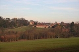
The Viking Way is a long distance footpath in England
running 147 miles (236.6 km) between the Humber Bridge
in North Lincolnshire
and Oakham
in Rutland
. The Countryside Commission
recognised the significance of the Viking Way as a high quality long distance walk linking other major routes in Eastern England, these being the Yorkshire Wolds Way
at the northern end, the Hereward
and Macmillan Way
from Oakham
and indirectly via the Hereward Way
, the Jurassic Way
from Stamford
and the southern end of the Peddars Way
from Thetford
. The route almost entirely forms part of European path E2. Many pre-historic settlements were established on dry ground in the Lincolnshire Wolds
and on the Limestone Heath. Sites of early settlements will be passed on the route. From the 9th century there is evidence that the Vikings were exercising their influence over the county. This is evident in the place names (ending in “by”), Scandinavia
n names recorded in documents and also names marked on coins. Significant parts of the Viking Way are classified as Byway Open to All Traffic (BOAT)
and are used as vehicular rights of way.
Valley over the M180
at the A15 roundabout. It follows the Lincolnshire Wolds
over the AONB through Caistor
and Horncastle, where it follows the River Bain
into Woodhall Spa
. It heads north-west through Stixwould
, Southrey
, Bardney
, Stainfield
, before reaching Fiskerton
where it follows the south side of the River Witham
towards Lincoln
due west. It used to run alongside the river on Waterside South and then down Canwick Road, but was diverted in around 2002 to take a detour near Washingborough
over the river.
From here it crosses the Lincoln - Grimsby railway, then enters Lincoln on Crofton Road then skirts the south side of Lincoln County Hospital
then follows Lindum
Terrace and crosses the A15. It passes Pottergate and enters the grounds of Lincoln Cathedral
, passing the south side on Minster Yard. It heads down Steep Hill and follows the main shopping High Street of Lincoln, over the River Witham and crossing the railway at a level crossing. It follows Tentercroft Street then along Sincil Bank towards the football ground
. It heads along Scorer Street towards South Park, and meets the old route on Canwick Road (B1188). It then runs along the southern edge of the South Common, which also forms the boundary between the borough of Lincoln and North Kesteven
and crosses the A15 on the North Kesteven boundary.
It runs parallel to the A607 to the west of Bracebridge Heath
and through Waddington, Harmston
, Coleby
, Boothby Graffoe
, Navenby
and Wellingore
along the Lincoln Cliff, then follows the old Ermine Street
, crossing the A607. Near High Dyke Farm, just north of the A17 it meets the boundary of South Kesteven
and North Kesteven. At Byard's Leap it crosses the A17 and follows the B6403 towards Ancaster
along the South Kesteven boundary (which continues to just outside Ancaster). It heads west and enters South Kesteven. It meets the A607 again at Carlton Scroop
, then crosses the River Witham and passes through Marston
and Long Bennington
. It was extended to Long Bennington in 1997 to allow walkers to cross the A1 on a roadbridge, as previously they were obliged to cross the road directly, near Foston
. It no longer goes through Allington
, and crosses the A52
near Sedgebrook and a level crossing over the Nottingham to Grantham Line
. It then follows what used to be called Sewstern Lane and meets the Lincolnshire - Leicestershire
boundary near Harston
which it follows and crosses the A607.
It passes Saltby
Airfield and Buckminster
, then goes through Sewstern
where it enters Leicestershire and the borough of Melton. It rejoins the Lincolnshire boundary near to the source of the River Witham then enters Rutland
and Thistleton
. It passes alarmingly close to RAF Cottesmore
and goes through Greetham
and Exton
. It meets the A606 and Hereward Way at Whitwell
, then passes through the two watersports centres on Rutland Water
at Whitwell and Barnsdale. From here it follows the A606 into Oakham.
Google Maps route map
Bing route map
Wikiloc route map
Every Trail route map
Trailzilla route map
Route You route map
Trimble Outdoors route map
Viewranger route map
GPS eXchange Format
Memory Map route map
England
England is a country that is part of the United Kingdom. It shares land borders with Scotland to the north and Wales to the west; the Irish Sea is to the north west, the Celtic Sea to the south west, with the North Sea to the east and the English Channel to the south separating it from continental...
running 147 miles (236.6 km) between the Humber Bridge
Humber Bridge
The Humber Bridge, near Kingston upon Hull, England, is a 2,220 m single-span suspension bridge, which opened to traffic on 24 June 1981. It is the fifth-largest of its type in the world...
in North Lincolnshire
North Lincolnshire
North Lincolnshire is a unitary authority area in the region of Yorkshire and the Humber in England. For ceremonial purposes it is part of Lincolnshire....
and Oakham
Oakham
-Oakham's horseshoes:Traditionally, members of royalty and peers of the realm who visited or passed through the town had to pay a forfeit in the form of a horseshoe...
in Rutland
Rutland
Rutland is a landlocked county in central England, bounded on the west and north by Leicestershire, northeast by Lincolnshire and southeast by Peterborough and Northamptonshire....
. The Countryside Commission
Countryside Commission
The Countryside Commission was a statutory body in England and Wales, and later in England only...
recognised the significance of the Viking Way as a high quality long distance walk linking other major routes in Eastern England, these being the Yorkshire Wolds Way
Yorkshire Wolds Way
The Yorkshire Wolds Way is a National Trail in Yorkshire, England. It runs 79 miles from Hessle to Filey, around the Yorkshire Wolds...
at the northern end, the Hereward
Hereward Way
Hereward Way is a long-distance footpath in England.The path takes its name from Hereward the Wake, the 11th century leader who fought against William the Conqueror, who had his base on the Isle of Ely that is located near to the middle of the path....
and Macmillan Way
Macmillan Way
The Macmillan Way is a long-distance footpath in England that links Boston, Lincolnshire to Abbotsbury in Dorset. The route's distance is . It is promoted to raise money for the charity Macmillan Cancer Relief....
from Oakham
Oakham
-Oakham's horseshoes:Traditionally, members of royalty and peers of the realm who visited or passed through the town had to pay a forfeit in the form of a horseshoe...
and indirectly via the Hereward Way
Hereward Way
Hereward Way is a long-distance footpath in England.The path takes its name from Hereward the Wake, the 11th century leader who fought against William the Conqueror, who had his base on the Isle of Ely that is located near to the middle of the path....
, the Jurassic Way
Jurassic Way
The Jurassic Way is a designated and signed long-distance footpath that connects the Oxfordshire town of Banbury with the Lincolnshire town of Stamford in England...
from Stamford
Stamford, Lincolnshire
Stamford is a town and civil parish within the South Kesteven district of the county of Lincolnshire, England. It is approximately to the north of London, on the east side of the A1 road to York and Edinburgh and on the River Welland...
and the southern end of the Peddars Way
Peddars Way
The Peddars Way is a long distance footpath in Norfolk, England. It is 46 miles long and follows the route of a Roman road. It has been suggested by more than one writer that it was not created by the Romans but was an ancient trackway, a branch or extension of the Icknield Way, used and...
from Thetford
Thetford
Thetford is a market town and civil parish in the Breckland district of Norfolk, England. It is on the A11 road between Norwich and London, just south of Thetford Forest. The civil parish, covering an area of , has a population of 21,588.-History:...
. The route almost entirely forms part of European path E2. Many pre-historic settlements were established on dry ground in the Lincolnshire Wolds
Lincolnshire Wolds
The Lincolnshire Wolds is a range of hills in the county of Lincolnshire, England. It is a designated Area of Outstanding Natural Beauty , and the highest area of land in eastern England between Yorkshire and Kent...
and on the Limestone Heath. Sites of early settlements will be passed on the route. From the 9th century there is evidence that the Vikings were exercising their influence over the county. This is evident in the place names (ending in “by”), Scandinavia
Scandinavia
Scandinavia is a cultural, historical and ethno-linguistic region in northern Europe that includes the three kingdoms of Denmark, Norway and Sweden, characterized by their common ethno-cultural heritage and language. Modern Norway and Sweden proper are situated on the Scandinavian Peninsula,...
n names recorded in documents and also names marked on coins. Significant parts of the Viking Way are classified as Byway Open to All Traffic (BOAT)
Byway (road)
A byway in the United Kingdom is a minor secondary or tertiary road. In 2000 the legal term 'restricted byway' was introduced to cover roads on which it is possible to travel by any mode but not using 'mechanically propelled vehicles'.-Byway Open to All Traffic :In England & Wales, a Byway Open to...
and are used as vehicular rights of way.
Route
The walk passes under the Humber Bridge, then follows the escarpment of the AncholmeRiver Ancholme
The River Ancholme is a river in North Lincolnshire, England, and a tributary of the Humber estuary.It rises south of Bishopbridge and passes through many Lincolnshire villages and the market town of Brigg before flowing north into the Humber at South Ferriby.North of Bishopbridge, where the River...
Valley over the M180
M180 motorway
The M180 motorway is a short but major motorway in England from junction 5 on the M18 motorway in the Metropolitan Borough of Doncaster to a point close to Humberside Airport some from the ports of Immingham and Grimsby and the east coast and provides access for major routes to Cleethorpes,...
at the A15 roundabout. It follows the Lincolnshire Wolds
Lincolnshire Wolds
The Lincolnshire Wolds is a range of hills in the county of Lincolnshire, England. It is a designated Area of Outstanding Natural Beauty , and the highest area of land in eastern England between Yorkshire and Kent...
over the AONB through Caistor
Caistor
See Caistor St Edmund for the Roman settlement in Norfolk or Caister-on-Sea for the town in NorfolkCaistor is a town and civil parish situated in the West Lindsey district of Lincolnshire, England. As its name implies, it was originally a Roman castrum or fortress...
and Horncastle, where it follows the River Bain
River Bain
The River Bain is a river in Lincolnshire, England, and a tributary of the River Witham.The Bain rises in the Lincolnshire Wolds at Ludford, a village on The Viking Way long-distance footpath, and flows through or past the villages of Burgh on Bain, Biscathorpe, Donington on Bain, Goulceby with...
into Woodhall Spa
Woodhall Spa
Woodhall Spa is a civil parish and village in the East Lindsey district of Lincolnshire, England within a wooded area on the Southern edge of the Lincolnshire Wolds, about south-west of Horncastle and about east-south-east of Lincoln...
. It heads north-west through Stixwould
Stixwould
Stixwould is a small village in the civil parish of Stixwould and Woodhall in the East Lindsey district of Lincolnshire, England, near the large village of Woodhall Spa....
, Southrey
Southrey
Southrey is a village in the civil parish of Bardney in the West Lindsey district of Lincolnshire, England, about south east of Bardney.In the 1086 Domesday Book Southrey was listed as "Sutrei" and consisted of eleven households....
, Bardney
Bardney
Bardney is a village and Civil Parish east of Lincoln, sitting on the north side of the River Witham in the West Lindsey district of Lincolnshire, England.-The village:...
, Stainfield
Stainfield
Stainfield is a village and civil parish about east of the city of Lincoln, in the West Lindsey district of Lincolnshire, England.-St Andrews Church:...
, before reaching Fiskerton
Fiskerton, Lincolnshire
Fiskerton is a small commuter village within the West Lindsey district of Lincolnshire, England, located approximately east of the city of Lincoln and on the north side of the River Witham.-History:...
where it follows the south side of the River Witham
River Witham
The River Witham is a river, almost entirely in the county of Lincolnshire, in the east of England. It rises south of Grantham close to South Witham, at SK8818, passes Lincoln at SK9771 and at Boston, TF3244, flows into The Haven, a tidal arm of The Wash, near RSPB Frampton Marsh...
towards Lincoln
Lincoln, Lincolnshire
Lincoln is a cathedral city and county town of Lincolnshire, England.The non-metropolitan district of Lincoln has a population of 85,595; the 2001 census gave the entire area of Lincoln a population of 120,779....
due west. It used to run alongside the river on Waterside South and then down Canwick Road, but was diverted in around 2002 to take a detour near Washingborough
Washingborough
Washingborough is a large village east of the city of Lincoln in North Kesteven, located on the lower slopes of the limestone escarpment known as the Lincoln Cliff where the River Witham breaks through the Lincoln Edge.-Geography:...
over the river.
From here it crosses the Lincoln - Grimsby railway, then enters Lincoln on Crofton Road then skirts the south side of Lincoln County Hospital
Lincoln County Hospital
Lincoln County Hospital is a large district general hospital on the eastern edge of north-east Lincoln. It is not in the most accessible part of the city, via road. It is the largest hospital, and offers the most comprehensive services, in Lincolnshire....
then follows Lindum
Lindum Colonia
Lindum Colonia was a town in the Roman province of Britannia. Today it is called Lincoln, in the English county of Lincolnshire.-Fort and name:...
Terrace and crosses the A15. It passes Pottergate and enters the grounds of Lincoln Cathedral
Lincoln Cathedral
Lincoln Cathedral is a historic Anglican cathedral in Lincoln in England and seat of the Bishop of Lincoln in the Church of England. It was reputedly the tallest building in the world for 249 years . The central spire collapsed in 1549 and was not rebuilt...
, passing the south side on Minster Yard. It heads down Steep Hill and follows the main shopping High Street of Lincoln, over the River Witham and crossing the railway at a level crossing. It follows Tentercroft Street then along Sincil Bank towards the football ground
Sincil Bank
Sincil Bank is a football stadium in Lincoln, England and has been the home of Lincoln City since 1895. Previously, Lincoln City had played at the nearby John O'Gaunts ground since the club's 1884 inception. Sincil Bank has an overall capacity of 10,120 and is colloquially known to fans as "The...
. It heads along Scorer Street towards South Park, and meets the old route on Canwick Road (B1188). It then runs along the southern edge of the South Common, which also forms the boundary between the borough of Lincoln and North Kesteven
North Kesteven
North Kesteven is a local government district in the East Midlands. Just over north of London, it is east of Nottingham and south of Lincoln. North Kesteven is one of seven districts in Lincolnshire, England and is in the centre of the County...
and crosses the A15 on the North Kesteven boundary.
It runs parallel to the A607 to the west of Bracebridge Heath
Bracebridge Heath
Bracebridge Heath is a commuter village approximately south of Lincoln, Lincolnshire, England. It lies at the junction of two major roads the A15 to Sleaford and the A607 to Grantham, and was part of the Boothby Graffoe Wapentake...
and through Waddington, Harmston
Harmston
Harmston is a village and civil parish in the North Kesteven district of Lincolnshire, England. It lies just east off the A607. south of Lincoln...
, Coleby
Coleby, North Kesteven
Coleby is a village and civil parish in the North Kesteven district of Lincolnshire, England. It lies on the A607 approximately south of Lincoln....
, Boothby Graffoe
Boothby Graffoe
Boothby Graffoe is a village and civil parish in the North Kesteven district of Lincolnshire, England. It lies approximately 7 miles south of Lincoln, on A607 . It's population is approximately 400....
, Navenby
Navenby
Navenby is a village and civil parish in Lincolnshire, England. Lying south of Lincoln and north-northwest of Sleaford, Navenby has a population of 1,666 and is a dormitory village for Lincoln...
and Wellingore
Wellingore
Wellingore is a small rural village in Lincolnshire, approximately south of Lincoln, England on the A607 in the district of North Kesteven. It is just south of Navenby.-History:...
along the Lincoln Cliff, then follows the old Ermine Street
Ermine Street
Ermine Street is the name of a major Roman road in England that ran from London to Lincoln and York . The Old English name was 'Earninga Straete' , named after a tribe called the Earningas, who inhabited a district later known as Armingford Hundred, around Arrington, Cambridgeshire and Royston,...
, crossing the A607. Near High Dyke Farm, just north of the A17 it meets the boundary of South Kesteven
South Kesteven
South Kesteven is a local government district in Lincolnshire, England, forming part of the traditional Kesteven division of the county. It covers Grantham, Stamford, Bourne and Market Deeping.-History:...
and North Kesteven. At Byard's Leap it crosses the A17 and follows the B6403 towards Ancaster
Ancaster, Lincolnshire
Ancaster is a village in the South Kesteven district of Lincolnshire, England, on the site of the Roman town of "Causennae"Ancaster Hall at The University of Nottingham is named after the parish and the, now extinct, title of the Earl of Ancaster....
along the South Kesteven boundary (which continues to just outside Ancaster). It heads west and enters South Kesteven. It meets the A607 again at Carlton Scroop
Carlton Scroop
Carlton Scroop is a small village and civil parish in the South Kesteven district of Lincolnshire, England. It lies 6 miles north-east of Grantham, 4 miles east of Hougham, 2 miles east of Ancaster and 1 mile south of Normanton...
, then crosses the River Witham and passes through Marston
Marston, Lincolnshire
Marston is a village in Lincolnshire, England, just north of the A1 near Long Bennington.There is a church dedicated to St Mary, a Hall , a Fishery Marston is a village in Lincolnshire, England, just north of the A1 near Long Bennington.There is a church dedicated to St Mary, a Hall (Marston Hall),...
and Long Bennington
Long Bennington
Long Bennington is a village in South Kesteven, south Lincolnshire, England. It is equidistant from Newark-on-Trent and Grantham, and from the villages of Stubton and Orston. It has a population of 1,847.-Geography:...
. It was extended to Long Bennington in 1997 to allow walkers to cross the A1 on a roadbridge, as previously they were obliged to cross the road directly, near Foston
Foston, Lincolnshire
Foston is a small village and civil parish in the South Kesteven district of Lincolnshire, England. It is situated northwest of Grantham, just off the A1....
. It no longer goes through Allington
Allington, Lincolnshire
Allington is a village and civil parish in the South Kesteven district of Lincolnshire, England, five miles north-west of Grantham. At the time of the Norman conquest the name of the village was Adelinctune. The 2001 census gave a population of 728 for the parish.Allington Grade II listed Anglican...
, and crosses the A52
A52 road
The A52 is a major road in the East Midlands, England. It runs east from the junction with the A53 at Newcastle-under-Lyme near Stoke-on-Trent via Ashbourne, Derby, Stapleford, Nottingham, West Bridgford, Bingham, Grantham, Boston and Skegness before terminating on the east Lincolnshire coast at...
near Sedgebrook and a level crossing over the Nottingham to Grantham Line
Nottingham to Grantham Line
The Nottingham to Grantham Line is a branch line between the towns of Nottingham and Grantham in the East Midlands of England. It follows the A52.The following places are served by the line.* Nottingham* Netherfield* Radcliffe on Trent* Bingham...
. It then follows what used to be called Sewstern Lane and meets the Lincolnshire - Leicestershire
Leicestershire
Leicestershire is a landlocked county in the English Midlands. It takes its name from the heavily populated City of Leicester, traditionally its administrative centre, although the City of Leicester unitary authority is today administered separately from the rest of Leicestershire...
boundary near Harston
Harston, Leicestershire
Harston is a crossroads village in Leicestershire, England.Harston is near to the border with Lincolnshire; its nearest town being Grantham in that county.-Governance:...
which it follows and crosses the A607.
It passes Saltby
Saltby
Saltby is a village within the civil parish of Sproxton and Melton borough of Leicestershire, England. It lies close to the River Eye and the border with Lincolnshire.The village includes the former RAF Saltby....
Airfield and Buckminster
Buckminster
Buckminster is a village and civil parish within the Melton district of Leicestershire, England. It is on the B676 road, between Melton Mowbray and the A1....
, then goes through Sewstern
Sewstern
Sewstern is a village in the Melton district of east Leicestershire.It lies just south of Buckminster, with which it shares a , situated between the two villages, and a parish council...
where it enters Leicestershire and the borough of Melton. It rejoins the Lincolnshire boundary near to the source of the River Witham then enters Rutland
Rutland
Rutland is a landlocked county in central England, bounded on the west and north by Leicestershire, northeast by Lincolnshire and southeast by Peterborough and Northamptonshire....
and Thistleton
Thistleton
Thistleton is the most northerly village in the county of Rutland in the East Midlands of England.The Thistleton area has shown evidence of Romano-British occupation including a large temple precinct and a possible small market settlement...
. It passes alarmingly close to RAF Cottesmore
RAF Cottesmore
RAF Cottesmore was a Royal Air Force station in Rutland, England, situated between Cottesmore and Market Overton. The station housed all the operational Harrier GR9 squadrons in the Royal Air Force, and No 122 Expeditionary Air Wing...
and goes through Greetham
Greetham, Rutland
Greetham is a village in the county of Rutland in the East Midlands of England.It on the B668 between the county town of Oakham and the A1 and on the north-south Viking Way long distance footpath running between the Humber Bridge and Oakham....
and Exton
Exton, Rutland
Exton is a village and civil parish in the county of Rutland in the East Midlands of England.The village includes a tree-planted green overlooked by the Fox & Hounds pub....
. It meets the A606 and Hereward Way at Whitwell
Whitwell, Rutland
Whitwell is a village in the county of Rutland in the East Midlands of England.It is located about four miles east of Oakham, on the north shore of Rutland Water. A pleasure boat known as the Rutland Belle operates from Whitwell Harbour. It is also a popular sailing and water sports...
, then passes through the two watersports centres on Rutland Water
Rutland Water
Rutland Water is Anglian Water's drinking water reservoir in the county of Rutland, England, just east of the county town Oakham. It was known as Empingham Reservoir during its construction and until its official opening in 1976. The centre of its dam is at British national grid reference...
at Whitwell and Barnsdale. From here it follows the A606 into Oakham.
Route Electronic Downloads
Google Earth route mapGoogle Maps route map
Bing route map
Wikiloc route map
Every Trail route map
Trailzilla route map
Route You route map
Trimble Outdoors route map
Viewranger route map
GPS eXchange Format
Memory Map route map
Ordnance Survey Maps
The Viking Way is shown on the following maps by Ordnance Survey:- Explorer maps 234, 247, 272, 273, 281, 282, 284
- Landranger maps 112, 113, 121, 122, 130, 141
See also
- Humber BridgeHumber BridgeThe Humber Bridge, near Kingston upon Hull, England, is a 2,220 m single-span suspension bridge, which opened to traffic on 24 June 1981. It is the fifth-largest of its type in the world...
- Lincolnshire WoldsLincolnshire WoldsThe Lincolnshire Wolds is a range of hills in the county of Lincolnshire, England. It is a designated Area of Outstanding Natural Beauty , and the highest area of land in eastern England between Yorkshire and Kent...
AONB - National Trails
- Long-distance footpaths in the UK
- European Walking Route E2