
North Kesteven
Encyclopedia
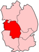
North Kesteven is a local government district
in the East Midlands. Just over 100 miles (160.9 km) north of London, it is east of Nottingham and south of Lincoln. North Kesteven is one of seven districts in Lincolnshire
, England
and is in the centre of the County. Its council, North Kesteven District Council, is based in Sleaford
in the former offices of Kesteven County Council.
The district was formed on 1 April 1974, under the Local Government Act 1972
. It was a merger of the previous urban district
of Sleaford
, along with East Kesteven Rural District
and North Kesteven Rural District
, all from the administrative county
of Kesteven
.
(along the Foss Dyke
and the River Witham
) and the city of Lincoln
to the north, East Lindsey
to the north-east (along the River Witham), Boston (borough)
to the east, South Holland
to the south-east, South Kesteven
to the south, and the county of Nottinghamshire
to the west.
North Kesteven covers an area of 356 square miles (922 km²), of which 94% is classified as green space, which includes agricultural land and open space.
The district is characterised by small settlements and large areas of arable farmland. More than 80% of the population live in rural settlements or a market town.
North Kesteven also has a relatively underdeveloped transport infrastructure. As a result, local communities have historically been self-reliant, with parish and town councils providing services, such as playing fields or play areas, which are frequently provided by district councils elsewhere.
The district has two main RAF bases - RAF Cranwell
, and RAF Waddington
, both situated close to the A15, the main road through the district. There is also RAF Digby
between Sleaford and Metheringham
. RAF Swinderby
closed in 1995.
North Kesteven's residents live in around 100 mainly small communities. Major concentrations are in Sleaford, with a population of over 17,000; North Hykeham, with around 13,500 residents; and 10 larger villages with populations of over 2,500. Within the district, 40% of the population live in the "Lincoln Fringe", the area immediately surrounding Lincoln City. 72 parishes serve the district communities, comprising 58 parish councils, two town councils and 12 parish meetings.
The population of the district is 104,800 equating to just over one person per hectare. The population grew by 11.5% between 2001 and 2007, making the district one of the top six fastest-growing districts in England and Wales. This rate of growth is a result of high house-building rates and consequent in-migration to the district from elsewhere in England, as opposed to natural population change.
The growth in population is projected to continue with an extra 14,000 homes expected from 2001 to 2026.
At the 2001 census, there were 94,024 citizens in the district. Of all districts in Lincolnshire, it contains the highest proportion of married people and the least number of divorced people. According to the Indices of deprivation 2007
, it is the least socially deprived area in Lincolnshire, with South Kesteven
, the next.
, Branston
and Welbourn
. The area around Sleaford
(including Ruskington
) has selective schools. In 2007, the district had the third best results in the county at GCSE. Other schools in the area include Kesteven and Sleaford High School
and Branston Community College
.
Non-metropolitan district
Non-metropolitan districts, or colloquially shire districts, are a type of local government district in England. As created, they are sub-divisions of non-metropolitan counties in a so-called "two-tier" arrangement...
in the East Midlands. Just over 100 miles (160.9 km) north of London, it is east of Nottingham and south of Lincoln. North Kesteven is one of seven districts in Lincolnshire
Lincolnshire
Lincolnshire is a county in the east of England. It borders Norfolk to the south east, Cambridgeshire to the south, Rutland to the south west, Leicestershire and Nottinghamshire to the west, South Yorkshire to the north west, and the East Riding of Yorkshire to the north. It also borders...
, England
England
England is a country that is part of the United Kingdom. It shares land borders with Scotland to the north and Wales to the west; the Irish Sea is to the north west, the Celtic Sea to the south west, with the North Sea to the east and the English Channel to the south separating it from continental...
and is in the centre of the County. Its council, North Kesteven District Council, is based in Sleaford
Sleaford
Sleaford is a town in the North Kesteven district of Lincolnshire, England. It is located thirteen miles northeast of Grantham, seventeen miles west of Boston, and nineteen miles south of Lincoln, and had a total resident population of around 14,500 in 6,167 households at the time...
in the former offices of Kesteven County Council.
History
It was originally planned to have the council offices in Bracebridge Hall on Newark Road in Lincoln, then the base of North Kesteven Rural District. In November 1973, a decision was taken to base it in The Hoplands in Sleaford, the base of East Kesteven Rural District. In January 1974 it was realised that this building was far too small for the size needed, and the 81 rooms of Kesteven County Council's headquarters on East Road in Sleaford would suit the new council instead. The Hoplands has now been demolished for housing.The district was formed on 1 April 1974, under the Local Government Act 1972
Local Government Act 1972
The Local Government Act 1972 is an Act of Parliament in the United Kingdom that reformed local government in England and Wales on 1 April 1974....
. It was a merger of the previous urban district
Urban district
In the England, Wales and Ireland, an urban district was a type of local government district that covered an urbanised area. Urban districts had an elected Urban District Council , which shared local government responsibilities with a county council....
of Sleaford
Sleaford
Sleaford is a town in the North Kesteven district of Lincolnshire, England. It is located thirteen miles northeast of Grantham, seventeen miles west of Boston, and nineteen miles south of Lincoln, and had a total resident population of around 14,500 in 6,167 households at the time...
, along with East Kesteven Rural District
East Kesteven Rural District
East Kesteven was a rural district in Lincolnshire, Parts of Kesteven from 1931 to 1974. It was formed under a County Review Order, by the merger of most of the Sleaford Rural District and the parish of Haceby from Grantham Rural District....
and North Kesteven Rural District
North Kesteven Rural District
North Kesteven was a rural district in Kesteven, Lincolnshire from 1931 to 1974.It was created in 1931 under a County Review Order, and was formed from the Branston Rural District, part of the Claypole Rural District and part of the Sleaford Rural District....
, all from the administrative county
Administrative counties of England
Administrative counties were a level of subnational division of England used for the purposes of local government from 1889 to 1974. They were created by the Local Government Act 1888 as the areas for which county councils were elected. Some large counties were divided into several administrative...
of Kesteven
Kesteven
The Parts of Kesteven are a traditional subdivision of Lincolnshire, England. This subdivision had long had a separate county administration , along with the other two parts, Lindsey and Holland.-Etymology:...
.
Geography
North Kesteven borders West LindseyWest Lindsey
West Lindsey is a local government district in Lincolnshire, England.-History:The district was formed on 1 April 1974, from the urban districts of Gainsborough, Market Rasen, along with Caistor Rural District, Gainsborough Rural District and Welton Rural District...
(along the Foss Dyke
Foss Dyke
The Foss Dyke, or Fossdyke, connects the River Trent at Torksey to Lincoln, the county town of Lincolnshire, and may be the oldest canal in England that is still in use. It is usually thought to have been built around 120 AD by the Romans, but there is no consensus among authors...
and the River Witham
River Witham
The River Witham is a river, almost entirely in the county of Lincolnshire, in the east of England. It rises south of Grantham close to South Witham, at SK8818, passes Lincoln at SK9771 and at Boston, TF3244, flows into The Haven, a tidal arm of The Wash, near RSPB Frampton Marsh...
) and the city of Lincoln
Lincoln, Lincolnshire
Lincoln is a cathedral city and county town of Lincolnshire, England.The non-metropolitan district of Lincoln has a population of 85,595; the 2001 census gave the entire area of Lincoln a population of 120,779....
to the north, East Lindsey
East Lindsey
East Lindsey is a local government district in Lincolnshire, England. The council is based in Manby near Louth, and other major settlements in the district include Alford, Spilsby, Mablethorpe, Skegness, Horncastle and Chapel St Leonards....
to the north-east (along the River Witham), Boston (borough)
Boston (borough)
Boston is a local government district with borough status in Lincolnshire, England. Its council is based in the town of Boston. It lies around N53°0'0" W0°0'0"....
to the east, South Holland
South Holland, Lincolnshire
South Holland is a local government district of Lincolnshire. The district council is based in Spalding.It was formed on 1 April 1974, under the Local Government Act 1972, as a merger of the Spalding urban district with East Elloe Rural District and Spalding Rural District...
to the south-east, South Kesteven
South Kesteven
South Kesteven is a local government district in Lincolnshire, England, forming part of the traditional Kesteven division of the county. It covers Grantham, Stamford, Bourne and Market Deeping.-History:...
to the south, and the county of Nottinghamshire
Nottinghamshire
Nottinghamshire is a county in the East Midlands of England, bordering South Yorkshire to the north-west, Lincolnshire to the east, Leicestershire to the south, and Derbyshire to the west...
to the west.
North Kesteven covers an area of 356 square miles (922 km²), of which 94% is classified as green space, which includes agricultural land and open space.
The district is characterised by small settlements and large areas of arable farmland. More than 80% of the population live in rural settlements or a market town.
North Kesteven also has a relatively underdeveloped transport infrastructure. As a result, local communities have historically been self-reliant, with parish and town councils providing services, such as playing fields or play areas, which are frequently provided by district councils elsewhere.
The district has two main RAF bases - RAF Cranwell
RAF Cranwell
RAF Cranwell is a Royal Air Force station in Lincolnshire close to the village of Cranwell, near Sleaford. It is currently commanded by Group Captain Dave Waddington...
, and RAF Waddington
RAF Waddington
RAF Waddington is a Royal Air Force station in Lincolnshire, England.-Formation:Waddington opened as a Royal Flying Corps flying training station in 1916 until 1920, when the station went into care and maintenance....
, both situated close to the A15, the main road through the district. There is also RAF Digby
RAF Digby
RAF Digby is a Royal Air Force station which, since March 2005, has been operated by the Ministry of Defence's Joint Service Signals Organisation, part of the Intelligence Collection Group. Formerly a training and fighter airfield, it is currently a tri-service military signals installation located...
between Sleaford and Metheringham
Metheringham
Metheringham is a medium sized village in Lincolnshire approximately ten miles south of the English city of Lincoln...
. RAF Swinderby
RAF Swinderby
RAF Swinderby was a Royal Air Force Bomber Command airfield opened in 1940, one of the last of the stations completed under the RAF's expansion plans started in the 1930s...
closed in 1995.
Demographics
The predominately rural nature of the district has encouraged people to move to tha area to take advantage of its quality of life, low crime rates, relatively low house prices, good-quality education and local heritage. This is reflected in research, which has shown 90% of residents are satisfied with their local area as a place to live and 82% of residents feel their area is a place where people from different backgrounds can get on well together.North Kesteven's residents live in around 100 mainly small communities. Major concentrations are in Sleaford, with a population of over 17,000; North Hykeham, with around 13,500 residents; and 10 larger villages with populations of over 2,500. Within the district, 40% of the population live in the "Lincoln Fringe", the area immediately surrounding Lincoln City. 72 parishes serve the district communities, comprising 58 parish councils, two town councils and 12 parish meetings.
The population of the district is 104,800 equating to just over one person per hectare. The population grew by 11.5% between 2001 and 2007, making the district one of the top six fastest-growing districts in England and Wales. This rate of growth is a result of high house-building rates and consequent in-migration to the district from elsewhere in England, as opposed to natural population change.
The growth in population is projected to continue with an extra 14,000 homes expected from 2001 to 2026.
At the 2001 census, there were 94,024 citizens in the district. Of all districts in Lincolnshire, it contains the highest proportion of married people and the least number of divorced people. According to the Indices of deprivation 2007
Indices of deprivation 2007
The Indices of deprivation 2007 is a Deprivation index at the small area level, created by the British Department for Communities and Local Government and released on June 12, 2007...
, it is the least socially deprived area in Lincolnshire, with South Kesteven
South Kesteven
South Kesteven is a local government district in Lincolnshire, England, forming part of the traditional Kesteven division of the county. It covers Grantham, Stamford, Bourne and Market Deeping.-History:...
, the next.
Education
The district has comprehensive schools in North HykehamNorth Hykeham
North Hykeham is administratively a town immediately south of Lincoln, in the county of Lincolnshire, England. Geographically it is part of the greater Lincoln urban sprawl, and comprises 4,915 dwellings...
, Branston
Branston, Lincolnshire
Branston is a large village in the North Kesteven district of Lincolnshire, England, approximately south-east of Lincoln.In the 2001 Census the population was recorded as 4019.-Geography:...
and Welbourn
Welbourn
Welbourn is a village in North Kesteven, central Lincolnshire on the A607 between Leadenham and Wellingore.-Village:The village church is St Chad's, part of the Loveden Deanery of the Diocese of Lincoln: the incumbent is the Revd Dr Alan Megahey....
. The area around Sleaford
Sleaford
Sleaford is a town in the North Kesteven district of Lincolnshire, England. It is located thirteen miles northeast of Grantham, seventeen miles west of Boston, and nineteen miles south of Lincoln, and had a total resident population of around 14,500 in 6,167 households at the time...
(including Ruskington
Ruskington
Ruskington is a large village in the English county of Lincolnshire, on the north-south B1188 road, just north of the A153. The village has approximately 2,200 dwellings, and from east to west is two kilometres long.-History:...
) has selective schools. In 2007, the district had the third best results in the county at GCSE. Other schools in the area include Kesteven and Sleaford High School
Kesteven and Sleaford High School
Kesteven and Sleaford High School is a grammar school for girls aged between eleven and eighteen, located on Jermyn Street in the small market town of Sleaford, Lincolnshire, England, close to Sleaford train station.-Awards:...
and Branston Community College
Branston Community College
Branston Community Academy, formerly known as Branston School and Community College, is a comprehensive school for 11-18 year old students on Station Road in Branston, Lincolnshire, England...
.