
South Holland, Lincolnshire
Encyclopedia
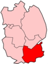
South Holland is a local government district
of Lincolnshire
. The district council is based in Spalding
.
It was formed on 1 April 1974, under the Local Government Act 1972
, as a merger of the Spalding urban district
with East Elloe Rural District
and Spalding Rural District
. All these were previously in the administrative county
of Holland
.
South Holland borders the borough of Boston
to the north, The Wash
and the county of Norfolk
to the east, the county of Cambridgeshire
and Peterborough
unitary authority to the south, the Lincolnshire district of South Kesteven
to the west, and the district of North Kesteven
to the north-west.
(St Helens
has the highest proportion of Christians in the UK at 86.9%). The district has the lowest unemployment in Lincolnshire and average hours worked per week are the second highest for UK districts (Eden, Cumbria
has the highest).
Non-metropolitan district
Non-metropolitan districts, or colloquially shire districts, are a type of local government district in England. As created, they are sub-divisions of non-metropolitan counties in a so-called "two-tier" arrangement...
of Lincolnshire
Lincolnshire
Lincolnshire is a county in the east of England. It borders Norfolk to the south east, Cambridgeshire to the south, Rutland to the south west, Leicestershire and Nottinghamshire to the west, South Yorkshire to the north west, and the East Riding of Yorkshire to the north. It also borders...
. The district council is based in Spalding
Spalding, Lincolnshire
Spalding is a market town with a population of 30,000 on the River Welland in the South Holland district of Lincolnshire, England. Little London is a hamlet directly south of Spalding on the B1172 road....
.
It was formed on 1 April 1974, under the Local Government Act 1972
Local Government Act 1972
The Local Government Act 1972 is an Act of Parliament in the United Kingdom that reformed local government in England and Wales on 1 April 1974....
, as a merger of the Spalding urban district
Urban district
In the England, Wales and Ireland, an urban district was a type of local government district that covered an urbanised area. Urban districts had an elected Urban District Council , which shared local government responsibilities with a county council....
with East Elloe Rural District
East Elloe Rural District
East Elloe was a rural district in Holland in Lincolnshire from 1894 to 1974.It was formed under the Local Government Act 1894 from the Holbeach rural sanitary district, and named after the historic Elloe hundred of Lincolnshire....
and Spalding Rural District
Spalding Rural District
Spalding was a rural district in Holland in Lincolnshire, England from 1894 to 1974.It was formed under the Local Government Act 1894 from the Spalding rural sanitary district...
. All these were previously in the administrative county
Administrative counties of England
Administrative counties were a level of subnational division of England used for the purposes of local government from 1889 to 1974. They were created by the Local Government Act 1888 as the areas for which county councils were elected. Some large counties were divided into several administrative...
of Holland
Holland, Lincolnshire
Holland is an area of south-east Lincolnshire, England. The name is still recognised locally and survives in the district of South Holland.-Administration:...
.
South Holland borders the borough of Boston
Boston (borough)
Boston is a local government district with borough status in Lincolnshire, England. Its council is based in the town of Boston. It lies around N53°0'0" W0°0'0"....
to the north, The Wash
The Wash
The Wash is the square-mouthed bay and estuary on the northwest margin of East Anglia on the east coast of England, where Norfolk meets Lincolnshire. It is among the largest estuaries in the United Kingdom...
and the county of Norfolk
Norfolk
Norfolk is a low-lying county in the East of England. It has borders with Lincolnshire to the west, Cambridgeshire to the west and southwest and Suffolk to the south. Its northern and eastern boundaries are the North Sea coast and to the north-west the county is bordered by The Wash. The county...
to the east, the county of Cambridgeshire
Cambridgeshire
Cambridgeshire is a county in England, bordering Lincolnshire to the north, Norfolk to the northeast, Suffolk to the east, Essex and Hertfordshire to the south, and Bedfordshire and Northamptonshire to the west...
and Peterborough
Peterborough
Peterborough is a cathedral city and unitary authority area in the East of England, with an estimated population of in June 2007. For ceremonial purposes it is in the county of Cambridgeshire. Situated north of London, the city stands on the River Nene which flows into the North Sea...
unitary authority to the south, the Lincolnshire district of South Kesteven
South Kesteven
South Kesteven is a local government district in Lincolnshire, England, forming part of the traditional Kesteven division of the county. It covers Grantham, Stamford, Bourne and Market Deeping.-History:...
to the west, and the district of North Kesteven
North Kesteven
North Kesteven is a local government district in the East Midlands. Just over north of London, it is east of Nottingham and south of Lincoln. North Kesteven is one of seven districts in Lincolnshire, England and is in the centre of the County...
to the north-west.
Demographics
There were 76,512 citizens in the district at the 2001 census. The median age is nearly 43. 82.6% of people in the district claim to be of a Christian religion - the highest proportion for any district in the East MidlandsEast Midlands
The East Midlands is one of the regions of England, consisting of most of the eastern half of the traditional region of the Midlands. It encompasses the combined area of Nottinghamshire, Derbyshire, Leicestershire, Rutland, Northamptonshire and most of Lincolnshire...
(St Helens
Metropolitan Borough of St Helens
The Metropolitan Borough of St Helens is a metropolitan borough of Merseyside, in North West England. It is named after its largest town St Helens, and covers an area which includes the settlements of Newton-le-Willows, Earlestown, Haydock, Rainhill, Eccleston, Clock Face, Billinge and...
has the highest proportion of Christians in the UK at 86.9%). The district has the lowest unemployment in Lincolnshire and average hours worked per week are the second highest for UK districts (Eden, Cumbria
Eden, Cumbria
Eden is a local government district in Cumbria, England. Its council is based in Penrith. It is named after the River Eden which flows north through the district toward Carlisle....
has the highest).