
2009 Pacific hurricane season
Encyclopedia
The 2009 Pacific hurricane season was an active event in the annual cycle of tropical cyclone
formation, due to a moderate El Niño, unlike the 2009 Atlantic hurricane season
, which was relatively quiet. The season officially started on May 15 in the eastern Pacific, and on June 1 for the central Pacific, and officially ended on November 30, 2009. For the first time in ten years, no tropical depressions formed during the month of May. This inactivity continued into the early part of June and was the least active since 1994. The first named storm of the season did not develop until June 21, marking the latest start to a Pacific hurricane season in 40 years. However, the NHC
's tropical weather summary, released in early September, found that August 2009, with seven named storms, was one of the most active Augusts on record for the basin. This level of activity had rarely occurred, if at all, in the past 41 years, since 1968
, when the most active August on record for the eastern Pacific with eight named storms occurred. When Hurricane Rick reached Category 5 strength on October 17, 2009, it became the first Category 5 Eastern Pacific hurricane since Kenna
in 2002, and the second-strongest Pacific hurricane on record, behind 1997's Linda
.
On May 21, 2009, NOAA released their forecast for the 2009 Eastern Pacific and Central Pacific hurricane seasons. They predicted a below-normal level of activity in the Eastern Pacific, with 13 to 18 named storms, of which 6 to 10 were expected to become hurricanes, and 2 to 5 expected to become major hurricanes. The forecast was based on the dissipation of a La Niña
in April 2009. Sea surface temperatures were near normal around the equator makes the season a ENSO-neutral. Additionally, an El Niño was forecast to develop during the latter part of the season. Depending on the intensity of the El Niño, forecasters were unsure of whether or not it would have an effect on the overall activity in the basin. However, due to the low-activity cycle that began in 1995, the El Niño only brought the activity to a slightly above normal season.
The Central Pacific basin was also expected to be slightly below average, with three to five tropical cyclones expected to form or cross into the area. However, it was slightly more active than expected, the number of three to five was exceeded, as seven tropical cyclones moved into or formed in the Central Pacific.
 The 2009 eastern Pacific season was characterized as "near-normal", featuring 17 named storms, 7 hurricanes and 4 major hurricanes. The central Pacific experienced above-average activity with three additional storms forming west of 140°W and three more crossing over from the eastern Pacific. The overall number of storms contrasted to a relative lull in activity experienced over the previous decade. During the course of the year, large-scale factors such as an El Niño and two Madden–Julian oscillations greatly contributed to the changed pattern. The season's activity, east of 140°W, was reflected with a near-average cumulative accumulated cyclone energy
(ACE) rating of 100, roughly 94% of the 30-year median. ACE is, broadly speaking, a measure of the power of the hurricane multiplied by the length of time it existed, so storms that last a long time, as well as particularly strong hurricanes, have high ACEs. ACE is only calculated for full advisories on tropical systems at or exceeding 34 knots (39 mph, 63 km/h) or tropical storm strength.
The 2009 season started at a below-average pace, with only one named storm forming by the end of June. This marked the first time since 2000
that no tropical storms formed during the month of May; however, on average only one storm develops in the month every other year. The ten year span of May named storms marked the longest occurrence of this event. The first hurricane of the year, Hurricane Andres
, also became the first June hurricane since Hurricane Carlotta
in 2000. Below-average activity continued into July with four named storms forming. By the end of the month, season to date ACE values were roughly 37% of the long-term mean, the sixth lowest since reliable records began in 1971.
An abrupt shift in activity took place during August as seven named storms formed, three of which became major hurricanes. This marked the most storms to form in a single month since 1985
and the most in August since 1968
. Of these storms, Hurricane Jimena
became the first cyclone of the season to make landfall
, as well as the strongest storm to strike the west coast Baja California Sur
, alongside Hurricane Norbert
in 2008
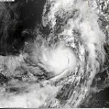
. Following the well-above average August, September experienced below-average activity with ACE reaching 70% of the long-term mean. The final month of activity featured the second-strongest storm on record in the eastern Pacific: Hurricane Rick
. A Category 5 storm, Rick attained winds of 180 mph (285 km/h) off the coast of Mexico
on October 18 before succumbing to increased wind shear
and dry air. ACE for the month was 59% above average, mostly attributed to Rick.
on June 18 roughly 405 mi (650 km) south-southwest of Mazatlán
and initially tracked slowly northwards. Throughout the day, convection
developed around the center of circulation
and the system was anticipated to become a tropical storm. Late on June 18, the National Hurricane Center
noted that the system was on the verge of becoming a tropical storm. However, the following day, strong wind shear
caused the depression to rapidly degenerate into a trough
of low pressure before dissipating off the coast of Sinaloa
.
Although no longer a tropical cyclone, the remnants of the depression brought moderate rainfall to parts of Sinaloa, Nayarit
and Jalisco
. High winds accompanied the rainfall and left about 50,000 residences without power. Several trees were downed and some structures sustained damage from fresh water flooding. Landslides occurred along major highways and significant structural damage was reported around Mazatlán. However, there was no loss of life or reports of injuries.
developed around the center of circulation
and by June 23, the storm attained hurricane-status, peaking with winds of 80 mph (130 km/h). Upon attaining this intensity, the storm featured a developing eyewall
within a central dense overcast. Within 36 hours, the storm rapidly degenerated, having most of the convection being displaced by high wind shear
, becoming a non-tropical trough
during the afternoon of June 24.
Prior to becoming a tropical depression, Andres produced heavy rainfall Oaxaca
and Honduras
, resulting in two deaths. Rough seas off the coast of Guerrero
resulted in one fatality. Inland, flooding caused by heavy rains killed two people and injured twenty. Several dozen structures were damaged and a few were destroyed. Following the storm, roughly 350 people were left homeless.
originating off the coast of Africa entered the eastern Pacific. Convection associated with the wave gradually consolidated around a low pressure system by July 4. Further organization took place over the next two days before the low was declared a tropical depression on July 6; upon classification, the depression was situated roughly 435 mi (700 km) south of Cabo San Lucas
, Mexico. Tracking west-northwest in response to a mid-level ridge, the depression quickly intensified into a tropical storm, at which time it was named Blanca. During the day, satellite imagery depicted an eye-like feature
; however, this did not develop further and was no longer present a few hours later. Early on July 7, Blanca attained peak winds of 50 mph (85 km/h) before succumbing to decreasing sea surface temperatures. Convection gradually diminished over the following days and the system degenerated into a remnant low by July 9. Remaining a well-defined system, the remnants continued northwestward before turning due north and dissipating on July 12 over the open waters of the Pacific.
southern tip of Baja California
became more concentrated around a developing low level centre. In the early hours of July 10, the system was designated as Tropical Depression Four-E, and the NHC commenced advisories. Around 2:00 p.m. PDT, the system strengthened into Tropical Storm Carlos. On July 11, Tropical Storm Carlos strengthened into a minimal Category 1 hurricane. It also developed a small eye feature, based on satellite presentation. However, by morning of July 12, the National Hurricane Center noted that the small eye-like feature had disappeared. Overnight on July 11 through the morning of July 12, the structure of Carlos became disorganized for unknown reasons. Deep convection contracted to a small region around the center of circulation and the overall size of the storm diminished. In the early afternoon hours, the continued degeneration of the system led to its downgrade to tropical storm status. Throughout the rest of the 12th and until mid-day on July 13, Carlos continued to weaken, but the weakening trend slightly abated, enough for Carlos to reintensify slightly, from 50 mph to 65 mph. The NHC that day predicted Carlos to either stay at 65 mph for the next three days or so, or to constantly fluctuate in intensity.
However, by July 14, a new eye wall developed and Carlos was given hurricane status again. It rapidly intensified to a peak of 105 mph (165 km/h). By the end of July 14, the eye had started to get less defined, and on July 15, the system began a weakening trend. On July 16, Carlos degenerated into a remnant low, and the final advisory was issued.
several hundred miles south of Acapulco, Mexico. Shower and thunderstorm activity associated with the system gradually increased over the next several days as it tracked west-northwestward. By July 15, the low became sufficiently organized and was declared a tropical depression roughly 695 mi (1,120 km) of Manzanillo, Colima
. Turning towards the northwest in response to a ridge
over Mexico, the depression intensified into Tropical Storm Dolores later that day. Despite southwesterly wind shear
displacing the center of Dolores from the deepest convection, the system continued to strengthen, attaining peak winds of 60 mph (95 km/h) on July 16. Shortly thereafter, convection associated with the storm dissipated, possibly due to entrainment of dry air. Later that day the system degenerated into a remnant low and gradually weakened. The remnants eventually dissipated on July 19 roughly 995 mi (1,600 km) west-southwest of Los Angeles, California
.
's area of responsibility. Later that day, it moved into the Central Pacific as a tropical depression, quickly strengthening into Tropical Storm Lana, the first Central Pacific storm since 2008's Kika
. Lana is one of four central Pacific tropical cyclones to form as a depression in the eastern Pacific but be named in the Central; the others are Lala, Iniki
, and Li. Lana was also the first tropical cyclone
to cross from the eastern north to central north Pacific since 2007's Flossie
. It also started to develop an eye feature, based on satellite imagery. But, southerly shear, introduced by a large upper-level trough, caused Lana to become slightly disorganized on July 31. Despite this, Lana reached its peak intensity of 65 mph early on August 1, and slowly weakened to become a very disorganized, yet still fairly strong tropical storm, maintaining maximum winds of 50 mph for the next couple of days. However, Lana weakened to a tropical depression late on August 2, while continuing to quickly become disorganized. Lana degenerated to a remnant low on August 3, roughly 580 miles southwest of Honolulu
, and 410 miles east of Johnston Island, with the CPHC issuing their last advisory at the same time. Lana's remnants lingered for the next day or so, until dissipating on August 4.
. The center of circulation was embedded within a central dense overcast and located within an area favoring further development. The depression tracked just north of due west in response to a mid-tropospheric ridge north of the system. Upon becoming a tropical cyclone, second area of low pressure, that would later become Hurricane Felicia
located nine degrees of longitude to the west, had the possibility to develop into a tropical depression and possibly influence the system. Late on August 3, the depression intensified to a tropical storm and was given the name Enrique. Enrique strengthened to reach a peak intensity of 65 mph on August 4. However, interaction with Hurricane Felicia weakened the system late that evening, with maximum winds decreasing to 50 mph. Enrique maintained winds of 50 mph for the next day or so, until early on August 6, when the NHC downgraded Enrique to depression status. On August 7, the NHC issued their final advisory on Enrique as the system degenerated into a remnant low.
on August 3, developing into Tropical Depression Eight-E the next day, shortly after Tropical Depression Seven-E formed directly to the east. It strengthened into a tropical storm and was named Felicia early on August 4. It rapidly strengthened that morning as an eyewall quickly developed, the rapid intensification being attributed to warm water along the forecast track, which allowed for more rapid intensification. Felicia continued to intensify and became a hurricane that afternoon. Rapid intensification continued into that evening, and the NHC upgraded Felicia to a Category 2 hurricane. It continued to rapidly strengthen, becoming the first major hurricane of the season on the morning of August 5, when the NHC upgraded it to a Category 3 hurricane. Later that day, Felicia rapidly intensified to a Category 4 hurricane, with maximum winds increasing to 145 mph (230 km/h), making it the strongest storm in the Eastern Pacific since Daniel
in 2006
. The NHC predicted that Felicia would rapidly weaken during the next couple of days starting on August 6, but it was also noted by the NHC that Felicia was displaying annular hurricane characteristics, which would allow for it to maintain intensity for longer than expected over marginal SSTS.
On August 8 it crossed into the Central Pacific basin, gradually weakening to a tropical storm and then a tropical depression as it approached the Hawaiian Islands. Tropical storm and flash flood watches were issued on August 7 for the Big Island of Hawaii
and Maui County
, and were extended to include Oahu
on August 9. The watches for the Big Island were later canceled as the track for Felicia appeared to turn toward the north. All watches were canceled at 11 a.m. HST August 11 as Felicia dissipated to a remnant low.
, as a result, the probability for regeneration was low. Nine-E's remnants dissipated on August 15, while located just within the central Pacific.
(CPHC) as an area of disturbed weather roughly 835 mi (1,345 km) south of Lihue, Hawaii. Situated over warm waters, estimated at 28 °C (82.4 °F) and within an area of low wind shear
, the system gradually intensified as it tracked northwestward in response to a subtropical
ridge
to the north. By August 11, convection
had consolidated around an area of low pressure
that formed within the system. Since further development was expected, a Tropical Cyclone Formation Alert
was issued. Shortly thereafter, the CPHC upgraded the low to a tropical depression, assigning it with the identifier One-C. Over the following 12 hours, further development took place, and the depression intensified into a tropical storm. Upon attaining this intensity, the storm was given the name Maka from the list of names for the Central Pacific basin. The next afternoon, the final advisory on Maka was issued as it weakened, degenerating into a remnant low, likely caused by unexpected shear. The remnants of Tropical Storm Maka crossed the international dateline and moved into the Western Pacific, regenerating into a tropical depression.
. The system developed a good series of banding features and convection, and as a result, in the afternoon later that day, it strengthened into a tropical storm, the seventh in the eastern Pacific that year. On August 14, it strengthened to become the fourth hurricane of the season, concurrent to the development of a good, banding type eye. That afternoon, Guillermo strengthened to a Category 2 hurricane with maximum winds increasing to 100 mph (155 km/h). Early on August 15, Guillermo intensified to become the second major hurricane of the season, as it was upgraded by the NHC to a Category 3 hurricane, with maximum winds increasing to 125 mph (205 km/h). On August 16 it crossed into the Central Pacific basin as a Category 1 hurricane, and then quickly weakened to a tropical storm thereafter due to very high wind shear. Despite over very strong as high as 45 mph of shear, Guillermo survived as a weak tropical storm for a further 3 days before weakening to a depression and dissipating on August 19 near the west coast.
Although Guillermo remained well away from land, large swells
produced by the system resulted in 6 to 8 ft (1.8 to 2.4 m) surf along the eastern coasts of the Hawaiian Islands between August 18 and 19.
and passed into the CPHC's area of responsibility. On August 26, Hilda quickly weakened to a depression after several small pulses of brief convection in the disorganized center, but these waned quickly when it weakened to depression status. Hilda also attempted, but failed, to reorganize its overall structure throughout the late 25th and most of the 26th. The system's structure continued to degrade, and finally, on August 28, the CPHC issued their final advisory on Hilda, as it had degenerated into a remnant low. The remnants of Hilda lingered for several days, until finally dissipating on the 31st.
in the Atlantic. The portion of the wave that would become Ignacio crossed Central America for three days, from August 16 to the 19th, and the next day, while the wave axis was located over the eastern Pacific, shower and thunderstorm activity began to increase, but associated convection remained minimal. Two days later, on the 22nd, the wave transformed into a broad area of low pressure, with convective activity organizing enough over the next couple of days to be classified as Tropical Depression Twelve-E on August 24 about 660 mi (1060 km) SW of the southern tip of the Baja California peninsula
. Though convection
within the rainband
located along the western semicircle of the system diminished somewhat, the system continued to become better organized, and became a tropical storm that evening, receiving the name Ignacio. Despite the upgrade, the storm was not well organized, with several smaller swirls rotating around a common cyclonic gyre. Ignacio weakened to a tropical depression on the morning of August 27 as it moved over sub-26°C SSTs
, the lowest tempuratrue nedded to matain a tropical cyclone and entered an environment of stable air. The system continued to weaken, and degenerated into an area of low pressure later that day.
, moving across Central America earlier in the week, and slowly developed off the west coast of Mexico, about 200 miles south of Acapulco
, until it organized into a tropical depression early in the morning of August 29. It soon strengthened to become Tropical Storm Jimena, and intensified rapidly to become a Category 2 hurricane later the same day as a pinhole eye developed. The next day it strengthened into a Category 3 hurricane, becoming the third major hurricane of season. Later that day, it continued to intensify and became a Category 4 hurricane. However, by the morning of August 31, the eye had become less defined, likely because of an eyewall replacement cycle. The NHC noted in their tropical weather discussion released at 8 p.m. PDT on the 31st that Jimena may have been a Category 5 earlier in the day; however, the intensity was not upgraded in the post-season analysis. As Jimena moved over cooler waters, and shear began to increase, it began to weaken starting on September 1, weakening below major hurricane status later that day. The storm soon made first landfall of the season as a weak Category 2 early the next day near Cabo San Lazaro, Mexico. Jimena then made second and final landfall as a weakening Category 1 later that day, near San Buenaventura, Mexico, also causing an unknown amount of damage there. Finally, around 0300 UTC on the 3rd, Jimena weakened to a tropical storm, but despite reemerging in the Gulf of California, Jimena continued to weaken. Early on September 4, the storm weakened to a tropical depression, while moving extremely slowly over the Gulf of California, and it degenerated into a remnant low later that day.
Owing to the storm's slow movement, torrential rains fell over much of Baja California Sur and Sinaloa, resulting in widespread flooding. In Guaymas
, a record 26.54 in (671.9 mm) of rain fell in association with Jimena. According to a report by Mexico's Centro Nacional de Prevención de Desastres, the magnitude of the event was analyzed to be a once in 2000 year occurrence. Thousands of homes were damaged or destroyed across Baja California and much of Puerto Lopez Mateos was leveled. Significant damage to infrastructure not only left people without water and power, it hampered relief efforts as many towns were isolated from surrounding areas. At least six people were killed and an estimated 72,000 were affected across the region. Total losses related to Hurricane Jimena reached 2.3 billion pesos
($173.9 million).
around (0300 UTC) on August 29. Early the next day, the depression crossed the International Date Line
and warning responsibility of the system was passed on to the Japan Meteorological Agency
.
. The system strengthened to Tropical Storm Kevin later that day, the seventh named storm in August, and the tenth tropical cyclone of the month overall. Kevin began to weaken early on August 30, and this trend continued for the next day or so, until early on the 31st, when Kevin weakened to a tropical depression. Kevin continued to degrade, and the NHC declared it dissipated on September 1, as it had weakened to a remnant low. It finally was absorbed into the ITCZ in the area of Central Pacific on September 8, seven days after it dissipated.
on September 7 several hundred miles west-southwest of the Baja California Peninsula
. Tracking generally towards the west, the storm steadily intensified within a region only slightly favorable for intensification. By September 9, Linda turned northward in response to a weakening subtropical
ridge
to its north and a new ridge forming to the east. Early on September 10, the cyclone attained its peak intensity with winds of 80 mph (130 km/h) and a barometric pressure of 985 mbar
(hPa
; 29.09 inHg) following the formation of an eye
close to the center of circulation. However, increasing wind shear displaced the center to the northeast of the low-level circulation. Linda began to weaken and deteriorated into a tropical storm early on September 11. Lacking deep convection, the storm degenerated into a remnant low pressure area later that day. The remnants of the former hurricane persisted for several more days, dissipating roughly 1,195 mi (1,925 km) east of the Hawaiian Islands
on September 15.
. Within a few hours it strengthened to become a tropical storm and receive the name Marty. Marty strengthened to reach peak intensity of 45 mph on September 17, but southwesterly shear caused by a mid-upper level trough and the entrainment of dry, stable air into the storm's circulation caused the system to begin weakening. Despite this, and reaching sub-26.5°C water temperatures, Marty managed to remain at tropical storm strength until 1800 UTC on the 18th, when it finally weakened back to depression strength. With all environmental factors against it, and almost completely devoid of any convection, on September 19, the NHC issued their last advisory on Marty as it had weakened into a remnant low. The remnants lingered until eventual complete dissipation on September 23.
. The disturbance slowly started to organize, strengthening into a tropical depression late on September 22 (September 23 in UTC time). On the early morning of September 23, the depression strengthened into a tropical storm and received the name Nora. On September 23, Tropical Storm Nora reached a peak intensity of 60 mph before starting to weaken back into a depression on September 24. Early on September 25, the NHC issued their last advisory on Nora as it weakened into a remnant low.
, cooler waters and shearing winds caused it to weaken to a tropical depression on October 3. Later that day, the NHC issued their last advisory on Olaf as it weakened into a remnant low.
In Baja California Sur, heavy rains from the remnants of Olaf resulted in flooding of low-lying areas in several municipalities, notably near the city of La Paz
. Officials in the affected regions also opened shelters if residents wanted to seek refuge away from their home. Heavy rains, amounting to 1.7 in (43.2 mm), fell across portions of Sonora hit hard by Hurricane Jimena a month earlier; however, no damage resulted from Olaf.
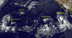
that traversed the Atlantic Ocean during September and was first classified as a tropical depression on October 11 several hundred miles south of the Baja California Peninsula
. The system quickly intensified into a tropical storm as it tracked in a general northward direction. By October 12, Patricia attained its peak intensity with winds of 60 mph (95 km/h) and a minimum barometric pressure of 996 mbar (hPa; 29.41 inHg). The following day, increasing wind shear
and unfavorable conditions caused the storm to rapidly weaken. By the morning of October 14, Patricia had degenerated into a remnant low near the southern coastline of Baja California Sur
. The remnants of the storm persisted until October 15, at which time they dissipated over open waters.
Although the center
of Patricia did not impact land, the outer bands
caused significant rainfall in portions of western Mexico. In Sonora
, up to 240 mm (9.4 in) of rain fell, leading to significant flooding that left 600 people homeless.
in 2002
east of 140°W.
Early on October 18, the storm attained its peak intensity with winds of 180 mph (285 km/h) and a barometric pressure of 906 mbar (hPa; 26.75 inHg). Not long after attaining this intensity, the combination of increasing wind shear and dry air caused the storm to rapidly weaken. By October 19, Rick weakened below Category 3 status and began to turn north, towards the Baja California Peninsula. Continued degradation of the structure led to the hurricane being downgraded to a tropical storm on October 20. By this time, the storm had become highly asymmetric, with most deep convection being displaced to the northeast. The following day, Rick made landfall near Mazatlán with winds of 60 mph (95 km/h). The storm rapidly degenerated as it moved over land, dissipating within 12 hours of landfall.
Prior to making landfall, the NHC initially forecasted Rick to make landfall in southern Baja California as a high-end Category 2 hurricane, prompting hurricane watches. Officials ordered several hundred residents to evacuate from low-lying areas, although tropical storm warnings replaced the hurricane watches after the storm had weakened. Overall, the damage from Rick was significantly less than what was initially anticipated. Throughout Mexico, three people were killed by the storm, one in Oaxaca and two in Baja California Sur. Total losses from the storm reached 192 million pesos
($14.6 million USD
).
south of Hawaii
. Moving northwestward, it slowly organized at first due to its large size. After reaching hurricane status on October 21, Neki intensified at a much faster rate and peaked with winds of 125 mph (205 km/h). It later turned to the north and north-northeast and weakened due to hostile conditions. While passing through the Papahānaumokuākea Marine National Monument, Neki was downgraded to a tropical storm after the center became exposed from the deepest convection. It caused little impact in the island chain. After stalling and executing a small loop, Neki resumed its northward track and dissipated on October 27.
and will be reused during 2015. The first Central Pacific name to be used was Lana, when it formed there on July 30. With the use of Maka on August 11, this season became the first in seven years to use multiple Central Pacific names.
For the central Pacific Ocean, four consecutive lists are used, with the names used sequentially until exhausted, rather than until the end of the year, due to the low number of storms each year.
Tropical cyclone
A tropical cyclone is a storm system characterized by a large low-pressure center and numerous thunderstorms that produce strong winds and heavy rain. Tropical cyclones strengthen when water evaporated from the ocean is released as the saturated air rises, resulting in condensation of water vapor...
formation, due to a moderate El Niño, unlike the 2009 Atlantic hurricane season
2009 Atlantic hurricane season
The 2009 Atlantic hurricane season was a below-average year, unlike the 2009 Pacific hurricane season, which was above average, both due to a moderate El Niño. During this year, nine tropical storms formed, the fewest since the 1997 season.An average season has ten tropical storms, six hurricanes...
, which was relatively quiet. The season officially started on May 15 in the eastern Pacific, and on June 1 for the central Pacific, and officially ended on November 30, 2009. For the first time in ten years, no tropical depressions formed during the month of May. This inactivity continued into the early part of June and was the least active since 1994. The first named storm of the season did not develop until June 21, marking the latest start to a Pacific hurricane season in 40 years. However, the NHC
National Hurricane Center
The National Hurricane Center , located at Florida International University in Miami, Florida, is the division of the National Weather Service responsible for tracking and predicting weather systems within the tropics between the Prime Meridian and the 140th meridian west poleward to the 30th...
's tropical weather summary, released in early September, found that August 2009, with seven named storms, was one of the most active Augusts on record for the basin. This level of activity had rarely occurred, if at all, in the past 41 years, since 1968
1968 Pacific hurricane season
The 1968 Pacific hurricane season ties the record for having the most active August in terms of tropical storms. It officially started on May 15, 1968 in the eastern Pacific and June 1 in the central Pacific and lasted until November 30, 1968...
, when the most active August on record for the eastern Pacific with eight named storms occurred. When Hurricane Rick reached Category 5 strength on October 17, 2009, it became the first Category 5 Eastern Pacific hurricane since Kenna
Hurricane Kenna
Hurricane Kenna was the second-most intense Pacific hurricane to strike the west coast of Mexico in recorded history. Kenna was the sixteenth tropical depression, thirteenth tropical storm, seventh hurricane, sixth major hurricane, and third Category 5 hurricane of the 2002 Pacific hurricane season...
in 2002, and the second-strongest Pacific hurricane on record, behind 1997's Linda
Hurricane Linda (1997)
Hurricane Linda was the strongest eastern Pacific hurricane on record. Forming from a tropical wave on September 9, 1997, Linda steadily intensified and reached hurricane status within 36 hours of developing. It rapidly intensified, reaching winds of and an estimated central pressure...
.
Seasonal forecasts
| Source | Date | b>Named storms |
b>Hurricanes | b>Major hurricanes |
| NOAA National Oceanic and Atmospheric Administration The National Oceanic and Atmospheric Administration , pronounced , like "noah", is a scientific agency within the United States Department of Commerce focused on the conditions of the oceans and the atmosphere... |
Average | 15.3 (3 – 5) |
8.8 ( – ) |
4.2 ( – ) |
| NOAA | 1995-2008 average | 14 | 7 | 3 |
| NOAA | May 21, 2009 | 13 – 18 (3 – 5) |
6 – 10 ( – ) |
2 – 5 ( – ) |
| Record high activity | 27 1992 Pacific hurricane season The 1992 Pacific hurricane season was the most active Pacific hurricane season on record. The most notable storm was Hurricane Iniki, which caused billions of dollars of damage to the Hawaiian Islands. Hurricanes Lester, Virgil, Winifred, and Orlene also made landfall and killed several people, but... |
16 1990 Pacific hurricane season The 1990 Pacific hurricane season is the fifth most active season on record. The 1990 season officially started on May 15 in the eastern Pacific, and on June 1 in the central Pacific, and lasted until November 30. These dates conventionally delimit the period of each year when most tropical... (Tie 1992 Pacific hurricane season The 1992 Pacific hurricane season was the most active Pacific hurricane season on record. The most notable storm was Hurricane Iniki, which caused billions of dollars of damage to the Hawaiian Islands. Hurricanes Lester, Virgil, Winifred, and Orlene also made landfall and killed several people, but... ) |
10 1992 Pacific hurricane season The 1992 Pacific hurricane season was the most active Pacific hurricane season on record. The most notable storm was Hurricane Iniki, which caused billions of dollars of damage to the Hawaiian Islands. Hurricanes Lester, Virgil, Winifred, and Orlene also made landfall and killed several people, but... |
|
| Record low activity | 8 1977 Pacific hurricane season The 1977 Pacific hurricane season was, at the time, the least active in recorded history. Only eight tropical storms formed, and four hurricanes; they would be tied and surpassed, respectively, by the 2010 Pacific hurricane season. There were no major hurricanes; the next time this happened would... (Tie 2010 Pacific hurricane season The 2010 Pacific hurricane season was the least active Pacific hurricane season, in terms of the number of named storms and hurricanes, on record, due to a moderate La Niña, unlike the 2010 Atlantic hurricane season, which was one of the most active on record... ) |
3 2010 Pacific hurricane season The 2010 Pacific hurricane season was the least active Pacific hurricane season, in terms of the number of named storms and hurricanes, on record, due to a moderate La Niña, unlike the 2010 Atlantic hurricane season, which was one of the most active on record... |
0 1977 Pacific hurricane season The 1977 Pacific hurricane season was, at the time, the least active in recorded history. Only eight tropical storms formed, and four hurricanes; they would be tied and surpassed, respectively, by the 2010 Pacific hurricane season. There were no major hurricanes; the next time this happened would... (Tie 2003 Pacific hurricane season The 2003 Pacific hurricane season produced an unusually large number of tropical cyclones which affected Mexico. The most notable cyclones the year were Hurricanes Ignacio and Marty, which killed 2 and 12 people in Mexico, respectively, and were collectively responsible for about... ) |
|
| –––––––––––––––––––––––––––––––––––––– | ||||
| Actual activity | 17 (6) |
7 (2) |
4 (1) |
|
On May 21, 2009, NOAA released their forecast for the 2009 Eastern Pacific and Central Pacific hurricane seasons. They predicted a below-normal level of activity in the Eastern Pacific, with 13 to 18 named storms, of which 6 to 10 were expected to become hurricanes, and 2 to 5 expected to become major hurricanes. The forecast was based on the dissipation of a La Niña
La Niña
La Niña is a coupled ocean-atmosphere phenomenon that is the counterpart of El Niño as part of the broader El Niño-Southern Oscillation climate pattern. During a period of La Niña, the sea surface temperature across the equatorial Eastern Central Pacific Ocean will be lower than normal by 3–5 °C...
in April 2009. Sea surface temperatures were near normal around the equator makes the season a ENSO-neutral. Additionally, an El Niño was forecast to develop during the latter part of the season. Depending on the intensity of the El Niño, forecasters were unsure of whether or not it would have an effect on the overall activity in the basin. However, due to the low-activity cycle that began in 1995, the El Niño only brought the activity to a slightly above normal season.
The Central Pacific basin was also expected to be slightly below average, with three to five tropical cyclones expected to form or cross into the area. However, it was slightly more active than expected, the number of three to five was exceeded, as seven tropical cyclones moved into or formed in the Central Pacific.
Season summary
Accumulated cyclone energy
Accumulated cyclone energy is a measure used by the National Oceanic and Atmospheric Administration to express the activity of individual tropical cyclones and entire tropical cyclone seasons, particularly the North Atlantic hurricane season. It uses an approximation of the energy used by a...
(ACE) rating of 100, roughly 94% of the 30-year median. ACE is, broadly speaking, a measure of the power of the hurricane multiplied by the length of time it existed, so storms that last a long time, as well as particularly strong hurricanes, have high ACEs. ACE is only calculated for full advisories on tropical systems at or exceeding 34 knots (39 mph, 63 km/h) or tropical storm strength.
The 2009 season started at a below-average pace, with only one named storm forming by the end of June. This marked the first time since 2000
2000 Pacific hurricane season
The 2000 Pacific hurricane season was an event in tropical cyclone meteorology. There were few notable storms this year. Tropical Storms Miriam, Norman, and Rosa all made landfall in Mexico with minimal impact. Hurricane Daniel briefly threatened the U.S. state of Hawaii while weakening...
that no tropical storms formed during the month of May; however, on average only one storm develops in the month every other year. The ten year span of May named storms marked the longest occurrence of this event. The first hurricane of the year, Hurricane Andres
Hurricane Andres (2009)
Hurricane Andres was the first named storm and hurricane of the 2009 Pacific hurricane season. Forming on June 21, Andres gradually intensified as it tracked along the Mexican coastline. Deep convection developed around the center of circulation and by June 23, the storm attained...
, also became the first June hurricane since Hurricane Carlotta
Hurricane Carlotta (2000)
Hurricane Carlotta was the most powerful hurricane of the 2000 Pacific hurricane season. The third tropical cyclone of the season, Carlotta developed from a tropical wave on June 18 about 270 miles southeast off the coast of Mexico...
in 2000. Below-average activity continued into July with four named storms forming. By the end of the month, season to date ACE values were roughly 37% of the long-term mean, the sixth lowest since reliable records began in 1971.
An abrupt shift in activity took place during August as seven named storms formed, three of which became major hurricanes. This marked the most storms to form in a single month since 1985
1985 Pacific hurricane season
The 1985 Pacific hurricane season was an event in tropical cyclone meteorology. It officially started on May 15, 1985 in the eastern Pacific, and on June 1, 1985 in the central Pacific, and lasted until November 30, 1985...
and the most in August since 1968
1968 Pacific hurricane season
The 1968 Pacific hurricane season ties the record for having the most active August in terms of tropical storms. It officially started on May 15, 1968 in the eastern Pacific and June 1 in the central Pacific and lasted until November 30, 1968...
. Of these storms, Hurricane Jimena
Hurricane Jimena (2009)
Hurricane Jimena was a Category 4 storm that is tied with Hurricane Norbert as the strongest tropical cyclone to make landfall on western Baja California. Forming from a tropical wave late on August 28, off Mexico's Pacific coast, the system rapidly intensified into a Category 2...
became the first cyclone of the season to make landfall
Landfall (meteorology)
Landfall is the event of a tropical cyclone or a waterspout coming onto land after being over water. When a waterspout makes landfall it is reclassified as a tornado, which can then cause damage inland...
, as well as the strongest storm to strike the west coast Baja California Sur
Baja California Sur
Baja California Sur , is one of the 31 states which, with the Federal District, comprise the 32 Federal Entities of Mexico. Before becoming a state on October 8, 1974, the area was known as the South Territory of Baja California. It has an area of , or 3.57% of the land mass of Mexico and comprises...
, alongside Hurricane Norbert
Hurricane Norbert (2008)
Hurricane Norbert was the strongest tropical cyclone in the below-average 2008 Pacific hurricane season. Norbert originated as a tropical wave, developed into a tropical depression on October 3, and into a tropical storm the next day. Norbert ultimately rapidly intensified to a major...
in 2008
2008 Pacific hurricane season
The 2008 Pacific hurricane season was an event in the annual cycle of tropical cyclone formation. It officially started May 15, 2008 in the eastern Pacific, started on June 1, 2008 in the central Pacific, and lasted until November 30, 2008....
. Following the well-above average August, September experienced below-average activity with ACE reaching 70% of the long-term mean. The final month of activity featured the second-strongest storm on record in the eastern Pacific: Hurricane Rick
Hurricane Rick (2009)
Hurricane Rick was the second-most intense Pacific hurricane on record and the strongest ever to form during October. Developing south of Mexico on October 15, 2009, Hurricane Rick traversed an area favoring rapid intensification, allowing it to become a hurricane within 24 hours of being...
. A Category 5 storm, Rick attained winds of 180 mph (285 km/h) off the coast of Mexico
Mexico
The United Mexican States , commonly known as Mexico , is a federal constitutional republic in North America. It is bordered on the north by the United States; on the south and west by the Pacific Ocean; on the southeast by Guatemala, Belize, and the Caribbean Sea; and on the east by the Gulf of...
on October 18 before succumbing to increased wind shear
Wind shear
Wind shear, sometimes referred to as windshear or wind gradient, is a difference in wind speed and direction over a relatively short distance in the atmosphere...
and dry air. ACE for the month was 59% above average, mostly attributed to Rick.
Tropical Depression One-E
The first system of season, One-E formed out of a tropical waveTropical wave
Tropical waves, easterly waves, or tropical easterly waves, also known as African easterly waves in the Atlantic region, are a type of atmospheric trough, an elongated area of relatively low air pressure, oriented north to south, which move from east to west across the tropics causing areas of...
on June 18 roughly 405 mi (650 km) south-southwest of Mazatlán
Mazatlán
Mazatlán is a city in the Mexican state of Sinaloa; the surrounding municipio for which the city serves as the municipal seat is Mazatlán Municipality. It is located at on the Pacific coast, across from the southernmost tip of the Baja California peninsula.Mazatlán is a Nahuatl word meaning...
and initially tracked slowly northwards. Throughout the day, convection
Atmospheric convection
Atmospheric convection is the result of a parcel-environment instability, or temperature difference, layer in the atmosphere. Different lapse rates within dry and moist air lead to instability. Mixing of air during the day which expands the height of the planetary boundary layer leads to...
developed around the center of circulation
Eye (cyclone)
The eye is a region of mostly calm weather found at the center of strong tropical cyclones. The eye of a storm is a roughly circular area and typically 30–65 km in diameter. It is surrounded by the eyewall, a ring of towering thunderstorms where the second most severe weather of a cyclone...
and the system was anticipated to become a tropical storm. Late on June 18, the National Hurricane Center
National Hurricane Center
The National Hurricane Center , located at Florida International University in Miami, Florida, is the division of the National Weather Service responsible for tracking and predicting weather systems within the tropics between the Prime Meridian and the 140th meridian west poleward to the 30th...
noted that the system was on the verge of becoming a tropical storm. However, the following day, strong wind shear
Wind shear
Wind shear, sometimes referred to as windshear or wind gradient, is a difference in wind speed and direction over a relatively short distance in the atmosphere...
caused the depression to rapidly degenerate into a trough
Trough (meteorology)
A trough is an elongated region of relatively low atmospheric pressure, often associated with fronts.Unlike fronts, there is not a universal symbol for a trough on a weather chart. The weather charts in some countries or regions mark troughs by a line. In the United States, a trough may be marked...
of low pressure before dissipating off the coast of Sinaloa
Sinaloa
Sinaloa officially Estado Libre y Soberano de Sinaloa is one of the 31 states which, with the Federal District, comprise the 32 Federal Entities of Mexico. It is divided in 18 municipalities and its capital city is Culiacán Rosales....
.
Although no longer a tropical cyclone, the remnants of the depression brought moderate rainfall to parts of Sinaloa, Nayarit
Nayarit
Nayarit officially Estado Libre y Soberano de Nayarit is one of the 31 states which, with the Federal District, comprise the 32 Federal Entities of Mexico. It is divided in 20 municipalities and its capital city is Tepic.It is located in Western Mexico...
and Jalisco
Jalisco
Jalisco officially Estado Libre y Soberano de Jalisco is one of the 31 states which, with the Federal District, comprise the 32 Federal Entities of Mexico. It is located in Western Mexico and divided in 125 municipalities and its capital city is Guadalajara.It is one of the more important states...
. High winds accompanied the rainfall and left about 50,000 residences without power. Several trees were downed and some structures sustained damage from fresh water flooding. Landslides occurred along major highways and significant structural damage was reported around Mazatlán. However, there was no loss of life or reports of injuries.
Hurricane Andres
Hurricane Andres formed on June 21 out of an area of disturbed weather associated with a shower and thunder storm that crossed Central America a few days earlier. Andres gradually intensified as it tracked along the Mexican coastline. Deep convectionAtmospheric convection
Atmospheric convection is the result of a parcel-environment instability, or temperature difference, layer in the atmosphere. Different lapse rates within dry and moist air lead to instability. Mixing of air during the day which expands the height of the planetary boundary layer leads to...
developed around the center of circulation
Eye (cyclone)
The eye is a region of mostly calm weather found at the center of strong tropical cyclones. The eye of a storm is a roughly circular area and typically 30–65 km in diameter. It is surrounded by the eyewall, a ring of towering thunderstorms where the second most severe weather of a cyclone...
and by June 23, the storm attained hurricane-status, peaking with winds of 80 mph (130 km/h). Upon attaining this intensity, the storm featured a developing eyewall
Eye (cyclone)
The eye is a region of mostly calm weather found at the center of strong tropical cyclones. The eye of a storm is a roughly circular area and typically 30–65 km in diameter. It is surrounded by the eyewall, a ring of towering thunderstorms where the second most severe weather of a cyclone...
within a central dense overcast. Within 36 hours, the storm rapidly degenerated, having most of the convection being displaced by high wind shear
Wind shear
Wind shear, sometimes referred to as windshear or wind gradient, is a difference in wind speed and direction over a relatively short distance in the atmosphere...
, becoming a non-tropical trough
Trough (meteorology)
A trough is an elongated region of relatively low atmospheric pressure, often associated with fronts.Unlike fronts, there is not a universal symbol for a trough on a weather chart. The weather charts in some countries or regions mark troughs by a line. In the United States, a trough may be marked...
during the afternoon of June 24.
Prior to becoming a tropical depression, Andres produced heavy rainfall Oaxaca
Oaxaca
Oaxaca , , officially Estado Libre y Soberano de Oaxaca is one of the 31 states which, along with the Federal District, comprise the 32 federative entities of Mexico. It is divided into 571 municipalities; of which 418 are governed by the system of customs and traditions...
and Honduras
Honduras
Honduras is a republic in Central America. It was previously known as Spanish Honduras to differentiate it from British Honduras, which became the modern-day state of Belize...
, resulting in two deaths. Rough seas off the coast of Guerrero
Guerrero
Guerrero officially Estado Libre y Soberano de Guerrero is one of the 31 states which, with the Federal District, comprise the 32 Federal Entities of Mexico. It is divided in 81 municipalities and its capital city is Chilpancingo....
resulted in one fatality. Inland, flooding caused by heavy rains killed two people and injured twenty. Several dozen structures were damaged and a few were destroyed. Following the storm, roughly 350 people were left homeless.
Tropical Storm Blanca
On June 29, a tropical waveTropical wave
Tropical waves, easterly waves, or tropical easterly waves, also known as African easterly waves in the Atlantic region, are a type of atmospheric trough, an elongated area of relatively low air pressure, oriented north to south, which move from east to west across the tropics causing areas of...
originating off the coast of Africa entered the eastern Pacific. Convection associated with the wave gradually consolidated around a low pressure system by July 4. Further organization took place over the next two days before the low was declared a tropical depression on July 6; upon classification, the depression was situated roughly 435 mi (700 km) south of Cabo San Lucas
Cabo San Lucas
Cabo San Lucas , commonly called Cabo, is a city at the southern tip of the Baja California peninsula, in the municipality of Los Cabos in the Mexican state of Baja California Sur. As of the 2010 census, the population was 68,463 people...
, Mexico. Tracking west-northwest in response to a mid-level ridge, the depression quickly intensified into a tropical storm, at which time it was named Blanca. During the day, satellite imagery depicted an eye-like feature
Eye (cyclone)
The eye is a region of mostly calm weather found at the center of strong tropical cyclones. The eye of a storm is a roughly circular area and typically 30–65 km in diameter. It is surrounded by the eyewall, a ring of towering thunderstorms where the second most severe weather of a cyclone...
; however, this did not develop further and was no longer present a few hours later. Early on July 7, Blanca attained peak winds of 50 mph (85 km/h) before succumbing to decreasing sea surface temperatures. Convection gradually diminished over the following days and the system degenerated into a remnant low by July 9. Remaining a well-defined system, the remnants continued northwestward before turning due north and dissipating on July 12 over the open waters of the Pacific.
Hurricane Carlos
On July 9, showers and thunderstorms associated with an area of disturbed weather located about 900 mi (1,448.4 km) south of thesouthern tip of Baja California
Baja California
Baja California officially Estado Libre y Soberano de Baja California is one of the 31 states which, with the Federal District, comprise the 32 Federal Entities of Mexico. It is both the northernmost and westernmost state of Mexico. Before becoming a state in 1953, the area was known as the North...
became more concentrated around a developing low level centre. In the early hours of July 10, the system was designated as Tropical Depression Four-E, and the NHC commenced advisories. Around 2:00 p.m. PDT, the system strengthened into Tropical Storm Carlos. On July 11, Tropical Storm Carlos strengthened into a minimal Category 1 hurricane. It also developed a small eye feature, based on satellite presentation. However, by morning of July 12, the National Hurricane Center noted that the small eye-like feature had disappeared. Overnight on July 11 through the morning of July 12, the structure of Carlos became disorganized for unknown reasons. Deep convection contracted to a small region around the center of circulation and the overall size of the storm diminished. In the early afternoon hours, the continued degeneration of the system led to its downgrade to tropical storm status. Throughout the rest of the 12th and until mid-day on July 13, Carlos continued to weaken, but the weakening trend slightly abated, enough for Carlos to reintensify slightly, from 50 mph to 65 mph. The NHC that day predicted Carlos to either stay at 65 mph for the next three days or so, or to constantly fluctuate in intensity.
However, by July 14, a new eye wall developed and Carlos was given hurricane status again. It rapidly intensified to a peak of 105 mph (165 km/h). By the end of July 14, the eye had started to get less defined, and on July 15, the system began a weakening trend. On July 16, Carlos degenerated into a remnant low, and the final advisory was issued.
Tropical Storm Dolores
On July 11, a broad area of low pressure developed within a tropical waveTropical wave
Tropical waves, easterly waves, or tropical easterly waves, also known as African easterly waves in the Atlantic region, are a type of atmospheric trough, an elongated area of relatively low air pressure, oriented north to south, which move from east to west across the tropics causing areas of...
several hundred miles south of Acapulco, Mexico. Shower and thunderstorm activity associated with the system gradually increased over the next several days as it tracked west-northwestward. By July 15, the low became sufficiently organized and was declared a tropical depression roughly 695 mi (1,120 km) of Manzanillo, Colima
Manzanillo, Colima
The name Manzanillo refers to the city as well as its surrounding municipality in the Mexican state of Colima. The city, located on the Pacific Ocean, contains Mexico's busiest port. Manzanillo was the third port created by the Spanish in the Pacific during the New Spain period...
. Turning towards the northwest in response to a ridge
Ridge (meteorology)
A ridge is an elongated region of relatively high atmospheric pressure, the opposite of a trough....
over Mexico, the depression intensified into Tropical Storm Dolores later that day. Despite southwesterly wind shear
Wind shear
Wind shear, sometimes referred to as windshear or wind gradient, is a difference in wind speed and direction over a relatively short distance in the atmosphere...
displacing the center of Dolores from the deepest convection, the system continued to strengthen, attaining peak winds of 60 mph (95 km/h) on July 16. Shortly thereafter, convection associated with the storm dissipated, possibly due to entrainment of dry air. Later that day the system degenerated into a remnant low and gradually weakened. The remnants eventually dissipated on July 19 roughly 995 mi (1,600 km) west-southwest of Los Angeles, California
Los Angeles, California
Los Angeles , with a population at the 2010 United States Census of 3,792,621, is the most populous city in California, USA and the second most populous in the United States, after New York City. It has an area of , and is located in Southern California...
.
Tropical Storm Lana
On July 30, the NHC began issuing advisories on Tropical Depression Six-E near the Central Pacific Hurricane CenterCentral Pacific Hurricane Center
The Central Pacific Hurricane Center of the United States National Weather Service is the official body responsible for tracking and issuing tropical cyclone warnings, watches, advisories, discussions, and statements for the Central North Pacific Basin...
's area of responsibility. Later that day, it moved into the Central Pacific as a tropical depression, quickly strengthening into Tropical Storm Lana, the first Central Pacific storm since 2008's Kika
Tropical Storm Kika (2008)
Tropical Storm Kika was the only tropical cyclone to form in the central Pacific basin in the 2008 Pacific hurricane season and the first to form in the basin since Hurricane Ioke in 2006. Kika developed out of a tropical wave which was first noted on August 5 while located 1,200 mi ...
. Lana is one of four central Pacific tropical cyclones to form as a depression in the eastern Pacific but be named in the Central; the others are Lala, Iniki
Hurricane Iniki
Hurricane Iniki was the most powerful hurricane to strike the U.S. state of Hawaii in recorded history. Forming on September 5 during the strong El Niño of 1991–1994, Iniki was one of eleven Central Pacific tropical cyclones during the 1992 season. It attained tropical storm status on...
, and Li. Lana was also the first tropical cyclone
Tropical cyclone
A tropical cyclone is a storm system characterized by a large low-pressure center and numerous thunderstorms that produce strong winds and heavy rain. Tropical cyclones strengthen when water evaporated from the ocean is released as the saturated air rises, resulting in condensation of water vapor...
to cross from the eastern north to central north Pacific since 2007's Flossie
Hurricane Flossie (2007)
Hurricane Flossie was a strong Category Four Hurricane which brushed the island of Hawaiʻi as it rapidly weakened to a tropical storm. Flossie was the ninth tropical cyclone and sixth named storm of the 2007 Pacific hurricane season. Flossie developed from an ill defined wave which formed off the...
. It also started to develop an eye feature, based on satellite imagery. But, southerly shear, introduced by a large upper-level trough, caused Lana to become slightly disorganized on July 31. Despite this, Lana reached its peak intensity of 65 mph early on August 1, and slowly weakened to become a very disorganized, yet still fairly strong tropical storm, maintaining maximum winds of 50 mph for the next couple of days. However, Lana weakened to a tropical depression late on August 2, while continuing to quickly become disorganized. Lana degenerated to a remnant low on August 3, roughly 580 miles southwest of Honolulu
Honolulu, Hawaii
Honolulu is the capital and the most populous city of the U.S. state of Hawaii. Honolulu is the southernmost major U.S. city. Although the name "Honolulu" refers to the urban area on the southeastern shore of the island of Oahu, the city and county government are consolidated as the City and...
, and 410 miles east of Johnston Island, with the CPHC issuing their last advisory at the same time. Lana's remnants lingered for the next day or so, until dissipating on August 4.
Tropical Storm Enrique
Tropical Storm Enrique developed out of a broad area of low pressure several hundred miles south-southwest of Baja California SurBaja California Sur
Baja California Sur , is one of the 31 states which, with the Federal District, comprise the 32 Federal Entities of Mexico. Before becoming a state on October 8, 1974, the area was known as the South Territory of Baja California. It has an area of , or 3.57% of the land mass of Mexico and comprises...
. The center of circulation was embedded within a central dense overcast and located within an area favoring further development. The depression tracked just north of due west in response to a mid-tropospheric ridge north of the system. Upon becoming a tropical cyclone, second area of low pressure, that would later become Hurricane Felicia
Hurricane Felicia (2009)
Hurricane Felicia was the third strongest tropical cyclone of the 2009 Pacific hurricane season, as well as the strongest storm to exist in the eastern Pacific at the time since Hurricane Daniel in 2006. Forming as a tropical depression on August 3, the storm supported strong thunderstorm...
located nine degrees of longitude to the west, had the possibility to develop into a tropical depression and possibly influence the system. Late on August 3, the depression intensified to a tropical storm and was given the name Enrique. Enrique strengthened to reach a peak intensity of 65 mph on August 4. However, interaction with Hurricane Felicia weakened the system late that evening, with maximum winds decreasing to 50 mph. Enrique maintained winds of 50 mph for the next day or so, until early on August 6, when the NHC downgraded Enrique to depression status. On August 7, the NHC issued their final advisory on Enrique as the system degenerated into a remnant low.
Hurricane Felicia
Hurricane Felicia developed out of a broad area of low pressure that formed several hundred miles southwest of Baja California SurBaja California Sur
Baja California Sur , is one of the 31 states which, with the Federal District, comprise the 32 Federal Entities of Mexico. Before becoming a state on October 8, 1974, the area was known as the South Territory of Baja California. It has an area of , or 3.57% of the land mass of Mexico and comprises...
on August 3, developing into Tropical Depression Eight-E the next day, shortly after Tropical Depression Seven-E formed directly to the east. It strengthened into a tropical storm and was named Felicia early on August 4. It rapidly strengthened that morning as an eyewall quickly developed, the rapid intensification being attributed to warm water along the forecast track, which allowed for more rapid intensification. Felicia continued to intensify and became a hurricane that afternoon. Rapid intensification continued into that evening, and the NHC upgraded Felicia to a Category 2 hurricane. It continued to rapidly strengthen, becoming the first major hurricane of the season on the morning of August 5, when the NHC upgraded it to a Category 3 hurricane. Later that day, Felicia rapidly intensified to a Category 4 hurricane, with maximum winds increasing to 145 mph (230 km/h), making it the strongest storm in the Eastern Pacific since Daniel
Hurricane Daniel (2006)
Hurricane Daniel was the second strongest hurricane of the 2006 Pacific hurricane season. The fourth named storm of the season, Daniel originated on July 16 from a tropical wave off the coast of Mexico. It tracked westward, intensifying steadily to reach peak winds of 150 mph on...
in 2006
2006 Pacific hurricane season
The 2006 Pacific hurricane season was the most active Pacific hurricane season since 2000 producing 19 tropical storms or hurricanes. Eighteen developed within the National Hurricane Center area of warning responsibility, which is east of 140ºW, and one storm formed between 140ºW and the...
. The NHC predicted that Felicia would rapidly weaken during the next couple of days starting on August 6, but it was also noted by the NHC that Felicia was displaying annular hurricane characteristics, which would allow for it to maintain intensity for longer than expected over marginal SSTS.
On August 8 it crossed into the Central Pacific basin, gradually weakening to a tropical storm and then a tropical depression as it approached the Hawaiian Islands. Tropical storm and flash flood watches were issued on August 7 for the Big Island of Hawaii
Hawaii (island)
The Island of Hawaii, also called the Big Island or Hawaii Island , is a volcanic island in the North Pacific Ocean...
and Maui County
Maui County, Hawaii
-National protected areas:* Haleakala National Park* Kakahaia National Wildlife Refuge* Kealia Pond National Wildlife Refuge- Demographics :As of the 2000 Census, there were 128,094 people, 43,507 households, and 29,889 families residing in the county. The population density was 110 people per...
, and were extended to include Oahu
Oahu
Oahu or Oahu , known as "The Gathering Place", is the third largest of the Hawaiian Islands and most populous of the islands in the U.S. state of Hawaii. The state capital Honolulu is located on the southeast coast...
on August 9. The watches for the Big Island were later canceled as the track for Felicia appeared to turn toward the north. All watches were canceled at 11 a.m. HST August 11 as Felicia dissipated to a remnant low.
Tropical Depression Nine-E
Tropical Depression Nine-E developed out of a small area of low pressure west-southwest of Baja California on August 9. Nine-E initially formed as a tropical wave that had entered the eastern Pacific on August 1, but was ill-defined, and difficult to trace. The NHC had initially forecast Nine-E to strengthen to a tropical storm by August 10, but moderate shear inhibited development, and the depression was no longer forecast to strengthen to a tropical storm, as the shear inhibited deep convection within the depression's circulation. Shear continually inhibited development until the end, when Nine-E degenerated to a remnant low on August 12. The next day, the NHC noted the possibility for regeneration of the system, although, by late on the 14th, the disturbance had weakened, and was becoming embedded in the ITCZIntertropical Convergence Zone
The Intertropical Convergence Zone , known by sailors as The Doldrums, is the area encircling the earth near the equator where winds originating in the northern and southern hemispheres come together....
, as a result, the probability for regeneration was low. Nine-E's remnants dissipated on August 15, while located just within the central Pacific.
Tropical Storm Maka
Tropical Storm Maka was first identified on August 8, 2010 by the Central Pacific Hurricane CenterCentral Pacific Hurricane Center
The Central Pacific Hurricane Center of the United States National Weather Service is the official body responsible for tracking and issuing tropical cyclone warnings, watches, advisories, discussions, and statements for the Central North Pacific Basin...
(CPHC) as an area of disturbed weather roughly 835 mi (1,345 km) south of Lihue, Hawaii. Situated over warm waters, estimated at 28 °C (82.4 °F) and within an area of low wind shear
Wind shear
Wind shear, sometimes referred to as windshear or wind gradient, is a difference in wind speed and direction over a relatively short distance in the atmosphere...
, the system gradually intensified as it tracked northwestward in response to a subtropical
Subtropical cyclone
A subtropical cyclone is a weather system that has some characteristics of a tropical and an extratropical cyclone. As early as the 1950s, meteorologists were unclear whether they should be characterized as tropical or extratropical cyclones. They were officially recognized by the National...
ridge
Ridge (meteorology)
A ridge is an elongated region of relatively high atmospheric pressure, the opposite of a trough....
to the north. By August 11, convection
Atmospheric convection
Atmospheric convection is the result of a parcel-environment instability, or temperature difference, layer in the atmosphere. Different lapse rates within dry and moist air lead to instability. Mixing of air during the day which expands the height of the planetary boundary layer leads to...
had consolidated around an area of low pressure
Low pressure area
A low-pressure area, or "low", is a region where the atmospheric pressure at sea level is below that of surrounding locations. Low-pressure systems form under areas of wind divergence which occur in upper levels of the troposphere. The formation process of a low-pressure area is known as...
that formed within the system. Since further development was expected, a Tropical Cyclone Formation Alert
Tropical Cyclone Formation Alert
A Tropical Cyclone Formation Alert is a bulletin released by the U.S. Navy-operated Joint Typhoon Warning Center in Honolulu, Hawaii or the Naval Maritime Forecast Center in Norfolk, Virginia, warning of the possibility of a tropical cyclone forming from a tropical disturbance that has been...
was issued. Shortly thereafter, the CPHC upgraded the low to a tropical depression, assigning it with the identifier One-C. Over the following 12 hours, further development took place, and the depression intensified into a tropical storm. Upon attaining this intensity, the storm was given the name Maka from the list of names for the Central Pacific basin. The next afternoon, the final advisory on Maka was issued as it weakened, degenerating into a remnant low, likely caused by unexpected shear. The remnants of Tropical Storm Maka crossed the international dateline and moved into the Western Pacific, regenerating into a tropical depression.
Hurricane Guillermo
Hurricane Guillermo formed on August 12 from a broad area of low pressure nearly 700 miles SW of Baja CaliforniaBaja California
Baja California officially Estado Libre y Soberano de Baja California is one of the 31 states which, with the Federal District, comprise the 32 Federal Entities of Mexico. It is both the northernmost and westernmost state of Mexico. Before becoming a state in 1953, the area was known as the North...
. The system developed a good series of banding features and convection, and as a result, in the afternoon later that day, it strengthened into a tropical storm, the seventh in the eastern Pacific that year. On August 14, it strengthened to become the fourth hurricane of the season, concurrent to the development of a good, banding type eye. That afternoon, Guillermo strengthened to a Category 2 hurricane with maximum winds increasing to 100 mph (155 km/h). Early on August 15, Guillermo intensified to become the second major hurricane of the season, as it was upgraded by the NHC to a Category 3 hurricane, with maximum winds increasing to 125 mph (205 km/h). On August 16 it crossed into the Central Pacific basin as a Category 1 hurricane, and then quickly weakened to a tropical storm thereafter due to very high wind shear. Despite over very strong as high as 45 mph of shear, Guillermo survived as a weak tropical storm for a further 3 days before weakening to a depression and dissipating on August 19 near the west coast.
Although Guillermo remained well away from land, large swells
Swell (ocean)
A swell, in the context of an ocean, sea or lake, is a series surface gravity waves that is not generated by the local wind. Swell waves often have a long wavelength but this varies with the size of the water body, e.g. rarely more than 150 m in the Mediterranean, and from event to event, with...
produced by the system resulted in 6 to 8 ft (1.8 to 2.4 m) surf along the eastern coasts of the Hawaiian Islands between August 18 and 19.
Tropical Storm Hilda
Tropical Depression Eleven-E formed toward the western edge of the eastern Pacific basin on August 22, and soon strengthened to become Tropical Storm Hilda. The next day it crossed the 140°W meridian140th meridian west
The meridian 140° west of Greenwich is a line of longitude that extends from the North Pole across the Arctic Ocean, North America, the Pacific Ocean, the Southern Ocean, and Antarctica to the South Pole....
and passed into the CPHC's area of responsibility. On August 26, Hilda quickly weakened to a depression after several small pulses of brief convection in the disorganized center, but these waned quickly when it weakened to depression status. Hilda also attempted, but failed, to reorganize its overall structure throughout the late 25th and most of the 26th. The system's structure continued to degrade, and finally, on August 28, the CPHC issued their final advisory on Hilda, as it had degenerated into a remnant low. The remnants of Hilda lingered for several days, until finally dissipating on the 31st.
Tropical Storm Ignacio
Ignacio formed as a portion of the same tropical wave that caused the formation of Tropical Storm AnaTropical Storm Ana (2009)
Tropical Storm Ana was the first named storm of the 2009 Atlantic hurricane season and the first tropical cyclone to impact the Caribbean islands during 2009. Forming out of an area of low pressure associated with a tropical wave on August 11, Ana briefly attained tropical storm intensity on...
in the Atlantic. The portion of the wave that would become Ignacio crossed Central America for three days, from August 16 to the 19th, and the next day, while the wave axis was located over the eastern Pacific, shower and thunderstorm activity began to increase, but associated convection remained minimal. Two days later, on the 22nd, the wave transformed into a broad area of low pressure, with convective activity organizing enough over the next couple of days to be classified as Tropical Depression Twelve-E on August 24 about 660 mi (1060 km) SW of the southern tip of the Baja California peninsula
Baja California Peninsula
The Baja California peninsula , is a peninsula in northwestern Mexico. Its land mass separates the Pacific Ocean from the Gulf of California. The Peninsula extends from Mexicali, Baja California in the north to Cabo San Lucas, Baja California Sur in the south.The total area of the Baja California...
. Though convection
Convection
Convection is the movement of molecules within fluids and rheids. It cannot take place in solids, since neither bulk current flows nor significant diffusion can take place in solids....
within the rainband
Rainband
A rainband is a cloud and precipitation structure associated with an area of rainfall which is significantly elongated. Rainbands can be stratiform or convective, and are generated by differences in temperature. When noted on weather radar imagery, this precipitation elongation is referred to as...
located along the western semicircle of the system diminished somewhat, the system continued to become better organized, and became a tropical storm that evening, receiving the name Ignacio. Despite the upgrade, the storm was not well organized, with several smaller swirls rotating around a common cyclonic gyre. Ignacio weakened to a tropical depression on the morning of August 27 as it moved over sub-26°C SSTs
Sea surface temperature
Sea surface temperature is the water temperature close to the oceans surface. The exact meaning of surface varies according to the measurement method used, but it is between and below the sea surface. Air masses in the Earth's atmosphere are highly modified by sea surface temperatures within a...
, the lowest tempuratrue nedded to matain a tropical cyclone and entered an environment of stable air. The system continued to weaken, and degenerated into an area of low pressure later that day.
Hurricane Jimena
Tropical Depression Thirteen-E formed out of an area of disturbed weather associated with a tropical wave that had formed in the western CaribbeanCaribbean Sea
The Caribbean Sea is a sea of the Atlantic Ocean located in the tropics of the Western hemisphere. It is bounded by Mexico and Central America to the west and southwest, to the north by the Greater Antilles, and to the east by the Lesser Antilles....
, moving across Central America earlier in the week, and slowly developed off the west coast of Mexico, about 200 miles south of Acapulco
Acapulco
Acapulco is a city, municipality and major sea port in the state of Guerrero on the Pacific coast of Mexico, southwest from Mexico City. Acapulco is located on a deep, semi-circular bay and has been a port since the early colonial period of Mexico’s history...
, until it organized into a tropical depression early in the morning of August 29. It soon strengthened to become Tropical Storm Jimena, and intensified rapidly to become a Category 2 hurricane later the same day as a pinhole eye developed. The next day it strengthened into a Category 3 hurricane, becoming the third major hurricane of season. Later that day, it continued to intensify and became a Category 4 hurricane. However, by the morning of August 31, the eye had become less defined, likely because of an eyewall replacement cycle. The NHC noted in their tropical weather discussion released at 8 p.m. PDT on the 31st that Jimena may have been a Category 5 earlier in the day; however, the intensity was not upgraded in the post-season analysis. As Jimena moved over cooler waters, and shear began to increase, it began to weaken starting on September 1, weakening below major hurricane status later that day. The storm soon made first landfall of the season as a weak Category 2 early the next day near Cabo San Lazaro, Mexico. Jimena then made second and final landfall as a weakening Category 1 later that day, near San Buenaventura, Mexico, also causing an unknown amount of damage there. Finally, around 0300 UTC on the 3rd, Jimena weakened to a tropical storm, but despite reemerging in the Gulf of California, Jimena continued to weaken. Early on September 4, the storm weakened to a tropical depression, while moving extremely slowly over the Gulf of California, and it degenerated into a remnant low later that day.
Owing to the storm's slow movement, torrential rains fell over much of Baja California Sur and Sinaloa, resulting in widespread flooding. In Guaymas
Guaymas
Guaymas is a city and municipality located in the southwest part of the state of Sonora in northwestern Mexico. The city is located 117 km south of the state capital of Hermosillo, and 242 miles from the U.S. border, and is the principal port for the state. The municipality is located in the...
, a record 26.54 in (671.9 mm) of rain fell in association with Jimena. According to a report by Mexico's Centro Nacional de Prevención de Desastres, the magnitude of the event was analyzed to be a once in 2000 year occurrence. Thousands of homes were damaged or destroyed across Baja California and much of Puerto Lopez Mateos was leveled. Significant damage to infrastructure not only left people without water and power, it hampered relief efforts as many towns were isolated from surrounding areas. At least six people were killed and an estimated 72,000 were affected across the region. Total losses related to Hurricane Jimena reached 2.3 billion pesos
Mexican peso
The peso is the currency of Mexico. Modern peso and dollar currencies have a common origin in the 15th–19th century Spanish dollar, most continuing to use its sign, "$". The Mexican peso is the 12th most traded currency in the world, the third most traded in the Americas, and by far the most...
($173.9 million).
Tropical Depression Two-C
Tropical Depression Two-C formed out of a small area of disturbed weather to the southwest of KauaiKauai
Kauai or Kauai, known as Tauai in the ancient Kaua'i dialect, is geologically the oldest of the main Hawaiian Islands. With an area of , it is the fourth largest of the main islands in the Hawaiian archipelago, and the 21st largest island in the United States. Known also as the "Garden Isle",...
around (0300 UTC) on August 29. Early the next day, the depression crossed the International Date Line
International Date Line
The International Date Line is a generally north-south imaginary line on the surface of the Earth, passing through the middle of the Pacific Ocean, that designates the place where each calendar day begins...
and warning responsibility of the system was passed on to the Japan Meteorological Agency
Japan Meteorological Agency
The or JMA, is the Japanese government's weather service. Charged with gathering and reporting weather data and forecasts in Japan, it is a semi-autonomous part of the Ministry of Land, Infrastructure and Transport...
.
Tropical Storm Kevin
Kevin formed from Tropical Depression Fourteen-E on August 29 from an area of disturbed weather 1000 miles southwest of Baja CaliforniaBaja California
Baja California officially Estado Libre y Soberano de Baja California is one of the 31 states which, with the Federal District, comprise the 32 Federal Entities of Mexico. It is both the northernmost and westernmost state of Mexico. Before becoming a state in 1953, the area was known as the North...
. The system strengthened to Tropical Storm Kevin later that day, the seventh named storm in August, and the tenth tropical cyclone of the month overall. Kevin began to weaken early on August 30, and this trend continued for the next day or so, until early on the 31st, when Kevin weakened to a tropical depression. Kevin continued to degrade, and the NHC declared it dissipated on September 1, as it had weakened to a remnant low. It finally was absorbed into the ITCZ in the area of Central Pacific on September 8, seven days after it dissipated.
Hurricane Linda
Hurricane Linda originated from a tropical waveTropical wave
Tropical waves, easterly waves, or tropical easterly waves, also known as African easterly waves in the Atlantic region, are a type of atmospheric trough, an elongated area of relatively low air pressure, oriented north to south, which move from east to west across the tropics causing areas of...
on September 7 several hundred miles west-southwest of the Baja California Peninsula
Baja California Peninsula
The Baja California peninsula , is a peninsula in northwestern Mexico. Its land mass separates the Pacific Ocean from the Gulf of California. The Peninsula extends from Mexicali, Baja California in the north to Cabo San Lucas, Baja California Sur in the south.The total area of the Baja California...
. Tracking generally towards the west, the storm steadily intensified within a region only slightly favorable for intensification. By September 9, Linda turned northward in response to a weakening subtropical
Subtropical cyclone
A subtropical cyclone is a weather system that has some characteristics of a tropical and an extratropical cyclone. As early as the 1950s, meteorologists were unclear whether they should be characterized as tropical or extratropical cyclones. They were officially recognized by the National...
ridge
Ridge (meteorology)
A ridge is an elongated region of relatively high atmospheric pressure, the opposite of a trough....
to its north and a new ridge forming to the east. Early on September 10, the cyclone attained its peak intensity with winds of 80 mph (130 km/h) and a barometric pressure of 985 mbar
Bar (unit)
The bar is a unit of pressure equal to 100 kilopascals, and roughly equal to the atmospheric pressure on Earth at sea level. Other units derived from the bar are the megabar , kilobar , decibar , centibar , and millibar...
(hPa
Pascal (unit)
The pascal is the SI derived unit of pressure, internal pressure, stress, Young's modulus and tensile strength, named after the French mathematician, physicist, inventor, writer, and philosopher Blaise Pascal. It is a measure of force per unit area, defined as one newton per square metre...
; 29.09 inHg) following the formation of an eye
Eye (cyclone)
The eye is a region of mostly calm weather found at the center of strong tropical cyclones. The eye of a storm is a roughly circular area and typically 30–65 km in diameter. It is surrounded by the eyewall, a ring of towering thunderstorms where the second most severe weather of a cyclone...
close to the center of circulation. However, increasing wind shear displaced the center to the northeast of the low-level circulation. Linda began to weaken and deteriorated into a tropical storm early on September 11. Lacking deep convection, the storm degenerated into a remnant low pressure area later that day. The remnants of the former hurricane persisted for several more days, dissipating roughly 1,195 mi (1,925 km) east of the Hawaiian Islands
Hawaiian Islands
The Hawaiian Islands are an archipelago of eight major islands, several atolls, numerous smaller islets, and undersea seamounts in the North Pacific Ocean, extending some 1,500 miles from the island of Hawaii in the south to northernmost Kure Atoll...
on September 15.
Tropical Storm Marty
Marty's origins can be found in a tropical wave that crossed the African coastline on August 28, with minimal convection during its entire journey across the Atlantic. The wave passed though the Lesser Antilles on September 5, entering the Caribbean that same day, and eventually crossed Central America and entered the eastern Pacific on the 10th. Convection was scattered and disorganized, but slowly organized until a broad area of low pressure formed along the wave axis, and soon formed into Tropical Depression Sixteen-E on September 16 from the low pressure area, while about 340 mi SSW of Cabo San LucasCabo San Lucas
Cabo San Lucas , commonly called Cabo, is a city at the southern tip of the Baja California peninsula, in the municipality of Los Cabos in the Mexican state of Baja California Sur. As of the 2010 census, the population was 68,463 people...
. Within a few hours it strengthened to become a tropical storm and receive the name Marty. Marty strengthened to reach peak intensity of 45 mph on September 17, but southwesterly shear caused by a mid-upper level trough and the entrainment of dry, stable air into the storm's circulation caused the system to begin weakening. Despite this, and reaching sub-26.5°C water temperatures, Marty managed to remain at tropical storm strength until 1800 UTC on the 18th, when it finally weakened back to depression strength. With all environmental factors against it, and almost completely devoid of any convection, on September 19, the NHC issued their last advisory on Marty as it had weakened into a remnant low. The remnants lingered until eventual complete dissipation on September 23.
Tropical Storm Nora
On September 21, a broad area of low pressure formed about 900 mi west-southwest of the southern tip of Baja CaliforniaBaja California
Baja California officially Estado Libre y Soberano de Baja California is one of the 31 states which, with the Federal District, comprise the 32 Federal Entities of Mexico. It is both the northernmost and westernmost state of Mexico. Before becoming a state in 1953, the area was known as the North...
. The disturbance slowly started to organize, strengthening into a tropical depression late on September 22 (September 23 in UTC time). On the early morning of September 23, the depression strengthened into a tropical storm and received the name Nora. On September 23, Tropical Storm Nora reached a peak intensity of 60 mph before starting to weaken back into a depression on September 24. Early on September 25, the NHC issued their last advisory on Nora as it weakened into a remnant low.
Tropical Storm Olaf
Tropical Depression Eighteen-E formed from a broad area of low pressure on October 1, and quickly strengthened to become Tropical Storm Olaf. However, as it moved north or northeast towards the Baja California peninsulaBaja California Peninsula
The Baja California peninsula , is a peninsula in northwestern Mexico. Its land mass separates the Pacific Ocean from the Gulf of California. The Peninsula extends from Mexicali, Baja California in the north to Cabo San Lucas, Baja California Sur in the south.The total area of the Baja California...
, cooler waters and shearing winds caused it to weaken to a tropical depression on October 3. Later that day, the NHC issued their last advisory on Olaf as it weakened into a remnant low.
In Baja California Sur, heavy rains from the remnants of Olaf resulted in flooding of low-lying areas in several municipalities, notably near the city of La Paz
La Paz, Baja California Sur
La Paz is the capital city of the Mexican state of Baja California Sur and an important regional commercial center. The city had a 2010 census population of 215,178 persons, but its metropolitan population is somewhat larger because of surrounding towns like el Centenario, el Zacatal and San Pedro...
. Officials in the affected regions also opened shelters if residents wanted to seek refuge away from their home. Heavy rains, amounting to 1.7 in (43.2 mm), fell across portions of Sonora hit hard by Hurricane Jimena a month earlier; however, no damage resulted from Olaf.
Tropical Storm Patricia
Patricia developed from a tropical waveTropical wave
Tropical waves, easterly waves, or tropical easterly waves, also known as African easterly waves in the Atlantic region, are a type of atmospheric trough, an elongated area of relatively low air pressure, oriented north to south, which move from east to west across the tropics causing areas of...
that traversed the Atlantic Ocean during September and was first classified as a tropical depression on October 11 several hundred miles south of the Baja California Peninsula
Baja California Peninsula
The Baja California peninsula , is a peninsula in northwestern Mexico. Its land mass separates the Pacific Ocean from the Gulf of California. The Peninsula extends from Mexicali, Baja California in the north to Cabo San Lucas, Baja California Sur in the south.The total area of the Baja California...
. The system quickly intensified into a tropical storm as it tracked in a general northward direction. By October 12, Patricia attained its peak intensity with winds of 60 mph (95 km/h) and a minimum barometric pressure of 996 mbar (hPa; 29.41 inHg). The following day, increasing wind shear
Wind shear
Wind shear, sometimes referred to as windshear or wind gradient, is a difference in wind speed and direction over a relatively short distance in the atmosphere...
and unfavorable conditions caused the storm to rapidly weaken. By the morning of October 14, Patricia had degenerated into a remnant low near the southern coastline of Baja California Sur
Baja California Sur
Baja California Sur , is one of the 31 states which, with the Federal District, comprise the 32 Federal Entities of Mexico. Before becoming a state on October 8, 1974, the area was known as the South Territory of Baja California. It has an area of , or 3.57% of the land mass of Mexico and comprises...
. The remnants of the storm persisted until October 15, at which time they dissipated over open waters.
Although the center
Atmospheric circulation
Atmospheric circulation is the large-scale movement of air, and the means by which thermal energy is distributed on the surface of the Earth....
of Patricia did not impact land, the outer bands
Rainband
A rainband is a cloud and precipitation structure associated with an area of rainfall which is significantly elongated. Rainbands can be stratiform or convective, and are generated by differences in temperature. When noted on weather radar imagery, this precipitation elongation is referred to as...
caused significant rainfall in portions of western Mexico. In Sonora
Sonora
Sonora officially Estado Libre y Soberano de Sonora is one of the 31 states which, with the Federal District, comprise the 32 Federal Entities of Mexico. It is divided into 72 municipalities; the capital city is Hermosillo....
, up to 240 mm (9.4 in) of rain fell, leading to significant flooding that left 600 people homeless.
Hurricane Rick
The second-strongest eastern Pacific hurricane on record, Hurricane Rick originated from a very strong tropical disturbance wave that developed into a tropical depression on October 15. Situated off the southern coast of Mexico, the depression tracked west-northwest in a region favoring explosive development. Shortly after being classified as Tropical Depression Twenty-E, the system intensified into Tropical Storm Rick. Roughly 18 hours later, Rick had become a Category 1 hurricane as it underwent rapid intensification. After a brief pause in this phase, the storm went through another period of intensification, reaching Category 5 status on October 17, becoming the first storm of this intensity since Hurricane KennaHurricane Kenna
Hurricane Kenna was the second-most intense Pacific hurricane to strike the west coast of Mexico in recorded history. Kenna was the sixteenth tropical depression, thirteenth tropical storm, seventh hurricane, sixth major hurricane, and third Category 5 hurricane of the 2002 Pacific hurricane season...
in 2002
2002 Pacific hurricane season
The 2002 Pacific hurricane season was an event in tropical cyclone meteorology. The most notable storm that year was Hurricane Kenna, which reached Category 5 on the Saffir-Simpson Hurricane Scale. It made landfall near Puerto Vallarta, in the Mexican state of Jalisco, on October 25...
east of 140°W.
Early on October 18, the storm attained its peak intensity with winds of 180 mph (285 km/h) and a barometric pressure of 906 mbar (hPa; 26.75 inHg). Not long after attaining this intensity, the combination of increasing wind shear and dry air caused the storm to rapidly weaken. By October 19, Rick weakened below Category 3 status and began to turn north, towards the Baja California Peninsula. Continued degradation of the structure led to the hurricane being downgraded to a tropical storm on October 20. By this time, the storm had become highly asymmetric, with most deep convection being displaced to the northeast. The following day, Rick made landfall near Mazatlán with winds of 60 mph (95 km/h). The storm rapidly degenerated as it moved over land, dissipating within 12 hours of landfall.
Prior to making landfall, the NHC initially forecasted Rick to make landfall in southern Baja California as a high-end Category 2 hurricane, prompting hurricane watches. Officials ordered several hundred residents to evacuate from low-lying areas, although tropical storm warnings replaced the hurricane watches after the storm had weakened. Overall, the damage from Rick was significantly less than what was initially anticipated. Throughout Mexico, three people were killed by the storm, one in Oaxaca and two in Baja California Sur. Total losses from the storm reached 192 million pesos
Mexican peso
The peso is the currency of Mexico. Modern peso and dollar currencies have a common origin in the 15th–19th century Spanish dollar, most continuing to use its sign, "$". The Mexican peso is the 12th most traded currency in the world, the third most traded in the Americas, and by far the most...
($14.6 million USD
United States dollar
The United States dollar , also referred to as the American dollar, is the official currency of the United States of America. It is divided into 100 smaller units called cents or pennies....
).
Hurricane Neki
The final tropical cyclone of the season developed on October 18 as an unusually large disturbance from a troughTrough (meteorology)
A trough is an elongated region of relatively low atmospheric pressure, often associated with fronts.Unlike fronts, there is not a universal symbol for a trough on a weather chart. The weather charts in some countries or regions mark troughs by a line. In the United States, a trough may be marked...
south of Hawaii
Hawaii
Hawaii is the newest of the 50 U.S. states , and is the only U.S. state made up entirely of islands. It is the northernmost island group in Polynesia, occupying most of an archipelago in the central Pacific Ocean, southwest of the continental United States, southeast of Japan, and northeast of...
. Moving northwestward, it slowly organized at first due to its large size. After reaching hurricane status on October 21, Neki intensified at a much faster rate and peaked with winds of 125 mph (205 km/h). It later turned to the north and north-northeast and weakened due to hostile conditions. While passing through the Papahānaumokuākea Marine National Monument, Neki was downgraded to a tropical storm after the center became exposed from the deepest convection. It caused little impact in the island chain. After stalling and executing a small loop, Neki resumed its northward track and dissipated on October 27.
Storm names
The names on the following list were used to name storms that formed in East Pacific during 2009. This is the same list used in the 2003 season2003 Pacific hurricane season
The 2003 Pacific hurricane season produced an unusually large number of tropical cyclones which affected Mexico. The most notable cyclones the year were Hurricanes Ignacio and Marty, which killed 2 and 12 people in Mexico, respectively, and were collectively responsible for about...
and will be reused during 2015. The first Central Pacific name to be used was Lana, when it formed there on July 30. With the use of Maka on August 11, this season became the first in seven years to use multiple Central Pacific names.
|
Hurricane Jimena (2009) Hurricane Jimena was a Category 4 storm that is tied with Hurricane Norbert as the strongest tropical cyclone to make landfall on western Baja California. Forming from a tropical wave late on August 28, off Mexico's Pacific coast, the system rapidly intensified into a Category 2... Tropical Storm Patricia (2009) Tropical Storm Patricia was a short-lived tropical cyclone that briefly affected parts of Baja California Sur before rapidly degenerating over water. Developing from a tropical wave that traversed the Atlantic Ocean during September 2009, Patricia was first classified as a tropical depression on... |
Hurricane Rick (2009) Hurricane Rick was the second-most intense Pacific hurricane on record and the strongest ever to form during October. Developing south of Mexico on October 15, 2009, Hurricane Rick traversed an area favoring rapid intensification, allowing it to become a hurricane within 24 hours of being... |
For the central Pacific Ocean, four consecutive lists are used, with the names used sequentially until exhausted, rather than until the end of the year, due to the low number of storms each year.
|
Season effects
This is a table of all of the storms in the 2009 Pacific hurricane season. It includes their durations, peak intensities, names, landfall(s) – denoted by bold location names – damages, and death totals. Deaths in parentheses are additional and indirect (an example of an indirect death would be a traffic accident), but are still storm-related. Damage and deaths include totals while the storm was extratropical or a wave or a low. All of the damage figures are in 2009 USD.See also
- List of Pacific hurricanes
- List of Pacific hurricane seasons
- 2009 Atlantic hurricane season2009 Atlantic hurricane seasonThe 2009 Atlantic hurricane season was a below-average year, unlike the 2009 Pacific hurricane season, which was above average, both due to a moderate El Niño. During this year, nine tropical storms formed, the fewest since the 1997 season.An average season has ten tropical storms, six hurricanes...
- 2009 Pacific typhoon season2009 Pacific typhoon seasonThe 2009 Pacific typhoon season was the period that tropical cyclones formed in the Western Pacific Ocean. The season ran throughout the year during 2009, with most tropical cyclones forming between May and November. The scope of this article is limited to the Pacific Ocean, north of the equator...
- 2009 North Indian Ocean cyclone season2009 North Indian Ocean cyclone seasonThe 2009 North Indian Ocean cyclone season was an event in the annual cycle of tropical cyclone formation. The North Indian Ocean cyclone season has no official bounds, but cyclones tend to form between April and December, with peaks in May and November...
- South-West Indian Ocean cyclone seasons: 2008–09, 2009–102009–10 South-West Indian Ocean cyclone seasonThe 2009–10 South-West Indian Ocean tropical cyclone year officially started on July 1, 2009, and ended on June 30, 2010, after incorporating the tropical cyclone season which ran from November 1 to April 30 for all areas except for Mauritius and the Seychelles, for which it ended on May 15, 2010...
- Australian region cyclone seasons: 2008–09, 2009–102009–10 Australian region cyclone seasonThe 2009–10 Australian region cyclone season was a below average tropical cyclone season, with eight tropical cyclones forming compared to an average of 12. The season began on 1 November 2009 and ran through until it end on 30 April 2010. The Australian region is defined as being to south of the...
- South Pacific cyclone seasons: 2008–09, 2009–102009–10 South Pacific cyclone seasonThe 2009–10 South Pacific cyclone season began on December 3, 2009 with the formation of Tropical Disturbance 01F. This was 32 days after the season had officially begun on November 1, 2009 and ended on April 30, 2010. These dates conventionally delimit the period of each year when most tropical...