
1977 Pacific hurricane season
Encyclopedia
The 1977 Pacific hurricane season was, at the time, the least active in recorded history. Only eight tropical storms formed, and four hurricanes; they would be tied and surpassed, respectively, by the 2010 Pacific hurricane season
. There were no major hurricanes; the next time this happened would be the 2003 season
. In addition, there was just one storm in each of May, June, July, August, and October, which is also low; the other three storms were in September. Activity in the central Pacific was zero, as no storms formed there nor moved in from the east.
The low seasonal activity also occurred in the Atlantic hurricane season and in the typhoon season of the western Pacific. This was a worldwide trend; various factors inhibited tropical cyclone development throughout the northern hemisphere, resulting in a record low level of tropical cyclones worldwide.
on the August 18. The remnants of the hurricane did bring heavy rain to California, however. The highest amount reported was 7.45 inches at Mount San Jacinto in southern California. In desert areas in the southwestern part of the state, rains destroyed 325 homes and businesses and caused the evacuation of several people. Parts of the recently-repaired Interstate 8
were destroyed again, and two of the lanes of Interstate 25
were washed out. In San Diego
and Imperial County
, the total damage to agricultural interests was $25 million (1977 USD).
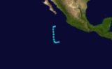
Hurricane Anita
entered the Pacific Ocean September 3 as a tropical depression. It was designated Tropical Depression Eleven, which lasted for one day before dissipating.
.
. Up to 14 inches fell in the mountains of southeast Arizona.
. This is also the last time that this list was used, as modern naming began in 1978. This is therefore the final Pacific hurricane season to have lists with only female names.
The central Pacific used names and numbers from the western Pacific's typhoon list. No names were required.
2010 Pacific hurricane season
The 2010 Pacific hurricane season was the least active Pacific hurricane season, in terms of the number of named storms and hurricanes, on record, due to a moderate La Niña, unlike the 2010 Atlantic hurricane season, which was one of the most active on record...
. There were no major hurricanes; the next time this happened would be the 2003 season
2003 Pacific hurricane season
The 2003 Pacific hurricane season produced an unusually large number of tropical cyclones which affected Mexico. The most notable cyclones the year were Hurricanes Ignacio and Marty, which killed 2 and 12 people in Mexico, respectively, and were collectively responsible for about...
. In addition, there was just one storm in each of May, June, July, August, and October, which is also low; the other three storms were in September. Activity in the central Pacific was zero, as no storms formed there nor moved in from the east.
The low seasonal activity also occurred in the Atlantic hurricane season and in the typhoon season of the western Pacific. This was a worldwide trend; various factors inhibited tropical cyclone development throughout the northern hemisphere, resulting in a record low level of tropical cyclones worldwide.
Tropical Storm Ava
Tropical Storm Ava formed on May 26 about 600 miles (965 km) southwest of Manzanillo. It moved northward, quickly intensifying into a tropical storm. At its peak intensity it had winds of 65 mph (101 km/h) and lowest pressure of 997mb. It weakened to a tropical depression on May 29 and dissipated on May 30 about 390 miles (630 km) west of Manzanillo.Tropical Depression Two
This depression formed 70 miles (110 km) southwest of the Honduras–Nicaragua border. On June 1 it dissipated just off the El Salvador coast.Tropical Depression Three
Tropical Depression Three formed 350 miles (565 km) west of the Honduras–Nicaragua border on June 9. Two days later it dissipated in almost the same location.Tropical Storm Bernice
Tropical Storm Bernice formed on June 25 about 555 miles (895 km) southeast of Acapulco. It moved northwestward and strengthened to a tropical storm on June 26. At its peak intensity it had winds of 40 mph (64 km/h). It continued moving north-west and dissipated on June 28 about 890 miles (1430 km) west of Cabo San Lucas, Mexico.Hurricane Claudia
Hurricane Claudia formed on July 3 about 580 miles (935 km) south of Cabo San Lucas, Mexico. It moved westward, quickly intensifying into a tropical storm and becoming a hurricane on July 4. At its peak intensity it had winds of 90 mph (148 km/h). It continued moving westward, weakening to a tropical storm on July 5 before dissipating on July 7.Tropical Depression Six
This depression existed from July 8 until July 9 off the southwest coast of the Baja California peninsula.Hurricane Doreen
Hurricane Doreen formed on August 13 and moved northward. The next day it intensified into a hurricane. At its peak intensity it had winds of 75 mph (121 km/h) and lowest pressure of 979mb, making it the lowest measured pressure of the season. It paralleled Mexico, moving north. It brushed the extreme west of Mexico on August 16 and dissipated before reaching CaliforniaCalifornia
California is a state located on the West Coast of the United States. It is by far the most populous U.S. state, and the third-largest by land area...
on the August 18. The remnants of the hurricane did bring heavy rain to California, however. The highest amount reported was 7.45 inches at Mount San Jacinto in southern California. In desert areas in the southwestern part of the state, rains destroyed 325 homes and businesses and caused the evacuation of several people. Parts of the recently-repaired Interstate 8
Interstate 8
Interstate 8 is an Interstate Highway in the southwestern United States. It runs from the southern edge of Mission Bay at Sunset Cliffs Blvd, in San Diego, California, almost at the Pacific Ocean, to the junction with Interstate 10, just southeast of Casa Grande, Arizona...
were destroyed again, and two of the lanes of Interstate 25
Interstate 25
Interstate 25 is an Interstate Highway in the western United States. It is primarily a north–south highway. I-25 stretches from Interstate 10 at Las Cruces, New Mexico, , to Interstate 90 in Buffalo, Wyoming, .Interstate 25 is the main north–south expressway through...
were washed out. In San Diego
San Diego County, California
San Diego County is a large county located in the southwestern corner of the US state of California. Hence, San Diego County is also located in the southwestern corner of the 48 contiguous United States. Its county seat and largest city is San Diego. Its population was about 2,813,835 in the 2000...
and Imperial County
Imperial County, California
Imperial County is a county located in the Imperial Valley, in the far southeast of the U.S. state of California, bordering both Arizona and Mexico. It is part of the El Centro Metropolitan Area, which encompasses all of Imperial County. The population as of 2000 was 142,361. The county seat is the...
, the total damage to agricultural interests was $25 million (1977 USD).
Tropical Depression Eleven (Anita)
The remains of Atlantic1977 Atlantic hurricane season
The 1977 Atlantic hurricane season officially began on June 1, 1977, and lasted until November 30, 1977. These dates conventionally delimit the period of each year when most tropical cyclones form in the Atlantic basin....
Hurricane Anita
Hurricane Anita
Hurricane Anita was a powerful Atlantic hurricane during an otherwise quiet 1977 Atlantic hurricane season. The first tropical cyclone of the season, Anita developed from a tropical wave on August 29 in the north-central Gulf of Mexico. It tracked westward into an area with conditions favorable for...
entered the Pacific Ocean September 3 as a tropical depression. It was designated Tropical Depression Eleven, which lasted for one day before dissipating.
Tropical Storm Emily
Tropical Storm Emily formed on September 13 and moved northwestward. At its peak intensity it had winds of 40 mph (64 km/h). It continued moving north-west and dissipated on September 14 about 875 miles (1410 km) west of Cabo San Lucas, Mexico.Hurricane Florence
A tropical depression formed on September 20 and moved northward, intensifying into a tropical storm the next day. On September 22 it became Hurricane Florence. At its peak intensity of 105 mph (165 km/h), Florence became the strongest storm of the season. It turned moving northeast and dissipated on September 24. Its remnants brought rain to CaliforniaCalifornia
California is a state located on the West Coast of the United States. It is by far the most populous U.S. state, and the third-largest by land area...
.
Tropical Storm Glenda
Tropical Storm Glenda formed on September 24 and moved northwestward. At its peak intensity it had winds of 40 mph (64 km/h). It continued moving north-northwest and dissipated on the September 27.Hurricane Heather
A tropical depression formed on October 4 about 495 miles (800 km) west of Acapulco, Mexico. It quickly intensified into a tropical storm as it moved northwestward, and became Hurricane Heather on October 5. At its peak intensity it had winds of 85 mph (138 km/h). It turned moving north-northeast and dissipated on October 7. The remnants of Heather continued moving in that direction, and brought rain to ArizonaArizona
Arizona ; is a state located in the southwestern region of the United States. It is also part of the western United States and the mountain west. The capital and largest city is Phoenix...
. Up to 14 inches fell in the mountains of southeast Arizona.
Tropical Depression Seventeen
This depression existed from October 22 until October 23 off the southwest coast of the Baja California peninsula.1977 Storm names
This is the same list used in the 1973 season1973 Pacific hurricane season
The 1973 Pacific hurricane season was an event in tropical cyclone meteorology. The most important system this year was Hurricane Ava, which was the most intense Pacific hurricane known at the time. Several other much weaker tropical cyclones came close to, or made landfall on, the Pacific coast of...
. This is also the last time that this list was used, as modern naming began in 1978. This is therefore the final Pacific hurricane season to have lists with only female names.
|
|
The central Pacific used names and numbers from the western Pacific's typhoon list. No names were required.
See also
- List of Pacific hurricanes
- List of Pacific hurricane seasons
- 1977 Atlantic hurricane season1977 Atlantic hurricane seasonThe 1977 Atlantic hurricane season officially began on June 1, 1977, and lasted until November 30, 1977. These dates conventionally delimit the period of each year when most tropical cyclones form in the Atlantic basin....
- 1977 Pacific typhoon season1977 Pacific typhoon seasonThe 1977 Pacific typhoon season was one of the least active Pacific typhoon seasons on record, with only 19 tropical storms forming. It was also the only known typhoon season during the satellite era to not produce a Category 5 equivalent super typhoon...
- 1977 North Indian Ocean cyclone season
- Southern Hemisphere tropical cyclone seasons: 1976–77, 1977–78
- Timeline of the 1977 Pacific hurricane season