
2006 Pacific hurricane season
Encyclopedia

2006 Pacific hurricane season
The 2006 Pacific hurricane season was the most active Pacific hurricane season since 2000 producing 19 tropical storms or hurricanes. Eighteen developed within the National Hurricane Center area of warning responsibility, which is east of 140ºW, and one storm formed between 140ºW and the...
was the most active Pacific hurricane season
Pacific hurricane
A Pacific hurricane or tropical storm is a tropical cyclone that develops in the northeastern part of the Pacific Ocean. For organizational purposes, the northern Pacific Ocean is divided into three regions: the eastern, , central , and western...
since 2000
2000 Pacific hurricane season
The 2000 Pacific hurricane season was an event in tropical cyclone meteorology. There were few notable storms this year. Tropical Storms Miriam, Norman, and Rosa all made landfall in Mexico with minimal impact. Hurricane Daniel briefly threatened the U.S. state of Hawaii while weakening...
producing 19 tropical storms
Tropical cyclone
A tropical cyclone is a storm system characterized by a large low-pressure center and numerous thunderstorms that produce strong winds and heavy rain. Tropical cyclones strengthen when water evaporated from the ocean is released as the saturated air rises, resulting in condensation of water vapor...
or hurricanes. Eighteen developed within the National Hurricane Center
National Hurricane Center
The National Hurricane Center , located at Florida International University in Miami, Florida, is the division of the National Weather Service responsible for tracking and predicting weather systems within the tropics between the Prime Meridian and the 140th meridian west poleward to the 30th...
(NHC) area of warning responsibility, which is east of 140ºW
140th meridian west
The meridian 140° west of Greenwich is a line of longitude that extends from the North Pole across the Arctic Ocean, North America, the Pacific Ocean, the Southern Ocean, and Antarctica to the South Pole....
, and one storm formed between 140ºW and the International Date Line
International Date Line
The International Date Line is a generally north-south imaginary line on the surface of the Earth, passing through the middle of the Pacific Ocean, that designates the place where each calendar day begins...
, which is the area of responsibility of the Central Pacific Hurricane Center
Central Pacific Hurricane Center
The Central Pacific Hurricane Center of the United States National Weather Service is the official body responsible for tracking and issuing tropical cyclone warnings, watches, advisories, discussions, and statements for the Central North Pacific Basin...
(CPHC). Of the 19 total storms, eleven became hurricanes, of which six attained major hurricane status
Tropical cyclone scales
Tropical systems are officially ranked on one of several tropical cyclone scales according to their maximum sustained winds and in what oceanic basin they are located...
. In addition to the named storms, three tropical depressions developed in each the NHC and CPHC regions of the basin.
The season officially began on May 15 in the NHC portion of the basin, and on June 1 the season began in the CPHC portion; the season officially ended on November 30. These dates conventionally delimit the period of each year when most tropical cyclones form in the eastern Pacific basin
Pacific Ocean
The Pacific Ocean is the largest of the Earth's oceanic divisions. It extends from the Arctic in the north to the Southern Ocean in the south, bounded by Asia and Australia in the west, and the Americas in the east.At 165.2 million square kilometres in area, this largest division of the World...
.
Tropical activity began on May 27, when Tropical Storm Aletta formed off the southwest coast of Mexico. After no storms formed in June, the season became active in July when five named storms developed, including Hurricane Daniel
Hurricane Daniel (2006)
Hurricane Daniel was the second strongest hurricane of the 2006 Pacific hurricane season. The fourth named storm of the season, Daniel originated on July 16 from a tropical wave off the coast of Mexico. It tracked westward, intensifying steadily to reach peak winds of 150 mph on...
which was the second-strongest storm of the season. During August, Hurricanes Ioke and John formed, as well as four other storms. September was a relatively quiet month with two storms, of which one was Hurricane Lane. Three storms developed in October and two formed in November; this marked the first time on record when more than one tropical storm developed in the basin during the month of November.
The strongest hurricane of the season was Hurricane Ioke
Hurricane Ioke
Hurricane Ioke was the strongest hurricane ever recorded in the Central Pacific...
, which reached Category 5 status on the Saffir-Simpson Hurricane Scale
Saffir-Simpson Hurricane Scale
The Saffir–Simpson Hurricane Scale , or the Saffir–Simpson Hurricane Wind Scale , classifies hurricanes — Western Hemisphere tropical cyclones that exceed the intensities of tropical depressions and tropical storms — into five categories distinguished by the intensities of their sustained winds...
in the central Pacific Ocean; Ioke passed near Johnston Atoll
Johnston Atoll
Johnston Atoll is a atoll in the North Pacific Ocean about west of Hawaii. There are four islands located on the coral reef platform, two natural islands, Johnston Island and Sand Island, which have been expanded by coral dredging, as well as North Island and East Island , an additional two...
and later near Wake Island
Wake Island
Wake Island is a coral atoll having a coastline of in the North Pacific Ocean, located about two-thirds of the way from Honolulu west to Guam east. It is an unorganized, unincorporated territory of the United States, administered by the Office of Insular Affairs, U.S. Department of the Interior...
, where it caused heavy damage but no deaths. The deadliest storm of the season was Hurricane John
Hurricane John (2006)
Hurricane John was the eleventh named storm, seventh hurricane, and fifth major hurricane of the 2006 Pacific hurricane season. Hurricane John developed on August 28 from a tropical wave to the south of Mexico. Favorable conditions allowed the storm to intensify quickly, and it attained peak winds...
, which killed six people after striking the Baja California Peninsula
Baja California Peninsula
The Baja California peninsula , is a peninsula in northwestern Mexico. Its land mass separates the Pacific Ocean from the Gulf of California. The Peninsula extends from Mexicali, Baja California in the north to Cabo San Lucas, Baja California Sur in the south.The total area of the Baja California...
, and the costliest storm was Hurricane Lane
Hurricane Lane (2006)
Hurricane Lane was the thirteenth named storm, ninth hurricane, and sixth major hurricane of the 2006 Pacific hurricane season. The strongest Pacific hurricane to make landfall in Mexico since Hurricane Kenna of 2002, Lane developed on September 13 from a tropical wave to the south of Mexico...
, which caused $203 million in damage (2006 USD
United States dollar
The United States dollar , also referred to as the American dollar, is the official currency of the United States of America. It is divided into 100 smaller units called cents or pennies....
) in southwestern Mexico.
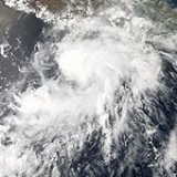
Tropical Storm Aletta
On May 27, 12 days into the season, Tropical Depression One formed about 190 miles (305 km) south of Acapulco. It slowly organized and became a tropical storm with 45 mph (75 km/h) sustained winds. While named tropical cyclones in May are infrequent events, Aletta marked the seventh consecutive year to have a named cyclone form in May. The storm moved toward the GuerreroGuerrero
Guerrero officially Estado Libre y Soberano de Guerrero is one of the 31 states which, with the Federal District, comprise the 32 Federal Entities of Mexico. It is divided in 81 municipalities and its capital city is Chilpancingo....
coast in southwestern Mexico, prompting the Mexican government to issue tropical storm watches between Punta Maldonado and Zihuatanejo
Zihuatanejo
Zihuatanejo or Ixtapa-Zihuatanejo, is the fourth-largest city in the Mexican state of Guerrero. Politically the city belongs to the municipality of Zihuatanejo de Azueta in the western part of Guerrero, but both are commonly referred to as Zihuatanejo...
. Aletta then became stationary over the Guerrero
Guerrero
Guerrero officially Estado Libre y Soberano de Guerrero is one of the 31 states which, with the Federal District, comprise the 32 Federal Entities of Mexico. It is divided in 81 municipalities and its capital city is Chilpancingo....
and Oaxaca
Oaxaca
Oaxaca , , officially Estado Libre y Soberano de Oaxaca is one of the 31 states which, along with the Federal District, comprise the 32 federative entities of Mexico. It is divided into 571 municipalities; of which 418 are governed by the system of customs and traditions...
coastlines, but it later turned to the west and dissipated on May 30.
Aletta produced moderate rainfall across Mexico, including a 24-hour rainfall total of 3.94 inches (100 mm)Rainfall totals are rounded to the nearest 1/100th of an inch
Inch
An inch is the name of a unit of length in a number of different systems, including Imperial units, and United States customary units. There are 36 inches in a yard and 12 inches in a foot...
and to the nearest millimetre
Millimetre
The millimetre is a unit of length in the metric system, equal to one thousandth of a metre, which is the SI base unit of length....
. in Jacatepec, Oaxaca on May 30, and 3.78 inches (96 mm) in La Calera, Guerrero, the next day. There were no reports of damage, flooding, or casualties.
Tropical Depression Two-E
On the day after Aletta dissipated, a new area of disturbed weather developed off the southwest Mexican coast. High shear slowed the development of the system, although it gained enough convection and organization to be classified as a tropical depression on June 3. The depression strengthened to near tropical storm status as it approached the coast of southwestern Mexico; however, shear persisted over the system and it weakened before dissipating on June 4.Despite never becoming a named storm, heavy rain occurred, including a total of 19.13 inches (486 mm) measured in a 48 hour period in Acapulco. Mudslides and flash flooding were reported, forcing 72 people from their homes. No deaths or serious damage was reported.
Hurricane Bud
On July 11, after over a month of inactivity, a disturbance off the Peninsula of Baja CaliforniaBaja California Peninsula
The Baja California peninsula , is a peninsula in northwestern Mexico. Its land mass separates the Pacific Ocean from the Gulf of California. The Peninsula extends from Mexicali, Baja California in the north to Cabo San Lucas, Baja California Sur in the south.The total area of the Baja California...
developed into a tropical depression. It moved west-northwestward for its entire duration, quickly intensifying into a tropical storm and hurricane. A clear, well-defined eye
Eye (cyclone)
The eye is a region of mostly calm weather found at the center of strong tropical cyclones. The eye of a storm is a roughly circular area and typically 30–65 km in diameter. It is surrounded by the eyewall, a ring of towering thunderstorms where the second most severe weather of a cyclone...
developed, and Bud became the first major hurricane
Tropical cyclone scales
Tropical systems are officially ranked on one of several tropical cyclone scales according to their maximum sustained winds and in what oceanic basin they are located...
of the season. On July 13, the hurricane attained peak winds of 125 mph (205 km/h), although cooler waters and stable air caused a marked weakening trend. By July 15, Bud weakened to tropical depression status, and the next day it degenerated into a remnant low pressure area. The remnants of Bud produced light rainfall across Hawaii
Hawaii
Hawaii is the newest of the 50 U.S. states , and is the only U.S. state made up entirely of islands. It is the northernmost island group in Polynesia, occupying most of an archipelago in the central Pacific Ocean, southwest of the continental United States, southeast of Japan, and northeast of...
.
Hurricane Carlotta
Late on July 11, a new tropical depression formed about 250 miles (400 km) southwest of the Mexican state of GuerreroGuerrero
Guerrero officially Estado Libre y Soberano de Guerrero is one of the 31 states which, with the Federal District, comprise the 32 Federal Entities of Mexico. It is divided in 81 municipalities and its capital city is Chilpancingo....
. The depression intensified quickly, and six hours later it was upgraded to tropical storm status, receiving the name Carlotta. The storm continued to strengthen, and became a hurricane 24 hours later. However, the system encountered unfavorable conditions and cooler waters and weakened into a tropical storm during the afternoon of July 14. Carlotta managed to regain some convection and restrengthened into a hurricane late that evening, only to weaken back into a tropical storm again the following morning. The system continued to weaken and was downgraded to tropical depression status on the morning of July 16. Carlotta degenerated into a non-convective remnant low later that night. Early in its duration, Carlotta produced light rainfall along the coast, and there were no reports of tropical storm-force winds over land. No fatalities or damages were reported.
Hurricane Daniel
On July 16, a tropical disturbance formed far to the south of the Baja California PeninsulaBaja California Peninsula
The Baja California peninsula , is a peninsula in northwestern Mexico. Its land mass separates the Pacific Ocean from the Gulf of California. The Peninsula extends from Mexicali, Baja California in the north to Cabo San Lucas, Baja California Sur in the south.The total area of the Baja California...
and quickly increased in convective activity and organization, becoming a tropical depression. The system continued to organize and was designated as a tropical storm the next day. On July 18, Daniel attained hurricane status, and two days later underwent rapid intensification; it reached major hurricane status
Tropical cyclone scales
Tropical systems are officially ranked on one of several tropical cyclone scales according to their maximum sustained winds and in what oceanic basin they are located...
and was later upgraded further to Category 4 status on the Saffir-Simpson Hurricane Scale
Saffir-Simpson Hurricane Scale
The Saffir–Simpson Hurricane Scale , or the Saffir–Simpson Hurricane Wind Scale , classifies hurricanes — Western Hemisphere tropical cyclones that exceed the intensities of tropical depressions and tropical storms — into five categories distinguished by the intensities of their sustained winds...
. Its peak intensity was 150 mph (240 km/h). The hurricane underwent eyewall replacement cycles
Eye (cyclone)
The eye is a region of mostly calm weather found at the center of strong tropical cyclones. The eye of a storm is a roughly circular area and typically 30–65 km in diameter. It is surrounded by the eyewall, a ring of towering thunderstorms where the second most severe weather of a cyclone...
, which are internal mechanisms that occur in most intense hurricanes. Daniel later became an annular hurricane
Annular hurricane
An annular hurricane, also known as a truck tire or doughnut hurricane, is a tropical cyclone in the Atlantic or Eastern Pacific Oceans that features a large, symmetric eye surrounded by a thick ring of intense convection. This type of storm is not prone to the fluctuations in intensity associated...
, which allowed it to maintain Category 4 status for longer than it otherwise would have.
It crossed over into the Central Pacific early on July 24 and was predicted to affect Hawaii as a tropical storm; however, Daniel encountered weak steering currents in the open ocean, causing it to slow down considerably. It rapidly degenerated to a tropical depression on July 25, and the CPHC issued its last advisory on July 26 while the storm was still well to the east of Hawaii. Its remnants later moved across the Hawaiian islands, dropping heavy rainfall and causing flooding. West Wailuaiki on Maui recorded 3.87 inches (98 mm) in one day, which was the highest daily rainfall total from the hurricane.
Tropical Storm Emilia
The origins of Emilia were from a tropical waveTropical wave
Tropical waves, easterly waves, or tropical easterly waves, also known as African easterly waves in the Atlantic region, are a type of atmospheric trough, an elongated area of relatively low air pressure, oriented north to south, which move from east to west across the tropics causing areas of...
that developed into a tropical depression on July 21, a short distance off the coast of Acapulco
Acapulco
Acapulco is a city, municipality and major sea port in the state of Guerrero on the Pacific coast of Mexico, southwest from Mexico City. Acapulco is located on a deep, semi-circular bay and has been a port since the early colonial period of Mexico’s history...
. It moved generally north-northwestward, reaching tropical storm status on July 22 and passing about 175 mi (280 km) southwest of Manzanillo, Colima
Manzanillo, Colima
The name Manzanillo refers to the city as well as its surrounding municipality in the Mexican state of Colima. The city, located on the Pacific Ocean, contains Mexico's busiest port. Manzanillo was the third port created by the Spanish in the Pacific during the New Spain period...
. An eyewall
Eye (cyclone)
The eye is a region of mostly calm weather found at the center of strong tropical cyclones. The eye of a storm is a roughly circular area and typically 30–65 km in diameter. It is surrounded by the eyewall, a ring of towering thunderstorms where the second most severe weather of a cyclone...
began to form that day, and Emilia reached peak winds of 65 mph (105 km/h). It briefly weakened due to wind shear
Wind shear
Wind shear, sometimes referred to as windshear or wind gradient, is a difference in wind speed and direction over a relatively short distance in the atmosphere...
, although restrengthening occurred as the storm turned toward the Baja California peninsula
Baja California Peninsula
The Baja California peninsula , is a peninsula in northwestern Mexico. Its land mass separates the Pacific Ocean from the Gulf of California. The Peninsula extends from Mexicali, Baja California in the north to Cabo San Lucas, Baja California Sur in the south.The total area of the Baja California...
. On July 26, Emilia again reached peak winds of 65 mph (105 km/h), and shortly thereafter it passed about 60 mi (95 km) southwest of the southern tip of Baja California. It weakened as it turned into cooler waters, first to tropical depression status on July 27 and then to a convective-less remnant low on July 28. The remnants dissipated on July 31 about 495 mi (800 km) west-southwest of San Diego, California
San Diego, California
San Diego is the eighth-largest city in the United States and second-largest city in California. The city is located on the coast of the Pacific Ocean in Southern California, immediately adjacent to the Mexican border. The birthplace of California, San Diego is known for its mild year-round...
.
In southwestern Mexico, Emilia produced tropical storm force winds along the coastline. Rainfall in the southern portion of the Baja California peninsula caused minor flooding, and gusty winds caused damage to buildings and power lines. Moisture from Emilia reached the southwestern United States. Thunderstorms and rainfall occurred across Arizona, causing flooding. In southern California, the storm dropped light rainfall, which assisted firefighters in containing a wildfire.
Tropical Storm Fabio
Tropical Storm Fabio developed from a tropical wave on July 31, about 980 miles (1,580 km) southwest of the southern tip of the Baja California peninsulaBaja California Peninsula
The Baja California peninsula , is a peninsula in northwestern Mexico. Its land mass separates the Pacific Ocean from the Gulf of California. The Peninsula extends from Mexicali, Baja California in the north to Cabo San Lucas, Baja California Sur in the south.The total area of the Baja California...
. It moved steadily westward, and on August 1 Fabio reached peak winds of 50 mph (85 km/h). Later, the storm began weakening due to increased wind shear
Wind shear
Wind shear, sometimes referred to as windshear or wind gradient, is a difference in wind speed and direction over a relatively short distance in the atmosphere...
and dry air. On August 3, Fabio deteriorated to tropical depression status, and later that day it degenerated into a remnant low pressure area
Low pressure area
A low-pressure area, or "low", is a region where the atmospheric pressure at sea level is below that of surrounding locations. Low-pressure systems form under areas of wind divergence which occur in upper levels of the troposphere. The formation process of a low-pressure area is known as...
. The remnants continued westward toward Hawaii
Hawaii
Hawaii is the newest of the 50 U.S. states , and is the only U.S. state made up entirely of islands. It is the northernmost island group in Polynesia, occupying most of an archipelago in the central Pacific Ocean, southwest of the continental United States, southeast of Japan, and northeast of...
, moving across the state on August 7. As a tropical cyclone, Fabio did not affect land, although the remnants produced heavy rainfall across much of the state. The highest rainfall total was on Mount Waiʻaleʻale on the island of Kauai
Kauai
Kauai or Kauai, known as Tauai in the ancient Kaua'i dialect, is geologically the oldest of the main Hawaiian Islands. With an area of , it is the fourth largest of the main islands in the Hawaiian archipelago, and the 21st largest island in the United States. Known also as the "Garden Isle",...
, where 15.08 inches (383 mm) of rainfall fell in a 24 hour period; this 24 hour total alone was greater than all other monthly rainfall totals in the state. The rainfall caused some localized flooding, although no significant damage was reported.
Tropical Storm Gilma
On July 17, a tropical waveTropical wave
Tropical waves, easterly waves, or tropical easterly waves, also known as African easterly waves in the Atlantic region, are a type of atmospheric trough, an elongated area of relatively low air pressure, oriented north to south, which move from east to west across the tropics causing areas of...
exited Africa and crossed the Atlantic without developing. On July 25 it entered the Eastern Pacific, gradually developing an area of organized convection. Despite marginally favorable upper-level winds, the system organized enough to be declared a tropical depression on August 1, several hundred miles southwest of Acapulco, Mexico. Moving around the western periphery of a ridge, the depression tracked west-northwestward. Despite wind shear in the area, the depression was upgraded to Tropical Storm Gilma later on August 1. The wind shear prevented further strengthening or organization, and Gilma weakened to a tropical depression early on August 2. The depression turned westward, and Gilma degenerated into a remnant low by August 4.
Hurricane Hector
The origins of Hector, like most other storms during the season, were from a tropical wave. On August 15, a tropical depression formed off the southwest coast of Mexico, and it maintained a west-northwest track for the early part of its duration. With favorable conditions, it intensified into a tropical storm on August 16, and into a hurricane the next day. On August 18, Hector reached peak winds of 110 mph (175 km/h) over the open waters of the Pacific Ocean. The hurricane began a slow weakening trend due to wind shear and cooler waters, and as convection diminished, Hector weakened to tropical storm status on August 20. It turned to a slow west drift, and by August 23 degenerated into a remnant low pressure area. The system never affected land.Hurricane Ioke
The cyclone developed from the Intertropical Convergence ZoneIntertropical Convergence Zone
The Intertropical Convergence Zone , known by sailors as The Doldrums, is the area encircling the earth near the equator where winds originating in the northern and southern hemispheres come together....
on August 20 far to the south of Hawaii
Hawaii
Hawaii is the newest of the 50 U.S. states , and is the only U.S. state made up entirely of islands. It is the northernmost island group in Polynesia, occupying most of an archipelago in the central Pacific Ocean, southwest of the continental United States, southeast of Japan, and northeast of...
. Encountering warm waters, little wind shear
Wind shear
Wind shear, sometimes referred to as windshear or wind gradient, is a difference in wind speed and direction over a relatively short distance in the atmosphere...
, and well-defined outflow
Outflow (meteorology)
Outflow, in meteorology, is air that flows outwards from a storm system. It is associated with ridging, or anticyclonic flow. In the low levels of the troposphere, outflow radiates from thunderstorms in the form of a wedge of rain-cooled air, which is visible as a thin rope-like cloud on weather...
, Ioke intensified from a tropical depression to Category 4
Saffir-Simpson Hurricane Scale
The Saffir–Simpson Hurricane Scale , or the Saffir–Simpson Hurricane Wind Scale , classifies hurricanes — Western Hemisphere tropical cyclones that exceed the intensities of tropical depressions and tropical storms — into five categories distinguished by the intensities of their sustained winds...
status within 48 hours. Late on August 22 it rapidly weakened to Category 2 status before crossing over Johnston Atoll
Johnston Atoll
Johnston Atoll is a atoll in the North Pacific Ocean about west of Hawaii. There are four islands located on the coral reef platform, two natural islands, Johnston Island and Sand Island, which have been expanded by coral dredging, as well as North Island and East Island , an additional two...
. Two days later favorable conditions again allowed for rapid strengthening
Rapid deepening
Rapid deepening, also known as rapid intensification, is a meteorological condition that occurs when the minimum sea-level atmospheric pressure of a tropical cyclone decreases drastically in a short period of time. The National Weather Service describes rapid deepening as a decrease of...
, and Ioke attained Category 5 status on August 25 before crossing the International Date Line. At the time, its barometric pressure was estimated at 915 mbar
Bar (unit)
The bar is a unit of pressure equal to 100 kilopascals, and roughly equal to the atmospheric pressure on Earth at sea level. Other units derived from the bar are the megabar , kilobar , decibar , centibar , and millibar...
, thus becoming the strongest hurricane on record in the Central Pacific. As it continued westward its intensity fluctuated, and on August 31 it passed near Wake Island
Wake Island
Wake Island is a coral atoll having a coastline of in the North Pacific Ocean, located about two-thirds of the way from Honolulu west to Guam east. It is an unorganized, unincorporated territory of the United States, administered by the Office of Insular Affairs, U.S. Department of the Interior...
with winds of 155 mph (249.4 km/h). Ioke gradually weakened as it turned northwestward and northward, and by September 6 it had transitioned into an extratropical cyclone
Extratropical cyclone
Extratropical cyclones, sometimes called mid-latitude cyclones or wave cyclones, are a group of cyclones defined as synoptic scale low pressure weather systems that occur in the middle latitudes of the Earth having neither tropical nor polar characteristics, and are connected with fronts and...
. By then, the cyclone had lasted 19 days, reaching the equivalent of Category 5 status on the Saffir-Simpson Hurricane Scale
Saffir-Simpson Hurricane Scale
The Saffir–Simpson Hurricane Scale , or the Saffir–Simpson Hurricane Wind Scale , classifies hurricanes — Western Hemisphere tropical cyclones that exceed the intensities of tropical depressions and tropical storms — into five categories distinguished by the intensities of their sustained winds...
three times. The remnants of Ioke accelerated northeastward and ultimately crossed into Alaska
Alaska
Alaska is the largest state in the United States by area. It is situated in the northwest extremity of the North American continent, with Canada to the east, the Arctic Ocean to the north, and the Pacific Ocean to the west and south, with Russia further west across the Bering Strait...
.
Ioke did not affect any permanently populated areas in the Central Pacific or Western Pacific basins as a hurricane or a typhoon. A crew of 12 people stayed in a hurricane-proof bunker on Johnston Atoll
Johnston Atoll
Johnston Atoll is a atoll in the North Pacific Ocean about west of Hawaii. There are four islands located on the coral reef platform, two natural islands, Johnston Island and Sand Island, which have been expanded by coral dredging, as well as North Island and East Island , an additional two...
during the hurricane's passage; the crew estimated winds reached over 100 mph (160.9 km/h), which damaged trees on the island but did not impact the island's bird population. The hurricane left moderate damage on Wake Island
Wake Island
Wake Island is a coral atoll having a coastline of in the North Pacific Ocean, located about two-thirds of the way from Honolulu west to Guam east. It is an unorganized, unincorporated territory of the United States, administered by the Office of Insular Affairs, U.S. Department of the Interior...
totaling $88 million (2006 USD), which resulted from blown off roofs and damaged buildings, although the infrastructure of the island was left intact. All military personnel were evacuated from the island, the first full-scale evacuation of the island since Typhoon Sarah in 1967
1967 Pacific typhoon season
The 1967 Pacific typhoon season has no official bounds; it ran year-round in 1967, but most tropical cyclones tend to form in the northwestern Pacific Ocean between June and December...
. Later, the extratropical remnants of Ioke produced a severe storm surge along the Alaska
Alaska
Alaska is the largest state in the United States by area. It is situated in the northwest extremity of the North American continent, with Canada to the east, the Arctic Ocean to the north, and the Pacific Ocean to the west and south, with Russia further west across the Bering Strait...
n coastline, causing beach erosion.
Hurricane Ileana
The origins of Hurricane Ileana were from a tropical wave that moved off the coast of Africa on August 8. It entered the Eastern North Pacific on August 16 and developed into a tropical depression on August 21 near AcapulcoAcapulco
Acapulco is a city, municipality and major sea port in the state of Guerrero on the Pacific coast of Mexico, southwest from Mexico City. Acapulco is located on a deep, semi-circular bay and has been a port since the early colonial period of Mexico’s history...
. The depression strengthened into Tropical Storm Ileana six hours after forming. Ileana continued to strengthen, becoming a hurricane in 24 hours and a major hurricane a day after that. Ileana reached its peak intensity of 120 mph (195 km/h) before beginning a slow weakening phase on August 24 when it encountered cooler waters. Ileana weakened a tropical depression on the morning of August 27 and quickly degenerated into a remnant low, dissipating on August 29. As Ileana was heading north along the Mexican coastline, slight rainfall was recorded along the coast. There were also reports of hurricane force winds on Socorro Island
Socorro Island
Socorro Island is a small volcanic island in the Revillagigedo Islands, a Mexican possession lying some 600 kilometers off the country's western coast at 18°48'N, 110°59'W. The size is 16.5 by 11.5 km, with an area of 132 km².- Geology :...
. One fatality was reported when a man drowned in heavy surf near Cabo San Lucas
Cabo San Lucas
Cabo San Lucas , commonly called Cabo, is a city at the southern tip of the Baja California peninsula, in the municipality of Los Cabos in the Mexican state of Baja California Sur. As of the 2010 census, the population was 68,463 people...
.
Hurricane John
On August 28, a persistent area of low pressure southwest of AcapulcoAcapulco
Acapulco is a city, municipality and major sea port in the state of Guerrero on the Pacific coast of Mexico, southwest from Mexico City. Acapulco is located on a deep, semi-circular bay and has been a port since the early colonial period of Mexico’s history...
, Mexico developed into a tropical depression. Later that day it strengthened into a tropical storm, and it reached hurricane strength 24 hours later on August 29. John underwent rapid intensification and reached Category 3 intensity later that day and Category 4 on August 30. Hours later, the hurricane underwent another eyewall replacement cycle, and subsequently weakened to Category 3 status as it paralleled the Mexican coastline a short distance offshore. Potentially due to its eyewall replacement cycle or its interaction with land, Hurricane John weakened to a 105 mph hurricane by late on August 31, but restrengthened to a major hurricane shortly after. It made landfall near the southern tip of the Baja California peninsula
Baja California Peninsula
The Baja California peninsula , is a peninsula in northwestern Mexico. Its land mass separates the Pacific Ocean from the Gulf of California. The Peninsula extends from Mexicali, Baja California in the north to Cabo San Lucas, Baja California Sur in the south.The total area of the Baja California...
as a Category 2 hurricane on September 1. John continued northwestward along the eastern Baja California peninsula, weakening to tropical depression status by September 3 and dissipating on September 4 in the Gulf of California
Gulf of California
The Gulf of California is a body of water that separates the Baja California Peninsula from the Mexican mainland...
.
Along the southwestern coast of Mexico, Hurricane John produced heavy surf, strong winds, and heavy rainfall, which flooded roads, caused mudslides, and downed trees. Along the Baja California Peninsula, the hurricane dropped heavy rainfall, with a 24-hour peak of 10.8 inches (276 mm) in Los Planes. The heavy rainfall caused flooding, closed roads, and caused a dam to overflow. The winds and rainfall destroyed thousands of flimsy houses across the region. Across Mexico, five people were killed, and damage amounted to $663 million (2006 MXN
Mexican peso
The peso is the currency of Mexico. Modern peso and dollar currencies have a common origin in the 15th–19th century Spanish dollar, most continuing to use its sign, "$". The Mexican peso is the 12th most traded currency in the world, the third most traded in the Americas, and by far the most...
, $60.8 million 2006 USD
United States dollar
The United States dollar , also referred to as the American dollar, is the official currency of the United States of America. It is divided into 100 smaller units called cents or pennies....
). Moisture from the remnants of John produced flooding across Texas, which closed a ½ mile (800 m) portion of Interstate 10
Interstate 10
Interstate 10 is the fourth-longest Interstate Highway in the United States, after I-90, I-80, and I-40. It is the southernmost east–west, coast-to-coast Interstate Highway, although I-4 and I-8 are further south. It stretches from the Pacific Ocean at State Route 1 in Santa Monica,...
in El Paso. In southern New Mexico, the rainfall caused widespread street flooding and some minor damage. Tropical moisture from the storm also produced rainfall in Arizona
Arizona
Arizona ; is a state located in the southwestern region of the United States. It is also part of the western United States and the mountain west. The capital and largest city is Phoenix...
and southern California
California
California is a state located on the West Coast of the United States. It is by far the most populous U.S. state, and the third-largest by land area...
, where eight separate mudslides occurred, trapping 19 vehicles but causing no injuries.
Hurricane Kristy
On August 30, a tropical wave located about 525 miles (850 km) south-southwest of Baja CaliforniaBaja California
Baja California officially Estado Libre y Soberano de Baja California is one of the 31 states which, with the Federal District, comprise the 32 Federal Entities of Mexico. It is both the northernmost and westernmost state of Mexico. Before becoming a state in 1953, the area was known as the North...
became more organized and was designated as the twelfth tropical depression of the 2006 season. It strengthened into Tropical Storm Kristy and became Hurricane Kristy the next day. It did not retain this status for long, partly due to its proximity to Hurricane John. There was a possibility of a Fujiwhara interaction between both systems, causing Kristy to weaken or perhaps be absorbed into the circulation of John. This did not occur, however. Kristy weakened steadily after its peak intensity and looked to be close to dissipating, but on September 3 and again on September 5, convection flared up and it returned to tropical storm strength. After oscillating between storm and depression strength, the system degenerated into a remnant low on September 7, which dissipated on September 8 without affecting land.
Hurricane Lane
On September 13, a tropical disturbance located about 125 miles (200 km) west-southwest of AcapulcoAcapulco
Acapulco is a city, municipality and major sea port in the state of Guerrero on the Pacific coast of Mexico, southwest from Mexico City. Acapulco is located on a deep, semi-circular bay and has been a port since the early colonial period of Mexico’s history...
, Mexico, gradually became better organized and was designated the thirteenth tropical depression of the 2006 season. The depression intensified in a favorable environment, and was upgraded to Tropical Storm Lane later that night. As it moved parallel to the Mexican coast it continued to strengthen and became a hurricane on September 15, and a major hurricane early the next day. Hurricane Lane reached peak winds of 125 mph (205 km/h) before it made landfall on the coast of Sinaloa
Sinaloa
Sinaloa officially Estado Libre y Soberano de Sinaloa is one of the 31 states which, with the Federal District, comprise the 32 Federal Entities of Mexico. It is divided in 18 municipalities and its capital city is Culiacán Rosales....
on September 16. It quickly weakened over land and dissipated on September 17.
Tropical Storm Lane produced heavy rainfall and high seas along the west coast of Mexico, including Acapulco
Acapulco
Acapulco is a city, municipality and major sea port in the state of Guerrero on the Pacific coast of Mexico, southwest from Mexico City. Acapulco is located on a deep, semi-circular bay and has been a port since the early colonial period of Mexico’s history...
where flood waters reached 16 inches (40 cm) in depth. The Acapulco airport also experienced flooding, though service was not interrupted. Throughout Mexico, the hurricane caused four deaths and $2.2 billion (2006 MXN, $203 million 2006 USD) in damage, half of which in Sinaloa
Sinaloa
Sinaloa officially Estado Libre y Soberano de Sinaloa is one of the 31 states which, with the Federal District, comprise the 32 Federal Entities of Mexico. It is divided in 18 municipalities and its capital city is Culiacán Rosales....
where heavy crop damage was reported. An estimated 4,320 homes were affected by the hurricane, and 19,200 miles (30,000 km) of roads and highways were damaged to some degree, including some destroyed bridges.
Tropical Storm Miriam
A disturbance associated with a northerly extension of the Intertropical Convergence ZoneIntertropical Convergence Zone
The Intertropical Convergence Zone , known by sailors as The Doldrums, is the area encircling the earth near the equator where winds originating in the northern and southern hemispheres come together....
and a tropical wave developed a closed circulation on September 15. It moved northeastward due to the influence from nearby Hurricane Lane, and organized enough to be declared Tropical Depression Fourteen-E on September 16 while located about 500 miles southwest of Cabo San Lucas
Cabo San Lucas
Cabo San Lucas , commonly called Cabo, is a city at the southern tip of the Baja California peninsula, in the municipality of Los Cabos in the Mexican state of Baja California Sur. As of the 2010 census, the population was 68,463 people...
, Mexico. It quickly strengthened, and organized into Tropical Storm Miriam later that day. After reaching a peak intensity of 45 mph (70 km/h), vertical wind shear and cooler waters rapidly weakened the storm, and the circulation decoupled from the convection on September 17. After turning more towards the north, Miriam weakened to tropical depression status, and on September 18 it degenerated to a remnant low. The remnant circulation turned to the northwest, then to the east, and dissipated on September 21 a short distance west of Baja California
Baja California
Baja California officially Estado Libre y Soberano de Baja California is one of the 31 states which, with the Federal District, comprise the 32 Federal Entities of Mexico. It is both the northernmost and westernmost state of Mexico. Before becoming a state in 1953, the area was known as the North...
. No deaths are damage are associated with Miriam, and only one ship recorded winds of over tropical storm force near the center.
Tropical Depression Two-C
On September 18, an area of disturbed weather associated with the Intertropical Convergence ZoneIntertropical Convergence Zone
The Intertropical Convergence Zone , known by sailors as The Doldrums, is the area encircling the earth near the equator where winds originating in the northern and southern hemispheres come together....
became sufficiently organized to be designated Tropical Depression Two-C. Initially, it was thought that the depression formed from the remnants of Hurricane Kristy
Hurricane Kristy (2006)
Hurricane Kristy in 2006 was a relatively long-lived tropical cyclone in the 2006 Pacific hurricane season. It developed on August 30 from a tropical wave off the southwest coast of Mexico, and quickly intensified to attain hurricane status, reaching peak winds of 80 mph...
, although subsequent analysis confirmed they were two separate systems. Initially, the depression was in an area of favorable conditions, with little wind shear and warm waters. As a result, the CPHC predicted significant strengthening to at least hurricane status. Instead, a high pressure system to its north increased wind shear over the depression, causing the convection to become removed from the center. The depression weakened into a remnant low on September 20, never reaching tropical storm status.
Tropical Depression Three-C
During September, El NiñoEl Niño-Southern Oscillation
El Niño/La Niña-Southern Oscillation, or ENSO, is a quasiperiodic climate pattern that occurs across the tropical Pacific Ocean roughly every five years...
conditions became established across the Pacific, which produced an area of warmer waters along the International Date Line. A few days after Tropical Depression Two-C dissipated, another area of disturbed weather formed, and although it was disorganized, it was also persistent. The CPHC initiated advisories on Tropical Depression Three-C on September 26 after a circulation was evident in the system. Strong wind shear prevented any development, and the system dissipated on September 27.
Tropical Storm Norman
Early in October, a low pressure system began to organize to the west of the Mexican coast, and on October 9 it developed into Tropical Depression Fifteen-E. It strengthened into a tropical storm the next day, but strong wind shear and low sea-surface temperatures hindered development. Norman slowly began to weaken, and on October 11 it degenerated into a remnant low pressure area. Turning eastward, the system combined with a new tropical disturbance off the southwest Mexican coast, and slowly began to reorganize. The system was re-designated a tropical depression on October 15 just south-southeast of Manzanillo, ColimaManzanillo, Colima
The name Manzanillo refers to the city as well as its surrounding municipality in the Mexican state of Colima. The city, located on the Pacific Ocean, contains Mexico's busiest port. Manzanillo was the third port created by the Spanish in the Pacific during the New Spain period...
, although within a few hours it again dissipated.
The storm brought heavy rainfall to southwestern Mexico, peaking at 6.35 inches (161 mm) in La Villita, Michoacán. The rainfall caused flooding and mudslides around Acapulco, affecting 170 homes, of which 20 were destroyed. About 300 hectares (740 acres) of crop fields sustained damage. Initially there were two people missing; however, a subsequent report indicated there were no casualties associated with the storm.
Tropical Storm Olivia
On September 18, a tropical waveTropical wave
Tropical waves, easterly waves, or tropical easterly waves, also known as African easterly waves in the Atlantic region, are a type of atmospheric trough, an elongated area of relatively low air pressure, oriented north to south, which move from east to west across the tropics causing areas of...
exited Africa
Africa
Africa is the world's second largest and second most populous continent, after Asia. At about 30.2 million km² including adjacent islands, it covers 6% of the Earth's total surface area and 20.4% of the total land area...
and later crossed into the eastern Pacific
Pacific Ocean
The Pacific Ocean is the largest of the Earth's oceanic divisions. It extends from the Arctic in the north to the Southern Ocean in the south, bounded by Asia and Australia in the west, and the Americas in the east.At 165.2 million square kilometres in area, this largest division of the World...
on September 29 without development. Convection increased in the Pacific along the wave axis, spawning a broad low pressure area
Low pressure area
A low-pressure area, or "low", is a region where the atmospheric pressure at sea level is below that of surrounding locations. Low-pressure systems form under areas of wind divergence which occur in upper levels of the troposphere. The formation process of a low-pressure area is known as...
on October 5. Despite the presence of wind shear
Wind shear
Wind shear, sometimes referred to as windshear or wind gradient, is a difference in wind speed and direction over a relatively short distance in the atmosphere...
, it organized enough for the NHC to initiate advisories on Tropical Depression Sixteen-E on October 9 about 1360 miles (2,188.7 km) to the west-southwest of the southern tip of Baja California
Baja California
Baja California officially Estado Libre y Soberano de Baja California is one of the 31 states which, with the Federal District, comprise the 32 Federal Entities of Mexico. It is both the northernmost and westernmost state of Mexico. Before becoming a state in 1953, the area was known as the North...
. Influenced by a high pressure system, the depression drifted northward. Six hours after being upgraded to a tropical storm, Olivia attained peak winds of 45 mph (75 km/h), although the convection was limited to its northern side due to wind shear. On October 11, the convective activity diminished and Olivia weakened to tropical depression status. Olivia deteriorated into a remnant low on October 13. It moved towards the east-southeast, and on October 15 was absorbed into the remnants of Tropical Storm Norman
Tropical Storm Norman (2006)
Tropical Storm Norman was a weak tropical cyclone that brought heavy rainfall to southwestern Mexico in October 2006. The twelfth named storm of the 2006 Pacific hurricane season, Norman developed on October 9 from a tropical wave well to the southwest of Mexico...
. Olivia never affected land.
Tropical Depression Four-C
In the middle of October, the Intertropical Convergence Zone extended across the central Pacific Ocean, resembling an extension of the monsoon troughMonsoon trough
The monsoon trough is that portion of the Intertropical Convergence Zone which extends into or through a monsoon circulation, as depicted by a line on a weather map showing the locations of minimum sea level pressure, and as such, is a convergence zone between the wind patterns of the southern and...
. An area of disturbed weather formed well to the southwest of Hawaii, organizing slowly for several days. Late on October 13, after the development of a low-level circulation and persistent convection, the CPHC classified the system as Tropical Depression Four-C about 750 mi (1,200 km) southwest of Honolulu, Hawaii
Honolulu, Hawaii
Honolulu is the capital and the most populous city of the U.S. state of Hawaii. Honolulu is the southernmost major U.S. city. Although the name "Honolulu" refers to the urban area on the southeastern shore of the island of Oahu, the city and county government are consolidated as the City and...
. Upon being classified, the depression was located in an unusual steering flow that caused it to track eastward. Due to the approach of an upper-level trough
Trough (meteorology)
A trough is an elongated region of relatively low atmospheric pressure, often associated with fronts.Unlike fronts, there is not a universal symbol for a trough on a weather chart. The weather charts in some countries or regions mark troughs by a line. In the United States, a trough may be marked...
, it was expected to dissipate quickly from wind shear
Wind shear
Wind shear, sometimes referred to as windshear or wind gradient, is a difference in wind speed and direction over a relatively short distance in the atmosphere...
, although forecasters noted the possibility for the trough to provide an outflow
Outflow (meteorology)
Outflow, in meteorology, is air that flows outwards from a storm system. It is associated with ridging, or anticyclonic flow. In the low levels of the troposphere, outflow radiates from thunderstorms in the form of a wedge of rain-cooled air, which is visible as a thin rope-like cloud on weather...
channel, which might allow strengthening. On October 14, strong wind shear removed the convection completely from the center, and the system degenerated into a remnant low.
The remnant circulation continued slowly eastward, dissipating on October 16. Concurrently, the convection tracked northeastward ahead of the upper-level trough, which contributed to heavy rainfall and flooding on the island of Hawaii
Hawaii (island)
The Island of Hawaii, also called the Big Island or Hawaii Island , is a volcanic island in the North Pacific Ocean...
on October 17. The rainfall event coincided with an earthquake
2006 Hawaii earthquake
The 2006 Hawaii earthquake was an offshore earthquake occurring southwest from Puakō and north of Kailua-Kona, Hawaii, just offshore of the Kona Airport, on Sunday October 15, 2006 at 7:07:49 AM local time . It measured 6.7 on the moment magnitude scale, and was located at , at a depth of...
striking the area.
Hurricane Paul
Hurricane Paul developed from an area of disturbed weather on October 21, and slowly intensified as it moved into an area of warm waters and progressively decreasing wind shear. Paul attained hurricane status on October 23, and later that day it reached its peak intensity of 105 mph (165 km/h), a strong Category 2 hurricane on the Saffir-Simpson scaleSaffir-Simpson Hurricane Scale
The Saffir–Simpson Hurricane Scale , or the Saffir–Simpson Hurricane Wind Scale , classifies hurricanes — Western Hemisphere tropical cyclones that exceed the intensities of tropical depressions and tropical storms — into five categories distinguished by the intensities of their sustained winds...
. A strong trough turned the hurricane to the north and northeast into an area of strong vertical shear, and Paul weakened to a tropical storm on October 24, later passing just south of the Baja California Peninsula. Paul weakened to a tropical depression on October 25 a short distance off the coast of Mexico
Mexico
The United Mexican States , commonly known as Mexico , is a federal constitutional republic in North America. It is bordered on the north by the United States; on the south and west by the Pacific Ocean; on the southeast by Guatemala, Belize, and the Caribbean Sea; and on the east by the Gulf of...
, and after briefly turning away from the coast it made landfall on northwestern Sinaloa
Sinaloa
Sinaloa officially Estado Libre y Soberano de Sinaloa is one of the 31 states which, with the Federal District, comprise the 32 Federal Entities of Mexico. It is divided in 18 municipalities and its capital city is Culiacán Rosales....
on October 26.
Paul was the third hurricane to threaten western Mexico in the season, the others being Hurricanes John
Hurricane John (2006)
Hurricane John was the eleventh named storm, seventh hurricane, and fifth major hurricane of the 2006 Pacific hurricane season. Hurricane John developed on August 28 from a tropical wave to the south of Mexico. Favorable conditions allowed the storm to intensify quickly, and it attained peak winds...
and Lane
Hurricane Lane (2006)
Hurricane Lane was the thirteenth named storm, ninth hurricane, and sixth major hurricane of the 2006 Pacific hurricane season. The strongest Pacific hurricane to make landfall in Mexico since Hurricane Kenna of 2002, Lane developed on September 13 from a tropical wave to the south of Mexico...
. Rough surf killed two people along Baja California Sur
Baja California Sur
Baja California Sur , is one of the 31 states which, with the Federal District, comprise the 32 Federal Entities of Mexico. Before becoming a state on October 8, 1974, the area was known as the South Territory of Baja California. It has an area of , or 3.57% of the land mass of Mexico and comprises...
, while two deaths from flooding were reported in Sinaloa
Sinaloa
Sinaloa officially Estado Libre y Soberano de Sinaloa is one of the 31 states which, with the Federal District, comprise the 32 Federal Entities of Mexico. It is divided in 18 municipalities and its capital city is Culiacán Rosales....
. Paul dropped moderate rainfall across mainland Mexico, including a 24-hour total of 2.28 inches (58 mm) in Mazatlán
Mazatlán
Mazatlán is a city in the Mexican state of Sinaloa; the surrounding municipio for which the city serves as the municipal seat is Mazatlán Municipality. It is located at on the Pacific coast, across from the southernmost tip of the Baja California peninsula.Mazatlán is a Nahuatl word meaning...
, Sinaloa
Sinaloa
Sinaloa officially Estado Libre y Soberano de Sinaloa is one of the 31 states which, with the Federal District, comprise the 32 Federal Entities of Mexico. It is divided in 18 municipalities and its capital city is Culiacán Rosales....
. Damage totaled more than $35 million (2006 MXN
Mexican peso
The peso is the currency of Mexico. Modern peso and dollar currencies have a common origin in the 15th–19th century Spanish dollar, most continuing to use its sign, "$". The Mexican peso is the 12th most traded currency in the world, the third most traded in the Americas, and by far the most...
, $3.2 million 2006 USD
United States dollar
The United States dollar , also referred to as the American dollar, is the official currency of the United States of America. It is divided into 100 smaller units called cents or pennies....
).
Tropical Depression Eighteen-E
The origins of Tropical Depression Eighteen-E were from a tropical wave that exited the coast of Africa on October 7. It briefly spawned a low-pressure area as the wave continued westward without development. On October 20, the wave entered the Pacific Ocean, developing an area of thunderstorms about four days later. By 1200 UTC on October 26, a tropical depression formed about 155 mi (260 km) south of Manzanillo. Initially, Tropical Depression Eighteen-E was located in an area of light wind shear, and the NHC anticipated further organization and strengthening to near hurricane status. The tropical depression initially maintained a steady westward motion away from the Mexican coastline, due to a ridge north of the cyclone. By October 17, convection had decreased, and the depression was not forecast to intensify as much. Possibly due to intrusion of dry air, the circulation became exposed from the thunderstorms, and having weakened, it turned to a southward drift. By 0000 UTC on October 28, the system had weakened to a non-convective remnant low, which dissipated the following day.Tropical Storm Rosa
A tropical wave exited western Africa on October 22 and continued westward into the Pacific on November 2, spawning a tropical depression on November 8 about 440 mi (710 km) south of Manzanillo, ColimaManzanillo, Colima
The name Manzanillo refers to the city as well as its surrounding municipality in the Mexican state of Colima. The city, located on the Pacific Ocean, contains Mexico's busiest port. Manzanillo was the third port created by the Spanish in the Pacific during the New Spain period...
. Environmental conditions appeared favorable, although wind shear removed the convection from the circulation. Throughout its duration, the storm maintained a northwest track through a weakness in a subtropical ridge. By November 9, a new area of convection persisted near the center, and a banding feature
Rainband
A rainband is a cloud and precipitation structure associated with an area of rainfall which is significantly elongated. Rainbands can be stratiform or convective, and are generated by differences in temperature. When noted on weather radar imagery, this precipitation elongation is referred to as...
formed. Despite the shear, the depression was upgraded to Tropical Storm Rosa, although the shear prevented intensification beyond its peak of 40 mph (65 km/h). Rosa remained a tropical storm for only 18 hours, becoming a tropical depression early on November 10 and dissipating later that day. Rosa was the first tropical storm in the basin to develop during November since 2000, and was also the first tropical depression to form in the month since 2002's Tropical Depression Sixteen-E. No impact was reported from the storm.
Tropical Depression Twenty-E
A tropical wave moved off the western coast of Africa on October 21, briefly developing two weak low pressure areas before the wave crossed into the Pacific Ocean on November 1. Thunderstorm activity slowly increased as the wave interacted within the Intertropical Convergence Zone. After a curved band of convection developed, it is estimated the system formed into Tropical Depression Twenty-E around 0000 UTC on November 11, about 550 mi (1,050 km) southwest of Manzanillo. Throughout its duration, the depression never completely separated from the Intertropical Convergence Zone. When the NHC issued its first advisory on the depression, the agency predicted slight intensification to tropical storm status and for the depression to last at least two days. This was due to a forecast of gradually increasing wind shear after the first 24 hours. Instead, the circulation became very elongated; it is estimated the cyclone degenerated into a trough by late on November 11.Hurricane Sergio
Just days after Tropical Depression Twenty-E degenerated into an open trough, Tropical Depression Twenty One-E developed from a tropical waveTropical wave
Tropical waves, easterly waves, or tropical easterly waves, also known as African easterly waves in the Atlantic region, are a type of atmospheric trough, an elongated area of relatively low air pressure, oriented north to south, which move from east to west across the tropics causing areas of...
on November 13 about 460 miles (740 km) south of Manzanillo, Colima
Manzanillo, Colima
The name Manzanillo refers to the city as well as its surrounding municipality in the Mexican state of Colima. The city, located on the Pacific Ocean, contains Mexico's busiest port. Manzanillo was the third port created by the Spanish in the Pacific during the New Spain period...
. It steadily intensified as it tracked southeastward, reaching peak winds of 110 mph (175 km/h) on November 15. Subsequently it began to weaken due to increased wind shear
Wind shear
Wind shear, sometimes referred to as windshear or wind gradient, is a difference in wind speed and direction over a relatively short distance in the atmosphere...
as it turned to the north. Sergio later turned to the west, remaining well off the coast of Mexico
Mexico
The United Mexican States , commonly known as Mexico , is a federal constitutional republic in North America. It is bordered on the north by the United States; on the south and west by the Pacific Ocean; on the southeast by Guatemala, Belize, and the Caribbean Sea; and on the east by the Gulf of...
, and it dissipated on November 20 about 320 miles (515 km) west-northwest of where it originally formed.
Sergio produced light rainfall along the coast of Mexico, though its effects were minimal. The formation of Sergio marked the 2006 season as the most active in 12 years and the first season in which more than one tropical storm formed in November. Sergio set records for the month of November in the basin, becoming the strongest hurricane as well as the longest-lived Pacific tropical cyclone
Pacific hurricane
A Pacific hurricane or tropical storm is a tropical cyclone that develops in the northeastern part of the Pacific Ocean. For organizational purposes, the northern Pacific Ocean is divided into three regions: the eastern, , central , and western...
with a duration of seven days.
Accumulated Cyclone Energy (ACE) Rating
| ACE (104kt2) — Storm: | ||||||||
|---|---|---|---|---|---|---|---|---|
| 1 | (34.2) | Ioke Hurricane Ioke Hurricane Ioke was the strongest hurricane ever recorded in the Central Pacific... |
8 | 6.80 | Lane Hurricane Lane (2006) Hurricane Lane was the thirteenth named storm, ninth hurricane, and sixth major hurricane of the 2006 Pacific hurricane season. The strongest Pacific hurricane to make landfall in Mexico since Hurricane Kenna of 2002, Lane developed on September 13 from a tropical wave to the south of Mexico... |
14 | 1.13 | Aletta Tropical Storm Aletta (2006) Tropical Storm Aletta was the first tropical cyclone of the 2006 Pacific hurricane season. Aletta developed from an area of disturbed weather located south-southwest of the Mexican port of Acapulco, Guerrero... |
| 2 | 27.3 (2.25) |
Daniel Hurricane Daniel (2006) Hurricane Daniel was the second strongest hurricane of the 2006 Pacific hurricane season. The fourth named storm of the season, Daniel originated on July 16 from a tropical wave off the coast of Mexico. It tracked westward, intensifying steadily to reach peak winds of 150 mph on... |
9 | 6.06 | Paul Hurricane Paul (2006) Hurricane Paul was a hurricane that ultimately struck Mexico as a tropical depression in October 2006. It developed from an area of disturbed weather on October 21, and slowly intensified as it moved into an area of warm waters and progressively decreasing wind shear... |
15 | 0.970 | Miriam |
| 3 | 18.3 | John Hurricane John (2006) Hurricane John was the eleventh named storm, seventh hurricane, and fifth major hurricane of the 2006 Pacific hurricane season. Hurricane John developed on August 28 from a tropical wave to the south of Mexico. Favorable conditions allowed the storm to intensify quickly, and it attained peak winds... |
10 | 6.03 | Carlotta Hurricane Carlotta (2006) Hurricane Carlotta was a minimal hurricane that briefly affected southwestern Mexico with light rainfall in July 2006. The second hurricane and fourth tropical cyclone of the 2006 Pacific hurricane season, Carlotta developed on July 12 from a tropical wave off the southwest coast of Mexico... |
16 | 0.768 | Norman Tropical Storm Norman (2006) Tropical Storm Norman was a weak tropical cyclone that brought heavy rainfall to southwestern Mexico in October 2006. The twelfth named storm of the 2006 Pacific hurricane season, Norman developed on October 9 from a tropical wave well to the southwest of Mexico... |
| 4 | 12.1 | Ileana Hurricane Ileana (2006) Hurricane Ileana was the fourth of six major hurricanes in the 2006 Pacific hurricane season. Forming from a tropical wave on August 21, Ileana tracked northwestward off the coast of Mexico throughout its duration. With favorable conditions for intensification, Ileana reached peak winds of... |
11 | 4.75 | Kristy Hurricane Kristy (2006) Hurricane Kristy in 2006 was a relatively long-lived tropical cyclone in the 2006 Pacific hurricane season. It developed on August 30 from a tropical wave off the southwest coast of Mexico, and quickly intensified to attain hurricane status, reaching peak winds of 80 mph... |
17 | 0.725 | Olivia |
| 5 | 12.0 | Hector Hurricane Hector (2006) Hurricane Hector was the ninth tropical cyclone of the 2006 Pacific hurricane season. Hector originated from a tropical wave that emerged from the western coast of Africa on July 31. The wave was ill-defined, while traversing the Atlantic Ocean, but became more active as it entered the Caribbean... |
12 | 4.58 | Emilia Tropical Storm Emilia (2006) Tropical Storm Emilia was a rare tropical cyclone that affected the Baja California peninsula in July 2006. The sixth tropical depression and fifth tropical storm of the 2006 Pacific hurricane season, it developed on July 21 about 400 miles off the coast of Mexico... |
18 | 0.368 | Gilma |
| 6 | 8.98 | Bud Hurricane Bud (2006) Hurricane Bud was the first hurricane and third named tropical cyclone of the 2006 Pacific hurricane season. It formed as a tropical depression on July 10, to the south of the southern tip of Baja California. Shortly after, it became a tropical storm, and soon after the storm began to develop an... |
13 | 1.34 | Fabio Tropical Storm Fabio (2006) Tropical Storm Fabio was a short-lived tropical cyclone that contributed to a period of heavy rainfall in Hawaii. The fourth named storm of the 2006 Pacific hurricane season, Fabio developed from a tropical wave on July 31 off the southwest coast of Mexico... |
19 | 0.368 | Rosa |
| 7 | 8.00 | Sergio Hurricane Sergio (2006) Hurricane Sergio was the second strongest Pacific hurricane in the month of November on record, just after 2011's Kenneth. The nineteenth named storm and eleventh hurricane of the 2006 Pacific hurricane season, Sergio developed from a tropical wave on November 13 about 460 miles south of... |
14 | 1.13 | Aletta Tropical Storm Aletta (2006) Tropical Storm Aletta was the first tropical cyclone of the 2006 Pacific hurricane season. Aletta developed from an area of disturbed weather located south-southwest of the Mexican port of Acapulco, Guerrero... |
|||
| Total: 120 (36.5) | ||||||||
The table on the right shows the ACE
Accumulated cyclone energy
Accumulated cyclone energy is a measure used by the National Oceanic and Atmospheric Administration to express the activity of individual tropical cyclones and entire tropical cyclone seasons, particularly the North Atlantic hurricane season. It uses an approximation of the energy used by a...
for each storm in the season. ACE is, broadly speaking, a measure of the power of the hurricane multiplied by the length of time it existed, so storms that last a long time, as well as particularly strong hurricanes, have high ACEs. ACE is only calculated for full advisories on tropical systems at or exceeding 34 knots (39 mph, 63 km/h), or tropical storm strength. The figures in parenthesis are for storms in the Central Pacific basin west of 140°W; those not in parentheses are for the Eastern Pacific basin.
The cumulative ACE for the Eastern Pacific this season fell within the official "Near Normal" grading, even though the number of tropical storms, hurricanes, and major hurricanes was above the long term average.
See also
- List of Pacific hurricanes
- List of Pacific hurricane seasons
- 2006 Atlantic hurricane season2006 Atlantic hurricane seasonThe 2006 Atlantic hurricane season was significantly less active than the record previous season. It marked the first since 2001 in which no hurricanes made landfall in the United States, and was the first since 1994 that no tropical cyclones formed during October. Following the intense activity of...
- 2006 Pacific typhoon season2006 Pacific typhoon seasonThe 2006 Pacific typhoon season had no official bounds; it ran year-round in 2006, but most tropical cyclones tend to form in the northwestern Pacific Ocean between May and November...
- 2006 North Indian Ocean cyclone season
- South-West Indian Ocean cyclone seasons: 2005–06, 2006–07
- Australian region cyclone seasons: 2005–06, 2006–07
- South Pacific cyclone seasons: 2005–06, 2006–07